"I'll take the High Road ..." - A Loop Hike around the Canyons of Needles - May 2022

TrailScot

Member
.
Joined
Dec 2, 2019
Messages
137
I recently completed a 105 mile loop hike, over 7 days, around the eastern section of the Needles canyon system in Canyonlands National Park; namely Salt Creek, Horse Canyon, Davis Canyon, and Lavender Creek.

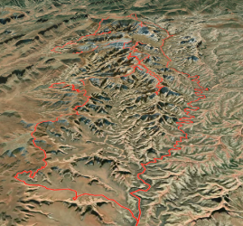
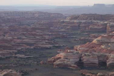
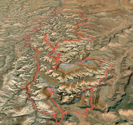
One of the inspirations for the hike was the incredible Google Earth aerial view of the canyons of Needles, which appear, in color and form, as if they are arteries and blood vessels of the human circulatory system. It is a truly mesmerising image of the natural world. I had always wondered whether it would be possible to access these high ridges above the canyons.

.
.....
Aerial view #2.png

Although the initial part of the route would follow Salt Creek to the southern park boundary, my plan was to try to return along the high ridgelines which separate the individual canyon systems. These rims sit 500-1,000 feet above the surrounding drainages. Despite my detailed planning, and advance permit reservation, I wasn't 100% sure that I could link the various ridges together to form a loop, but after several conversations with the excellent Backcountry Rangers in the park, I realised that it could probably be done.

My hike started at Needles Outpost (4,900 feet) and followed Salt Creek for 27 miles, before climbing up to the Cathedral Butte Trailhead. From there, I did a return hike out to Cathedral Point (7,100 feet), at the end of the nearby promintary (the Cathedral Catwalk :)). I then dropped into Lavender Canyon, which has several interesting ancient granaries, located in alcoves. I then exited Lavender, and hiked along the Davis/Lavender Ridgeline, before following an old 4WD track out to the edge of Cedar Mesa, at 7,000 feet. From there, I dropped down from the mesa onto the Salt/Davis Ridgeline (6,300 feet). I then day-hiked a spur route along the Salt/Horse Ridgeline (Archview Ridge :)) until no further progress was possible. I then hiked along the Horse/Davis Ridgeline and dropped into Davis Canyon, to visit some of the archeological sites in the area. Returning to the ridge, I then followed the eastern rim of Horse Canyon (5,800 feet), before dropping back into Salt Creek, and completing the loop at Needles Outpost.


...3D View #1b.png..
.3D View #2b.png
.
.
.......
.Elevation profile.png

Although I had researched the ridge routes quite carefully, my planning for accessing water wasn't very well thought through. I knew that I would be able to obtain water at several places in Salt Creek, especially towards the southern section at Kirk Spring, so this wasn't an issue initially. As I hoped, there was running water in the upper sections of Lavender Canyon, and also some more further down. Thus, I had plenty of water for the first 4 days of my hike, until I reached the Salt/Davis Ridgeline.

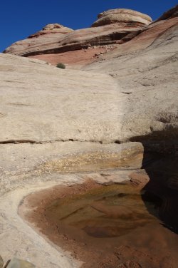
Since I wasn't certain of finding water in Davis Canyon on the following day, I realised that I would have to sacrifice at least half a day to drop back 500 feet into Salt Creek, via the Fisheye Route, and load up on water from Kirk Spring. I would then need to return to camp with at least 9 litres, to get me through the final 3 days. Incredibly, about 1/3 of the way down this route, I came across a pothole in the slickrock, containing clean water. I was very fortunate, and celebrated my good luck, by spending an unexpected free afternoon lazing in the sun !

Although there is a continuous 1/2 mile stretch of large healthy cottonwood trees in Davis Canyon, I wasn't able to ascertain whether there was actually any accessible running water nearby. I had therefore made the correct decision to collect enough water on the previous day, to see me through to the end of my hike. In hindsight, apart from caching water in advance, there probably weren't too many other options for obtaining sufficient water on this route, but I should certainly have thought it through a little better, before setting off.

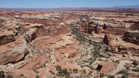
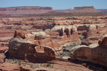
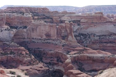
This route lived up to all my expectations, and then some; it was a wonderful week's hiking, with a series of magnificent views of the surrounding canyons. In fact, it would be quite difficult to select a camping spot on the route that did not have an incredible vista !

.
.
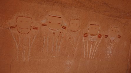
Rock Art in Salt Creek

DSC00791_20pc.JPG
.
.

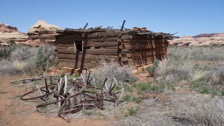
Kirk Cabin in Salt Creek
DSC00834_20pc.JPG
.
.

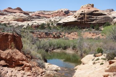
Kirk Spring in Salt Creek
DSC00845_20pc.JPG
.
.

Leaving the National Park and ascending towards Cathedral Butte
DSC00861_20pc.JPG
.
.

Lavender Creek from the Cathedral Catwalk
DSC00889_20pc.JPG
.
.

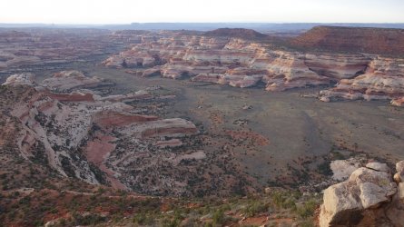
Big Pocket from Cathedral Point
DSC00902_20pc.JPG
.
.

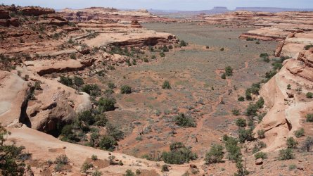
Salt Creek from Cathedral Point
DSC00912_20pc.JPG
.
.

Descending towards Lavender Creek from Cathedral Butte Trailhead
DSC00943_20pc.JPG
.
.

Teapot Arch in Lavender Creek
DSC06074_20pc.JPG
.
.

Cleft Arch in Lavender Creek
DSC06094_20pc.JPG
.
.

Granary in Lavender Creek
DSC06125_20pc.JPG
.
.

Large alcove in West Fork Lavender Creek
DSC06146_20pc.JPG
.
.

Granaries in Lavender Creek
DSC06166_20pc.JPG
.
.

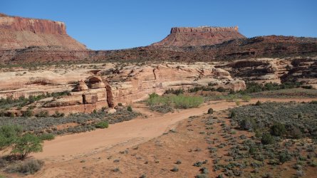
Old 4WD track along the Davis/Lavender Ridgeline heading towards Cedar Mesa
DSC06203_20pc.JPG
.
.

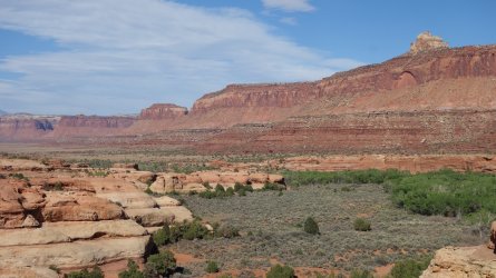
Davis Canyon from Davis/Lavender Ridgeline
DSC06221_20pc.JPG
.
.

Old jeep on the steep descent from Cedar Mesa
DSC06227_20pc.JPG
.
.

Salt Creek from Cedar Mesa, looking north-west
DSC06235_20pc.JPG
.
.

Salt Creek from Cedar Mesa, looking west towards Beef Basin
DSC06244_20pc.JPG
.
.

Big Pocket and Salt Creek from Cedar Mesa, looking south-west towards North Long Point and Dark Canyon Plateau
DSC06253_20pc.JPG
.
.

Davis Canyon from Salt/Davis Ridgeline
DSC06262_20pc.JPG
.
.

Davis Canyon, Indian Creek Recreation Area, Hatch Point Mesa, and La Sal Mountains from Salt/Davis Ridgeline
DSC06289_20pc.JPG
.
.

Descending the Fisheye Route towards Salt Creek
DSC06298_20pc.JPG
.
.

Descending the Fisheye Route towards Salt Creek
DSC06301_20pc.JPG
.
.

A pothole on the Fisheye Route
DSC06318_20pc.JPG
.
.

Side canyon of Salt Creek from Salt/Davis Ridgeline
DSC06333_20pc.JPG
.
.

Horse Canyon from Archview Ridge
DSC06354_20pc.JPG
.
.

Side canyon of Horse Canyon and Castle Arch from Archview Ridge
DSC06372_20pc.JPG

.
.

Castle Arch from Archview Ridge
DSC06410_20pc.JPG
.
.

Castle Arch from Archview Ridge
DSC06408_20pc.JPG
.
.

Side Canyon of Salt Creek from Archview Ridge
DSC06392_20pc.JPG
.
.

Unnamed (?) Arch from Archview Ridge, perhaps Turnaround Arch :)
DSC06427_20pc.JPG
.
.

West Fork Horse Canyon from Archview Ridge
DSC06457_20pc.JPG
.
.

Angel Arch from Archview Ridge
DSC06495_20pc.JPG
.
.

Davis Canyon from Salt/Davis Ridgeline
DSC06507_20pc.JPG
.
.

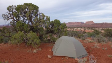
Camping on Salt/Davis Ridgeline
DSC06516_20pc.JPG
.
.

Side canyon of Salt Creek from Salt/Davis Ridgeline
DSC06345_20pc.JPG
.
.

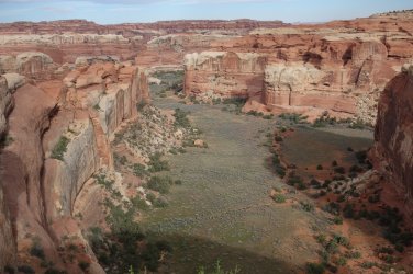
Side canyon of Horse Canyon from Horse/Davis Ridgeline
DSC06741_20pc.JPG
.
.

Descending towards Davis Canyon
DSC06714_20pc.JPG
.
.

Descending towards Davis Canyon
DSC06717_20pc.JPG

.
.

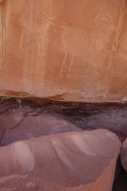
Signs of the Ancient Ones in Davis Canyon
DSC06666_20pc.JPG.........DSC06675_20pc.JPG
.
.

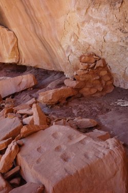
Rock art in Davis Canyon
DSC06687_20pc.JPG
.
.

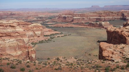
Tower Ruin Pocket from rim of Horse Canyon
DSC06750_20pc.JPG
.
.

Davis Canyon area from rim of Horse Canyon
DSC06768_20pc.JPG
.
.

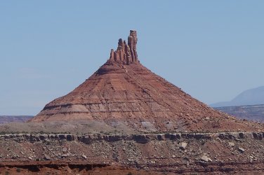
South Six-Shooter Peak
DSC06777_20pc.JPG
.
.

Salt Creek Pocket
DSC06783_20pc.JPG
.
.

Old gate-post above Salt Creek Pocket
DSC06786_20pc.JPG

O ye'll tak' the high road, and I'll tak' the low road, and I'll be in Scotland a'fore ye
 
Last edited:
That looks like a hell of a trip, thanks for sharing
 
This is some great stuff, the views from those ridges are amazing. Would love to get back to the Needles someday to explore some more "off the beaten path" stuff like what you've done.
 
Fantastic - and I can see why that Google Earth view was so enticing. We hope to explore that area sometime, and your great pictures increase our interest even more. Thanks!
 
Your photos quite literally took my breath away. Thank you for sharing -- this is an inspiration and a trip I may have to base something off of in the near future :)
 
I recently completed a 105 mile loop hike, over 7 days, around the eastern section of the Needles canyon system in Canyonlands National Park; namely Salt Creek, Horse Canyon, Davis Canyon, and Lavender Creek.

One of the inspirations for the hike was the incredible Google Earth aerial view of the canyons of Needles, which appear, in color and form, as if they are arteries and blood vessels of the human circulatory system. It is a truly mesmerising image of the natural world. I had always wondered whether it would be possible to access these high ridges above the canyons.

.
.....
View attachment 110443

Although the initial part of the route would follow Salt Creek to the southern park boundary, my plan was to try to return along the high ridgelines which separate the individual canyon systems. These rims sit 500-1,000 feet above the surrounding drainages. Despite my detailed planning, and advance permit reservation, I wasn't 100% sure that I could link the various ridges together to form a loop, but after several conversations with the excellent Backcountry Rangers in the park, I realised that it could probably be done.

My hike started at Needles Outpost (4,900 feet) and followed Salt Creek for 27 miles, before climbing up to the Cathedral Butte Trailhead. From there, I did a return hike out to Cathedral Point (7,100 feet), at the end of the nearby promintary (the Cathedral Catwalk :)). I then dropped into Lavender Canyon, which has several interesting ancient granaries, located in alcoves. I then exited Lavender, and hiked along the Davis/Lavender Ridgeline, before following an old 4WD track out to the edge of Cedar Mesa, at 7,000 feet. From there, I dropped down from the mesa onto the Salt/Davis Ridgeline (6,300 feet). I then day-hiked a spur route along the Salt/Horse Ridgeline (Archview Ridge :)) until no further progress was possible. I then hiked along the Horse/Davis Ridgeline and dropped into Davis Canyon, to visit some of the archeological sites in the area. Returning to the ridge, I then followed the eastern rim of Horse Canyon (5,800 feet), before dropping back into Salt Creek, and completing the loop at Needles Outpost.


...View attachment 110451..
.View attachment 110450
.
.
.......
.View attachment 110449

Although I had researched the ridge routes quite carefully, my planning for accessing water wasn't very well thought through. I knew that I would be able to obtain water at several places in Salt Creek, especially towards the southern section at Kirk Spring, so this wasn't an issue initially. As I hoped, there was running water in the upper sections of Lavender Canyon, and also some more further down. Thus, I had plenty of water for the first 4 days of my hike, until I reached the Salt/Davis Ridgeline.

Since I wasn't certain of finding water in Davis Canyon on the following day, I realised that I would have to sacrifice at least half a day to drop back 500 feet into Salt Creek, via the Fisheye Route, and load up on water from Kirk Spring. I would then need to return to camp with at least 9 litres, to get me through the final 3 days. Incredibly, about 1/3 of the way down this route, I came across a pothole in the slickrock, containing clean water. I was very fortunate, and celebrated my good luck, by spending an unexpected free afternoon lazing in the sun !

Although there is a continuous 1/2 mile stretch of large healthy cottonwood trees in Davis Canyon, I wasn't able to ascertain whether there was actually any accessible running water nearby. I had therefore made the correct decision to collect enough water on the previous day, to see me through to the end of my hike. In hindsight, apart from caching water in advance, there probably weren't too many other options for obtaining sufficient water on this route, but I should certainly have thought it through a little better, before setting off.

This route lived up to all my expectations, and then some; it was a wonderful week's hiking, with a series of magnificent views of the surrounding canyons. In fact, it would be quite difficult to select a camping spot on the route that did not have an incredible vista !

.
.
Rock Art in Salt Creek

View attachment 110371
.
.

Kirk Cabin in Salt Creek
View attachment 110374
.
.

Kirk Spring in Salt Creek
View attachment 110375
.
.

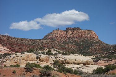
Leaving the National Park and ascending towards Cathedral Butte
View attachment 110376
.
.

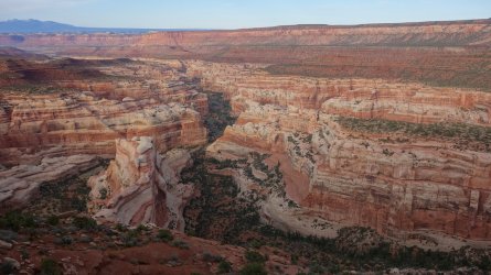
Lavender Creek from the Cathedral Catwalk
View attachment 110377
.
.

Big Pocket from Cathedral Point
View attachment 110378
.
.

Salt Creek from Cathedral Point
View attachment 110379
.
.

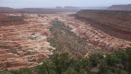
Descending towards Lavender Creek from Cathedral Butte Trailhead
View attachment 110381
.
.

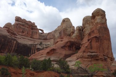
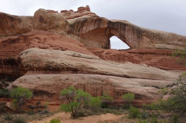
Teapot Arch in Lavender Creek
View attachment 110385
.
.

Cleft Arch in Lavender Creek
View attachment 110388
.
.

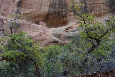
Granary in Lavender Creek
View attachment 110390
.
.

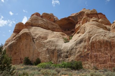
Large alcove in West Fork Lavender Creek
View attachment 110391
.
.

Granaries in Lavender Creek
View attachment 110392
.
.

Old 4WD track along the Davis/Lavender Ridgeline heading towards Cedar Mesa
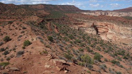
View attachment 110393
.
.

Davis Canyon from Davis/Lavender Ridgeline
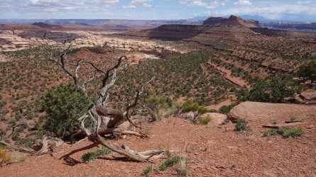
View attachment 110394
.
.

Old jeep on the steep descent from Cedar Mesa
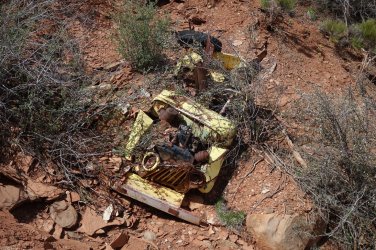
View attachment 110395
.
.

Salt Creek from Cedar Mesa, looking north-west
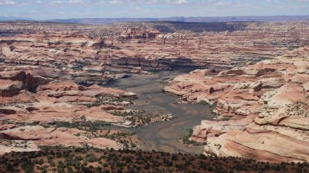
View attachment 110397
.
.

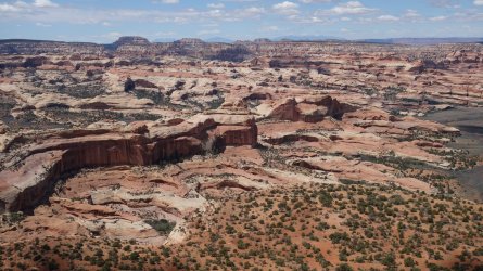
Salt Creek from Cedar Mesa, looking west towards Beef Basin
View attachment 110398
.
.

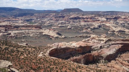
Big Pocket and Salt Creek from Cedar Mesa, looking south-west towards North Long Point and Dark Canyon Plateau
View attachment 110401
.
.

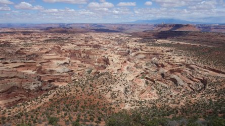
Davis Canyon from Salt/Davis Ridgeline
View attachment 110403
.
.

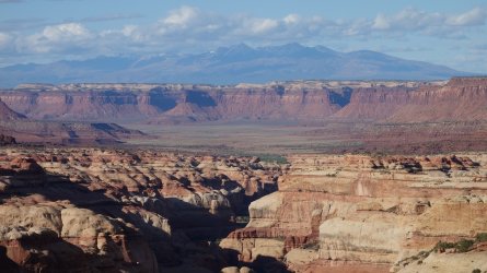
Davis Canyon, Indian Creek Recreation Area, Hatch Point Mesa, and La Sal Mountains from Salt/Davis Ridgeline
View attachment 110404
.
.

Descending the Fisheye Route towards Salt Creek
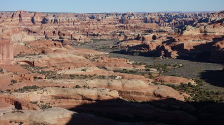
View attachment 110405
.
.

Descending the Fisheye Route towards Salt Creek
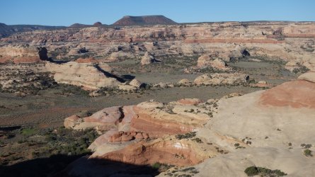
View attachment 110406
.
.

A pothole on the Fisheye Route
View attachment 110407
.
.

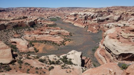
Side canyon of Salt Creek from Salt/Davis Ridgeline
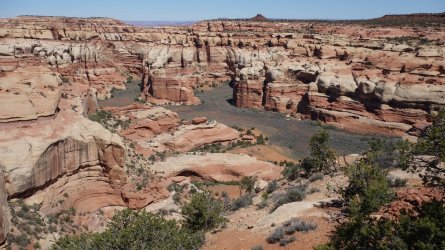
View attachment 110408
.
.

Horse Canyon from Archview Ridge
View attachment 110411
.
.

Side canyon of Horse Canyon and Castle Arch from Archview Ridge
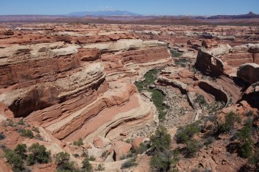
View attachment 110412

.
.

Castle Arch from Archview Ridge
View attachment 110417
.
.

Castle Arch from Archview Ridge
View attachment 110416
.
.

Side Canyon of Salt Creek from Archview Ridge
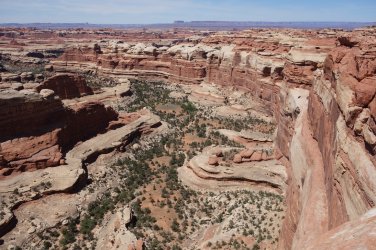
View attachment 110414
.
.

Unnamed (?) Arch from Archview Ridge, perhaps Turnaround Arch :)
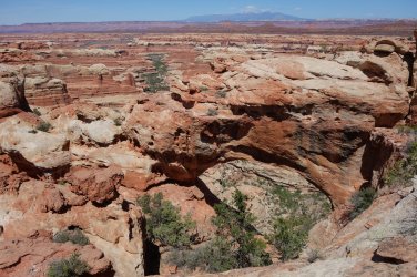
View attachment 110418
.
.

West Fork Horse Canyon from Archview Ridge
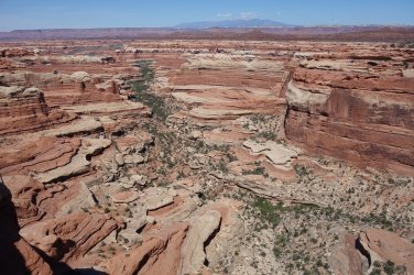
View attachment 110419
.
.

Angel Arch from Archview Ridge
View attachment 110424
.
.

Davis Canyon from Salt/Davis Ridgeline
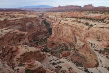
View attachment 110425
.
.

Camping on Salt/Davis Ridgeline
View attachment 110426
.
.

Side canyon of Salt Creek from Salt/Davis Ridgeline
View attachment 110410
.
.

Side canyon of Horse Canyon from Horse/Davis Ridgeline
View attachment 110433
.
.

Descending towards Davis Canyon
View attachment 110431
.
.

Descending towards Davis Canyon
View attachment 110432

.
.

Signs of the Ancient Ones in Davis Canyon
View attachment 110428.........View attachment 110429
.
.

Rock art in Davis Canyon
View attachment 110430
.
.

Tower Ruin Pocket from rim of Horse Canyon
View attachment 110435
.
.

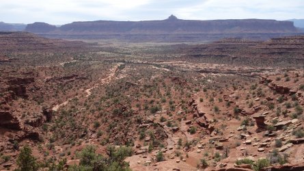
Davis Canyon area from rim of Horse Canyon
View attachment 110436
.
.

South Six-Shooter Peak
View attachment 110437
.
.

Salt Creek Pocket
View attachment 110439
.
.

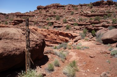
Old gate-post above Salt Creek Pocket
View attachment 110440

O ye'll tak' the high road, and I'll tak' the low road, and I'll be in Scotland a'fore ye
Amazing report and pics. Thank you. I've never heard it called Cathedral Point. I've always called it Big Pocket Overlook. I've been there many times in the last 40 years but have never found anybody there when I got there. I suppose the chances of that happening again are getting slim.
 
Amazing report and pics. Thank you. I've never heard it called Cathedral Point. I've always called it Big Pocket Overlook. I've been there many times in the last 40 years but have never found anybody there when I got there. I suppose the chances of that happening again are getting slim.
Thank you for that ...

Yes, I've now heard from a couple of people, who refer to this point as Big Pocket Overlook ... the only mapping reference I found was on a US Topo map, where it was called it Cathedral Point
 
I know I'm over a year late on this, but... awesome report! I've wanted to walk that ridge for a while now, but never seem to get the opportunity. Thanks for sharing the look at it.
 
Somehow I missed this trail report when it was posted (like @Jammer), which is a shame because it's one of the coolest I've seen on BCP.

I love your thought process for the route and the execution looks just as stellar. I have tendency towards more alpine/sub-alpine and have been trying to convince myself to do something longer than a couple days in Utah for years - you may have finally gotten me. Such a cool trip/environment.

Thanks for sharing!
 
Similar threads
Thread starter Title Forum Replies Date
TheMountainRabbit Dana Meadows to Twin Lakes via the High Route (Yosemite/Hoover Wilderness) - August 2023 Backpacking 8
meowtaingal Wind river high route mid september Trip Planning 7
Timber High Sierra - North Lake to South Lake Loop - Layover Day Trip Planning 9
Kullaberg63 Gore high traverse Backpacking 11
Parma Camping with a double high air mattress? General Discussion 2
travel2walk preventing high altitude (khumbu) cough techniques? Resource Discussions 2
NorthwestWanderer First time in the High Uintas | Red Castle SNEAK Loop | I give these mountains 5 out of 5 stars Backpacking 7
NorthwestWanderer 8 Day High Sierra trek : Humphreys Basin, Star Col, Granite Park, Lake Italy & Piute Canyon 6/25-7/2/22 Backpacking 7
TheMountainRabbit Red's Meadow to Tuolumne Meadows via the High Route (Ansel Adams/Yosemite Wilderness) - August 2022 Backpacking 5
Bob Teton Wilderness - 50 miles of High Country - Aug 2022 Backpacking 45
balzaccom My second mystery novel set in the High Sierra is now out! General Discussion 6
balzaccom Gibbs Lake, High Sierra Backpacking 2
fossana Palisades Roundabout (High Sierra) Backpacking 12
fossana Evolution Loop (High Sierra) Hiking & Camping 10
N Gilbert Meadows- High Uintas Trip Planning 0
norwegianxplorer Backpacking Norway, Lysefjorden/Kjerag/Kjerag Waterfall/Kjeragbolten, 4 days Solo Hiking high above the Norwegian Fjords Trip Reports 2
balzaccom Mystery set in the High Sierra General Discussion 4
WasatchWill The High Uintas 4-4-4: Four Basins, Four Passes, Four Days Backpacking 20
C High Uintas Wilderness - Last minute plans Trip Planning 4
Mountain Wanderer High Uintas Wilderness - Granddaddy Basin Backpacking 4
Tarp Boy High Sierra Camp Loop, Yosemite, CA Trip Reports 5
fossana A taste of the GR11: 6 Days on the Travesía Pirenaica (High Pyrenees, Spain) Backpacking 18
Born to Hike Mountain Solitude: Reconnaissance Lake, High Uintas, early Sept 2019 Backpacking 9
fossana Bear Lakes > Royce Lakes overnighter (High Sierra) Backpacking 12
DrNed Plan B to High Uintas Backpacking Trip Planning 20
Dave High Uinta sheep grazing EIS General Discussion 2
J Cali: Cinder Cones, High Sierra Rambles, Famous Domes Oct 26-31, 2018 Hiking & Camping 3
R Psuedoephedrine at high altitude General Discussion 6
fossana Pine Creek/Granite Park fall excursion (High Sierra) Hiking & Camping 14
David Rule High Peaks Wilderness-August 2018 Backpacking 1
Boognish Four days in the High Sierra Backpacking 10
Born to Hike Clements Lake and East Basin in the High Uintas, mid-July 2018 Backpacking 6
scatman High Sierra Trail Backpacking 23
D Wind River High Route Trip Planning 4
LarryBoy Absarokas Fun Route - 12 Days of High Adventure Backpacking 21
Ross High Spur and North Wash Canyoneering 5
westy High Uintas - West Basin Backpacking 0
George_Washington_Hayduke High Uintas: Allen Lake and Thunderstorms Backpacking 0
westy High Uintas - Henry's, Painter, Yellowstone, Smith's Backpacking 5
westy High Uintas - Middle Basin Backpacking 5
Luke High elevation uinta campgrounds/lakes General Discussion 9
S Central Utah high alpine suggestions Trip Planning 2
N Which High Uintas overnight hike? Trip Planning 2
mattvogt7 High Water Bruneau On The Water 8
Tim Valentine High Sierra Lakes Tour Backpacking 11
Perry Sierra Designs High Route 1FL Tent - Looks interesting Gear 6
S High alpine in central Utah Trip Planning 4
Devin Ashby Ostler Peak - Amethyst Basin - High Uinta Wilderness Backpacking 0
Devin Ashby Ostler Peak - High Uintas - Who's Done It? Trip Planning 5
Jen High Uintas Quintuple Pass backpacking adventure Backpacking 15

Similar threads

Back
Top