- Joined
- Dec 2, 2019
- Messages
- 182
I recently completed a 105 mile loop hike, over 7 days, around the eastern section of the Needles canyon system in Canyonlands National Park; namely Salt Creek, Horse Canyon, Davis Canyon, and Lavender Creek.
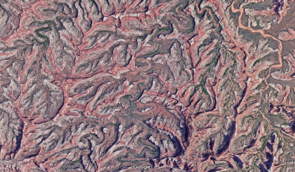
One of the inspirations for the hike was the incredible Google Earth aerial view of the canyons of Needles, which appear, in color and form, as if they are arteries and blood vessels of the human circulatory system. It is a truly mesmerising image of the natural world. I had always wondered whether it would be possible to access these high ridges above the canyons.
.
.....
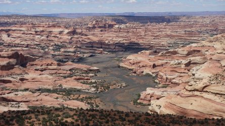
Although the initial part of the route would follow Salt Creek to the southern park boundary, my plan was to try to return along the high ridgelines which separate the individual canyon systems. These rims sit 500-1,000 feet above the surrounding drainages. Despite my detailed planning, and advance permit reservation, I wasn't 100% sure that I could link the various ridges together to form a loop, but after several conversations with the excellent Backcountry Rangers in the park, I realised that it could probably be done.
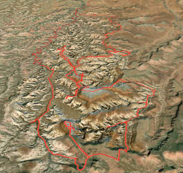
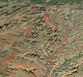
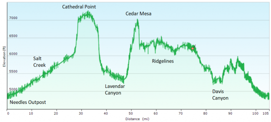
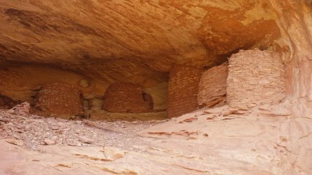
My hike started at Needles Outpost (4,900 feet) and followed Salt Creek for 27 miles, before climbing up to the Cathedral Butte Trailhead. From there, I did a return hike out to Cathedral Point (7,100 feet), at the end of the nearby promintary (the Cathedral Catwalk ). I then dropped into Lavender Canyon, which has several interesting ancient granaries, located in alcoves. I then exited Lavender, and hiked along the Davis/Lavender Ridgeline, before following an old 4WD track out to the edge of Cedar Mesa, at 7,000 feet. From there, I dropped down from the mesa onto the Salt/Davis Ridgeline (6,300 feet). I then day-hiked a spur route along the Salt/Horse Ridgeline (Archview Ridge
  ) until no further progress was possible. I then hiked along the Horse/Davis Ridgeline and dropped into Davis Canyon, to visit some of the archeological sites in the area. Returning to the ridge, I then followed the eastern rim of Horse Canyon (5,800 feet), before dropping back into Salt Creek, and completing the loop at Needles Outpost.
... ...
...
.One of the inspirations for the hike was the incredible Google Earth aerial view of the canyons of Needles, which appear, in color and form, as if they are arteries and blood vessels of the human circulatory system. It is a truly mesmerising image of the natural world. I had always wondered whether it would be possible to access these high ridges above the canyons.
.
.....

Although the initial part of the route would follow Salt Creek to the southern park boundary, my plan was to try to return along the high ridgelines which separate the individual canyon systems. These rims sit 500-1,000 feet above the surrounding drainages. Despite my detailed planning, and advance permit reservation, I wasn't 100% sure that I could link the various ridges together to form a loop, but after several conversations with the excellent Backcountry Rangers in the park, I realised that it could probably be done.
My hike started at Needles Outpost (4,900 feet) and followed Salt Creek for 27 miles, before climbing up to the Cathedral Butte Trailhead. From there, I did a return hike out to Cathedral Point (7,100 feet), at the end of the nearby promintary (the Cathedral Catwalk
...
 ...
...
.
........
Although I had researched the ridge routes quite carefully, my planning for accessing water wasn't very well thought through. I knew that I would be able to obtain water at several places in Salt Creek, especially towards the southern section at Kirk Spring, so this wasn't an issue initially. As I hoped, there was running water in the upper sections of Lavender Canyon, and also some more further down. Thus, I had plenty of water for the first 4 days of my hike, until I reached the Salt/Davis Ridgeline.
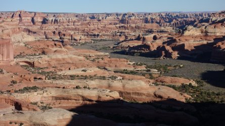
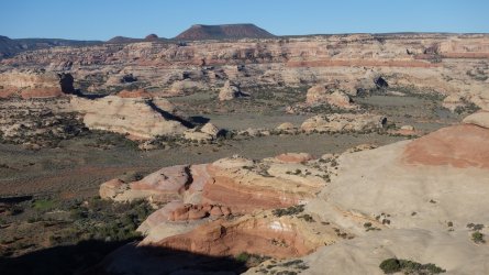
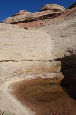
Since I wasn't certain of finding water in Davis Canyon on the following day, I realised that I would have to sacrifice at least half a day to drop back 500 feet into Salt Creek, via the Fisheye Route, and load up on water from Kirk Spring. I would then need to return to camp with at least 9 litres, to get me through the final 3 days. Incredibly, about 1/3 of the way down this route, I came across a pothole in the slickrock, containing clean water. I was very fortunate, and celebrated my good luck, by spending an unexpected free afternoon lazing in the sun !
Although there is a continuous 1/2 mile stretch of large healthy cottonwood trees in Davis Canyon, I wasn't able to ascertain whether there was actually any accessible running water nearby. I had therefore made the correct decision to collect enough water on the previous day, to see me through to the end of my hike. In hindsight, apart from caching water in advance, there probably weren't too many other options for obtaining sufficient water on this route, but I should certainly have thought it through a little better, before setting off.
This route lived up to all my expectations, and then some; it was a wonderful week's hiking, with a series of magnificent views of the surrounding canyons. In fact, it would be quite difficult to select a camping spot on the route that did not have an incredible vista !
.
.
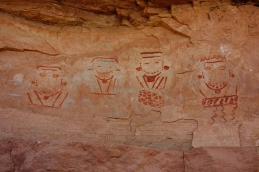
Rock Art in Salt Creek
.Since I wasn't certain of finding water in Davis Canyon on the following day, I realised that I would have to sacrifice at least half a day to drop back 500 feet into Salt Creek, via the Fisheye Route, and load up on water from Kirk Spring. I would then need to return to camp with at least 9 litres, to get me through the final 3 days. Incredibly, about 1/3 of the way down this route, I came across a pothole in the slickrock, containing clean water. I was very fortunate, and celebrated my good luck, by spending an unexpected free afternoon lazing in the sun !
Although there is a continuous 1/2 mile stretch of large healthy cottonwood trees in Davis Canyon, I wasn't able to ascertain whether there was actually any accessible running water nearby. I had therefore made the correct decision to collect enough water on the previous day, to see me through to the end of my hike. In hindsight, apart from caching water in advance, there probably weren't too many other options for obtaining sufficient water on this route, but I should certainly have thought it through a little better, before setting off.
This route lived up to all my expectations, and then some; it was a wonderful week's hiking, with a series of magnificent views of the surrounding canyons. In fact, it would be quite difficult to select a camping spot on the route that did not have an incredible vista !
.
.
Rock Art in Salt Creek

.
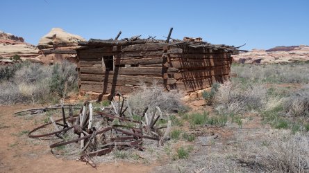
Kirk Cabin in Salt Creek
.
.
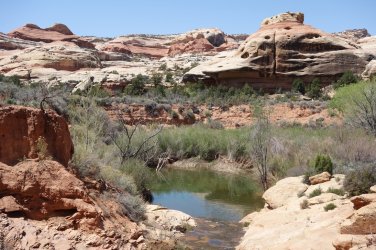
Kirk Spring in Salt Creek
.
.
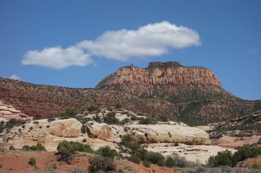
Leaving the National Park and ascending towards Cathedral Butte
.
.
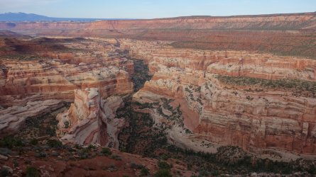
Lavender Creek from the Cathedral Catwalk
.
.
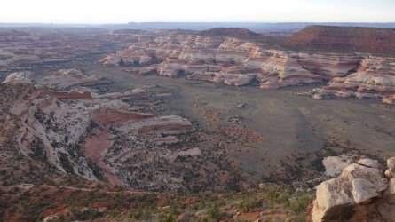
Big Pocket from Cathedral Point
.
.
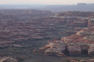
Salt Creek from Cathedral Point
.
.
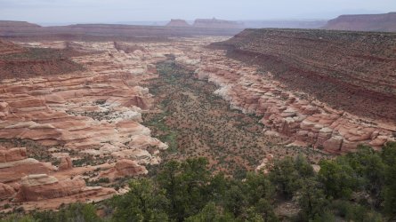
Descending towards Lavender Creek from Cathedral Butte Trailhead
.
.
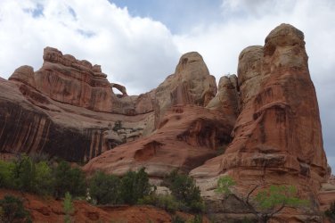
Teapot Arch in Lavender Creek
.
.
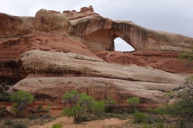
Cleft Arch in Lavender Creek
.
.
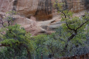
Granary in Lavender Creek
.
.
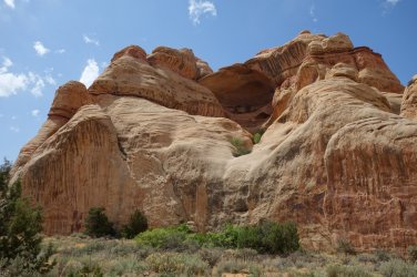
Large alcove in West Fork Lavender Creek
.
.
Granaries in Lavender Creek
.
.
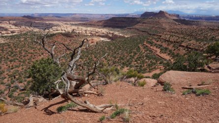
Old 4WD track along the Davis/Lavender Ridgeline heading towards Cedar Mesa
.
.
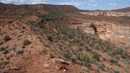
Davis Canyon from Davis/Lavender Ridgeline
.
.
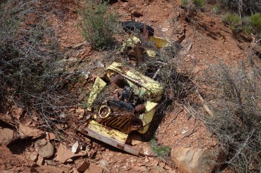
Old jeep on the steep descent from Cedar Mesa
.
.
Salt Creek from Cedar Mesa, looking north-west
.
.
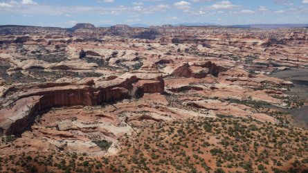
Salt Creek from Cedar Mesa, looking west towards Beef Basin
.
.
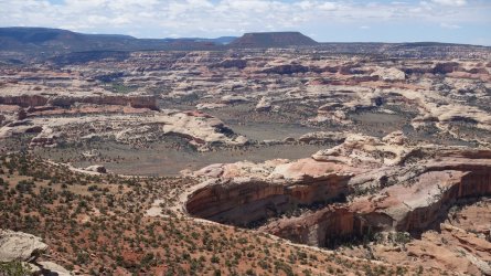
Big Pocket and Salt Creek from Cedar Mesa, looking south-west towards North Long Point and Dark Canyon Plateau
.
.
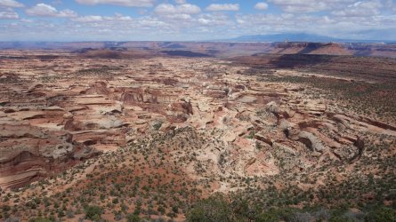
Davis Canyon from Salt/Davis Ridgeline
.
.
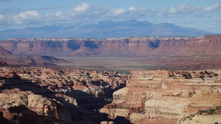
Davis Canyon, Indian Creek Recreation Area, Hatch Point Mesa, and La Sal Mountains from Salt/Davis Ridgeline
.
.
Descending the Fisheye Route towards Salt Creek
.
.
Descending the Fisheye Route towards Salt Creek
.
.
A pothole on the Fisheye Route
.
.
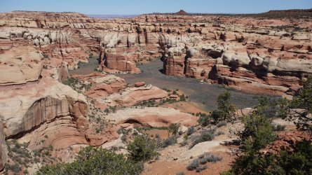
Side canyon of Salt Creek from Salt/Davis Ridgeline
.
.
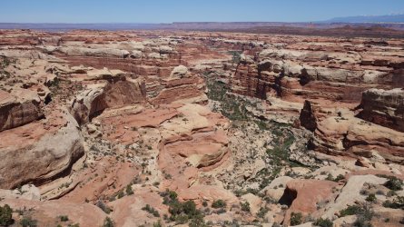
Horse Canyon from Archview Ridge
.
.
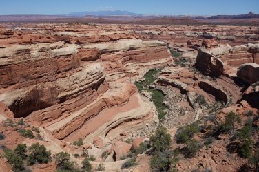
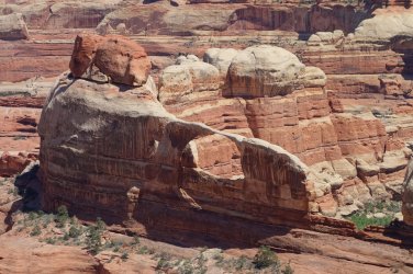
Side canyon of Horse Canyon and Castle Arch from Archview Ridge
.
.
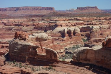
Castle Arch from Archview Ridge
.
.
Castle Arch from Archview Ridge
.
.
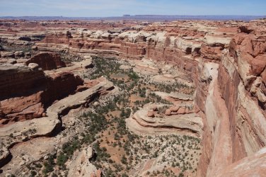
Side Canyon of Salt Creek from Archview Ridge
.
.
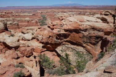
Unnamed (?) Arch from Archview Ridge, perhaps Turnaround Arch
.
.
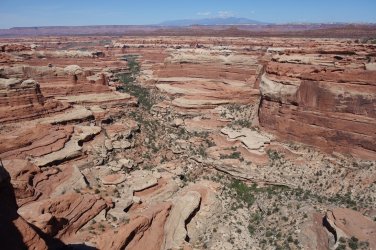
West Fork Horse Canyon from Archview Ridge
.
.
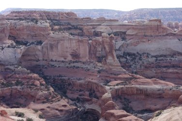
Angel Arch from Archview Ridge
.
.
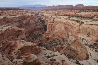
Davis Canyon from Salt/Davis Ridgeline
.
.
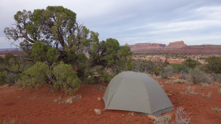
Camping on Salt/Davis Ridgeline
.
.
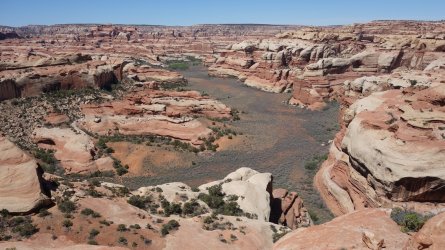
Side canyon of Salt Creek from Salt/Davis Ridgeline
.
.
Side canyon of Horse Canyon from Horse/Davis Ridgeline
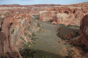
.
.
Descending towards Davis Canyon
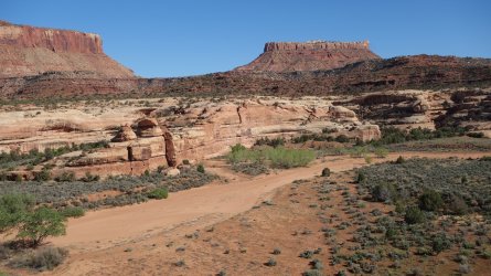
.
.
Descending towards Davis Canyon
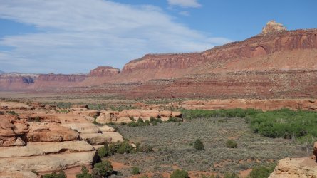
.
.
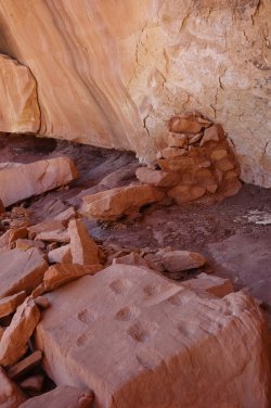
Signs of the Ancient Ones in Davis Canyon
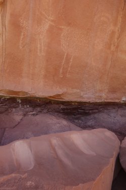 .........
.
.
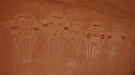
Rock art in Davis Canyon
.
.
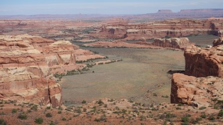
Tower Ruin Pocket from rim of Horse Canyon
.
.
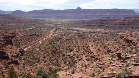
Davis Canyon area from rim of Horse Canyon
.
.
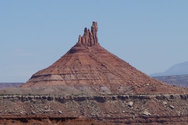
South Six-Shooter Peak
.
.
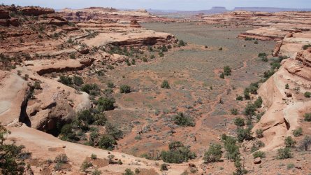
Salt Creek Pocket
.
.
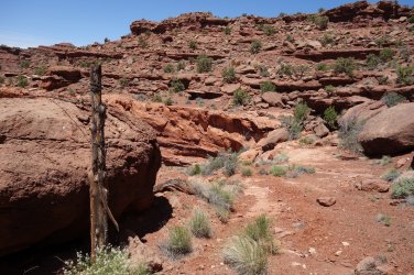
Old gate-post above Salt Creek Pocket
O ye'll tak' the high road, and I'll tak' the low road, and I'll be in Scotland a'fore ye
Last edited:
