- Joined
- Dec 2, 2019
- Messages
- 196
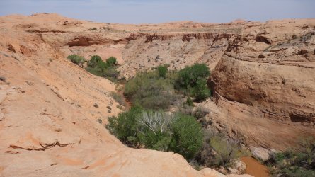
Although I had been carrying plenty of water, I hoped that I'd be able to refill my bottles at Lake Canyon. The dirt road from the highway out to Aladdins Lamp Pass used to skirt the edge of the canyon, but it has now completely collapsed and 4WD drivers now need to take a detour further south. From Google Earth, it looked to me that, even if I couldn't get water here, I'd be able to slide down and hike up large sand slopes on either side of the canyon to proceed across the mesa. I've had a few issues (!) in the past relying on 3D mapping research to plan routes, but I was fairly sure about the access to this drainage. Thankfully, it all worked out fine, and the routes into and out of the canyon were steep, but quite straightforward. There was plenty of water available, although it appears that the local cattle also enjoy this area; the water's edge was very messy.
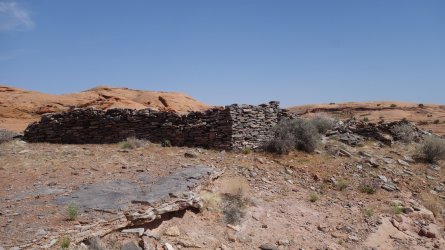
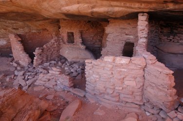
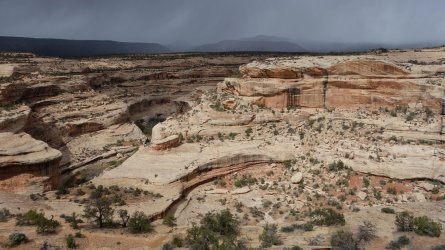
This canyon does appear to be virtually collapsing in on itself, with severely crumbling slopes, and many large cottonwoods having fallen or about to fall into the drainage. There were several interesting archaeological sites in this area, which is not surprising given the availability of reliable water.
Now that I was off of the established dirt road, progress across the ground was much slower, involving trudging through deep sand, or up and over steep slickrock domes. It was a hot day, and I was feeling quite exhausted as the day wore on, but by late afternoon I was back on the road. One of the group of Jeep drivers that I had met the previous day at Aladdins Lamp pass stopped and offered me some water, which was very kind. Although I was tired, my incentive for the day was to be reunited with my next food cache, which I had left in place a few weeks previously. I got to the spot just after sunset, and I thoroughly enjoyed a few extra tasty goodies from my cache.
(Day 25 18.4 miles, Total 340.4)
=====
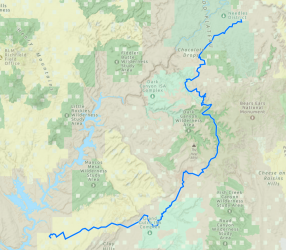
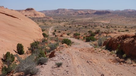
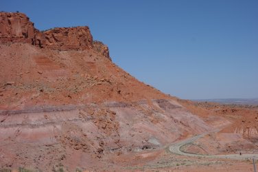
In addition to my worries about crossing Lake Powell, I had been very nervous about the hike up from the lake, across Grey and Wilson Mesas, through Death Valley, and on to the highway. This is not a well documented area for backpacking, with little known about potential water sources. I was now only 3 miles from Highway 276, and woke up feeling a huge sense of relief that I had traversed this little known area. In hindsight there was enough passing traffic, and available water to make the hike relatively straightforward, but I didn't quite know what would lie in store, when I initially crossed Lake Powell. Although,I still had a few days to go to complete my trip, I was delighted to be approaching more familiar territory. I was heading towards Cedar Mesa and Grand Gulch.
Firstly, however, I had a long road-walk along Highway 276, alongside Castle Creek, and over Clay Hills Pass, to reach Cedar Mesa, although fortunately I was able, initially, to follow some dirt roads parallel to the main highway. I had planned to take a cross-country route over the Clay Hills, towards the Red House Cliffs, before descending to the highway, but after an intense and quite stressful few days, I decided to postpone this 'adventure' for another occasion. A fast and easy 10 mile road-walk, accompanied by a few podcasts, would do me just nicely today.
(Day 26 18.1 miles, Total 358.5)
=====
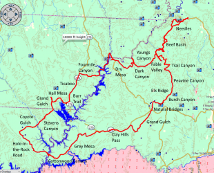
I had initially hoped to descend into Grand Gulch using a little known southern drainage, sometimes termed Rope Canyon. However, in preparation for my trip, I hiked to the rim of this canyon from the highway, and couldn't find any feasible route in. I also checked the possibility of exiting Grand Gulch via Dripping Canyon, and despite some information that it was impassable, I was able to reach the Gulch without too much difficulty on a day-hike. Thus, after crossing the mesa, I dropped into Grand Gulch from the Collins Spring Trailhead, and proceeded northwards.
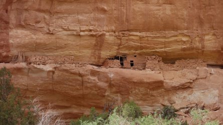
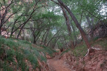
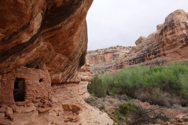
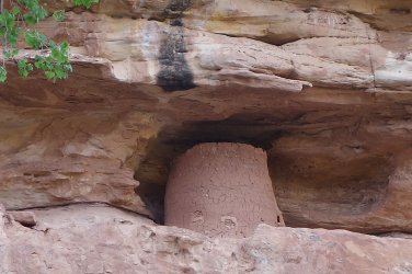
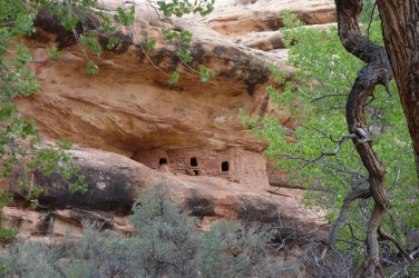
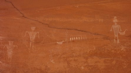
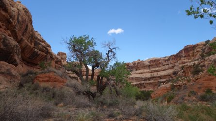
The main canyon can be a frustrating experience because the main trail effectively lies in an earthen trench, bordered by tall trees, some 6-8 feet below the canyon floor. It is only at this upper level, where it is possible to be able to catch sight of any ruins and rock-art in the vicinity. Progress is relatively fast and straightforward, through the tree-tunnel, but in order to visit the magnificent archaeological sights in the area, it is necessary to regularly clamber out of the trench, and generally then bushwack towards the canyon walls. The amount of ancient sights one sees in Grand Gulch depends entirely on how energetic you are feeling at the time.
It is necessary to have a permit to camp overnight in Grand Gulch and the surrounding side canyons, and this needs to be picked up in person at the Kane Gulch Ranger Station, before the start of the hike. This wasn't feasible for me to do, given my route, so it was necessary for me to exit the canyon and camp on the mesa for the night, before dropping back in the next day. I had an annual day-hiking permit for the canyon.
(Day 27 21.8 miles, Total 380.3)
=====
I had a wonderful time in Grand Gulch, visiting many fantastic ruins and rock-art, and I'm sure I barely scratched the surface of what treasures are hidden in this area. I traversed Dripping Canyon relatively quickly, and made my way up to Cedar Mesa once more.
(Day 28 14.4 miles, Total 394.7)
=====
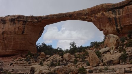
After resuming my cross-country route on Cedar Mesa, I picked up a water cache just south of Highway 95. I made my way along an old jeep road to the southern boundary of Natural Bridges National Monument. I had checked a few weeks previously that it was possible to drop into the Monument's canyon system from the top of the mesa here. Despite some snow falling, as I slid my down the slickrock slope, I eventually made it into Tuwa Canyon and from there to magnificent Owachomo Bridge, one of several massive natural stone bridges in the park.
I took the marked trail across the mesa, which is a delightful walk, and ended up at the visitor's center by late afternoon. I had a food resupply to collect just outside the park that evening, but could not remember for the life of me, if I had also cached water at the same time. I couldn't take the chance, so ended up collecting 3 liters of water from the nearby faucet, and carrying it with me along the highway. Of course, this was entirely unnecessary as I then found that I had in fact placed a gallon container alongside my cache.
(Day 29 16 miles, Total 410.7)
=====
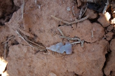
From the park highway, I headed cross-country to join up with Burch Canyon Road in order to reach Elk Ridge. On the way through the brush, I found a couple of very interesting archaeological sites: one of lithic scatter, where the Ancient Ones had worked on their hunting tools, and the other a small square arrangement of vertical slabs at ground level. Among the discarded stone chips at the first site, I found a tiny 'birdpoint' arrowhead. I had never seen one before, outside of a museum, so was very excited about that. I left it where I had found it.
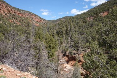
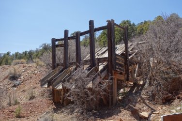
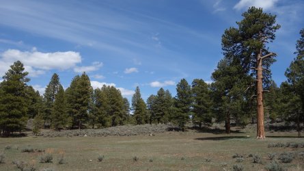
The hike along the little-used dirt road through Burch Canyon was very pretty, with a lovely flowing stream. There was an increasing preponderance of tall pine trees, as the altitude changed. Eventually the trail passes some old mine workings, and then joins up with the maze-like array of dirt roads around Elk Ridge. The road maxes out around 8,400 feet, close to a lovely alpine meadow, and across from Peavine Canyon Trailhead.
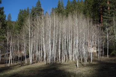
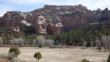
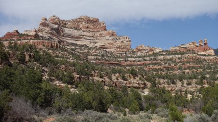
Peavine Canyon is a very pretty and easy walk, initially through a deeply forested area, with several large groves of aspens close to the trail.
(Day 30 14.7 miles, Total 425.4)
=====
The foot trail then joins up with a sandy 4WD road, which starts at Little Notch and the Hammond Canyon Trailhead, and winds its way down Kigalia Canyon. The valley begins to widen and the views of the surrounding high ridges start to open up. As the jeep road ends, the trail passes Rig Canyon, and officially becomes Dark Canyon. The scenery is just magnificent from this point, with superb views of large blond sandstone buttes and high cliffs. This is a wonderful stretch of the trail. There was water available close to the junction of Trail Canyon. Although it was getting late in the day, I wanted to make a start on Trail Canyon this evening.
(Day 31 17.2 miles, Total 442.6)
=====
After a steep morning hike through Trail Canyon, I headed along the wide dirt road across Dark Canyon Plateau, and took the side road towards Sweet Alice Spring. I was interested to see that there is a small BLM maintenance facility located along this road. My grand plan today was to head cross-country on the Sweet Alice Hills and drop down directly into Beef Basin from the buttes at its southern edge. There is no actual trail here, but using Google Earth, I was sure that there was a route down. Big mistake ! After walking through the dense brush for over a mile, I came to the edge of the first butte, and realized that there were now a series of sheer sandstone cliffs in front if me. These looked close to impassible, and even if I made it down the first, I had no idea if I'd be able to progress much further. Perhaps, if making an ascent, rather than a descent it might have been feasible to pick a route up through the cliffs, but I decided that discretion was the better part of valor this time. I really should learn my lesson about using 3D digital mapping to plan a route !
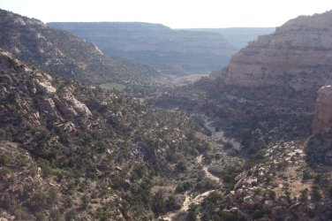
I headed back to the dirt road that winds its way across Wild Cow Point, and then drops down into Fable Valley. The descent into the valley is quite spectacular, and follows the edge of a deep, narrow canyon. The cattlemen of old put quite a bit of effort into the construction of this trail. It was nice to be back in the familiar surroundings of Fable Valley.
(Day 32 19.5 miles, Total 462.1)
=====
I was now on the home stretch of my trip, and so took my time to enjoy the lovely walk through Fable Valley, that then heads high above Gypsum Canyon, and drops into Beef Basin. I didn't really have enough time to do any more exploring in Beef Basin unfortunately, so I took the dirt road north and spent my final night in a beautiful little side valley, close to the top of the Bobby's Hole dugway.
(Day 33 20.3 miles, Total 482.4)
=====
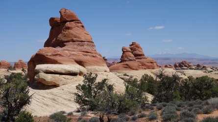
Instead of re-tracing my steps from the outward part of my hike, I decided to take the foot trail through the heart of the Needles, rather than the 4WD road. This was a longer and more undulating route, but is considerably more scenic since it weaves its way among the magnificent high sandstone features, so typical of the park.
(Day 34 20.4 miles, Total 502.8)
=====
The other parts of the adventure can be found here:
"I Would Walk 500 Miles ..." - A Utah Adventure - April 2022 - Part 1
Despite the many frustrations of the Covid restrictions of 2020 and 2021, I had plenty of time to pore over maps, blogs, and guide-books and plan a big hike on the Colorado Plateau for Spring 2022. My previous long-distance hike in the US South-West in 2019 was a fantastic experience and I...
backcountrypost.com
"I Would Walk 500 Miles ..." - A Utah Adventure - April 2022 - Part 2
I was unsure whether to spend another day in Fable Valley to look for archaeological sites, but decided it was worth staying on a bit longer, if only to dry out my still wet clothes from the previous day. I hiked almost to the end of the canyon, which was a beautiful walk, but I didn't find any...
backcountrypost.com
"I Would Walk 500 Miles ..." - A Utah Adventure - April 2022 - Part 3
After the magnificent hike through Dark Canyon, and the desert traverse to Hite on Lake Powell, I hadn't really been looking forward to the next day of my trip, since it involved an early morning 7 mile road-walk along Highway 95. In order to reach the far side of the lake, and proceed on my...
backcountrypost.com
"I Would Walk 500 Miles ..." - A Utah Adventure - April 2022 - Part 4
Update and warning December 2022: @IntrepidXJ Randy Langstraat reports in October 2022 that the narrow rock chute leading from Hole-in-the-Rock trailhead, down to the shore of Lake Powell, may now be impassable. It was certainly a much trickier descent than I had envisaged, in April 2022, but...
backcountrypost.com
"I Would Walk 500 Miles ..." - A Utah Adventure - April 2022 - Part 5
I had now been camped at the beach below the Hole-in-the-Rock for almost 48 hours. It did appear that my plan to hike almost 300 miles from Needles to Lake Powell and catch a ride across the lake to Cottonwood Canyon and Grey Mesa had ended in failure. Not a single boat had passed by during the...
backcountrypost.com
=====
.
.
.
.

.
.
.
.

.
.
Road junction

.
.
Lake Canyon
.
.
Ruins near Lake Canyon
.
.
Old vehicle
.
.
Approaching Highway 276
.
.
Ruins near Green Water Spring
.
.
Approaching Clay Hills Pass
.
.
View from Clay Hills Pass overlooking Cedar Mesa

.
.
Grand Gulch ruin
.
.
Grand Gulch 'tree tunnel'
.
.
Grand Gulch granary
.
.
Grand Gulch granary
.
.
Grand Gulch granaries
.
.
Grand Gulch rock-art
.
.
Grand Gulch
.
.
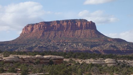
Butte
.
.
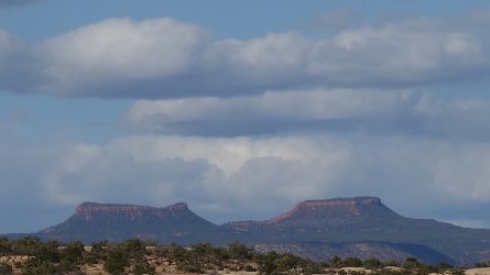
Bears Ears
.
.
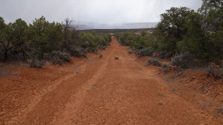
Old road to Natural Bridges NM
.
.
Owachomo Bridge, Natural Bridges NM
.
.
Natural Bridges NM
.
.
Bird-point
.
.
Climbing towards Elk Ridge

.
.
Burch Canyon
.
.
Old mine works
.
.
Elk Ridge at Peavine Trailhead
.
.
Peavine Canyon
.
.
Peavine Canyon
.
.
Peavine Canyon

.
.
Peavine Canyon
.
.
Trail Canyon

.
.
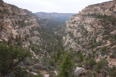
Trail Canyon
.
.
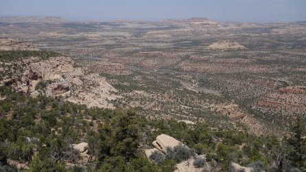
Beef Basin panorama
.
.
Descent from Wild Cow Point to Fable Valley
.
.
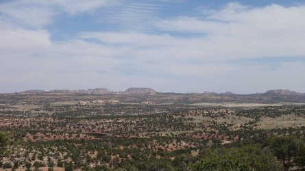
Beef Basin panorama
.
.
Beef Basin

.
.
Beef Basin
.
.
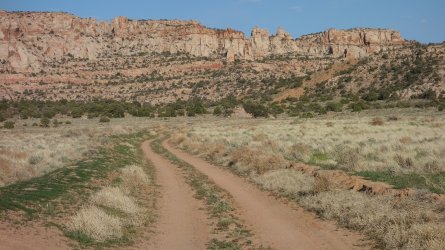
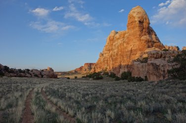
Beef Basin
.
.
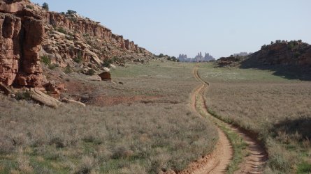
Entering The Grabens area of Needles
.
.
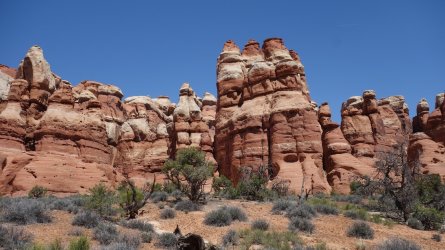
Chesler Park, Needles
.
.
Needles
.
.
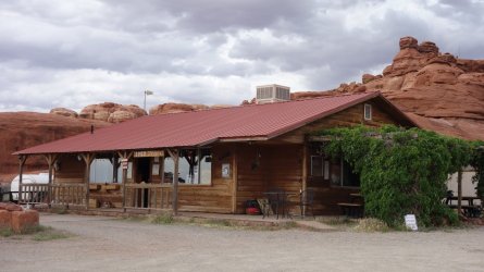
Needles Outpost
.
.
"I would walk 500 miles,.

.
.

.
.

.
.

.
.
Road junction

.
.
Lake Canyon

.
.
Ruins near Lake Canyon

.
.
Old vehicle

.
.
Approaching Highway 276

.
.
Ruins near Green Water Spring

.
.
Approaching Clay Hills Pass

.
.
View from Clay Hills Pass overlooking Cedar Mesa

.
.
Grand Gulch ruin

.
.
Grand Gulch 'tree tunnel'

.
.
Grand Gulch granary

.
.
Grand Gulch granary

.
.
Grand Gulch granaries

.
.
Grand Gulch rock-art

.
.
Grand Gulch

.
.
Butte

.
.
Bears Ears

.
.
Old road to Natural Bridges NM

.
.
Owachomo Bridge, Natural Bridges NM

.
.
Natural Bridges NM

.
.
Bird-point

.
.
Climbing towards Elk Ridge

.
.
Burch Canyon

.
.
Old mine works

.
.
Elk Ridge at Peavine Trailhead

.
.
Peavine Canyon

.
.
Peavine Canyon

.
.
Peavine Canyon

.
.
Peavine Canyon

.
.
Trail Canyon

.
.
Trail Canyon

.
.
Beef Basin panorama

.
.
Descent from Wild Cow Point to Fable Valley

.
.
Beef Basin panorama

.
.
Beef Basin

.
.
Beef Basin

.
.
Beef Basin

.
.
Entering The Grabens area of Needles

.
.
Chesler Park, Needles

.
.
Needles

.
.
Needles Outpost

.
.
And I would walk 500 more,
Just to be the man who walked a thousand
miles to fall down at your door" ... The Proclaimers
Last edited:

