Yvonne
I lava it!!!
- Joined
- Jan 19, 2012
- Messages
- 4,180
Since most of my hikes happen close to home right now, I can post it here as well. I live less than a mile away from several Cinder Cone Volcanoes which are part of the Red Cliffs Desert reserve, so most of my hikes happen there. I can go and do a short or a long loop, hiking anything from 3.5 miles up to 7 miles.
Having the volcanoes in my backyard almost feels like being back home in Hawai'i. I usually do not bring a camera when I hike there, in most cases my cellphone has to do the job.
on top of West Cinder Knoll: Scoria and Cinder cover the two pit craters
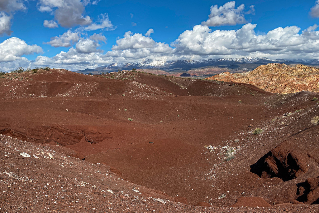
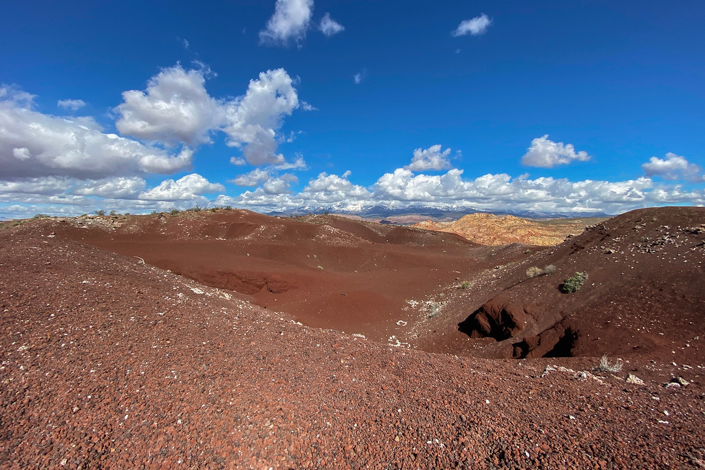
Looking into the crater: These all erupted during the middle Pleistocene, building up the two cinder cones with their typical steep angle of repose. At the end of their lifecycle, they produced lava flows that covered a small area, including the place where my house now is. Much of the basaltic lava is aphanitic with some olivine phenocrysts in it.
walking the rim of the crater
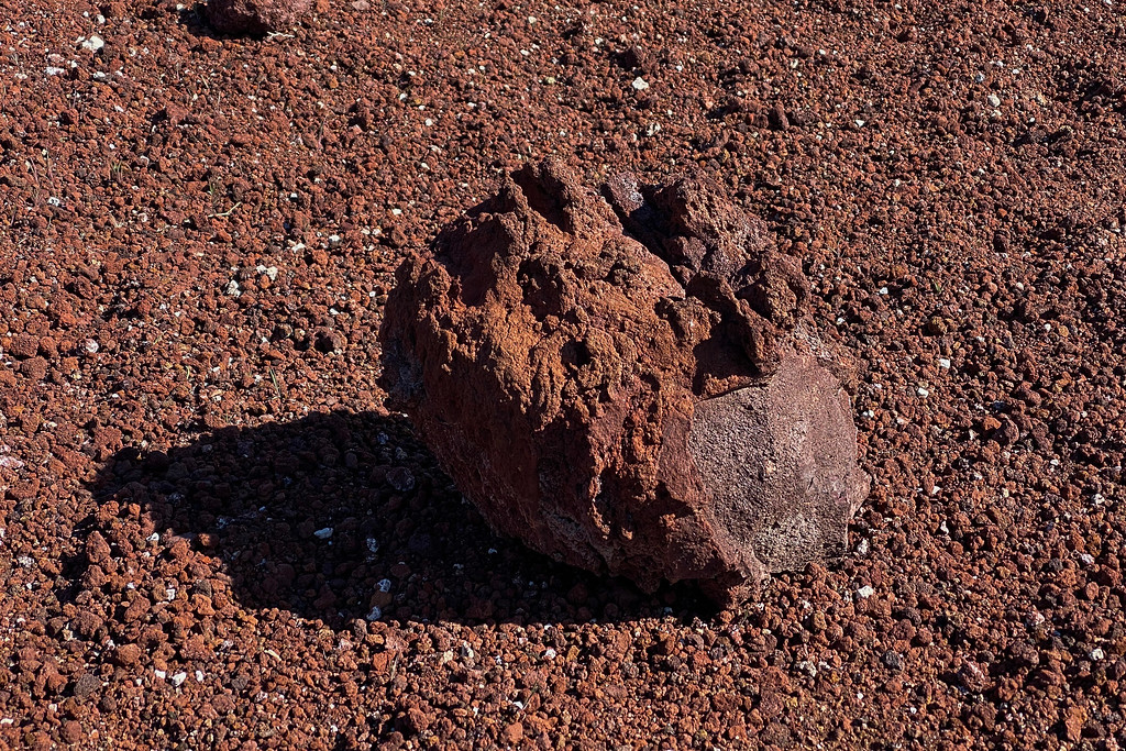
volcanic bomb emplaced in the crater: these are semi-molten pyroclasts ejected by the cinder cone. They cool before they reach the ground
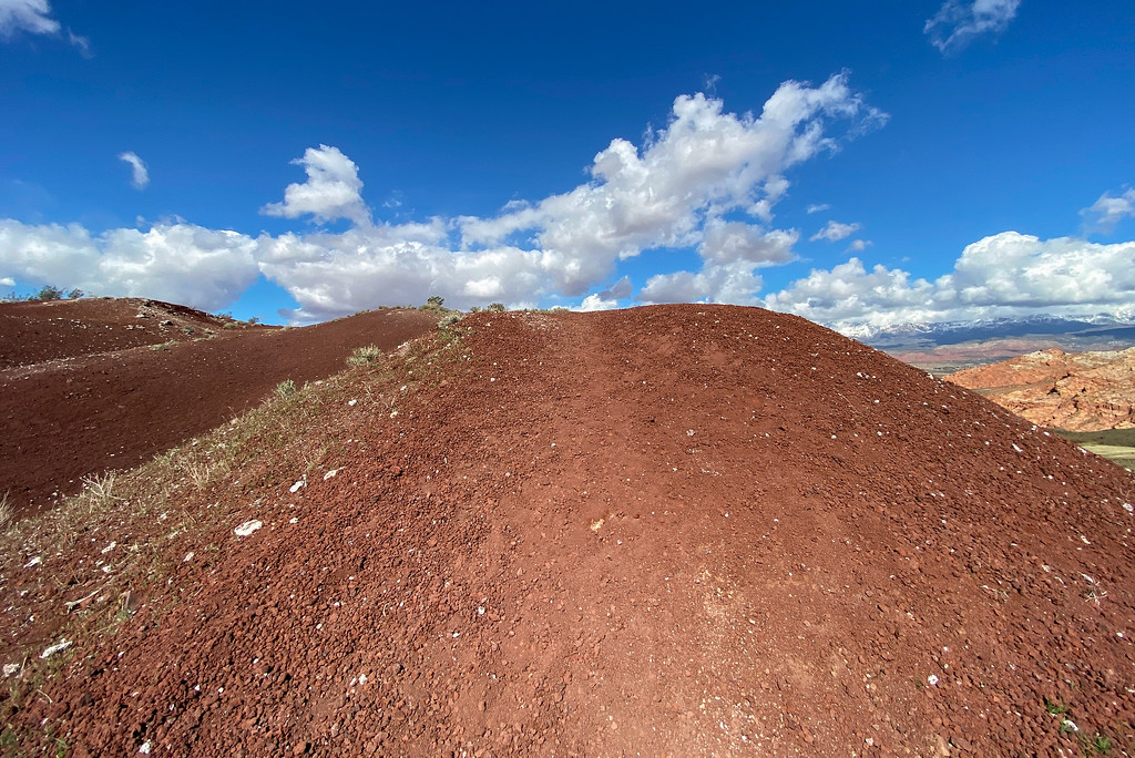
walking along the rim of one of the cinder cones: all the little pebbles are red cinder, also called lapilli. These lapilli pieces are smaller than 64mm and contain a lot of vesicles where trapped gases escaped rapidly.
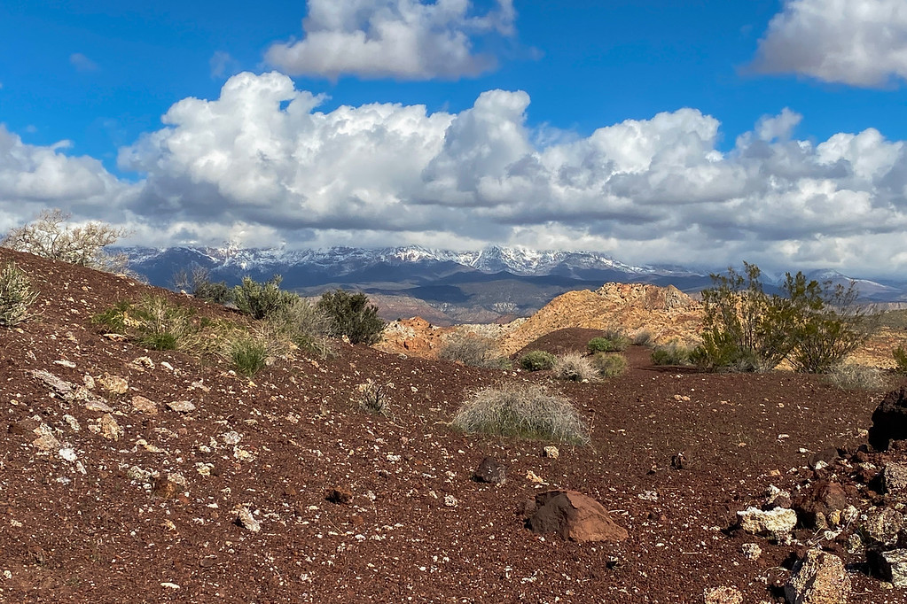
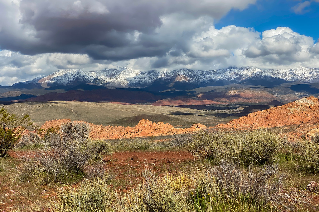
Looking to the north toward the snow-covered Pine Valley Mountains. The Pine Valley Mountains are actually a massive laccolith. When magma intruded between layers of sandstone, it warped up the layers into a mushroom-shaped dome. The magma cooled below the surface and crystallized, creating granitoid igneous rock, similar in composition to granite. The soft sandstone layers have long eroded away, exposing the intrusive igneous rocks.
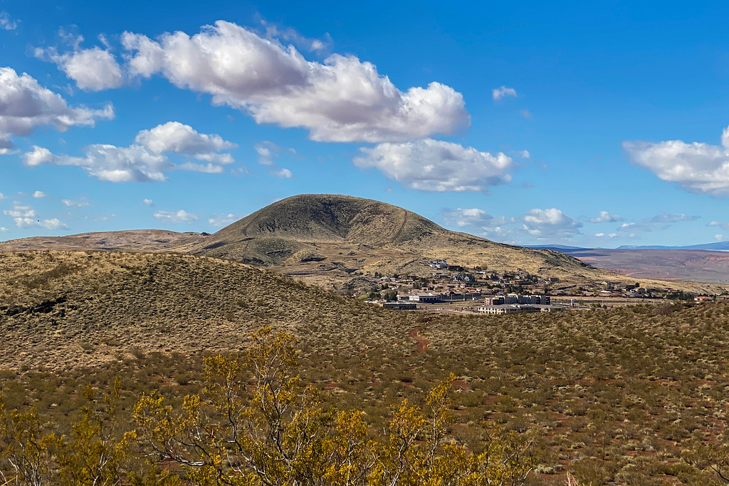
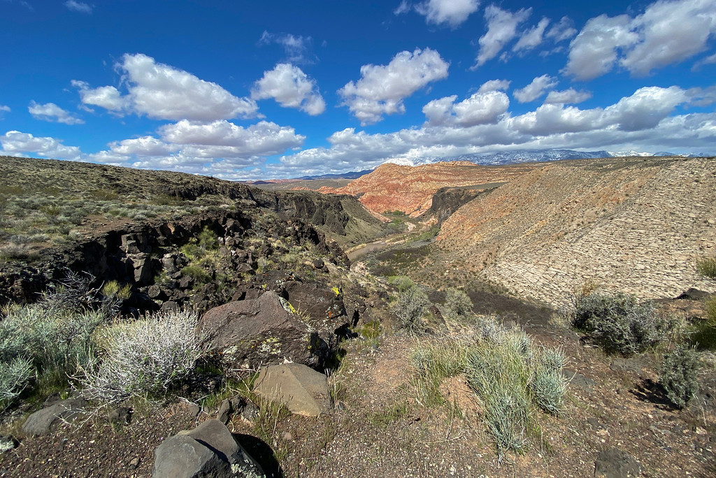
Sullivan Knoll - another Cinder Cone Volcano southwest of my place. Three different lava flows of three different time periods are in close vicinity. Like all cinder cone volcanoes, this one is monogenetic and erupts only once in its lifetime. The entire volcanic field is only dormant and not extinct, if volcanic activity will proceed at one time, it will create a new cinder cone nearby
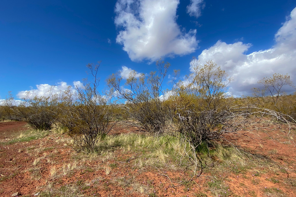
Creosote Bush: the bushes are plants of the Basin and Range Province. As soon as you drive about 4 miles to the east over the active Hurricane Fault, you'll enter the Colorado Plateau and no Creosote Bushes grow anymore. Hurricane lies in a large valley which is the transition zone between the Colorado Plateau and the Basin and Range Province. The active Hurricane Fault to the east is a normal fault, which means that the Hanging Wall dropped down. In case of the Hurricane Fault, it dropped about 5,000 ft. creating the large valley due to extensional forces.
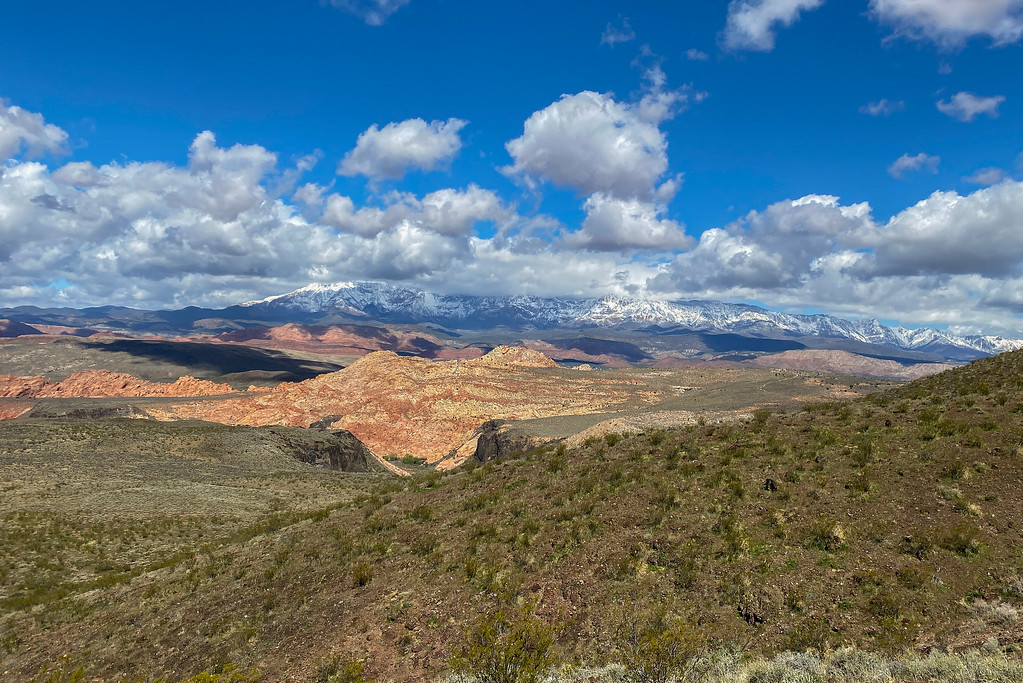
Another view of the snow-capped Pine Valley Mountains with Jurassic - Age Navajo Sandstone in the foreground
Sand Mountain to the northwest, a large lithified sand dune of Jurassic -aged sandstone
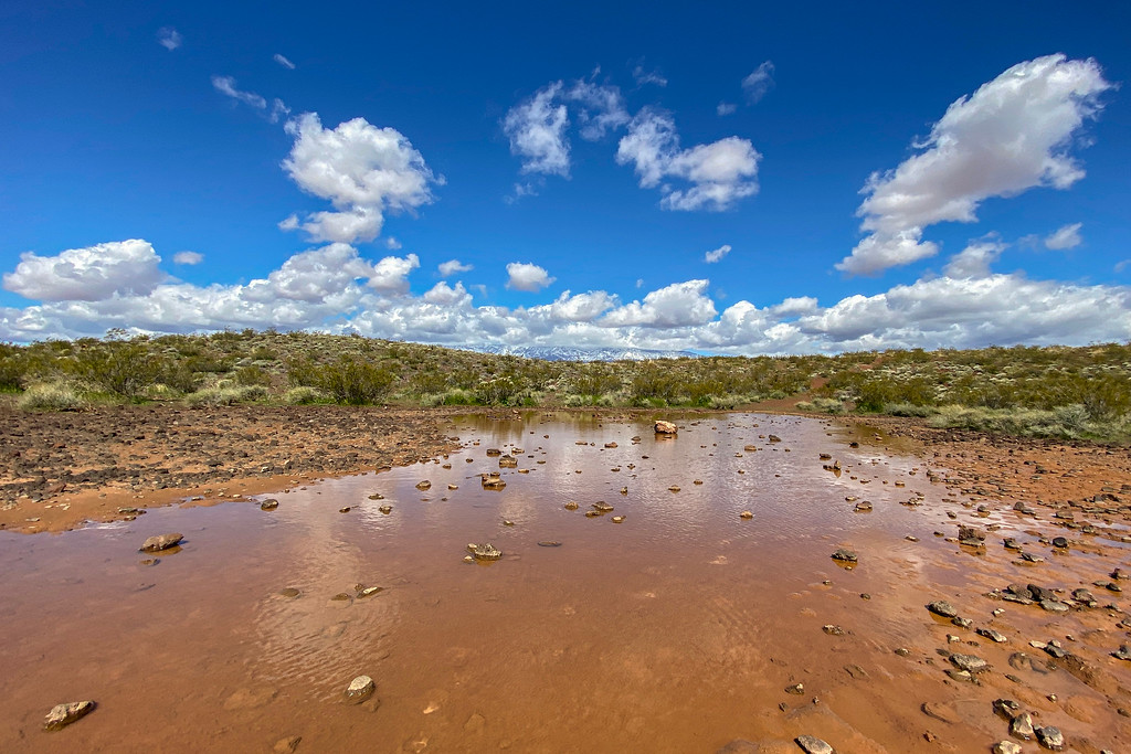
The top of East Cinder Knoll consists of a group of four cinder cone volcanoes. The crater often fills with water after heavy rains
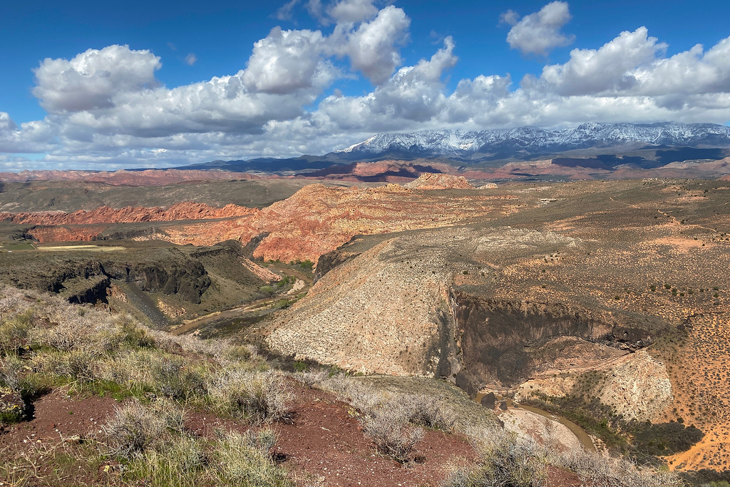
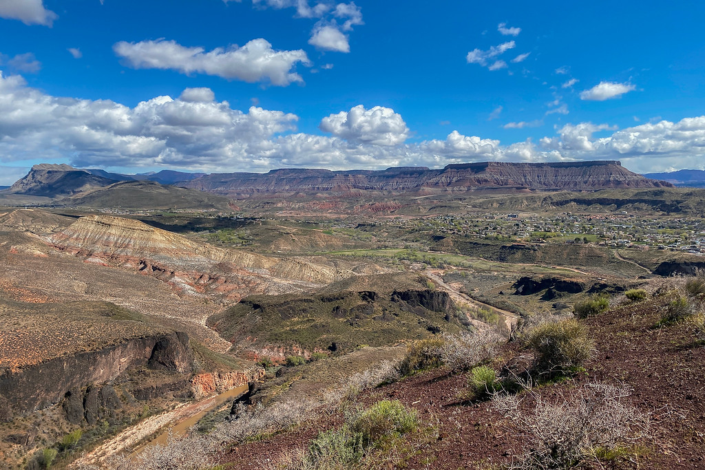
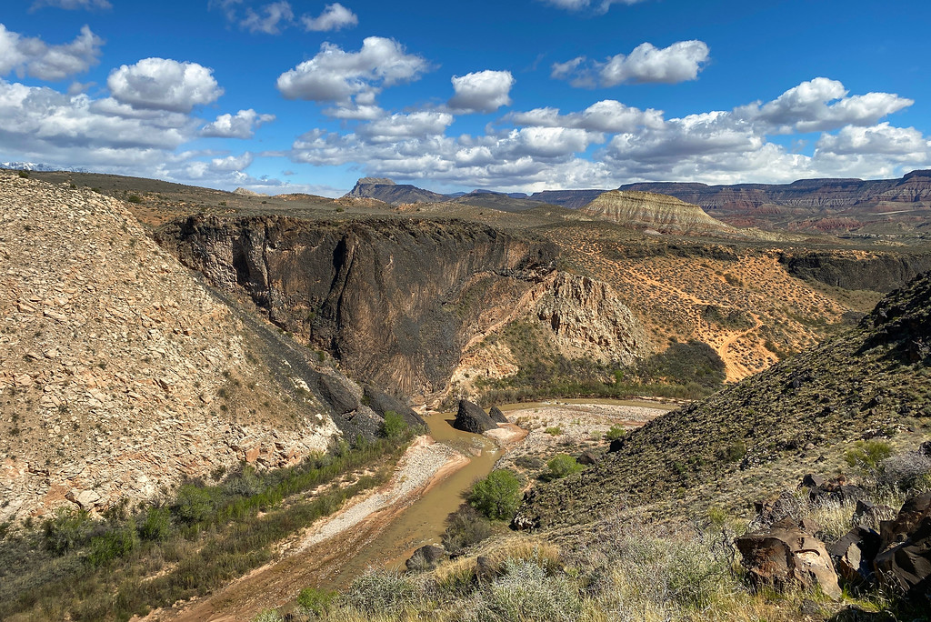
Looking down to the Virgin River and some of the massive lava flows on both sides of the river
Virgin River and view to the East toward Hurricane Cliff and the Colorado Plateau: The stratified cliffs of the Hurricane Cliffs include the first step of the Grand Staircase, which are made of the Chocolate Cliffs. The Chocolate Cliffs got their name because they resemble chocolate colors and include the Moenkopi Formation plus a caprock layer of Shinarump Formation with additional outcrops of the Petrified Forest Member of the Chinle Formation, most famous in this area for petrified wood and the infamous blue clay
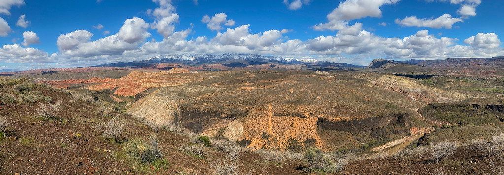
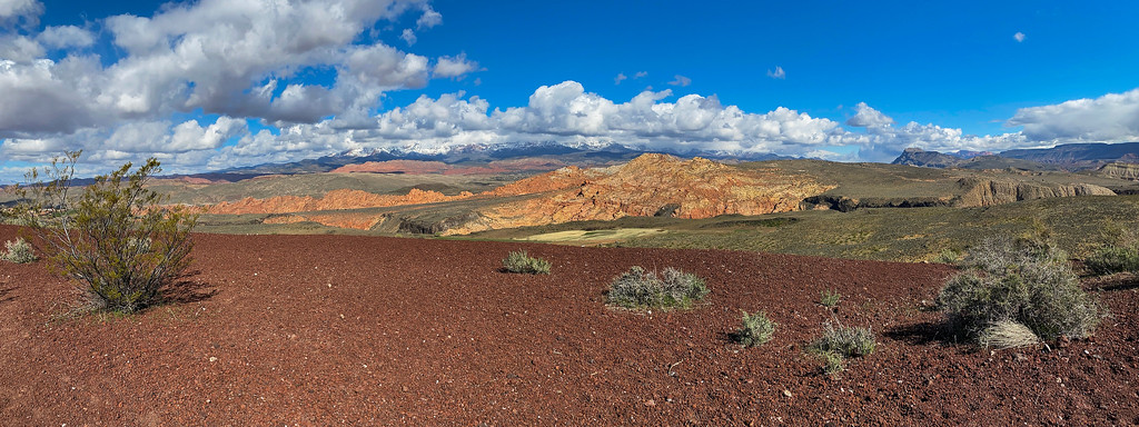
panoramic view of the Pine Valley Mountains, Virgin River, and Sand Mountain
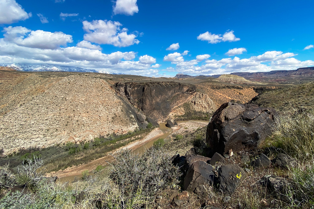
looking across the Virgin River and some of the lava flows
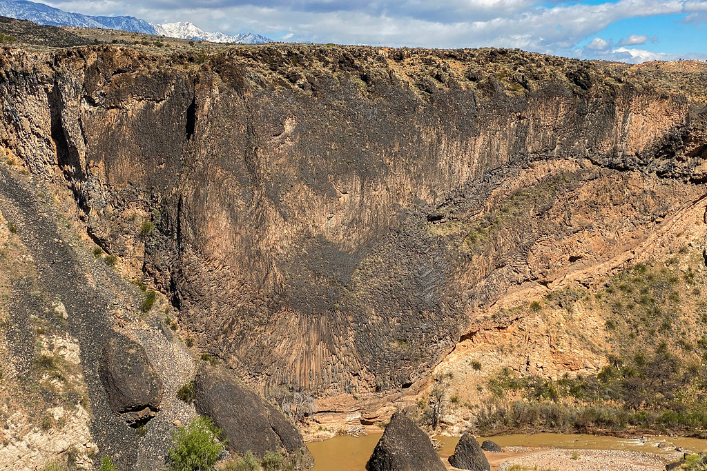
the view to the east has outcrops of massive columnar jointing
This view to the east shows some of the massive 180 ft. thick lava flows that erupted during the Pleistocene
a close-up view of the Columnar Jointing with created hexagonal-shaped pieces of basalt. The individual blocks of basalt are separated by joints or cracks that form when the rock contracted during cooling
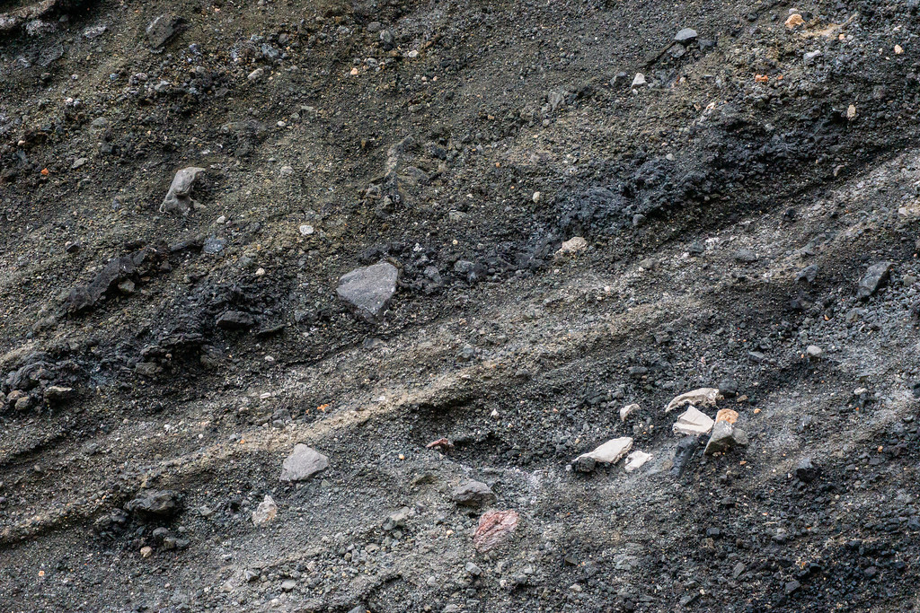
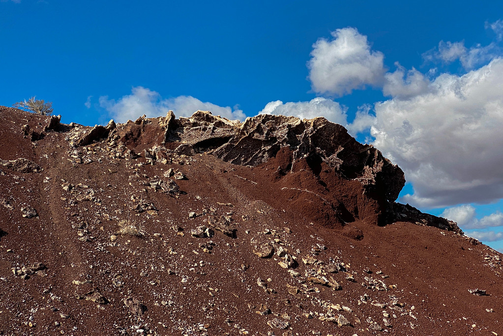
one of the steep flanks of East Cinder Knoll has wonderful beds of volcanic ash with embedded pyroclasts.
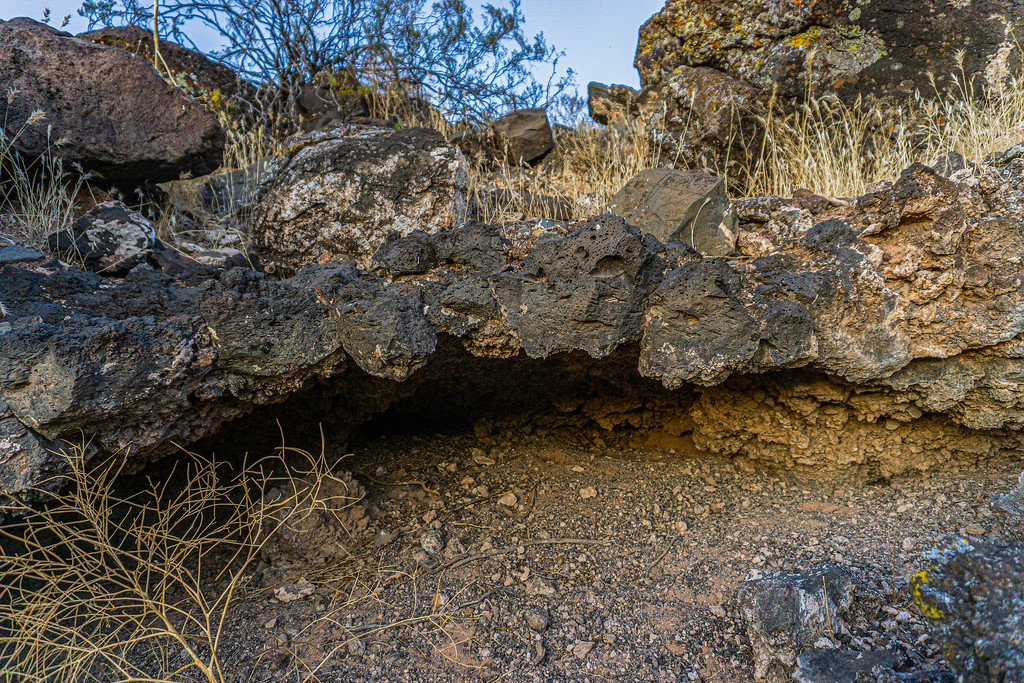
several lava tubes can be found at the base of East CInder Knoll
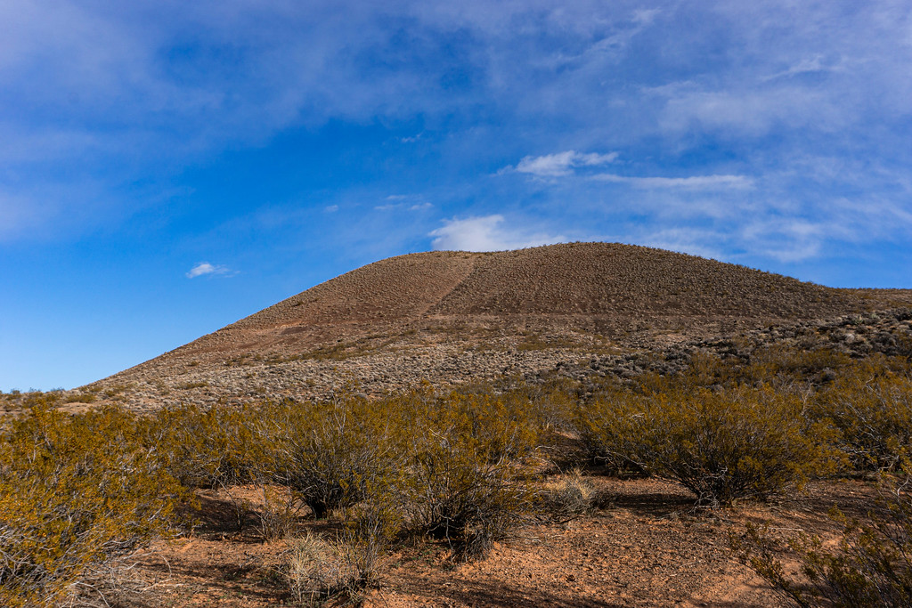
East Cinder Knoll shows the typical conical shape with a steep angle of repose which is common for cinder cone volcanoes. They are all primarily monogenetic, which means they erupt only once and usually never again.
I guess at one point I will know every corner of the cinder cone volcanoes. It's a fun hike and I can easily squeeze it in each day.
Having the volcanoes in my backyard almost feels like being back home in Hawai'i. I usually do not bring a camera when I hike there, in most cases my cellphone has to do the job.
on top of West Cinder Knoll: Scoria and Cinder cover the two pit craters
Looking into the crater: These all erupted during the middle Pleistocene, building up the two cinder cones with their typical steep angle of repose. At the end of their lifecycle, they produced lava flows that covered a small area, including the place where my house now is. Much of the basaltic lava is aphanitic with some olivine phenocrysts in it.
walking the rim of the crater
volcanic bomb emplaced in the crater: these are semi-molten pyroclasts ejected by the cinder cone. They cool before they reach the ground
walking along the rim of one of the cinder cones: all the little pebbles are red cinder, also called lapilli. These lapilli pieces are smaller than 64mm and contain a lot of vesicles where trapped gases escaped rapidly.
Looking to the north toward the snow-covered Pine Valley Mountains. The Pine Valley Mountains are actually a massive laccolith. When magma intruded between layers of sandstone, it warped up the layers into a mushroom-shaped dome. The magma cooled below the surface and crystallized, creating granitoid igneous rock, similar in composition to granite. The soft sandstone layers have long eroded away, exposing the intrusive igneous rocks.
Sullivan Knoll - another Cinder Cone Volcano southwest of my place. Three different lava flows of three different time periods are in close vicinity. Like all cinder cone volcanoes, this one is monogenetic and erupts only once in its lifetime. The entire volcanic field is only dormant and not extinct, if volcanic activity will proceed at one time, it will create a new cinder cone nearby
Creosote Bush: the bushes are plants of the Basin and Range Province. As soon as you drive about 4 miles to the east over the active Hurricane Fault, you'll enter the Colorado Plateau and no Creosote Bushes grow anymore. Hurricane lies in a large valley which is the transition zone between the Colorado Plateau and the Basin and Range Province. The active Hurricane Fault to the east is a normal fault, which means that the Hanging Wall dropped down. In case of the Hurricane Fault, it dropped about 5,000 ft. creating the large valley due to extensional forces.
Another view of the snow-capped Pine Valley Mountains with Jurassic - Age Navajo Sandstone in the foreground
Sand Mountain to the northwest, a large lithified sand dune of Jurassic -aged sandstone
The top of East Cinder Knoll consists of a group of four cinder cone volcanoes. The crater often fills with water after heavy rains
Looking down to the Virgin River and some of the massive lava flows on both sides of the river
Virgin River and view to the East toward Hurricane Cliff and the Colorado Plateau: The stratified cliffs of the Hurricane Cliffs include the first step of the Grand Staircase, which are made of the Chocolate Cliffs. The Chocolate Cliffs got their name because they resemble chocolate colors and include the Moenkopi Formation plus a caprock layer of Shinarump Formation with additional outcrops of the Petrified Forest Member of the Chinle Formation, most famous in this area for petrified wood and the infamous blue clay
panoramic view of the Pine Valley Mountains, Virgin River, and Sand Mountain
looking across the Virgin River and some of the lava flows
the view to the east has outcrops of massive columnar jointing
This view to the east shows some of the massive 180 ft. thick lava flows that erupted during the Pleistocene
a close-up view of the Columnar Jointing with created hexagonal-shaped pieces of basalt. The individual blocks of basalt are separated by joints or cracks that form when the rock contracted during cooling
one of the steep flanks of East Cinder Knoll has wonderful beds of volcanic ash with embedded pyroclasts.
several lava tubes can be found at the base of East CInder Knoll
East Cinder Knoll shows the typical conical shape with a steep angle of repose which is common for cinder cone volcanoes. They are all primarily monogenetic, which means they erupt only once and usually never again.
I guess at one point I will know every corner of the cinder cone volcanoes. It's a fun hike and I can easily squeeze it in each day.


")

")