shredhiker
Member
- Joined
- Feb 14, 2023
- Messages
- 190
I'd been trying to put together a big Utah trip with my buddies for quite some time. We actually had plans to make it out there in October of '23 but due to a scheduling mixup, they ended up there while I was in the Sierra. Our trip to remedy that this year worked out, sort of. Our original plan was do a big loop around Kings Peak & Red Castle, but then 1/3 of us had to cancel due to work obligations. Since he'd done his share of the leg work helping us plan that route, it didn't seem right to go without him. Since flights were already booked, the remaining two of us came up with a rough idea for a route starting & ending at the Highline Trailhead @ Hayden Pass.
It was pretty smooth sailing; flying into Salt Lake picking up our rental, and enjoying some great local food. The airbnb we stayed in was tiny, but it had a roof & shower. We made sure to enjoy a nice hot breakfast in town before making the couple hour drive to start our hike. We brought 8 days worth of food, and even though they weren't required, opted to bring our bear canisters along. We were already used to hauling them at that point, and it wouldn't make for easier campsite selection in an area we were unfamiliar with. We hiked in on August 28 and out on September 4.
Day 1:
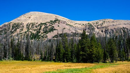
We arrived at the trailhead around 11:30. We were a little concerned about the hazy skies all around SLC, but it was perfectly clear up at the Highline. Our overall plan was to head south, toward Pinto Lake. Most of the day was in pretty dense forest, with an occasional clear view. Scudder was the first lake we came across, in an area that had been pretty heavily burned. Thankfully that wasn't the case for the rest of the day, just a long march mostly down hill. I couldn't help but notice how rocky the trails were, littered with softball up to basketball sized stones. Even though the overall terrain should have made for an easy first day, the rockiness of the trail definitely made us work for every mile. This was pretty much the case for the entire week we were out. Despite them showing quite a bit of wear by the time we hiked out, my barely worn in Hoka Speedgoats performed considerably well through the trip.
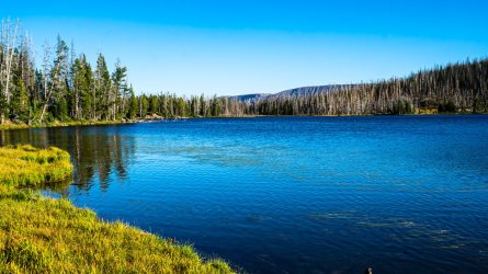
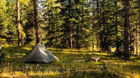
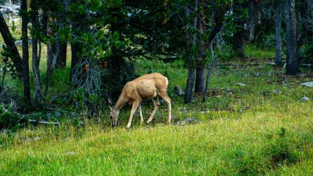
We finished the 8 mile hike in, and reached Pinto Lake around 5:30. It was a very attractive place to camp for the first night. The lake shore was very marshy, reminding me a lot of the lakes in Yellowstone actually. It was a quiet evening with no one else around, except one brave deer who was lurking around camp just before sunset.
Day 2:
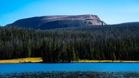
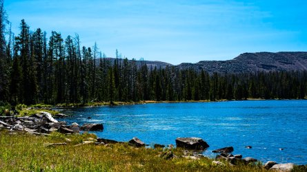
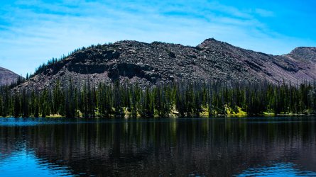
We woke up to another blue-bird day, hearing an elk bugle somewhere nearby. We tried to remain quiet & still hoping to get a glimpse of him, but no such luck. We hiked out around 9am heading further south toward Grandaddy Lake. Rather than taking the most direct route, where the trail forked off, we veered toward Pine Island & Fish Hatchery Lakes. That was definitely a worthwhile side trip, the scenery was gorgeous and we didn't see anyone else along that stretch. We found a nice big established camp at Betsy Lake, but decided to go a little further that day. Shortly after, we encountered a large mixed group of hikers with a couple of horse packers who were headed to that spot, so it's probably best that we passed it up.
Grandaddy Lake was absolutely beautiful, so we decided to make camp there. It took us a solid hour to find a good spot, between spur trails around the lakeshore being slow to get across, and a few other groups around we didn't want to impede on. We ended up finding a couple of small tent sites hidden just off the main trail. There were a couple of other groups a few hundred yards on either side of us, but we could barely see them wandering around from the waters edge. Having learned this was a popular area, it was as private a site as we could expect.
After getting set up, we hiked about another mile round trip to the eastern end of the lake. From there we got off trail for a bit, scrambling up to the top of a little knob that offered a nice look down toward Lodgepole Lake and a good view north, across that valley we'd be hiking the next day. By the time we got back to camp, the other groups nearby had settled down. We covered right around 7 miles for the day.

Day 3:
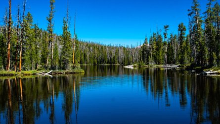
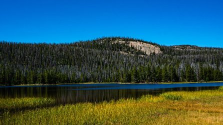
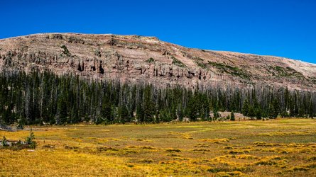
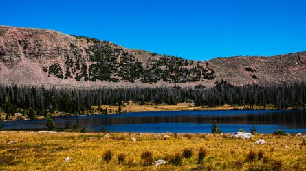
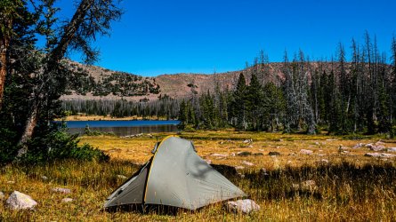
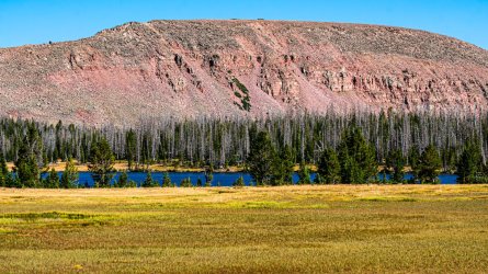
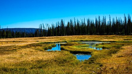
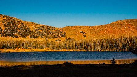
We decided to hike up toward Four Lakes Basin. Much like the first day, the trail was mostly wooded but there was the occasional meadow, lake, or clearing in the trees where we started to get views of the surrounding peaks. It was a pretty easy 7 miles to Daynes Lake, where we decided to make camp right be the tree line on the edge of a large open meadow that surrounded the lake. It seemed like a good enough place for wildlife watching that evening. There was one other tent set up down the lake from us, but we hardly saw the campers occupying it.
Since we arrived around 2:30, I decided to check out some of the other lakes in the basin. I followed the trail first over to Jean Lake, and then back toward Dale Lake. With everything being very open in the area, I decided to venture off trail back toward camp which was easy enough to find. I noticed several fire rings scattered around the area, though my map stated fires were prohibited in the basin, I saw no signs posting this. Despite it being a rather cold evening & the regulations being unclear, we opted not to have a campfire that night.
As the sun went down, we quietly made our way to a few different observation points around the lake. Once again, the only wildlife we saw was a lone deer. This was the coldest night of the trip by far.
Day 4:
We woke up to water frozen in our bottles, and left camp around 9am. This was the first day of the trip that we set out with big plans, that didn't pan out. Our intent was to make it over Rocky Sea Pass, and explore the lakes around the Rock Creek drainage. We made it up to the pass just fine, which was a beautiful trek up. It's also worth noting that at this point in the trip, we were both quite happy with easily we were handling the altitude & elevation. Both of us had really struggled to keep up on our Whitney trip, while feeling under the weather for most of it, so it was a huge relief to be a few days into a big trip and back to business as usual.
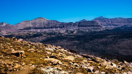
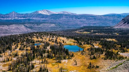
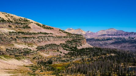
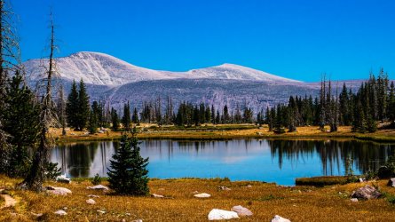
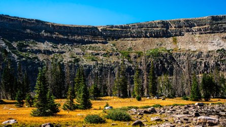
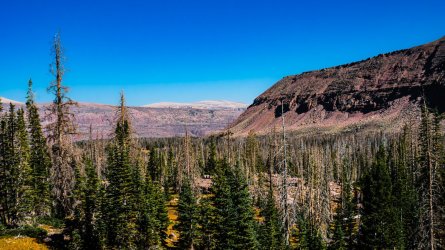
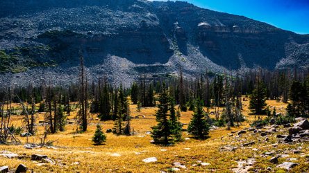
Around the top of the pass we started to encounter other hikers, mainly on their way out & completing the Uintas Highline. They all mentioned how badly burnt the area was that we were headed, one lady specifically mentioned trying to get over to Gladys Lake & how terrible it was with all the blow down. We spent some time hanging out, enjoying the views from the pass, and weighing out our options. Just over the other side, east of us, we looked down a couple of small unnamed lakes surrounded by big open meadows and scattered trees. Ultimately we decided to make camp at one of the visible water sources, and explore the basin below us off trail. We had a great view of Kings Peak as we made our way down, and stopped to recognize a few landmarks that would've been part of our original intended route.
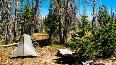
We arrived at camp around 1:00, and after setting up & having lunch, I started my off trail exploring. It was pretty easy moving across the meadows for the most part, with some occasional marshy/mucky sections that weren't too difficult to avoid. Later that evening back toward camp we came across a nice fire ring, and decided we'd make good use of it. It was around a 4 mile trip to our camp, and I probably did another mile or two of wandering the area.

Day 5:
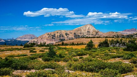
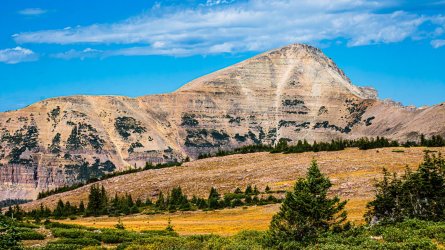
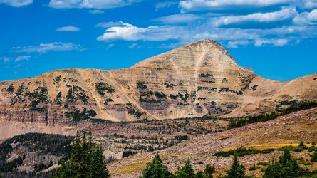
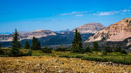
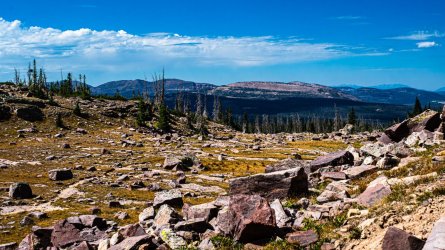
Right off the bat, we had to climb back up Rocky Sea Pass. From this direction, it wasn't the gradual moderate trail we'd encountered yesterday. The base of the climb was literally like walking right up to a sheer wall that shot straight up to the valley floor. We could barely make out the trail more than 100 yards ahead. Shockingly we made our way up in great time, slowing down only to be cautious on a few sketchy sections we'd noted the day before. Since it was going to be another short day, we spent some time getting off trail for a better look at Spread Eagle Peak and a glimpse down into the valley to our north.
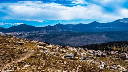
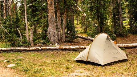
The scenery as we descended was just as gorgeous as the day before, and we opted to make it a short day, ending at Carolyn Lake. While it wasn't quite as beautiful as the previous couple of camps, it was a nice peaceful spot nestled in the trees. There were a few people fishing around the lake when we arrived, but they all hiked out about an hour later. One other group showed up later that evening, setting their tent up right by the waters edge, which I thought was odd. We had another nice campfire that night, and there were a tone of deer hanging around camp. I actually heard one of them stomping around very close to my tent after dark, so loudly that I actually got out of my tent to see what was making so much noise. We only covered around 3 miles that day.
Day 6:
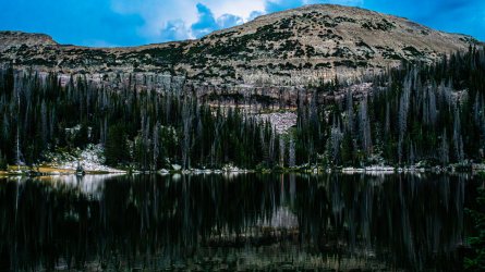
We used the in-reach to get an update on the weather, which had been abnormally perfect thus far. The forecast was scattered thunderstorms for the next few days. Naturalist Basin was on our to-see list for this trip, and a few days prior we'd talked to a lady who mentioned camping at Jordan Lake, so that seemed like as good a destination as any. We hiked out at 9am and began the climb up toward the basin, it didn't take long for storm clouds to gather overhead. Every hiker we encountered was heading down from that area, most of them hiking out. By the time we reached Jordan Lake we had some light rain falling on us, which had us picking the first useable campsite we came across. It was around 1pm when we chose a camp and by 1:30 we were in a pretty heavy rain & hail storm. Thankfully we got the tents set up and essential items inside just in time.
We spent most of the afternoon hiding out in our tents. Around 6:00 the rain finally let up long enough for us to have dinner & spend a few minutes walking the lakeshore. We found a few camp spots nearby that were much nicer than what we chose. It stormed most of the night, with the wind getting so heavy at one point that my tent walls were close to hitting me in the face. While the rain never stopped, eventually the wind let up and I was able to sleep through most of the night. It was only a 4.5 mile day, but quite eventful.

Day 7:
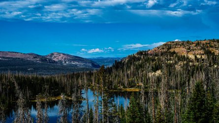
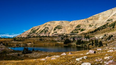
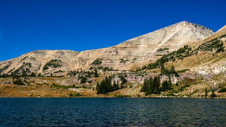
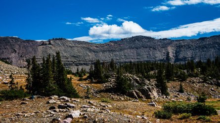
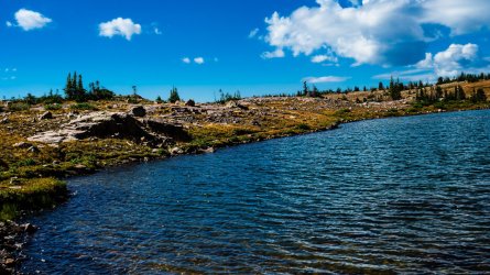
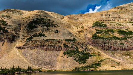
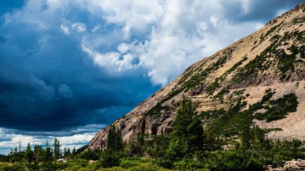
Despite the relentless storm, it cleared up quite nicely by morning. Even though it was quite clear overhead, the forecast was calling for more storms later that afternoon. We decided to leave camp set up where it was, and grab our small day packs to check out some of the other lakes around the basin. We followed a social trail that got us up on the little shelf that surrounds Jordan Lake, from there we were able to make our way toward Shaler Lake pretty easily. Getting the other lakes in the basin was mostly off trail route finding, occasionally we'd pick up a well used foot path but none of them got us very far. This was my favorite part of the trip by far, the lakes & surrounding peaks up there were just stunning.
By the time we'd made it over to Blue Lake, the skies were starting to turn dark and we heard a few thunder booms in the distance. Thankfully by that time, we'd found the official trail that would take us back toward our camp. Coming down from there was quite the scramble, it took us about an hour & a half to get back to camp. Despite all the signs, it never really rained on us that day. As best I could tell, we covered about 4 miles. Even with the off-trail, it was pretty easy hiking with the smaller day packs.
Day 8:
Not much to report here, this was our hike out day. We woke up around 7:30, the weather appeared to be completely clear but afternoon thunderstorms were forecasted once again. Originally we'd planned to hike out early, but decided to hang around camp an extra hour or so trying to let our tents and other gear dry out as much as possible. We both had to fly home the following day, and didn't want to do so with all of our stuff wet if we could help it. We both ended up leaving our tent bodies in the exterior pockets of our packs, so we let them dry a bit more whenever we stopped to take breaks. I put the camera away for this day, since it was all backtracking through the woods.
With Pizza & Beer on our brains, we covered the 6.5 miles back to the car in just over 2 hours. This was not only my first hike in the Uintas, but my first trip to Utah as well. I really enjoyed our time out there, it's a very easy wilderness to fall in love with. I still want to come back possibly next year, and attempt our originally planned route over Kings Peak and out to the Red Castle Lakes, but I'm glad we got to explore some lesser traveled parts of the range. I certainly don't feel like we missed out on anything by taking this route
It was pretty smooth sailing; flying into Salt Lake picking up our rental, and enjoying some great local food. The airbnb we stayed in was tiny, but it had a roof & shower. We made sure to enjoy a nice hot breakfast in town before making the couple hour drive to start our hike. We brought 8 days worth of food, and even though they weren't required, opted to bring our bear canisters along. We were already used to hauling them at that point, and it wouldn't make for easier campsite selection in an area we were unfamiliar with. We hiked in on August 28 and out on September 4.
Day 1:
We arrived at the trailhead around 11:30. We were a little concerned about the hazy skies all around SLC, but it was perfectly clear up at the Highline. Our overall plan was to head south, toward Pinto Lake. Most of the day was in pretty dense forest, with an occasional clear view. Scudder was the first lake we came across, in an area that had been pretty heavily burned. Thankfully that wasn't the case for the rest of the day, just a long march mostly down hill. I couldn't help but notice how rocky the trails were, littered with softball up to basketball sized stones. Even though the overall terrain should have made for an easy first day, the rockiness of the trail definitely made us work for every mile. This was pretty much the case for the entire week we were out. Despite them showing quite a bit of wear by the time we hiked out, my barely worn in Hoka Speedgoats performed considerably well through the trip.
We finished the 8 mile hike in, and reached Pinto Lake around 5:30. It was a very attractive place to camp for the first night. The lake shore was very marshy, reminding me a lot of the lakes in Yellowstone actually. It was a quiet evening with no one else around, except one brave deer who was lurking around camp just before sunset.


Day 2:
We woke up to another blue-bird day, hearing an elk bugle somewhere nearby. We tried to remain quiet & still hoping to get a glimpse of him, but no such luck. We hiked out around 9am heading further south toward Grandaddy Lake. Rather than taking the most direct route, where the trail forked off, we veered toward Pine Island & Fish Hatchery Lakes. That was definitely a worthwhile side trip, the scenery was gorgeous and we didn't see anyone else along that stretch. We found a nice big established camp at Betsy Lake, but decided to go a little further that day. Shortly after, we encountered a large mixed group of hikers with a couple of horse packers who were headed to that spot, so it's probably best that we passed it up.
Grandaddy Lake was absolutely beautiful, so we decided to make camp there. It took us a solid hour to find a good spot, between spur trails around the lakeshore being slow to get across, and a few other groups around we didn't want to impede on. We ended up finding a couple of small tent sites hidden just off the main trail. There were a couple of other groups a few hundred yards on either side of us, but we could barely see them wandering around from the waters edge. Having learned this was a popular area, it was as private a site as we could expect.
After getting set up, we hiked about another mile round trip to the eastern end of the lake. From there we got off trail for a bit, scrambling up to the top of a little knob that offered a nice look down toward Lodgepole Lake and a good view north, across that valley we'd be hiking the next day. By the time we got back to camp, the other groups nearby had settled down. We covered right around 7 miles for the day.


Day 3:
We decided to hike up toward Four Lakes Basin. Much like the first day, the trail was mostly wooded but there was the occasional meadow, lake, or clearing in the trees where we started to get views of the surrounding peaks. It was a pretty easy 7 miles to Daynes Lake, where we decided to make camp right be the tree line on the edge of a large open meadow that surrounded the lake. It seemed like a good enough place for wildlife watching that evening. There was one other tent set up down the lake from us, but we hardly saw the campers occupying it.
Since we arrived around 2:30, I decided to check out some of the other lakes in the basin. I followed the trail first over to Jean Lake, and then back toward Dale Lake. With everything being very open in the area, I decided to venture off trail back toward camp which was easy enough to find. I noticed several fire rings scattered around the area, though my map stated fires were prohibited in the basin, I saw no signs posting this. Despite it being a rather cold evening & the regulations being unclear, we opted not to have a campfire that night.
As the sun went down, we quietly made our way to a few different observation points around the lake. Once again, the only wildlife we saw was a lone deer. This was the coldest night of the trip by far.


Day 4:
We woke up to water frozen in our bottles, and left camp around 9am. This was the first day of the trip that we set out with big plans, that didn't pan out. Our intent was to make it over Rocky Sea Pass, and explore the lakes around the Rock Creek drainage. We made it up to the pass just fine, which was a beautiful trek up. It's also worth noting that at this point in the trip, we were both quite happy with easily we were handling the altitude & elevation. Both of us had really struggled to keep up on our Whitney trip, while feeling under the weather for most of it, so it was a huge relief to be a few days into a big trip and back to business as usual.
Around the top of the pass we started to encounter other hikers, mainly on their way out & completing the Uintas Highline. They all mentioned how badly burnt the area was that we were headed, one lady specifically mentioned trying to get over to Gladys Lake & how terrible it was with all the blow down. We spent some time hanging out, enjoying the views from the pass, and weighing out our options. Just over the other side, east of us, we looked down a couple of small unnamed lakes surrounded by big open meadows and scattered trees. Ultimately we decided to make camp at one of the visible water sources, and explore the basin below us off trail. We had a great view of Kings Peak as we made our way down, and stopped to recognize a few landmarks that would've been part of our original intended route.
We arrived at camp around 1:00, and after setting up & having lunch, I started my off trail exploring. It was pretty easy moving across the meadows for the most part, with some occasional marshy/mucky sections that weren't too difficult to avoid. Later that evening back toward camp we came across a nice fire ring, and decided we'd make good use of it. It was around a 4 mile trip to our camp, and I probably did another mile or two of wandering the area.


Day 5:
Right off the bat, we had to climb back up Rocky Sea Pass. From this direction, it wasn't the gradual moderate trail we'd encountered yesterday. The base of the climb was literally like walking right up to a sheer wall that shot straight up to the valley floor. We could barely make out the trail more than 100 yards ahead. Shockingly we made our way up in great time, slowing down only to be cautious on a few sketchy sections we'd noted the day before. Since it was going to be another short day, we spent some time getting off trail for a better look at Spread Eagle Peak and a glimpse down into the valley to our north.
The scenery as we descended was just as gorgeous as the day before, and we opted to make it a short day, ending at Carolyn Lake. While it wasn't quite as beautiful as the previous couple of camps, it was a nice peaceful spot nestled in the trees. There were a few people fishing around the lake when we arrived, but they all hiked out about an hour later. One other group showed up later that evening, setting their tent up right by the waters edge, which I thought was odd. We had another nice campfire that night, and there were a tone of deer hanging around camp. I actually heard one of them stomping around very close to my tent after dark, so loudly that I actually got out of my tent to see what was making so much noise. We only covered around 3 miles that day.


Day 6:
We used the in-reach to get an update on the weather, which had been abnormally perfect thus far. The forecast was scattered thunderstorms for the next few days. Naturalist Basin was on our to-see list for this trip, and a few days prior we'd talked to a lady who mentioned camping at Jordan Lake, so that seemed like as good a destination as any. We hiked out at 9am and began the climb up toward the basin, it didn't take long for storm clouds to gather overhead. Every hiker we encountered was heading down from that area, most of them hiking out. By the time we reached Jordan Lake we had some light rain falling on us, which had us picking the first useable campsite we came across. It was around 1pm when we chose a camp and by 1:30 we were in a pretty heavy rain & hail storm. Thankfully we got the tents set up and essential items inside just in time.
We spent most of the afternoon hiding out in our tents. Around 6:00 the rain finally let up long enough for us to have dinner & spend a few minutes walking the lakeshore. We found a few camp spots nearby that were much nicer than what we chose. It stormed most of the night, with the wind getting so heavy at one point that my tent walls were close to hitting me in the face. While the rain never stopped, eventually the wind let up and I was able to sleep through most of the night. It was only a 4.5 mile day, but quite eventful.


Day 7:
Despite the relentless storm, it cleared up quite nicely by morning. Even though it was quite clear overhead, the forecast was calling for more storms later that afternoon. We decided to leave camp set up where it was, and grab our small day packs to check out some of the other lakes around the basin. We followed a social trail that got us up on the little shelf that surrounds Jordan Lake, from there we were able to make our way toward Shaler Lake pretty easily. Getting the other lakes in the basin was mostly off trail route finding, occasionally we'd pick up a well used foot path but none of them got us very far. This was my favorite part of the trip by far, the lakes & surrounding peaks up there were just stunning.
By the time we'd made it over to Blue Lake, the skies were starting to turn dark and we heard a few thunder booms in the distance. Thankfully by that time, we'd found the official trail that would take us back toward our camp. Coming down from there was quite the scramble, it took us about an hour & a half to get back to camp. Despite all the signs, it never really rained on us that day. As best I could tell, we covered about 4 miles. Even with the off-trail, it was pretty easy hiking with the smaller day packs.


Day 8:
Not much to report here, this was our hike out day. We woke up around 7:30, the weather appeared to be completely clear but afternoon thunderstorms were forecasted once again. Originally we'd planned to hike out early, but decided to hang around camp an extra hour or so trying to let our tents and other gear dry out as much as possible. We both had to fly home the following day, and didn't want to do so with all of our stuff wet if we could help it. We both ended up leaving our tent bodies in the exterior pockets of our packs, so we let them dry a bit more whenever we stopped to take breaks. I put the camera away for this day, since it was all backtracking through the woods.
With Pizza & Beer on our brains, we covered the 6.5 miles back to the car in just over 2 hours. This was not only my first hike in the Uintas, but my first trip to Utah as well. I really enjoyed our time out there, it's a very easy wilderness to fall in love with. I still want to come back possibly next year, and attempt our originally planned route over Kings Peak and out to the Red Castle Lakes, but I'm glad we got to explore some lesser traveled parts of the range. I certainly don't feel like we missed out on anything by taking this route
