- Joined
- Jul 23, 2013
- Messages
- 1,666
When my friend Devin contacted me about wanting to do a weekend desert trip, he had been keen to do an unknown route he had strung together down on Cedar Mesa, but for various reasons, that was put on the back shelf. We then started considering a loop in Capitol Reef through Lower Muley Twist, but we were not sure how icy a crux spot along that route might be, if there was any left at all, especially with recent wet weather and below freezing temps at night. There was another route I had strung together to explore an unfamiliar canyon in the northern part of Capitol Reef but again, that too was shelved for another idea I had pitched to him: Halls Creek Narrows. Since Devin had yet to experience that himself, I was able to convince him that this would be a perfect opportunity for him to check that one off.
Friday - March 26, 2021
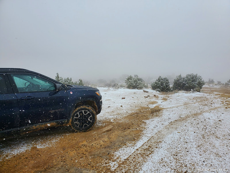
We started the long drive down to the trailhead at Hall Creek Overlook knowing that weather had been iffy earlier in the day, but forecasts had called for favorable conditions throughout the afternoon. However, as we made our way out on the dirt road, lingering clouds began dumping a bit of rain followed by snow making for a slick road. We still managed, barely, pull into the trailhead. We pulled another forecast on our satellite devices as we considered alternative contingency plans.
Snowy Trailhead
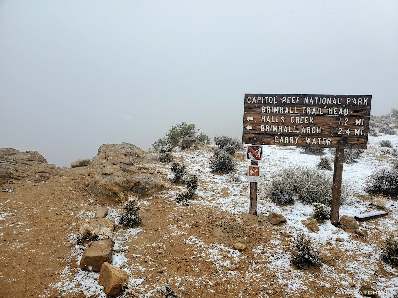
No visibility beyond the rim
We ended up waiting a little over an hour in the car before signs of sunlight began to emerge and the clouds began to pull away.
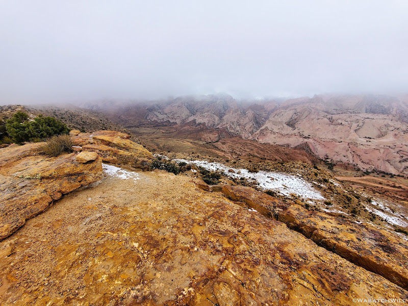
Clouds begin to lift
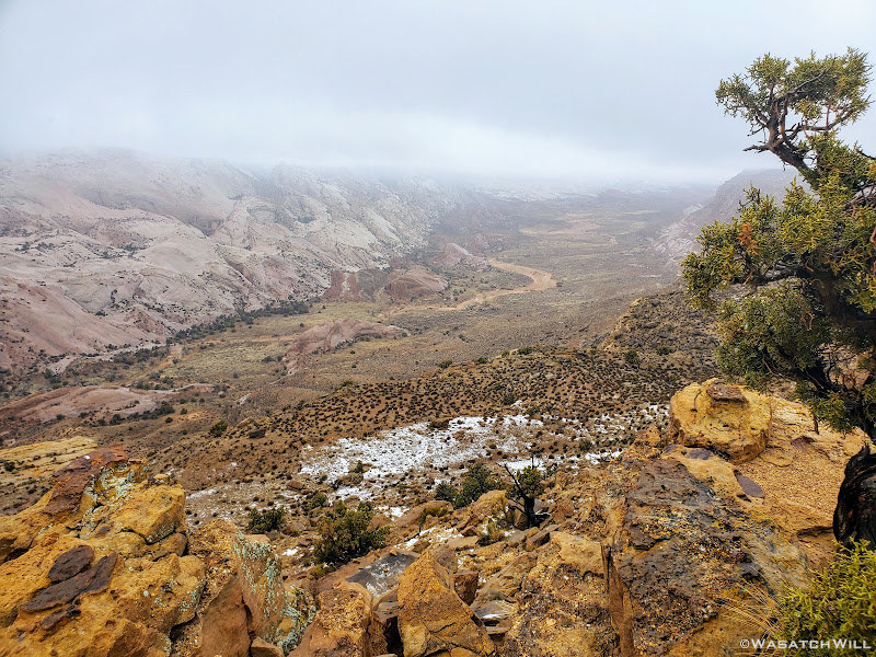
Looking north from the rim
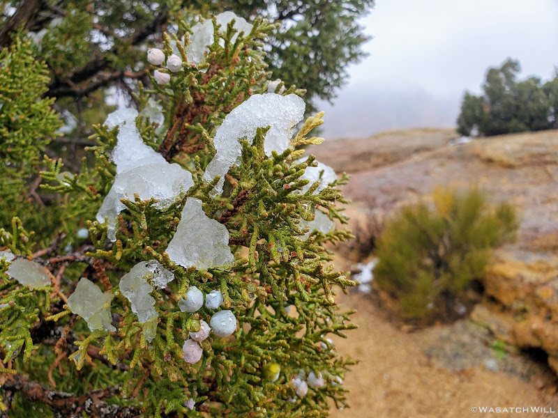
Snow clings to a juniper tree
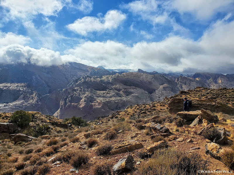
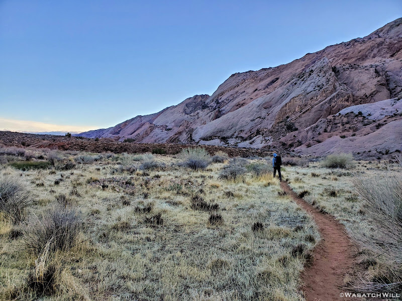
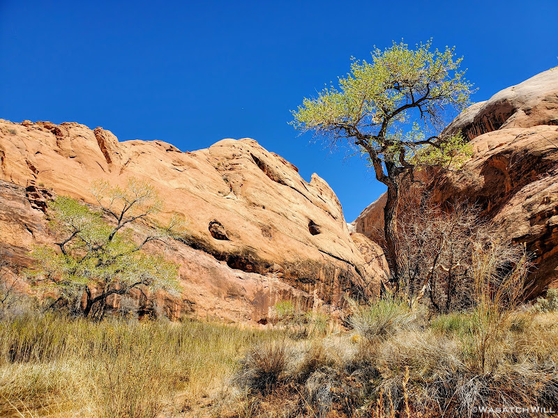
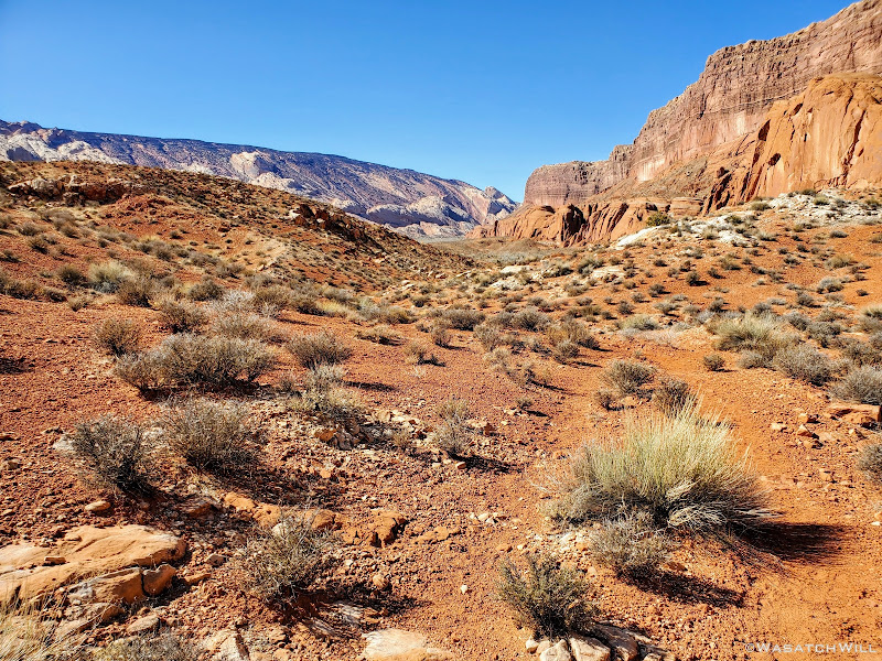
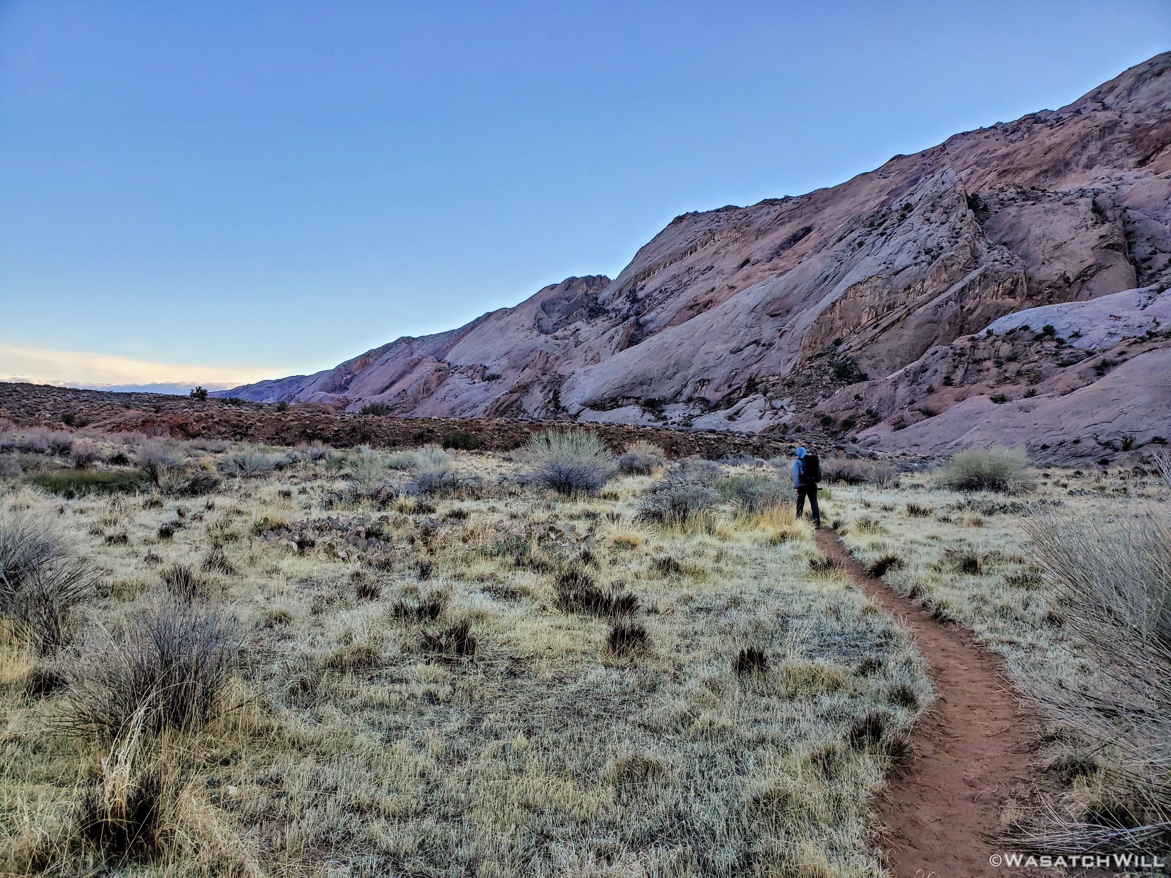
And shortly thereafter, the clouds broke apart to let through some blue sky. The trip was now a go. Though, with less time to hike now, we figured on setting up our base camp a little sooner than we had planned. We donned our packs and made the descent down into Halls Wash.
Devin gazes out into the brightening Halls Wash
Looking south into the wash, now clear of clouds
A wider angle looking southward
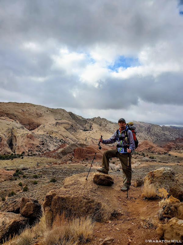
Myself, happy to be on our way
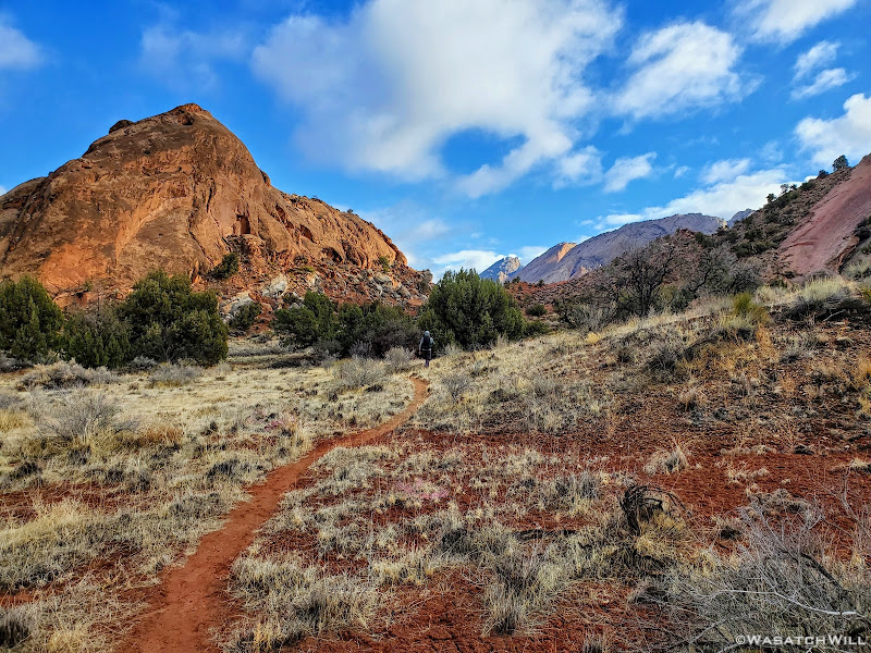
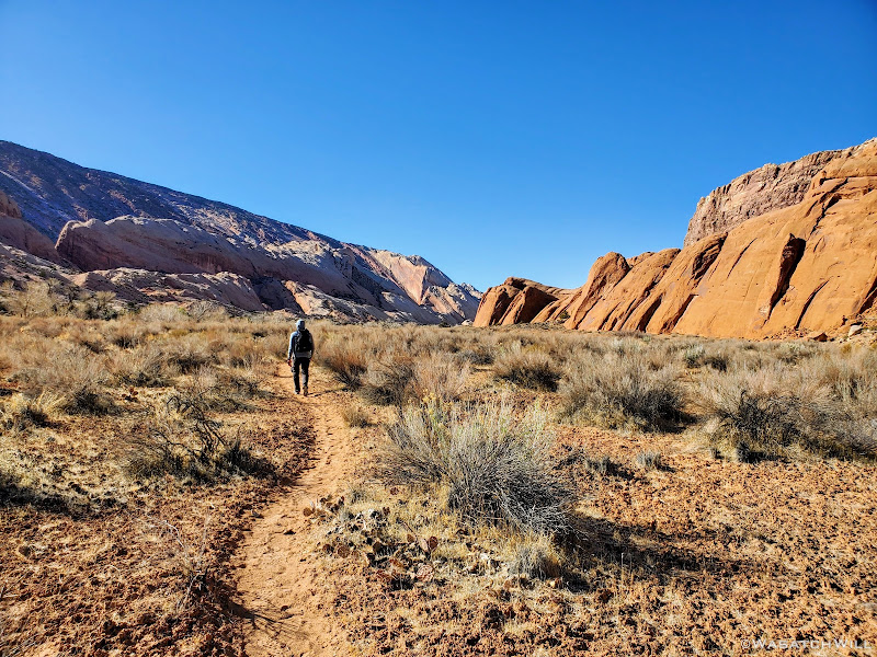
Once into and across the wash, we found ourselves taking a scenic little detour from the standard route before rejoining the wash.
Heading along a brief detour route
Down into a little 'hidden valley'
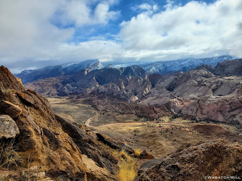
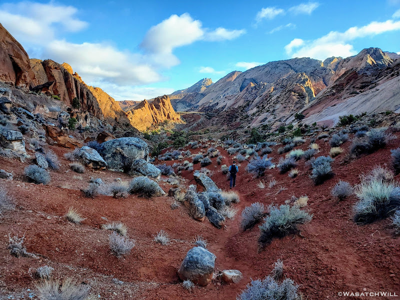
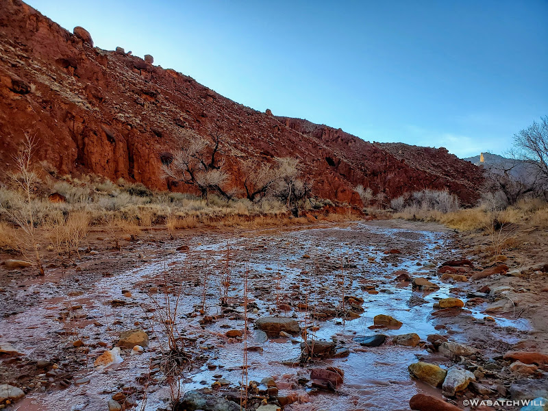
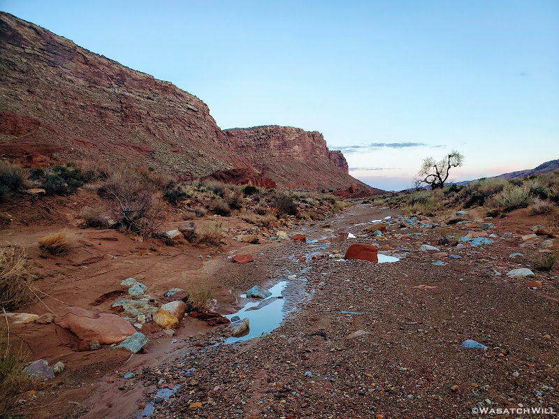
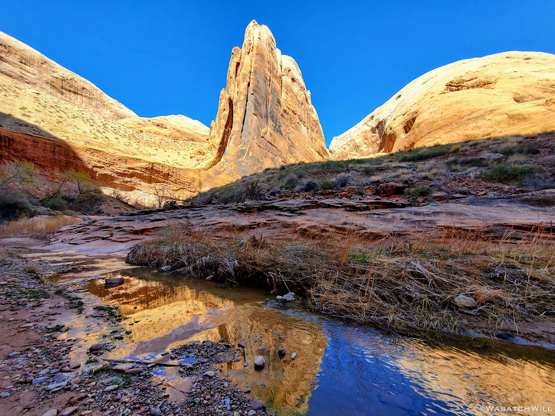
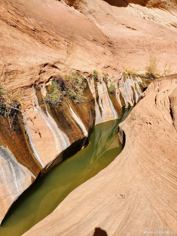
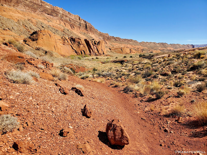
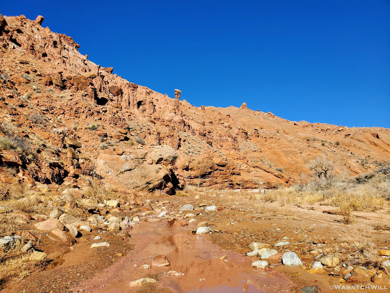
Once back down in the wash, we followed it down the rest of the way, passing Red Slide in the process.
Back down into a the wash along with an ephemeral stream
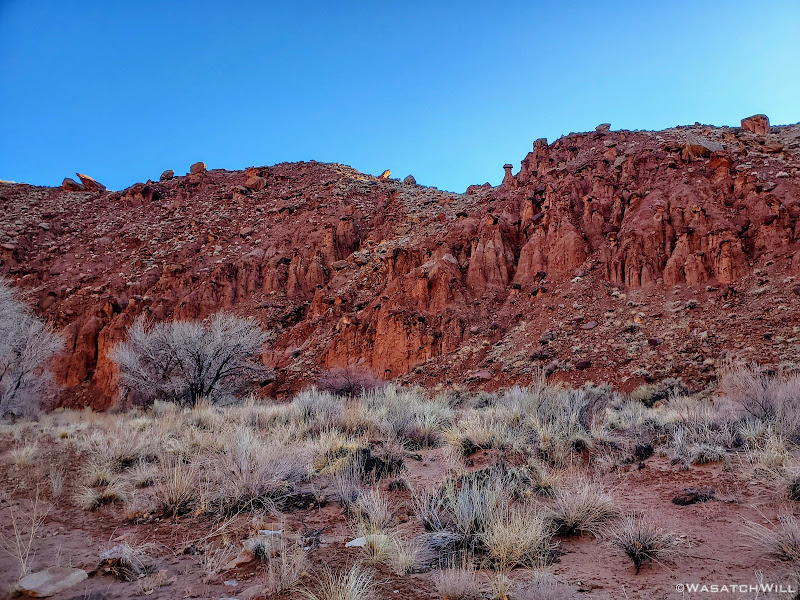
Red Slide
Red Slide
Further down trail
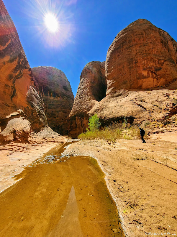
About halfway down the wash, we began to look around for a suitable campsite. To aid our search, Devin had walked up a little sandstone fin to get a better view. When I turned back to see him, a fantastic photo opportunity had presented itself.
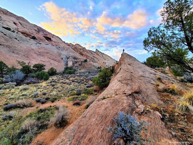
Devin atop sandstone fin
With skies now clear, only puddles leave evidence of the day's precipitation
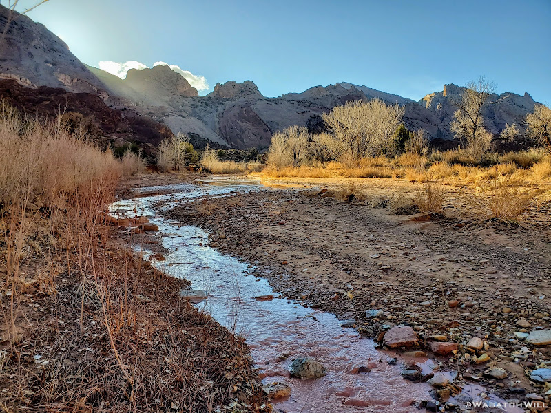
We ended up traveling nearly another mile down canyon before settling into a virtually perfect little spot, with fresh water from the recent storm close by and trees to shield any winds.
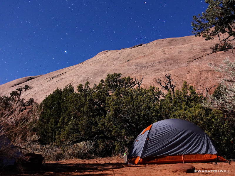
Camp under a full moon
Saturday - March 27, 2021
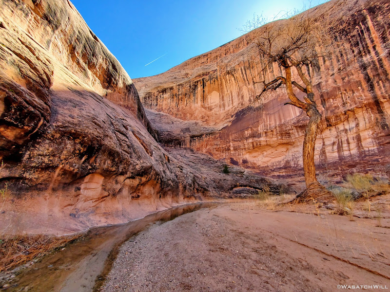
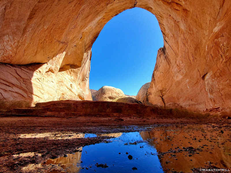
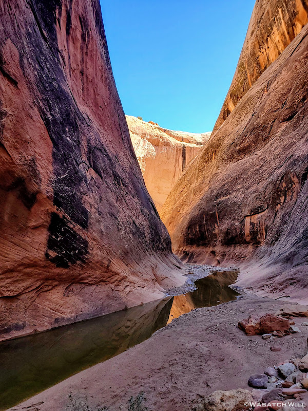
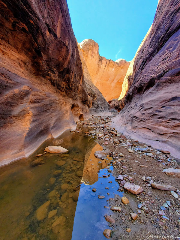
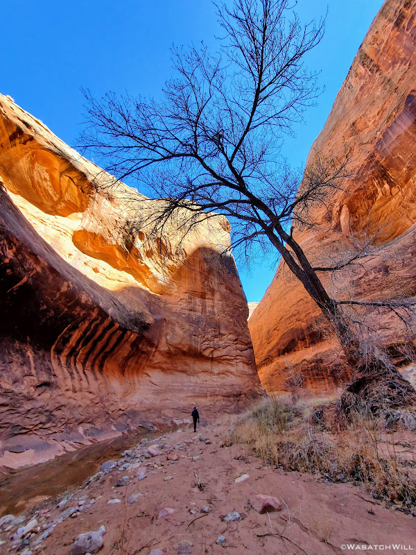
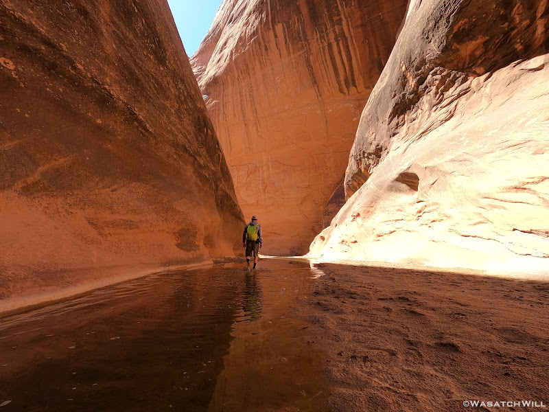
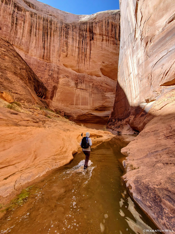
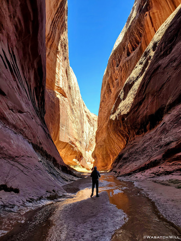
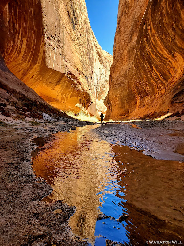
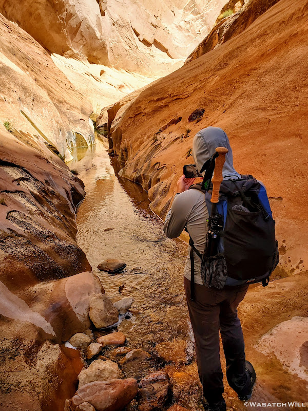
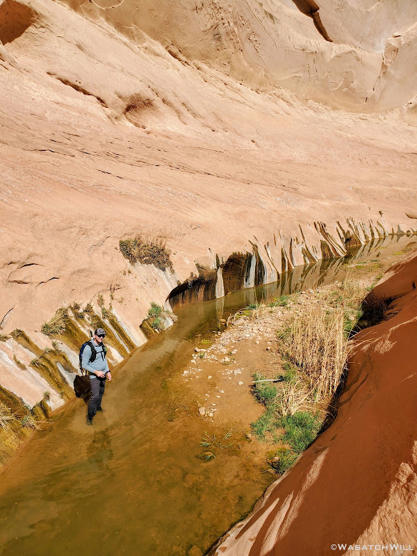
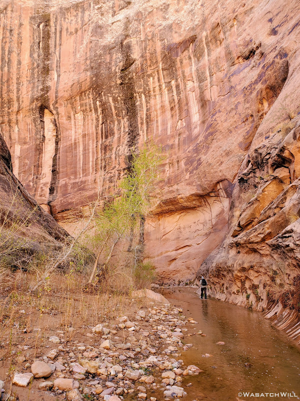
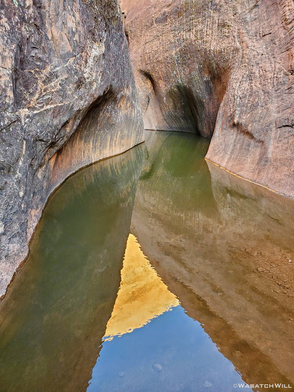
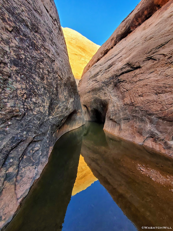
The night ended up dipping below freezing down into the 20's. This would mean that the water down in the narrows was sure to be extra brisk when it was time to get our feet wet. We got our things ready for the day's hike and made our way down the wash a few miles further and then into the narrows to begin our loop hike. The narrows were every bit as amazing as I remember being my first time down through. The water was indeed bone-chilling cold early on, but as we got moving more and more and the sun grew higher in the sky, the water temperature had backed off. At least a little of that in combination with our feet just adapting as time went on.
A barren box-elder along the entry into the narrows
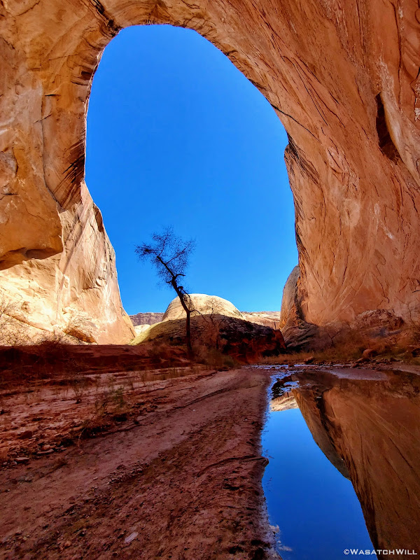
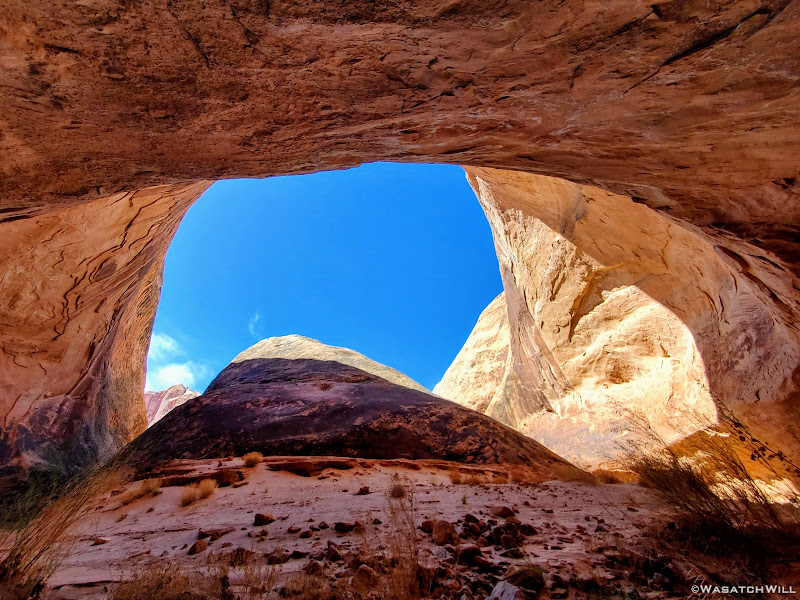
A reflection in the very large alcove
Silhouette
First wader
A look back up canyon
Into the frigid cold waters
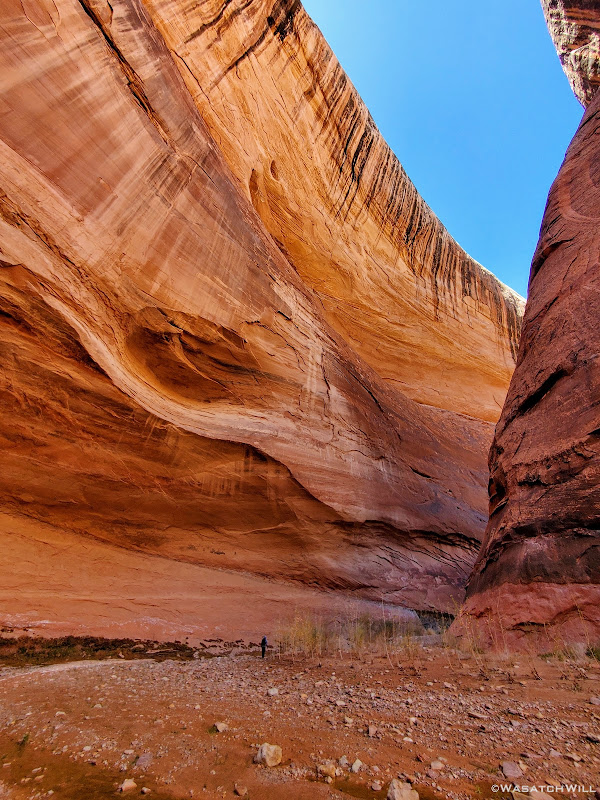
Yet another alcove along another canyon bend
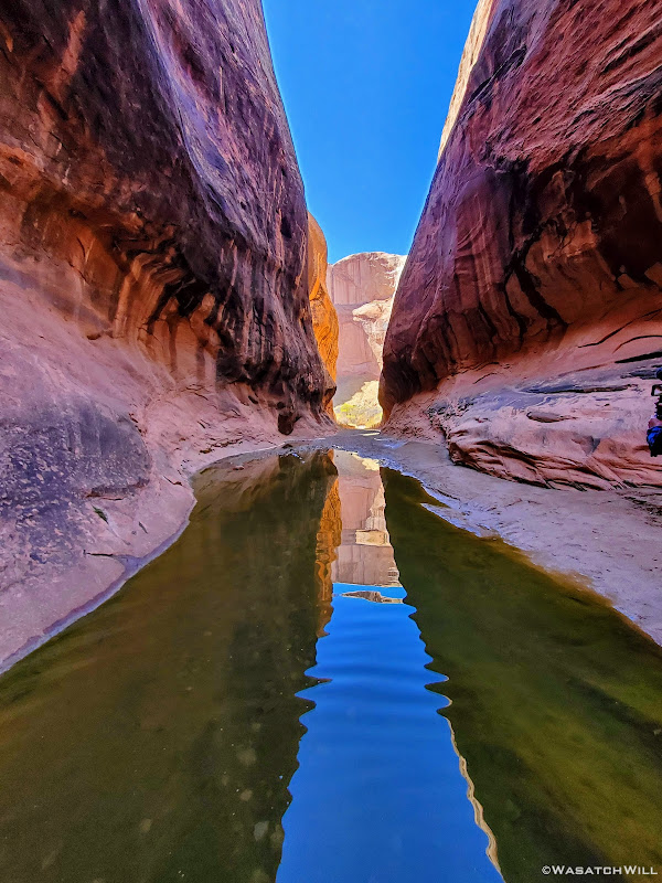
Reflection in another wader
Another little alcove down canyon
Approaching the end of another wader
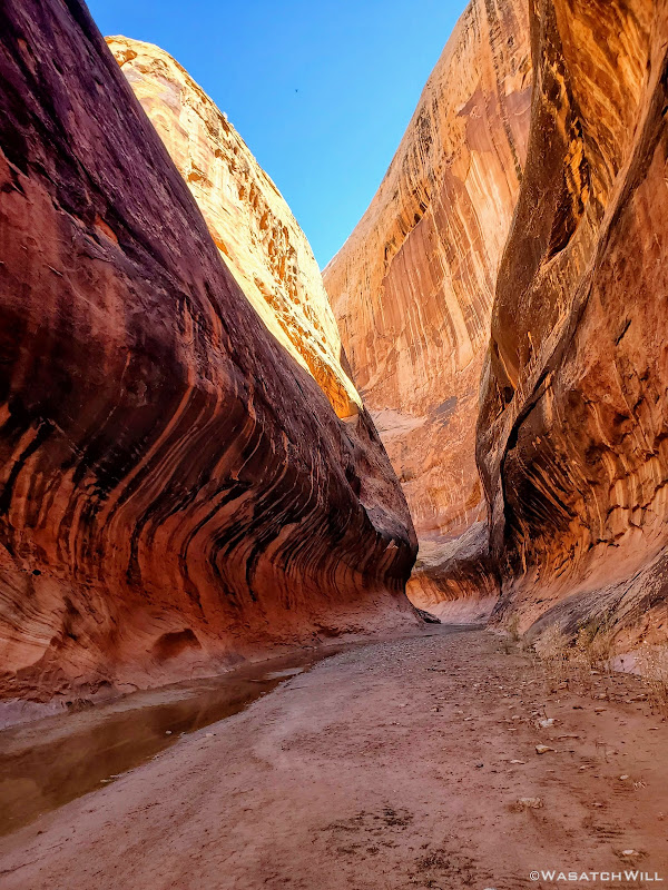
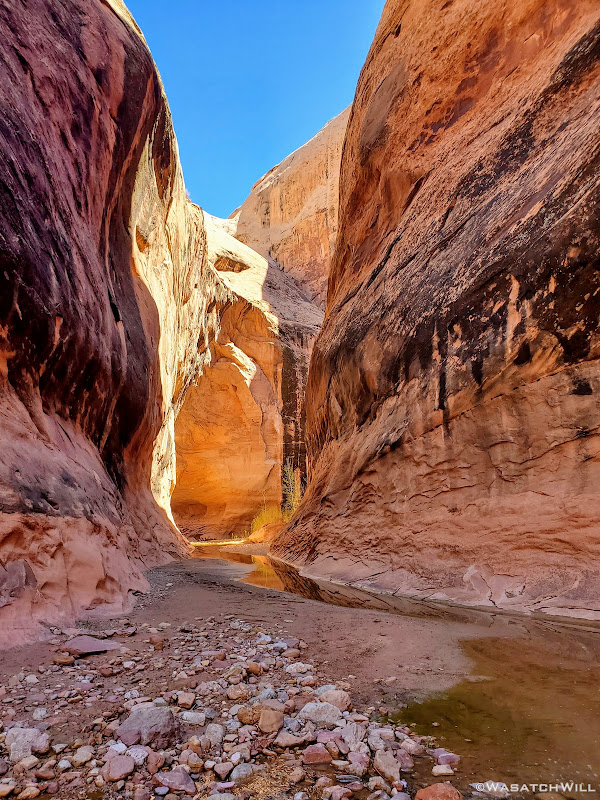
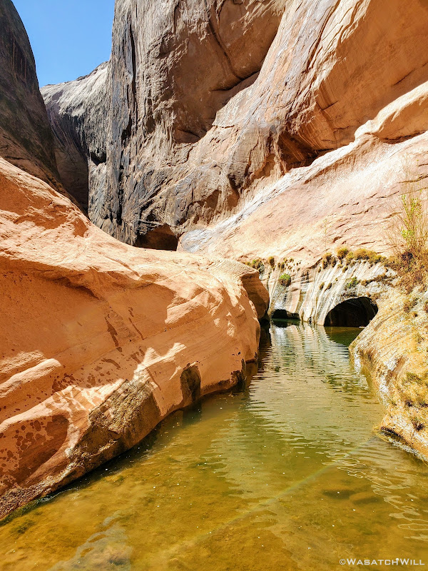
Halls 'subway'
Blooming Box Elders
Another silhouette
Myself, treadng down the creek
Full sun
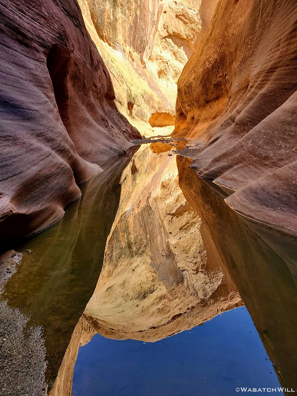
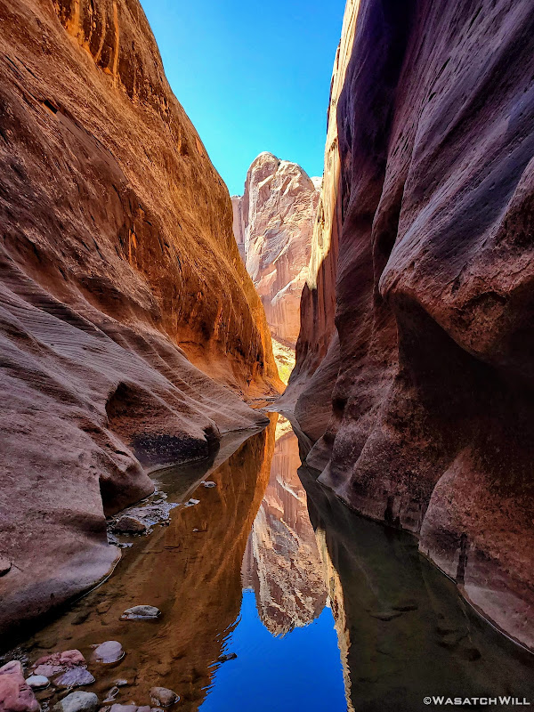
Spire reflection
Into the final stretches
Towering walls
Into the 'Chasm'
'Chasm' reflection
Near the end of the narrows came the crux of the route: A long narrow pool that in years past, had been nothing but a waist-high wader. At some point in the last year or two however, floods had washed out much of the built up sediment and sand, deepening the pool such that in order to get through it, one now has to swim for short stretch. Had the air above it been much warmer, it would have been an easy decision to go forward with the swim...however, we ended up opting for a more creative way to bypass it. We were able to assist each other in gaining the bench above it to the right of it and follow that around to the other end of the pool, where we were able to descend and slide down a very steep ramp to return back down to the creek bed.
Devin evaluates the 'Swimmer'
Up on the bench above the swimmer
Devin successfully back down off the bypass bench
Wet spots show our descent and splashes off the bypass bench
Having successfully bypassing the swimmer section, we each finished out the narrows with a comfortably dry upper torso.
More towering walls
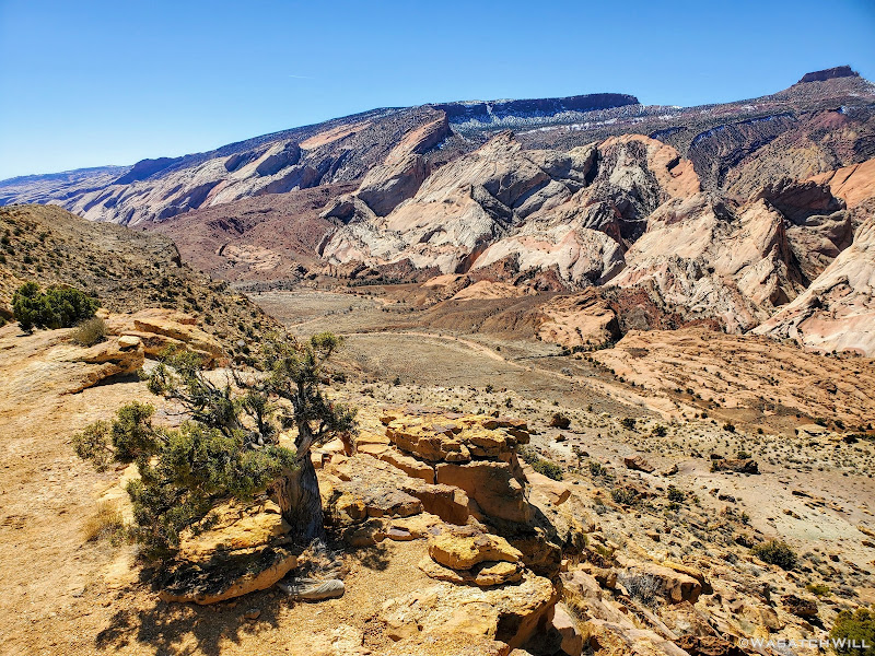
Once out of the narrows, it was time to complete and close the loop by exiting the creek and gaining a trial over Halls Diving back to where we had started the loop, and from there, we'd return back to camp for a restful and relaxing end to the day. Unlike last time, we encountered nobody on this particular down down through the narrows. My first time down, I had encountered about half a dozen different parties which is more the norm. The storm earlier in the day prior must have scared off any others that may have had similar plans.
Looking south from Halls Divide
Looking north from Halls Divide
Returning to camp
Sunday - March 28, 2021
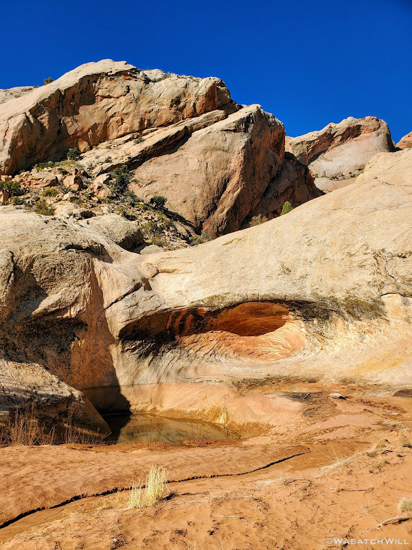
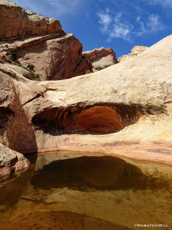
The final morning would be spent hiking back to the car the way we had come down. Before packing up though, I wandered up a nearby side canyon to see how far I could get. It wasn't very far at before I was presented with a deep and impassable pool.
Side canyon pool near camp
Alpenglow reflection
Along the way back up, we pulled over at Fountain Tanks where I was stunned to see how dry some of the pools were while others had very little water left in them, even after the big storm the day before that had sent water running off the walls. It was evidence of just how hot and dry the previous year had been.
Empty lower Fountain tank
Three years prior, all of the tanks were quite full.
lower Fountain Tanks (2018)
We'd also pass by Red Slide once more.
Red Slide bathed in morning sunlight
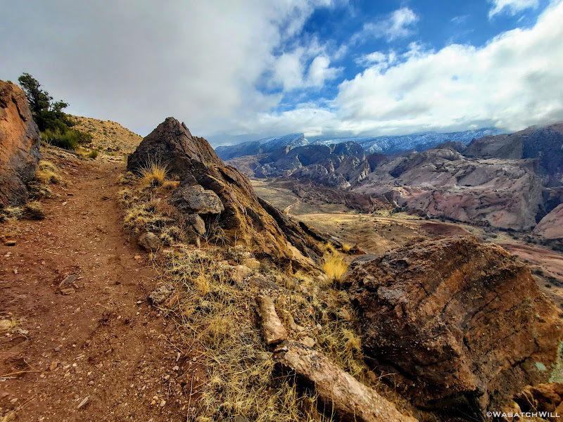
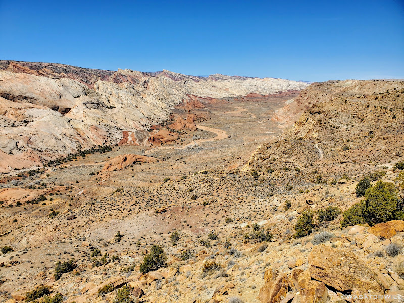
Hiking back up to the rim where the trailhead and Devin's car awaited us was a stark contrast from our way back in. The trail was mostly dried out and not a cloud in the sky.
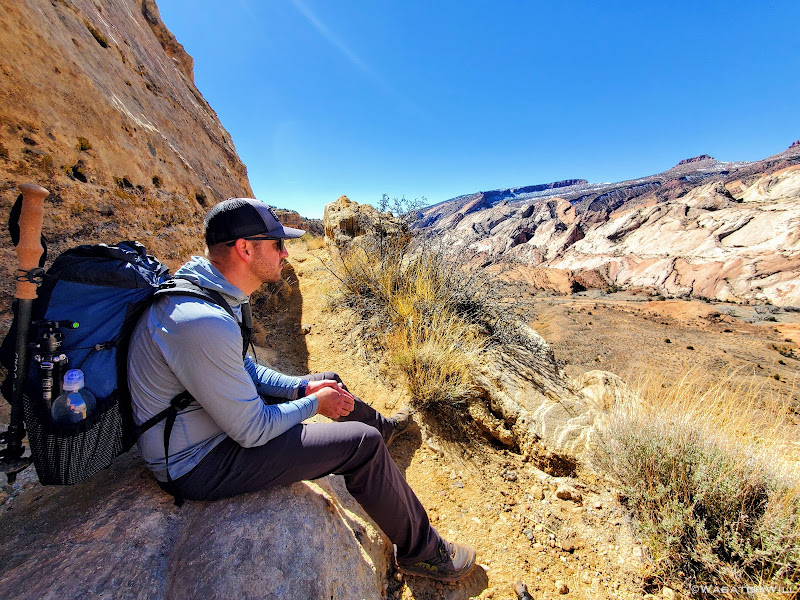
Devin takes in a view while resting from a strenuous hike back up the rim
Clear skies at Halls Creek Overlook
Looking south
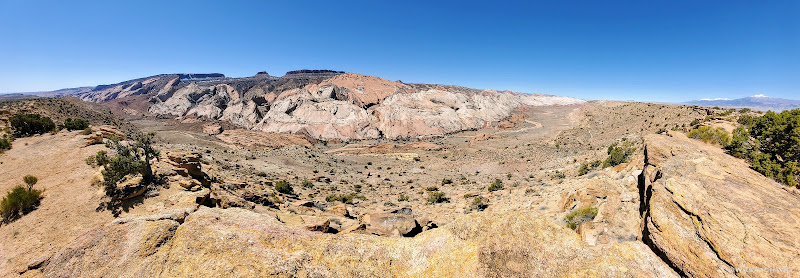
Halls Creek Overlook Panorama
Friday - March 26, 2021
We started the long drive down to the trailhead at Hall Creek Overlook knowing that weather had been iffy earlier in the day, but forecasts had called for favorable conditions throughout the afternoon. However, as we made our way out on the dirt road, lingering clouds began dumping a bit of rain followed by snow making for a slick road. We still managed, barely, pull into the trailhead. We pulled another forecast on our satellite devices as we considered alternative contingency plans.

Snowy Trailhead

No visibility beyond the rim
We ended up waiting a little over an hour in the car before signs of sunlight began to emerge and the clouds began to pull away.

Clouds begin to lift

Looking north from the rim

Snow clings to a juniper tree
And shortly thereafter, the clouds broke apart to let through some blue sky. The trip was now a go. Though, with less time to hike now, we figured on setting up our base camp a little sooner than we had planned. We donned our packs and made the descent down into Halls Wash.

Devin gazes out into the brightening Halls Wash

Looking south into the wash, now clear of clouds

A wider angle looking southward

Myself, happy to be on our way
Once into and across the wash, we found ourselves taking a scenic little detour from the standard route before rejoining the wash.

Heading along a brief detour route

Down into a little 'hidden valley'
Once back down in the wash, we followed it down the rest of the way, passing Red Slide in the process.

Back down into a the wash along with an ephemeral stream

Red Slide

Red Slide
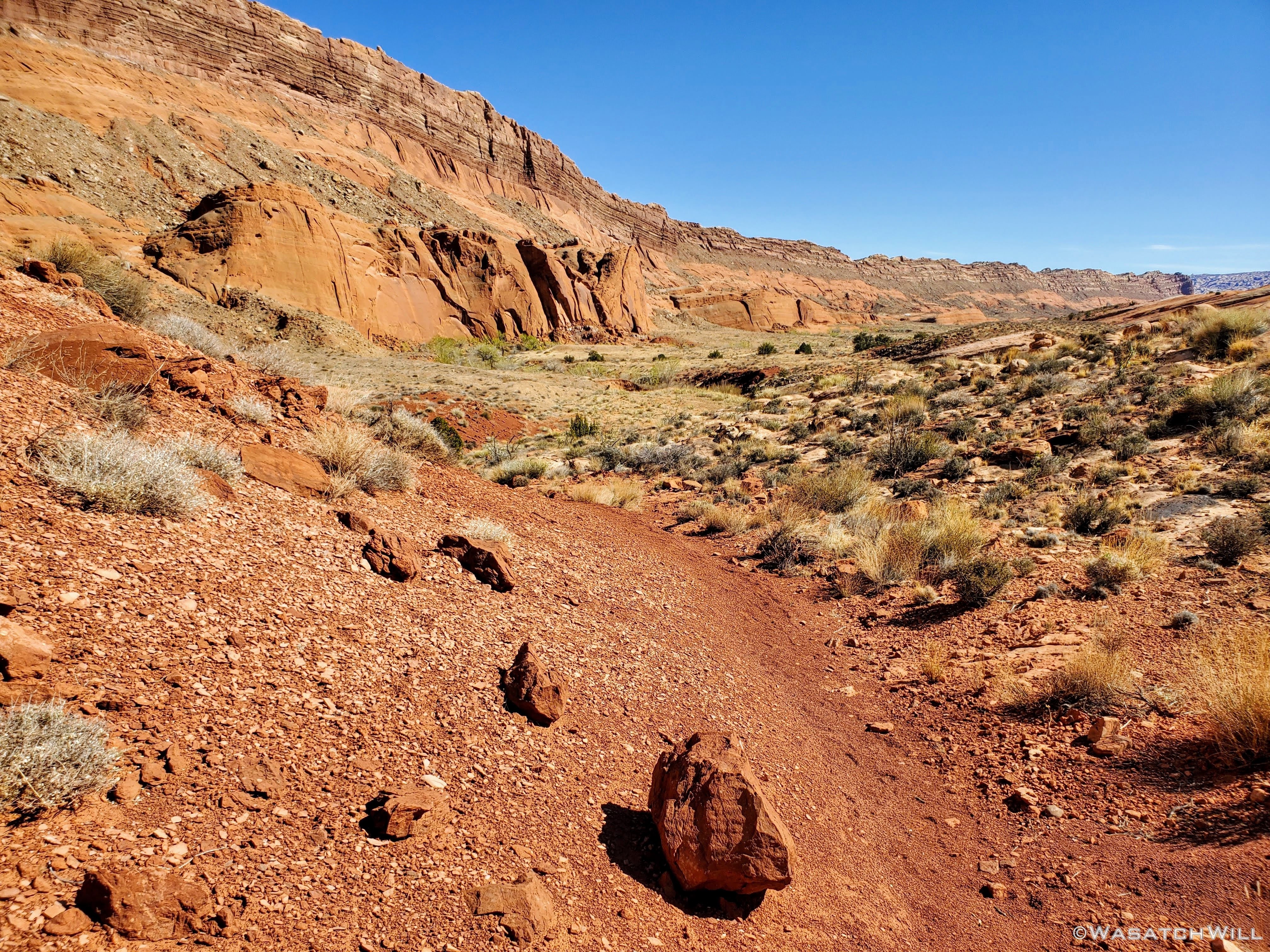
Further down trail
About halfway down the wash, we began to look around for a suitable campsite. To aid our search, Devin had walked up a little sandstone fin to get a better view. When I turned back to see him, a fantastic photo opportunity had presented itself.

Devin atop sandstone fin

With skies now clear, only puddles leave evidence of the day's precipitation
We ended up traveling nearly another mile down canyon before settling into a virtually perfect little spot, with fresh water from the recent storm close by and trees to shield any winds.

Camp under a full moon
Saturday - March 27, 2021
The night ended up dipping below freezing down into the 20's. This would mean that the water down in the narrows was sure to be extra brisk when it was time to get our feet wet. We got our things ready for the day's hike and made our way down the wash a few miles further and then into the narrows to begin our loop hike. The narrows were every bit as amazing as I remember being my first time down through. The water was indeed bone-chilling cold early on, but as we got moving more and more and the sun grew higher in the sky, the water temperature had backed off. At least a little of that in combination with our feet just adapting as time went on.

A barren box-elder along the entry into the narrows

A reflection in the very large alcove

Silhouette

First wader

A look back up canyon

Into the frigid cold waters

Yet another alcove along another canyon bend

Reflection in another wader

Another little alcove down canyon

Approaching the end of another wader

Halls 'subway'

Blooming Box Elders

Another silhouette

Myself, treadng down the creek

Full sun

Spire reflection

Into the final stretches

Towering walls

Into the 'Chasm'

'Chasm' reflection
Near the end of the narrows came the crux of the route: A long narrow pool that in years past, had been nothing but a waist-high wader. At some point in the last year or two however, floods had washed out much of the built up sediment and sand, deepening the pool such that in order to get through it, one now has to swim for short stretch. Had the air above it been much warmer, it would have been an easy decision to go forward with the swim...however, we ended up opting for a more creative way to bypass it. We were able to assist each other in gaining the bench above it to the right of it and follow that around to the other end of the pool, where we were able to descend and slide down a very steep ramp to return back down to the creek bed.

Devin evaluates the 'Swimmer'

Up on the bench above the swimmer

Devin successfully back down off the bypass bench

Wet spots show our descent and splashes off the bypass bench
Having successfully bypassing the swimmer section, we each finished out the narrows with a comfortably dry upper torso.

More towering walls
Once out of the narrows, it was time to complete and close the loop by exiting the creek and gaining a trial over Halls Diving back to where we had started the loop, and from there, we'd return back to camp for a restful and relaxing end to the day. Unlike last time, we encountered nobody on this particular down down through the narrows. My first time down, I had encountered about half a dozen different parties which is more the norm. The storm earlier in the day prior must have scared off any others that may have had similar plans.
Looking south from Halls Divide

Looking north from Halls Divide

Returning to camp
Sunday - March 28, 2021
The final morning would be spent hiking back to the car the way we had come down. Before packing up though, I wandered up a nearby side canyon to see how far I could get. It wasn't very far at before I was presented with a deep and impassable pool.

Side canyon pool near camp

Alpenglow reflection
Along the way back up, we pulled over at Fountain Tanks where I was stunned to see how dry some of the pools were while others had very little water left in them, even after the big storm the day before that had sent water running off the walls. It was evidence of just how hot and dry the previous year had been.

Empty lower Fountain tank
Three years prior, all of the tanks were quite full.

lower Fountain Tanks (2018)
We'd also pass by Red Slide once more.

Red Slide bathed in morning sunlight
Hiking back up to the rim where the trailhead and Devin's car awaited us was a stark contrast from our way back in. The trail was mostly dried out and not a cloud in the sky.

Devin takes in a view while resting from a strenuous hike back up the rim

Clear skies at Halls Creek Overlook

Looking south

Halls Creek Overlook Panorama
Last edited:
")