NateGeesaman
Donkey
- Joined
- Jan 20, 2012
- Messages
- 272
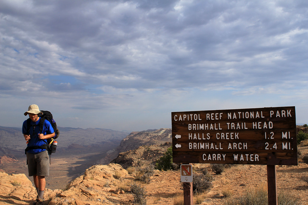
I have wanted to do Halls Creek Narrows since I read about it last year. The Southern tip of Capitol Reef really is an amazing chunk of earth and it pretty much blew us away the whole trail. Great views along The Waterpocket Fold followed by an amazing hike through narrows with 1200 ft tall cliffs towering on either side of you was a memorable experience and a big lift for my spirits.
The drive down the Burr Trail road was as beautiful as ever. I have driven this road many times, but am still enthralled by the experience. Feeling nuzzled between the beautiful cliffs to the West and the beautiful Henry Mountains to the East on a beautiful dirt road feels awesome.
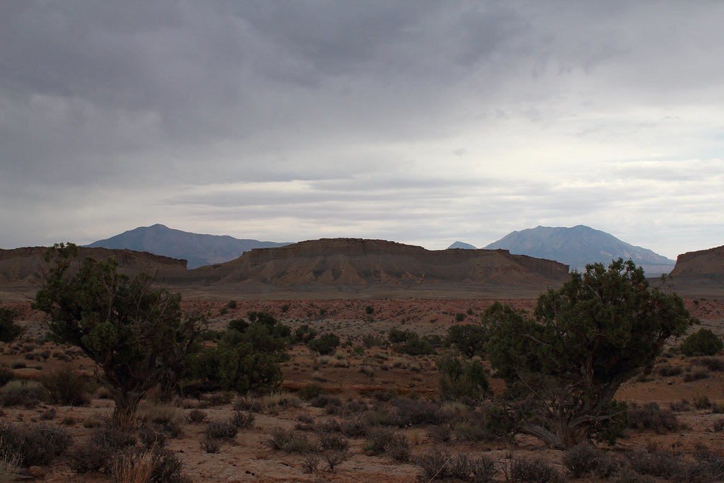
Henry Brothers by NateGeesaman, on Flickr
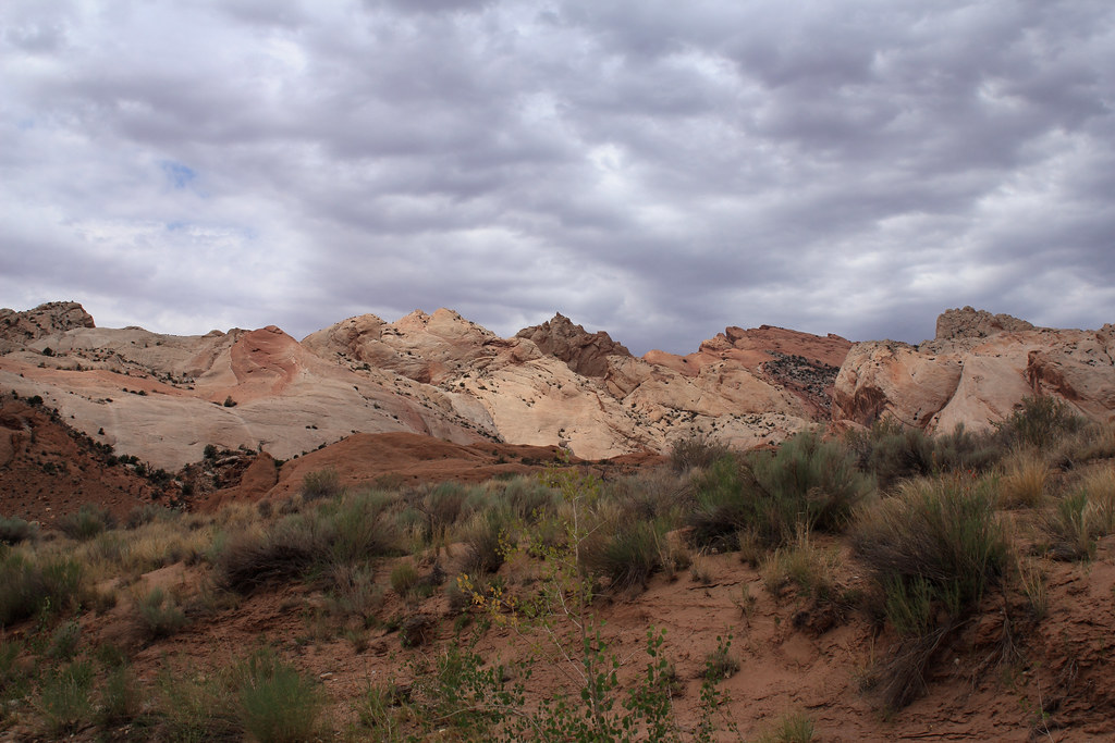
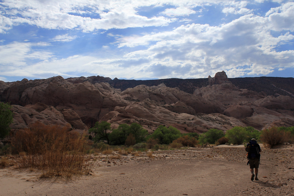
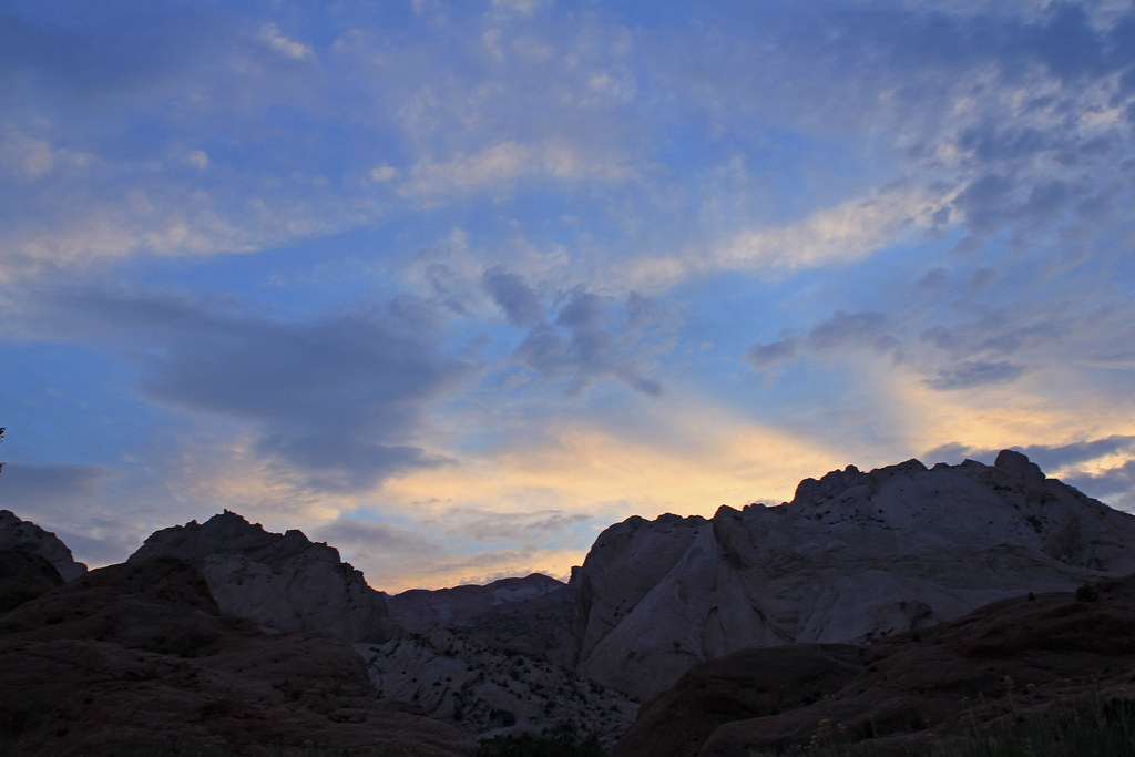
We got to the Halls Creek Overlook around 11:00 AM and were greeted with some great clouds rolling through that helped limit the affects of the July heat on our travels. It was good to finally be down there and be looking at some awesome weather to accompany us along the trail.
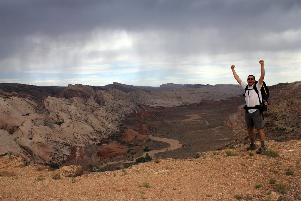
Dan Halls Creek Overlook by NateGeesaman, on Flickr
What a great chunk of The Waterpocket Fold!
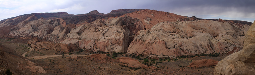
Halls Creek Overlook Pano by NateGeesaman, on Flickr
Dan Halls Creek Overlook 2 by NateGeesaman, on Flickr
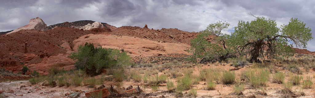
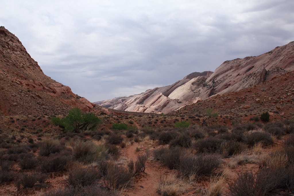
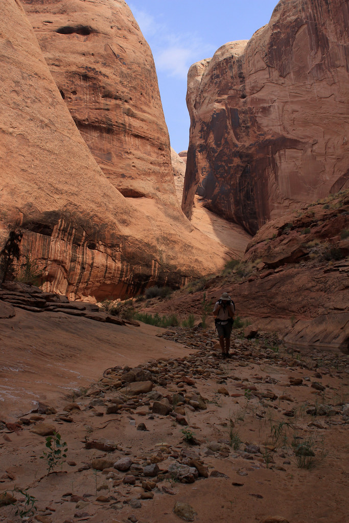
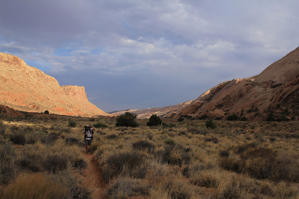
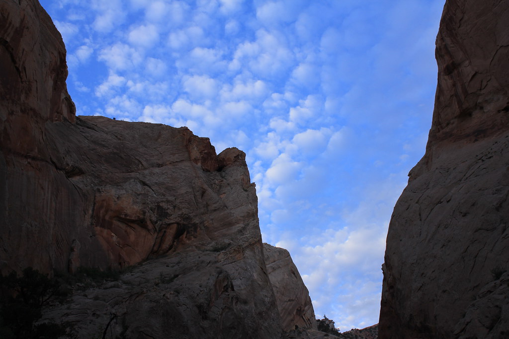
The trail started with a 700 ft. descent to Halls creek where we then continued South along The Waterpocket Fold for 7 miles til we reached The Narrows. The clouds hung around and kept the climate real nice for hiking until maybe 2:00 P.M. when the sun broke the clouds and made it hot as hell. We chilled under a big Cottonwood and took a nap until the clouds returned.
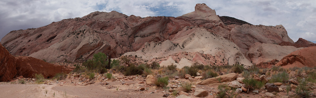
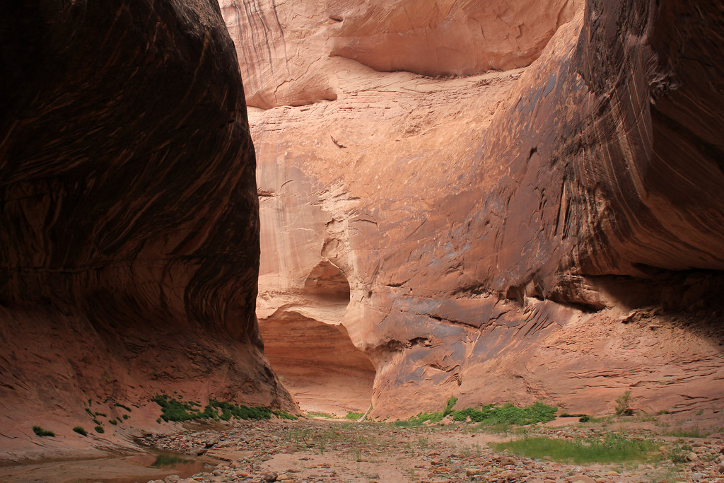
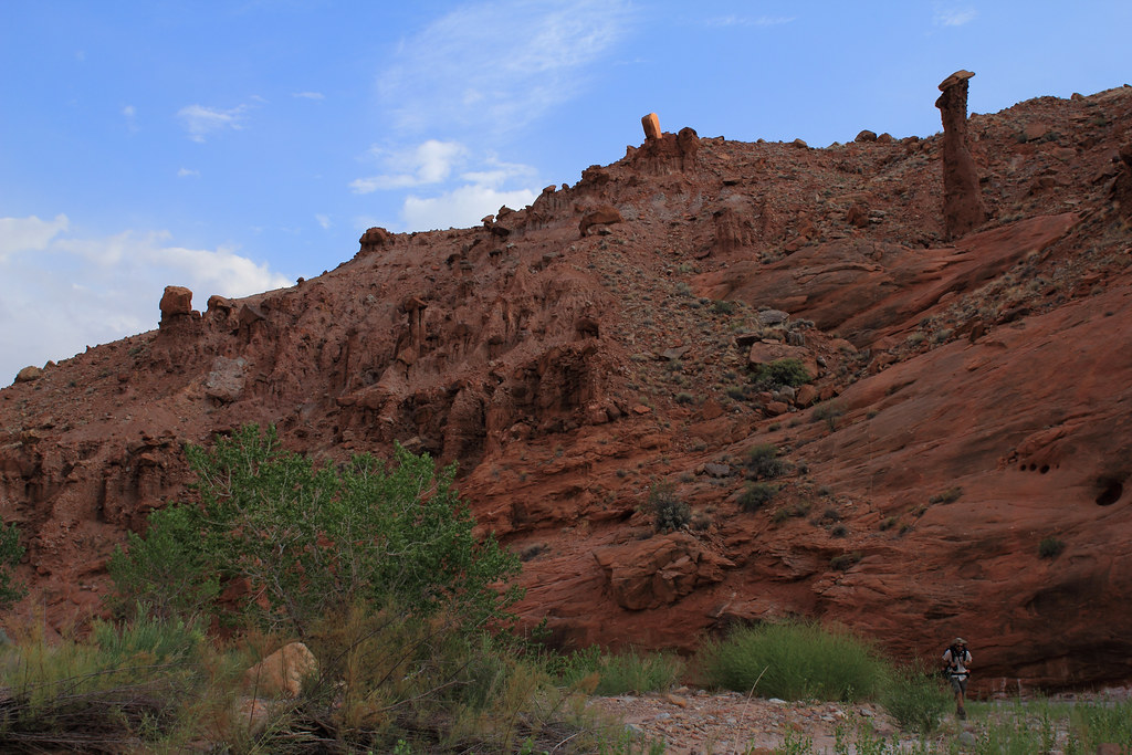
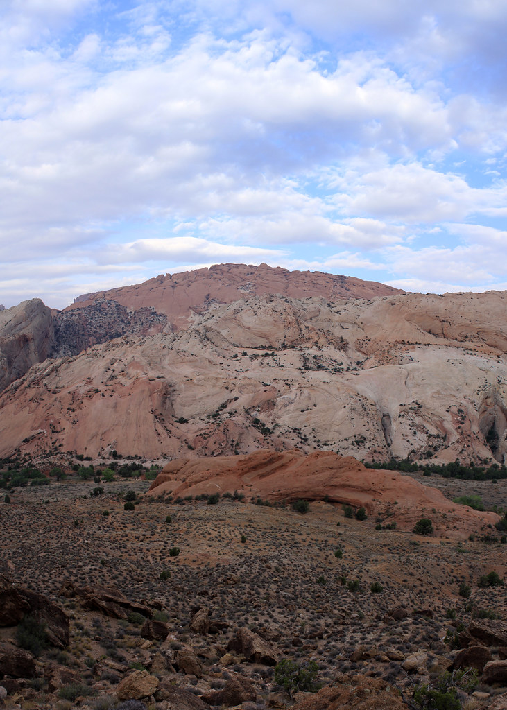
The views of the complicated cliffs changed constantly showing new angles, colors, and patterns to appreciate.
Red Slide Pano by NateGeesaman, on Flickr
The Red Slide area had some beautiful Hoodoos that contrasted the bright white creek bed and cliffs above beautifully.

Red Slide Hoodoo by NateGeesaman, on Flickr
Halls Creek View by NateGeesaman, on Flickr
Waterpocket Beauty by NateGeesaman, on Flickr
With views like this along the trail, we were glad we did not opt for the shortcut.
Beautiful Trail by NateGeesaman, on Flickr
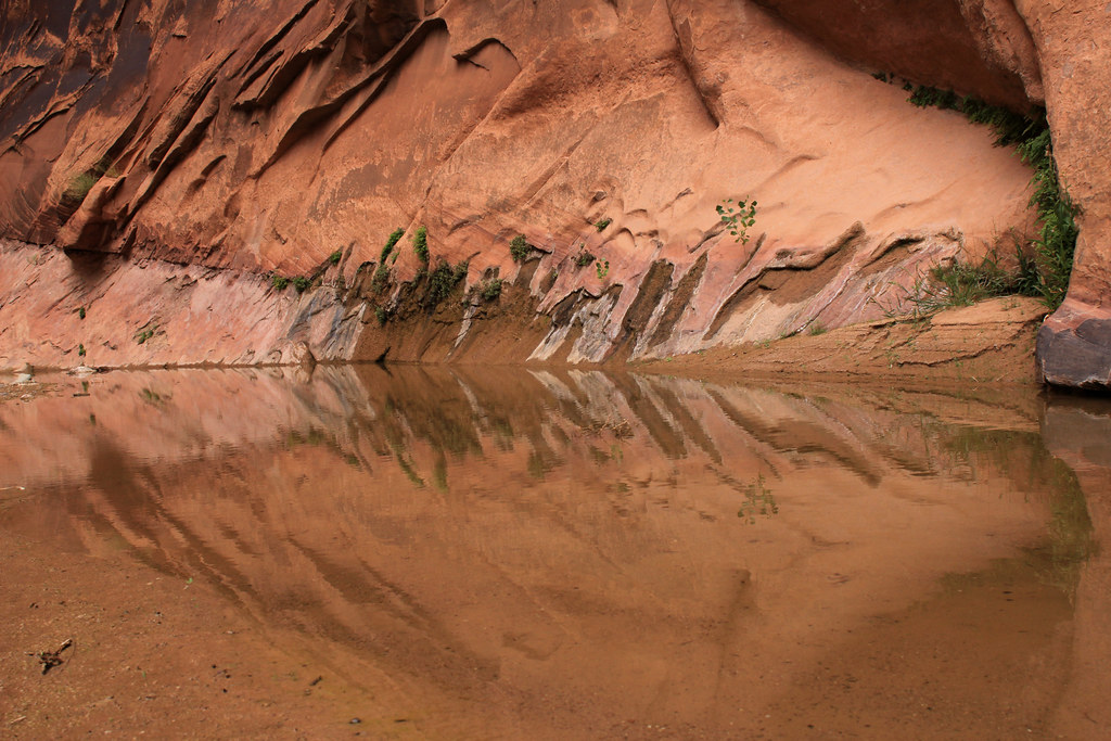
We made it to the Narrows and wandered through some real beautiful scenes.
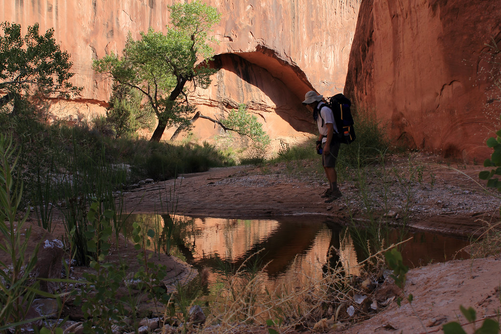
Dan Full Circle by NateGeesaman, on Flickr
Halls Creek Reflection 3 by NateGeesaman, on Flickr
We set up camp in a beautiful bend along the way. Great views all directions, nice and cool, close to decent water, minimal bugs, and a lot of places to spread out and soak up the beauty.
We saw a nice little sunset during dinner and soaked it all in.
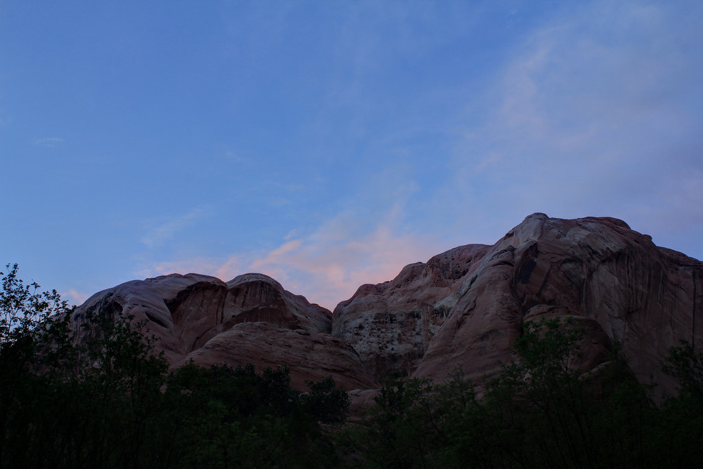
Narrows Sunset by NateGeesaman, on Flickr
Halls Creek Cliffburst2 by NateGeesaman, on Flickr
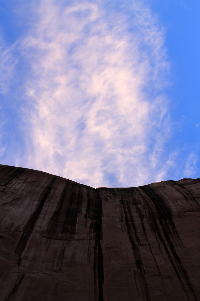
Halls Creek Cliffburst by NateGeesaman, on Flickr
I stayed up late listening to the toads and night time song of this beautiful place and tried to squeeze in an extra meal. Star shots were not great because of clouds and a BIG full moon. So bright! This was probably shot around midnight:
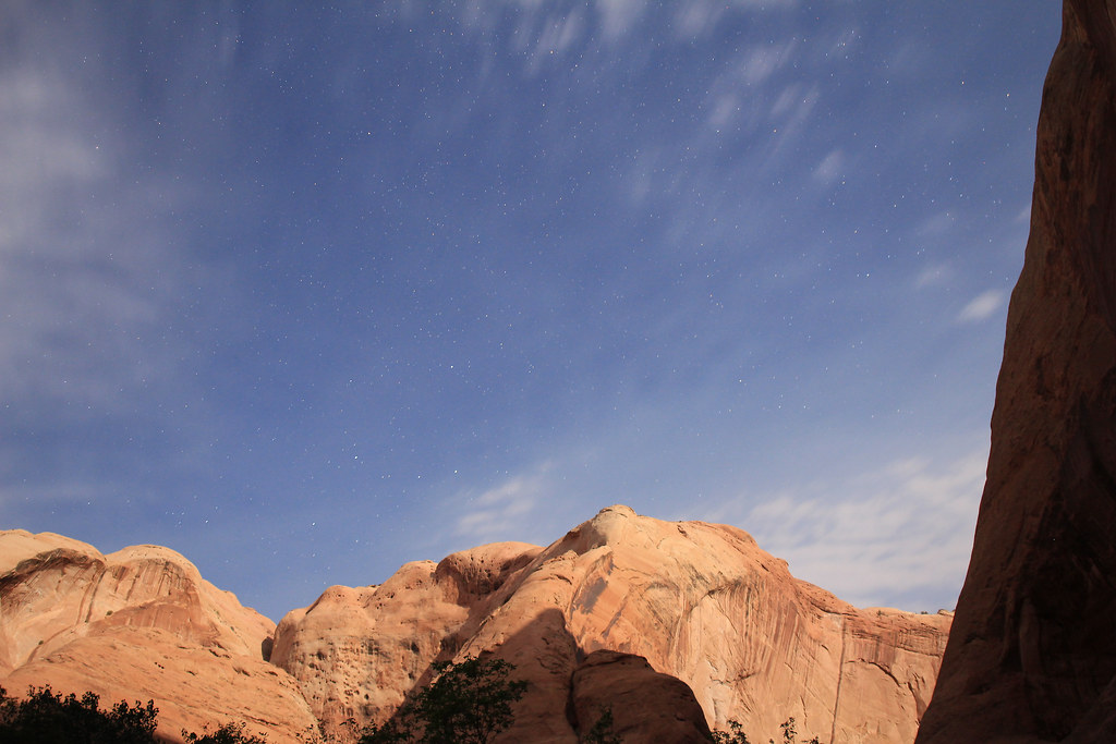
Halls Creek Night by NateGeesaman, on Flickr
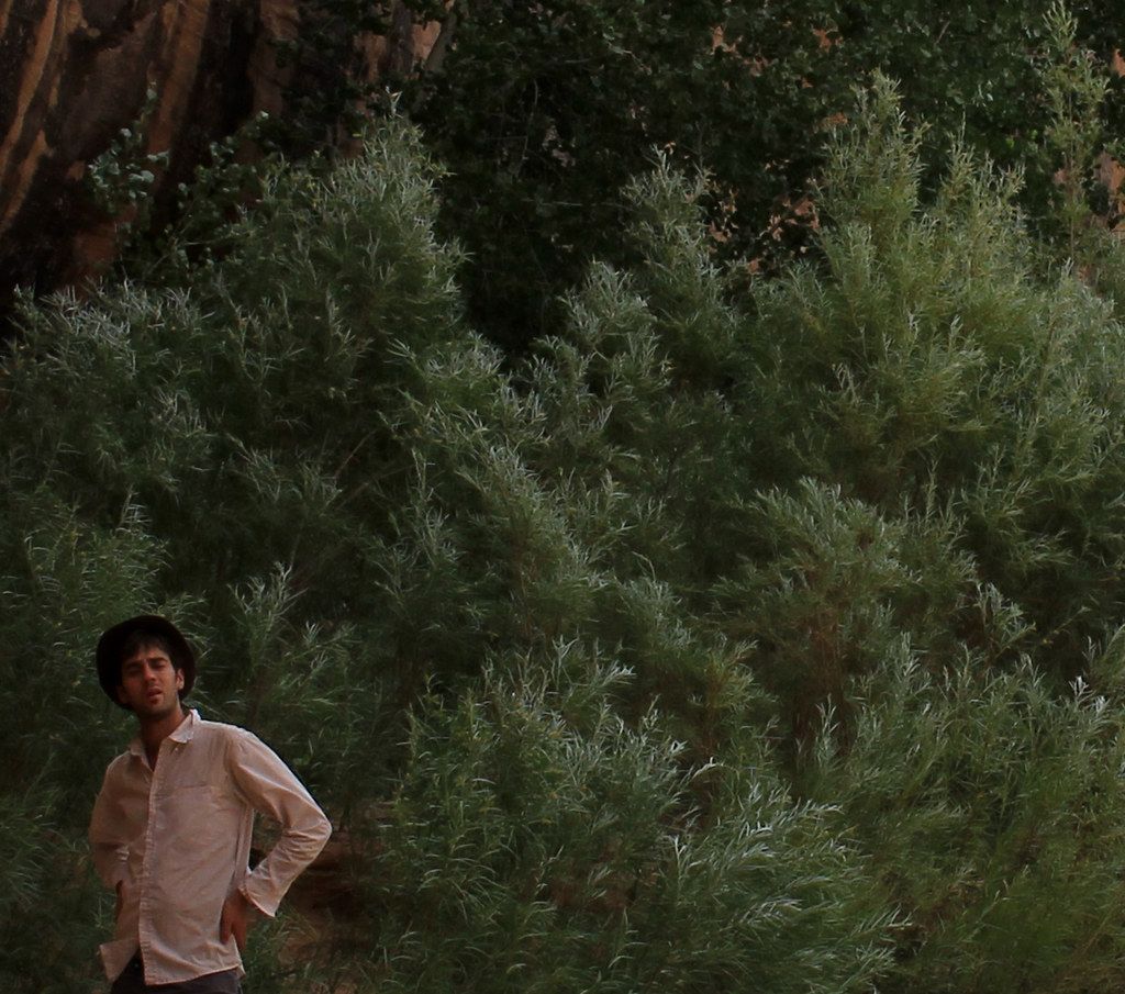
We had a nice leisurely morning; enjoying the beautiful camp as much as possible before we moved on. I took some self shots of the area just across the creek from where we set up our tent.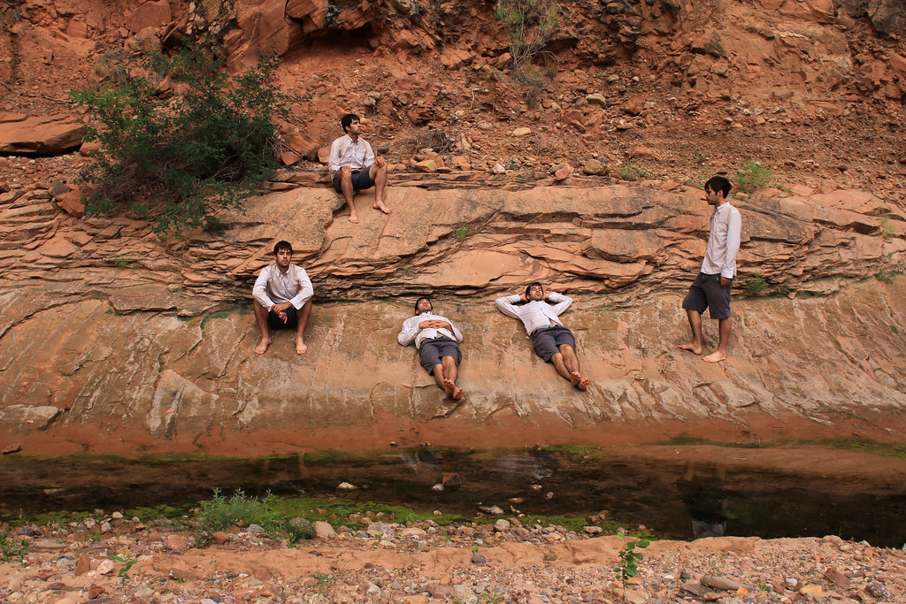
Narrows Camp Selfie by NateGeesaman, on Flickr
This area was so comfortable we just walked around barefoot through the cool wet sand and in and out of the water as we pleased. Temperatures were extremely comfortable as was the entire feel of the camp.
Halls Creek 9 by NateGeesaman, on Flickr
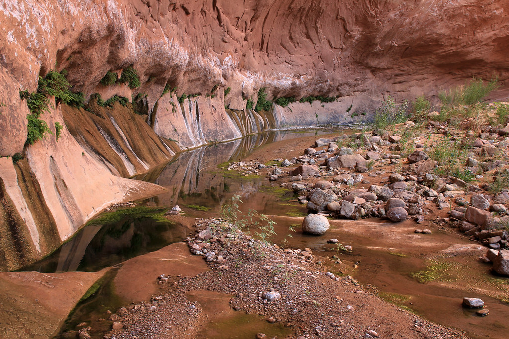
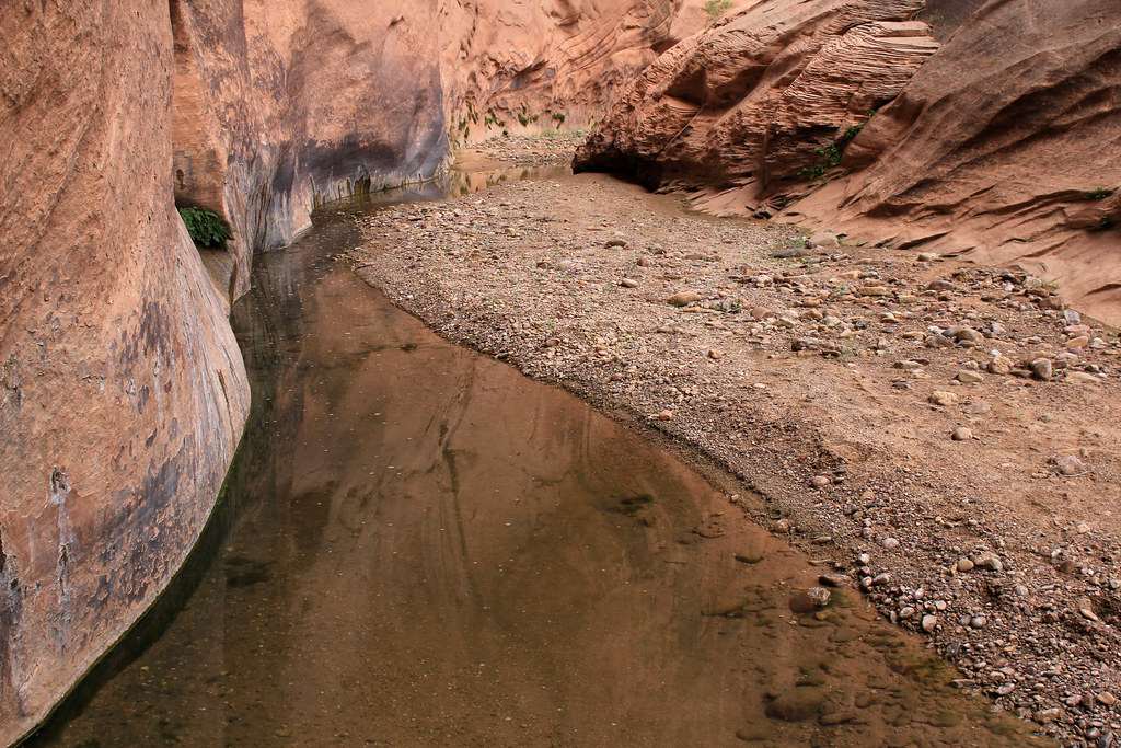
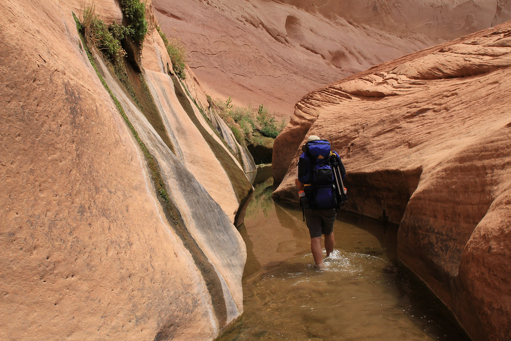
Eventually we got back on the trail and enjoyed the rest of the beautiful ride through The Narrows.
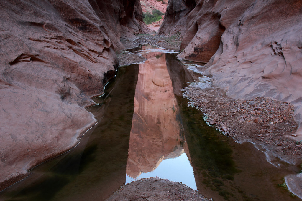
Halls Creek Narrows Reflection 1 by NateGeesaman, on Flickr
Halls Creek Dance by NateGeesaman, on Flickr
Halls Creek 7 by NateGeesaman, on Flickr
Halls Creek Reflection 2 by NateGeesaman, on Flickr
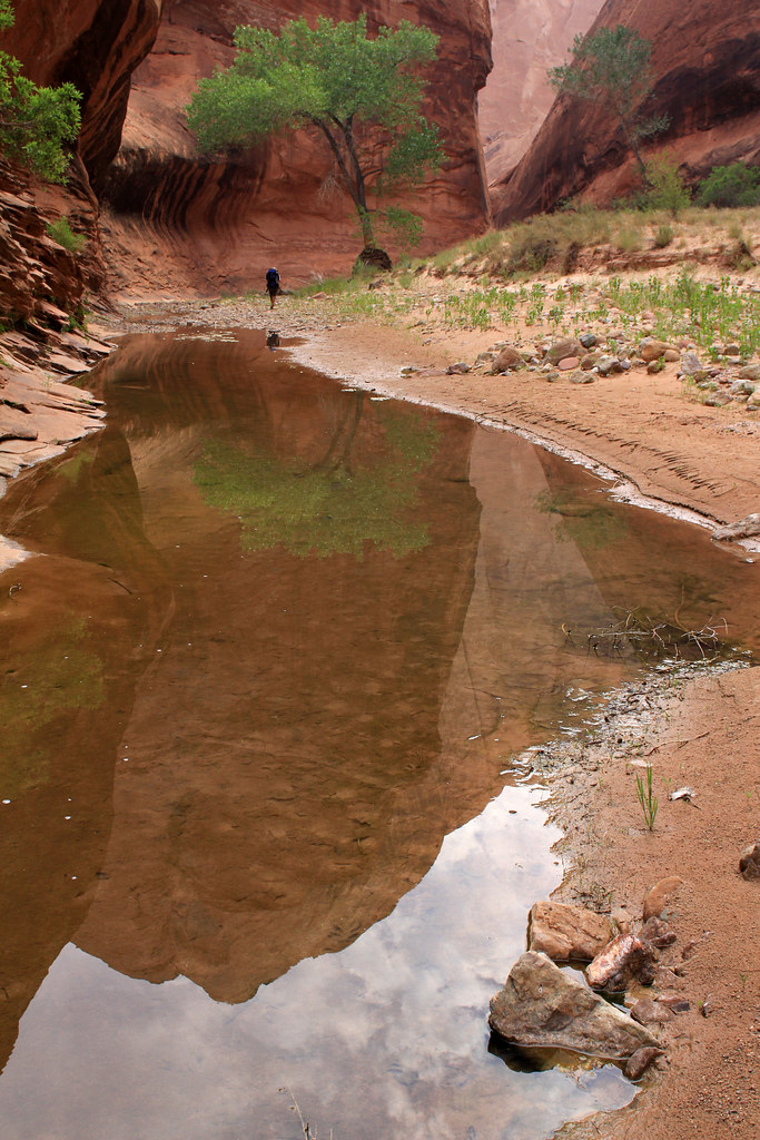
Halls Creek Reflection 4 by NateGeesaman, on Flickr
Halls Creek 10 by NateGeesaman, on Flickr
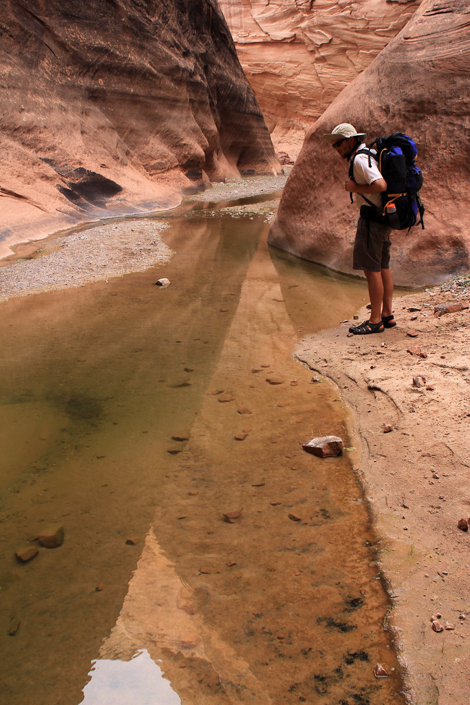
Dan Narrows by NateGeesaman, on Flickr
Halls Creek Dan 2 by NateGeesaman, on Flickr
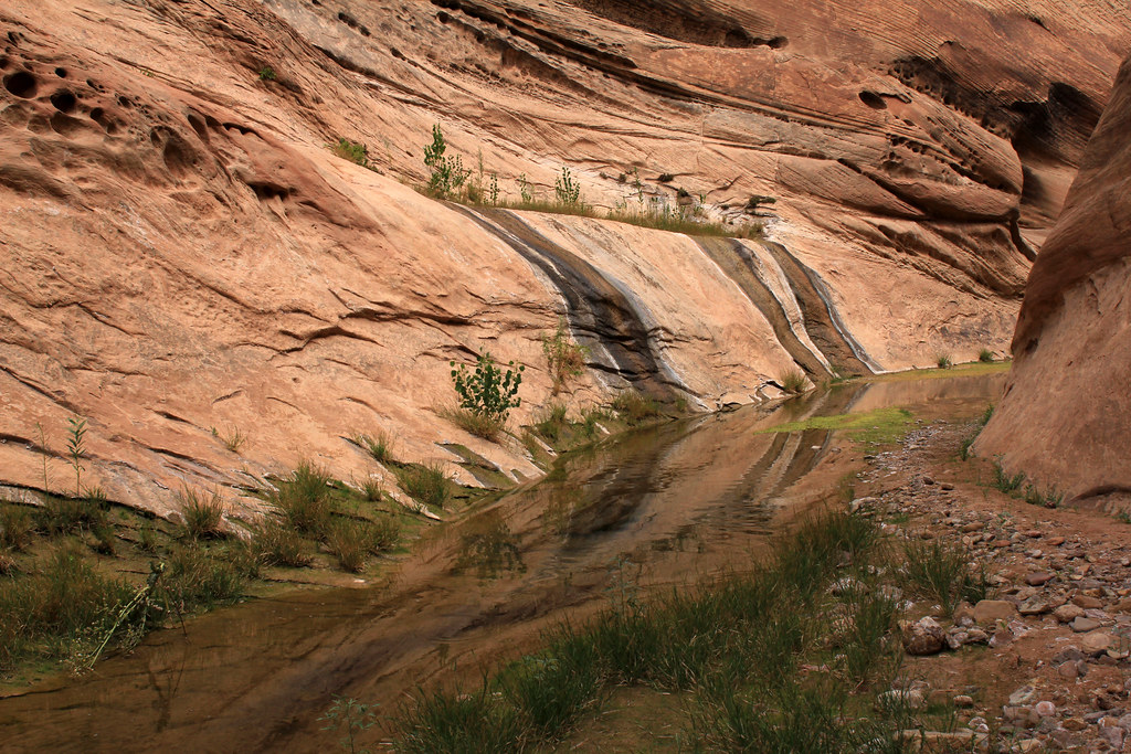
Halls Creek Life Lines by NateGeesaman, on Flickr
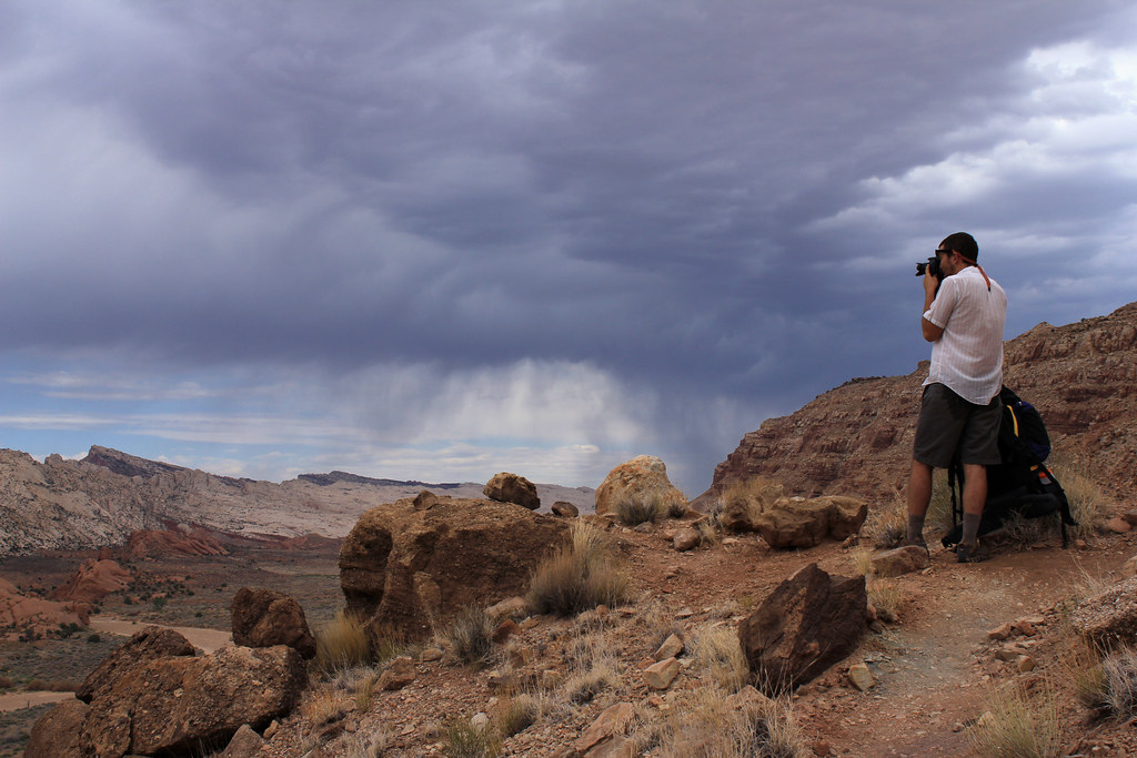
The experience of this portion of the hike was surreal and extremely beautiful. We took our time taking a lot of breaks, eating and drinking a lot to fuel the long days hike, and taking in all the beauty. We had some trouble finding the route out of The Narrows and added an extra mile or so onto our days hiking looking for the trail. Through a tiny bit of common sense and a good map we were able to locate the trail again and get on our way. Once again we were being blessed with beautiful clouds that kept the heat at bay.
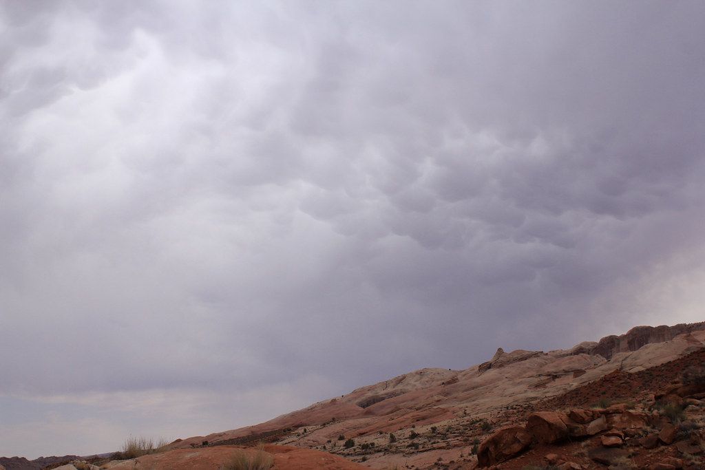
Halls Creek Mammatus by NateGeesaman, on Flickr
When the clouds broke during the hottest part of the day, we found some shade and some water to filter and took a nap and hydrated as much as possible. I took a little time lapse of us napping and this is a crop of one of the shots as we were packing up and I was feeling sore and dreading putting my heavy pack back on:
Exhausted Selfie by NateGeesaman, on Flickr
There were a lot of signs of animal life out there, but I think we were hiking during the day when the animals are avoiding the heat so we only saw a lot of tracks: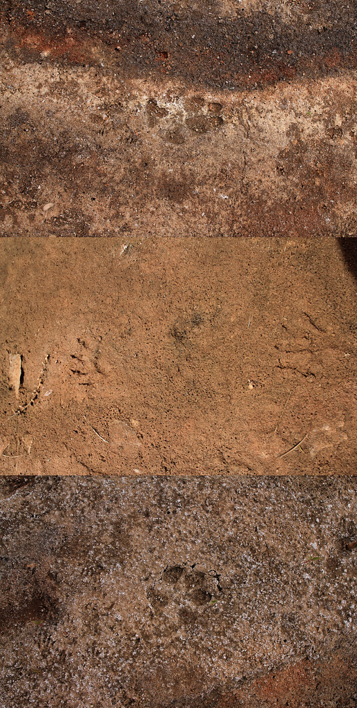
Tracks Collage Low by NateGeesaman, on Flickr
During one of our breaks in the shade a huge toad hopped a good 20 ft over towards us to pose for a portrait.
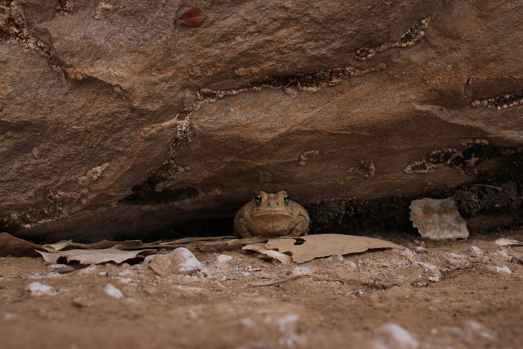
Halls Creek Toad by NateGeesaman, on Flickr
Trudging along on a beautiful day in a beautiful setting was an ideal way to get some great brainwaves going. There is really nothing like getting good and exhausted hiking around the desert. I love it.
Dan Waterpocket Pack by NateGeesaman, on Flickr
Dan Waterpocket Pack 2 by NateGeesaman, on Flickr
We made it back to The Red Slide area shortly before sunset and took a different route this time to get a bit closer to the amazing hoodoos.
Red Slide Hoodoos by NateGeesaman, on Flickr
We saw a subtle but nice sunset above the beautiful cliffs along the Waterpocket Fold.
Halls Creek Sunset by NateGeesaman, on Flickr
We were trying to complete the hike that night, but were too exhausted to do the 700 ft. 1 mile climb to the car. So we set up camp at the mouth of Brimhall Canyon leaving us a short climb to the car in the morning. Our camp spot choice sucked. After we set up our tent we saw a black widow in a big web about 10 feet from our tent that was not there in the morning. LOTS of ants! The days heat radiated off the cliffs all night and the air was hot and still. Nowhere to really spread out and relax either, so we didn't really stay up and enjoy whiskey and conversation as we would have liked and we just ate dinner packed it in early. We awoke to a still hot and stagnant camp.
IMG_0208 by NateGeesaman, on Flickr
We got back on the trail early and started the ascent to the car. Beautiful morning with some pleasant clouds and more great views to finish off our trip.
Much thanks for the awesome weather we got on this trip!
HC Overlook Verto by NateGeesaman, on Flickr
Thanks Dan for being crazy in love with the desert and being willing to do a hike like this in July at the drop of a hat. You are a great hiking partner!
Dan Waterpocket Pack 3 by NateGeesaman, on Flickr
Thanks again to my awesome Subie for getting me there, waiting patiently for 2.5 days in this spot, and starting when we were reunited!
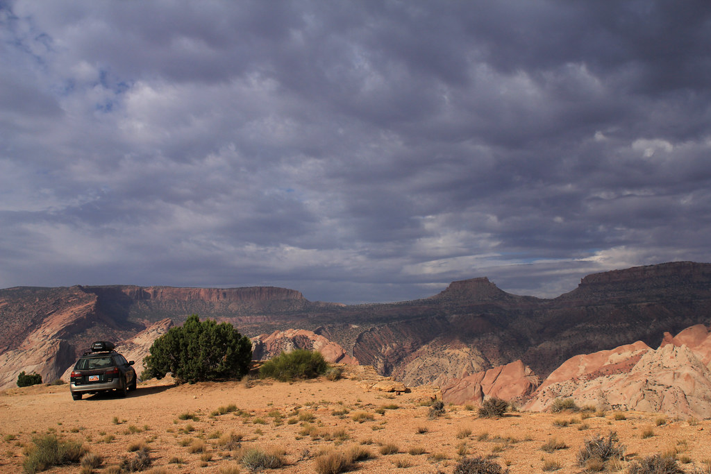
Subie Love by NateGeesaman, on Flickr
This was such a great time that will not be soon forgotten.
Featured image for home page:

The drive down the Burr Trail road was as beautiful as ever. I have driven this road many times, but am still enthralled by the experience. Feeling nuzzled between the beautiful cliffs to the West and the beautiful Henry Mountains to the East on a beautiful dirt road feels awesome.
Henry Brothers by NateGeesaman, on Flickr
We got to the Halls Creek Overlook around 11:00 AM and were greeted with some great clouds rolling through that helped limit the affects of the July heat on our travels. It was good to finally be down there and be looking at some awesome weather to accompany us along the trail.
Dan Halls Creek Overlook by NateGeesaman, on Flickr
What a great chunk of The Waterpocket Fold!
Halls Creek Overlook Pano by NateGeesaman, on Flickr
Dan Halls Creek Overlook 2 by NateGeesaman, on Flickr
The trail started with a 700 ft. descent to Halls creek where we then continued South along The Waterpocket Fold for 7 miles til we reached The Narrows. The clouds hung around and kept the climate real nice for hiking until maybe 2:00 P.M. when the sun broke the clouds and made it hot as hell. We chilled under a big Cottonwood and took a nap until the clouds returned.
The views of the complicated cliffs changed constantly showing new angles, colors, and patterns to appreciate.
Red Slide Pano by NateGeesaman, on Flickr
The Red Slide area had some beautiful Hoodoos that contrasted the bright white creek bed and cliffs above beautifully.
Red Slide Hoodoo by NateGeesaman, on Flickr
Halls Creek View by NateGeesaman, on Flickr
Waterpocket Beauty by NateGeesaman, on Flickr
With views like this along the trail, we were glad we did not opt for the shortcut.
Beautiful Trail by NateGeesaman, on Flickr
We made it to the Narrows and wandered through some real beautiful scenes.
Dan Full Circle by NateGeesaman, on Flickr
Halls Creek Reflection 3 by NateGeesaman, on Flickr
We set up camp in a beautiful bend along the way. Great views all directions, nice and cool, close to decent water, minimal bugs, and a lot of places to spread out and soak up the beauty.
We saw a nice little sunset during dinner and soaked it all in.
Narrows Sunset by NateGeesaman, on Flickr
Halls Creek Cliffburst2 by NateGeesaman, on Flickr
Halls Creek Cliffburst by NateGeesaman, on Flickr
I stayed up late listening to the toads and night time song of this beautiful place and tried to squeeze in an extra meal. Star shots were not great because of clouds and a BIG full moon. So bright! This was probably shot around midnight:
Halls Creek Night by NateGeesaman, on Flickr
We had a nice leisurely morning; enjoying the beautiful camp as much as possible before we moved on. I took some self shots of the area just across the creek from where we set up our tent.
Narrows Camp Selfie by NateGeesaman, on Flickr
This area was so comfortable we just walked around barefoot through the cool wet sand and in and out of the water as we pleased. Temperatures were extremely comfortable as was the entire feel of the camp.
Halls Creek 9 by NateGeesaman, on Flickr
Eventually we got back on the trail and enjoyed the rest of the beautiful ride through The Narrows.
Halls Creek Narrows Reflection 1 by NateGeesaman, on Flickr
Halls Creek Dance by NateGeesaman, on Flickr
Halls Creek 7 by NateGeesaman, on Flickr
Halls Creek Reflection 2 by NateGeesaman, on Flickr
Halls Creek Reflection 4 by NateGeesaman, on Flickr
Halls Creek 10 by NateGeesaman, on Flickr
Dan Narrows by NateGeesaman, on Flickr
Halls Creek Dan 2 by NateGeesaman, on Flickr
Halls Creek Life Lines by NateGeesaman, on Flickr
The experience of this portion of the hike was surreal and extremely beautiful. We took our time taking a lot of breaks, eating and drinking a lot to fuel the long days hike, and taking in all the beauty. We had some trouble finding the route out of The Narrows and added an extra mile or so onto our days hiking looking for the trail. Through a tiny bit of common sense and a good map we were able to locate the trail again and get on our way. Once again we were being blessed with beautiful clouds that kept the heat at bay.
Halls Creek Mammatus by NateGeesaman, on Flickr
When the clouds broke during the hottest part of the day, we found some shade and some water to filter and took a nap and hydrated as much as possible. I took a little time lapse of us napping and this is a crop of one of the shots as we were packing up and I was feeling sore and dreading putting my heavy pack back on:
Exhausted Selfie by NateGeesaman, on Flickr
There were a lot of signs of animal life out there, but I think we were hiking during the day when the animals are avoiding the heat so we only saw a lot of tracks:
Tracks Collage Low by NateGeesaman, on Flickr
During one of our breaks in the shade a huge toad hopped a good 20 ft over towards us to pose for a portrait.
Halls Creek Toad by NateGeesaman, on Flickr
Trudging along on a beautiful day in a beautiful setting was an ideal way to get some great brainwaves going. There is really nothing like getting good and exhausted hiking around the desert. I love it.
Dan Waterpocket Pack by NateGeesaman, on Flickr
Dan Waterpocket Pack 2 by NateGeesaman, on Flickr
We made it back to The Red Slide area shortly before sunset and took a different route this time to get a bit closer to the amazing hoodoos.
Red Slide Hoodoos by NateGeesaman, on Flickr
We saw a subtle but nice sunset above the beautiful cliffs along the Waterpocket Fold.
Halls Creek Sunset by NateGeesaman, on Flickr
We were trying to complete the hike that night, but were too exhausted to do the 700 ft. 1 mile climb to the car. So we set up camp at the mouth of Brimhall Canyon leaving us a short climb to the car in the morning. Our camp spot choice sucked. After we set up our tent we saw a black widow in a big web about 10 feet from our tent that was not there in the morning. LOTS of ants! The days heat radiated off the cliffs all night and the air was hot and still. Nowhere to really spread out and relax either, so we didn't really stay up and enjoy whiskey and conversation as we would have liked and we just ate dinner packed it in early. We awoke to a still hot and stagnant camp.
IMG_0208 by NateGeesaman, on Flickr
We got back on the trail early and started the ascent to the car. Beautiful morning with some pleasant clouds and more great views to finish off our trip.
Much thanks for the awesome weather we got on this trip!
HC Overlook Verto by NateGeesaman, on Flickr
Thanks Dan for being crazy in love with the desert and being willing to do a hike like this in July at the drop of a hat. You are a great hiking partner!
Dan Waterpocket Pack 3 by NateGeesaman, on Flickr
Thanks again to my awesome Subie for getting me there, waiting patiently for 2.5 days in this spot, and starting when we were reunited!
Subie Love by NateGeesaman, on Flickr
This was such a great time that will not be soon forgotten.
Featured image for home page:
