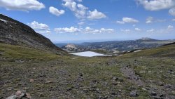
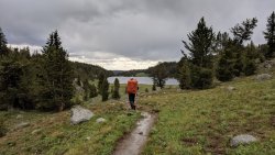
Hailey-Washakie Loop

Jackson

I ❤️ GYE
.
Joined
May 31, 2015
Messages
3,208
July 13-16, 2019

The high snow levels of this past winter and spring, combined with having to study for the bar exam all summer, have made for a summer generally lacking in outdoor exploits for me so far. Thankfully(?), the bar exam is in a week and a half, and after that, I can be free of the shackles of the guilt of not studying if I ever want to go out for an overnighter or something.

Despite the lack of trips so far, I had a really good one in the pipeline, and it had been planned several months in advance. My good friend Sam, his brother Nathan, and their friend Brian were coming out in July for a backpacking trip in celebration of Sam's wedding in August. After presenting them with some options that are usually decent in July, the group settled on the southern portion of the Winds, likely a loop incorporating the Cirque of the Towers and Dads Lake areas. That decision was made in January or February of this year. The snow kept piling up after that, it took forever to warm up out here, and it was looking unlikely that the Winds would be great for mid-July. We came up with a few alternatives and then watched the weather to see if our original plan would work. Fortunately, we had a few weeks of high temperatures in late June and early July that really helped melt out the area we wanted to visit. Unfortunately, we later found out that that would result in more mosquitoes than any of us had ever seen.

We changed the plan slightly and ended up avoiding the Cirque and therefore most of the crowds. I believe the number of groups we encountered on our 4-day trip was less than 10, which surprised me since we were in the Big Sandy area. Anyway, on to the trip. I'm sharing a lot of photos here. There was just a lot to see.

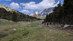
We got out to the trailhead in the early afternoon on Saturday. Lots of cars there, but also plenty of spaces to park still. To set the tone for the majority of our trip, we got swarmed by a ludicrous amount of mosquitoes as soon as we opened the car doors. We applied bug spray, readied up, and headed off. The destination for the night was Dads Lake. I didn't take a ton of photos along the way, but here are a few.
79800
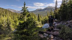
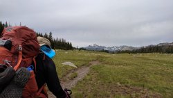
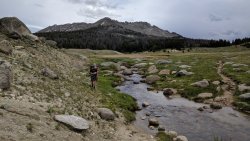
Brian entering Fish Creek Park. This was Brian's first backpacking trip. Heck of an initiation, handled deftly by him.
IMG_20190713_145457.jpg
Sam and Nathan just after crossing Fish Creek.
79802
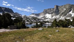
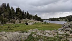
Dads Lake coming into view.

79803
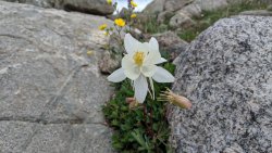
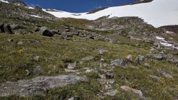
Columbine in the rocks above the lake. The wildflowers were a few weeks out from peak. Not much wildflower action on this trip.
79805
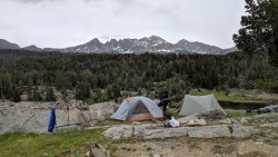
Camp.

79806
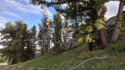
The best bear hang tree I've ever found. I camped at this same spot last year and was in awe then as well.
79807
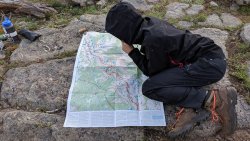
Nathan mobbed by mosquitoes as he looks at our proposed route.
79808

79809
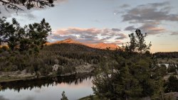
Nice evening.

The next day, whether our route would be a go was uncertain. We were headed over Hailey Pass and around Grave Lake. Then through Ranger Park and over Washakie Pass the next day. We were pretty sure we could make Hailey Pass, but not so sure about Washakie Pass. The trouble was that, if we went all the way over Hailey and around to Washakie and couldn't make it over, we'd have a reeaally long final day. Fortunately, only 15-20 minutes after starting out the second day, we came across two women just below Marms Lake who said they had come over Washakie Pass on their trip. There was definitely snow, but it was supposedly doable. Game on.

79810
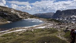
Marms Lake.

79811
Approaching Washakie Creek.

79812
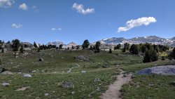
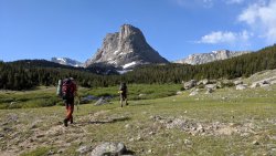
Maybe one of my favorite views on earth.

79813

79814
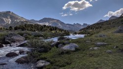
Crossing Washakie Creek. Tons of HDR on these from my phone, which has an automatic HDR setting that has to be re-disabled every time you open the camera app. I'm too lazy for that.

79815
We made it around Skull Lake quickly.

79816
Then to near Mae's.

79817

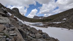
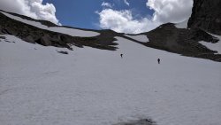
Started hitting snow as we began our climb to the pass. It covered the trail in lots of places, but it wasn't hard finding our way.

79818

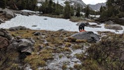
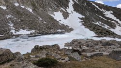
The lakes below the pass were frozen and awesome.

79819

79820
Not too much farther.

79821
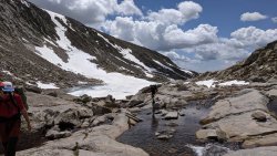
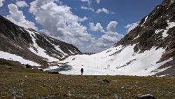
Crossing the outlet of the second lake.

79822
Sam nearing the top of the pass.

79823
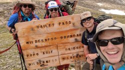
Happy to be here.

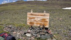
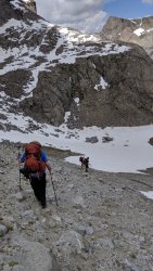
The descent was incredibly steep, and the trail was covered in snow too steep (to us) to glissade. We found another way down on the rocks.79824

79825
We kinda skied this part on our feet. Nathan glissaded the upper part.

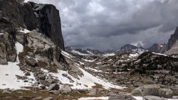
We stopped for a quick lunch but got going quickly because, as you can see, the clouds were building.

79826
Mount Hooker.

The entire trail from here down to Grave Lake was a mess. All the hillsides were just flowing marshes, and the trail was a creek. We came across a few members of a NOLS group looking in vain for a camp site. I think they ended up camping near Baptiste Lake.

We got to a pretty big creek crossing, and it started raining and hailing. We hid in the trees for 15 minutes and waited it out. Then we crossed the creek.

79827
Hail and rain spraying off the rock.

79828
Preparing for the crossing. So much water everywhere.

79829
Brian making the crossing. He and I crossed in an unnecessarily deep spot. I was a bad example and led him through it. Nathan and Sam picked a smarter route that only came up to their knees.

We walked and walked to Grave Lake and then around it. Grave Lake was really cool. It's just so big, and it feels so remote and isolated. There's also not many good places to camp along it. And it takes forever to walk the length of it.

79830
Grave Lake looking east. Those clouds are from the storm that hailed on us.

There was a decent sized creek to cross midway around the lake. I didn't get any pictures, but the current was very strong. We forded it and continued on.

79846
Because Grave Lake is so large, its outlet is likewise very large. There's a killer bridge going across it. Nicest backcountry bridge I've ever had the pleasure of crossing.

79847
Last look at the lake before heading into the forest.

By the time we had gotten around Grave Lake, we were beat. Time to start considering places for campsites.

79848
We found a very secluded spot in the middle of the forest between Grave Lake and the Little Wind River. Shockingly, the mosquitoes were not as bad as they had been at Dad's Lake.

The next day, we went through Ranger Park, then up to Washakie Pass. Beautiful walk. Strenuous at times. I've been writing too much so far, so I'll just let the photos talk for a bit.

79849

79851

79850

79852

79853


79854

79855
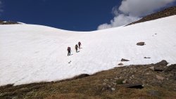
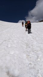
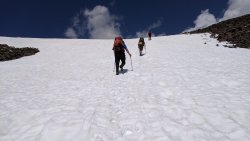
Washakie Pass. We decided just to go straight up the snow, using our poles for stability. Nathan led the way, kicking steps and showing us how it's done. Both he and Sam have some experience on snow and glaciers, so Brian and I deferred to them.

79856

79857
There was a lot more elevation to gain than it appeared.

79858

79859
No selfie this time.

79860
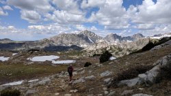
You could see way out into the flat parts of western Wyoming.

79861
East Fork Basin in the distance, looking real nice. Hope to go there another day.

79862
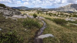
I took this to remind myself that the trail was a creek for most of the way down to Skull Lake.

We kept walking. Made it back across Washakie Creek, and headed on toward Dads Lake. We got rained and hailed on again, about the same time of day as the previous day. Opted to set up camp in Fish Creek Park, for an easy hike out the next morning.

79863
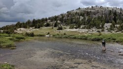
Sam making the ford at Washakie Creek.

79864
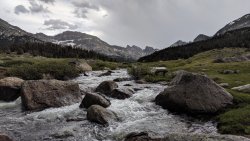
That view.

79865
The last remnants of the storm. We got very warm in all our rain gear after this.

79866
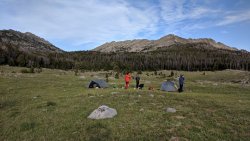
Night 3 camp in Fish Creek Park.

The mosquitoes in Fish Creek Park were nearly nonexistent at first. We had a good breeze and it kept them at bay. The breeze died though, and they were even worse there than they had been on our first night at Dads Lake. We ended up going to bed at 7:50 just to get away from the bugs. It was so comforting being the tent and not having to think constantly about your personal swarm of hundreds of mosquitoes following you everywhere. I have never seen mosquitoes this bad on any trip I've ever done. They were bad when I visited Dads Lake and Skull Lake in mid-July 2018, but that experience paled in comparison to this one. We all agreed that we'll save Winds trips for August and September now.

Another note is that Nathan discovered an old elk carcass about 100 yards from our tents. There was a pile of bear scat next to it. After a cautious approach and a quick look, we determined that the scat was at least a few weeks old. Probably not a concern. Still interesting to me though, as it was the first sign of bear I've come across in the Winds. Couldn't tell if it was grizzly or black bear though. I should've taken a photo for the scat scan discussion thread.

Watching the mosquitoes from the comfort of the tent's mesh wall.

The hike out in the morning was quick. We stopped for ice cream and sandwiches at the Farson Mercantile, and headed home. Awesome trip, even with the mosquitoes. We were fortunate all the passes were a go. A few days earlier may have been trickier. Who knows? Anyway, we all had a great time. Thanks for reading!
 
Last edited:
July 13-16, 2019

The high snow levels of this past winter and spring, combined with having to study for the bar exam all summer, have made for a summer generally lacking in outdoor exploits for me so far. Thankfully(?), the bar exam is in a week and a half, and after that, I can be free of the shackles of the guilt of not studying if I ever want to go out for an overnighter or something.

Despite the lack of trips so far, I had a really good one in the pipeline, and it had been planned several months in advance. My good friend Sam, his brother Nathan, and their friend Brian were coming out in July for a backpacking trip in celebration of Sam's wedding in August. After presenting them with some options that are usually decent in July, the group settled on the southern portion of the Winds, likely a loop incorporating the Cirque of the Towers and Dads Lake areas. That decision was made in January or February of this year. The snow kept piling up after that, it took forever to warm up out here, and it was looking unlikely that the Winds would be great for mid-July. We came up with a few alternatives and then watched the weather to see if our original plan would work. Fortunately, we had a few weeks of high temperatures in late June and early July that really helped melt out the area we wanted to visit. Unfortunately, we later found out that that would result in more mosquitoes than any of us had ever seen.

We changed the plan slightly and ended up avoiding the Cirque and therefore most of the crowds. I believe the number of groups we encountered on our 4-day trip was less than 10, which surprised me since we were in the Big Sandy area. Anyway, on to the trip. I'm sharing a lot of photos here. There was just a lot to see.

We got out to the trailhead in the early afternoon on Saturday. Lots of cars there, but also plenty of spaces to park still. To set the tone for the majority of our trip, we got swarmed by a ludicrous amount of mosquitoes as soon as we opened the car doors. We applied bug spray, readied up, and headed off. The destination for the night was Dads Lake. I didn't take a ton of photos along the way, but here are a few.

View attachment 79800
Brian entering Fish Creek Park. This was Brian's first backpacking trip. Heck of an initiation, handled deftly by him.

View attachment 79801
Sam and Nathan just after crossing Fish Creek.

View attachment 79802
Dads Lake coming into view.

View attachment 79803
Columbine in the rocks above the lake. The wildflowers were a few weeks out from peak. Not much wildflower action on this trip.

View attachment 79805
Camp.

View attachment 79806
The best bear hang tree I've ever found. I camped at this same spot last year and was in awe then as well.

View attachment 79807
Nathan mobbed by mosquitoes as he looks at our proposed route.
View attachment 79808

View attachment 79809
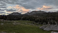
Nice evening.

The next day, whether our route would be a go was uncertain. We were headed over Hailey Pass and around Grave Lake. Then through Ranger Park and over Washakie Pass the next day. We were pretty sure we could make Hailey Pass, but not so sure about Washakie Pass. The trouble was that, if we went all the way over Hailey and around to Washakie and couldn't make it over, we'd have a reeaally long final day. Fortunately, only 15-20 minutes after starting out the second day, we came across two women just below Marms Lake who said they had come over Washakie Pass on their trip. There was definitely snow, but it was supposedly doable. Game on.
View attachment 79810
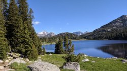
Marms Lake.

View attachment 79811
Approaching Washakie Creek.

View attachment 79812
Maybe one of my favorite views on earth.
View attachment 79813

View attachment 79814
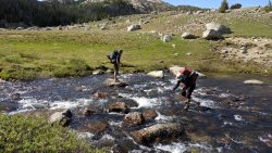
Crossing Washakie Creek. Tons of HDR on these from my phone, which has an automatic HDR setting that has to be re-disabled every time you open the camera app. I'm too lazy for that.

View attachment 79815
We made it around Skull Lake quickly.

View attachment 79816
Then to near Mae's.

View attachment 79817

Started hitting snow as we began our climb to the pass. It covered the trail in lots of places, but it wasn't hard finding our way.

View attachment 79818

The lakes below the pass were frozen and awesome.

View attachment 79819

View attachment 79820
Not too much farther.

View attachment 79821
Crossing the outlet of the second lake.

View attachment 79822
Sam nearing the top of the pass.

View attachment 79823
Happy to be here.

The descent was incredibly steep, and the trail was covered in snow too steep (to us) to glissade. We found another way down on the rocks.View attachment 79824

View attachment 79825
We kinda skied this part on our feet. Nathan glissaded the upper part.

We stopped for a quick lunch but got going quickly because, as you can see, the clouds were building.

View attachment 79826
Mount Hooker.

The entire trail from here down to Grave Lake was a mess. All the hillsides were just flowing marshes, and the trail was a creek. We came across a few members of a NOLS group looking in vain for a camp site. I think they ended up camping near Baptiste Lake.

We got to a pretty big creek crossing, and it started raining and hailing. We hid in the trees for 15 minutes and waited it out. Then we crossed the creek.

View attachment 79827
Hail and rain spraying off the rock.

View attachment 79828
Preparing for the crossing. So much water everywhere.

View attachment 79829
Brian making the crossing. He and I crossed in an unnecessarily deep spot. I was a bad example and led him through it. Nathan and Sam picked a smarter route that only came up to their knees.

We walked and walked to Grave Lake and then around it. Grave Lake was really cool. It's just so big, and it feels so remote and isolated. There's also not many good places to camp along it. And it takes forever to walk the length of it.

View attachment 79830
Grave Lake looking east. Those clouds are from the storm that hailed on us.

There was a decent sized creek to cross midway around the lake. I didn't get any pictures, but the current was very strong. We forded it and continued on.

View attachment 79846
Because Grave Lake is so large, its outlet is likewise very large. There's a killer bridge going across it. Nicest backcountry bridge I've ever had the pleasure of crossing.

View attachment 79847
Last look at the lake before heading into the forest.

By the time we had gotten around Grave Lake, we were beat. Time to start considering places for campsites.

View attachment 79848
We found a very secluded spot in the middle of the forest between Grave Lake and the Little Wind River. Shockingly, the mosquitoes were not as bad as they had been at Dad's Lake.

The next day, we went through Ranger Park, then up to Washakie Pass. Beautiful walk. Strenuous at times. I've been writing too much so far, so I'll just let the photos talk for a bit.

View attachment 79849

View attachment 79851

View attachment 79850

View attachment 79852

View attachment 79853


View attachment 79854

View attachment 79855
Washakie Pass. We decided just to go straight up the snow, using our poles for stability. Nathan led the way, kicking steps and showing us how it's done. Both he and Sam have some experience on snow and glaciers, so Brian and I deferred to them.

View attachment 79856

View attachment 79857
There was a lot more elevation to gain than it appeared.

View attachment 79858

View attachment 79859
No selfie this time.

View attachment 79860
You could see way out into the flat parts of western Wyoming.

View attachment 79861
East Fork Basin in the distance, looking real nice. Hope to go there another day.

View attachment 79862
I took this to remind myself that the trail was a creek for most of the way down to Skull Lake.

We kept walking. Made it back across Washakie Creek, and headed on toward Dads Lake. We got rained and hailed on again, about the same time of day as the previous day. Opted to set up camp in Fish Creek Park, for an easy hike out the next morning.

View attachment 79863
Sam making the ford at Washakie Creek.

View attachment 79864
That view.

View attachment 79865
The last remnants of the storm. We got very warm in all our rain gear after this.

View attachment 79866
Night 3 camp in Fish Creek Park.

The mosquitoes in Fish Creek Park were nearly nonexistent at first. We had a good breeze and it kept them at bay. The breeze died though, and they were even worse there than they had been on our first night at Dads Lake. We ended up going to bed at 7:50 just to get away from the bugs. It was so comforting being the tent and not having to think constantly about your personal swarm of hundreds of mosquitoes following you everywhere. I have never seen mosquitoes this bad on any trip I've ever done. They were bad when I visited Dads Lake and Skull Lake in mid-July 2018, but that experience paled in comparison to this one. We all agreed that we'll save Winds trips for August and September now.

Another note is that Nathan discovered an old elk carcass about 100 yards from our tents. There was a pile of bear scat next to it. After a cautious approach and a quick look, we determined that the scat was at least a few weeks old. Probably not a concern. Still interesting to me though, as it was the first sign of bear I've come across in the Winds. Couldn't tell if it was grizzly or black bear though. I should've taken a photo for the scat scan discussion thread.

Watching the mosquitoes from the comfort of the tent's mesh wall.

The hike out in the morning was quick. We stopped for ice cream and sandwiches at the Farson Mercantile, and headed home. Awesome trip, even with the mosquitoes. We were fortunate all the passes were a go. A few days earlier may have been trickier. Who knows? Anyway, we all had a great time. Thanks for reading!
Wonderful TR! I have been very curious how the bugs might be right now in the Winds. From your pics it looks like the snow only left a few weeks ago - Amazing. Really loved your trip report and all the pics. Looks like a great trip! This had to have been good medicine prepping for your bar exam - hope it goes well for you!
 
The mosquito's have always been the absolute worst I have ever seen in the Winds for some reason. They must agree that the area is just super beautiful. We once went there with the goal of getting to Grave lake. We ended up running into some people telling us a bear was terrorizing people camping there all week, so we chose another spot. In hindsight, I think they were told that by people wanting the lake to themselves!

Your pictures are awesome, your HDR feature sounds like my phone as well. Is it is Pixel phone? At least to me, it doesn't look like it went overboard with the HDR, but I always wonder why Google makes all the phone settings reset after you lock the screen.
 
Your pictures are awesome, your HDR feature sounds like my phone as well. Is it is Pixel phone? At least to me, it doesn't look like it went overboard with the HDR, but I always wonder why Google makes all the phone settings reset after you lock the screen.
Thanks! Yep, it's a Pixel 1. And yeah, I'm puzzled why they wouldn't give you a setting where you can make it so HDR is off when you open up the camera. Especially now that they've made 3 generations of the Pixel, and many others have complained about it too. Oh well. Great phone otherwise.

Also interesting about Grave Lake. I could see it being a hot spot for a bear, but your explanation sounds likely too. Haha.
 
Great TR! The ability to take such great photos certainly calls into question the need for a camera+minipod. I still use an older PowerShot with polarizer lens. The phones now seem to be able to even mimic polarization. But at a steep price!

Thought I recognized a camp chair in one of those shots. Nice luxury item! What were you using for shoes/boots? It looked like folks were carrying camp/wading shoes. I've been trying to convince myself that I'd be comfortable in non-GTX trail-runners and leaving the camp shoes behind, but haven't made the plunge yet. It's cold in those early morning shoulder seasons and more protection from the talus helps.
Yeah, it's insane how well they can stabilize and capture colors. Probably 1/4 to 1/3 of those photos were taken on the move as I was walking. It's taken a bit of practice, but it saves a lot of time when you don't have to stop every time you want to take a picture.

Yep! We all packed little camp chairs--cheap knockoffs of the Big Agnes ones. If it weren't for the bugs, we really could've enjoyed lounging around!

I used trail runners, and the shoes we all had strapped on our packs were just lightweight sandals, etc. for fording all the streams that couldn't be hopped across. And there ended up being more of those than we expected, so we were glad to have them. Brian used trail runners as well, and Nathan and Sam had waterproof boots. Everyone seemed happy with their footwear though. To each their own!
 
Great TR, your 'favorite view on earth' looks wonderful, so peaceful. Do you think the masses of mosquitos disappear end of August, early September in that area? Good luck with the bar exam!
 
Great TR, your 'favorite view on earth' looks wonderful, so peaceful. Do you think the masses of mosquitos disappear end of August, early September in that area? Good luck with the bar exam!
I've only been to that area in mid-July, so I can't say for sure. But I've been elsewhere in the Winds in August and I don't think I even applied bug spray. Early September is probably even better for bugs.

And thanks! Lots of studying going on this week.
 
Nice trip report! And timely, because I head out there tomorrow! Did you guys bring bear spray?
 
Nice trip report! And timely, because I head out there tomorrow! Did you guys bring bear spray?
Yeah, we had two cans among the four of us. I mentioned it above, but the only sign of bear we saw was likely weeks-old scat next to a pretty much fully consumed elk carcass.

Edit: there were two notices at the trailhead board that said that there had been run-ins with black bears at Big Sandy Lake. One in late June, another in early July. No mention of anything elsewhere, but I think bears have been seen all over the area over time.
 
Great pics and report Jackson. Looks like a good adventure. I'm glad you didn't let those mosquito ruin your trip. It's amazing how such a small insect can be such a huge nuisance. Here is a pic from the worst I have ever seen them. It was by Alice Lake in the Sawtooth's at the beginning of July 2016. This was the only time I ever let them ruin my trip. A 3 day trip turned into 1.5 days because they were unbearable. 20160702_172923.jpg
 
July 13-16, 2019

The high snow levels of this past winter and spring, combined with having to study for the bar exam all summer, have made for a summer generally lacking in outdoor exploits for me so far. Thankfully(?), the bar exam is in a week and a half, and after that, I can be free of the shackles of the guilt of not studying if I ever want to go out for an overnighter or something.

Despite the lack of trips so far, I had a really good one in the pipeline, and it had been planned several months in advance. My good friend Sam, his brother Nathan, and their friend Brian were coming out in July for a backpacking trip in celebration of Sam's wedding in August. After presenting them with some options that are usually decent in July, the group settled on the southern portion of the Winds, likely a loop incorporating the Cirque of the Towers and Dads Lake areas. That decision was made in January or February of this year. The snow kept piling up after that, it took forever to warm up out here, and it was looking unlikely that the Winds would be great for mid-July. We came up with a few alternatives and then watched the weather to see if our original plan would work. Fortunately, we had a few weeks of high temperatures in late June and early July that really helped melt out the area we wanted to visit. Unfortunately, we later found out that that would result in more mosquitoes than any of us had ever seen.

We changed the plan slightly and ended up avoiding the Cirque and therefore most of the crowds. I believe the number of groups we encountered on our 4-day trip was less than 10, which surprised me since we were in the Big Sandy area. Anyway, on to the trip. I'm sharing a lot of photos here. There was just a lot to see.

We got out to the trailhead in the early afternoon on Saturday. Lots of cars there, but also plenty of spaces to park still. To set the tone for the majority of our trip, we got swarmed by a ludicrous amount of mosquitoes as soon as we opened the car doors. We applied bug spray, readied up, and headed off. The destination for the night was Dads Lake. I didn't take a ton of photos along the way, but here are a few.

View attachment 79800
Brian entering Fish Creek Park. This was Brian's first backpacking trip. Heck of an initiation, handled deftly by him.

View attachment 79801
Sam and Nathan just after crossing Fish Creek.

View attachment 79802
Dads Lake coming into view.

View attachment 79803
Columbine in the rocks above the lake. The wildflowers were a few weeks out from peak. Not much wildflower action on this trip.

View attachment 79805
Camp.

View attachment 79806
The best bear hang tree I've ever found. I camped at this same spot last year and was in awe then as well.

View attachment 79807
Nathan mobbed by mosquitoes as he looks at our proposed route.

View attachment 79808

View attachment 79809
Nice evening.

The next day, whether our route would be a go was uncertain. We were headed over Hailey Pass and around Grave Lake. Then through Ranger Park and over Washakie Pass the next day. We were pretty sure we could make Hailey Pass, but not so sure about Washakie Pass. The trouble was that, if we went all the way over Hailey and around to Washakie and couldn't make it over, we'd have a reeaally long final day. Fortunately, only 15-20 minutes after starting out the second day, we came across two women just below Marms Lake who said they had come over Washakie Pass on their trip. There was definitely snow, but it was supposedly doable. Game on.

View attachment 79810
Marms Lake.

View attachment 79811
Approaching Washakie Creek.

View attachment 79812
Maybe one of my favorite views on earth.
View attachment 79813

View attachment 79814
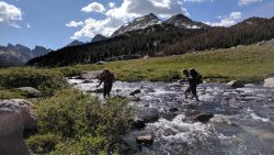
Crossing Washakie Creek. Tons of HDR on these from my phone, which has an automatic HDR setting that has to be re-disabled every time you open the camera app. I'm too lazy for that.
View attachment 79815
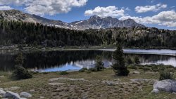
We made it around Skull Lake quickly.
View attachment 79816
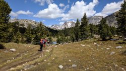
Then to near Mae's.

View attachment 79817

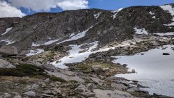
Started hitting snow as we began our climb to the pass. It covered the trail in lots of places, but it wasn't hard finding our way.
View attachment 79818

The lakes below the pass were frozen and awesome.
View attachment 79819

View attachment 79820
Not too much farther.

View attachment 79821
Crossing the outlet of the second lake.
View attachment 79822
Sam nearing the top of the pass.

View attachment 79823
Happy to be here.

The descent was incredibly steep, and the trail was covered in snow too steep (to us) to glissade. We found another way down on the rocks.View attachment 79824
View attachment 79825
We kinda skied this part on our feet. Nathan glissaded the upper part.

We stopped for a quick lunch but got going quickly because, as you can see, the clouds were building.
View attachment 79826
Mount Hooker.

The entire trail from here down to Grave Lake was a mess. All the hillsides were just flowing marshes, and the trail was a creek. We came across a few members of a NOLS group looking in vain for a camp site. I think they ended up camping near Baptiste Lake.

We got to a pretty big creek crossing, and it started raining and hailing. We hid in the trees for 15 minutes and waited it out. Then we crossed the creek.
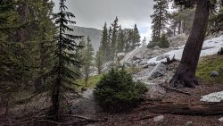
View attachment 79827
Hail and rain spraying off the rock.

View attachment 79828
Preparing for the crossing. So much water everywhere.
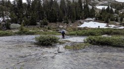
View attachment 79829
Brian making the crossing. He and I crossed in an unnecessarily deep spot. I was a bad example and led him through it. Nathan and Sam picked a smarter route that only came up to their knees.

We walked and walked to Grave Lake and then around it. Grave Lake was really cool. It's just so big, and it feels so remote and isolated. There's also not many good places to camp along it. And it takes forever to walk the length of it.
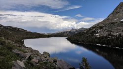
View attachment 79830
Grave Lake looking east. Those clouds are from the storm that hailed on us.

There was a decent sized creek to cross midway around the lake. I didn't get any pictures, but the current was very strong. We forded it and continued on.
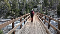
View attachment 79846
Because Grave Lake is so large, its outlet is likewise very large. There's a killer bridge going across it. Nicest backcountry bridge I've ever had the pleasure of crossing.
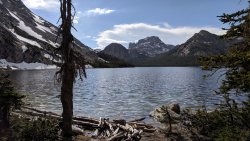
View attachment 79847
Last look at the lake before heading into the forest.

By the time we had gotten around Grave Lake, we were beat. Time to start considering places for campsites.
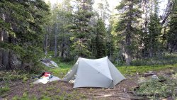
View attachment 79848
We found a very secluded spot in the middle of the forest between Grave Lake and the Little Wind River. Shockingly, the mosquitoes were not as bad as they had been at Dad's Lake.

The next day, we went through Ranger Park, then up to Washakie Pass. Beautiful walk. Strenuous at times. I've been writing too much so far, so I'll just let the photos talk for a bit.
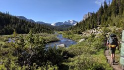
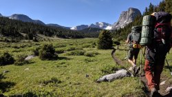
View attachment 79849

View attachment 79851

View attachment 79850

View attachment 79852

View attachment 79853


View attachment 79854

View attachment 79855
Washakie Pass. We decided just to go straight up the snow, using our poles for stability. Nathan led the way, kicking steps and showing us how it's done. Both he and Sam have some experience on snow and glaciers, so Brian and I deferred to them.
View attachment 79856

View attachment 79857
There was a lot more elevation to gain than it appeared.
View attachment 79858

View attachment 79859
No selfie this time.

View attachment 79860
You could see way out into the flat parts of western Wyoming.
View attachment 79861
East Fork Basin in the distance, looking real nice. Hope to go there another day.
View attachment 79862
I took this to remind myself that the trail was a creek for most of the way down to Skull Lake.

We kept walking. Made it back across Washakie Creek, and headed on toward Dads Lake. We got rained and hailed on again, about the same time of day as the previous day. Opted to set up camp in Fish Creek Park, for an easy hike out the next morning.
View attachment 79863
Sam making the ford at Washakie Creek.
View attachment 79864
That view.

View attachment 79865
The last remnants of the storm. We got very warm in all our rain gear after this.
View attachment 79866
Night 3 camp in Fish Creek Park.

The mosquitoes in Fish Creek Park were nearly nonexistent at first. We had a good breeze and it kept them at bay. The breeze died though, and they were even worse there than they had been on our first night at Dads Lake. We ended up going to bed at 7:50 just to get away from the bugs. It was so comforting being the tent and not having to think constantly about your personal swarm of hundreds of mosquitoes following you everywhere. I have never seen mosquitoes this bad on any trip I've ever done. They were bad when I visited Dads Lake and Skull Lake in mid-July 2018, but that experience paled in comparison to this one. We all agreed that we'll save Winds trips for August and September now.

Another note is that Nathan discovered an old elk carcass about 100 yards from our tents. There was a pile of bear scat next to it. After a cautious approach and a quick look, we determined that the scat was at least a few weeks old. Probably not a concern. Still interesting to me though, as it was the first sign of bear I've come across in the Winds. Couldn't tell if it was grizzly or black bear though. I should've taken a photo for the scat scan discussion thread.

Watching the mosquitoes from the comfort of the tent's mesh wall.

The hike out in the morning was quick. We stopped for ice cream and sandwiches at the Farson Mercantile, and headed home. Awesome trip, even with the mosquitoes. We were fortunate all the passes were a go. A few days earlier may have been trickier. Who knows? Anyway, we all had a great time. Thanks for reading!
Looks so pretty Jackson! Thank you for sharing. My soul feels better this morning after seeing this.
 
Great pics and report Jackson. Looks like a good adventure. I'm glad you didn't let those mosquito ruin your trip. It's amazing how such a small insect can be such a huge nuisance. Here is a pic from the worst I have ever seen them. It was by Alice Lake in the Sawtooth's at the beginning of July 2016. This was the only time I ever let them ruin my trip. A 3 day trip turned into 1.5 days because they were unbearable. View attachment 79892
You may have beat the Fish Creek Park mosquitoes with this one. There was a place or two we walked through in the woods where they were thick like this, but never in camp (thank goodness). You walk through and there are constantly dozens to hundreds of them just bouncing off of you. This picture may as well be of the apocalypse.
 
Similar threads
Thread starter Title Forum Replies Date
tarpon6 9 Days Solo Wind River Range Washakie Pass, Grave Lake, Hailey Pass Loop. Backpacking 6
marmot_boi Hailey Pass-Cirque of The Towers loop Backpacking 14
TheMountainRabbit Southern Absaroka & Thorofare Mountain (Teton/Washakie Wilderness) - July 2023 Backpacking 23
TheMountainRabbit Younts Peak (Teton/Washakie Wilderness) - July 2022 Backpacking 22
TeamJenkins17 Washakie Wilderness Hiking Hiking & Camping 0
TeamJenkins17 Washakie Wilderness Trip Advice Trip Planning 17
TeamJenkins17 Looking for info on Clark Creek drainage/Pierpont Pass into Hidden Basin in the Washakie Wilderness Trip Planning 5
TheMountainRabbit Southern Absaroka Loop (Teton/Washakie Wilderness) - August 2021 Backpacking 8
D Backpacking Advice in the Winds, Teton Wilderness and the Washakie Wilderness Trip Planning 8
D Recommendations in the Gros Ventre and Washakie Wilderness Areas Trip Planning 10
westy Fishhawk Creek, Washakie Wilderness Area Trip Planning 4
S Washakie: E. Dunoir Creek - Shoshone Pass Info Trip Planning 13
Born to Hike Windriver 36 mile loop: Skull Lake, Washakie Pass, South Fork Lakes, Lizard Head Trail, The Cirque, Big Sandy Lake Backpacking 6
westy Five Pockets, Washakie wilderness area Trip Planning 3
jjmcwill Looking for Wind River advice: Grave Lake, Washakie Lake area Trip Planning 18
Nick Lizard Head, Washakie, Cirque Loop - Wind Rivers Trip Planning 10
G Escalante area 4-5 night backpack trip suggestions in late September. Loop if possible. Limit technical sections if any. Thanks! Backpacking 6
TrailScot Escalante Loop via Dry Hollow and Boulder Mail Trail - September 2023 Backpacking 8
TractorDoc Paintbrush Canyon / Cascade Canyon Loop -- Grand Teton NP September 11, 2023 Hiking & Camping 9
D Grand Teton Cascade Loop Trip Planning 1
TrailScot Upper Paria Loop Hike - September 2023 Backpacking 4
M Mee/Knowles Canyon Loop, Grand Junction Colorado Backpacking 4
randakag Rawah Wilderness "Lollipop" Loop - September 2023 Backpacking 7
Ugly Oh Mother! A Mountain Loop Backpacking 12
Jackson Lollipop Loop in the Pintlers Backpacking 6
Timber High Sierra - North Lake to South Lake Loop - Layover Day Trip Planning 9
RockyMntCol Cloud Peak Wilderness Loop Trip Planning 1
BJett Part 3 - Tour de Canyon Country. Lower Escalante Loop Hiking & Camping 0
scatman City Creek Loop - April 23, 2023 Hiking & Camping 8
scatman The Van Cott Loop - April 15, 2023 Hiking & Camping 15
Kullaberg63 Loop on and around the Fold Backpacking 13
fossana AZ Strip bike exploration (Sunshine Trail/Hurricane Wash Loop) Everything Else 3
NorthwestWanderer First time in the High Uintas | Red Castle SNEAK Loop | I give these mountains 5 out of 5 stars Backpacking 7
scatman Mount Wire Loop - 2003 and 2016? Hiking & Camping 13
TheMountainRabbit Pitchstone/Bechler Loop (Yellowstone NP) - September 2022 Backpacking 17
scatman Teton Wilderness Loop - August 6, 2022 Backpacking 27
Mikjik86 Another Wind River Trip Planning! Elkhart/Titcomb/Knapsack/Shannons Pass loop back to Elkhart, or continue to Green River Lakes Trailhead? Trip Planning 10
scatman Shoshone Lake Lollipop Loop - Yellowstone National Park - July 24, 2022 Backpacking 63
TrailScot "I'll take the High Road ..." - A Loop Hike around the Canyons of Needles - May 2022 Trip Reports 14
BJett Big South Fork National River & Recreation Area Packraft/Backpack Loop (TN) Backpacking 6
Kerrie at Thru We Go Grand Canyon Backpack/Packraft Loop at New Hance Backpacking 11
Duketogo13 BMT- Death Hollow-Escalante Triangle loop Trip Planning 20
M Kannah Creek Basin loop, Grand Junction CO Backpacking 6
T Snow Canyon Loop Hiking & Camping 1
fossana Yellow Rock, Pollock Arch, Hackberry Canyon loop (GSENM) Hiking & Camping 10
scatman The Van Cott Loop - February 13, 2022 Hiking & Camping 9
Wesley Cheaha Freezing Out and Back Loop FAIL Backpacking 12
T Harris Wash/Silver Falls/Choprock/Fence Canyon Loop MLK weekend 2022 Backpacking 8
scatman Grandeur Peak Loop - December 4, 2021 Hiking & Camping 4
scatman Foothill Follies Part 2 - Black Mountain Ridge and City Creek Canyon Loop - November 11, 2021 Hiking & Camping 6

Similar threads

Back
Top