Navigation
Install the app
How to install the app on iOS
Follow along with the video below to see how to install our site as a web app on your home screen.
Note: This feature may not be available in some browsers.
More options
Style variation
You are using an out of date browser. It may not display this or other websites correctly.
You should upgrade or use an alternative browser.
You should upgrade or use an alternative browser.
Guess the spot
- Thread starter Backcountry Post
- Start date
- Joined
- Jun 25, 2012
- Messages
- 4,430
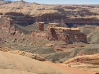
OK, I concede that one is obscure. I could go on and on with shapes and figures in canyon walls.. The Happy Face is in 40 mile Canyon or it's tributary Carcass Gulch (can't remember which on the backpack) all off the HITR road in the Monument.
But I have to keep it somewhat obscure to make it challenging for our resident-red-rock-expert, @Michael the Alien.
This is really not that obscure and I would be upset if @slc_dan, @NateGeesaman or @lostlandscapes didn't quickly pattern recognition this one.

But I have to keep it somewhat obscure to make it challenging for our resident-red-rock-expert, @Michael the Alien.
This is really not that obscure and I would be upset if @slc_dan, @NateGeesaman or @lostlandscapes didn't quickly pattern recognition this one.

Last edited:
- Joined
- Jun 25, 2012
- Messages
- 4,430
Score!Sawtooth Ridge!
- the Dirty Devil river drainage just south of the Angel Trail.
Yellowstone 1
Blah!
- Joined
- Jan 23, 2012
- Messages
- 601
Kinda looks like the first part of the Subway trail?
- Joined
- Aug 9, 2007
- Messages
- 12,962
Kinda looks like the first part of the Subway trail?
Nope. Very, very far away from there.
But now that you mention it - it kind of does!
Howells Outdoors
Adventure is my middle name...actually it's Keith.
- Joined
- Sep 26, 2012
- Messages
- 444
I really thought it was too...and I have no clue where it is...just wanted to agree.Nope. Very, very far away from there.
But now that you mention it - it kind of does!
Aldaron
Member
- Joined
- Jun 16, 2012
- Messages
- 1,487
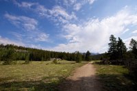
Should I guess Big Sandy?I'll say this much. This trail leads to a place that is similarly popular and world renowned as the subway.
Don't like ads? Become a BCP Supporting Member and kiss them all goodbye. Click here for more info.


