Navigation
Install the app
How to install the app on iOS
Follow along with the video below to see how to install our site as a web app on your home screen.
Note: This feature may not be available in some browsers.
More options
Style variation
You are using an out of date browser. It may not display this or other websites correctly.
You should upgrade or use an alternative browser.
You should upgrade or use an alternative browser.
Guess the spot: Utah Edition
- Thread starter Ben
- Start date
- Joined
- Jun 11, 2017
- Messages
- 4,612
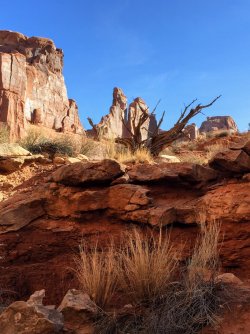
It really looks a lot like some of the Arches backcountry.
- Joined
- Jun 11, 2017
- Messages
- 4,612
I was going to say Park Avenue but it seemed too obvious to be true. LOL
- Joined
- Jul 24, 2021
- Messages
- 166
- Joined
- Jun 11, 2017
- Messages
- 4,612
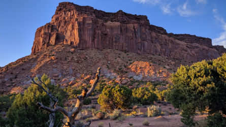
Capitol Reef country?
futurafree
Member
- Joined
- Apr 1, 2021
- Messages
- 195
Silver Falls/Choprock area?
- Joined
- Jul 24, 2021
- Messages
- 166
No, not in the Escalante or Capitol Reef area.Silver Falls/Choprock area?
Udink
Still right here.
- Joined
- Jan 17, 2012
- Messages
- 1,742
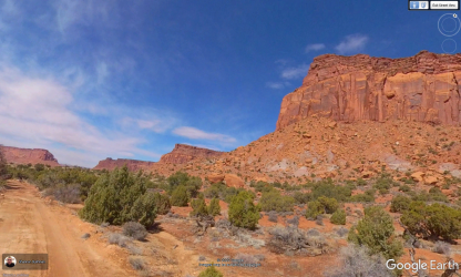
This is sort of a wild guess 'cause I can't match up any of the terrain (though the sandstone looks like a match), but is it along Cottonwood Creek between Indian Creek and Beef Basin?
Also, I just learned today that there's Street View in Google Earth for that road going into Beef Basin. Crazy.
Also, I just learned today that there's Street View in Google Earth for that road going into Beef Basin. Crazy.
regehr
Member
- Joined
- Mar 28, 2012
- Messages
- 2,458
waiting for street view of the road to Bobby's HoleAlso, I just learned today that there's Street View in Google Earth for that road going into Beef Basin. Crazy.
- Joined
- Jul 24, 2021
- Messages
- 166
Nope, it's on the other side of the Colorado river from where you're looking. At least from Beef Basin, because I can't find a Cottonwood creek anywhere between Indian Creek and Beef Basin(that should be my challenge!).This is sort of a wild guess 'cause I can't match up any of the terrain (though the sandstone looks like a match), but is it along Cottonwood Creek between Indian Creek and Beef Basin?
Also, I just learned today that there's Street View in Google Earth for that road going into Beef Basin. Crazy.
Also, learned that Smoky Mountain road on the KiKaiparowits Plateau is on street view as well.
- Joined
- Jul 24, 2021
- Messages
- 166
Nice Youtube video of Bobby's hole here:waiting for street view of the road to Bobby's Hole
regehr
Member
- Joined
- Mar 28, 2012
- Messages
- 2,458
a longtime trip buddy of mine -- tough and experienced and not one back down from any sort of challenge -- was known to become pale when discussing Bobby's Hole. I've never been there and as a driver of stock vehicles, do not plan on it.Nice Youtube video of Bobby's hole here:
Reef&Ruins
Colorado Plateau is calling...
- Joined
- Feb 3, 2017
- Messages
- 926
I could drive that in our minivan. Piece of cake. ROFL! Not.Nice Youtube video of Bobby's hole here:
regehr
Member
- Joined
- Mar 28, 2012
- Messages
- 2,458
I've often thought that I've probably never done anything in my 4runner that a properly skilled and motivated person in a shitty ford taurus who dgaf couldn't doI could drive that in our minivan. Piece of cake. ROFL! Not.
Don't like ads? Become a BCP Supporting Member and kiss them all goodbye. Click here for more info.


