Navigation
Install the app
How to install the app on iOS
Follow along with the video below to see how to install our site as a web app on your home screen.
Note: This feature may not be available in some browsers.
More options
Style variation
You are using an out of date browser. It may not display this or other websites correctly.
You should upgrade or use an alternative browser.
You should upgrade or use an alternative browser.
Guess the spot: Utah Edition
- Thread starter Ben
- Start date
John Morrow
Member
- Joined
- May 22, 2015
- Messages
- 1,119
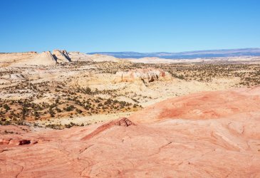
the pink confuses me. That's not Durfey Mesa across with the slickrock west of Brigham Tea at your feet?
SteveR
Member
- Joined
- Sep 22, 2016
- Messages
- 1,024
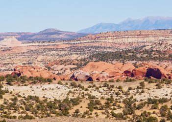
Deer Creek drainage?
No and no. Both not all that far off, though. There's a giveaway in the second photo, but it doesn't show up all that well.the pink confuses me. That's not Durfey Mesa across with the slickrock west of Brigham Tea at your feet?
John Morrow
Member
- Joined
- May 22, 2015
- Messages
- 1,119
Oh yeah, you got it, Ugly. Around Pt 5840. There's the highway....You're on the bench above Phipps?
I think I was just to your left last month....
SteveR
Member
- Joined
- Sep 22, 2016
- Messages
- 1,024
Yes Ugly, that is close enough for me! Best described maybe as the basin that forms the head of Phipps Wash. The visible clue in the second photo is Hwy 12 to the west, showing up above Jo. Set back beyond the escarpment at left is the Old Sheffield Road. It's a nice little area to explore.You're on the bench above Phipps?
I think I was just to your left last month....
I was almost thinking that I would have to let @Titans take it, as we will be gone for a week this afternoon with no on-line or cell contact with the outside world.
John Morrow
Member
- Joined
- May 22, 2015
- Messages
- 1,119
- Joined
- Apr 20, 2013
- Messages
- 1,509
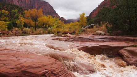
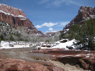
La Verkin Creek, cross Zion trail, after a good rain, or in the pic below...a good snow April 2012
Nice! I figured it may go fast.
John Morrow
Member
- Joined
- May 22, 2015
- Messages
- 1,119
SteveR
Member
- Joined
- Sep 22, 2016
- Messages
- 1,024
Udink
Still right here.
- Joined
- Jan 17, 2012
- Messages
- 1,742
I'm thinking this may not be as well-known among the folks here, but I'll give it a few before I take my "guess."fast or never! I happened t still be on.
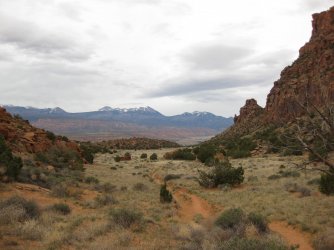
What trail is this? should be a fast one
View attachment 106571
- Joined
- Jun 11, 2017
- Messages
- 4,608
Is this the back road that cuts through Arches from Klondike to near Eye of the Whale? I was on it years ago, but can't recall what it's called.
John Morrow
Member
- Joined
- May 22, 2015
- Messages
- 1,119
Is this the back road that cuts through Arches from Klondike to near Eye of the Whale? I was on it years ago, but can't recall what it's called.
Right general location of southern Utah but not in Arches National Park
John Morrow
Member
- Joined
- May 22, 2015
- Messages
- 1,119
Wow, Udink, you are probably right but I always thought of it as well known. I guess bcpost is more west of the CO River centric!I'm thinking this may not be as well-known among the folks here, but I'll give it a few before I take my "guess."
- Joined
- Jun 11, 2017
- Messages
- 4,608
Is this the Behind the Rocks Road that goes out by Picture Frame Arch?
John Morrow
Member
- Joined
- May 22, 2015
- Messages
- 1,119
Close but not a road.Is this the Behind the Rocks Road that goes out by Picture Frame Arch?
- Joined
- Jun 11, 2017
- Messages
- 4,608
The trail through Hidden Valley above Barney's Rubble?
John Morrow
Member
- Joined
- May 22, 2015
- Messages
- 1,119
No longer hidden, yes it is Hidden Valley Trail!
- Joined
- Jun 11, 2017
- Messages
- 4,608
It's been ages since I hiked up there, so it looked really familiar, but took awhile. 
Don't like ads? Become a BCP Supporting Member and kiss them all goodbye. Click here for more info.

