Navigation
Install the app
How to install the app on iOS
Follow along with the video below to see how to install our site as a web app on your home screen.
Note: This feature may not be available in some browsers.
More options
Style variation
You are using an out of date browser. It may not display this or other websites correctly.
You should upgrade or use an alternative browser.
You should upgrade or use an alternative browser.
Guess the spot: Utah Edition
- Thread starter Ben
- Start date
regehr
Member
- Joined
- Mar 28, 2012
- Messages
- 2,445
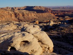
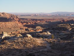
Silver falls?It’s one of the historic “trails” in the region and the only one that crosses the waterpocket fold.
regehr
Member
- Joined
- Mar 28, 2012
- Messages
- 2,445
Nevermind this guess, just looked at a mapSilver falls?
regehr
Member
- Joined
- Mar 28, 2012
- Messages
- 2,445
I'm stumped on a historic trail that crosses the fold and is outside the park! Even Halls Creek is (I think) inside the boundaries and a quick look at the map shows not much fold south of there. Looking forward to the answer to this one.It’s one of the historic “trails” in the region and the only one that crosses the waterpocket fold.
- Joined
- Jun 25, 2012
- Messages
- 4,430
That's pretty cool. How hard is the ascent?
SteveR
Member
- Joined
- Sep 22, 2016
- Messages
- 1,014
Yeah, I had a look at the map as well, as I have been in the process of planning our annual October Utah trip, but it was little help to me also. Could we be looking for the Burr "Trail" Road, but a locale outside the park? Or, perhaps this is a bit of a trick question? Was the picture (Capitol Gorge maybe, which would be a historic route) taken before Capitol Reef was designated as a national park and thus was not in the park at that time?I'm stumped on a historic trail that crosses the fold and is outside the park! Even Halls Creek is (I think) inside the boundaries and a quick look at the map shows not much fold south of there. Looking forward to the answer to this one.
Brendan S
Member
- Joined
- Mar 19, 2016
- Messages
- 433
SteveR
Member
- Joined
- Sep 22, 2016
- Messages
- 1,014
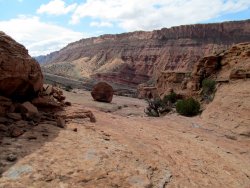
We never attempted to climb the feature itself. To reach it as described by Road Trip Ryan required a short pitch of class 3 scrambling. That's not where the picture was taken, which is simply hiking on a wide ledge.That's pretty cool. How hard is the ascent?
- Joined
- Aug 18, 2018
- Messages
- 1,800
@regehr is on the right track in the southern Fold. It’s not named on USGS maps. It’s named for a historic ranch that was at the base of the Fold and is one of a couple historic routes/trails in the area. It’s discussed in a guidebook of the region.
Is it Baker Route?
Brendan S
Member
- Joined
- Mar 19, 2016
- Messages
- 433
Yep that’s it. You’re up.Is it Baker Route?
- Joined
- Aug 18, 2018
- Messages
- 1,800
Don't like ads? Become a BCP Supporting Member and kiss them all goodbye. Click here for more info.


