Navigation
Install the app
How to install the app on iOS
Follow along with the video below to see how to install our site as a web app on your home screen.
Note: This feature may not be available in some browsers.
More options
Style variation
You are using an out of date browser. It may not display this or other websites correctly.
You should upgrade or use an alternative browser.
You should upgrade or use an alternative browser.
Guess the spot: Maps Edition
- Thread starter Backcountry Post
- Start date
jholmes01
Member
- Joined
- Nov 10, 2020
- Messages
- 224
That's the Chisos Mountains in Big Bend NP. The hint was helpful!Hint; in a national park
zionsky
Member
- Joined
- Dec 23, 2018
- Messages
- 765
Correct! You're upThat's the Chisos Mountains in Big Bend NP. The hint was helpful!
jholmes01
Member
- Joined
- Nov 10, 2020
- Messages
- 224
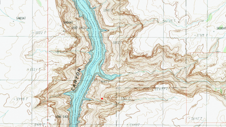
I can't find my copy of the book, but from memory is it Piano Key Arch?What's the guide book author's name for the spot marked in red?
jholmes01
Member
- Joined
- Nov 10, 2020
- Messages
- 224
Not Piano Key Arch.I can't find my copy of the book, but from memory is it Piano Key Arch?
Hint: Steve Allen is the guide book author for this one.
Udink
Still right here.
- Joined
- Jan 17, 2012
- Messages
- 1,742
I think the spot is easy to guess, but "guess the guidebook name" (which book I don't own) is a bit tougher...Another hint - Dark Canyon area.
jholmes01
Member
- Joined
- Nov 10, 2020
- Messages
- 224
That's it. All yours, if you'd like it!Allen just refers to it as the "crux traverse".
Wow interesting, I also don't have that book. Can someone fill me in on the route?That's it. All yours, if you'd like it!
jholmes01
Member
- Joined
- Nov 10, 2020
- Messages
- 224
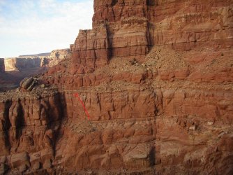
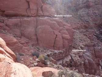
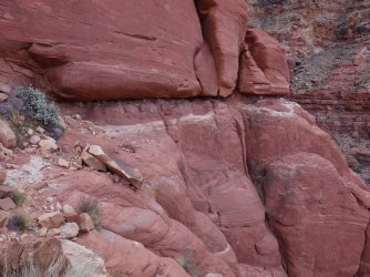
The Dark Canyon route is from Steve Allen's Canyoneering 2. It explores Dark, Bowdie, and Lean To or Youngs Canyons in a 6ish day loop. He describes the Crux Traverse as:Wow interesting, I also don't have that book. Can someone fill me in on the route?
"The crux
After heading the canyon, drop to a narrow ledge. At one point you will have to crawl under an overhanging protuberance on a three-foot-wide ledge with a 100-foot drop below it (Class 5.0, 50'). First reconnoiter this section without packs. Though not difficult, the exposure makes the crux an anxious undertaking.
There are many ways to make this passage more safe. It is imperative that everyone be belayed across the narrow ledge from both sides. On the near side, a rope can be anchored to a large boulder; the other rope on the far side can be tied around a large buffaloberry bush. Packs will have to be handed around the crux. Pack handlers should be belayed. Do not try to cross the ledge with a pack!"
This spot sticks in my memory as we were unknowingly one ledge too high, weren't able to safely make it around the corner, and had to retrace our steps for the better part of a day..
 .
.fossana
Member
- Joined
- Jan 11, 2018
- Messages
- 1,059
Supplemental photos of the above traverse from my TR. I unintentionally took the upper one. It goes, but it's a tad sketchy 


fossana
Member
- Joined
- Jan 11, 2018
- Messages
- 1,059
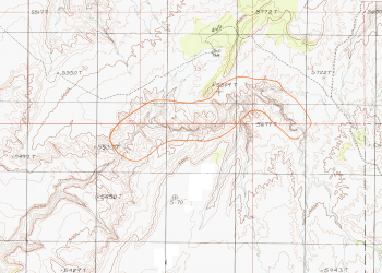
Looks to be High Spur Canyon.
That was too easy for you. Your turn.
b.stark
Forever Wandering
- Joined
- Apr 8, 2015
- Messages
- 1,250
jholmes01
Member
- Joined
- Nov 10, 2020
- Messages
- 224
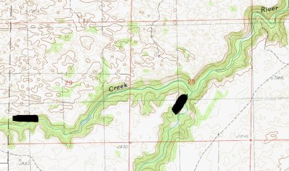
Looks like Steer Creek and Snake River in northern NE.Heh... I don't think you understand just how much time I spend looking at maps in my spare time! Had to do a bit of sleuthing to figure out the name though.
Name the creek or river (though you'll get both if you find this spot)
View attachment 128001
Don't like ads? Become a BCP Supporting Member and kiss them all goodbye. Click here for more info.

