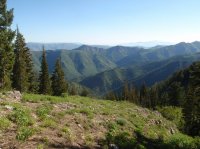
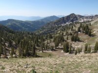
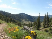
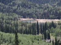
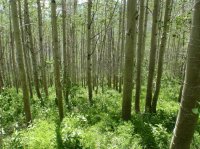
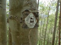
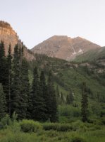
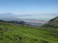
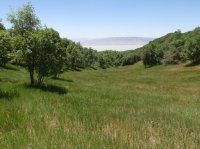
Great Western Trail through Utah

Cody

Member
Joined
Mar 4, 2012
Messages
100
Here is a trip report that won't be finished for a couple years (at least), but I think it will be more enjoyable to share as it unfolds rather than write up volumes on it once it is all finished.
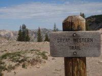
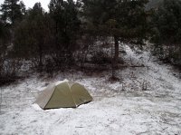
P6250110.JPG

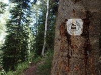
I have tossed around the idea for a decade or so of hiking the length of the Great Western Trail through Utah. I got the idea when I came across a man and his mule many years ago in American Fork Canyon. The man was a terminal cancer patient travelling the length of the GWT, or at least some section of it-- I don't remember; nor do I remember much else about this fellow, except that his ambition to take this on as his life was winding down was highly inspiring. My life isn't winding down, but ever since, the idea of a contiguous route travelling Utah top to bottom has been intriguing.

In 2012, I finally decided to make it happen. I am not at the stage of life right now where I can take on the whole length of the state at once in a through hike, but I figured I could do it section-wise by looping in and out of segments of trail with the help of shuttles on several long weekends each year. I picked a 63 mile section nearest me in the Wasatch to start in June. From there, I decided I would connect this core section in the Wasatch and tag on sections to the north and south alternatively until I've reached both the Idaho and Arizona borders at some point a few years down the road.

Section One - Central Wasatch - Parleys to Provo Canyon

The first outing started and ended on the valley floors of Salt Lake Valley and Utah Valley respectively. On a Saturday in June, my wife dropped me off at the park/trailhead at the north end of Wasatch Boulevard in Salt Lake City and I started up and over Grandeur Peak and then dropped down Church Fork into Millcreek Canyon.
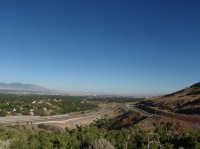
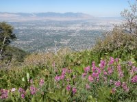
P6230001.JPGP6230004.JPG

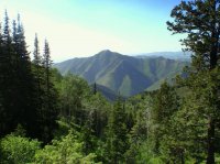
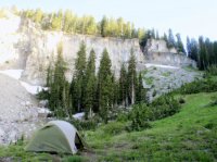
I wouldn't actually connect with the GWT for several miles; not until well into Sunday in fact. I could have road walked up Millcreek to connect with the GWT more directly, but I was interested in hiking the length of the 18 mile Desolation Trail instead. This meant I would omit a small section of GWT, but still be able to link it into a contiguous route. The Desolation Trail starts up Thayne Canyon which is essentially opposite Church Fork in Millcreek. It is a hearty climb--especially early on--then curves around Mount Raymond. I spent the night above Porter Fork and then made my way up to Desolation Lake the following day where I was finally able to connect into the GWT in ski resort land.
P6230006.JPGP6230008.JPGP6240015.JPGP6240019.JPGP6240031.JPG


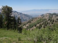
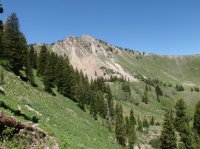
Once on the GWT I followed it north and dipped into the top of Big Cottonwood Canyon through Brighton at dusk.
P6240045.JPGP6240051.JPGP6240058.JPGP6240070.JPGP6240079.JPG
P6240081.JPGP6240083.JPGP6240087.JPGP6240089.JPG

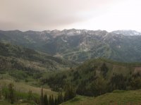
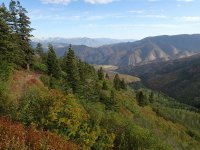
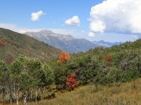
I set camp between Dog Lake and Lake Mary and started up over Catherine Pass the following day into the American Fork drainage (Dry Fork/North Fork). I detoured up onto the Ant Knolls for some fine views and continued south with my eye on the North Peak of Timpanogos--my goal for that evening. I hiked until dusk once again, and made it to Julie Andrews Meadow near Timponooke for the night.

P6250099.JPGP6250102.JPGP6250106.JPGP6250109.JPGP6250110.JPGP6250111.JPGP6250116.JPGP6250131.JPGP6250135.JPGP6250144.JPGP6250147.JPGP6250155.JPGP6250171.JPGP6250175.JPG

Tuesday's route was a very familiar section of trail wrapping around the front of Mount Timpanogos and out one of several canyons into Utah Valley. I chose Battle Creek, since it was the easiest for my wife to pick me up.

P6260186.JPGP6260189.JPGP6260194.JPGP6260197.JPGP6260200.JPG

It was 63 miles total over 4 days/3 nights. Most of the terrain was not new to me, but I really enjoyed putting it all together.

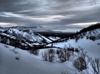
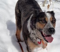
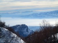
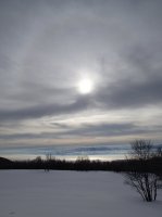
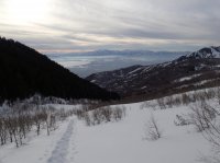
With that big chunk complete, I needed to add on a couple small day hikes to complete what I'm calling the Central Wasatch Leg (Parleys Canyon to Provo Canyon). I suppose I could have done this in conjunction with the 63 mile initial section, but I thought it would be nice to enter and exit that section from the valley floors instead. Plus, I needed a few snowshoe routes to keep me busy overwinter. So, to complete the Central Wasatch Leg, I did a snowshoe up Church Fork in Millcreek, along the Pipeline Trail, and then from Elbow Fork, I went up and over into Lambs Canyon, ending at Interstate 80 in Parley's Canyon. Then to complete the southern end of the leg on a separate day, I did a snowshoe up Battle Creek from Pleasant Grove, up and over Big Baldy on the face of Mount Timpanogos, and then down into Provo Canyon, ending at US-189. Here are some photos of my twilight hike over baldy into Provo Canyon to complete the Central Wasatch Leg. (Cowboy got to come along on this leg since we didn't cross any protected watershed):
P3020008.JPGP3020015.JPGP3020031.JPGP3020051.JPGP3020058.JPGP3020064.JPGP3020065.JPG

The next section I call the Southern Wasatch Leg and will go from US 189 in Provo Canyon to US-6 near Soldier Summit. Since this section involves a long section of pavement, I went ahead and knocked out a nine mile section of this leg on a training run for my recent marathon, up Provo Canyon, then turning into the South Fork and following it to the end of the road where the GWT once again becomes a trail. Depending on my work situation I hope to push this section to Soldier Creek (40ish miles) next month. Also, this summer I hope to start into my Northern Wasatch Leg which will go from Interstate 80 @ Lambs and drop back down onto the Wasatch Front in the Farmington/Fruit Heights area and that's probably as far as I'll get this year. In 2014, I'll shoot for having everything from the Idaho border to Interstate 70 complete.

Featured image for home page:
slide.jpg
 
Very cool, Cody! I enjoyed seeing this pics come across Facebook last year and enjoy it even more hearing all the story behind it all as well as your plans to connect it all together. Looking forward to more!
 
Didn't expect anything to get me excited for Winter for a few more months, but those snowshoeing pictures definitely do! Awesome!
 
Looking forward to more - I'm very familiar with the GWT around Torrey walking on it almost every day with the dogs when I'm here. If I can help you with this section please let me know (shuttles etc).
 
Looking forward to more - I'm very familiar with the GWT around Torrey walking on it almost every day with the dogs when I'm here. If I can help you with this section please let me know (shuttles etc).

Thanks, Bob. I am really looking forward to that section. I will be in touch once I make it down that way.

Sent from my SAMSUNG-SGH-I997 using Tapatalk 2
 
Nice report Cody. I too know some of the trail. I live near Parley's summit and have walked much of the trail up here (and elsewhere). Much of it is contended, crosses private property or is otherwise non-contiguous so I am greatly interested in how much of the "official" route you are able to walk. Let me know if I can help. :thumbsup: Mabye... this could be the fourth addition to the Great Three some day.
 
I made some more tracks on the Great Western Trail over Labor Day weekend. My prior southbound segment ended in the South Fork of Provo Canyon at Trefoil Ranch and that's where I picked up the trail Friday Night. I hiked full days on Saturday and Sunday and then had a leisurely late morning exit out Fifth Water Diamond Fork on Labor Day. I had considered pushing all the way to Soldier Summit Monday, but overnighting at the hot springs along Fifth Water sounded so much better. This route had a fair amount road walking, but the trail sections were lovely and more than made up for it.

Box Elder and GWT Wasatch South 194.JPG

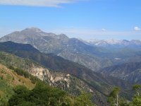
Here is a shot looking back at Trefoil Ranch where I began hiking Friday night. Shot was taken from Shingle Mill Hollow.

Box Elder and GWT Wasatch South 173.JPG

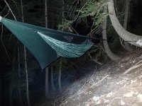
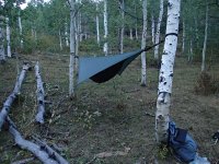
I camped in Shingle Mill Hollow just short of Windy Pass. With a late evening start on Friday, I only did about four miles Friday night before I hung the hammock.

Box Elder and GWT Wasatch South 170.JPG

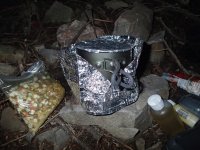
I've been cooking with Esbit fuel on a wing stove for the past several trips. Very light and gives a quick boil.

Box Elder and GWT Wasatch South 168.JPG

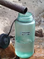
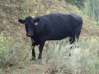
This spring is just below Windy Pass. Low flow is better than no flow. This got me a little nervous about the water situation. I was planning on filling up mostly just in springs indicated on the USGS quads. As it turns out, flow was good in most springs indicated along my route, but about two-thirds of them were so fouled up by cattle that I passed on them. I never went thirsty though; I was able to get by with the few that I found clean.

Box Elder and GWT Wasatch South 178.JPG

The southern slopes of Mount Timpanogos in the rear-view.

Box Elder and GWT Wasatch South 195.JPGBox Elder and GWT Wasatch South 190.JPGBox Elder and GWT Wasatch South 185.JPG

Saturday night I hung the hammock near the top of Left Fork Hobble Creek. Lots of grazing activity, but it was a nice spot with views and clean water.

Box Elder and GWT Wasatch South 229.JPG

See why we can't have nice things? Several of the springs along the way looked like this:

Box Elder and GWT Wasatch South 245.JPGBox Elder and GWT Wasatch South 254.JPG

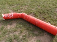
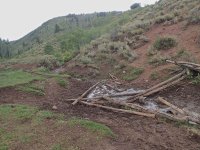
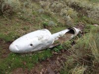
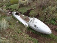
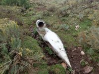
I came across this odd object in a hollow east of Two Tom Hill between Yellow Jacket Creek and Sixth Water. No idea. Anyone?

Box Elder and GWT Wasatch South 246.JPGBox Elder and GWT Wasatch South 247.JPGBox Elder and GWT Wasatch South 249.JPG

By late Sunday I was feeling like a detour to Fifth Water Hot Springs was no longer optional. Both Saturday and Sunday were 20+ mile days. To get to Fifth Water along the GWT though, I needed to go through upper Sixth Water, or work a longer network of roads and motorized trails in upper Diamond Fork to the north of Sixth Water where Fifth Water Ridge and Strawberry Ridge meet.

Box Elder and GWT Wasatch South 258.JPG

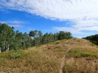
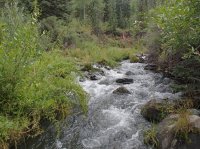
The USGS indicated a trail up Sixth Water, then southward at a fork climbing over Fifth Water Ridge. Choice seemed easy: a mile or so along lovely Sixth Water Creek. However... the trail no longer existed as indicated to the south of upper Sixth Water and it was a thrash for a good hour as I fought my way along densely vegetated banks of a creek that was flowing surprisingly swift and cold. Not much fun. There was an old road grade high on the slope above the north bank which I eventually crossed over to follow for quicker access up Sixth Water. I then went back across Sixth and up a draw climbing to where I finally re-intersected a trail coming off Fifth Water Ridge and followed it down to Fifth Water. I need to do some more investigation (I was in a hurry to get to the hot springs) but there may not be a good beaten path anymore to get from Sixth to Fifth without going east to Strawberry Ridge and then down Fifth Water Ridge. Going down Diamond Fork road is an option too, but quite boring I'm sure. I did it the hard way, even if it saved a few miles. I detoured off the GWT at that point and headed for the hot springs.

Box Elder and GWT Wasatch South 259.JPG

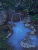
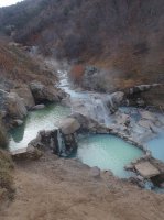
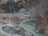
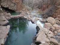
I cruised into the hot springs in the twilight and found a place to hang for the night just below the pools. Very nice. I soaked well into the early morning. By that point, I had 48 miles behind me in the past 48 hours, so the hot pools were just what i needed. After some good sleep, I had a lazy morning with more soaking before I hiked down to Three Forks in Diamond Fork for my pick-up.

For my next segment, I will probably link back into Fifth Water via Ray's Valley as a day hike or trail run. Later this fall hopefully. This segment rolls over Fourth, Third, and Second Water Ridges before it eventually drops down Strawberry Ridge toward Soldier Summit. Then, I'll be ready to push down the Wasatch Plateau/Skyline segment to I-70.
 
Nice trip report. Looks to me like that object you came across is a wing tank off an airplane.


Sent from my iPad using Tapatalk HD
 
I second Waynee-ack's guess. I am pretty sure it is a drop-tank off a jet. Your first hammock hanging shot shows you don't need a flat spot for your camps ;) Nice continuance of your report! You are putting ideas in my head. You may want to start a part 2 thread (new thread) when you are ready for the next update. WHY CAN'T we have nice things? Dang cattle on public lands....
 
For my next segment, I will probably link back into Fifth Water via Ray's Valley as a day hike or trail run. Later this fall hopefully. This segment rolls over Fourth, Third, and Second Water Ridges before it eventually drops down Strawberry Ridge toward Soldier Summit. Then, I'll be ready to push down the Wasatch Plateau/Skyline segment to I-70.

I traveled this segment of GWT this past weekend, going back in at Fifth Water and coming out Tie Fork on Highway 6 just below Soldier Summit. It was very nice to kick off the weekend with a soak in the hot pots Thursday night. After a Friday morning soak, I was on the trail by about 9:30 and followed a trail-less section of Third Water that intersects Fifth Water. Once Third Water crosses Ray's Valley Road, a trail then leads to a connection with the GWT where Second Water Ridge and Strawberry Ridge intersect. From there the GWT follows Strawberry Ridge South through a few valleys and eventually drops off the ridge down Tie Fork. Both Third Water and Tie Fork were nice hiking. I woke up to snow Saturday morning in Tie Fork and walked out to the highway, then a couple miles east on Highway 6 to Skyline Drive, where my next segment will begin. I will start a "Part II" thread for my Highway 6 to I-70 segment which I hope to complete all of next year. Here are a few photos from this weekend:

PB150317.JPGPB150321.JPGPB150328.JPGPB150339.JPGPB150341.JPGPB150345.JPGPB150348.JPGPB160350.JPG


Yesterday, after I finished the route and shuttle was completed, I couldn't resist looping back to Fifth Water in my truck for another soak to cap off the weekend. There was a large meetup group there who were a bit much to deal with (loud and messy), but once they cleared out I soaked the night away in some really good company.
 
Sweet! Doesn't look like the snow bothered you. Did Cowboy go? Are the springs hard to find/get to?
 
Did Cowboy go? Are the springs hard to find/get to?
Cowboy didn't come along this time. It would have been a great route for Cowboy, except for the stopover at the hot springs. He doesn't have that kind of patience. Fifth Water Hot Springs is an easy hike from Diamond Fork Road (<3 miles hiking one way); a few miles longer though once the canyon gets gated for the winter. Gate is still open as of today and I think it adds 3-4 miles of road walking once the gate is closed. It is the Three Forks Trailhead and the trail is well worn.
 
What a great trip. I signed up to backcountrypost just to follow this thread. I hope to complete the same route in the next few years as well. My dog loves hiking with me as well. Thanks for taking the time to document this and share it with us.
 
Good. And welcome to BCP! Feel free to hit me up for notes. When I can get some decent temperatures, I'm going to do sections of trail north of Parleys Canyon and south of Spanish Fork Canyon. There is 60 to 70 miles of trail that should be reasonable enough in the snow. Stay posted.

Sent from my SAMSUNG-SGH-I337 using Tapatalk
 
Very cool, I'll definitely be contacting you. If you ever need a slow hiking partner, hit me up. :)
 
Cody,
You might be interested to know there was a book recently published about the fellow you mentioned in your first paragraph, above. His name was Charles Christensen, and he rode the entire length of the GWT with horse and mules after he was diagnosed with cancer. He was my middle school English teacher in Teton Valley. The book about his journey was written by his daughter, Leann Bednar, using his journal excerpts and is entitled "My Final Ride: The thrilling Canada to Mexico Journey." The book was published in 2013 by Gowith Books (Driggs, Id) and can be purchased at leannbednar.com. I purchased it and so far it is a very good read. As a result I started researching the GWT in Utah and found your post. Enjoy! RGG


Wow! That's the guy. Reading from the site he did the Wasatch section in the early 1990s which would be just about when I remember meeting him at the bottom of Bear Canyon in the South Fork of American Fork Canyon in the Wasatch. Thanks so much for the tip, Regan! I'll be getting a copy.
 
Wow, this is awesome, I am looking forward to seeing more updates. I have always thought that doing something like this is a great way to see scenery and places that you would otherwise overlook and might not be motivated to visit.
 
Cody,
You might be interested to know there was a book recently published about the fellow you mentioned in your first paragraph, above. His name was Charles Christensen, and he rode the entire length of the GWT with horse and mules after he was diagnosed with cancer. He was my middle school English teacher in Teton Valley. The book about his journey was written by his daughter, Leann Bednar, using his journal excerpts and is entitled "My Final Ride: The thrilling Canada to Mexico Journey." The book was published in 2013 by Gowith Books (Driggs, Id) and can be purchased at leannbednar.com. I purchased it and so far it is a very good read. As a result I started researching the GWT in Utah and found your post. Enjoy! RGG


Wow, that looks like quite the story, I think I might pick up a copy for myself.
 
Cody, I just stumbled upon this thread and have to ask, what time of June did you do that first or "central" leg? I ask because I'm planning a trip from here in Provo up to Summit Park in Parley's Canyon where my in-laws live this year. I had originally penned the first week of June so as to assure more flowing springs and cooler temperatures along the way but I'd also like to have Catherine Pass and the Brighton lakes area mostly clear of snow. In looking at Google Earth's June 2013 images, that area looked like it was still pretty covered at that time last year so now I'm looking at early July.

Terrific trip report & pics by the way. How's the progress coming on your goal to complete the rest of the GWT sections?
 
Similar threads
Thread starter Title Forum Replies Date
Bob Great Western Trail - Canada Resource Discussions 0
Ranger Joe The Great Western Expedition, pt9...Epilogue Off Road 3
Ranger Joe The Great Western Expedition of 2011, pt8...snow days Off Road 1
Ranger Joe The Great Western Expedition of 2011, pt7...Poughkeepsie Gulch Off Road 1
Ranger Joe The Great Western Expedition of 2011, pt6...Black Bear Pass Off Road 2
Ranger Joe The Great Western Expedition of 2011, pt5...Hooray for Ouray Off Road 1
Ranger Joe The Great Western Expedition of 2011, pt4...We Go Navajo Off Road 1
Ranger Joe The Great Western Expedition of 2011, pt3...The Maze Off Road 7
Ranger Joe The Great Western Expedition of 2011, pt2...Elephant Hill Off Road 4
Ranger Joe The Great Western Expedition of 2011, Pt.1...Fun with Fins Off Road 1
kwc Great Camp Santanoni Hiking & Camping 1
Bob Technology is great ........... General Discussion 0
Mountain Wanderer Hiking the Idaho Centennial Trail in the Great Burn Backpacking 0
J Great to be here! Heading to White Pocket next month... Noobs: Introduce yourself! 8
chandlerwest Great Basin National Park - Wheeler Peak Hiking & Camping 13
Shrubs Thanks for the great reports! Noobs: Introduce yourself! 12
misSOULa The Great Burn Wilderness: Heart Lake Backpacking 3
Perry Great Packraft Deal Gear 2
scatman Little Cataloochee Trail, Great Smokey Mountains National Park - June 3, 2018 Hiking & Camping 13
scatman Lynn Camp Prong Lollipop Loop, Great Smokey Mountains National Park - May 29, 2018 Hiking & Camping 2
Dreamer Summer 2012: trip 1: a short visit to a small corner of The Great Wasted Forest of Northern Colorado Backpacking 11
Perry Great Deal on Gregory Baltoro Gear 0
Perry Great Deal on Sunto MC2 Compass Gear 0
Wanderlust073 Dayhiking Great Sand Dunes NP Hiking & Camping 4
slc_dan Great Smokey Mountains NP Trip Planning 12
T Pumping the Great Basin on a Handcar General Discussion 14
wsp_scott Clingman's Dome (Great Smoky Mountains NP) Backpacking 0
Nick Desha & Great Bend On The Water 7
TrektheWorld Need to find one great Uintas hike Trip Planning 1
WasatchWill Memorial Day: Another great trip to Torrey Hiking & Camping 11
scatman The Anthony Creek, Russell Field Trails Loop - Great Smoky Mountain National Park, June 10, 2016 Hiking & Camping 13
scatman Gold Mine Loop Trail / Noland Trail - Great Smoky Mountain National Park, June 7, 2016 Hiking & Camping 3
hatchcanyon The Great Traverse Off Road 9
danger02ward Very much enjoy and appreciate all of your great pictures, trip reports, and gear reviews! Noobs: Introduce yourself! 4
dfcooper Great Divide Trail Trip Planning 1
Red Rock Rangers Great Basin National Park Hiking & Camping 10
Vegan.Hiker Great Range Traverse Part 1 Backpacking 19
Dustin Gent great first trek in Utah? Trip Planning 16
Vegan.Hiker Great article about a fellow adventure seeker General Discussion 4
ogg Backpacking Ruby Mtns or Great Basin NP Trip Planning 9
Bob Winchester found in Great Basin NP General Discussion 0
steve Backpacking Great Basin NP Backpacking 18
LarryBoy Utah is great, isn't it? Noobs: Introduce yourself! 6
Lisa Came for some trip beta, stayed for the great community... Noobs: Introduce yourself! 1
mattvogt7 A Great Weekend in July On The Water 10
Jeremy C The Great Bear Photographer General Discussion 5
steve Backpacking Great Basin National Park - June 2014 Backpacking 11
BJett Lower Big Creek - Great Smoky Mountains National Park On The Water 2
Dave Great Basin NP, Aug. 31- Sept. 2 2013 Backpacking 8
Christian Great Basin NP and Crystal Ball Cave, UT Hiking & Camping 16

Similar threads

Back
Top