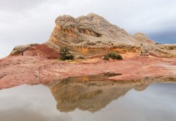
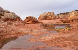
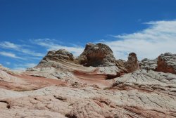
Great to be here! Heading to White Pocket next month...

JSSPhoto

New Member
Joined
Dec 16, 2019
Messages
3
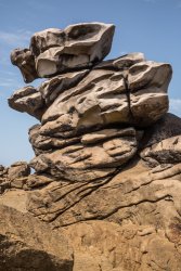
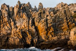
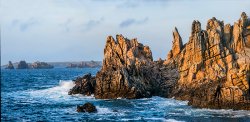
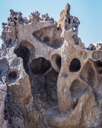
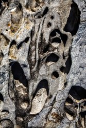
Hello Everyone, It's great to discover this site full of kindred spirits. I'm a pro photog who specializes in geological photos as fine art. I'm always looking for good abstract compositions. I'll post some that I've found.
Next month I'm headed for White Pocket in Coyote Buttes, and I'm wondering if anyone has any ideas about where to park overnight to sleep in a 4WD vehicle to catch the dawn. I understand that one has to be out of the site. I saw John Fowler's wonderful photos of White Pocket—best so far on the web.
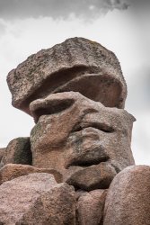
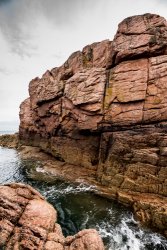
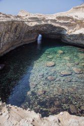
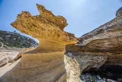
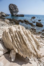
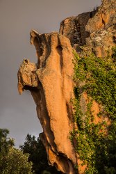
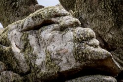
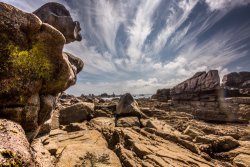
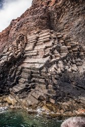
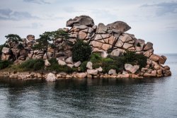
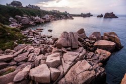
I was in Brittany, Catalonia, and Corsica last August ISO amazing geology—and I found it. Here are some results.
Joel Simpson
joelsimpsonart.com
IG: joelsimpsonphoto
book: Earthforms.net
19.08.03.Ploumenac'h.1.LR.017.jpg19.08.03.Ploumenac'h.1.LR.084.jpg19.08.04.Ploumenac'h.2.LR.029.jpg19.08.04.Ploumenac'h.2.LR.117.jpgBonifacio.2.LR.134A.jpgBonifacio.2.MR.102.edit..jpgBonifacio.MR.04.jpgCalanches.MR.10.jpgOuessant.LR.051.jpgOuessant.LR.172.jpgOuessant.LR.177.jpgOuessant.LR.252.jpgOussant.RockGalaxies.panorama.MR.jpgS'AlqueriaPetita.CapCreus.5*.MR.023.jpgS'AlqueriaPetita.MR.63.edit.jpgScandola.MR.07.jpg
 
Hello Everyone, It's great to discover this site full of kindred spirits. I'm a pro photog who specializes in geological photos as fine art. I'm always looking for good abstract compositions. I'll post some that I've found.
Next month I'm headed for White Pocket in Coyote Buttes, and I'm wondering if anyone has any ideas about where to park overnight to sleep in a 4WD vehicle to catch the dawn. I understand that one has to be out of the site. I saw John Fowler's wonderful photos of White Pocket—best so far on the web.
I was in Brittany, Catalonia, and Corsica last August ISO amazing geology—and I found it. Here are some results.
Joel Simpson
joelsimpsonart.com
IG: joelsimpsonphoto
book: Earthforms.net
View attachment 85494View attachment 85495View attachment 85496View attachment 85497View attachment 85498View attachment 85499View attachment 85500View attachment 85501View attachment 85502View attachment 85503View attachment 85504View attachment 85505View attachment 85506View attachment 85507View attachment 85508View attachment 85509

Coyote Buttes North and South are permit areas. White pocket is on BLM land and does not require permit.
You can camp in the right next to the parking area by White Pocket (Leave no trace of course).

Here is the Lower Route to White Pocket from House Rock Valley Rd.
White Pocket Lower Route
This route sees several vehicles each day, so if something unforeseen happens you will just have to wait a few hours before people comes by.
I followed an 2WD Toyota Tacoma to White Pocket on this route and it had no problems.
A couple of things to keep in mind:
1. The northern portion of House Rock Valley Rd has some clay and it crosses Buckskin Wash. So if there have been rains less than a day before, I would chose to come in from the south on House Rock Valley Rd (from Hwy 89A via Jacobs Lake).
2. When you reach White Pocket make sure you don't continue past the parking area on the left.. If you continue straight you will hit very deep sand and down hill. Would be very hard to get back up. Down that way, there is a nice secluded area for camping, but you need 4WD to get back out of there ;) .

Also if you have time you could hike down Wire Pass wash from House Rock Valley Rd. to some nice narrows (37.02128, -112.007723) Wire pass is a side wash to the more famous Buckskin Canyon.

There is also a nice petroglyph (Maze Petroglyph 36.985028, -112.026167) close to House Rock Valley Rd. Park at 36.984819, -112.032942.

Here is a previous post that answers a few questions about the area: https://backcountrypost.com/threads...-to-make-it-to-white-pocket.8196/#post-104292
 
Not going to Coyote South while in the area? I would. Getting a permit should be a given at this time of year.
We were planning on overnighting right at WP the last time there, but after a rainy week which made the sand driving easy- the parking area was a sea of water and mud.
 
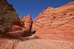
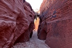
Thanks very much. I'm definitely going to White Pocket, and I appreciate the advice about access route, permit and rain warning. I bought our permits for Feb. 3-4, expecting to overnight at the trailhead, hopefully in the 4WD vehicle that we'll rent in Flagstaff. I guess we'll take our changes re: rain. I suppose rain could add some good reflections in the area, as long as it's not raining while we're there. We hiked about 2 hours into Wire Pass the last time I was there, in 2012—wonderful experience. I wish I could have gone further. We went as far at that big cross-pass.BuckskingGulch.OldPareah.MR.116.jpgBuckskingGulch.OldPareah.MR.117.jpg
 
Assuming we have a topo map, how far is it from the parking area to the formations? And how easy is it to get back to the parking area after dark?
 
The parking lot is very close by, seemed 5 minutes or less, in easy terrain. Never stayed out after dark but the close-by features should be simple enough to return from then. It's still worthwhile when wet- it rained for much of our last visit there in 2018.
IMGP0820 copy.jpg

IMGP0826 copy 2.jpg
 
Thanks very much. I'm definitely going to White Pocket, and I appreciate the advice about access route, permit and rain warning. I bought our permits for Feb. 3-4, expecting to overnight at the trailhead, hopefully in the 4WD vehicle that we'll rent in Flagstaff. I guess we'll take our changes re: rain. I suppose rain could add some good reflections in the area, as long as it's not raining while we're there. We hiked about 2 hours into Wire Pass the last time I was there, in 2012—wonderful experience. I wish I could have gone further. We went as far at that big cross-pass.View attachment 85561View attachment 85562


Do yourself a favor and get the “Gaia” app on your phone, learn how to use it ahead of time and then download the “long” route to WP from :

Once you get off the House Rock Valley rd all those sandy roads going off in all different directions look very much the same= deep sand & lots of sage brush. Having Gaia on your phone with the route downloaded will make it easier.

its not simple even with some moon light to find your way back from the WP rock formations to the parking lot, again, your need GPS. You can use Gaia. We spent a lot of time doing night photography at WP last December. We had some light from the moon and we had to use a Garmin to find the trail. You need GPS to find the trail back to P-lot. Once your locate the trail, its ok. It’s about 5-10 mins to the parking.

If its pitch black with no moon, then you certainly need GPS!!!! And its a great place to roll an ankle at night if it’s completely dark :rolleyes:
 

Don't like ads? Become a BCP Supporting Member and kiss them all goodbye. Click here for more info.

Back
Top