DAA
Member
- Joined
- Jun 14, 2012
- Messages
- 715
Bringing to an end months of anticipation, finally, on Fri. April 26th, I left straight from my son’s graduation ceremony at UVU to go pick Jared up at his house in Sandy – and we were on our way to Cedar Mesa!
With stops only for fuel in Wellington and fuel again in Hanksville plus a sandwich at Blondie’s (excellent Ruben – I’ll never darken Jerry’s door again…), we made it onto the mesa before dark. With no camp site for the night planned ahead of time, I just sort of randomly turned off onto the road that goes to the Owl Creek trail head and drove until we found a nice spot to crash for the night with nobody else nearby. Both Jared and I slept under the stars this night.
The next morning, Sat. the 27th, we got up and I had breakfast and a few cups of coffee before we hopped in the Lexus and motored back towards the hiway. We needed to pick up our permit at the Kane Gulch ranger station, but they wouldn’t be open for almost another hour. So we drove all the way out to the Gov’t trail TH and stashed my mountain bike and a cooler for the end of the trip. Then backtracked all the way up to the ranger station to watch the required propaganda video before being issued our permit and allowed to go our way.
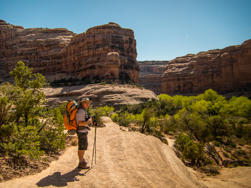
It was 10am by the time we finally had our packs on and started from the Bullet Canyon trail head.
Ahhh but what a glorious day to be descending into the Gulch!
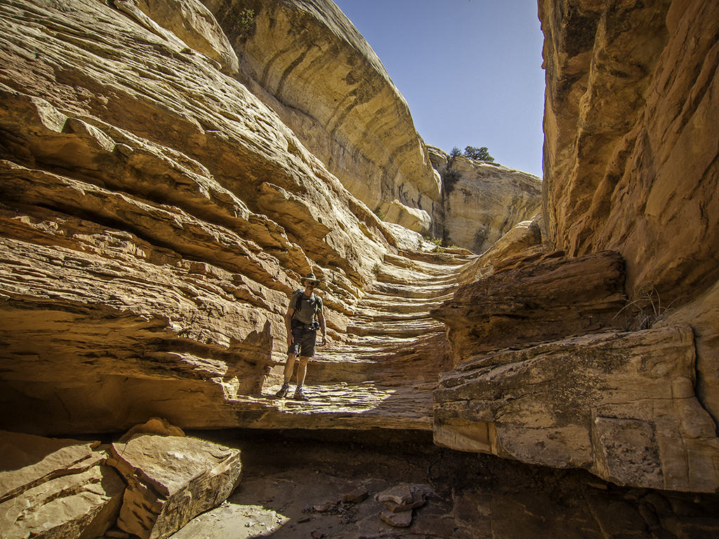
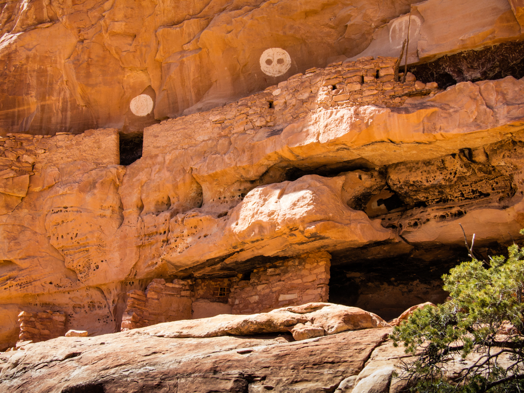
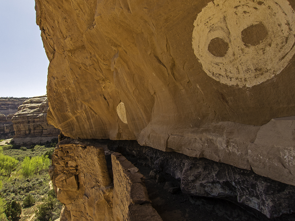
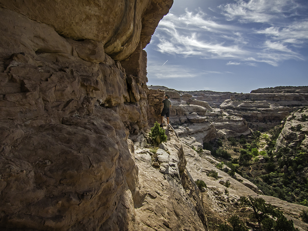
The density of archaeology and sights to see hiking Grand Gulch are too numerous to list in a trip report. I won’t try and remember, let alone document them all. The one site that defeated us on this trip was on this first day though. The 3 Moons site.
This is Jared, preparing to route find our way up to the 3 Moons ruin. The 3 Moons picto is visible on the sheer cliff face, sunlit top-center in this photo. It was much rougher getting up to it than the photo suggests…

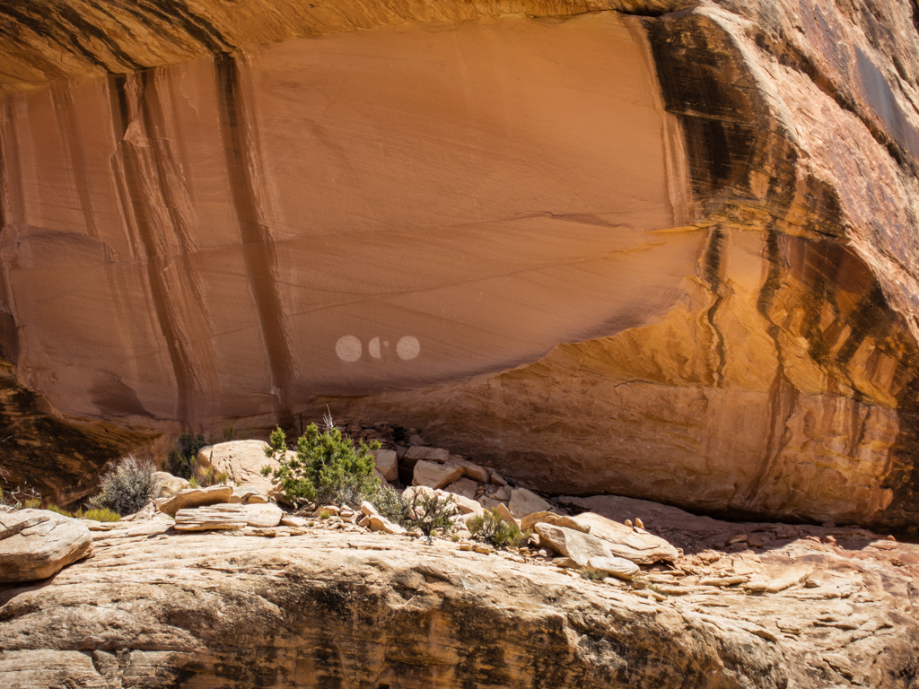
Here is a better look at the site, the ruins are in the shadows directly beneath the moon pictos, which might more accurately be called 2 ½ moons with Venus?
As mentioned a moment ago, we didn’t get all the way up to the site. The last pitch was just too exposed, too dang sketchy for us. I was 90% sure I could get up it okay, but that last 10% of doubt was too much. In addition to which, I was much less sure that I could get back down without a nasty fall…
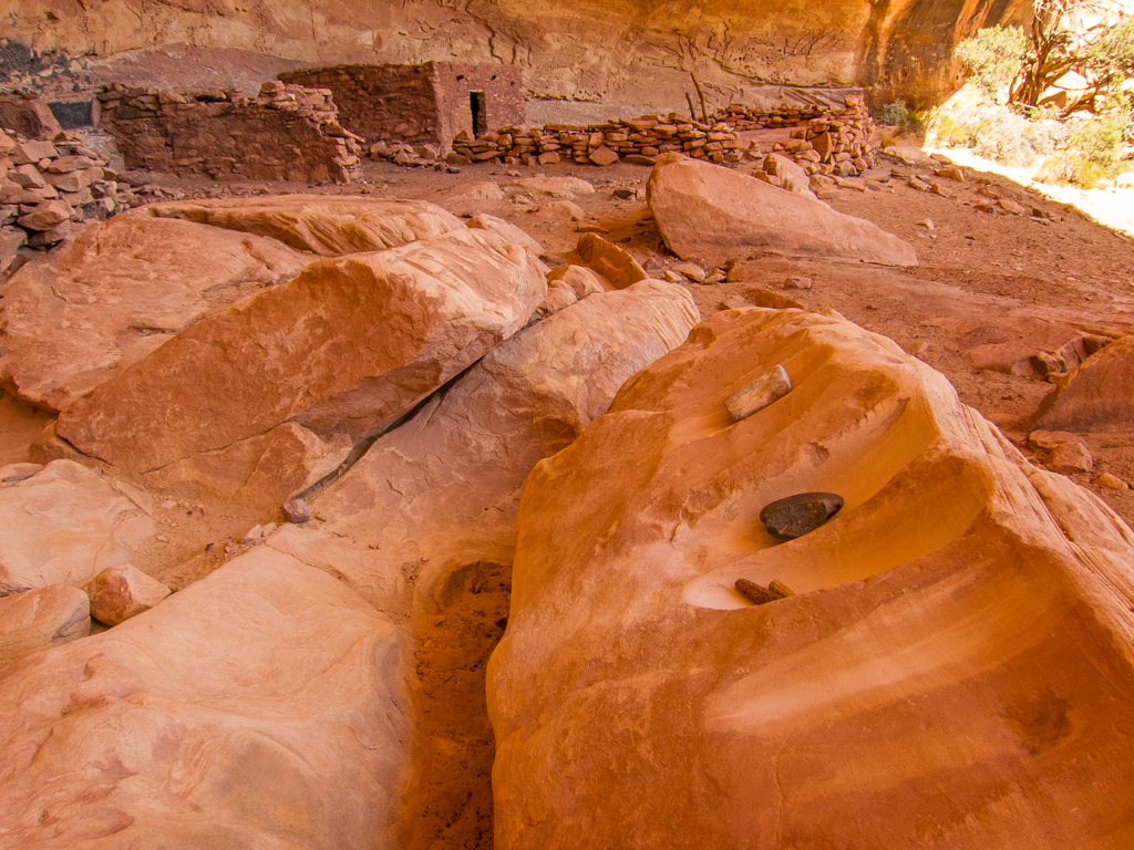
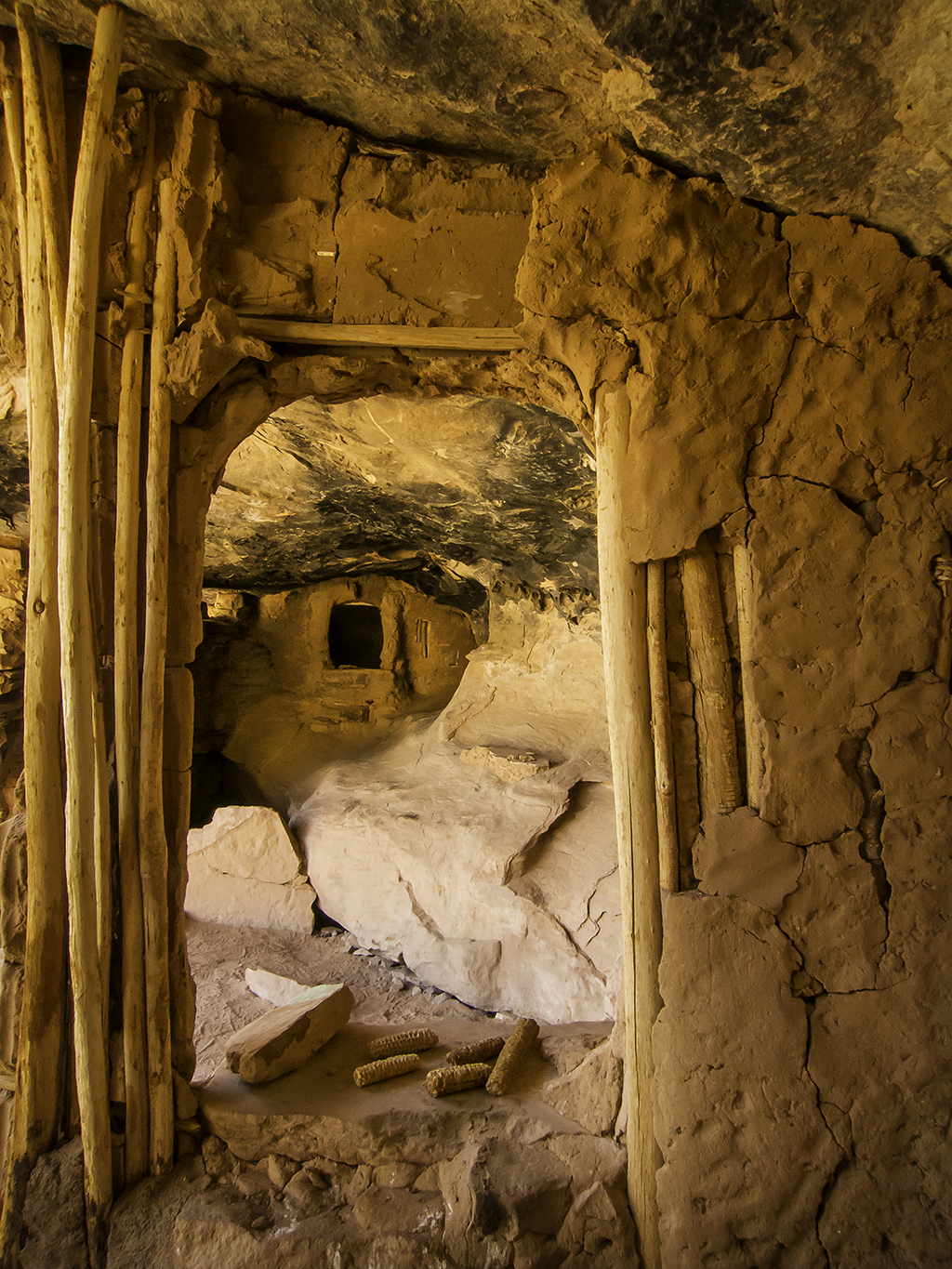
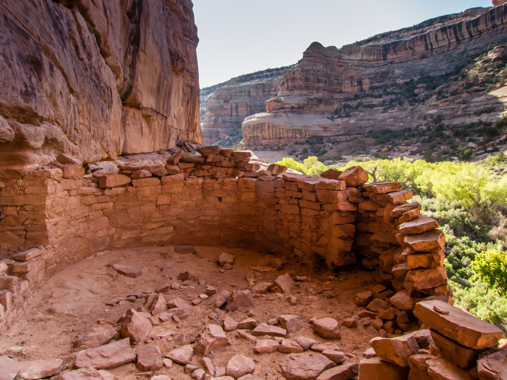
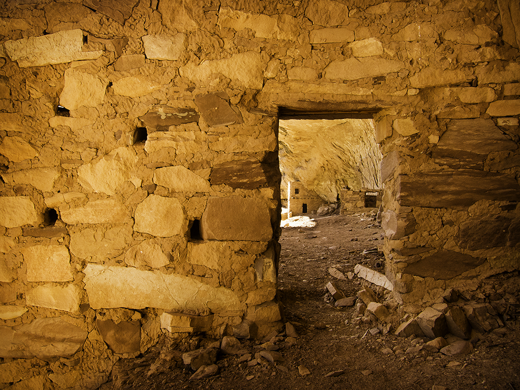
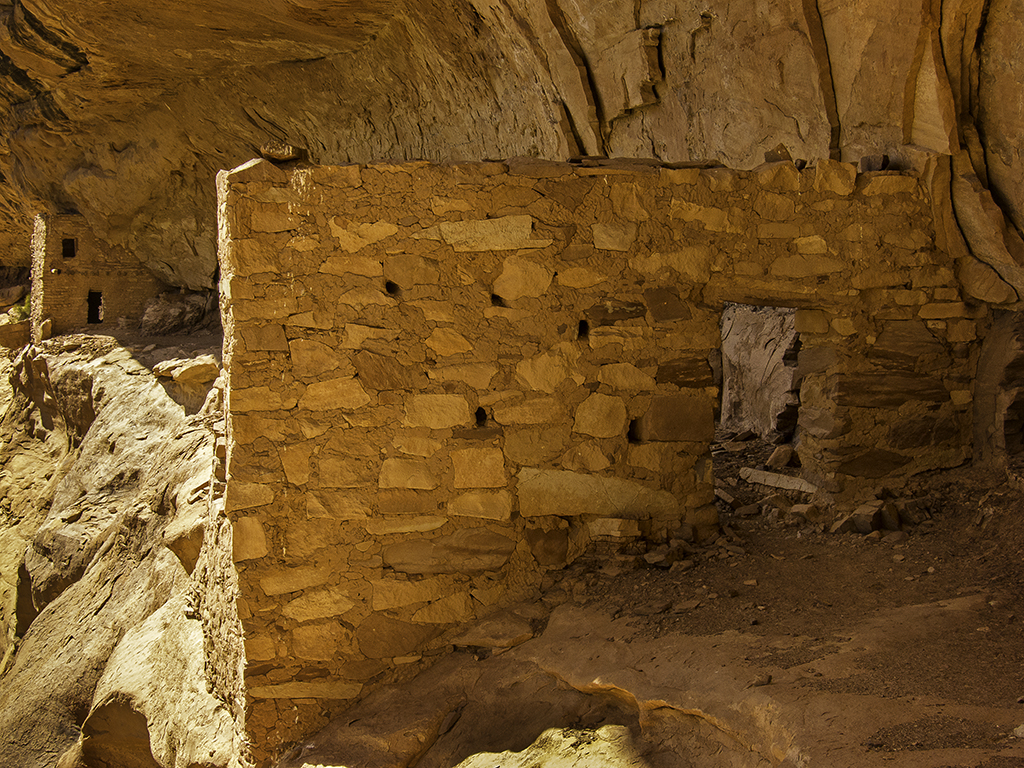
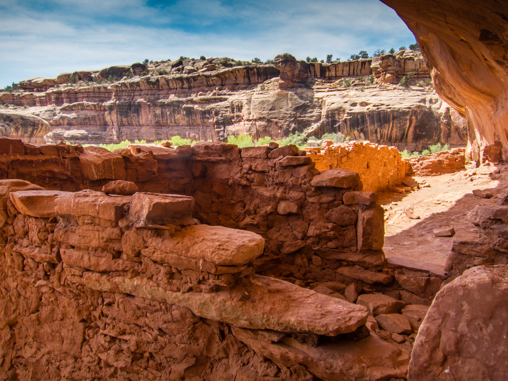
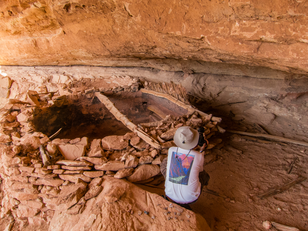
The next big attraction in Bullet Canyon was Perfect Kiva. A neat site, well worth the visit, albeit a bit sterile/stabilized for my taste.
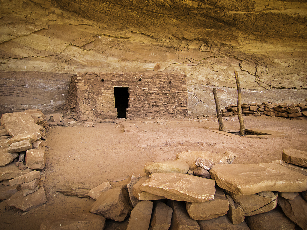
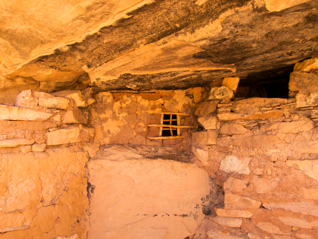
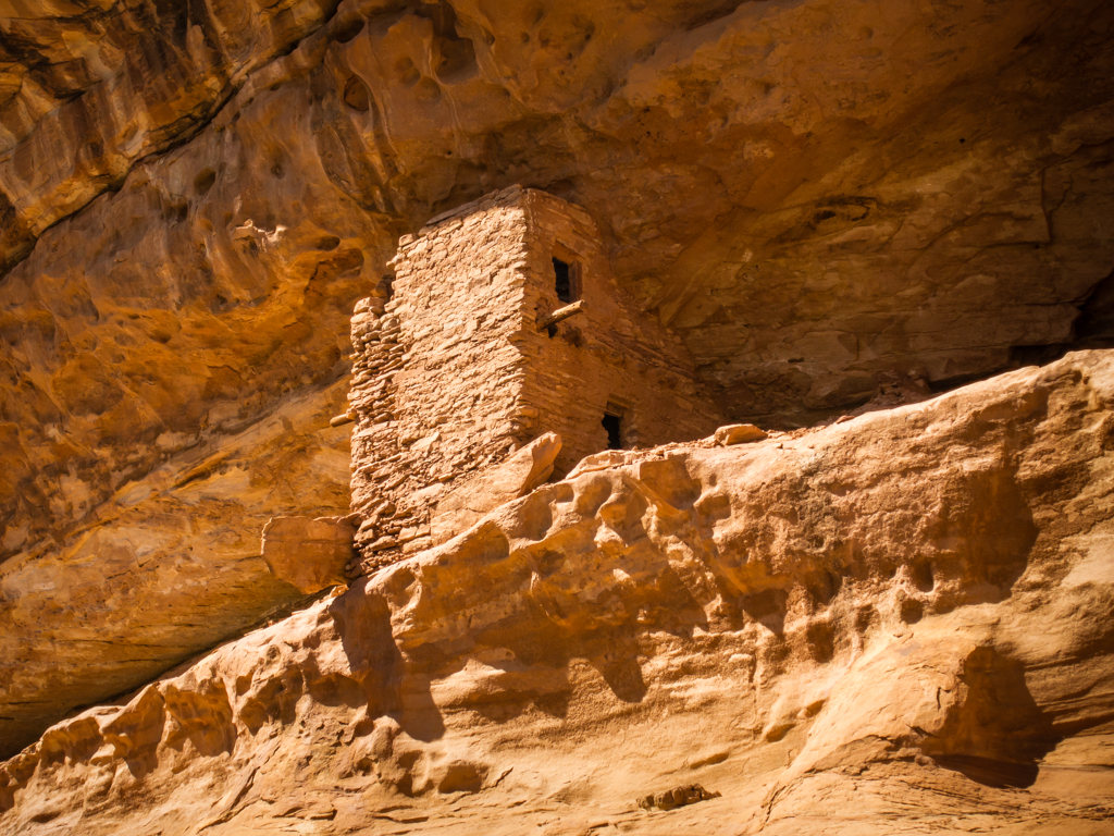
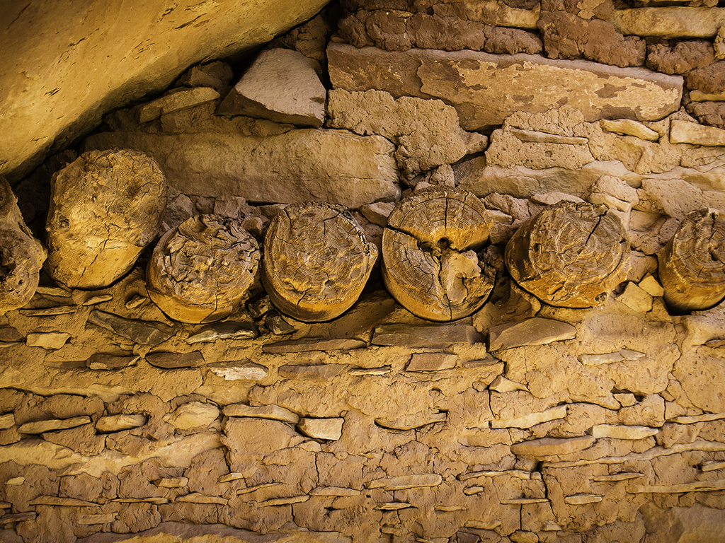
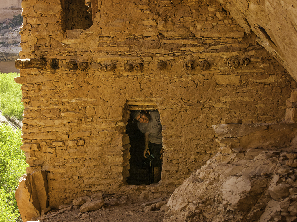
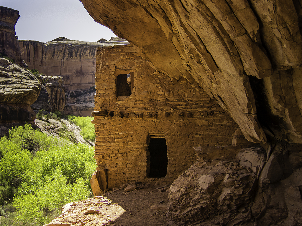
And of course, shortly after Perfect Kiva, was the absolutely delightful Jailhouse Ruin.

We had been warned by the rangers that Jailhouse spring was “putrid and undrinkable” (rangers exact words…), so we had each carried and extra quart of water into the canyon and didn’t bother trying to top off here.
Our eventual camp for the night was near the confluence of Bullet Canyon with the main canyon, where we planned to get water from Bullet Spring. Along the way, we passed up a big pothole full of water because it was pretty green. As it turns out, it was a lot less green than the water we found at Bullet Spring. It was entirely drinkable after filtering though, so no harm done.
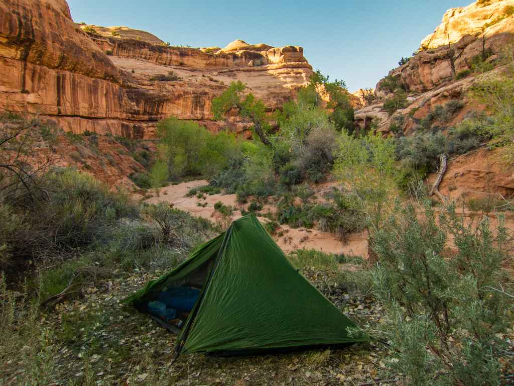
My tent setup on Sat. evening near Bullet Spring.
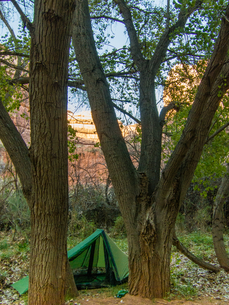
We had fantastic weather for the whole trip. Not a drop of rain, not too much wind and it kept getting warmer and warmer every night. I continued to setup my tent each night, but Jared spent the whole trip sleeping under the stars with no complaints.
We hiked about 11 miles total on that first day.
Sunday the 28th, we headed up the main canyon without our packs for awhile just checking out some of the ruins along the way.
Then we returned to camp, our packs and started down the main canyon. We were a little low on water when we started up Green House Canyon, but shortly after the main ruins we found the best water of the entire trip and spent a couple hours just relaxing in the shade and hydrating.
Couple pics of the Green House ruin.
After returning to the main canyon, we eventually ended up at the confluence with Dripping canyon to camp for the night. We were pretty low on water again by the time we got there, and not a lot of daylight remaining, so I was anxious to locate water before fully settling in for the evening. It turned out that we had to hike a full mile up Dripping canyon before we found water, but when we did, it was pretty good, so we tanked up.
Few more pics from Sunday.
We hiked about 13 miles total on this second day.
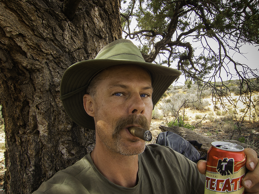
Something that happened in camp that night that really puzzled me too. I carried a fifth of Rendezvous Rye and a few cigars into the canyon with me and each night after dinner I would sip whiskey and smoke a cigar before bed. On this night, I placed my only half smoked cigar on a rock next to the empty tin cup I’d been drinking whiskey out of and went to bed. In the morning, my left over half cigar was gone. Pilfered by a varmint, obviously. But the varmint chose to carry off a half smoked cigar and ignore a ziplock ¼ full of powdered coffee creamer on the same rock? On the one hand, it seems like that varmint had strange tastes. But then again, if given the choice, I’d have take the cigar too. So maybe the varmint doesn’t have such strange taste after all?
At any rate, I took better care in protecting my cigars for the rest of the trip…
When we got up the morning of Monday the 29th, we decided not to take any chances with getting caught short on water this day. So we hiked the mile up canyon again to fill up on water. When we donned our packs and started down the main canyon again, I was carrying 3 quarts and I think Jared had a little more than that. As it turned out, I think we definitely made the right decision in loading up on water to start the day.
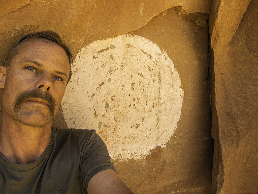
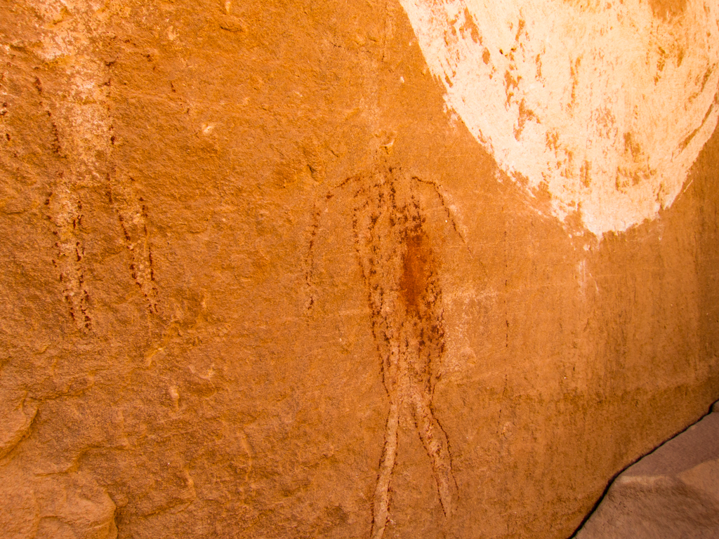
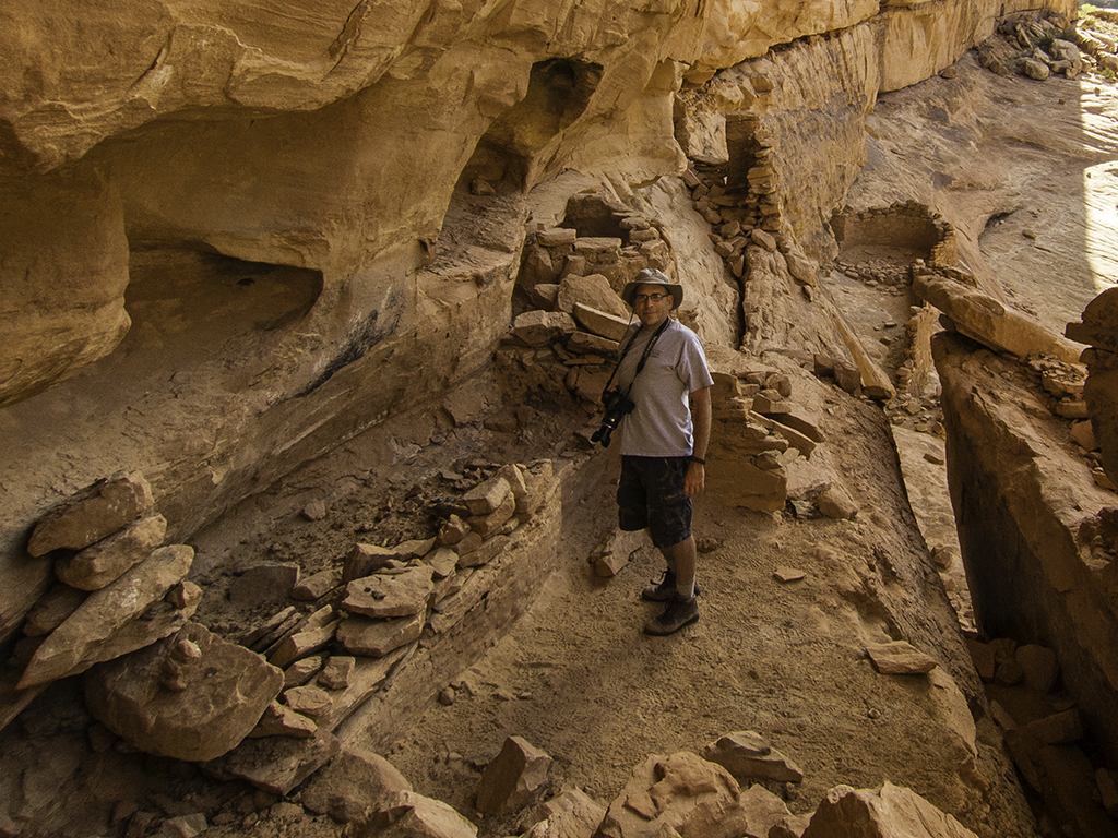
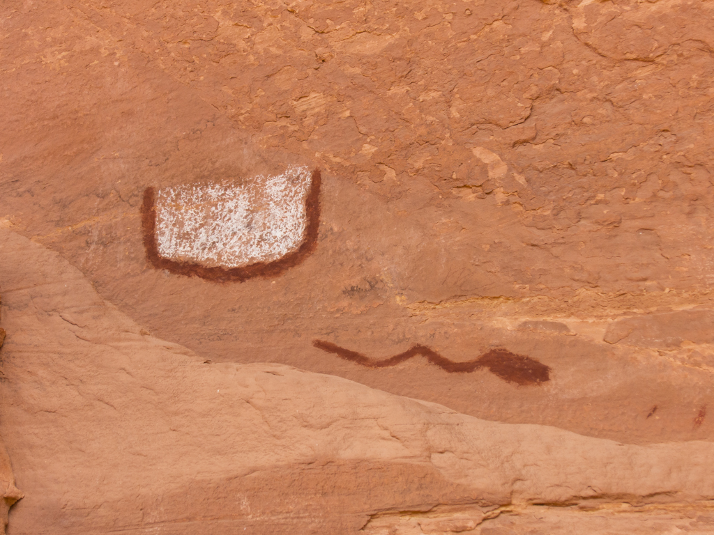
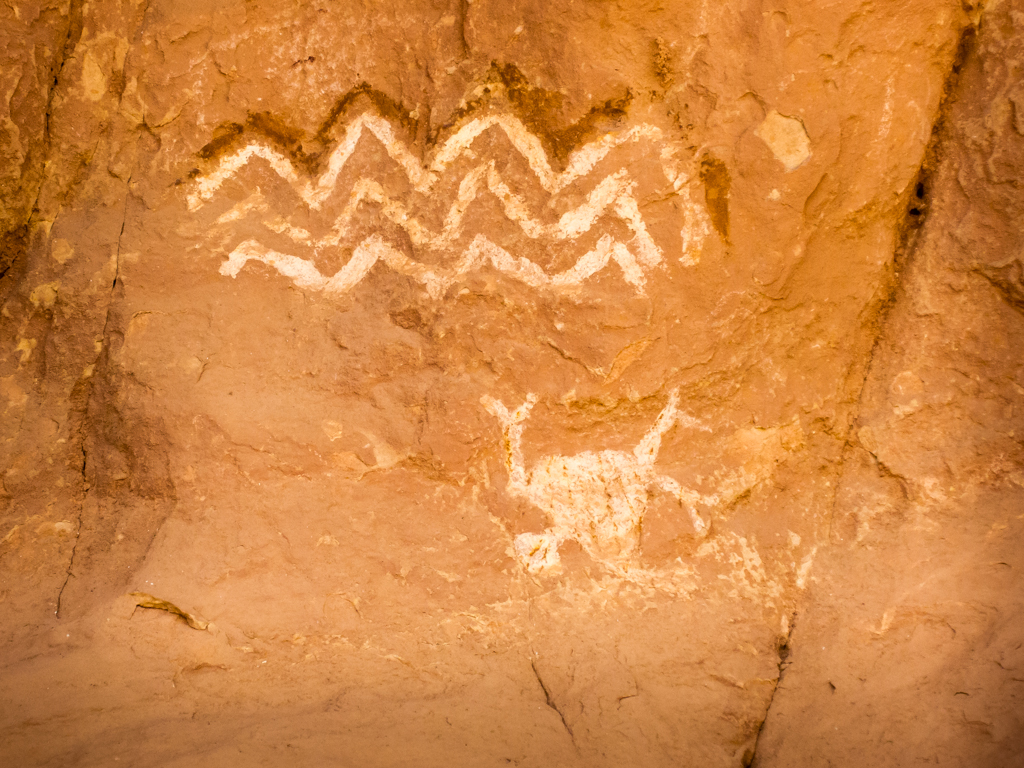
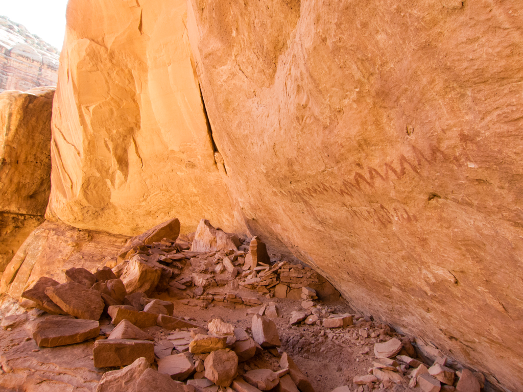
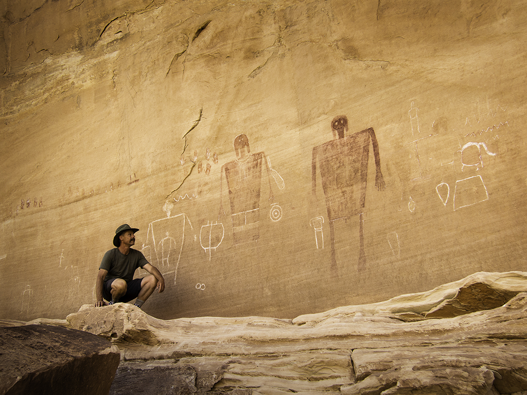
We saw many ruins and much rock art this day. Again, I won’t try to recall all of it, or what order it was in, and definitely won’t post pictures of it all. But here are a few from early in the day, some from the main canyon, others from Cow Tank canyon.

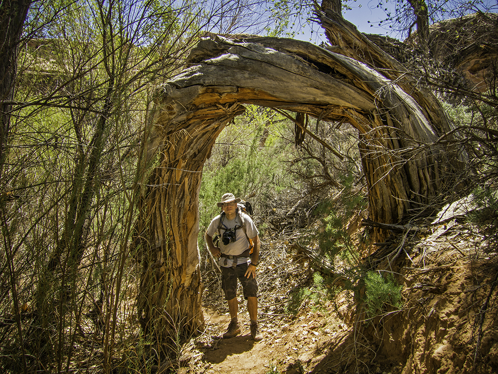
Nearing Big Man panel, were a couple of cool tree arches.
From Big Man, our intent was to find water and a nice campsite in Pollys Canyon, so that’s where we went next. By the time we started up Pollys, it had been a pretty long day already. The hike from Dripping Canyon to Polly’s doesn’t look like much on the map. And if you just walk from one to the other, I guess it wouldn’t be. But Jared and I had been investigating just about every ruin and rock art panel we had been able to sleuth out along the way. Bushwhacking from the floor of the canyon up onto the ledges and back down repeatedly throughout the day, which had also gotten very warm.
So… By the time we started up Pollys in search of a water source and a campsite, I had drank all of the three quarts I started the day with, Jared had drank most of his water too, and we were both pretty thirsty and tired.
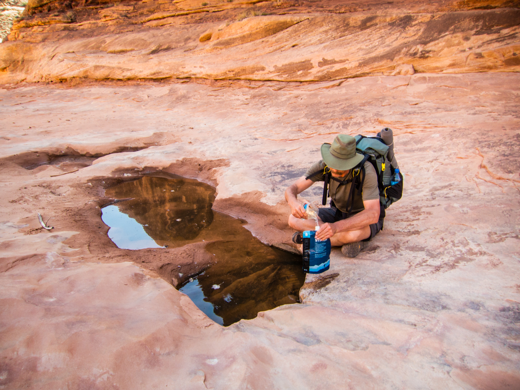
After travelling a little over half a mile up Pollys, we hadn’t found any water in the canyon, nor had we found a campsite either one of us liked that wasn’t already occupied. So we dropped our packs and I set out to do a little reconnoiter. I found good pot hole water just down the main canyon from Pollys and an excellent campsite on a shelf of the canyon wall not far from it. So I jetted back to Jared with the good news and we relocated from Pollys back into the main canyon.
Taking some very welcome water from a pot hole in the main canyon.
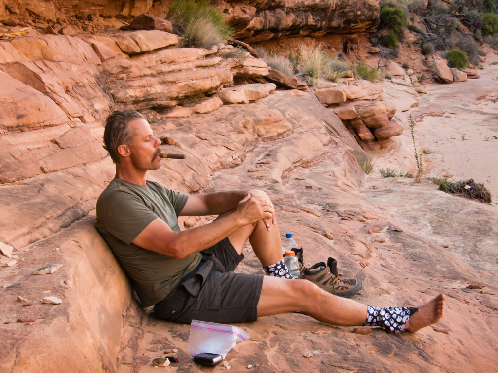
Hydrating and chilling in the shade.
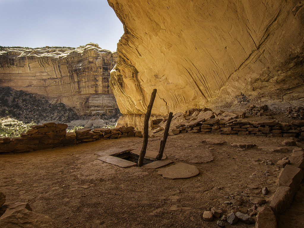
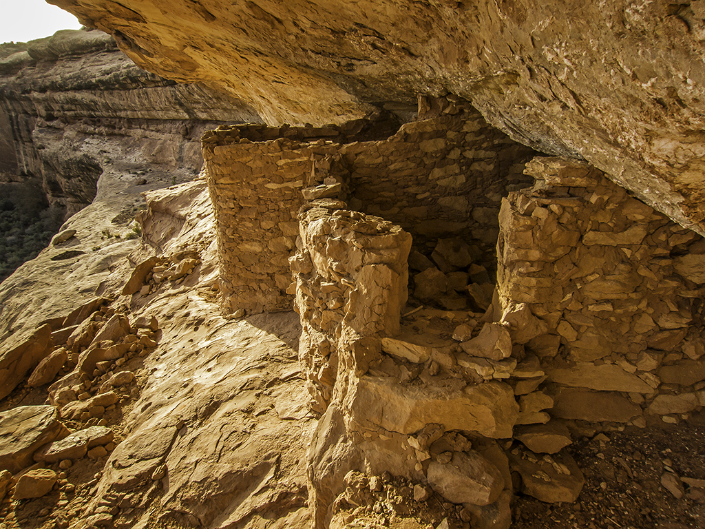
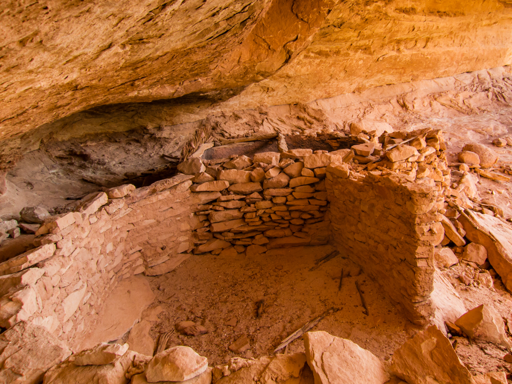
The littlest ruin.
Campsite for Monday night.

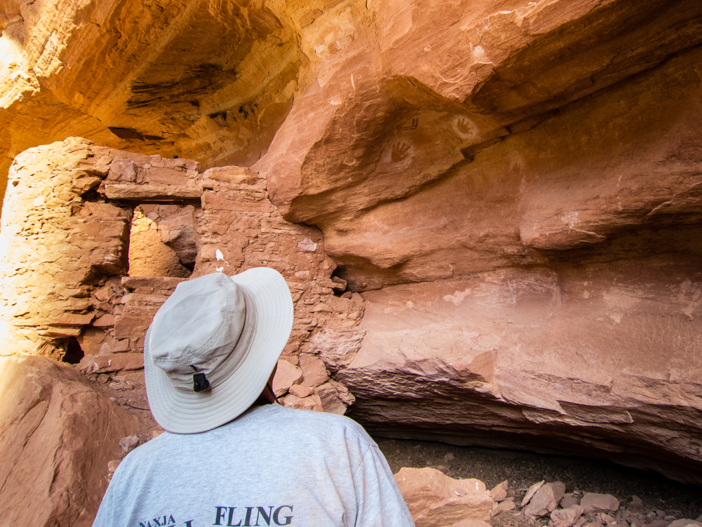
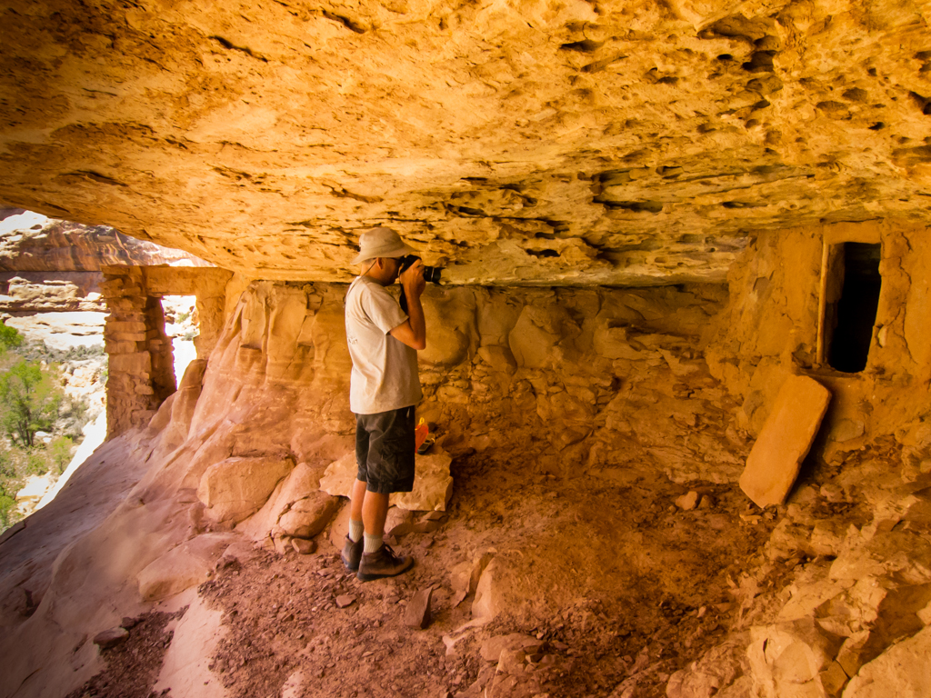
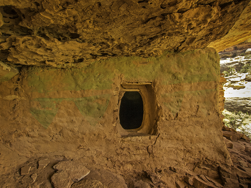
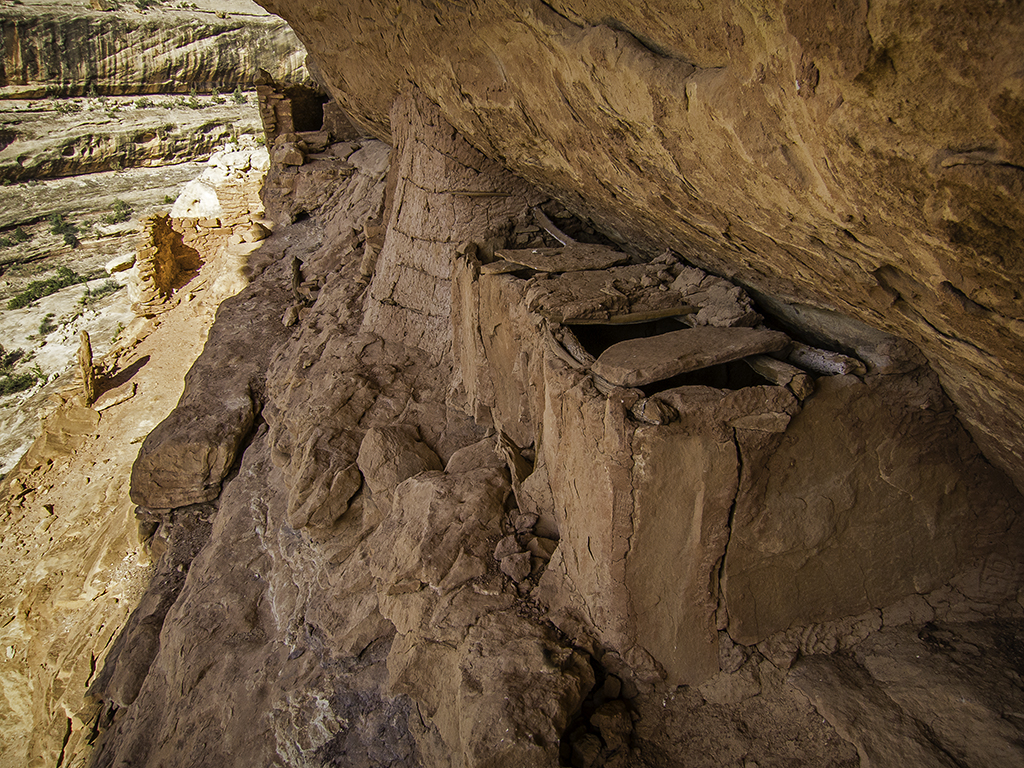
After spending the afternoon mostly just lounging in the shade, re-hydrating and nibbling on snacks (or smoking an awesome cigar if your name is DAA…), we both felt re-energized enough to head down canyon for a mile or two just to see what we could see. I’m glad we did! Found a great ruin in good light to finish out the day.
See the tiny handprint to the left o my hand? Can just imagine the kids “helping” by pressing their little hands in the mud…
We hiked about 13 miles total again for this day.
This proved to be the warmest night of the trip. I think in part because we were a couple hundred feet above the canyon floor, above where the coldest air settles during the night. I think Jared and I both kept our sleeping bags completely unzipped until just the last couple hours before dawn.
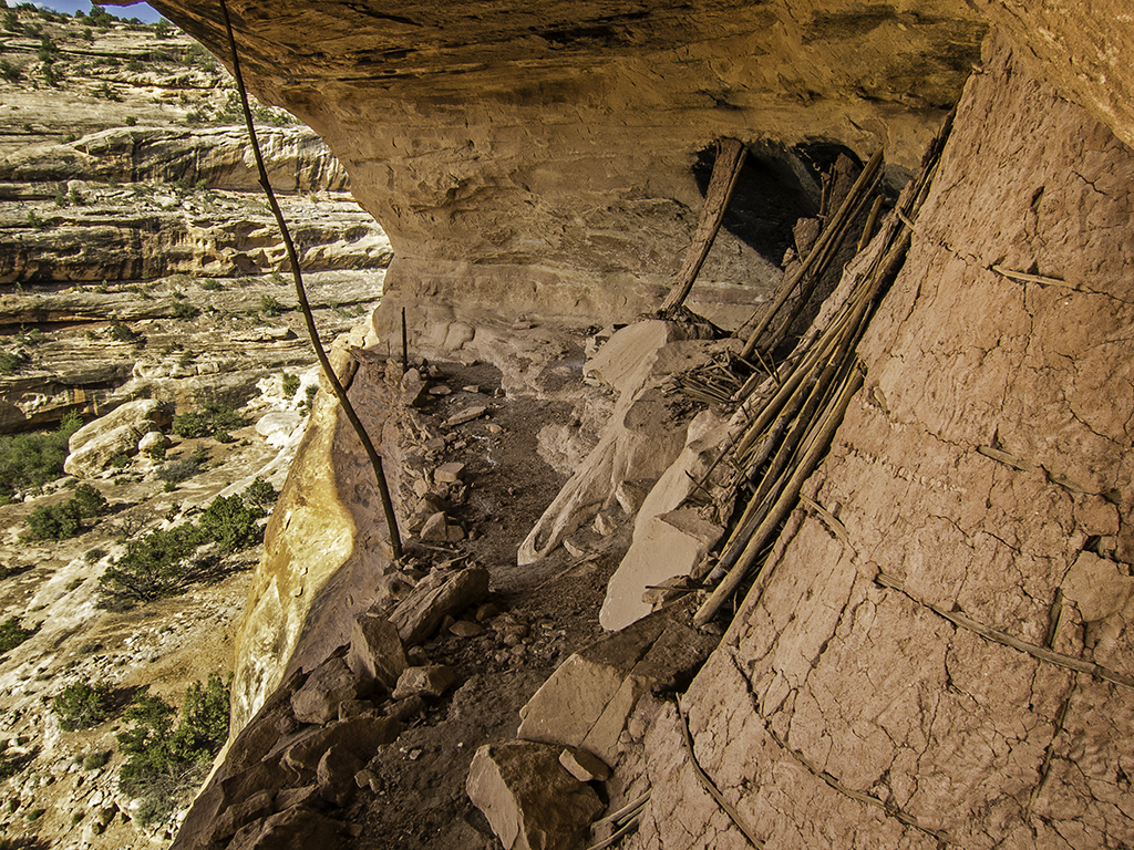
The morning of Tuesday the 30th, perhaps because of the warmth of the night, but I think more because of the combined anticipation and sadness of this being our last day, we both rolled out of our bags and were up and ready to move out well before the sun peeked over the canyon rim. After a brief discussion, we decided to hike approximately five miles round trip up Pollys and back down without our packs to visit one last ruins before exiting the main canyon via the Gov’t trail.
So, that is exactly what we did… A few pictures from our hike up Pollys.

And then, sadly, as all good things must end, it was time to put on our packs one more time and exit Grand Gulch via the Gov’t Trail.

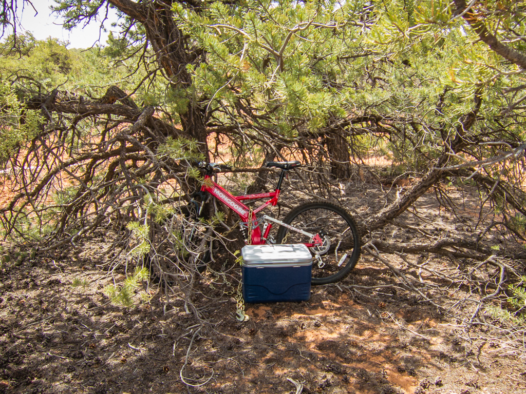
When we made it all the way out to the TH, we found my bike and cooler just as we had left them four days earlier.
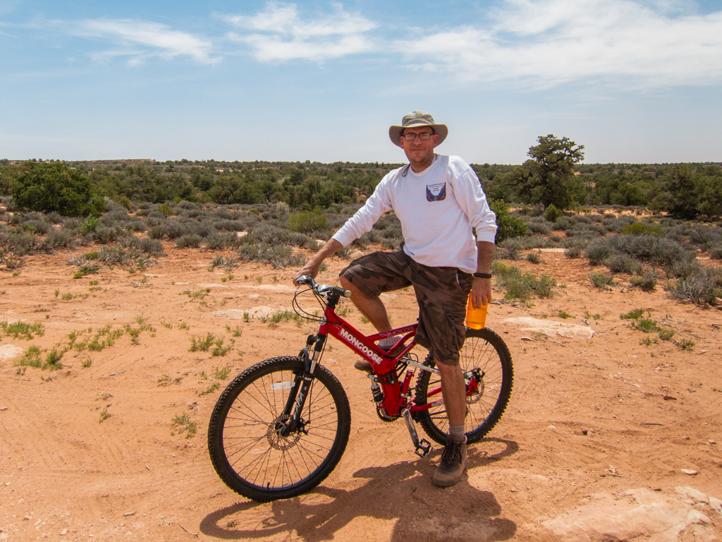
Jared graciously volunteered to make the 13 mile ride back to where the Lexus was parked at the Bullet TH.
Leaving me alone with the cooler for three hours…
Total miles on this last day, about 9, plus Jared had a 13 mile bike ride. So, grand total of about 45+ in 3.5 days. Great weather. Great company. Great scenery. Great ruins and rock art. I loved every second of it!
- DAA
Featured image for home page:

With stops only for fuel in Wellington and fuel again in Hanksville plus a sandwich at Blondie’s (excellent Ruben – I’ll never darken Jerry’s door again…), we made it onto the mesa before dark. With no camp site for the night planned ahead of time, I just sort of randomly turned off onto the road that goes to the Owl Creek trail head and drove until we found a nice spot to crash for the night with nobody else nearby. Both Jared and I slept under the stars this night.
The next morning, Sat. the 27th, we got up and I had breakfast and a few cups of coffee before we hopped in the Lexus and motored back towards the hiway. We needed to pick up our permit at the Kane Gulch ranger station, but they wouldn’t be open for almost another hour. So we drove all the way out to the Gov’t trail TH and stashed my mountain bike and a cooler for the end of the trip. Then backtracked all the way up to the ranger station to watch the required propaganda video before being issued our permit and allowed to go our way.
It was 10am by the time we finally had our packs on and started from the Bullet Canyon trail head.
Ahhh but what a glorious day to be descending into the Gulch!
The density of archaeology and sights to see hiking Grand Gulch are too numerous to list in a trip report. I won’t try and remember, let alone document them all. The one site that defeated us on this trip was on this first day though. The 3 Moons site.
This is Jared, preparing to route find our way up to the 3 Moons ruin. The 3 Moons picto is visible on the sheer cliff face, sunlit top-center in this photo. It was much rougher getting up to it than the photo suggests…
Here is a better look at the site, the ruins are in the shadows directly beneath the moon pictos, which might more accurately be called 2 ½ moons with Venus?
As mentioned a moment ago, we didn’t get all the way up to the site. The last pitch was just too exposed, too dang sketchy for us. I was 90% sure I could get up it okay, but that last 10% of doubt was too much. In addition to which, I was much less sure that I could get back down without a nasty fall…
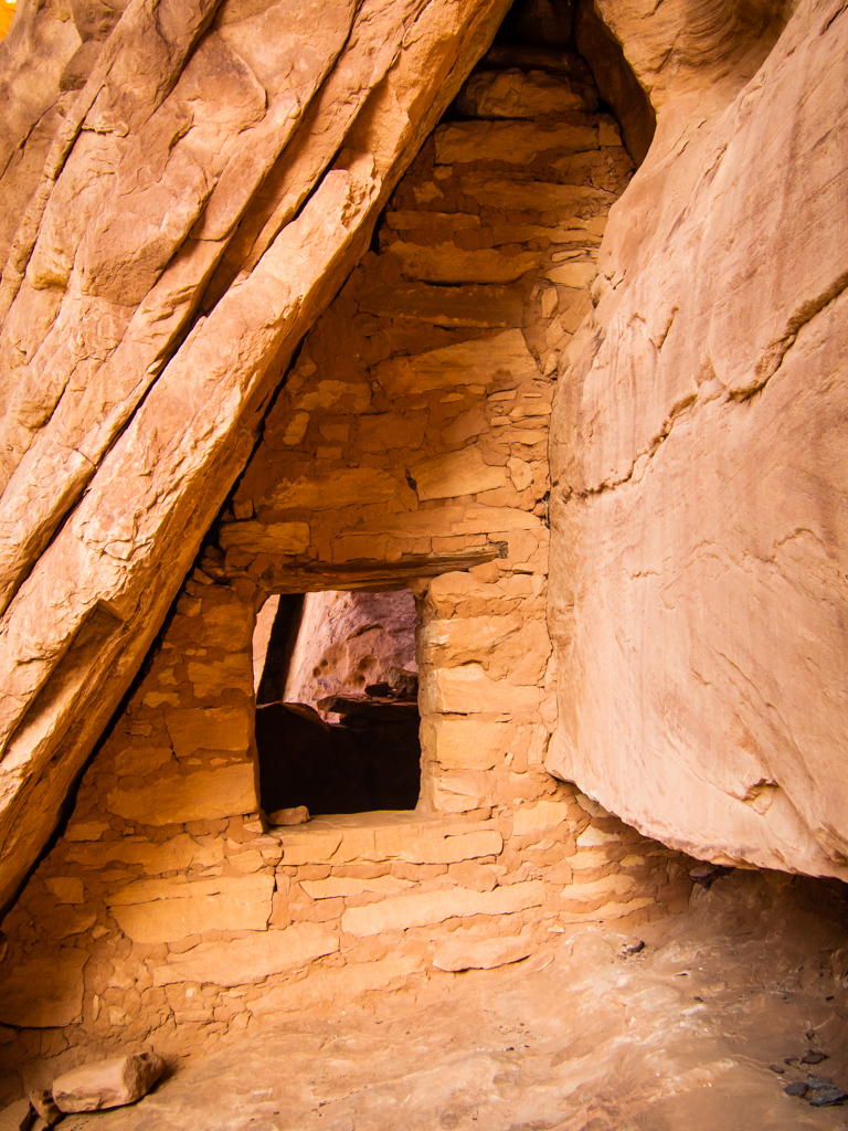
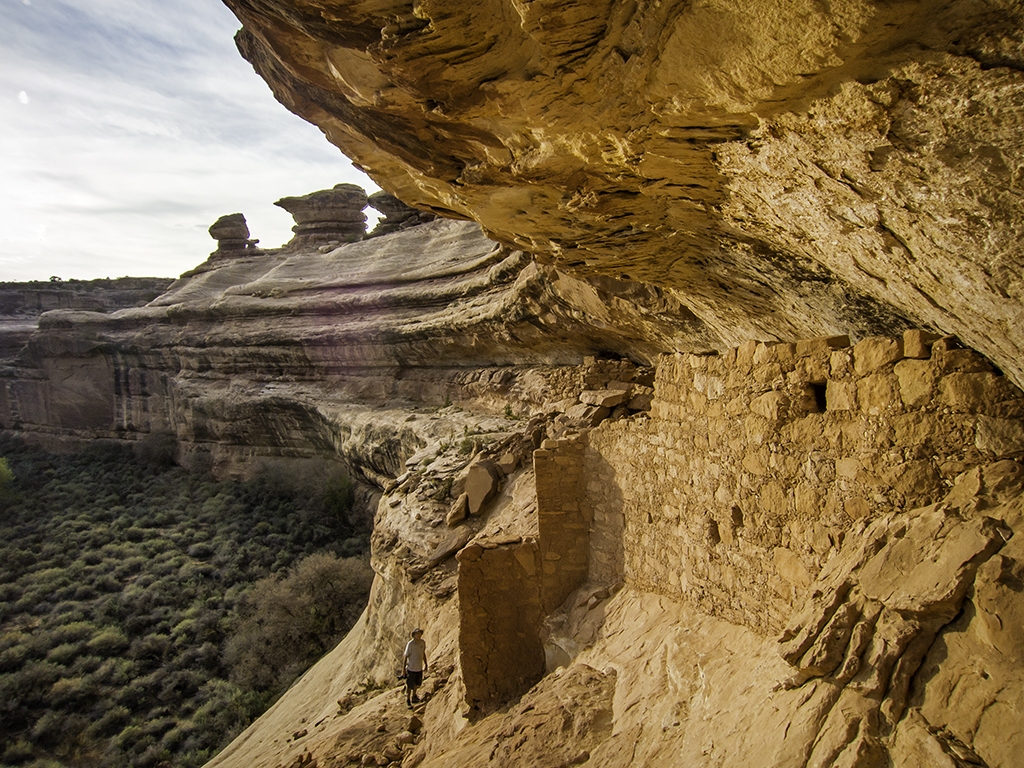
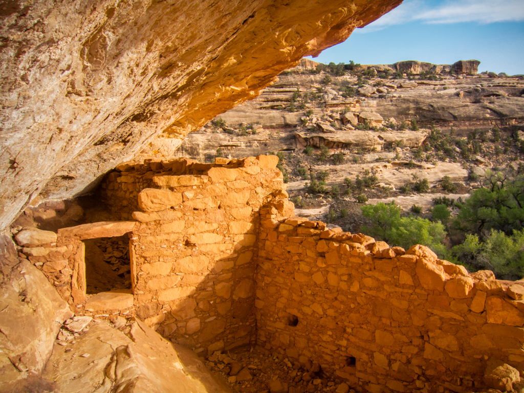
The next big attraction in Bullet Canyon was Perfect Kiva. A neat site, well worth the visit, albeit a bit sterile/stabilized for my taste.
And of course, shortly after Perfect Kiva, was the absolutely delightful Jailhouse Ruin.
We had been warned by the rangers that Jailhouse spring was “putrid and undrinkable” (rangers exact words…), so we had each carried and extra quart of water into the canyon and didn’t bother trying to top off here.
Our eventual camp for the night was near the confluence of Bullet Canyon with the main canyon, where we planned to get water from Bullet Spring. Along the way, we passed up a big pothole full of water because it was pretty green. As it turns out, it was a lot less green than the water we found at Bullet Spring. It was entirely drinkable after filtering though, so no harm done.
My tent setup on Sat. evening near Bullet Spring.
We had fantastic weather for the whole trip. Not a drop of rain, not too much wind and it kept getting warmer and warmer every night. I continued to setup my tent each night, but Jared spent the whole trip sleeping under the stars with no complaints.
We hiked about 11 miles total on that first day.
Sunday the 28th, we headed up the main canyon without our packs for awhile just checking out some of the ruins along the way.
Then we returned to camp, our packs and started down the main canyon. We were a little low on water when we started up Green House Canyon, but shortly after the main ruins we found the best water of the entire trip and spent a couple hours just relaxing in the shade and hydrating.
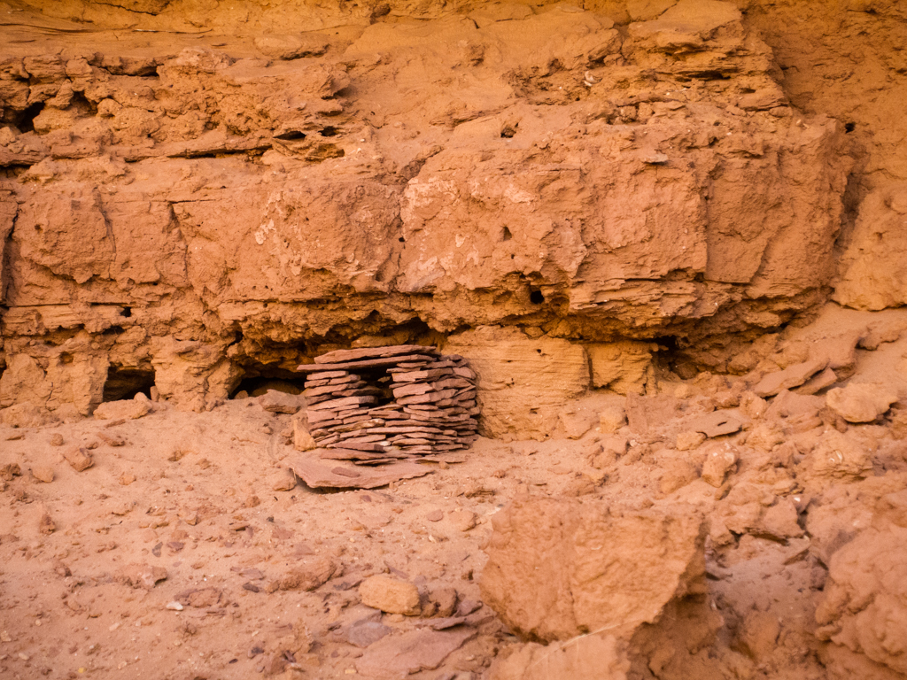
Couple pics of the Green House ruin.
After returning to the main canyon, we eventually ended up at the confluence with Dripping canyon to camp for the night. We were pretty low on water again by the time we got there, and not a lot of daylight remaining, so I was anxious to locate water before fully settling in for the evening. It turned out that we had to hike a full mile up Dripping canyon before we found water, but when we did, it was pretty good, so we tanked up.
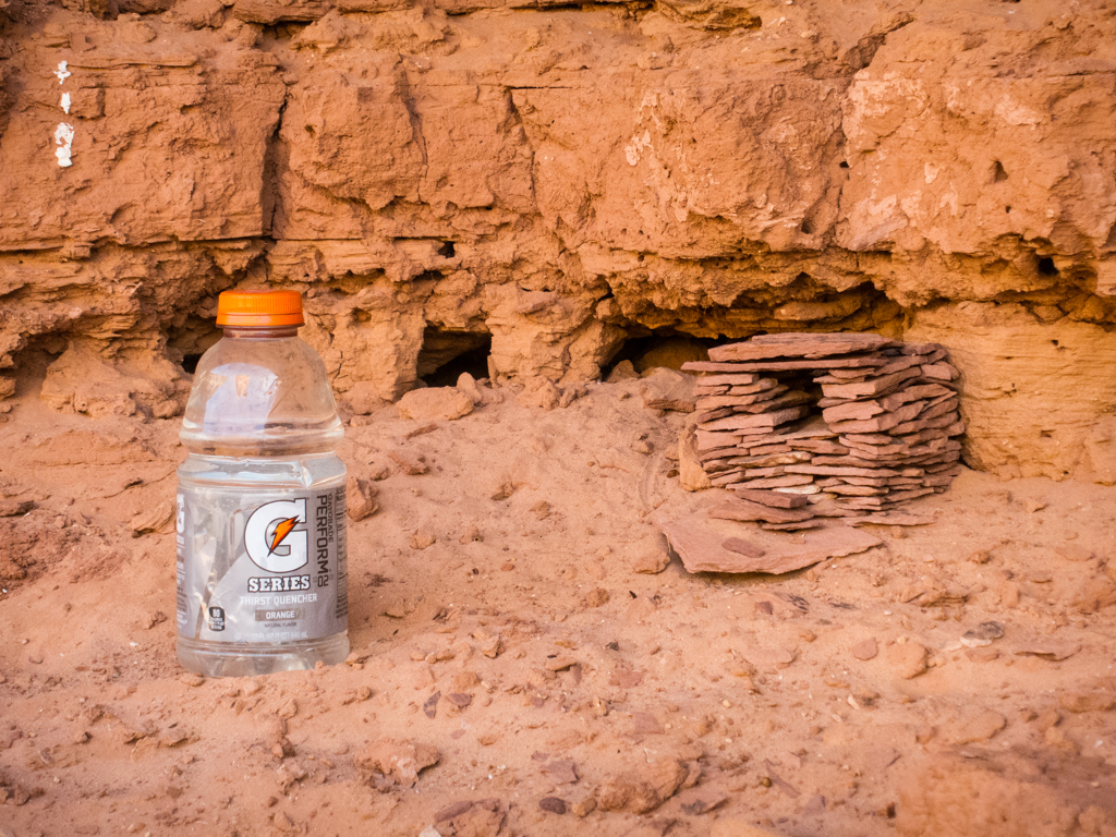
Few more pics from Sunday.
We hiked about 13 miles total on this second day.
Something that happened in camp that night that really puzzled me too. I carried a fifth of Rendezvous Rye and a few cigars into the canyon with me and each night after dinner I would sip whiskey and smoke a cigar before bed. On this night, I placed my only half smoked cigar on a rock next to the empty tin cup I’d been drinking whiskey out of and went to bed. In the morning, my left over half cigar was gone. Pilfered by a varmint, obviously. But the varmint chose to carry off a half smoked cigar and ignore a ziplock ¼ full of powdered coffee creamer on the same rock? On the one hand, it seems like that varmint had strange tastes. But then again, if given the choice, I’d have take the cigar too. So maybe the varmint doesn’t have such strange taste after all?
At any rate, I took better care in protecting my cigars for the rest of the trip…
When we got up the morning of Monday the 29th, we decided not to take any chances with getting caught short on water this day. So we hiked the mile up canyon again to fill up on water. When we donned our packs and started down the main canyon again, I was carrying 3 quarts and I think Jared had a little more than that. As it turned out, I think we definitely made the right decision in loading up on water to start the day.
We saw many ruins and much rock art this day. Again, I won’t try to recall all of it, or what order it was in, and definitely won’t post pictures of it all. But here are a few from early in the day, some from the main canyon, others from Cow Tank canyon.
Nearing Big Man panel, were a couple of cool tree arches.
From Big Man, our intent was to find water and a nice campsite in Pollys Canyon, so that’s where we went next. By the time we started up Pollys, it had been a pretty long day already. The hike from Dripping Canyon to Polly’s doesn’t look like much on the map. And if you just walk from one to the other, I guess it wouldn’t be. But Jared and I had been investigating just about every ruin and rock art panel we had been able to sleuth out along the way. Bushwhacking from the floor of the canyon up onto the ledges and back down repeatedly throughout the day, which had also gotten very warm.
So… By the time we started up Pollys in search of a water source and a campsite, I had drank all of the three quarts I started the day with, Jared had drank most of his water too, and we were both pretty thirsty and tired.
After travelling a little over half a mile up Pollys, we hadn’t found any water in the canyon, nor had we found a campsite either one of us liked that wasn’t already occupied. So we dropped our packs and I set out to do a little reconnoiter. I found good pot hole water just down the main canyon from Pollys and an excellent campsite on a shelf of the canyon wall not far from it. So I jetted back to Jared with the good news and we relocated from Pollys back into the main canyon.
Taking some very welcome water from a pot hole in the main canyon.
Hydrating and chilling in the shade.
The littlest ruin.
Campsite for Monday night.
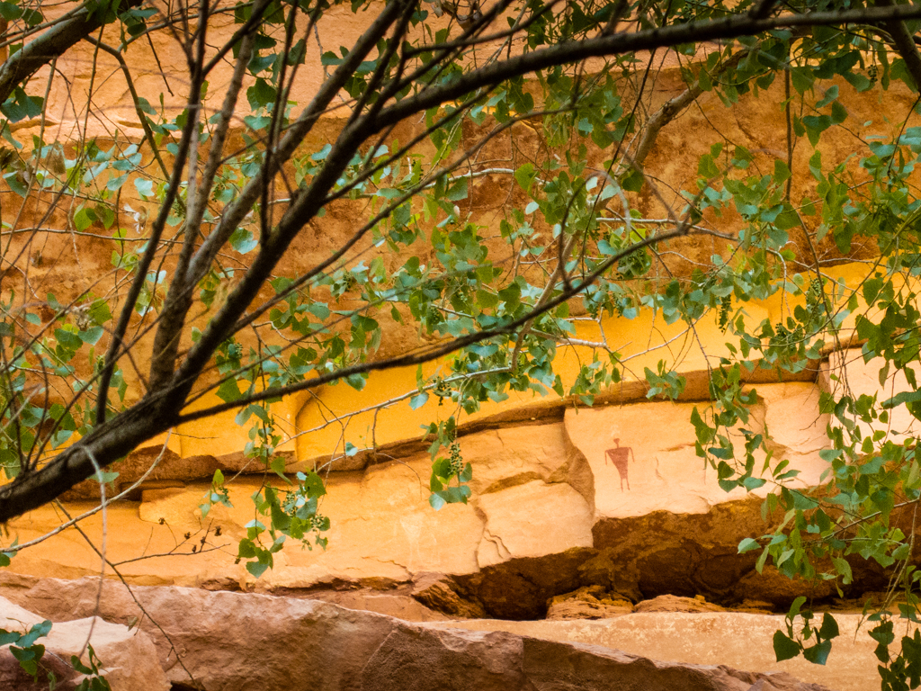
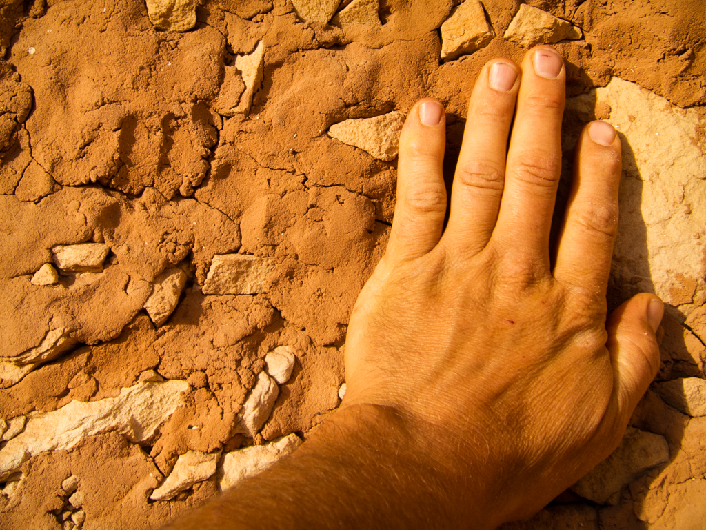
After spending the afternoon mostly just lounging in the shade, re-hydrating and nibbling on snacks (or smoking an awesome cigar if your name is DAA…), we both felt re-energized enough to head down canyon for a mile or two just to see what we could see. I’m glad we did! Found a great ruin in good light to finish out the day.
See the tiny handprint to the left o my hand? Can just imagine the kids “helping” by pressing their little hands in the mud…
We hiked about 13 miles total again for this day.
This proved to be the warmest night of the trip. I think in part because we were a couple hundred feet above the canyon floor, above where the coldest air settles during the night. I think Jared and I both kept our sleeping bags completely unzipped until just the last couple hours before dawn.
The morning of Tuesday the 30th, perhaps because of the warmth of the night, but I think more because of the combined anticipation and sadness of this being our last day, we both rolled out of our bags and were up and ready to move out well before the sun peeked over the canyon rim. After a brief discussion, we decided to hike approximately five miles round trip up Pollys and back down without our packs to visit one last ruins before exiting the main canyon via the Gov’t trail.
So, that is exactly what we did… A few pictures from our hike up Pollys.
And then, sadly, as all good things must end, it was time to put on our packs one more time and exit Grand Gulch via the Gov’t Trail.
When we made it all the way out to the TH, we found my bike and cooler just as we had left them four days earlier.
Jared graciously volunteered to make the 13 mile ride back to where the Lexus was parked at the Bullet TH.
Leaving me alone with the cooler for three hours…
Total miles on this last day, about 9, plus Jared had a 13 mile bike ride. So, grand total of about 45+ in 3.5 days. Great weather. Great company. Great scenery. Great ruins and rock art. I loved every second of it!
- DAA
Featured image for home page:

 .
.
 Thanks for sharing.
")