Kristen M. Caldon Photo
Backcountry and Remote Locations Imagery
- Joined
- Dec 27, 2012
- Messages
- 5
Grand Canyon Hiking
S. Bass to Tiyo
10/2012

In a lot of ways, I think a hike is never set until you have that permit in your hand. I had spent a lot of time putting this route together, trying to prepare for what laid ahead. Route descriptions had to be found and copied, water sources recognized, day plans made, ect. before I could get the permit and nail the plans in. These days, the rangers pull me into the office to put my permits together; my hikes can be complicated and generally take a lot of talking about. I like this because it’s easier to chitchat and get the digs from Matt, the ranger I talk with most often these days. He told me he had just gotten back from the Shinumo area, and had to turn back (for the second time) at exactly the break I was concerned about! So I was all shook up about that, whether I could hack it or not at the Flint Break. My plan became a lot more elaborate with a few backup plans that (if necessary) would require more time and also more food.
Originally, I had planned on hiking this trip in the opposite direction, making a big ‘ole loop from Phantom to Bass and back with a food drop somewhere in there. Given the new complications I begrudgingly split my hike into two trips, and since I had already set up the food drop with my roommate, Chelsea, I decided to send it down still so I only had to carry a few days of food and I would have extra in case I had to fall on a backup route. We decided and agreed upon a spot we both knew of at Crystal (about my halfway point). This was my first attempt at a food drop, so I took care to mark my ammo can with my signature Day-Glo Green duct tape, and label it as such:
Kristen M. Caldon. Food Cache to be dropped at Crystal, pickup 10/13. ATTENTION: THIS CACHE IS NECESSARY FOR MY SUCCESS AND WELL BEING ~ DO NOT TAMPER WITH OR MOVE.
I handed off the ammo can, got a new line to haul my pack with, and was as ready as I could be.
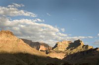
Heading down the S. Bass was fast, just as expected. Being about the same length as the S. Kaibab, I find a familiarity to pacing myself down such a trail, and I had been up and down this path a few times already this season. It was just my access point, anyway, my whole hike was on the north side of the river. I got down to Ross Wheeler, which is just a really nice place to spend some time waiting for boats. (which I have done my fair share of here). This beach has it all, a rapid to watch and listen to, a long beach, a good eddy for dunking, a few great secluded camp spots, and most of all great shade. I was rushing down, waiting to eat or drink until I had reached the river. You see, I had this plan of the most fantastic lunch of leftover pizza from last night, under the shade of a tammy, sitting on my bedroll enjoying the river. Sounds great, right? Well, when I got to Ross Wheeler I immediately got undressed, hopped in the river for a little cool off, and set down to enjoy that pizza. My little foil package of joy had left me on the trail somewhere! If you have ever seen my backpack there would be no wonder why, as the side pockets are in a constant state of utter disrepair, and it’s a wonder they hold anything at all! I laid down in the shade and ate my regular trail snacks, lamenting the loss of my last town food.
I had barely gotten comfortable, certainly hadn’t finished eating, when I looked up and saw some boaters on their way by. I jumped up and grabbed my clothes off the tree, hurriedly buttoning my shirt as I headed upstream to ask for a ride.
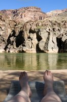
They obliged, and willingly, although they said they wished I hadn’t rushed so in getting dressed! As we went through Bass Rapid I was invited to dinner with them, and I agreed as I’d allowed myself the rest of the day just to get across the river. I’ve run into all sorts of river trips over the years in the canyon, and you get to meet some really neat and interesting people, but this group was especially great. A mixed group of river and ski guides, guide company owners, and general enthusiasts, we had a lot to talk about, and they wanted to know a lot, as this was everyone on the trips’ first time down the Grand.
I mostly connected with two guys, Nick and Matt, who are around my age, knowledgeable and fit, and had a great amount of enthusiasm about exploring ‘round here. I took them on the climber’s route down to the falls in Shinumo creek, which they seemed very comfortable on (even if I wasn’t so much given the generous libations in camp!) We just had a heck of a time splashing around, climbing, and just yakking all night. I told them about the break in Flint that I was so worried about, and being so adventurous they offered to try and get up to it with me the next day, on their layover.
I was really happy about this and took them up on it right away. I’m pretty much always hiking alone, so to have two awesome guys with me especially on a tough break would be fantastic!
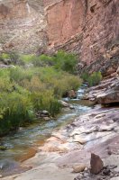
We headed up there the next day, though not too fast, and we only made it to the Flint/Shinumo confluence before they had to head back to camp. I headed up Flint by myself; ready to get within sight of that break. As the light waned, I climbed out of Flint onto the little Tonto slope just below the break, and I stared up at it, making my line, as I ate my dinner that night. It looked fun, the route. It was easy to match up key points from the route description with what lay ahead; the steep extended slope in the upper Muav, shorter climbs in the lower Red wall, traverse to the western edge of a massive bay in the Redwall, big sloping ramp curving around said bay, and the finger on which I would emerge, on top. Dinner was good and I slept well, as always.
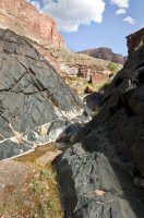
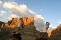
Morning came quickly, cloudy and threatening rain. I wanted to get to the top of that break before the rocks got wet, so I got going right away, totally focused, totally good to go. I had chosen the second ridgeline west of the bay in the Redwall I was shooting for, and really scrambled up there, knocking down big slides of flakes. A slope like this must be funny to watch someone go up, as it’s so steep, and also so loose that there is nothing to hold onto at all, so you’re kind of moving fast and digging in with your poles at the same time, in this jump/climb dance all the way up. This kind of material is really the most nerve wracking condition to hike on for me, I’d rather be climbing vertical, solid rock than these long, steep, loose slopes anytime!
As I climbed up, there were more ledges, small and negotiable, with steeper, looser slopes in between, and then I got to the first climb. It was about 40 feet, in a couple of levels where I was able to break and pull my shiza together. I can do more technical climbing, but it takes me a while, this kind of thing gets my heart going pretty fast!
The rocks were fairly undercut and I banged my pack up good hauling it, losing one of my water bottles on the way. Feeling good about making it through pretty much all the “climbing”, I celebrated with a Snickers. Then it started sprinkling. It was coming straight down, but it was possible that the arm of Redwall I was about to climb was just blocking the wind. I contoured up to the western edge of the bay, already about 1/4 the way up the Redwall. The next climb was about 30 ft, in two parts, and this time I kept my pack on. I would have preferred to have it off because it’s a little exposed, but it would’ve been a bigger pain to haul it in the end. At the top of this is a beautiful spot in the middle of the bay, a flat platform just covered in grass and other lush vegetation. The ramp going up to the top leaves from here, and is just a sweet way to go up the Redwall. When I got out to the end of the finger, the wind hit me hard, spitting cold hard drops in my face. Raingear came on then, and there was one very easy 15 ft climb and I was right on top of it all. WOW! The view was so stunning, I stood up to look out right away, and went right back down to my knees. The finger I had come out on was maybe 10 ft wide, all 500 ft or so down the Redwall! I truly felt so rewarded to be there right then, in the rain, on top of that really cool break, looking up and down Flint, great views of King Arthur and Guinevere. I moved in on the “mainland” sent off a Spot, had a snack and took in the view for a while. That was it, and it was amazing!
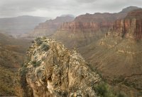
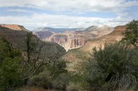
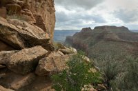
I made it up to the Flint/Tuna Saddle, and without too much hesitation I started heading down the other side, pleased with the sudden lack of vegetation to crash through on the south facing slope, into Tuna. It was pretty steep, ledges and boulders to stem down and soft ravines were the trend through the Supai. Next thing I knew I was on the top of the Redwall again, far below the saddle. The few pour offs here are easy to get around, and next thing I knew I was out in a wide, gravelly wash, Muav hills and Tonto rising gently up to the cliffs of Sagittarius Ridge to the immediate west. Evening was coming on, and I had to hit water before I got to camp. There were some potholes in the Redwall along the way, but they were quite “dirty”, more particles than water. I chose to press onward to Steck’s Tapeats spring, which he found producing water several times.
I approached where the spring was supposed to be just about at dark, noticing some sweet ledges in the Tapeats that could be great for camping. There was a lot of grass and other good signs of water, but nothing but dampness at the creek bed, so I just kept on going down canyon until a small creek emerges suddenly at the schist contact.
It had been raining on and off all day, and I expected much of the same weather through the night so finding a good camp was key. All the ledges I had checked out on the way down canyon were full of packrat middens, so I climbed up on the Tonto beneath point sublime and setup on a nice flat spot that I thought would afford a nice view in the morning. I set my tarp up and quickly got to making dinner. As my water boiled, I watched lightning spotlight the canyon, and I could see little bits of where I was headed the next day. It rained through the night, hard at times, but the pitch of my tarp was tight and I slept well.
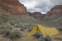
I hadn’t been on the Tonto long the next morning when I stumbled upon three American flags set into the ground, waving proudly with Tuna and Point Sublime in the background. This surely reminded me “oh yeah, I’m in AMERICA!” How great is this?
The little stretch of Tonto along the western flank of tuna was so beautiful, and the clouds were still swirling in and out changing the light constantly. As I headed out, I took a little bit longer to check over the edge of the schist into lower Tuna creek. I have heard you can get down there, and it looked passable everywhere I was able to glance down.
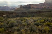
The break in the schist to reach the river at the mouth of Tuna Creek is really neat. Just downstream of the canyon is a notch, which you can just pick your way down from the Tonto. The only real technical part was the last 40 feet or so to the creek bed, where good route finding rewarded me with a much less scary passage than I thought I’d have to do.
It was just before lunchtime when I was at Tuna Rapid, facing my last leg for the day. All I had to do was go about a mile and a half upstream to Crystal, where my food drop awaited. I imagined laying on the beach, gorging myself on Indian Curry, and other specialty items I’d never have backpacking usually. According to Steck, this stretch in the schist was pretty rough and would take some navigating. Well, that turned out to be true; I was climbing all over the place, up and down in the range of 200ft. constantly just to make headway. Also, it continued to rain on and off, so I had to keep stopping to wait for the rocks to dry a bit. I definitely was trying to avoid a 100+ft. fall into the river! All this waiting was great for photos, though, and I got some shots of Crystal and Tuna Rapids that are spectacular.
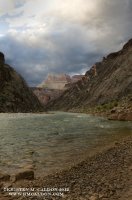
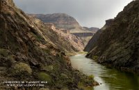
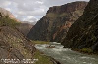
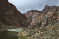
It was late afternoon when I arrived at Crystal. I dropped my pack, and went over to the agreed drop spot, kicking around at camel thorn, really excited at this point. It wasn’t there!!!
I started circling out, checking against all the schist outcroppings, in notches, behind trees and boulders in the area. By the time the sun went down I hadn’t found the ammo can, but I trusted Chelsea and was confident I would find the cache in the morning, with fresh eyes. So I ate my last dinner (teriyaki noodles I believe) and it was delicious.
The next morning broke with a fantastic sunrise, the storms and clouds from the day before had passed, leaving the canyon shining bright in the crisp light. Crystal rapid boomed and crashed, waiting for it’s next victim to float down to it. I didn’t dawdle in packing up and restarting my search, once again beginning with the set upon drop spot, and circling out. I covered the entire beach, from the camp and rapid scout down to crystal creek. Not a single rock, grass bunch, camel thorn pile, or tree was left unexamined. I went through all the variables, trying to figure out what happened to my food. I wasn’t sure if Chelsea herself had dropped the cache, she mentioned that her company didn’t scout crystal so there might have been a handoff. Did this person know the spot we agreed upon?? Did they forget? The only place I did not look was in the thick reeds, or tammy thickets that were impenetrable, keeping eyes out for sign of recent disturbance. I saw only normal traffic, including at the “spot”. It was noon, and I still had not found my ammo can. Also, no boats came by in that time.
I went back to my camp and got my map and my food bag out. Counting the bars and scraps of other snacks that remained; I had about 1,200 calories left. Looking at the map, maybe 2 days to phantom if I really hauled ass. It seemed kind of doable. Would probably end up being a little miserable, but the trip had just been just so great so far, and I didn’t want it to end. Not like I had any choice, there aren’t any escape routes nearby (that I thought of) given the location I was in and I couldn’t go back where I came from. I thought about getting some food from a river trip, but I had already wasted a half day of energy looking around that darned beach, so I made up my mind to go, and did so.
Crystal creek was beautiful, with sheer schist and granite walls and a shallow but pleasantly rippling creek. Going up canyon, pools started to form, shadows and reflections dancing with every bend. Every once and a while I could see the glowing Coconino tops of Mencius and Confucius temples popping into view. The canyon opens up just before the confluence of dragon and crystal creeks, and I got a great view of the dragon, rising up above the junction. I found a nice shady spot near here, cooled off, and got a little bit of water. Pushing on up dragon creek, I had not gotten far when I encountered many beaver ponds, having to wade through often. I’ve never seen this much beaver activity in a side canyon; they’ve really got something big going on there! The ponds continued right up to dragon spring. The climb around the dry fall on the east was well-marked and quite easy to follow, cairned and with a trail most of the time. If you were going down canyon towards the river it would be easy to miss the climb out.
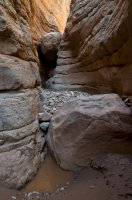
The short arm of Dragon, which is the access to Shiva saddle, is straight as an arrow, so I was able to see my climb up from the main arm of dragon. Looks just steep, loose, and forested from that far back, a fun scramble. Light was getting low now, and it looked so good up there on the saddle with the esplanade glowing in the sun that I decided to push and get there for sunset. Without stopping much, I boulder hopped and stemmed my way up dry falls, staying in the main drainage through the Redwall and into the Supai, aided by the occasional cairn here and there near the top.
When I emerged onto Shiva saddle, the last light was on the Coconino, so I hurried over to the other side immediately to look for a good view. Immediately I noticed the fortune of placement this saddle has, making it an island of esplanade sandstone almost completely surrounded by about 700 ft of cliffs. The one open side gave me the most fantastic view of Grand Canyon I believe I’ve ever seen, the saddle sits right above the head of Phantom Creek, falling away to the east, cottonwoods small yet glowing far below in the canyon bottom. Shiva and Isis Temples are the main features, big and in your face, begging for further exploration. The sunset was just so astounding; I was so full of bliss, satisfaction, and connectedness to the place. I was hungry, yes, but still I felt I needed nor wanted anything, that the canyon has and will provide all for me. I found a perfect camp, with an overhang and a porch, with the view. There were even potholes nearby for me to suck water out of! Even though I didn’t have any dinner and my stomach was really, really loudly grumbling, I lay there on the slick rock, considering my luck for having found myself there, right then. That evening really rocked me, and I’m still not sure why, but I plan to go back and spend some serious time here reflecting on this, getting to know it, and capture some images that might be able to reflect my feelings on the place.
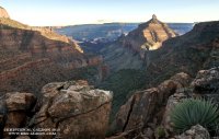
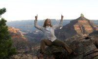
According to the J.D. Green guide, there are a few routes going through the Supai in the bay east of Shiva temple. I headed over by way of the hermit slope moving fast but with eyes peeled for a way through the Supai. I was having trouble seeing any passable routes, and spent A LOT of time scouting, without any real finds. I made a few elaborate down climbs, and back up again and again as I got cliffed out. All of this climbing up and down, hauling my pack, and the sun was making me shaky, anxious. At one point, I sat on top of that final 20 feet of sheer rock considering just using my webbing to hand line down, and it would be over with. I was just so close! Luckily, I thought better of this, and decided to head up to the top of the Supai again. My sudden and complete lack of route finding skills was worrisome and extremely frustrating. One of the biggest reasons this trip had been so fantastic was because of the difficulty of route finding, and I had no problems as of yet. I scanned the bay one last time, and begrudgingly turned back for the saddle to make some tough decisions.
I laid down in the shade and looked at my maps. The route descriptions I had made mention of a route from the saddle that would rim out just west of Tiyo point. This was my only real option for exit, but Tiyo is maybe 8 miles from the sublime road, which in turn is countless miles from the north rim village. I thought of all the stories told from pioneering days of epic escapes on the north rim, all seemed to end in tragedy such as being killed by natives or freezing in a snowstorm. Not really wanting to end up like these guys, I thought I’d better risk it. There wasn’t any other option at that point, so I headed on out. There were bison trails crisscrossing the saddle, all over the place, but I didn’t realize they were bison trails not humans until I had gone as far north as I could. By the time I realized I was not on the route, I did not care because at this spot, there was a great break in the Coconino, which I readily climbed. From there on out it was extremely steep and extremely brushy, of course all hooky, scratchy things. I found myself straight climbing at the Kaibab, maneuvering around dead trees. Even though the situation was fairly dire, I was still having a good time. My mind was clear and focused; I knew what I had to do and made the best of it. Almost to the rim, I was on a very steep slope, with one more cliff band of Kaibab above me. Looking at the map I saw drainage to the west that would take about 100 ft of climbing off, I went for it, and made it through but not without a wicked fight through locust and roses.
As soon as I hit the rim, I took a few minutes to sit down and send a Spot off. I try and do this whenever I get off my intended route, and as I did this I wondered if anyone would notice that something was amiss. From here I just bore east, keeping the sun at my back and chasing my shadow, hoping to hit the Tiyo road. I wasn’t sure how easy it would be to find, as it has been closed for a while and was probably grown over. Before too long I hit the road, and just walked it as fast as I could. It wasn’t too clear, and I doubted I would be able to stay on it after dark, so I tried my hardest to hit the sublime road as quickly as possible. The sun had already set, but I could still see when I hit the sublime road. For the first time since I rimmed out, I stopped, had a snack (my very last bit of food) and got all my layers on. The north rim is quite cold, and now that it was dark, I was breathing steam and my hands were stinging. At this point, I just had to keep going as I now had no food, about a 1/4 liter of water, and was definitely not prepared to sleep in those temps. I kept up a good pace on that road driven and ready to hit the village.
I was still about 5 or 6 miles from it when I heard an engine. YES! Luckily, the jeep stopped, and revealed an elderly couple, who ended up being from Minnesota. They had been out to point sublime to watch the sunset and were on their way back to the lodge. They really couldn’t figure out where I came from, and I don’t blame them! I was really in the middle of nowhere, and also really lucky that they happened to pass me there on the road. They offered me Cheezits, which I readily accepted and gobbled down. Funny, those little cheesy crackers were exactly what I was craving!
The couple dropped me right at my friends’ house, which I felt really bad knocking on their door at 10pm, but it was really my only choice. As soon as Kelly answered the door, she exclaimed, “Oh my god, what do you need?” Clearly, she knew something was wrong right away. I ate what I could, as my stomach was so shrunken I could barely eat anything, took a shower, and slept soundly in a nice warm bed.
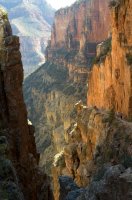
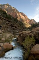
Getting back to the truck was an easy endeavor; all I had to do was the cross canyon hike to my truck waiting at the south Kaibab trailhead. The trails that run cross canyon are extremely familiar to me, as I’ve spent months at a time living on these trails, working on them. I know them like the back of my hand and could probably hike them with my eyes closed. I stopped at Phantom to check in with Joni, the manager there. She was expecting me, and told me right away that a few people had called her with great concern over my Spots sent from the north rim. So, people do pay attention after all, good to know! I made some calls to clear the air, let it be known I am OK, albeit being very hungry and unable to eat very much. Although it was tempting to stay at Phantom, I pushed onwards and got home safe that night, blown away by the intensity of the trip. Once again, the canyon let me in, granted me passage with good graces. Sanctuary, clarity, and boundless treasures all great gifts received, along with strengths found within myself. The Canyon keeps calling me.
Featured image for home page:
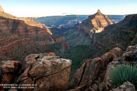
S. Bass to Tiyo
10/2012

In a lot of ways, I think a hike is never set until you have that permit in your hand. I had spent a lot of time putting this route together, trying to prepare for what laid ahead. Route descriptions had to be found and copied, water sources recognized, day plans made, ect. before I could get the permit and nail the plans in. These days, the rangers pull me into the office to put my permits together; my hikes can be complicated and generally take a lot of talking about. I like this because it’s easier to chitchat and get the digs from Matt, the ranger I talk with most often these days. He told me he had just gotten back from the Shinumo area, and had to turn back (for the second time) at exactly the break I was concerned about! So I was all shook up about that, whether I could hack it or not at the Flint Break. My plan became a lot more elaborate with a few backup plans that (if necessary) would require more time and also more food.
Originally, I had planned on hiking this trip in the opposite direction, making a big ‘ole loop from Phantom to Bass and back with a food drop somewhere in there. Given the new complications I begrudgingly split my hike into two trips, and since I had already set up the food drop with my roommate, Chelsea, I decided to send it down still so I only had to carry a few days of food and I would have extra in case I had to fall on a backup route. We decided and agreed upon a spot we both knew of at Crystal (about my halfway point). This was my first attempt at a food drop, so I took care to mark my ammo can with my signature Day-Glo Green duct tape, and label it as such:
Kristen M. Caldon. Food Cache to be dropped at Crystal, pickup 10/13. ATTENTION: THIS CACHE IS NECESSARY FOR MY SUCCESS AND WELL BEING ~ DO NOT TAMPER WITH OR MOVE.
I handed off the ammo can, got a new line to haul my pack with, and was as ready as I could be.

Heading down the S. Bass was fast, just as expected. Being about the same length as the S. Kaibab, I find a familiarity to pacing myself down such a trail, and I had been up and down this path a few times already this season. It was just my access point, anyway, my whole hike was on the north side of the river. I got down to Ross Wheeler, which is just a really nice place to spend some time waiting for boats. (which I have done my fair share of here). This beach has it all, a rapid to watch and listen to, a long beach, a good eddy for dunking, a few great secluded camp spots, and most of all great shade. I was rushing down, waiting to eat or drink until I had reached the river. You see, I had this plan of the most fantastic lunch of leftover pizza from last night, under the shade of a tammy, sitting on my bedroll enjoying the river. Sounds great, right? Well, when I got to Ross Wheeler I immediately got undressed, hopped in the river for a little cool off, and set down to enjoy that pizza. My little foil package of joy had left me on the trail somewhere! If you have ever seen my backpack there would be no wonder why, as the side pockets are in a constant state of utter disrepair, and it’s a wonder they hold anything at all! I laid down in the shade and ate my regular trail snacks, lamenting the loss of my last town food.
I had barely gotten comfortable, certainly hadn’t finished eating, when I looked up and saw some boaters on their way by. I jumped up and grabbed my clothes off the tree, hurriedly buttoning my shirt as I headed upstream to ask for a ride.

They obliged, and willingly, although they said they wished I hadn’t rushed so in getting dressed! As we went through Bass Rapid I was invited to dinner with them, and I agreed as I’d allowed myself the rest of the day just to get across the river. I’ve run into all sorts of river trips over the years in the canyon, and you get to meet some really neat and interesting people, but this group was especially great. A mixed group of river and ski guides, guide company owners, and general enthusiasts, we had a lot to talk about, and they wanted to know a lot, as this was everyone on the trips’ first time down the Grand.
I mostly connected with two guys, Nick and Matt, who are around my age, knowledgeable and fit, and had a great amount of enthusiasm about exploring ‘round here. I took them on the climber’s route down to the falls in Shinumo creek, which they seemed very comfortable on (even if I wasn’t so much given the generous libations in camp!) We just had a heck of a time splashing around, climbing, and just yakking all night. I told them about the break in Flint that I was so worried about, and being so adventurous they offered to try and get up to it with me the next day, on their layover.
I was really happy about this and took them up on it right away. I’m pretty much always hiking alone, so to have two awesome guys with me especially on a tough break would be fantastic!

We headed up there the next day, though not too fast, and we only made it to the Flint/Shinumo confluence before they had to head back to camp. I headed up Flint by myself; ready to get within sight of that break. As the light waned, I climbed out of Flint onto the little Tonto slope just below the break, and I stared up at it, making my line, as I ate my dinner that night. It looked fun, the route. It was easy to match up key points from the route description with what lay ahead; the steep extended slope in the upper Muav, shorter climbs in the lower Red wall, traverse to the western edge of a massive bay in the Redwall, big sloping ramp curving around said bay, and the finger on which I would emerge, on top. Dinner was good and I slept well, as always.


Morning came quickly, cloudy and threatening rain. I wanted to get to the top of that break before the rocks got wet, so I got going right away, totally focused, totally good to go. I had chosen the second ridgeline west of the bay in the Redwall I was shooting for, and really scrambled up there, knocking down big slides of flakes. A slope like this must be funny to watch someone go up, as it’s so steep, and also so loose that there is nothing to hold onto at all, so you’re kind of moving fast and digging in with your poles at the same time, in this jump/climb dance all the way up. This kind of material is really the most nerve wracking condition to hike on for me, I’d rather be climbing vertical, solid rock than these long, steep, loose slopes anytime!
As I climbed up, there were more ledges, small and negotiable, with steeper, looser slopes in between, and then I got to the first climb. It was about 40 feet, in a couple of levels where I was able to break and pull my shiza together. I can do more technical climbing, but it takes me a while, this kind of thing gets my heart going pretty fast!
The rocks were fairly undercut and I banged my pack up good hauling it, losing one of my water bottles on the way. Feeling good about making it through pretty much all the “climbing”, I celebrated with a Snickers. Then it started sprinkling. It was coming straight down, but it was possible that the arm of Redwall I was about to climb was just blocking the wind. I contoured up to the western edge of the bay, already about 1/4 the way up the Redwall. The next climb was about 30 ft, in two parts, and this time I kept my pack on. I would have preferred to have it off because it’s a little exposed, but it would’ve been a bigger pain to haul it in the end. At the top of this is a beautiful spot in the middle of the bay, a flat platform just covered in grass and other lush vegetation. The ramp going up to the top leaves from here, and is just a sweet way to go up the Redwall. When I got out to the end of the finger, the wind hit me hard, spitting cold hard drops in my face. Raingear came on then, and there was one very easy 15 ft climb and I was right on top of it all. WOW! The view was so stunning, I stood up to look out right away, and went right back down to my knees. The finger I had come out on was maybe 10 ft wide, all 500 ft or so down the Redwall! I truly felt so rewarded to be there right then, in the rain, on top of that really cool break, looking up and down Flint, great views of King Arthur and Guinevere. I moved in on the “mainland” sent off a Spot, had a snack and took in the view for a while. That was it, and it was amazing!


I made it up to the Flint/Tuna Saddle, and without too much hesitation I started heading down the other side, pleased with the sudden lack of vegetation to crash through on the south facing slope, into Tuna. It was pretty steep, ledges and boulders to stem down and soft ravines were the trend through the Supai. Next thing I knew I was on the top of the Redwall again, far below the saddle. The few pour offs here are easy to get around, and next thing I knew I was out in a wide, gravelly wash, Muav hills and Tonto rising gently up to the cliffs of Sagittarius Ridge to the immediate west. Evening was coming on, and I had to hit water before I got to camp. There were some potholes in the Redwall along the way, but they were quite “dirty”, more particles than water. I chose to press onward to Steck’s Tapeats spring, which he found producing water several times.
I approached where the spring was supposed to be just about at dark, noticing some sweet ledges in the Tapeats that could be great for camping. There was a lot of grass and other good signs of water, but nothing but dampness at the creek bed, so I just kept on going down canyon until a small creek emerges suddenly at the schist contact.
It had been raining on and off all day, and I expected much of the same weather through the night so finding a good camp was key. All the ledges I had checked out on the way down canyon were full of packrat middens, so I climbed up on the Tonto beneath point sublime and setup on a nice flat spot that I thought would afford a nice view in the morning. I set my tarp up and quickly got to making dinner. As my water boiled, I watched lightning spotlight the canyon, and I could see little bits of where I was headed the next day. It rained through the night, hard at times, but the pitch of my tarp was tight and I slept well.

I hadn’t been on the Tonto long the next morning when I stumbled upon three American flags set into the ground, waving proudly with Tuna and Point Sublime in the background. This surely reminded me “oh yeah, I’m in AMERICA!” How great is this?
The little stretch of Tonto along the western flank of tuna was so beautiful, and the clouds were still swirling in and out changing the light constantly. As I headed out, I took a little bit longer to check over the edge of the schist into lower Tuna creek. I have heard you can get down there, and it looked passable everywhere I was able to glance down.

The break in the schist to reach the river at the mouth of Tuna Creek is really neat. Just downstream of the canyon is a notch, which you can just pick your way down from the Tonto. The only real technical part was the last 40 feet or so to the creek bed, where good route finding rewarded me with a much less scary passage than I thought I’d have to do.
It was just before lunchtime when I was at Tuna Rapid, facing my last leg for the day. All I had to do was go about a mile and a half upstream to Crystal, where my food drop awaited. I imagined laying on the beach, gorging myself on Indian Curry, and other specialty items I’d never have backpacking usually. According to Steck, this stretch in the schist was pretty rough and would take some navigating. Well, that turned out to be true; I was climbing all over the place, up and down in the range of 200ft. constantly just to make headway. Also, it continued to rain on and off, so I had to keep stopping to wait for the rocks to dry a bit. I definitely was trying to avoid a 100+ft. fall into the river! All this waiting was great for photos, though, and I got some shots of Crystal and Tuna Rapids that are spectacular.


It was late afternoon when I arrived at Crystal. I dropped my pack, and went over to the agreed drop spot, kicking around at camel thorn, really excited at this point. It wasn’t there!!!
I started circling out, checking against all the schist outcroppings, in notches, behind trees and boulders in the area. By the time the sun went down I hadn’t found the ammo can, but I trusted Chelsea and was confident I would find the cache in the morning, with fresh eyes. So I ate my last dinner (teriyaki noodles I believe) and it was delicious.
The next morning broke with a fantastic sunrise, the storms and clouds from the day before had passed, leaving the canyon shining bright in the crisp light. Crystal rapid boomed and crashed, waiting for it’s next victim to float down to it. I didn’t dawdle in packing up and restarting my search, once again beginning with the set upon drop spot, and circling out. I covered the entire beach, from the camp and rapid scout down to crystal creek. Not a single rock, grass bunch, camel thorn pile, or tree was left unexamined. I went through all the variables, trying to figure out what happened to my food. I wasn’t sure if Chelsea herself had dropped the cache, she mentioned that her company didn’t scout crystal so there might have been a handoff. Did this person know the spot we agreed upon?? Did they forget? The only place I did not look was in the thick reeds, or tammy thickets that were impenetrable, keeping eyes out for sign of recent disturbance. I saw only normal traffic, including at the “spot”. It was noon, and I still had not found my ammo can. Also, no boats came by in that time.
I went back to my camp and got my map and my food bag out. Counting the bars and scraps of other snacks that remained; I had about 1,200 calories left. Looking at the map, maybe 2 days to phantom if I really hauled ass. It seemed kind of doable. Would probably end up being a little miserable, but the trip had just been just so great so far, and I didn’t want it to end. Not like I had any choice, there aren’t any escape routes nearby (that I thought of) given the location I was in and I couldn’t go back where I came from. I thought about getting some food from a river trip, but I had already wasted a half day of energy looking around that darned beach, so I made up my mind to go, and did so.
Crystal creek was beautiful, with sheer schist and granite walls and a shallow but pleasantly rippling creek. Going up canyon, pools started to form, shadows and reflections dancing with every bend. Every once and a while I could see the glowing Coconino tops of Mencius and Confucius temples popping into view. The canyon opens up just before the confluence of dragon and crystal creeks, and I got a great view of the dragon, rising up above the junction. I found a nice shady spot near here, cooled off, and got a little bit of water. Pushing on up dragon creek, I had not gotten far when I encountered many beaver ponds, having to wade through often. I’ve never seen this much beaver activity in a side canyon; they’ve really got something big going on there! The ponds continued right up to dragon spring. The climb around the dry fall on the east was well-marked and quite easy to follow, cairned and with a trail most of the time. If you were going down canyon towards the river it would be easy to miss the climb out.

The short arm of Dragon, which is the access to Shiva saddle, is straight as an arrow, so I was able to see my climb up from the main arm of dragon. Looks just steep, loose, and forested from that far back, a fun scramble. Light was getting low now, and it looked so good up there on the saddle with the esplanade glowing in the sun that I decided to push and get there for sunset. Without stopping much, I boulder hopped and stemmed my way up dry falls, staying in the main drainage through the Redwall and into the Supai, aided by the occasional cairn here and there near the top.
When I emerged onto Shiva saddle, the last light was on the Coconino, so I hurried over to the other side immediately to look for a good view. Immediately I noticed the fortune of placement this saddle has, making it an island of esplanade sandstone almost completely surrounded by about 700 ft of cliffs. The one open side gave me the most fantastic view of Grand Canyon I believe I’ve ever seen, the saddle sits right above the head of Phantom Creek, falling away to the east, cottonwoods small yet glowing far below in the canyon bottom. Shiva and Isis Temples are the main features, big and in your face, begging for further exploration. The sunset was just so astounding; I was so full of bliss, satisfaction, and connectedness to the place. I was hungry, yes, but still I felt I needed nor wanted anything, that the canyon has and will provide all for me. I found a perfect camp, with an overhang and a porch, with the view. There were even potholes nearby for me to suck water out of! Even though I didn’t have any dinner and my stomach was really, really loudly grumbling, I lay there on the slick rock, considering my luck for having found myself there, right then. That evening really rocked me, and I’m still not sure why, but I plan to go back and spend some serious time here reflecting on this, getting to know it, and capture some images that might be able to reflect my feelings on the place.


According to the J.D. Green guide, there are a few routes going through the Supai in the bay east of Shiva temple. I headed over by way of the hermit slope moving fast but with eyes peeled for a way through the Supai. I was having trouble seeing any passable routes, and spent A LOT of time scouting, without any real finds. I made a few elaborate down climbs, and back up again and again as I got cliffed out. All of this climbing up and down, hauling my pack, and the sun was making me shaky, anxious. At one point, I sat on top of that final 20 feet of sheer rock considering just using my webbing to hand line down, and it would be over with. I was just so close! Luckily, I thought better of this, and decided to head up to the top of the Supai again. My sudden and complete lack of route finding skills was worrisome and extremely frustrating. One of the biggest reasons this trip had been so fantastic was because of the difficulty of route finding, and I had no problems as of yet. I scanned the bay one last time, and begrudgingly turned back for the saddle to make some tough decisions.
I laid down in the shade and looked at my maps. The route descriptions I had made mention of a route from the saddle that would rim out just west of Tiyo point. This was my only real option for exit, but Tiyo is maybe 8 miles from the sublime road, which in turn is countless miles from the north rim village. I thought of all the stories told from pioneering days of epic escapes on the north rim, all seemed to end in tragedy such as being killed by natives or freezing in a snowstorm. Not really wanting to end up like these guys, I thought I’d better risk it. There wasn’t any other option at that point, so I headed on out. There were bison trails crisscrossing the saddle, all over the place, but I didn’t realize they were bison trails not humans until I had gone as far north as I could. By the time I realized I was not on the route, I did not care because at this spot, there was a great break in the Coconino, which I readily climbed. From there on out it was extremely steep and extremely brushy, of course all hooky, scratchy things. I found myself straight climbing at the Kaibab, maneuvering around dead trees. Even though the situation was fairly dire, I was still having a good time. My mind was clear and focused; I knew what I had to do and made the best of it. Almost to the rim, I was on a very steep slope, with one more cliff band of Kaibab above me. Looking at the map I saw drainage to the west that would take about 100 ft of climbing off, I went for it, and made it through but not without a wicked fight through locust and roses.
As soon as I hit the rim, I took a few minutes to sit down and send a Spot off. I try and do this whenever I get off my intended route, and as I did this I wondered if anyone would notice that something was amiss. From here I just bore east, keeping the sun at my back and chasing my shadow, hoping to hit the Tiyo road. I wasn’t sure how easy it would be to find, as it has been closed for a while and was probably grown over. Before too long I hit the road, and just walked it as fast as I could. It wasn’t too clear, and I doubted I would be able to stay on it after dark, so I tried my hardest to hit the sublime road as quickly as possible. The sun had already set, but I could still see when I hit the sublime road. For the first time since I rimmed out, I stopped, had a snack (my very last bit of food) and got all my layers on. The north rim is quite cold, and now that it was dark, I was breathing steam and my hands were stinging. At this point, I just had to keep going as I now had no food, about a 1/4 liter of water, and was definitely not prepared to sleep in those temps. I kept up a good pace on that road driven and ready to hit the village.
I was still about 5 or 6 miles from it when I heard an engine. YES! Luckily, the jeep stopped, and revealed an elderly couple, who ended up being from Minnesota. They had been out to point sublime to watch the sunset and were on their way back to the lodge. They really couldn’t figure out where I came from, and I don’t blame them! I was really in the middle of nowhere, and also really lucky that they happened to pass me there on the road. They offered me Cheezits, which I readily accepted and gobbled down. Funny, those little cheesy crackers were exactly what I was craving!
The couple dropped me right at my friends’ house, which I felt really bad knocking on their door at 10pm, but it was really my only choice. As soon as Kelly answered the door, she exclaimed, “Oh my god, what do you need?” Clearly, she knew something was wrong right away. I ate what I could, as my stomach was so shrunken I could barely eat anything, took a shower, and slept soundly in a nice warm bed.


Getting back to the truck was an easy endeavor; all I had to do was the cross canyon hike to my truck waiting at the south Kaibab trailhead. The trails that run cross canyon are extremely familiar to me, as I’ve spent months at a time living on these trails, working on them. I know them like the back of my hand and could probably hike them with my eyes closed. I stopped at Phantom to check in with Joni, the manager there. She was expecting me, and told me right away that a few people had called her with great concern over my Spots sent from the north rim. So, people do pay attention after all, good to know! I made some calls to clear the air, let it be known I am OK, albeit being very hungry and unable to eat very much. Although it was tempting to stay at Phantom, I pushed onwards and got home safe that night, blown away by the intensity of the trip. Once again, the canyon let me in, granted me passage with good graces. Sanctuary, clarity, and boundless treasures all great gifts received, along with strengths found within myself. The Canyon keeps calling me.
Featured image for home page:

