- Joined
- Jul 23, 2013
- Messages
- 1,665
Every now and then, one can be fortunate to find themselves hiking a route that offers breathtaking and beautiful scenery just about every single step of the journey. This proved to be just such a route.
Background:
When I was dating my wife, her family introduced me to Wayne County, UT and "Capitol Reef Country" during an annual family reunion her dad's family held every year in Torrey and Fruita. Landmarks down in Capitol Reef, such as Pectol's Pyramid and Hickman Bridge are named after ancestors in my wife's family tree: Ephraim Pectol, whom my wife is a direct descendant of, and Joseph Hickman, his brother-in-law. Both are credited with being the fathers of what is now known as Capitol Reef National Park. These and other ancestors of hers are now buried in cemeteries throughout Wayne County. In introducing me to their family history, her family also introduced me to an area rich in natural beauty, and like Ephraim Pectol who had a fond love of nature, I too fell in love with the surrounding landscape.
My in-laws have owned some property in the town of Torrey, just outside the Park, for decades and have now begun to develop it with plans to settle down and retire there over the next year. Needless to say, we now frequently make visits down there and each time I look forward to an opportunity to get out and explore spots I haven't yet been to and re-visit favorites. Last week I was fortunate to hike a route that afforded me the opportunity to do both. Due to my wife being eight months pregnant and opting to stay with our other kids and her parents in Torrey, and having no others available to join along, it would also be my first true solo backpacking trip.
Over the course of 3 days and 2 nights, I pursued a course that took me along unfamiliar trails up above Chimney Rock and through Chimney Canyon, Spring Canyon, Frying Pan Trail, and Cassidy Arch while also embarking along more familiar terrain in Grand Wash, Cohab Canyon, and up Sulphur Creek. After becoming acquainted with the Sulphur Creek between Chimney Rock and the Capitol Reef Visitor Center last spring and learning more about Spring Canyon, I looked for a way to loop together both. In looking over maps this past winter as I was putting together a list of hiking to-do's for this year, Grand Wash and the Frying Pan Trail appeared to be a perfect connector. Once the route was decided upon, it was time to find a place on the calendar for it. It was penciled in for last week, knowing my older kids would have their Spring Break, making it easier for the whole family to have a little get away. Seeing the post and video from @Joey who did a longer version of the route last year after I had begun planning my trip only got me more excited for April to arrive.
Leading up to the time, I was nervous about what the weather might hold in store since the area has a reputation for being notoriously windy and stormy in April. Much to my delight, the weather couldn't have been any better.
Route:
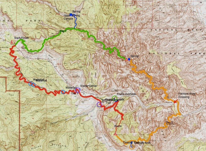
Report:
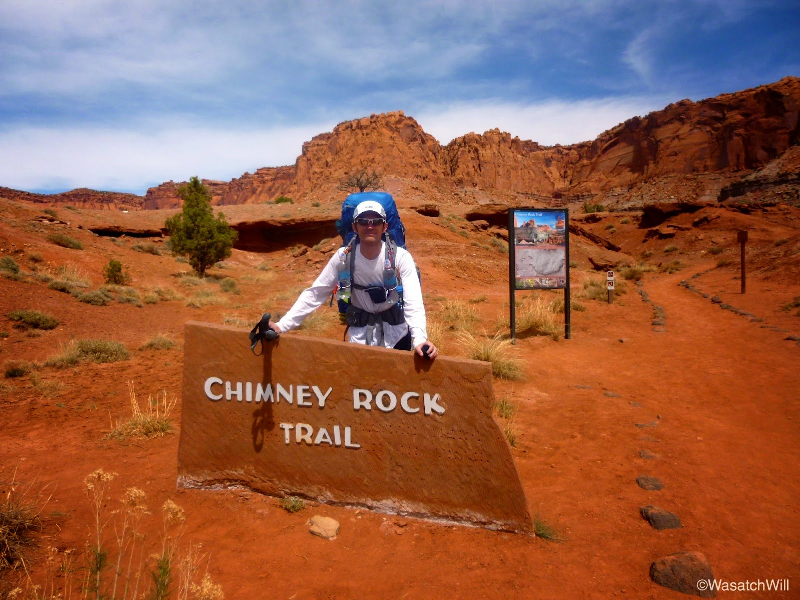
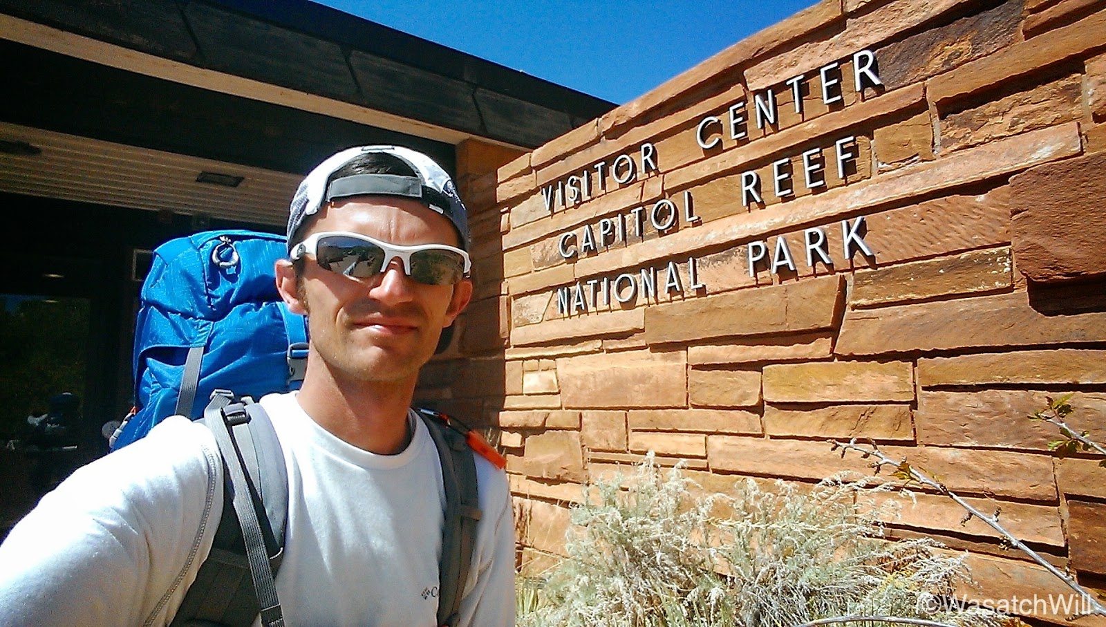
My journey started at the Chimney Rock Trailhead. In order to allow my wife to have the family car and to avoid occupying any space in the trailhead parking lot, which is often filled beyond capacity, I had my wife drop me off with plans for her and her dad to shuttle it back down to the trailhead for me to pick up on the final day.
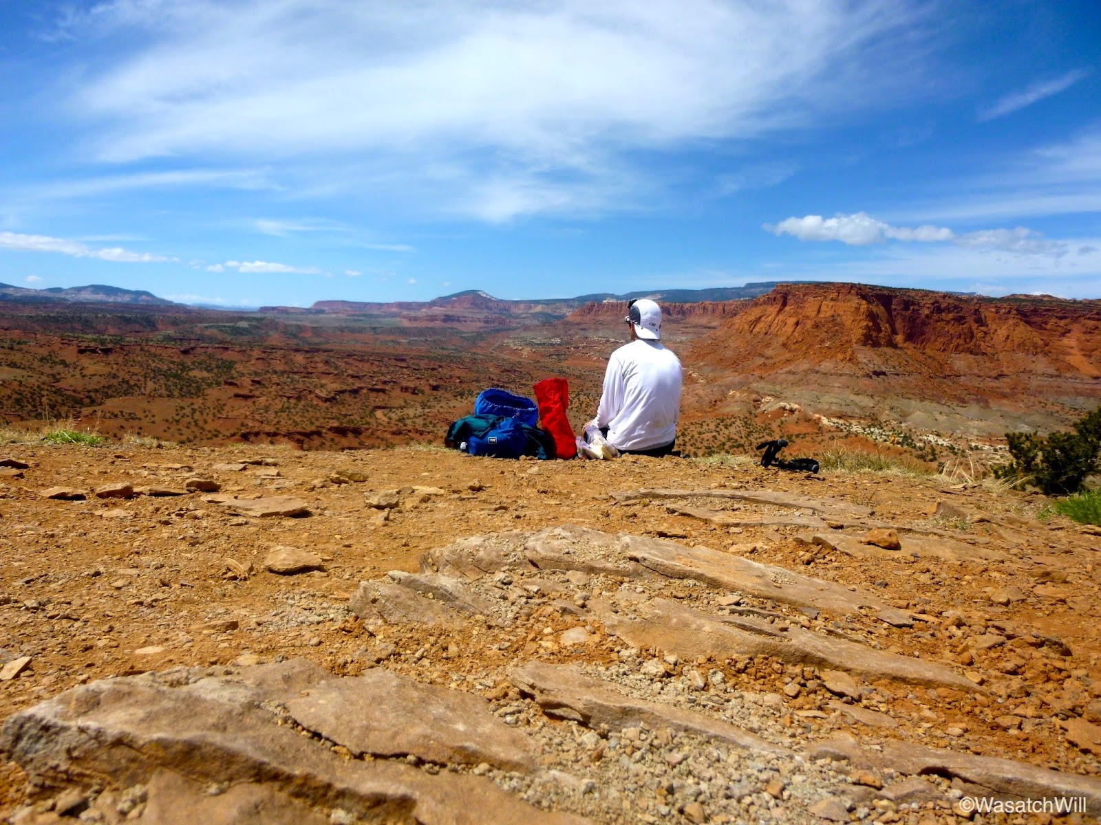
Since I would be away from my family for a couple days, I wanted to spend the morning with them by taking them to the city park in Torrey and getting some playtime in with them. This meant a late start on the trail, but luckily I had actually planned a short mileage day for the first day, allowing me ample time to get all my miles done in the afternoon.
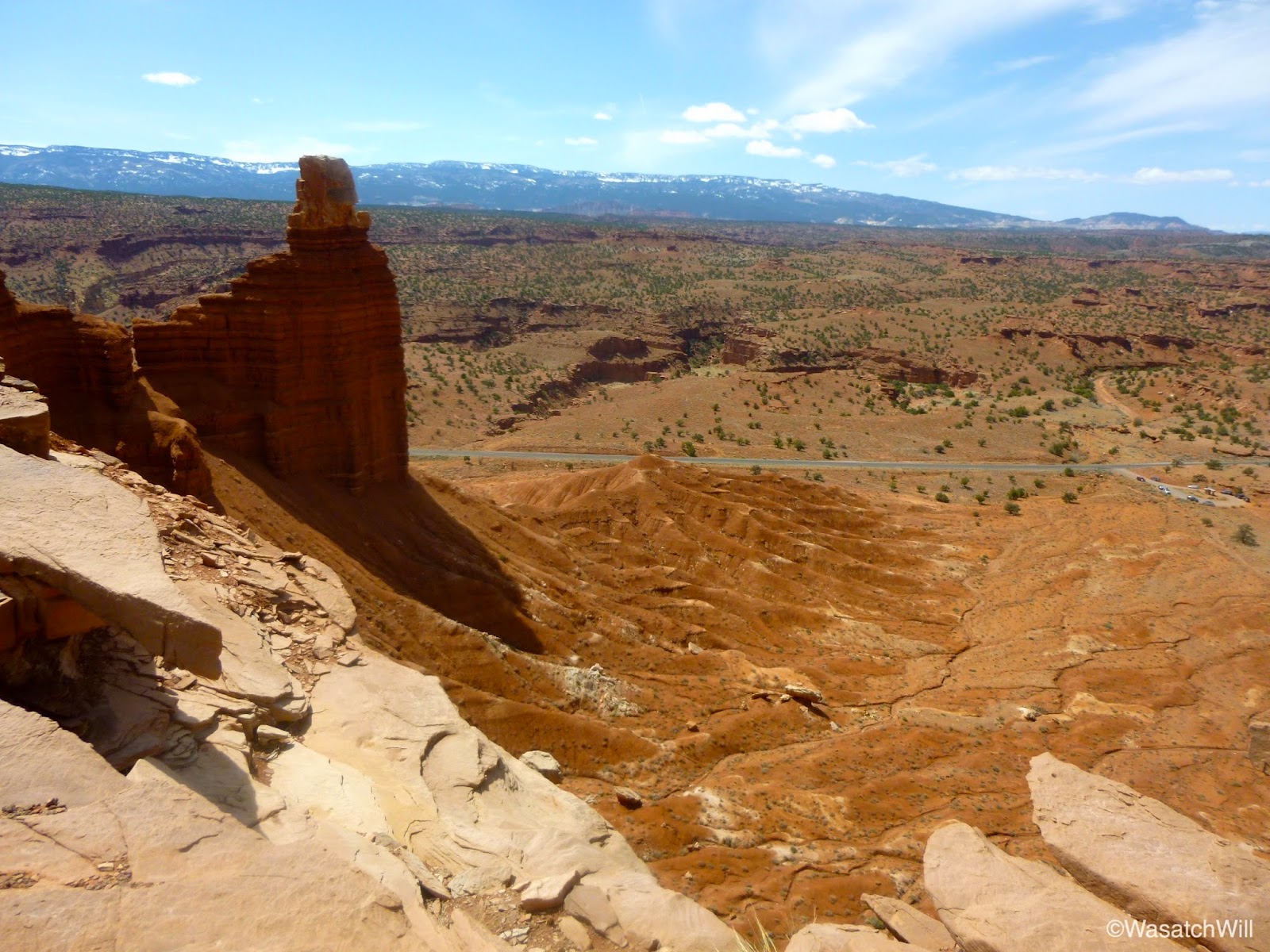
I had originally planned to hike directly up into Chimney Canyon but upon reaching the fork with the little loop trail that ventures out to an overlook of Chimney Rock and around Mummy Cliff, I decided it would be worth the extra mile to get the views. I paused for a brief lunch break at the Chimney Rock overlook spot.
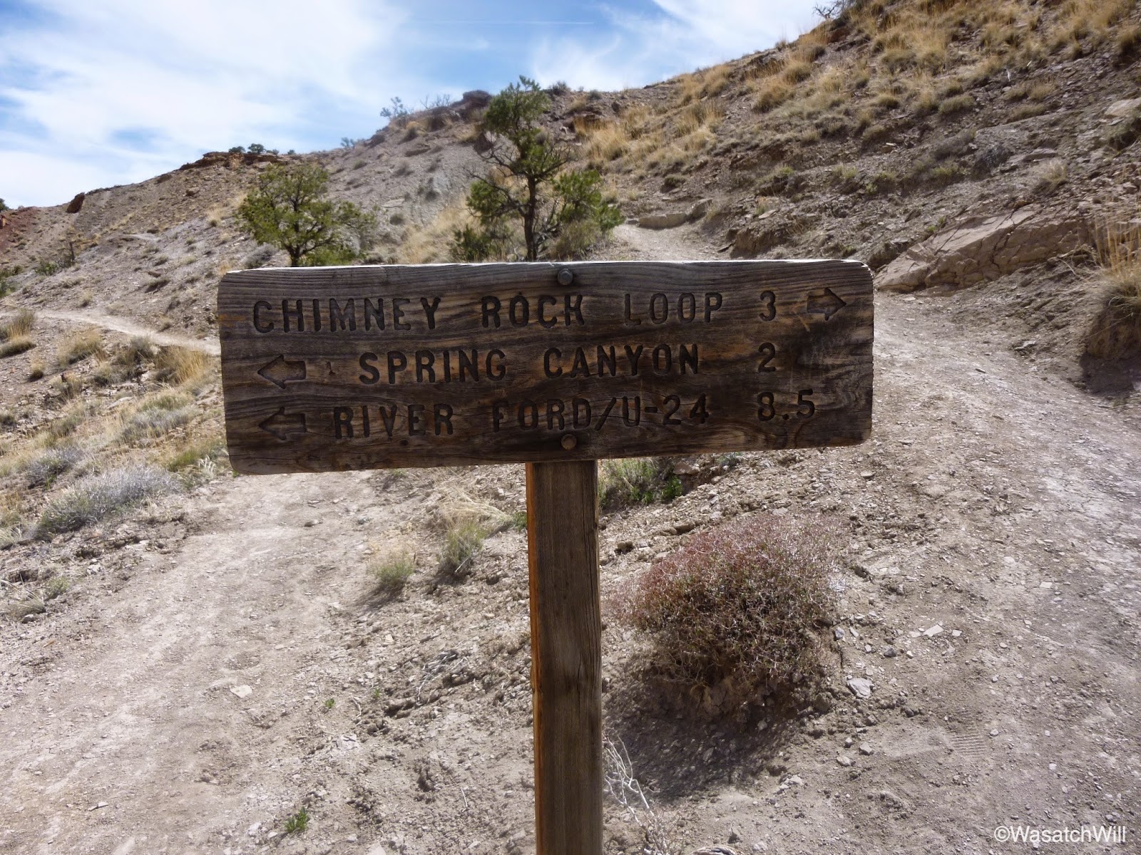
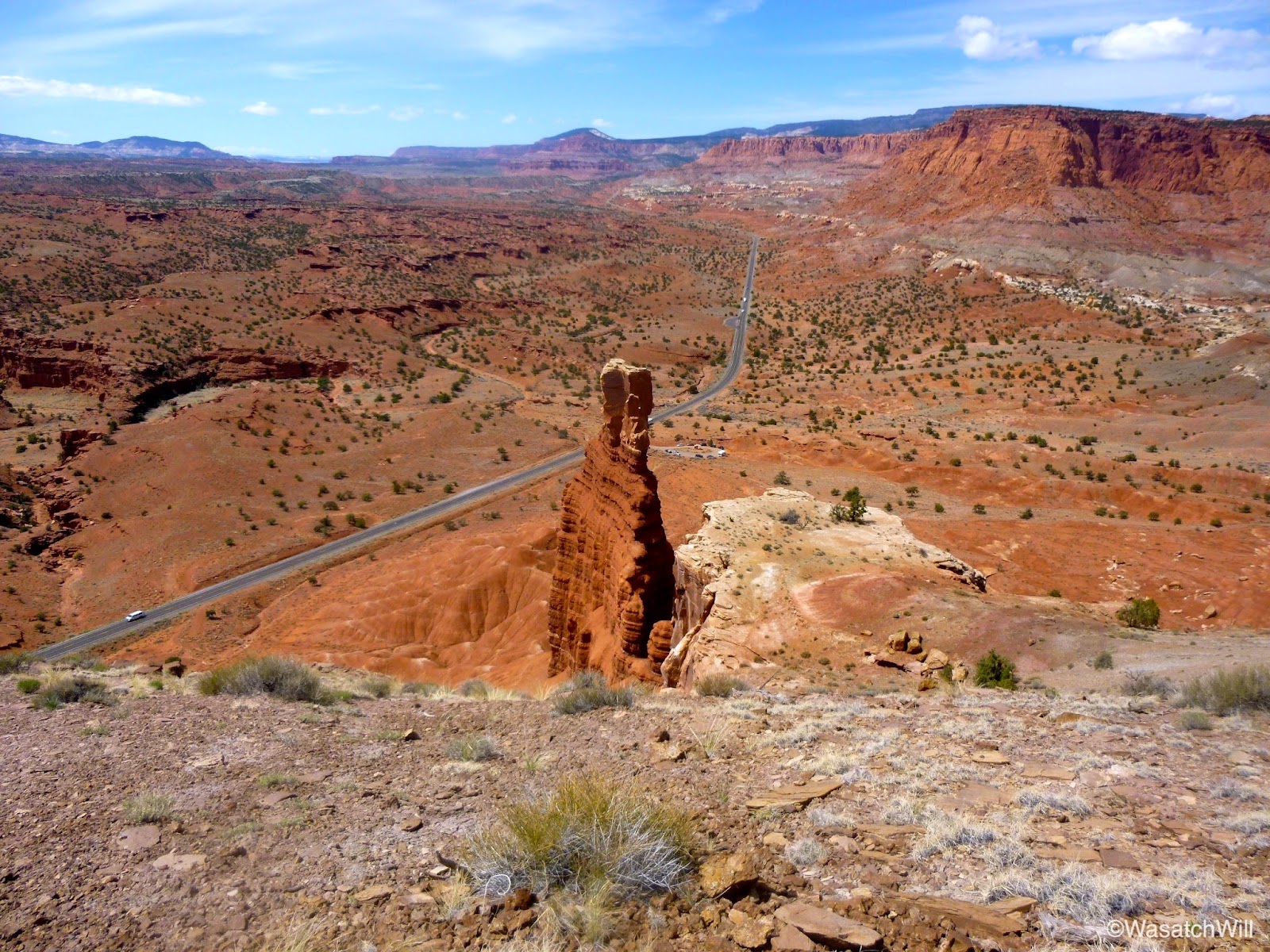
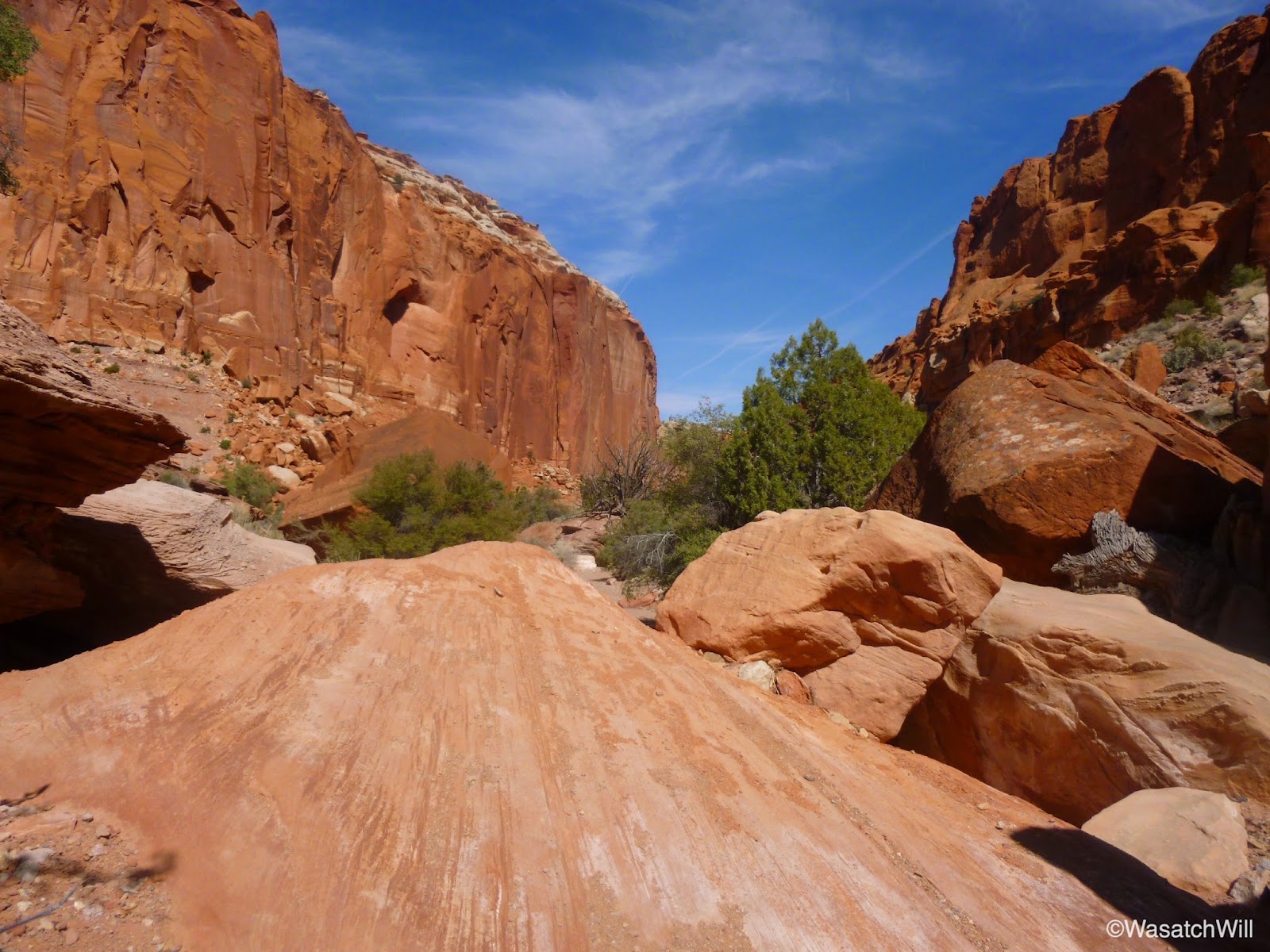
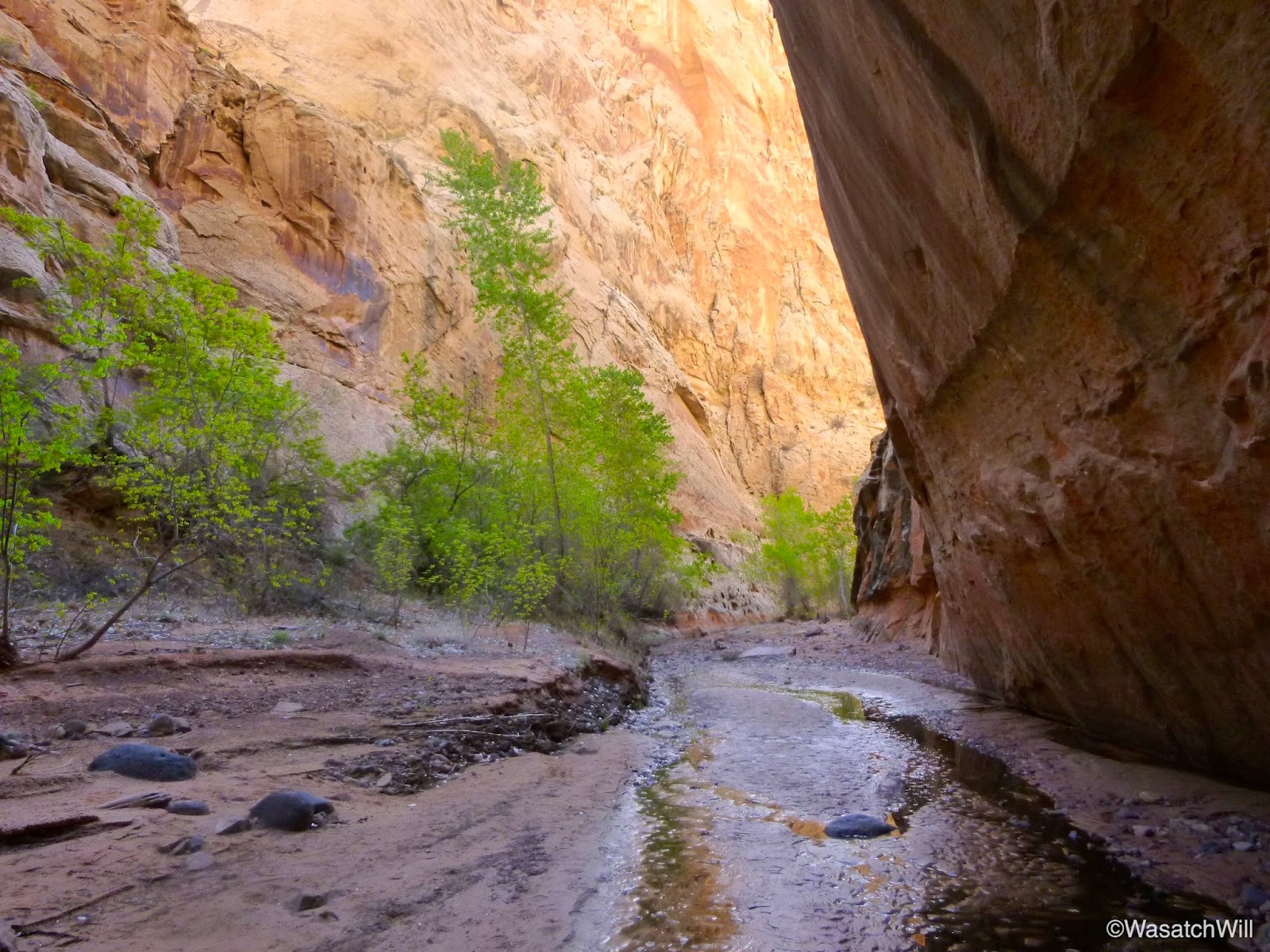
After lunch it was time to make my way down into Chimney Rock Canyon.
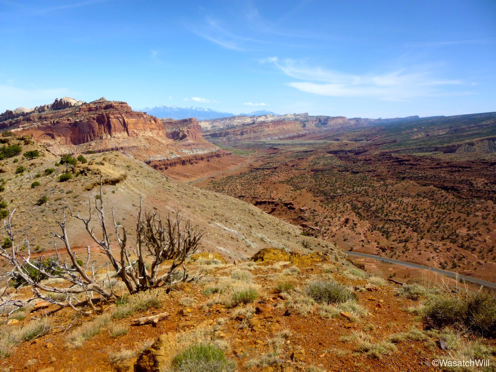

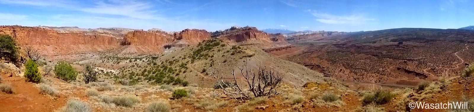
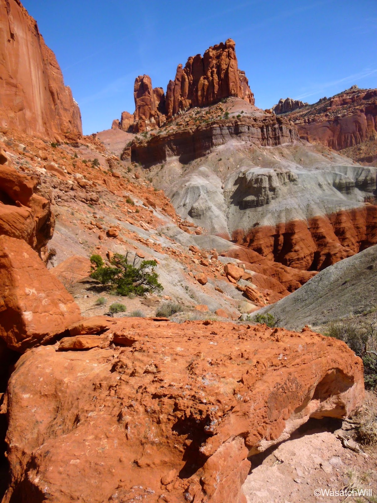
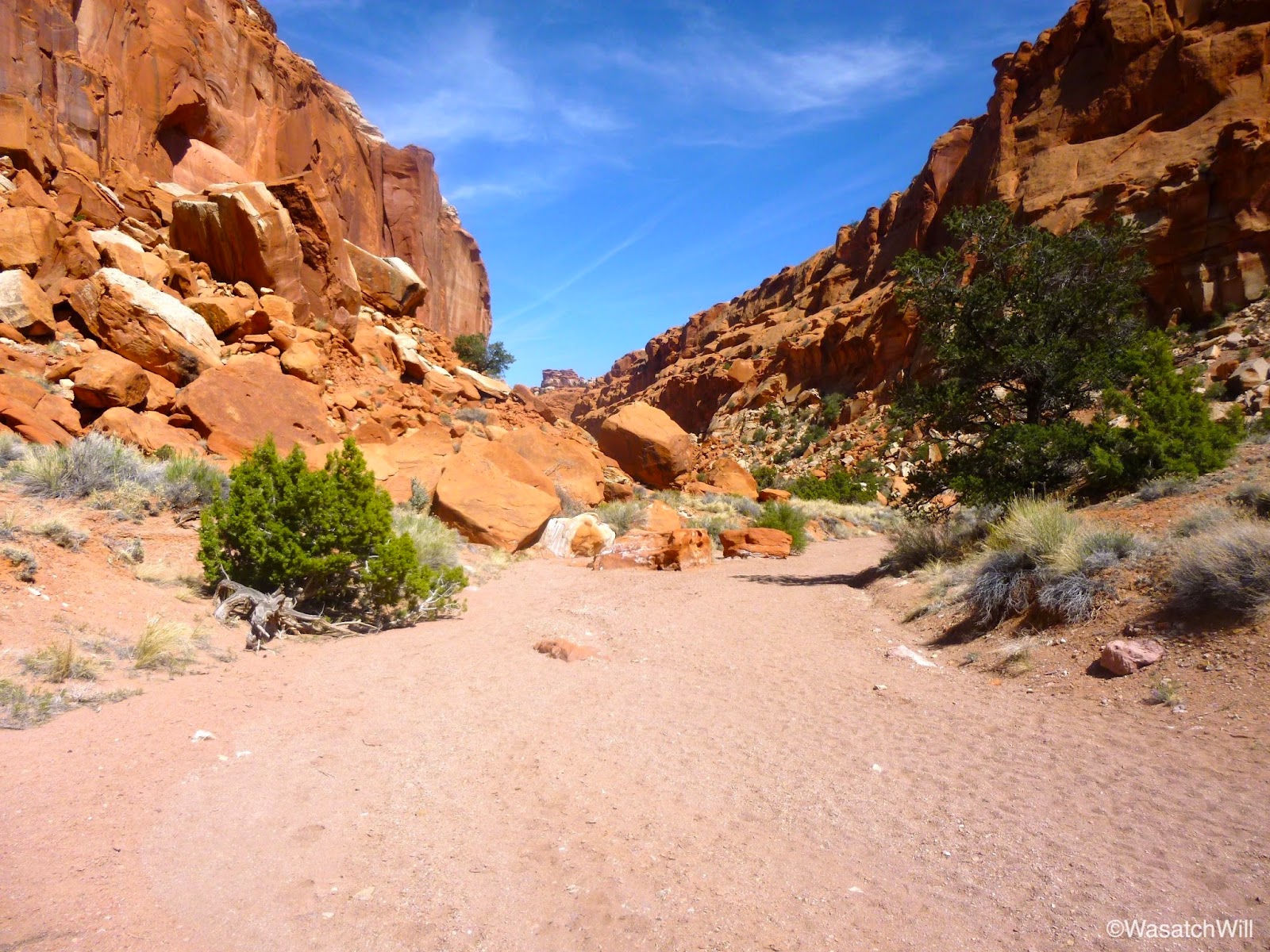
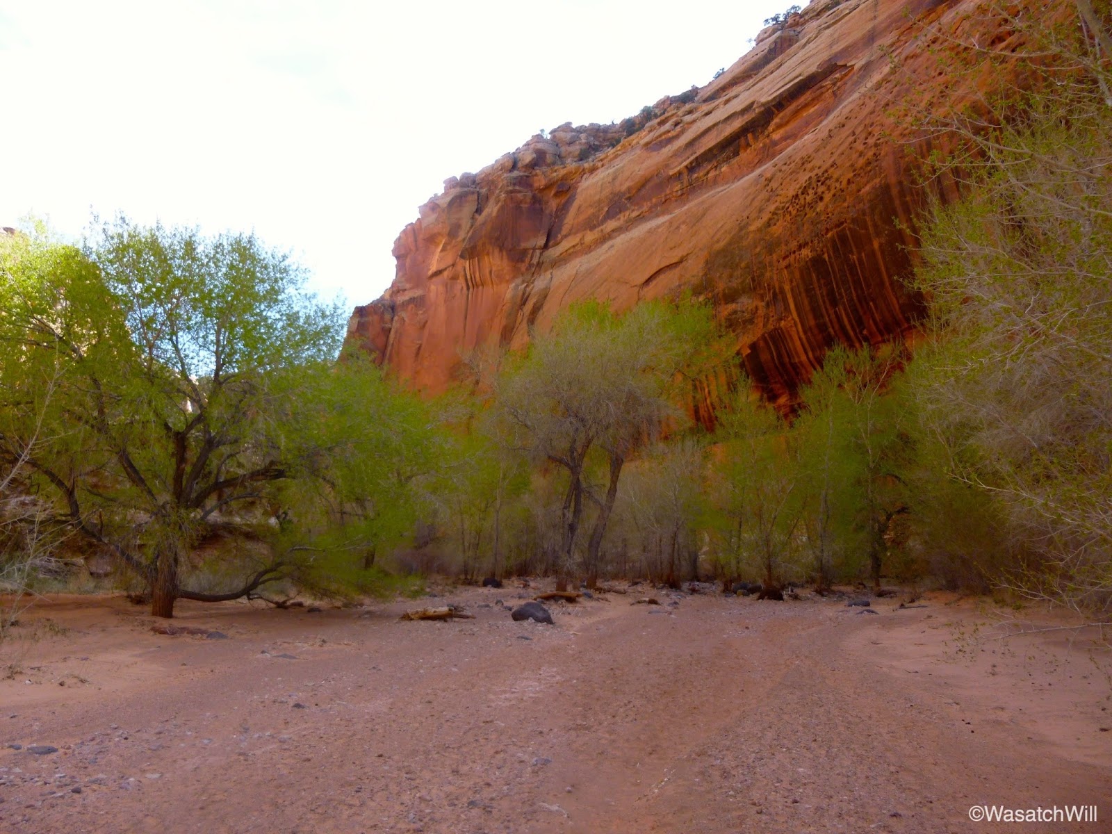
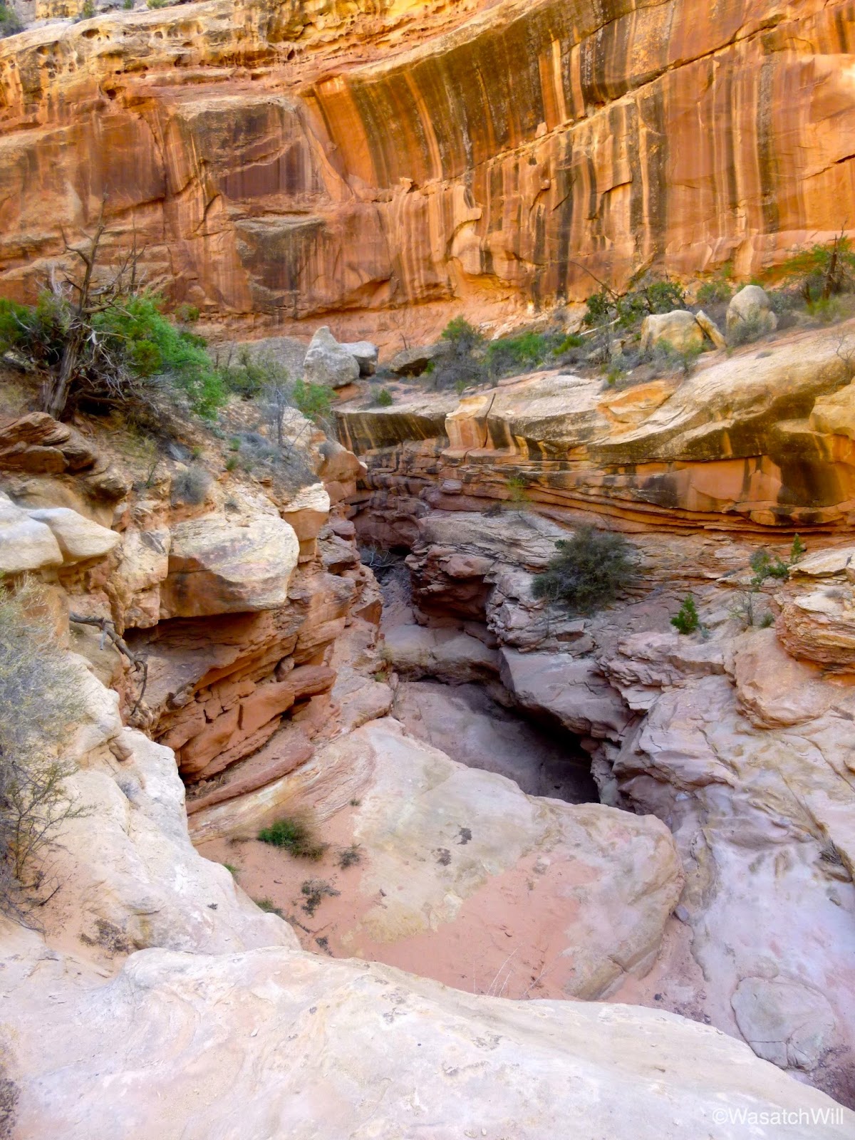
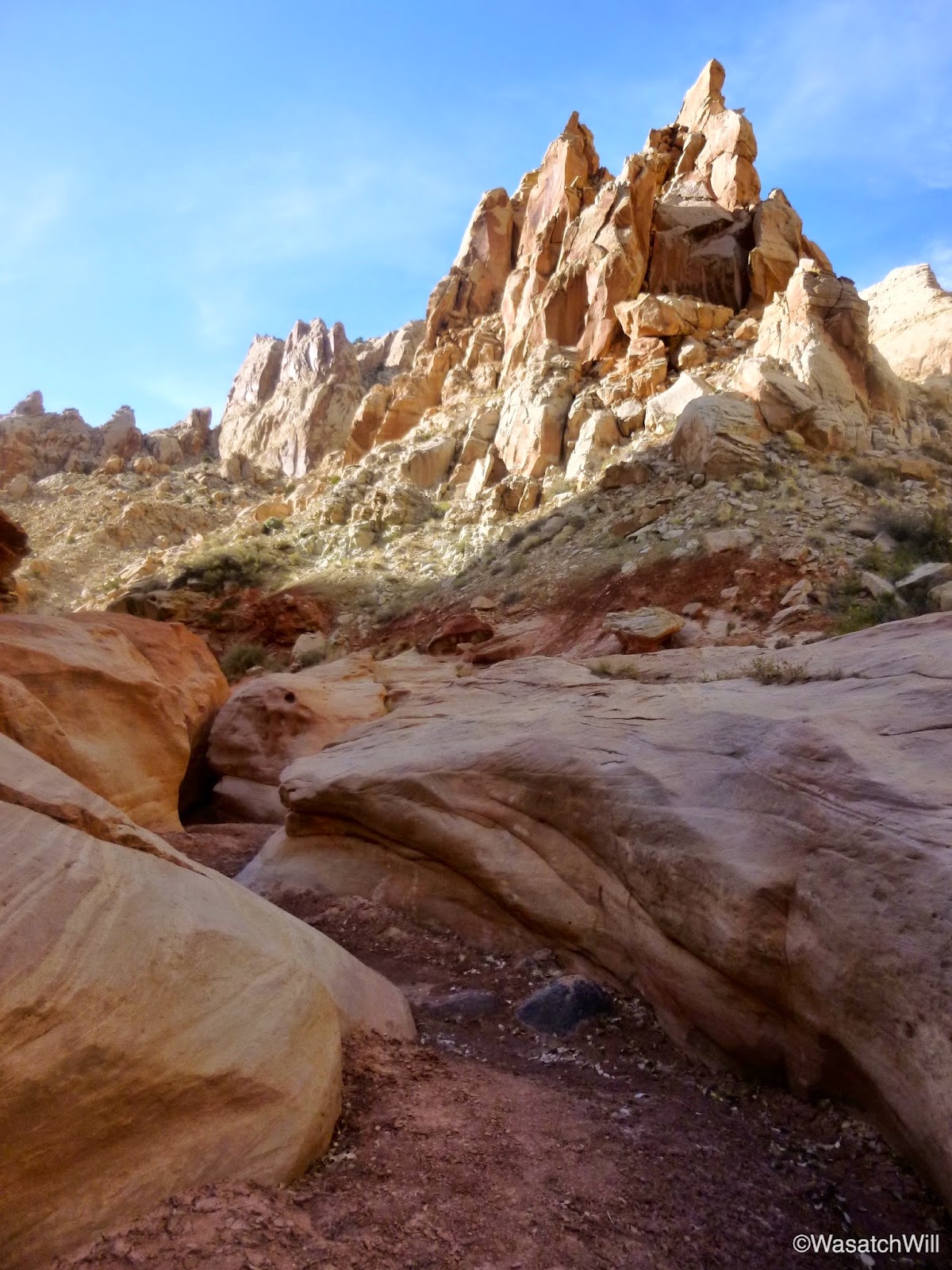
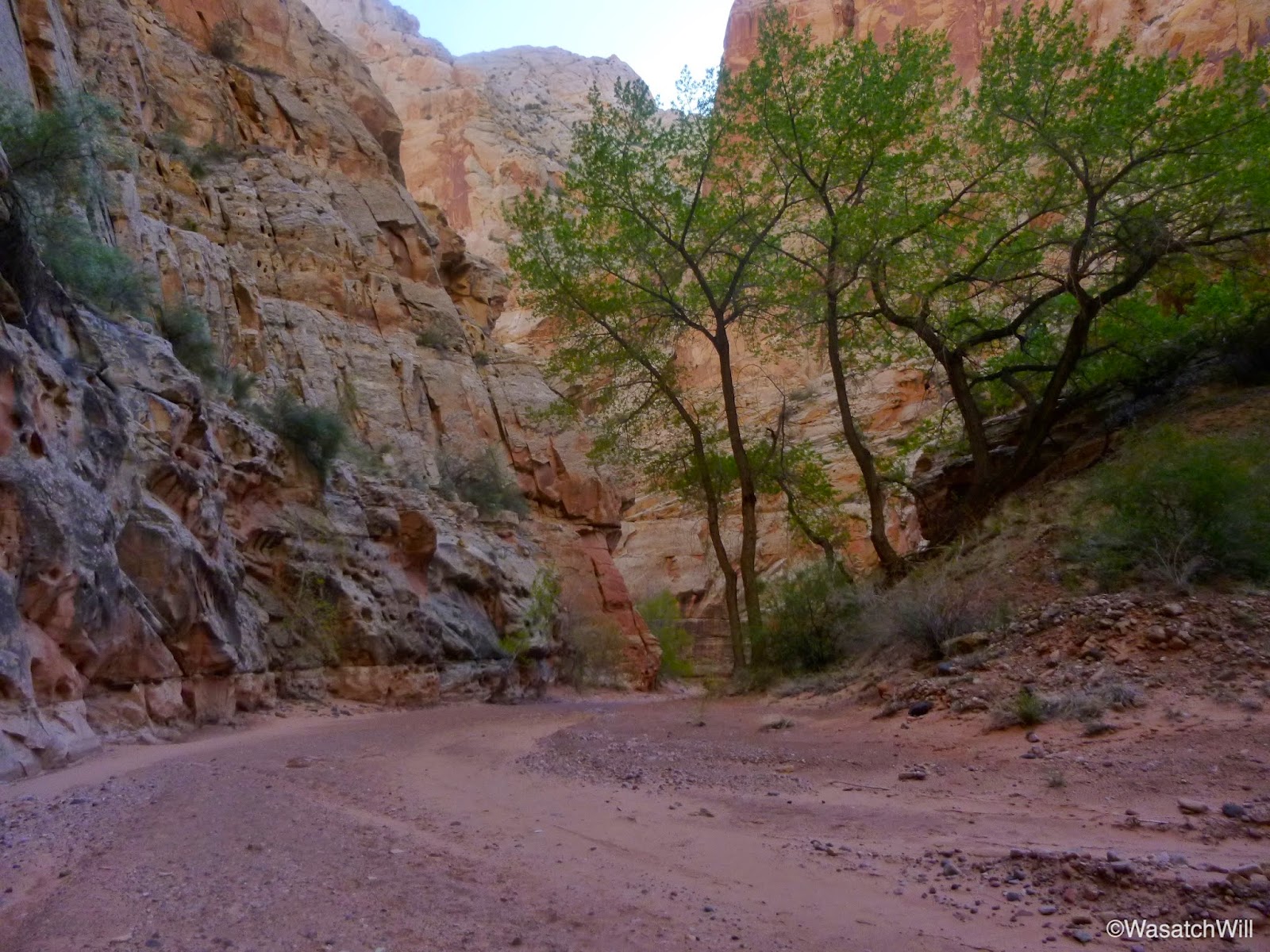
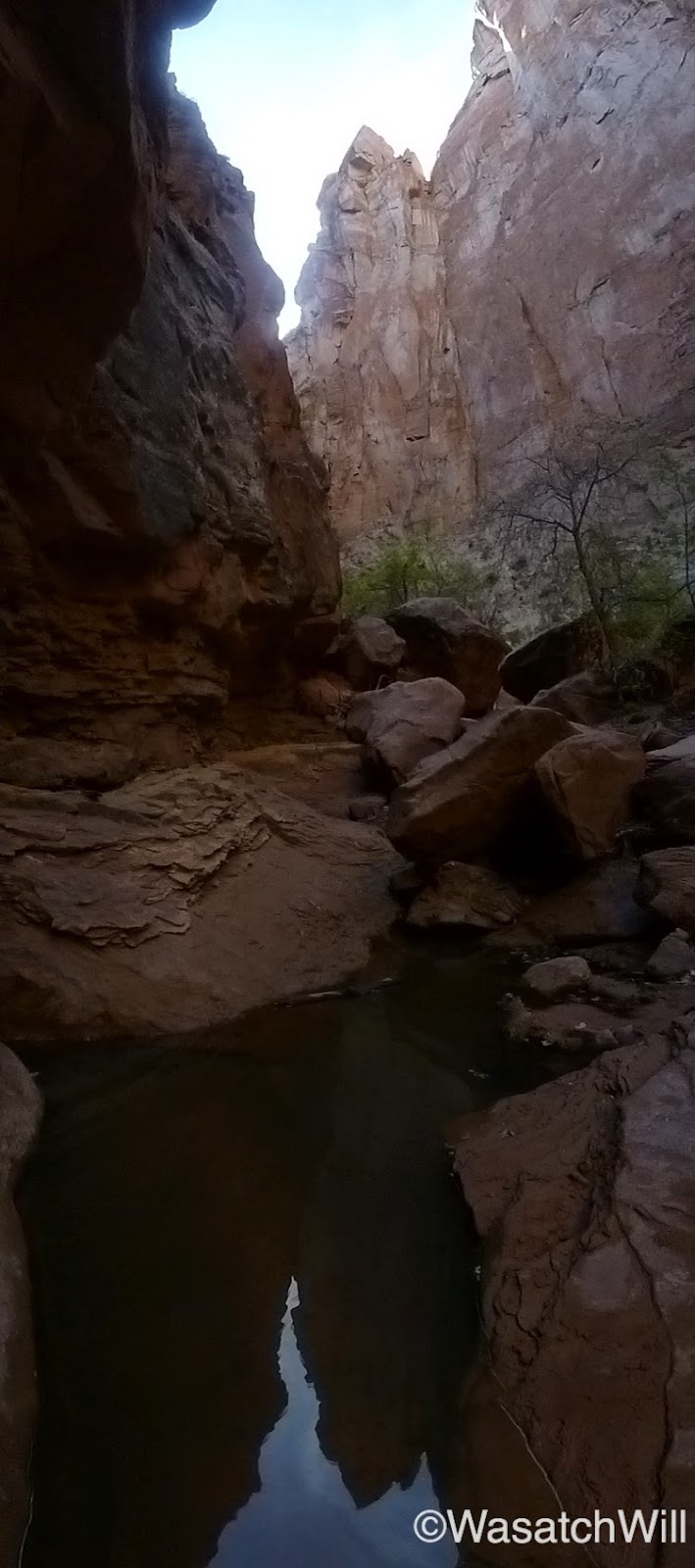
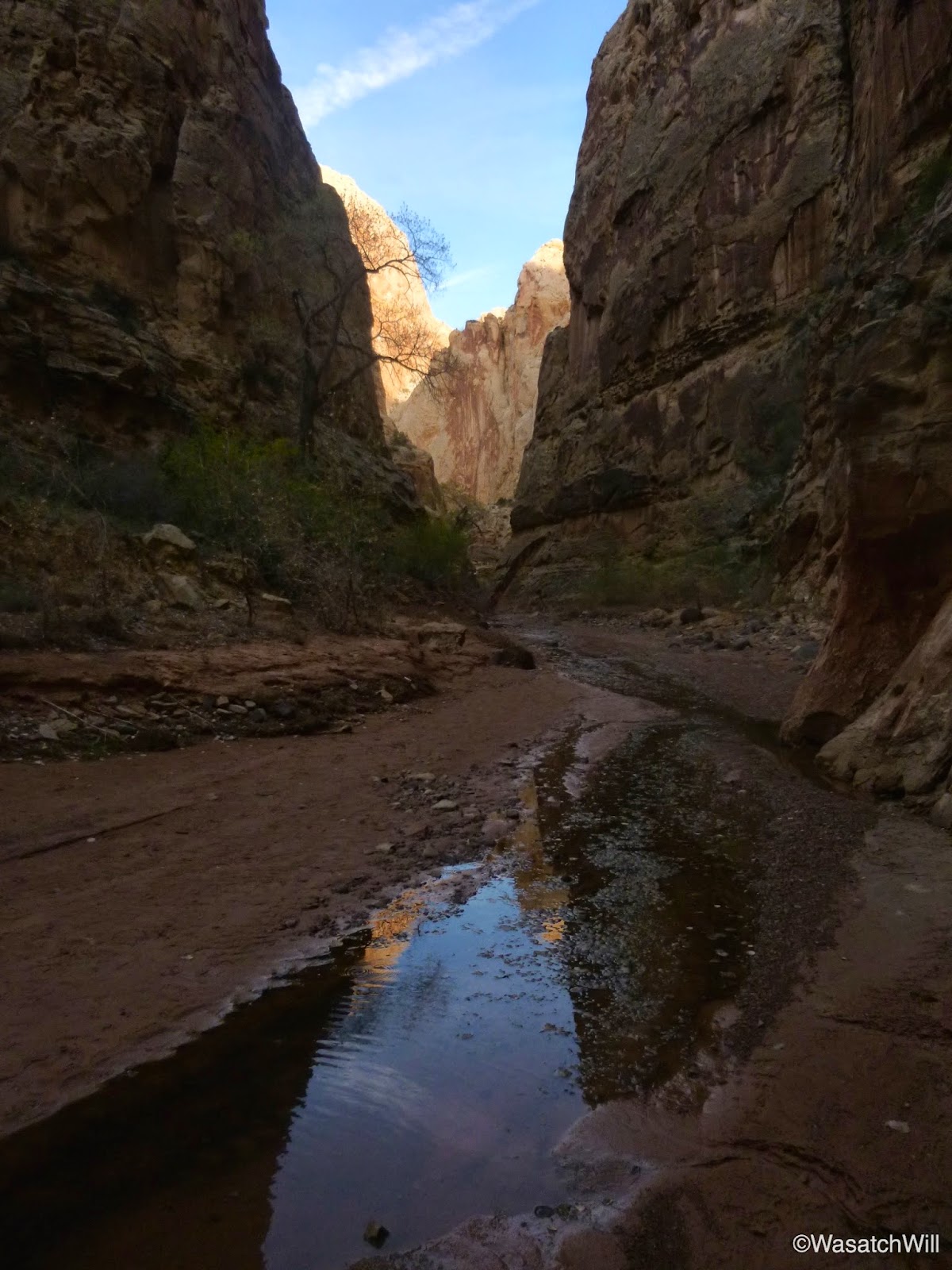
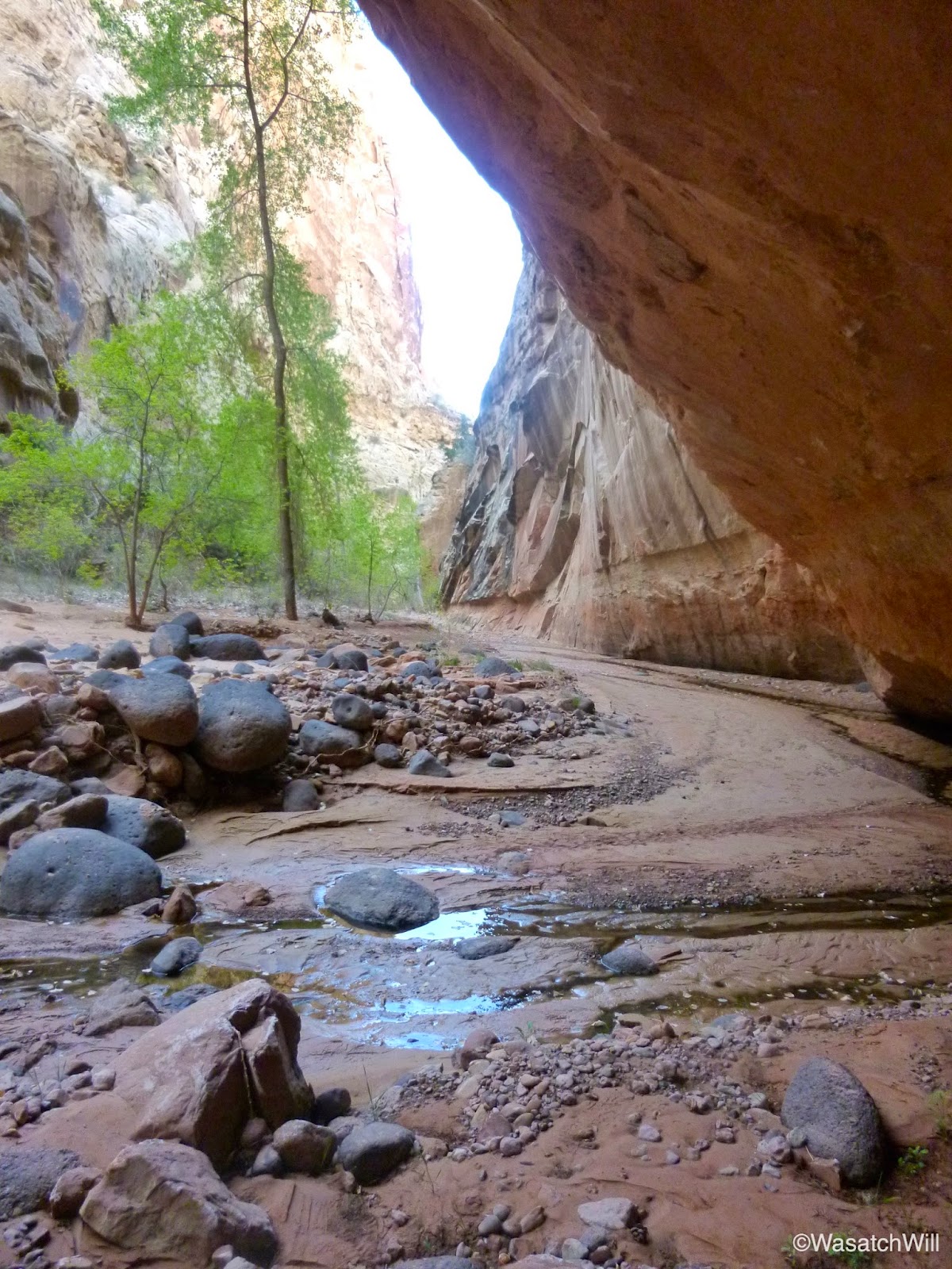
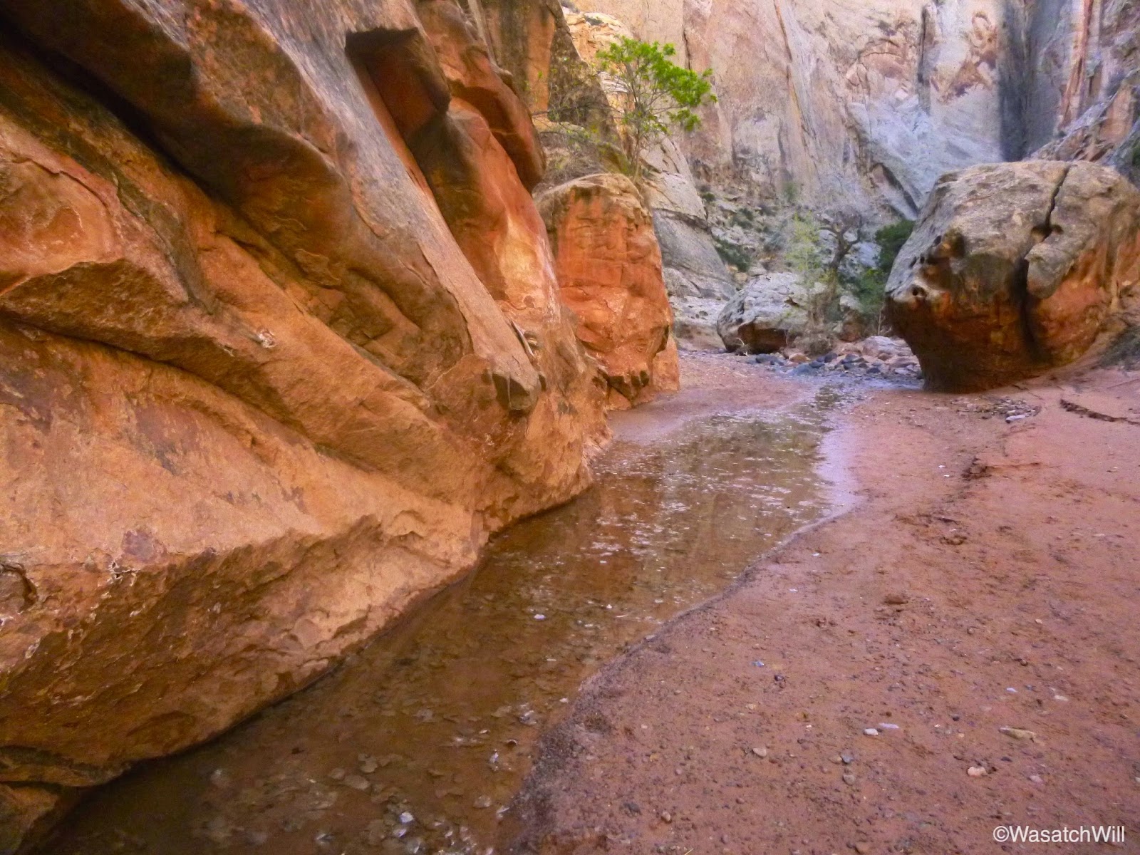
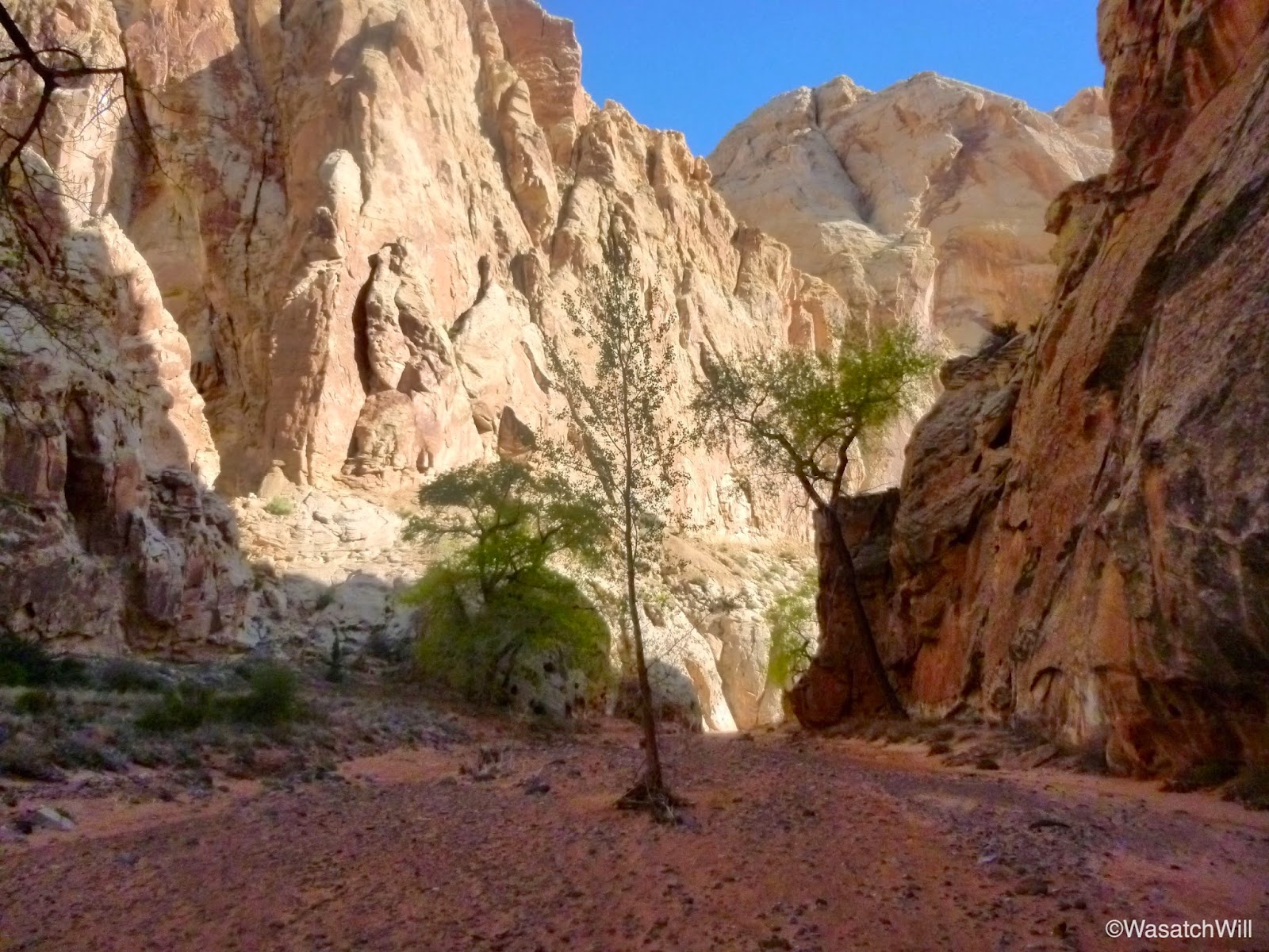
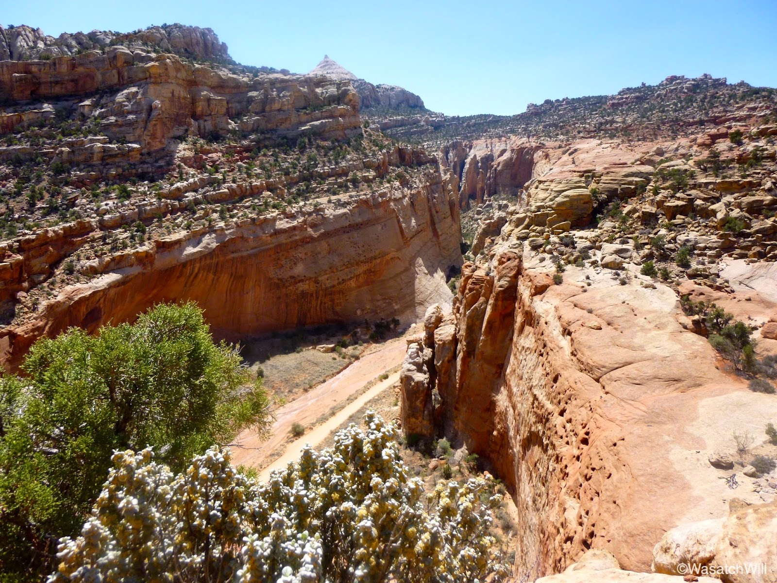
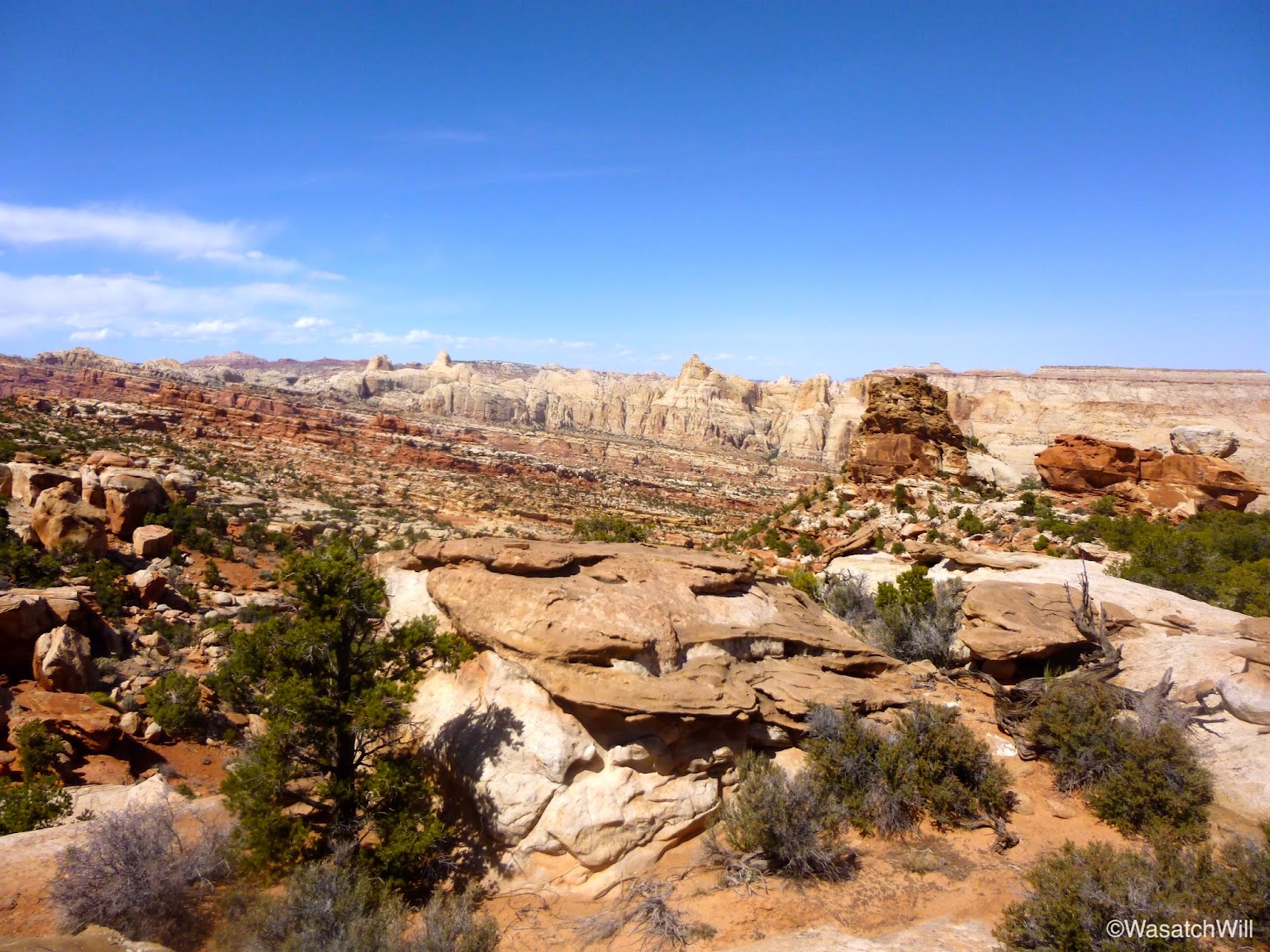
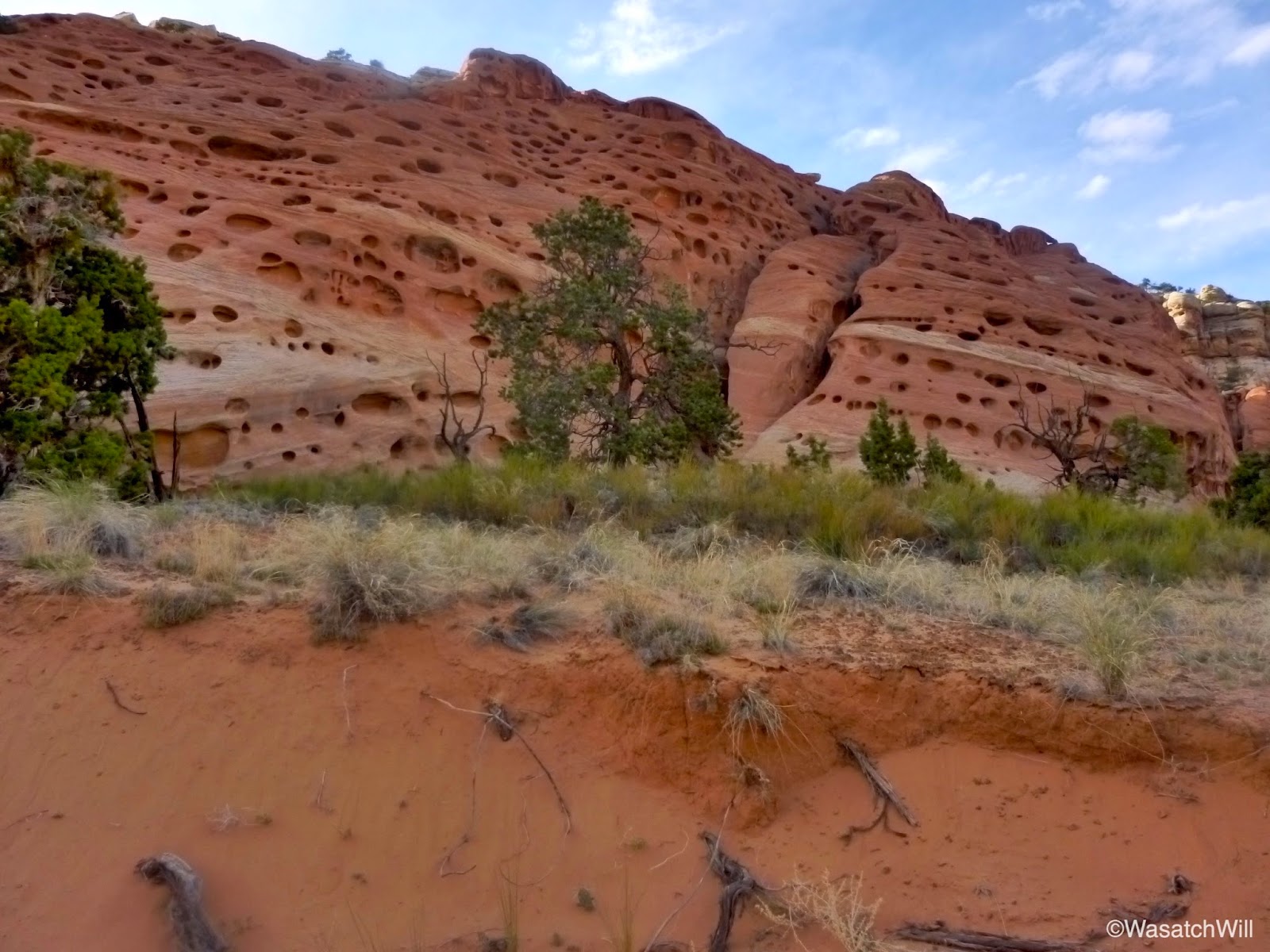
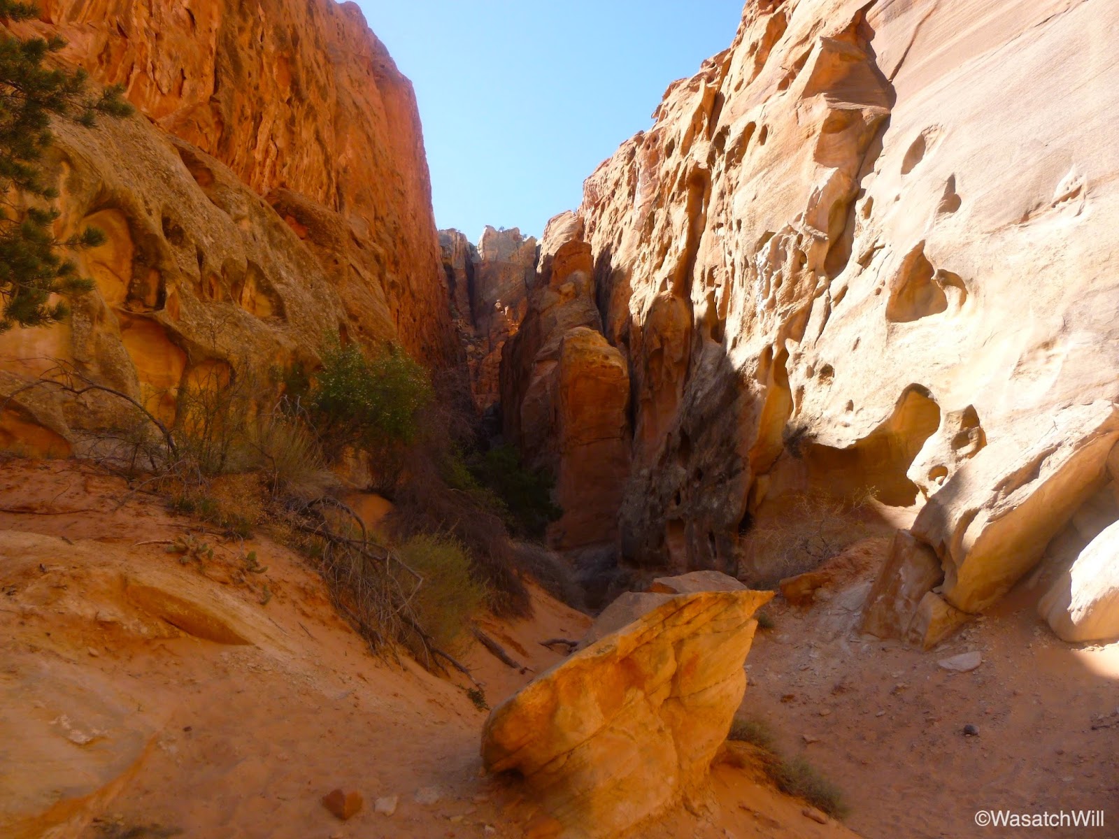
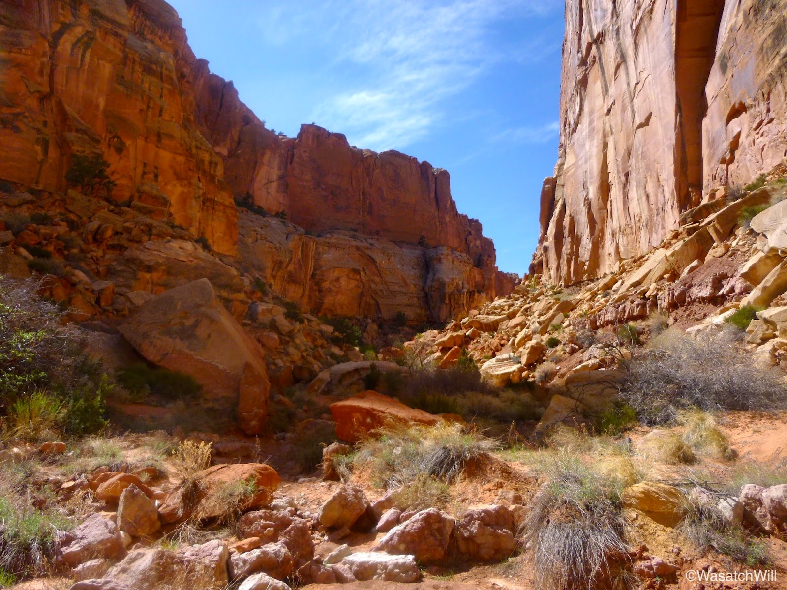
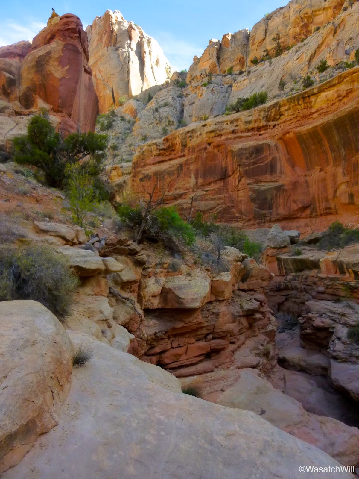
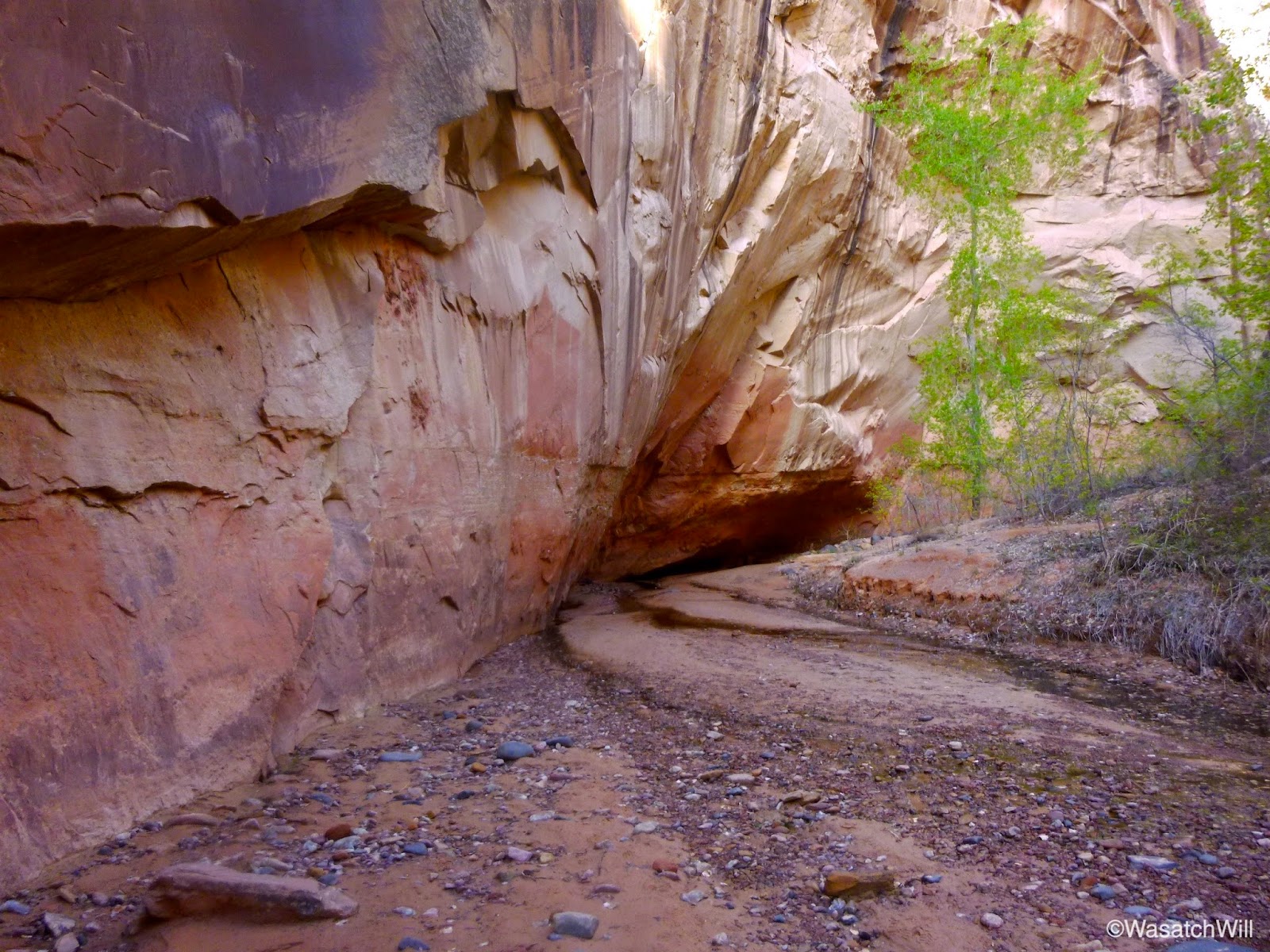
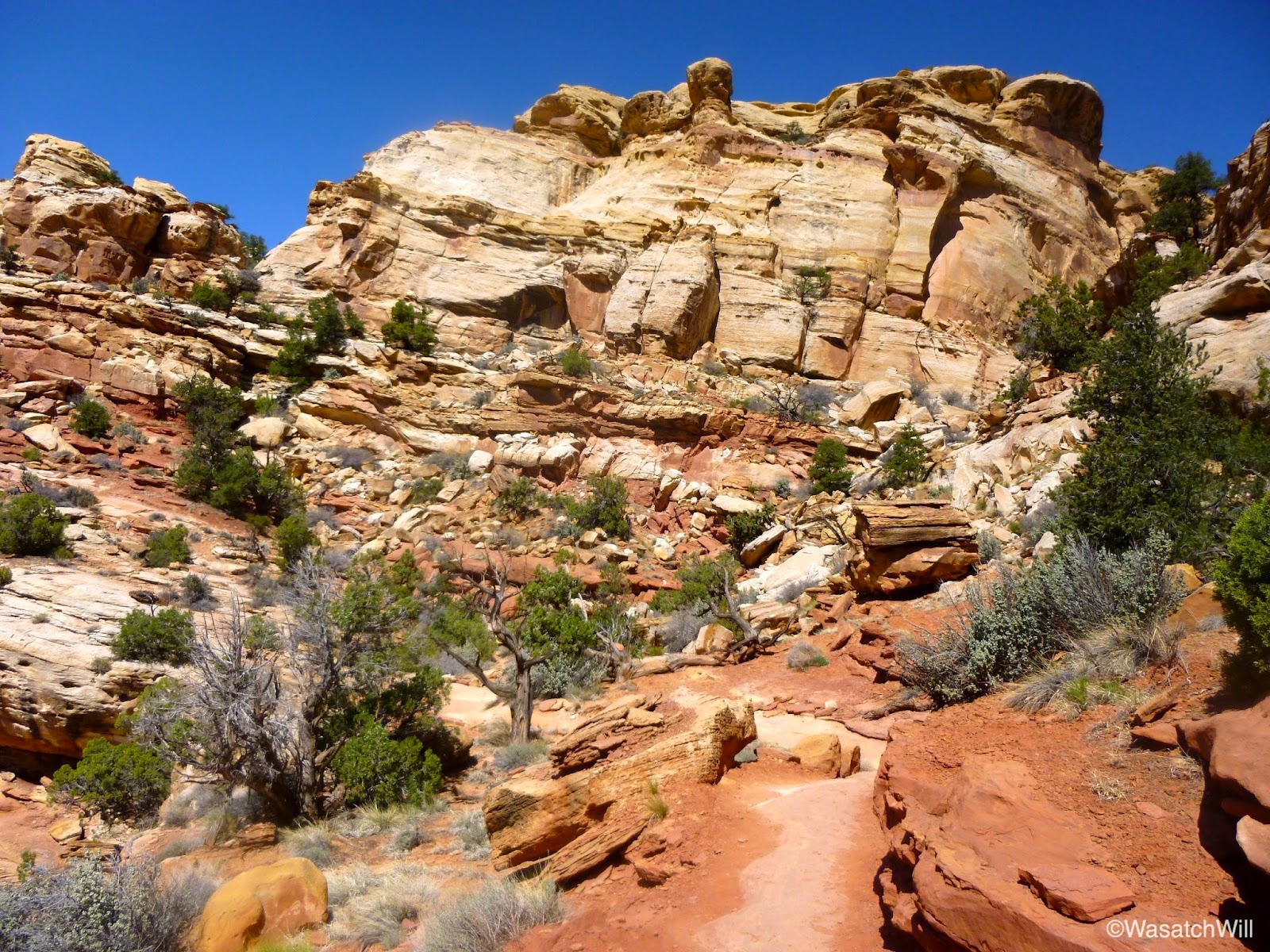
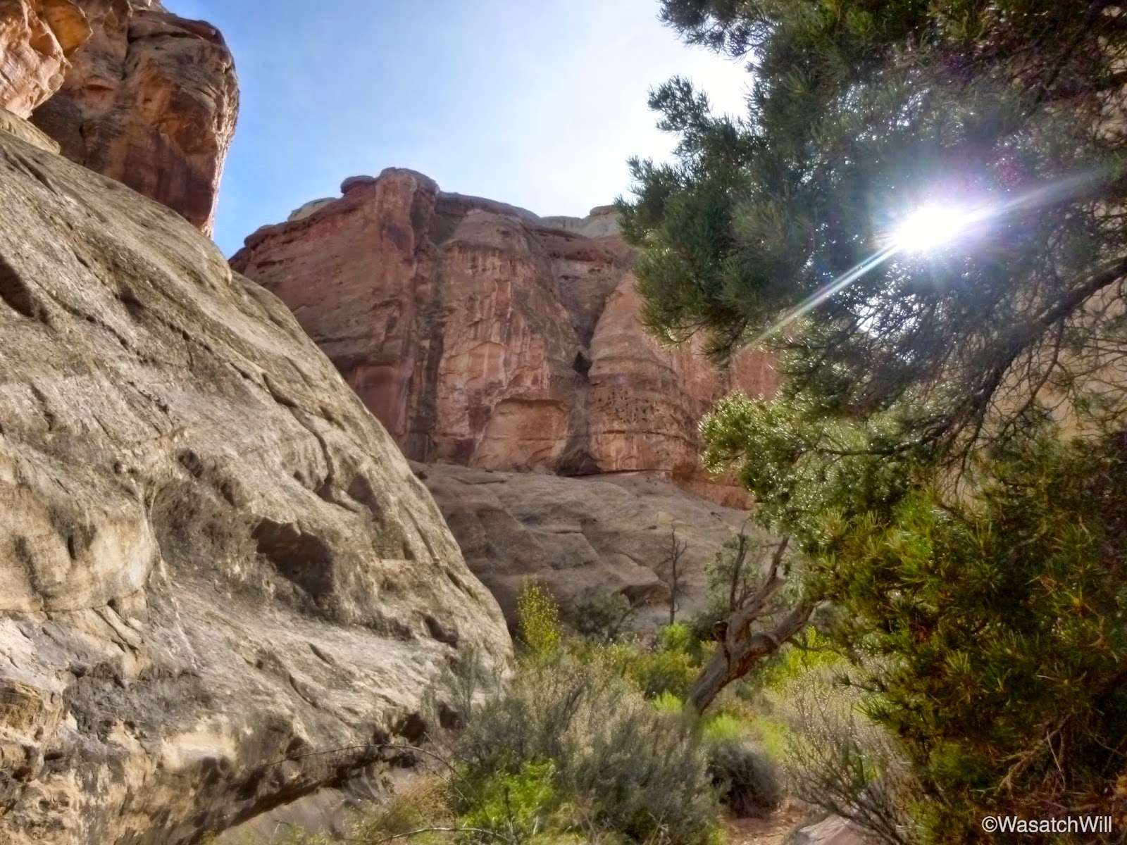
Once into Chimney Canyon, I was greeted with the usual magnificent red sandstone cliffs and formations on either side for which Southern Utah landscapes are so famous for.


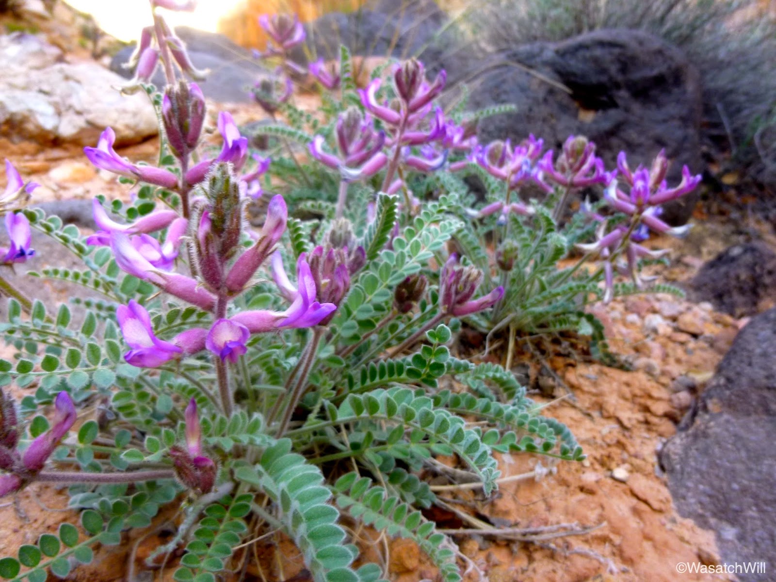
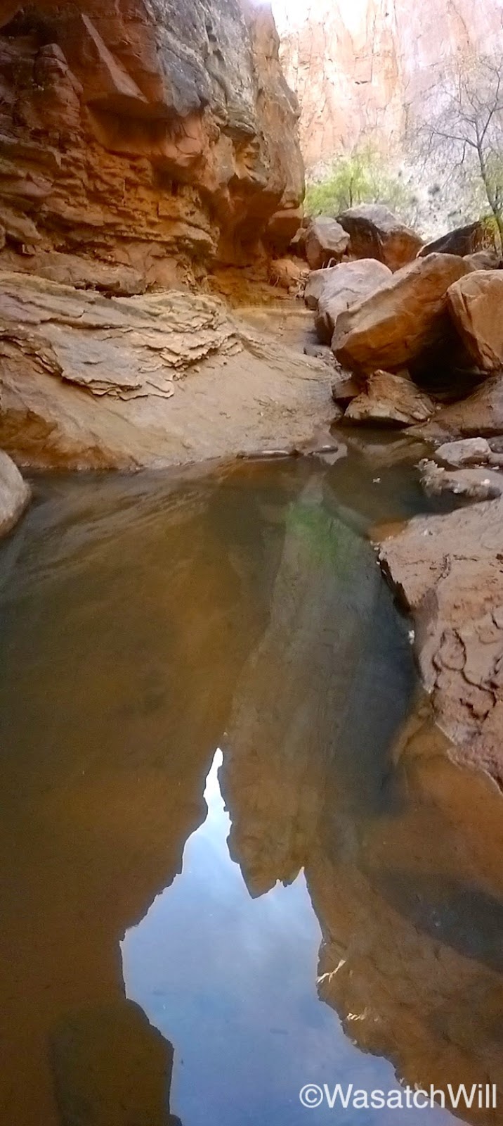
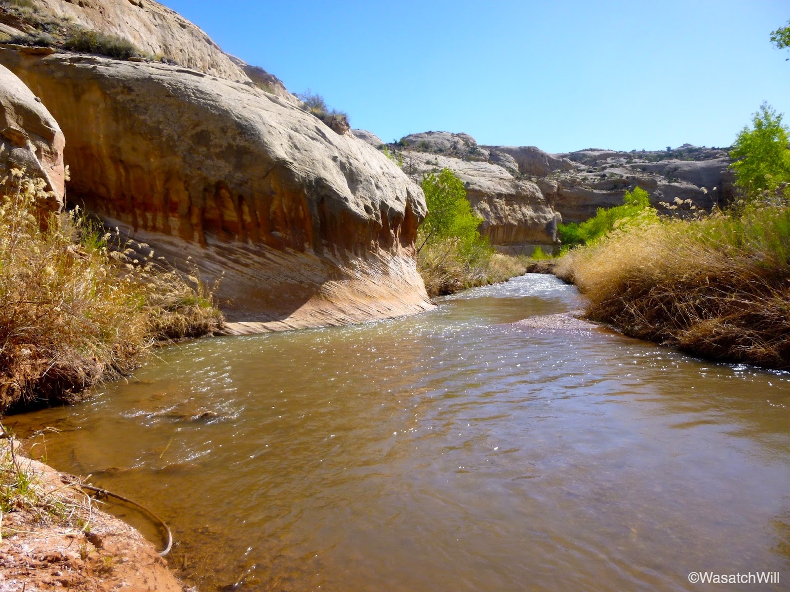
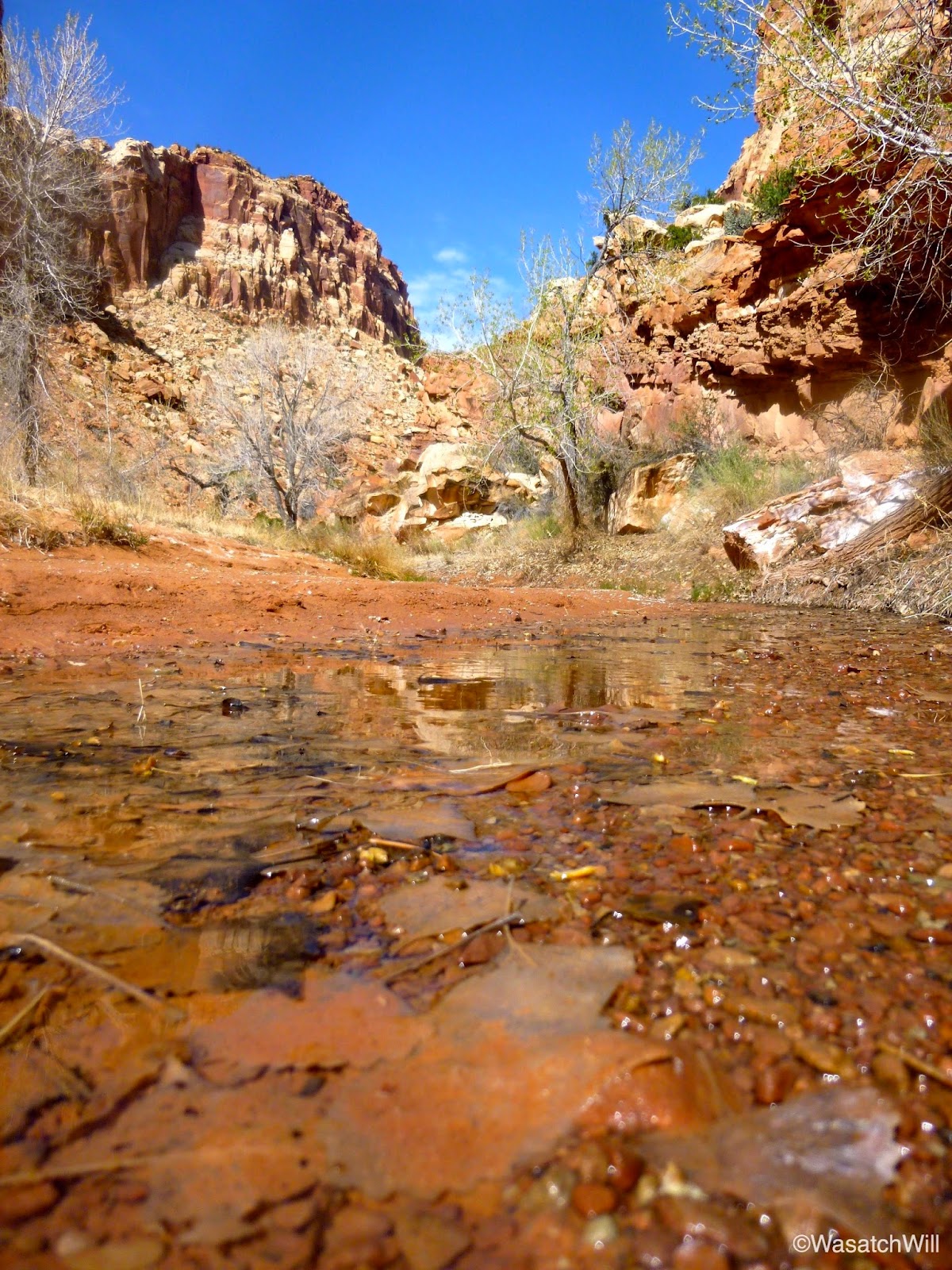
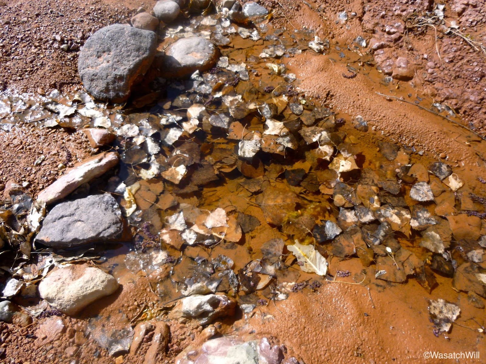
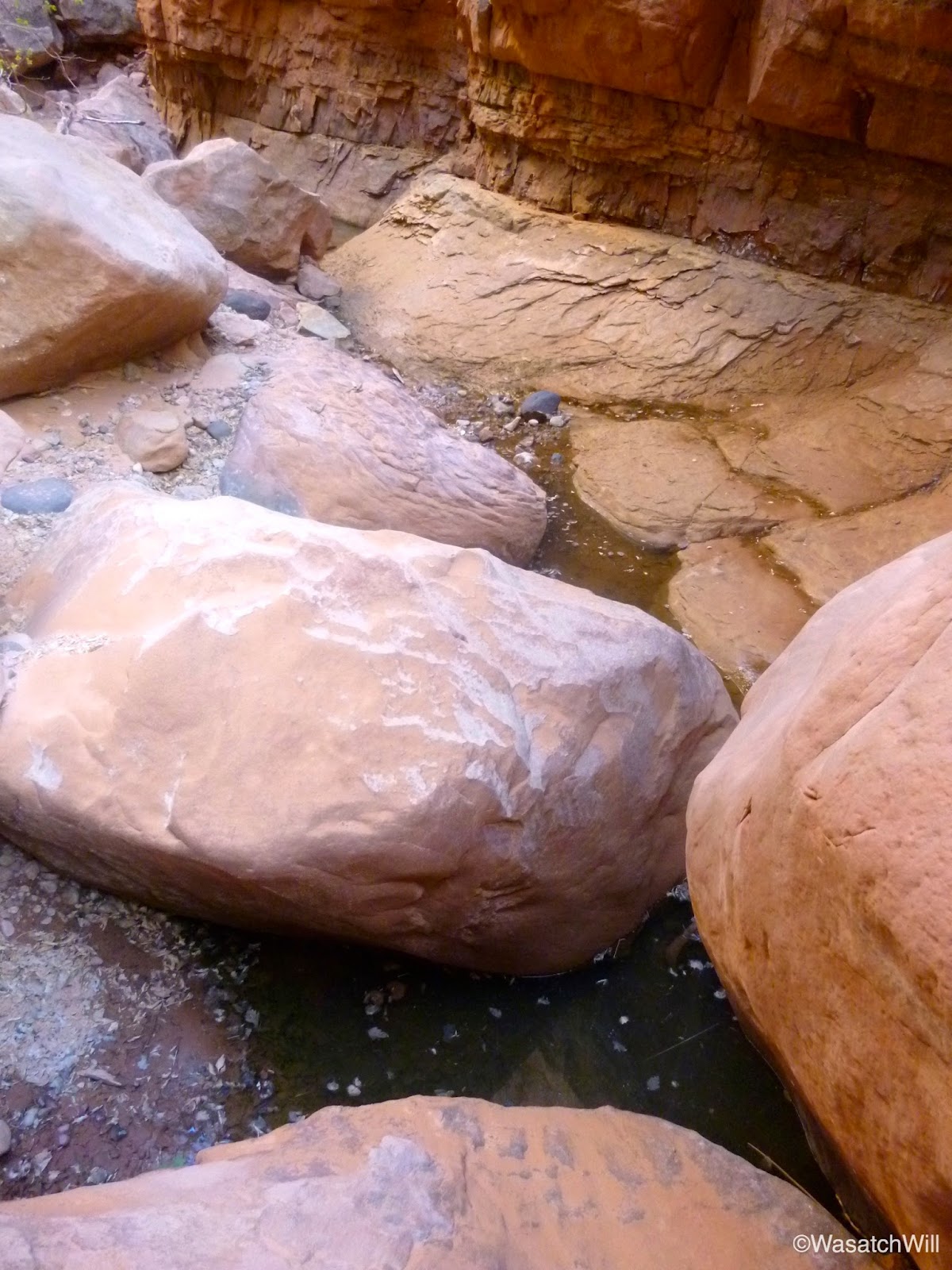
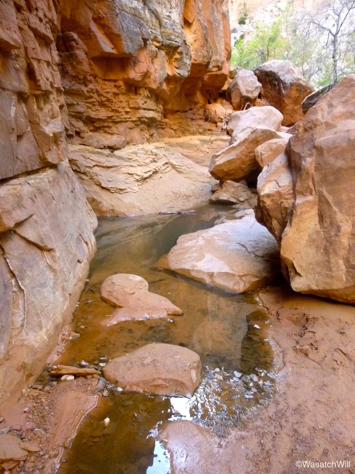
After a good couple of miles, I reached the junction with upper and lower Spring Canyon. With lots of daylight left, I opted to drop my pack and take my one empty water bottle along with my filter up the mile or so to the spring in upper Spring Canyon that gives the canyon its namesake.


The spot where the spring emerges was filled with debris. I was glad I brought my filter up with me.


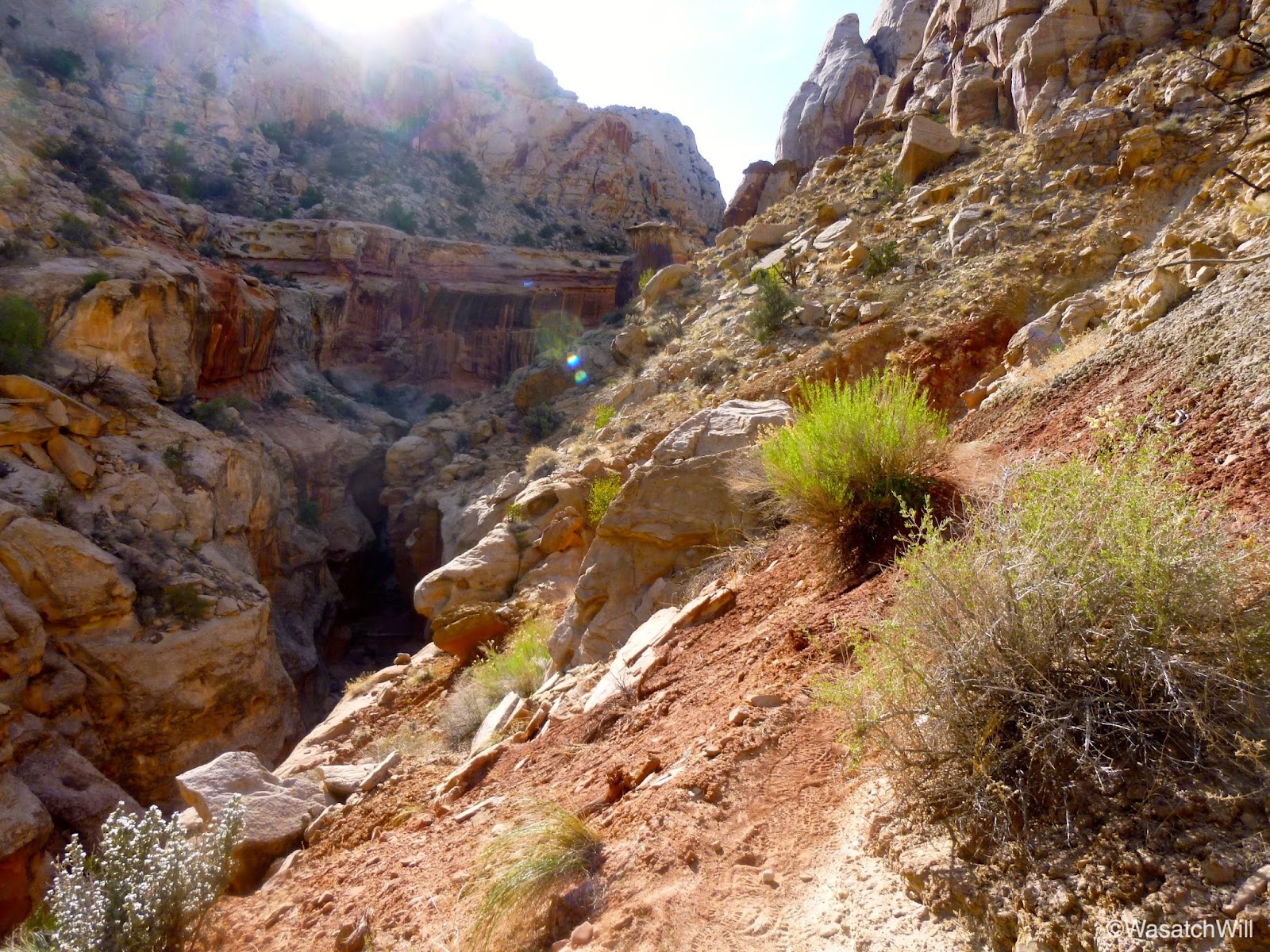
Heading back down upper Spring Canyon to the junction.

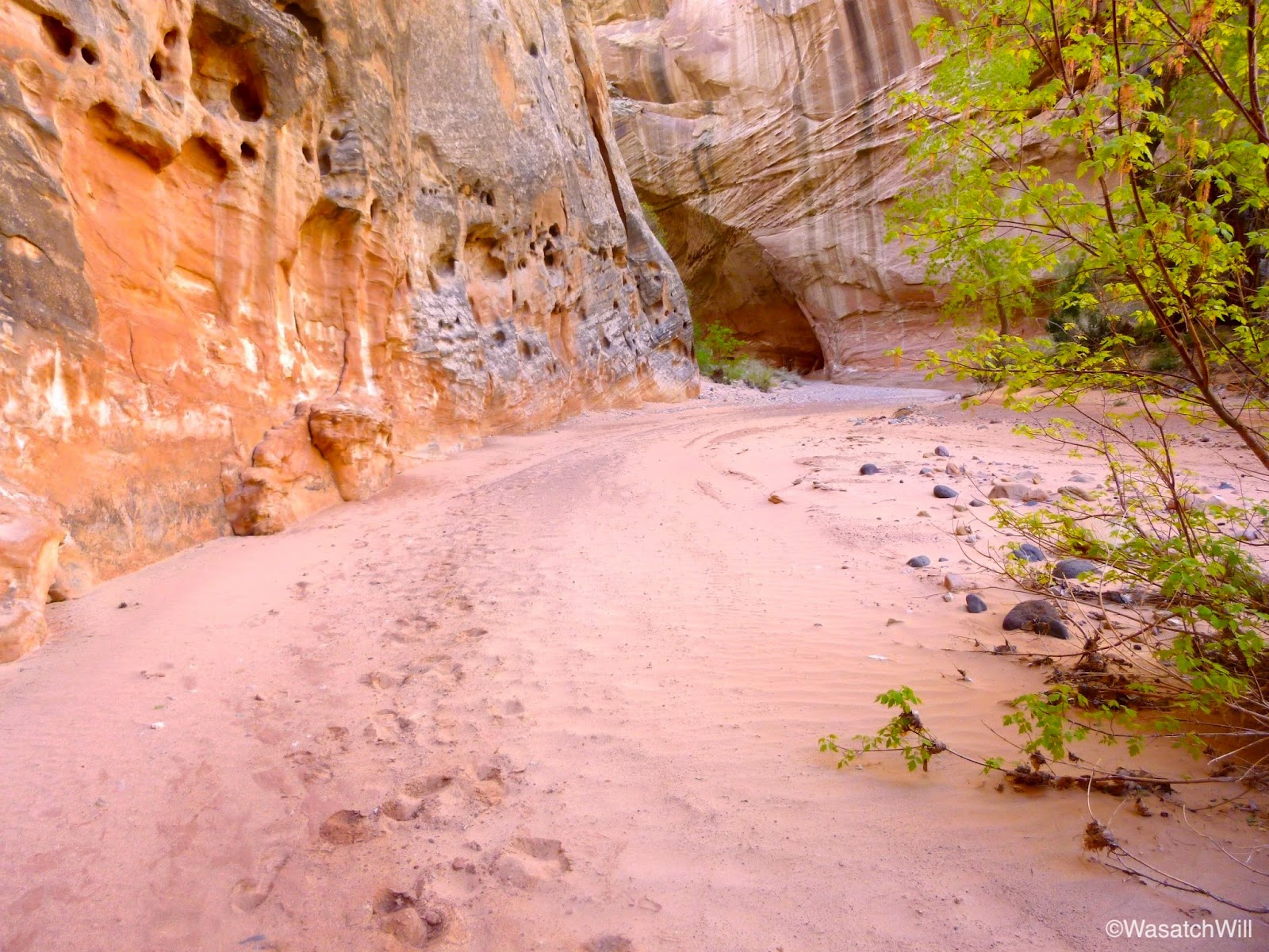
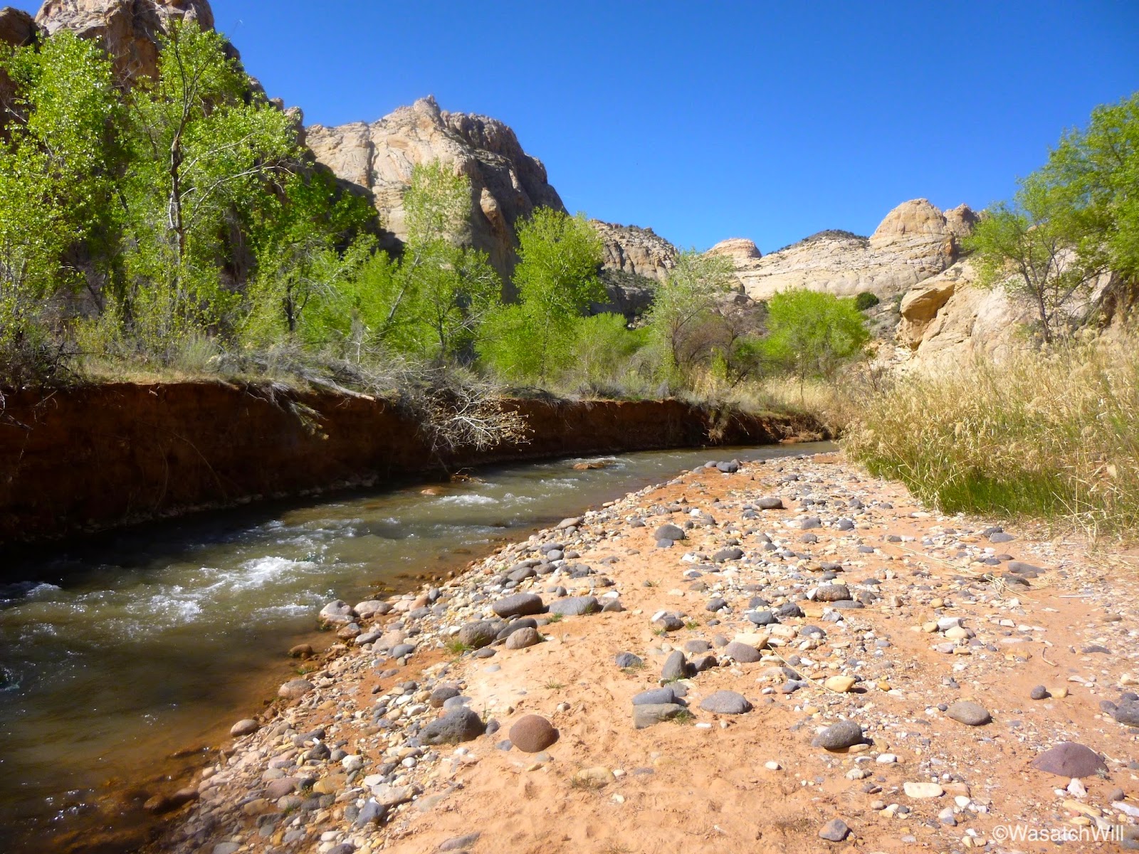
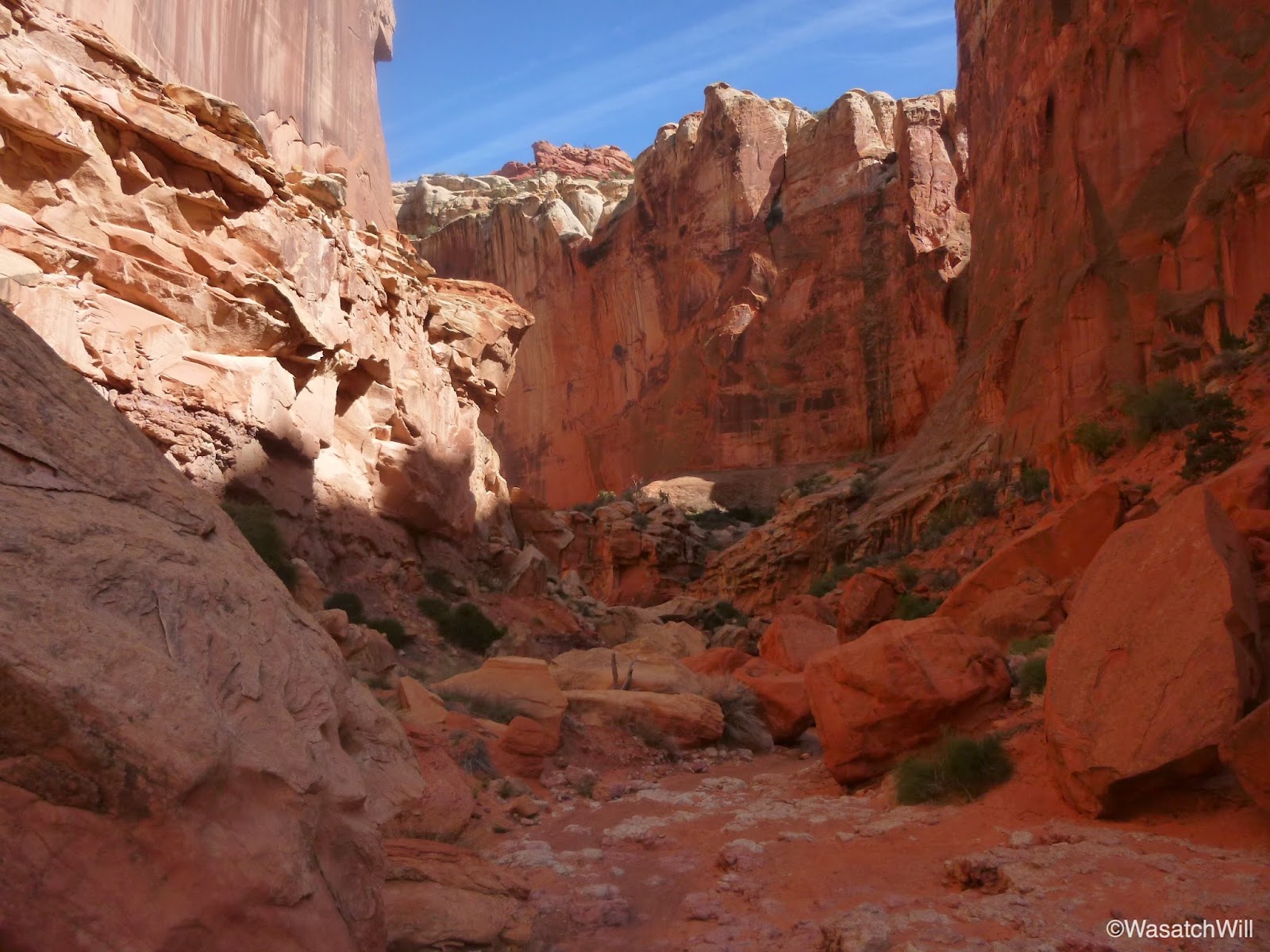
Back at the junction I reunited with my pack and made my way down lower Spring Canyon.


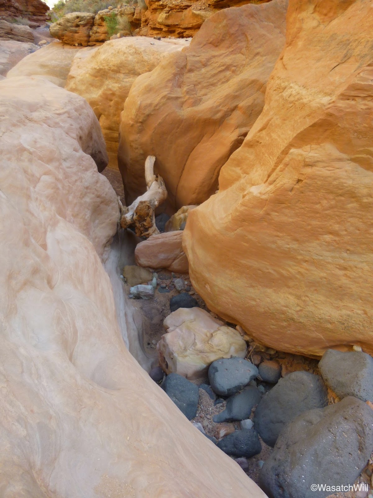


After a few miles, I took note of a potential camp site before continuing on for about another mile to scout out for anything better. Nothing else compared so back upstream I went to set up camp and retire for the night.
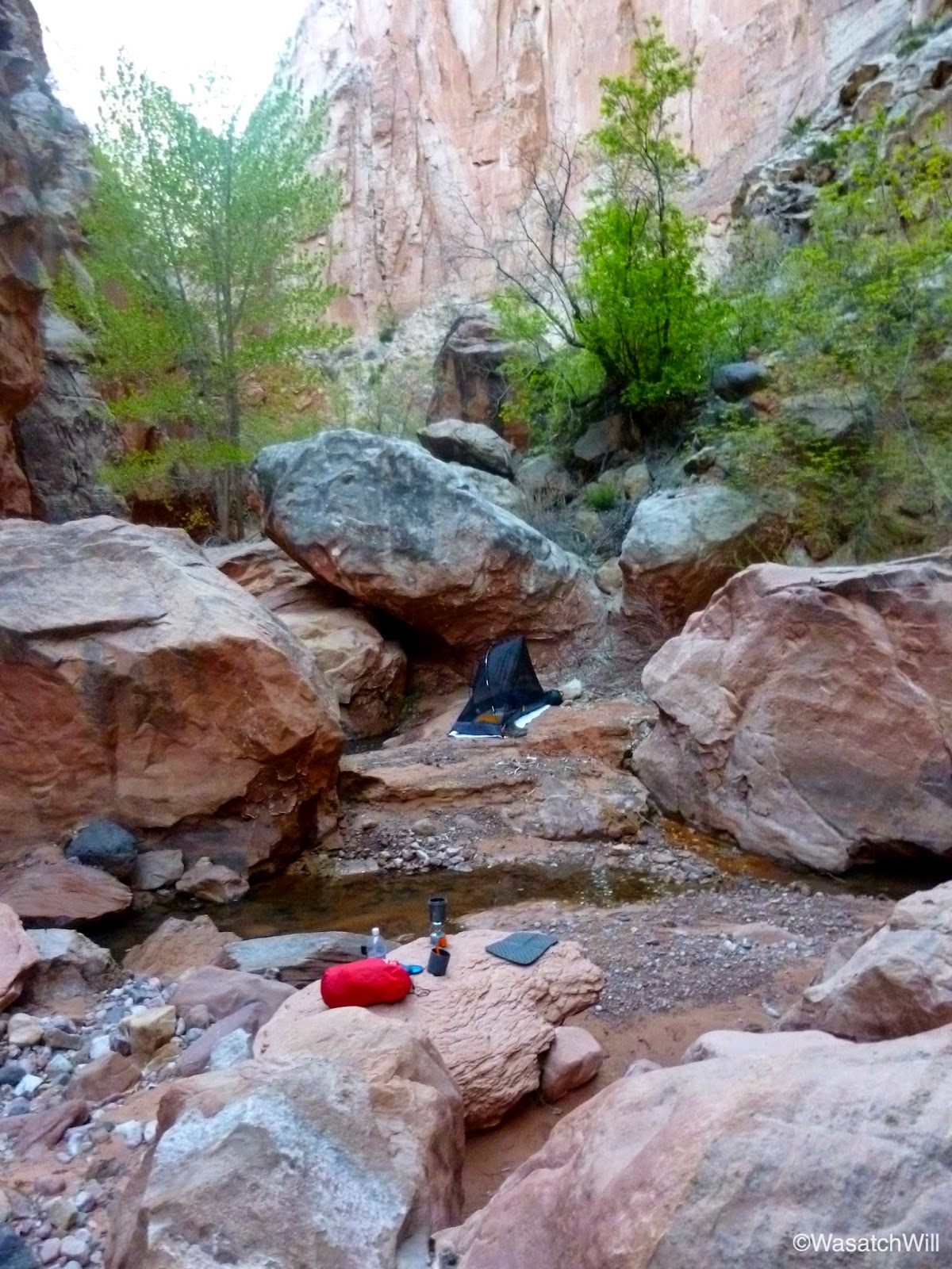
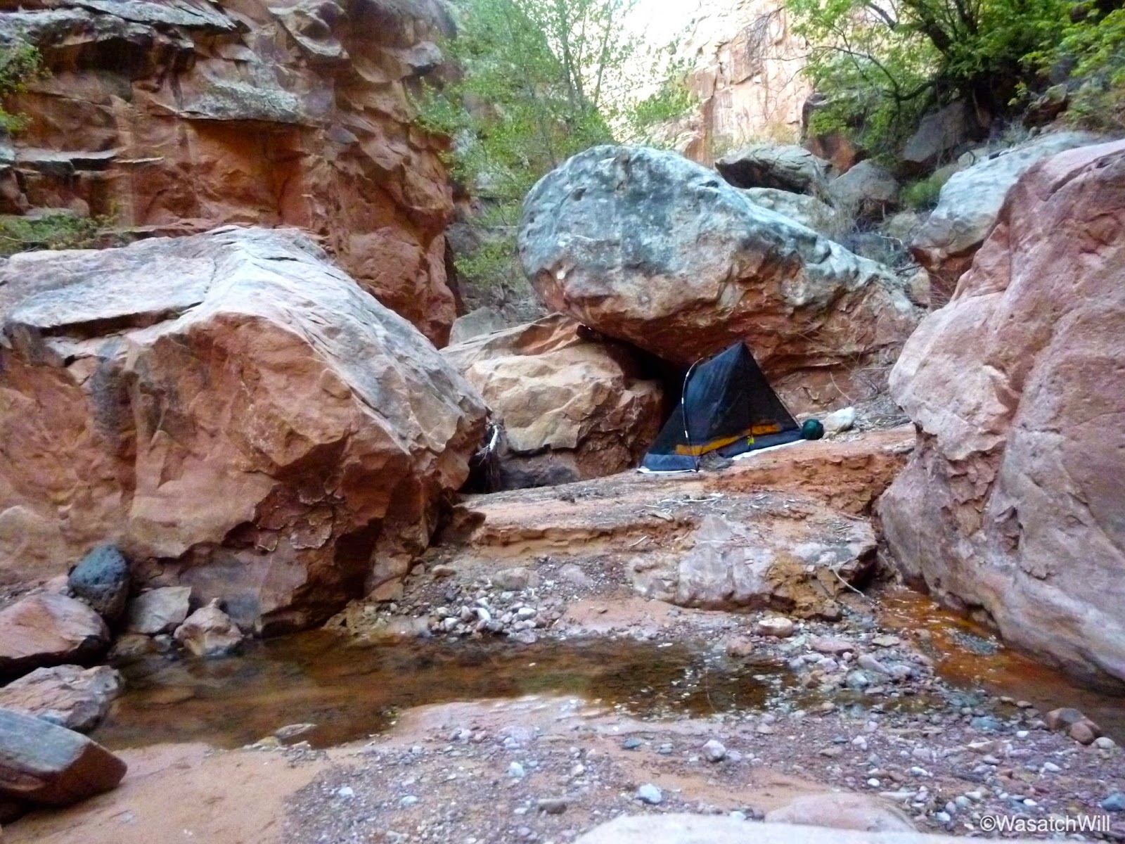

I was a little nervous about the temperature getting too cold for comfort. After speaking with the ranger when I obtained my permit earlier in the day, he said the lows down in the Park were typically a bit warmer than what was higher up in Torrey and so at the last minute, I opted to plug in a lighter weight sleeping bag in place of a warmer one I had packed. I was also prepared to sleep with my down jacket if needed, but fortunately I was able to keep it stuffed up for a pillow and my bag did just fine as the temperature would stay relatively mild.
While I was expecting the temperature to dip down into the mid 30's, my keychain thermometer showed a temperature of just below 50 when I awoke. After breakfast, topping off my water bottles, and packing back up, it was time to finish off the rest of lower Spring Canyon.


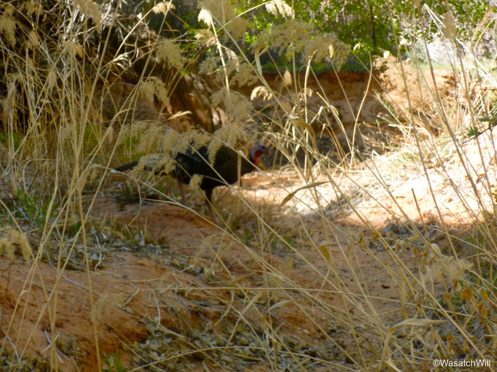
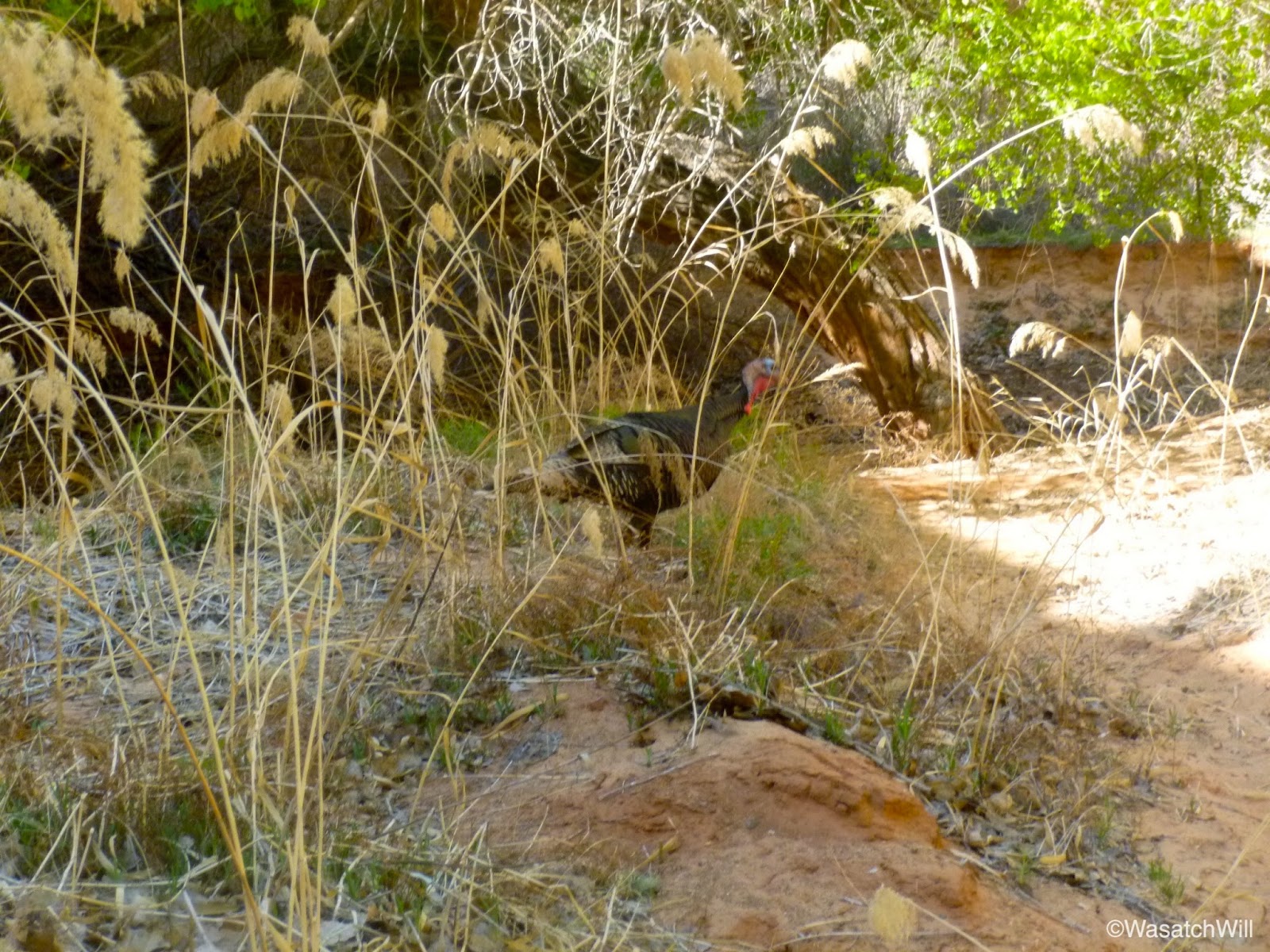
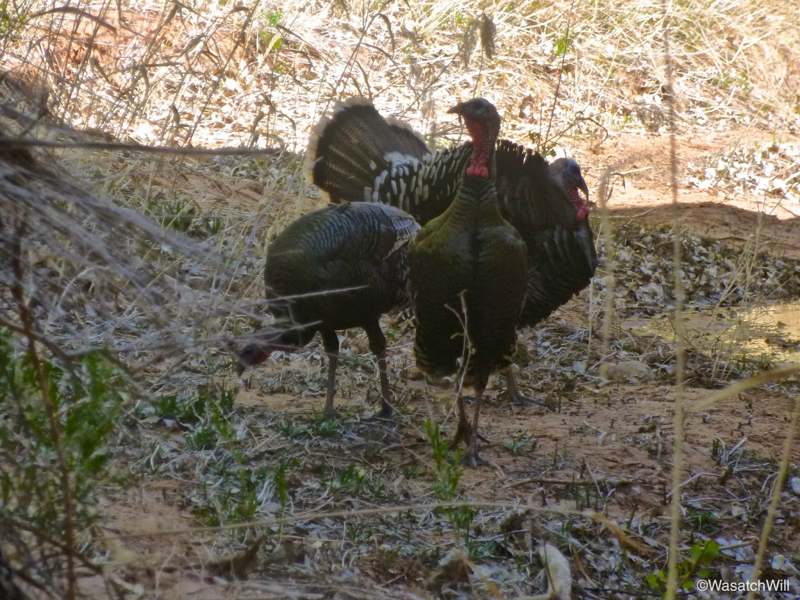
Near the end, just prior to reaching the confluence with the Fremont River, I stumbled into some wild turkeys.
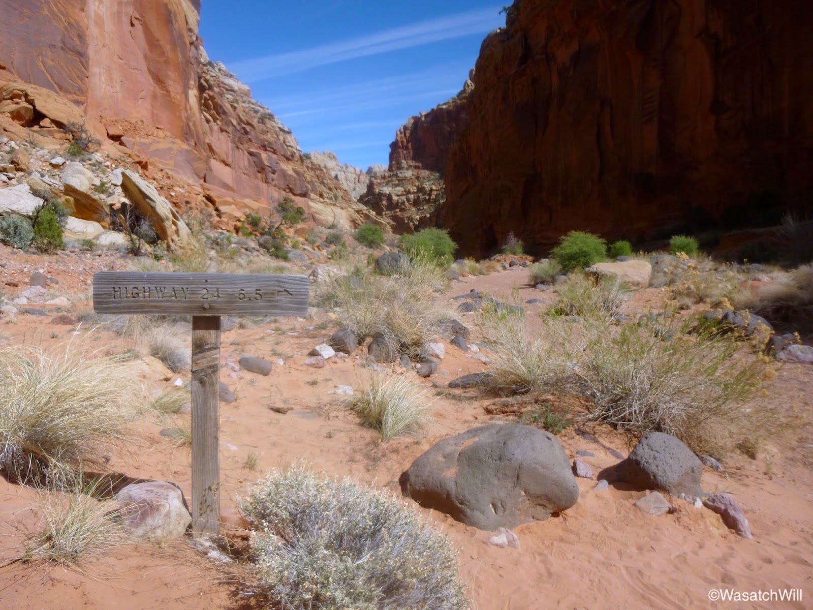
At last, I had reached the Fremont River. The sun was getting higher and the air was getting warmer, a nice contrast against what would be a frigid cold river to ford. Fortunately, it wasn't running very high and the icy cold sting across my toes did not have to last long. For a brief moment, it was actually a welcome respite for my sweating feet.
Once on the other side of the river, I swapped my sandals back off for my hiking shoes and made my way up the brief stretch of highway to reach Grand Wash. While hiking along side of the road, several show cars covered in decals whipped past. I didn't get any video or photos because I didn't realize what was going on until I realized one common decal on all the vehicles read "Dustball Rally". Apparently, I was witnessing an annual rally of drivers in the middle of their journey from El Paso to Vegas.


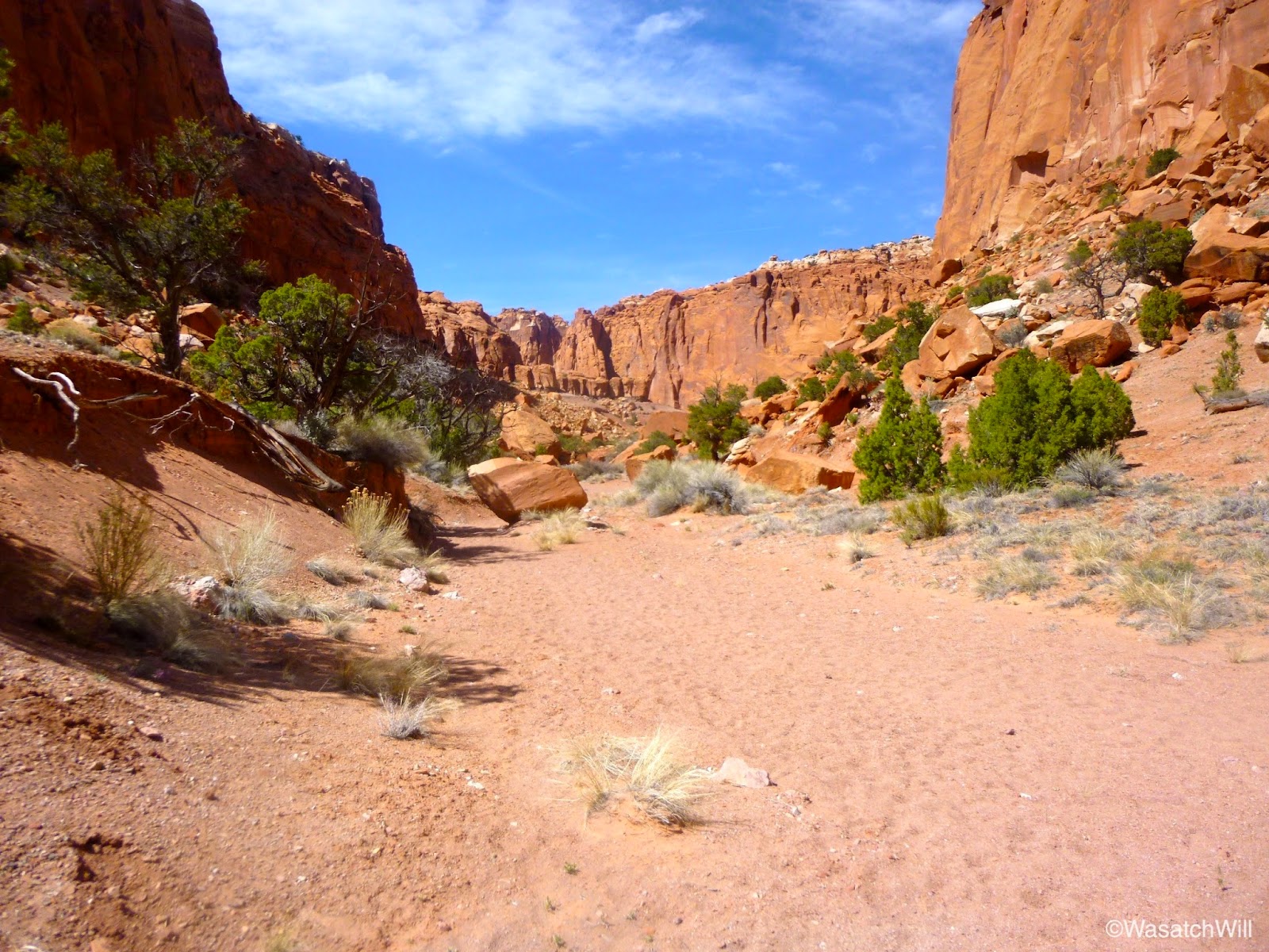
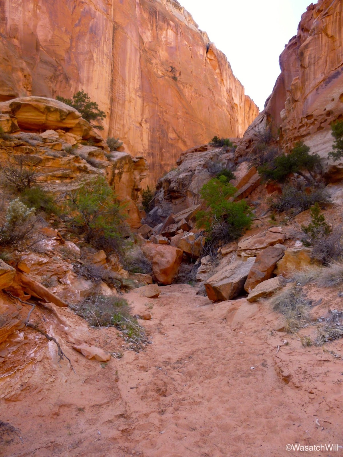
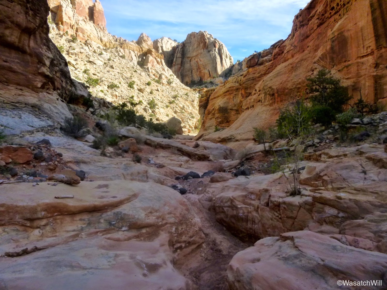
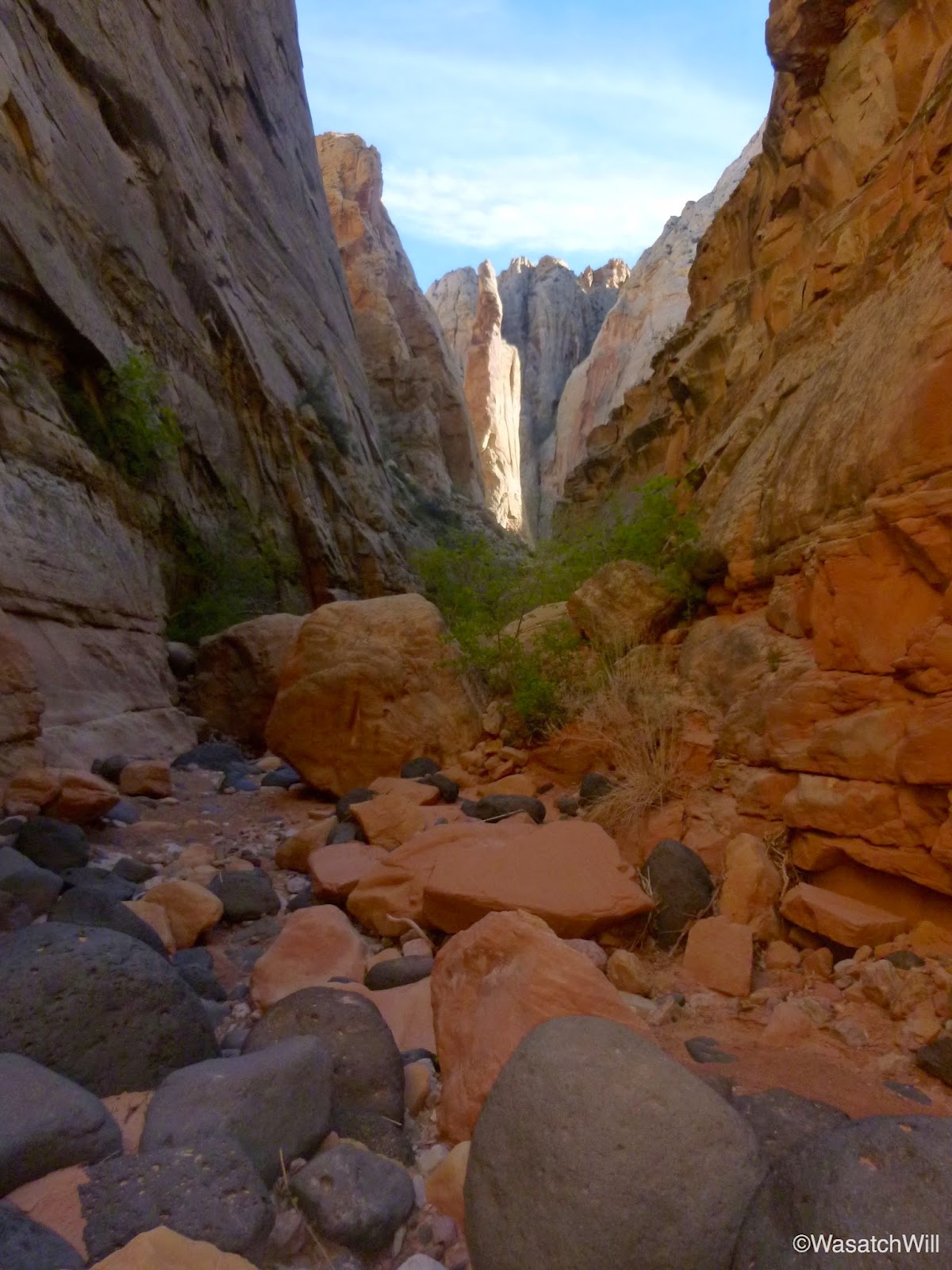
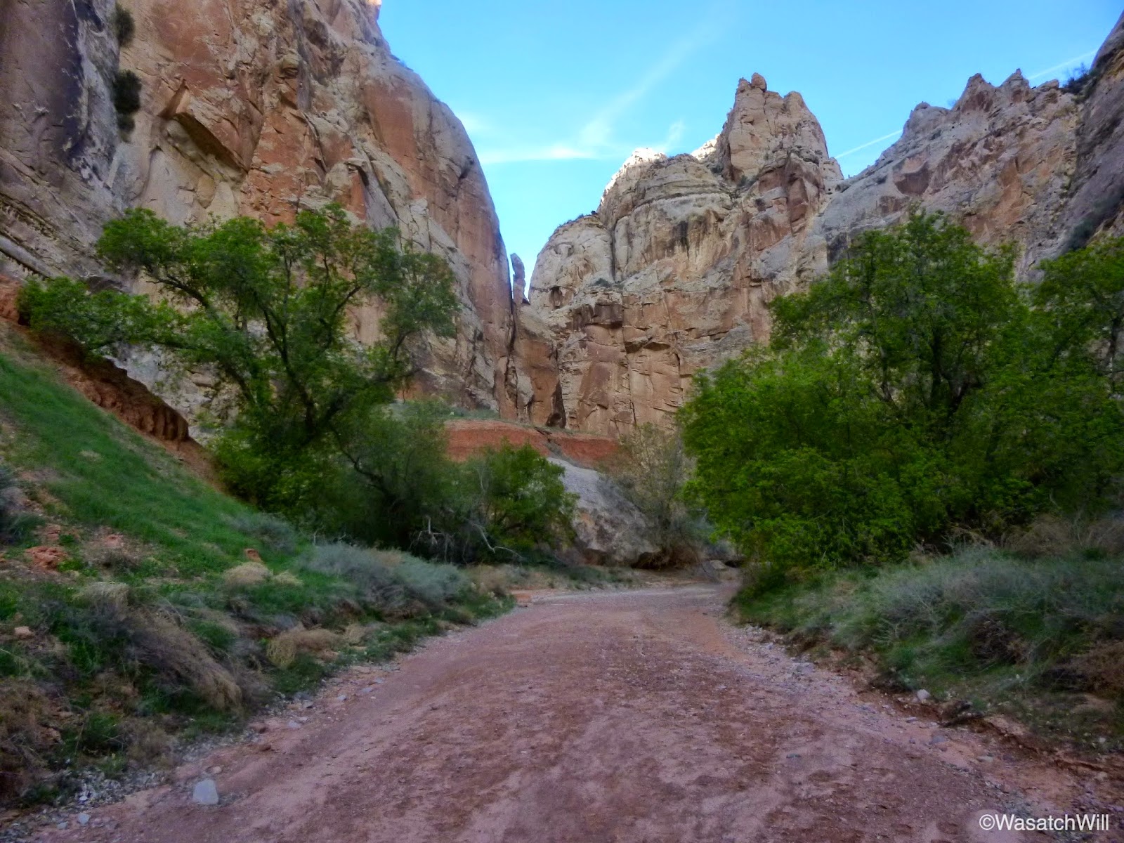
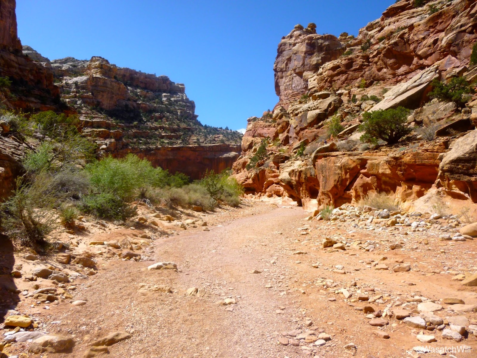
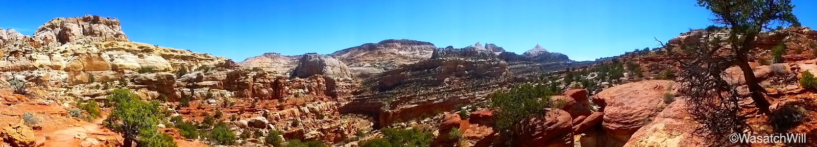
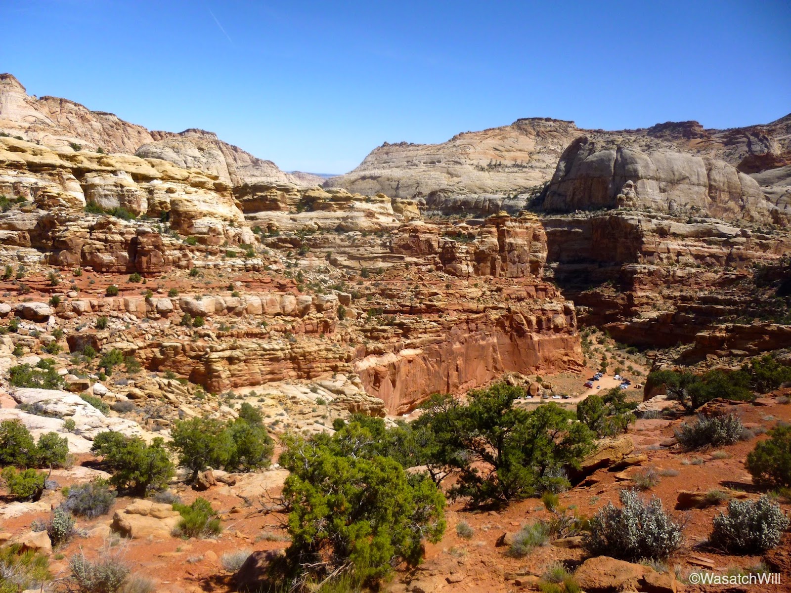
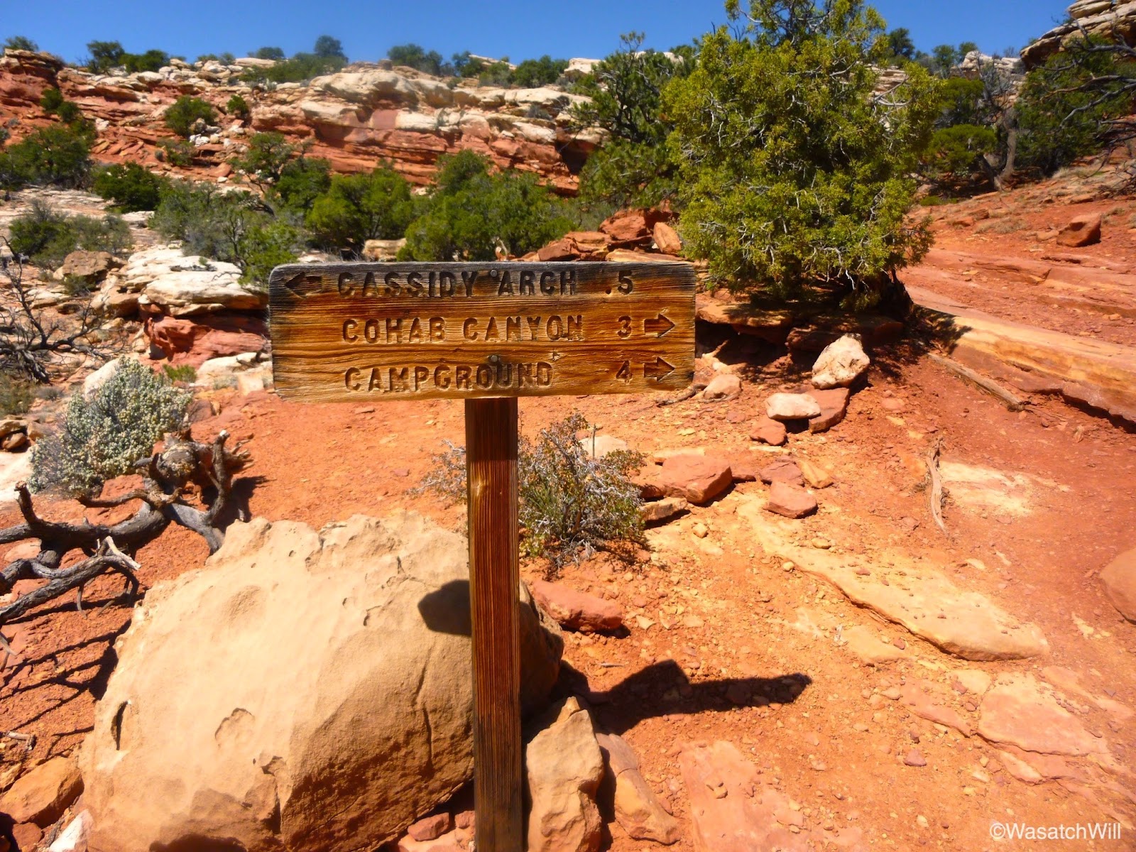
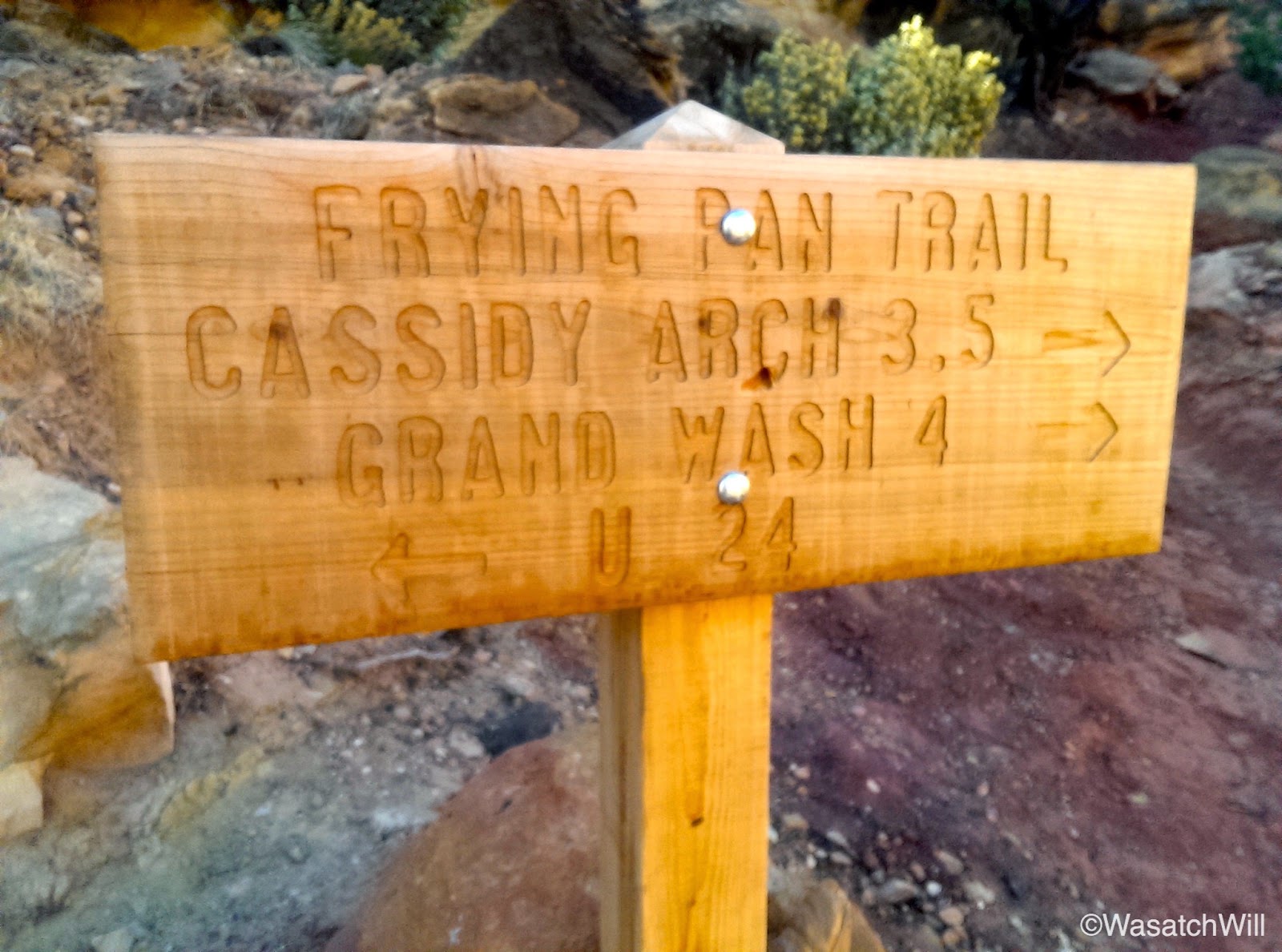
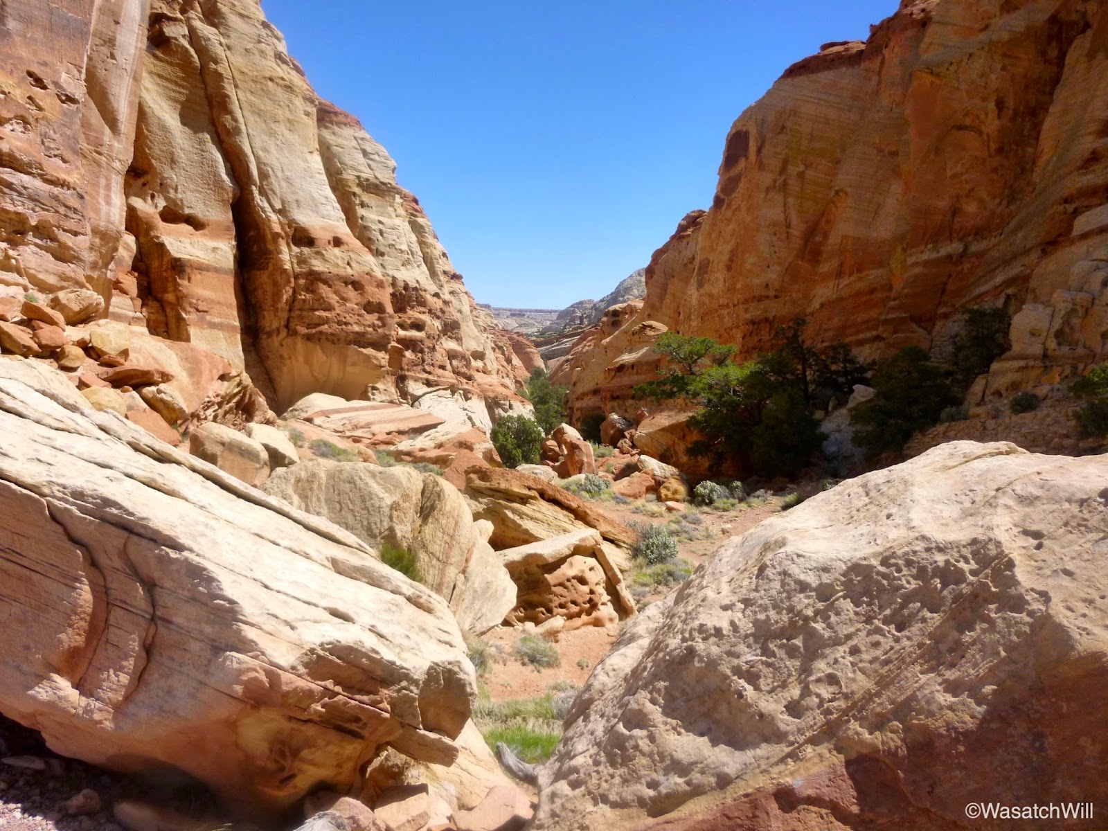
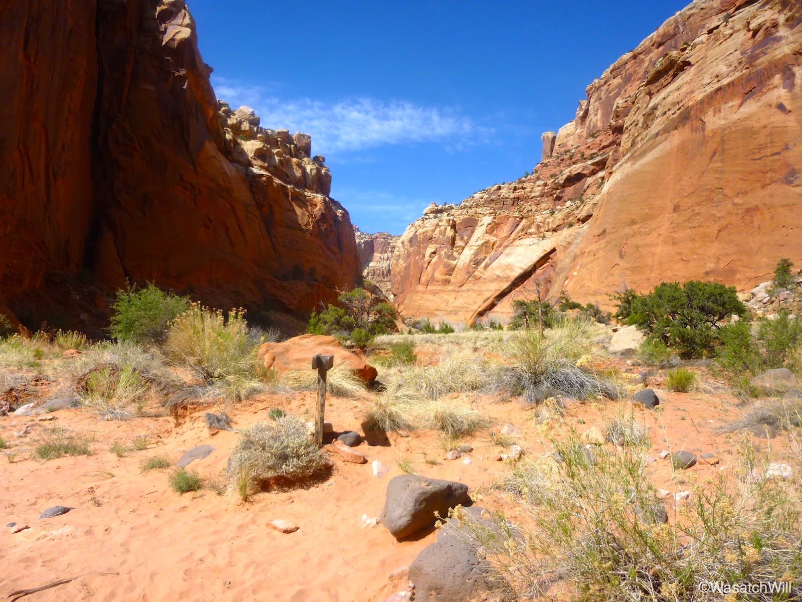
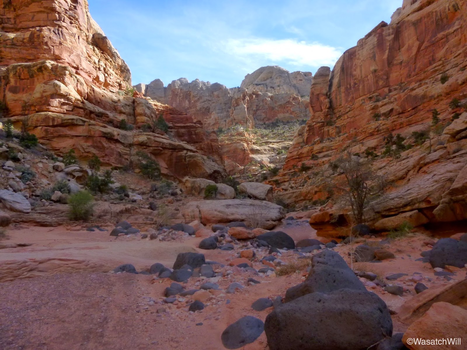
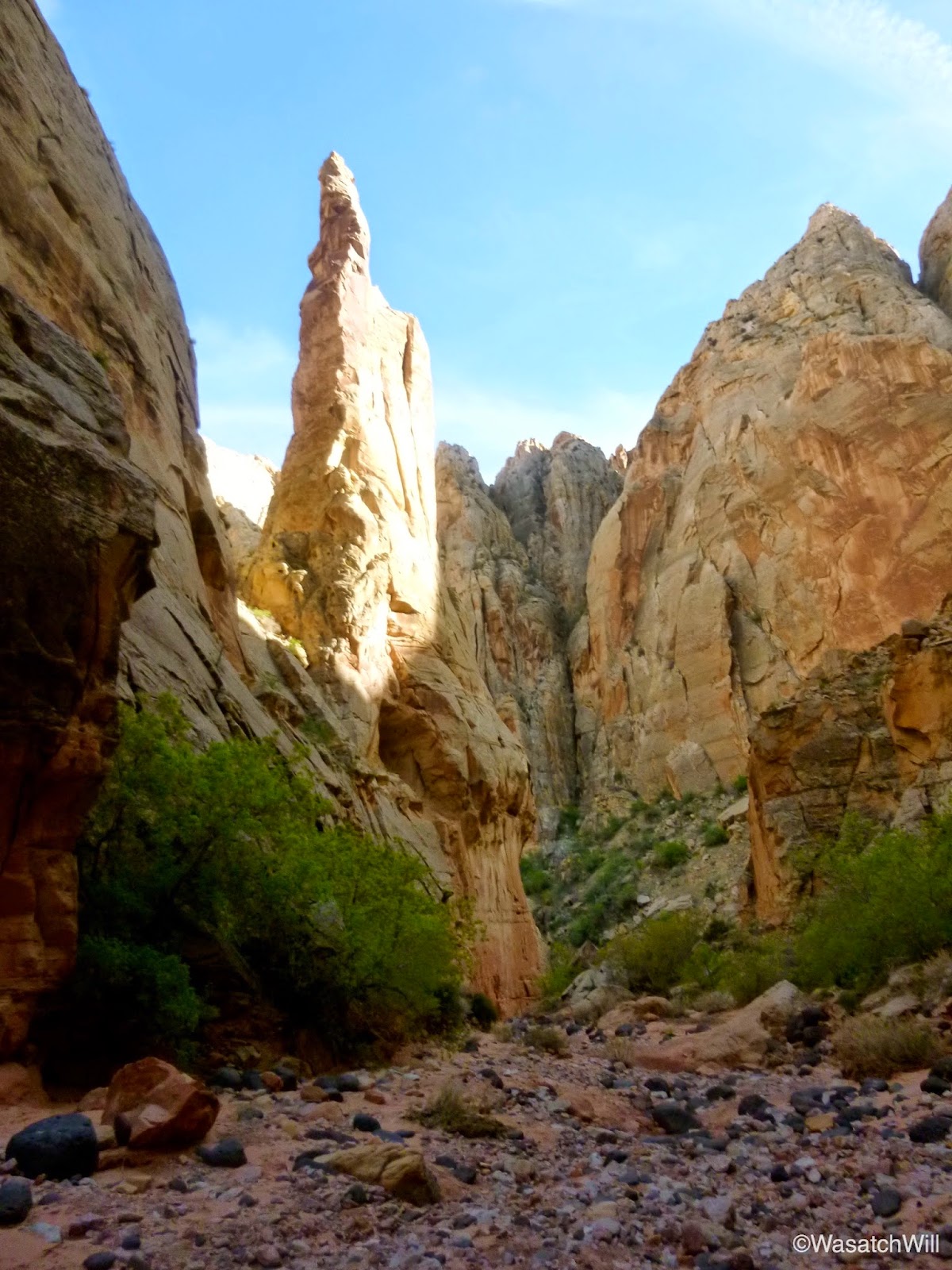
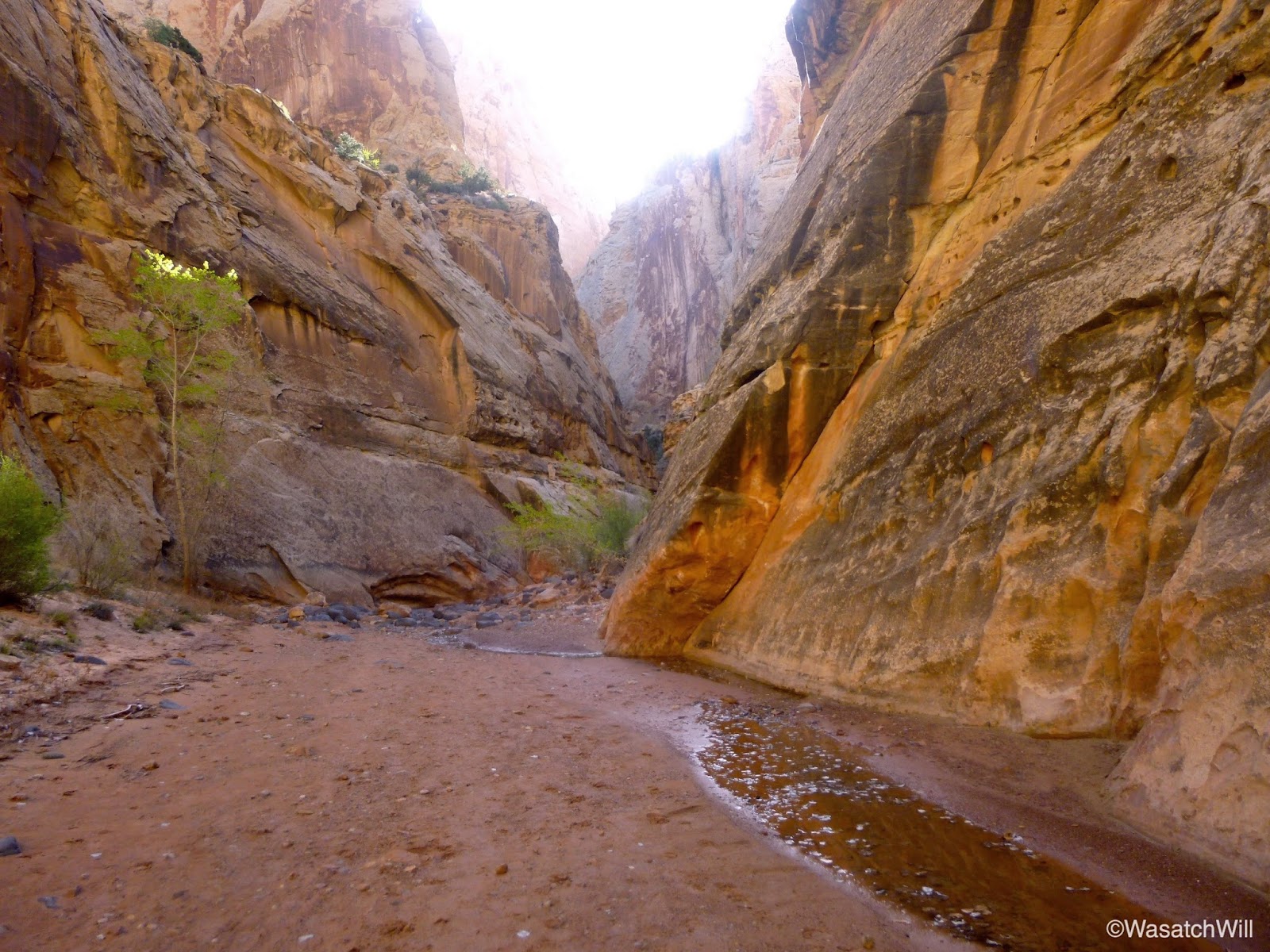
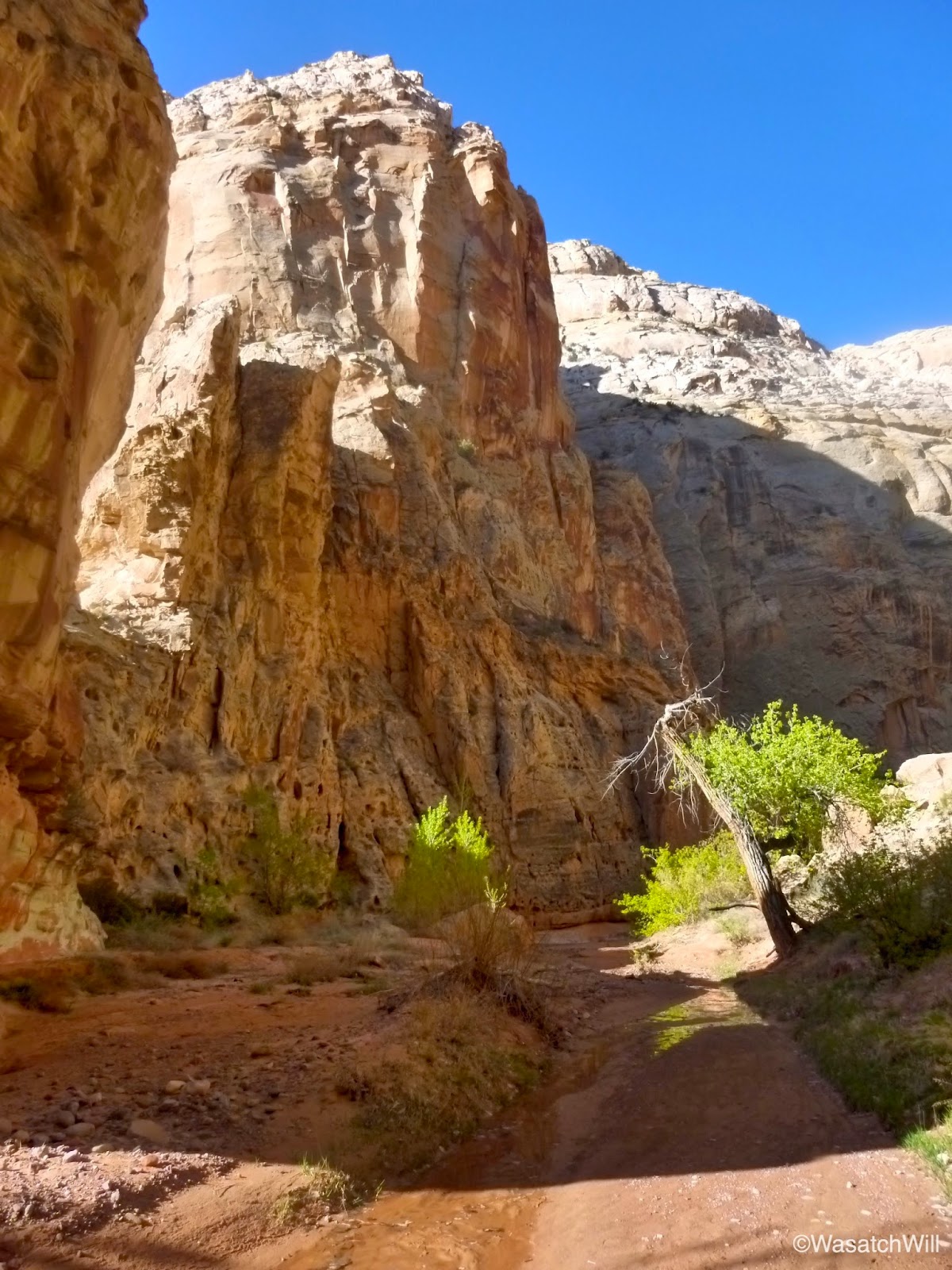
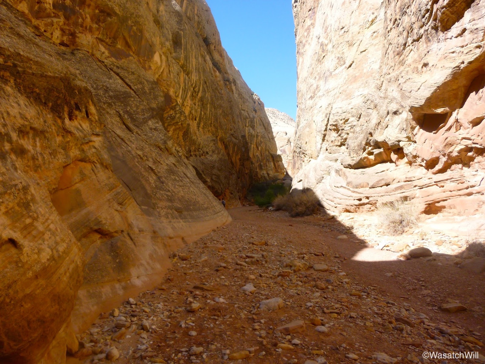
Soon, I was ready to hike Grand Wash en route to picking up the trail that leads up to Cassidy Arch and the Frying Pan Trail.

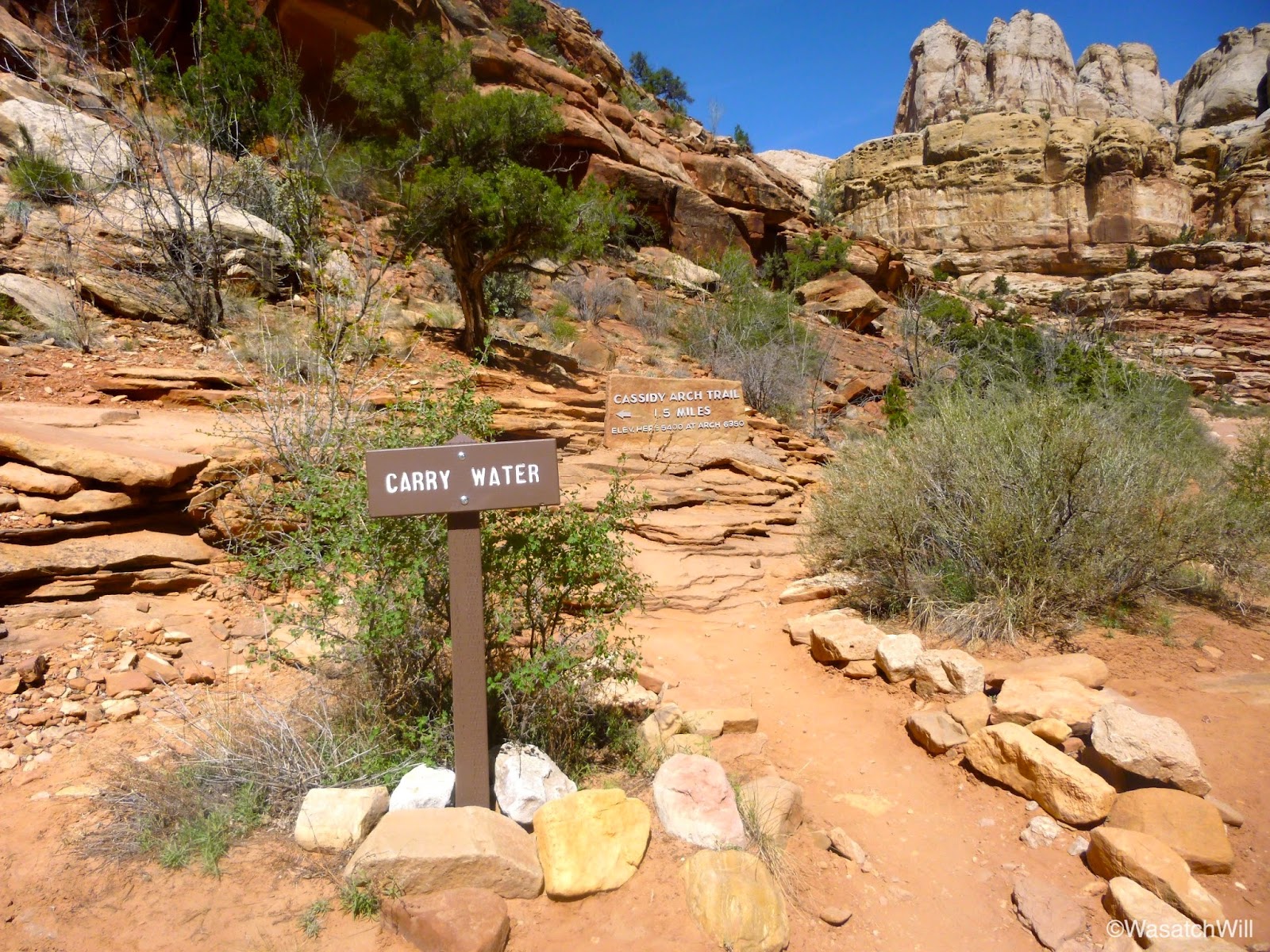
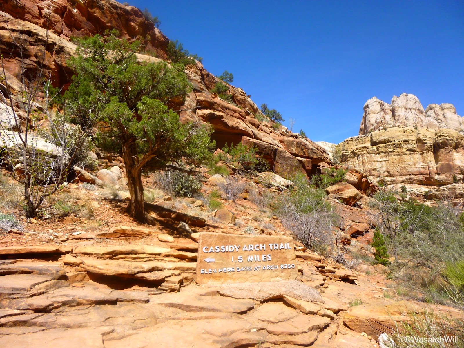
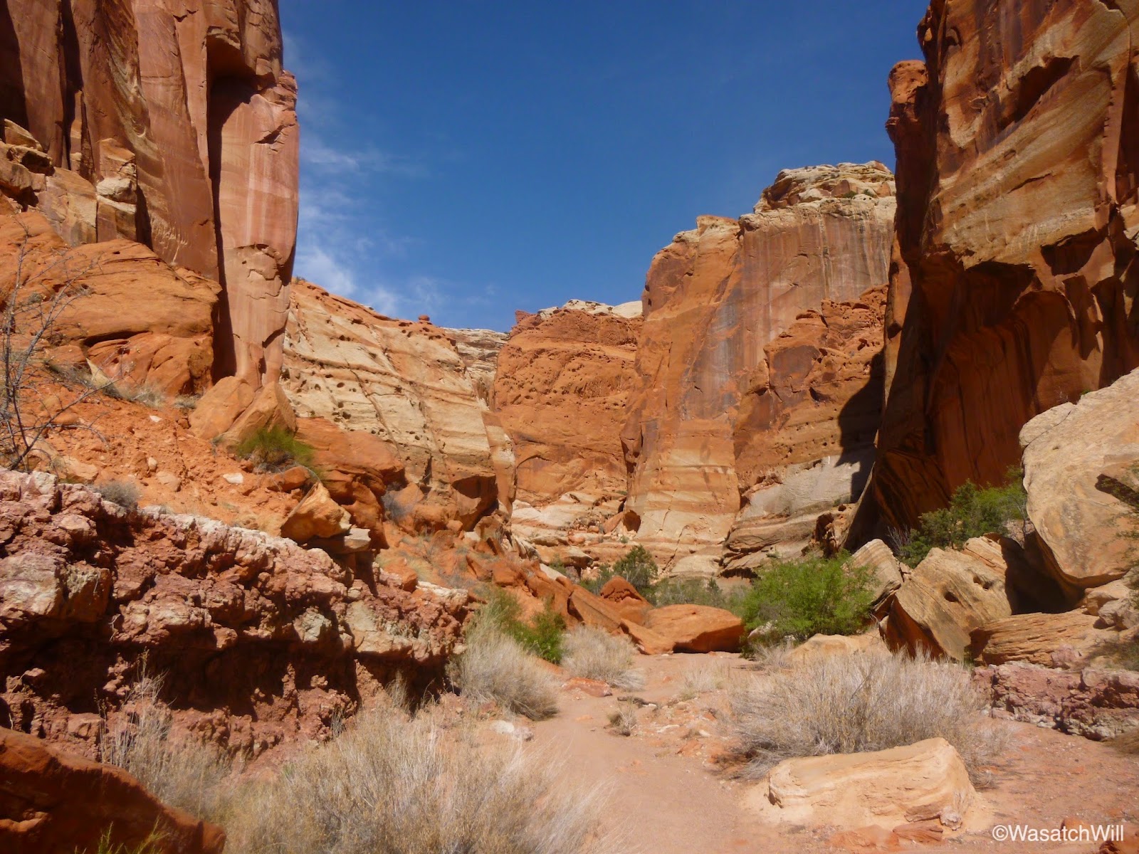
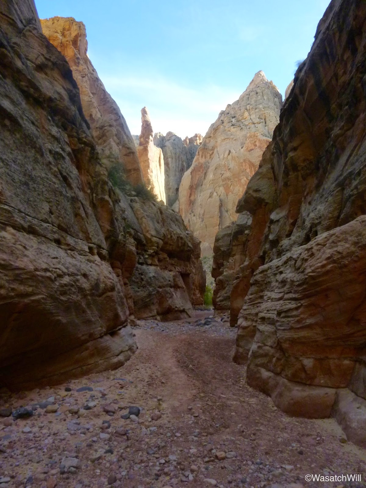
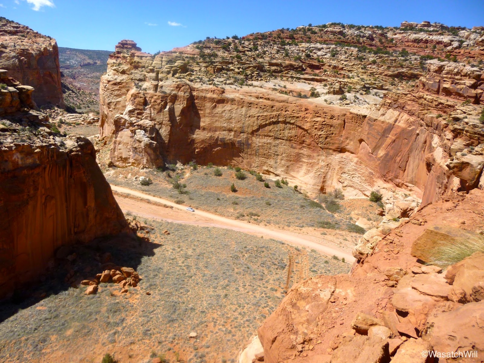
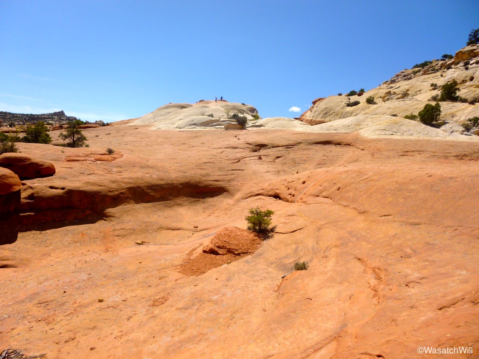
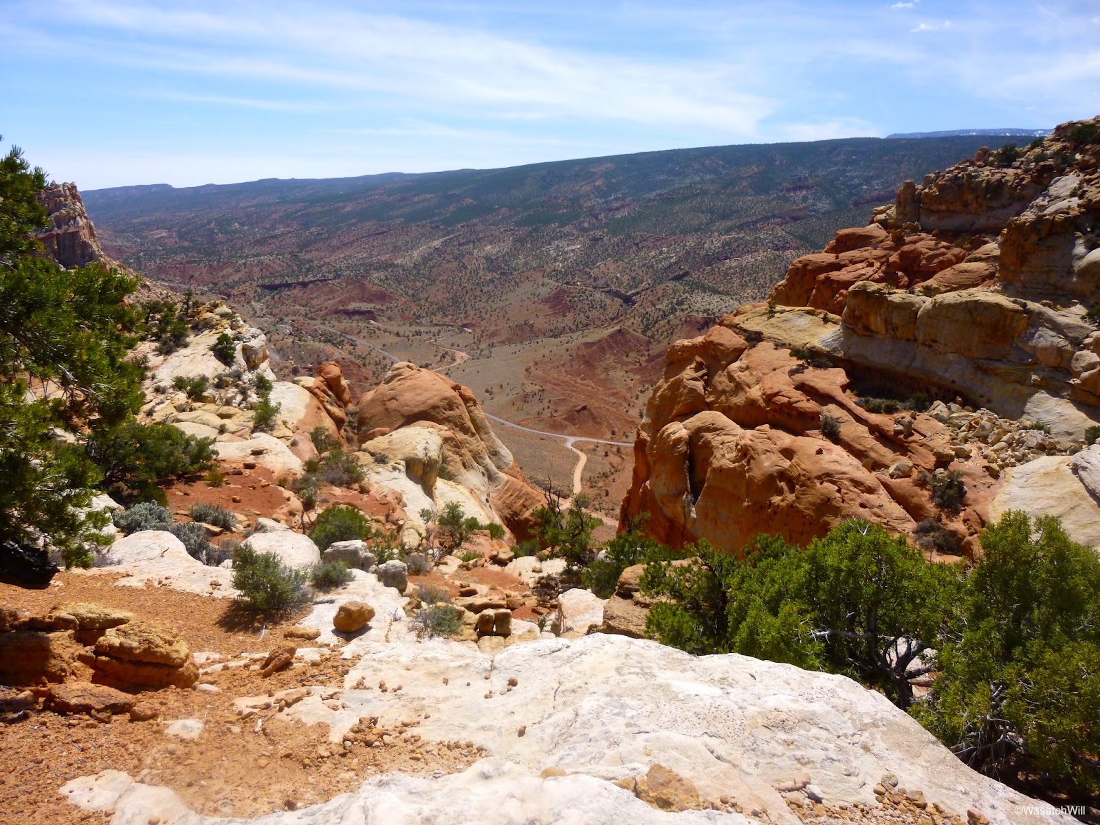
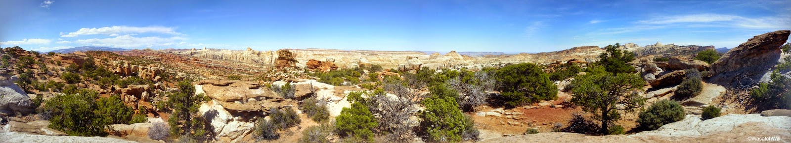
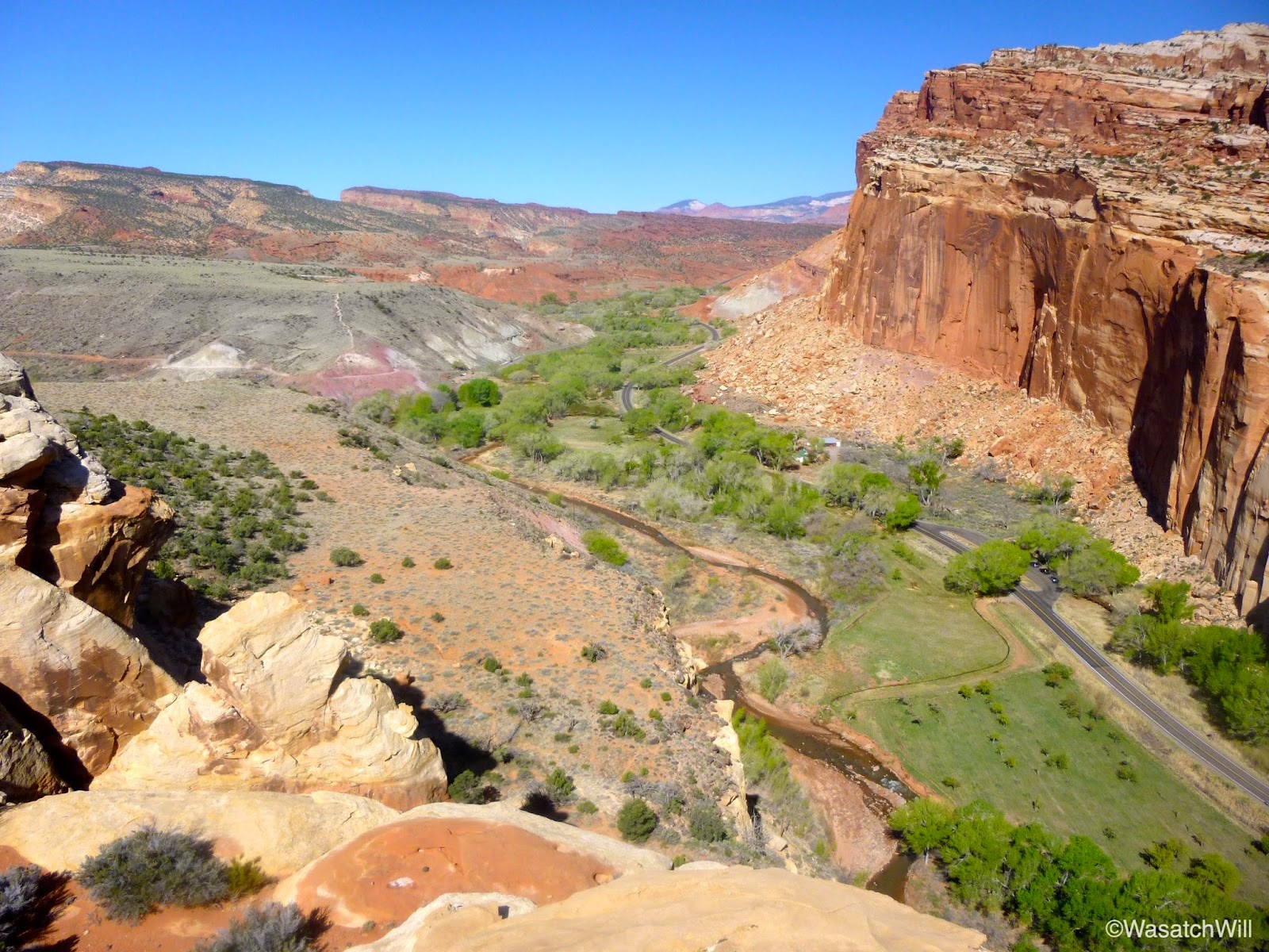
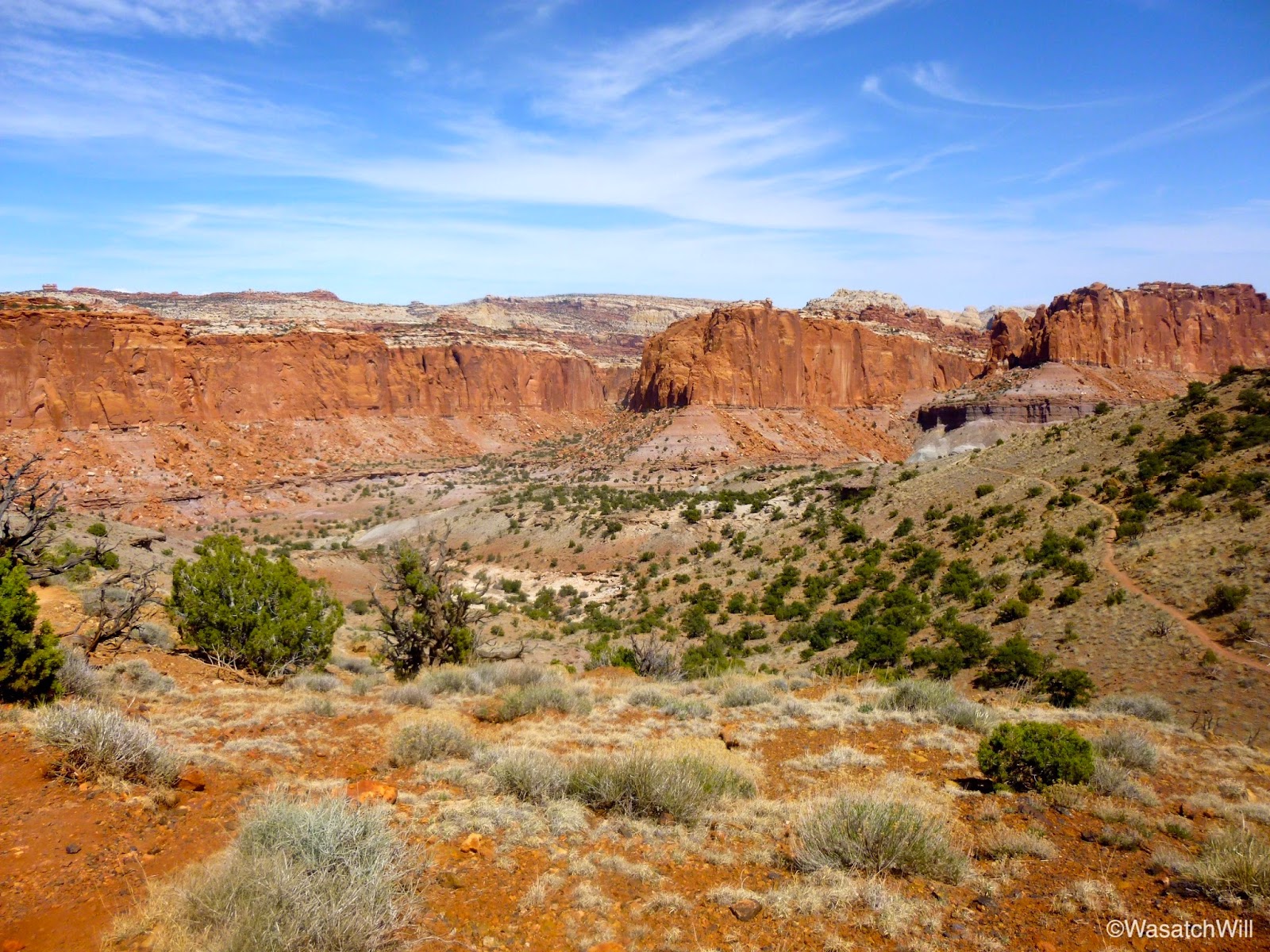
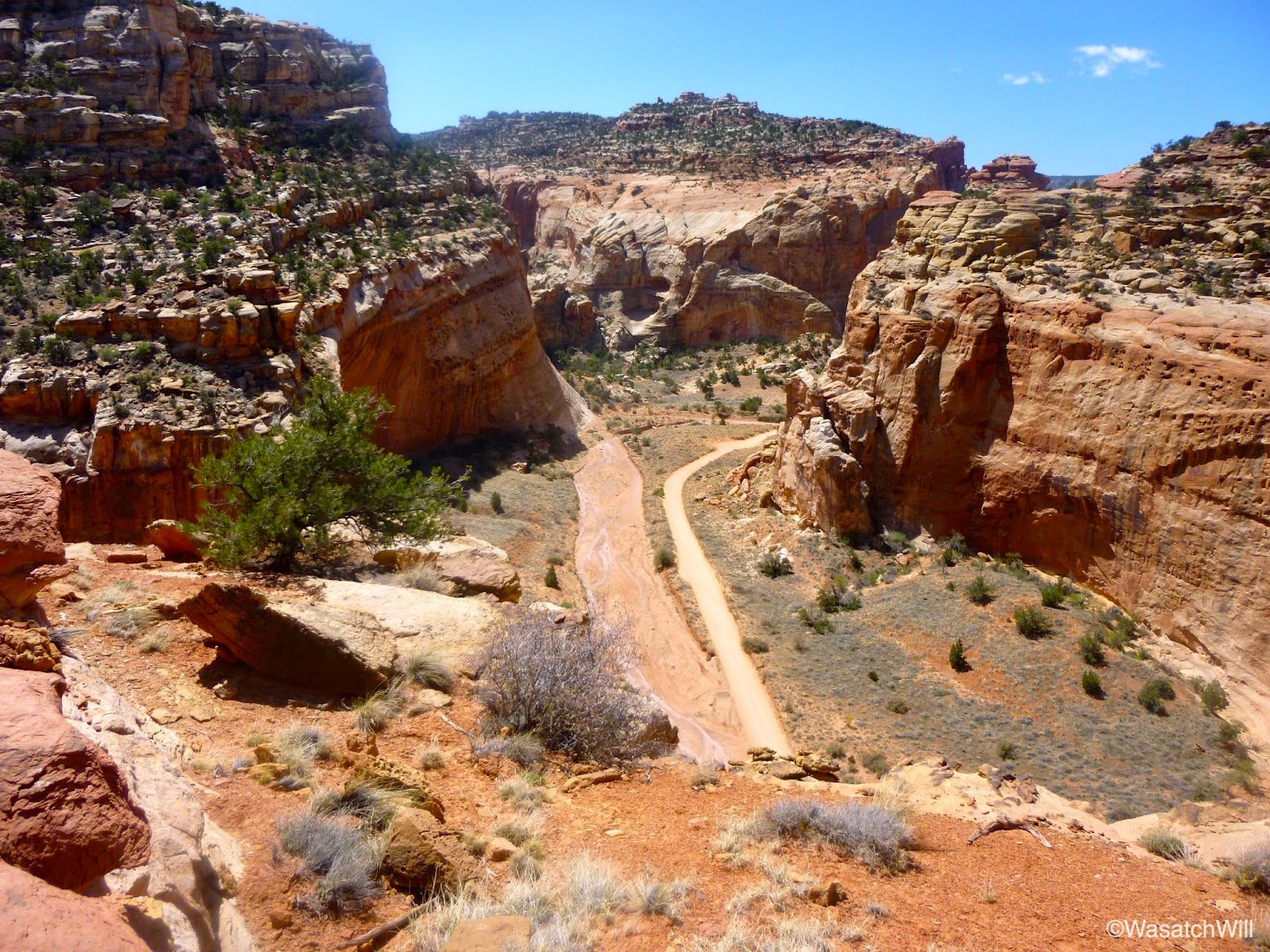
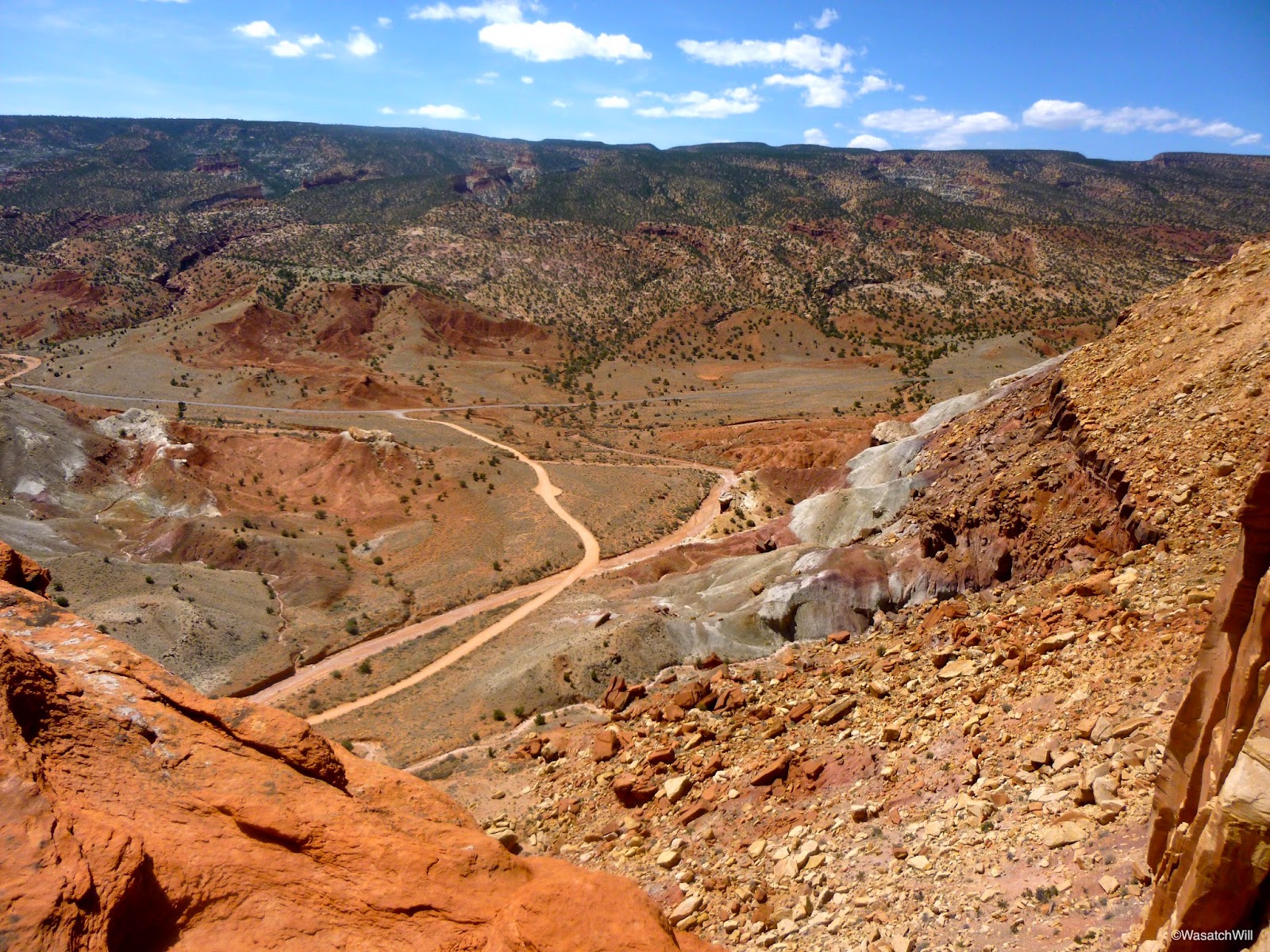
Once at the junction with the Cassidy Arch trail, I took another brief water break and began my way up another unfamiliar stretch of trail in anticipation of getting to see Cassidy Arch, another popular landmark in the Park I hadn't yet seen. The trail quickly gains elevation, offering fantastic views of Grand Wash and beyond.


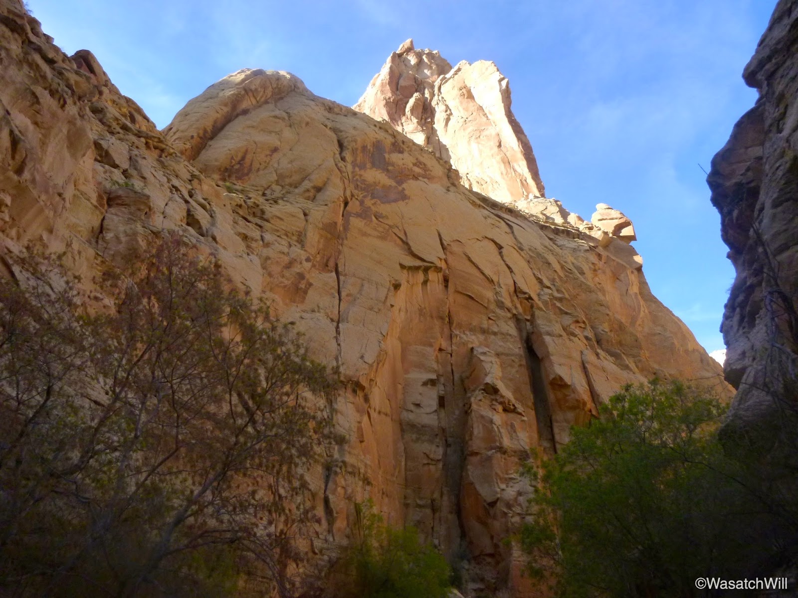
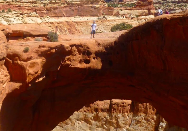
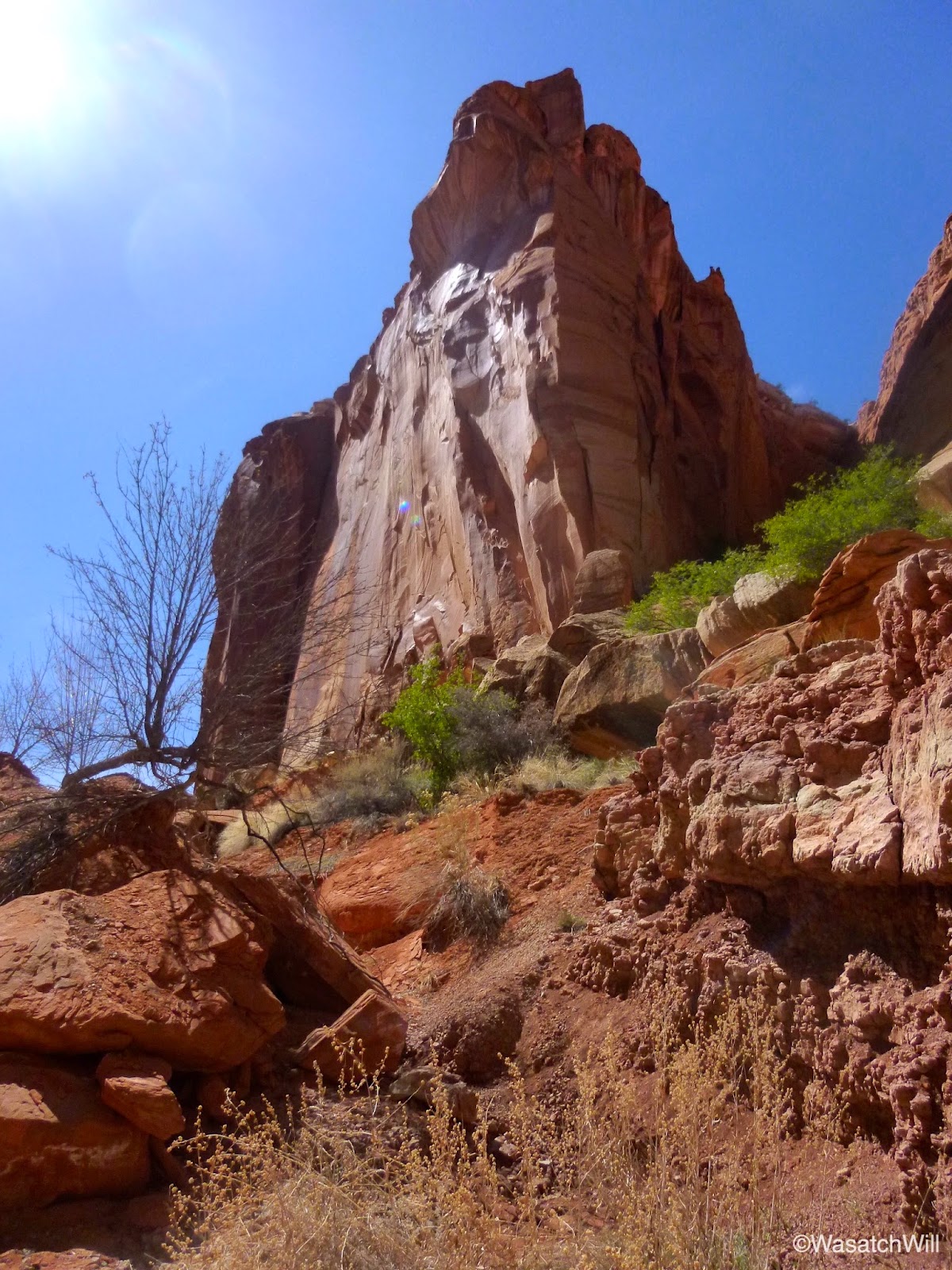
After rounding a bend, Cassidy Arch came into view.
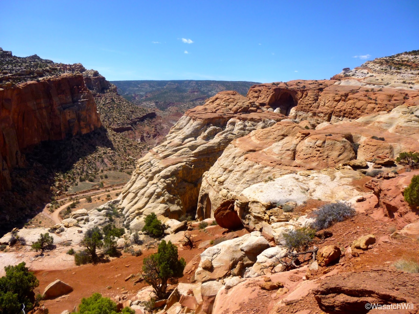
A little further on, I reached the turn-off for the arch and made the side trip out to break for lunch. It would be the second day in a row that I would enjoy lunch with such a spectacular view.
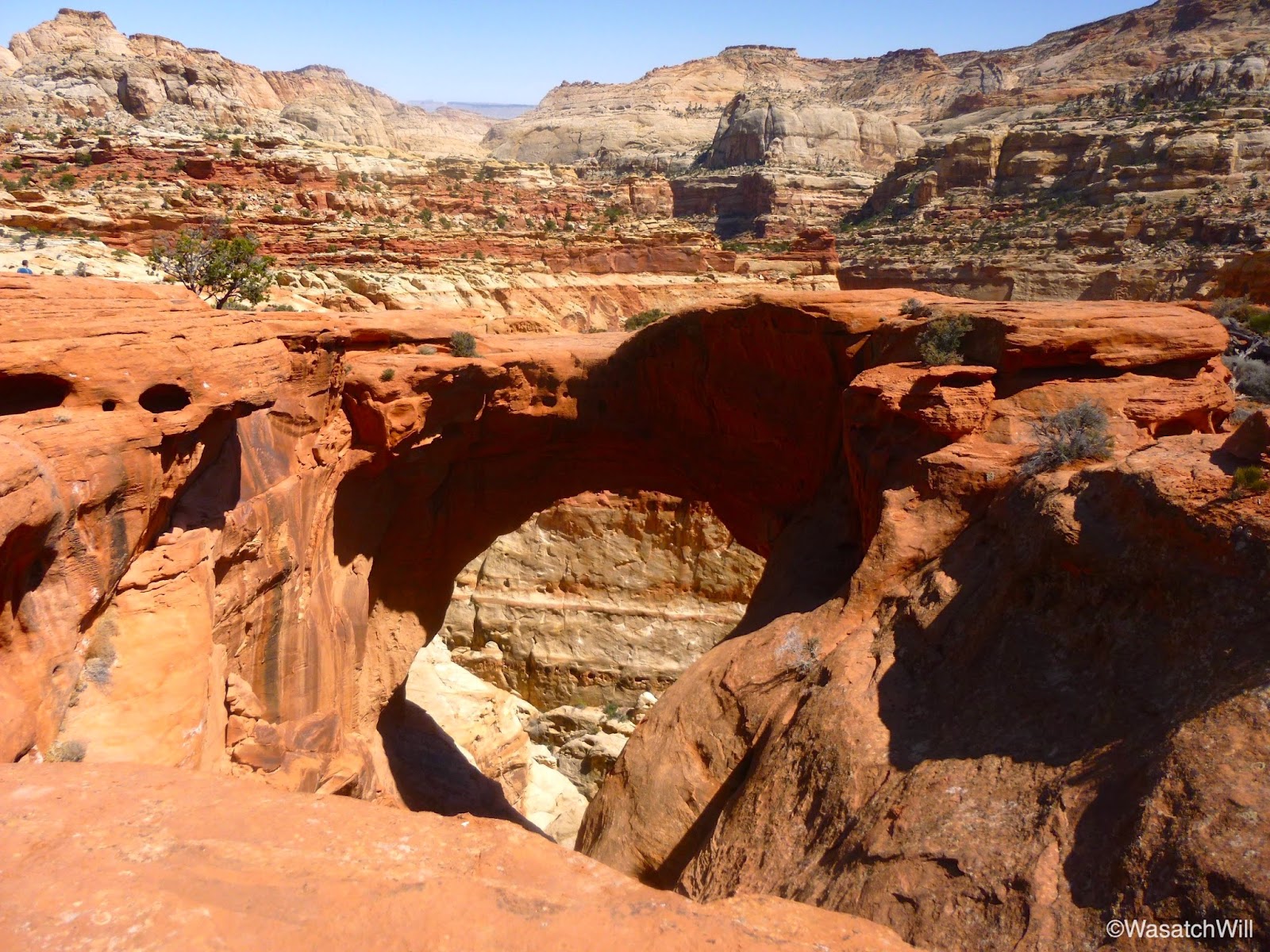
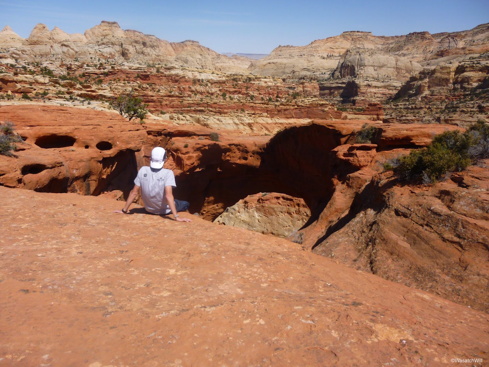
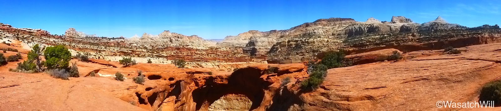
A couple hundred feet or so from the arch is a ledge where one can get a view down into the western end of Grand Wash.

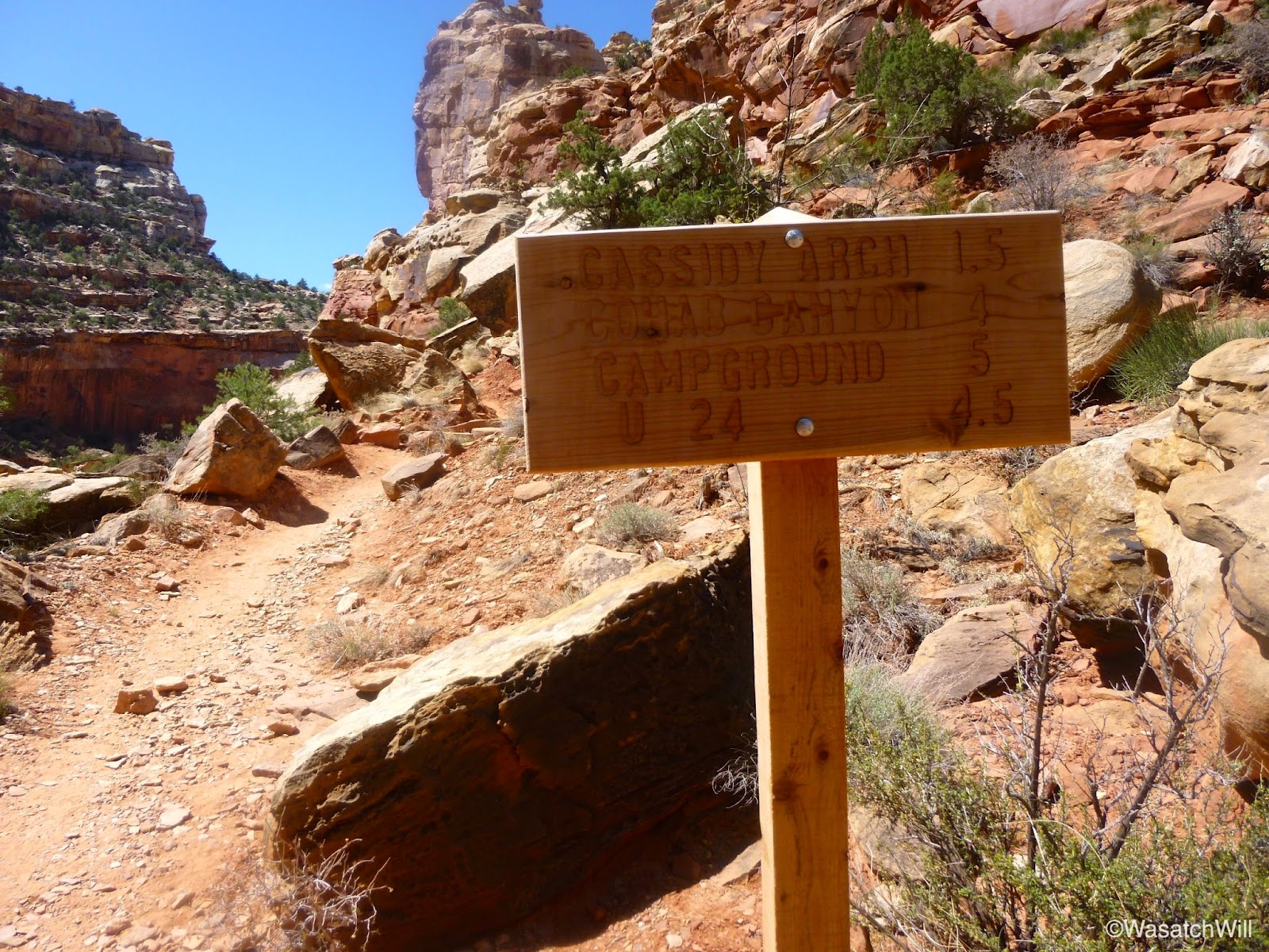
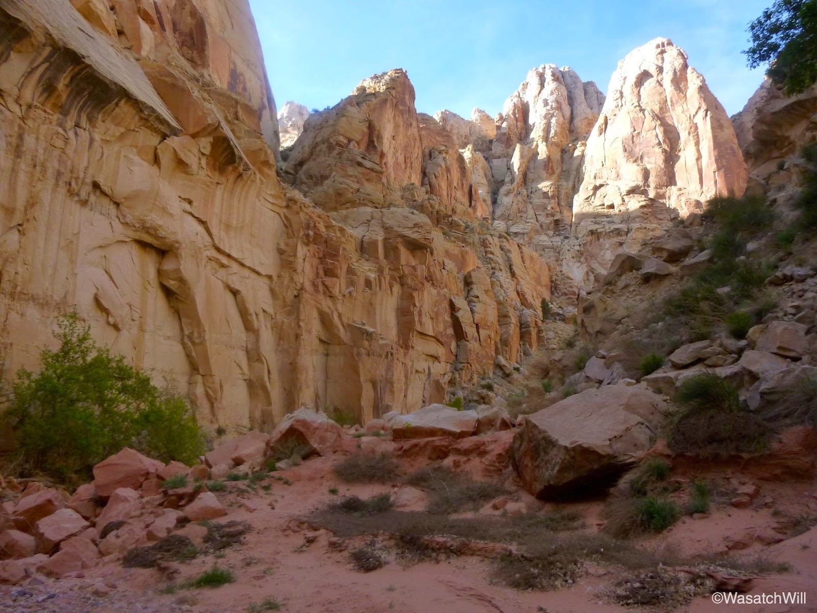
After a good long break, it was time to get moving again. Back out to the turn-off and upward and onward along the Frying Pan Trail I went.
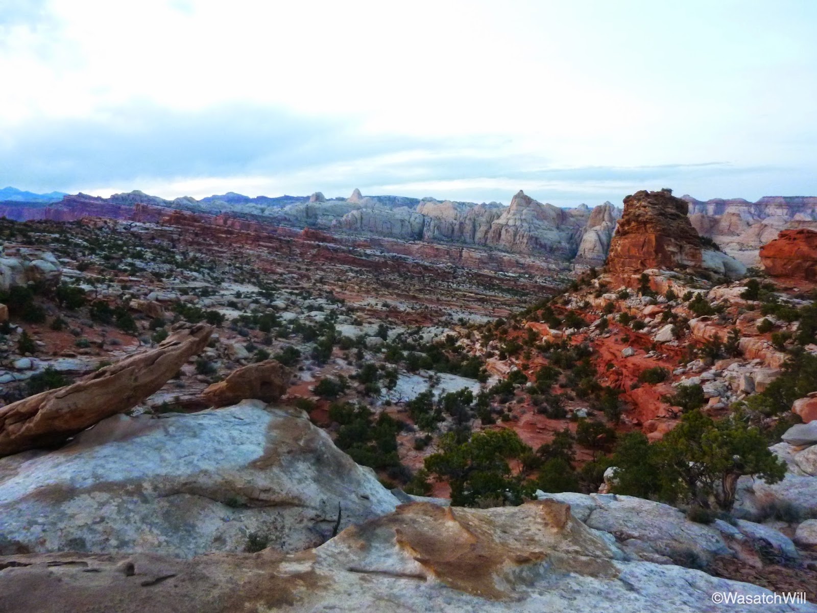
Near the area where the trail reaches it's highest point, I stumbled into a spot where it was very tempting to make camp at.
I resisted the urge to drop my pack and set up camp right then and there because I had marked up a handful of other potential spots out west of the trail that I thought would hold great views of Boulder Mountain and Fruita and from where I could watch the sunset over the horizon. When you look at satellite imagery, one would think that the area I had in mind was fairly open and easy to navigate. However, when I went westward, I encountered obstacle after obstacle that were much bigger than what the satellites would have you believe.
After some time making several attempts to find a safe way across and out to the western edge of the plateau, I concluded it wasn't worth pursuing, especially with how much I'd have to climb back up and through to get back to the trail the next morning. So, I returned back to the first spot I stumbled into. I do not regret it. In exchange for a prime sunset viewing spot it promised a prime sunrise spot.
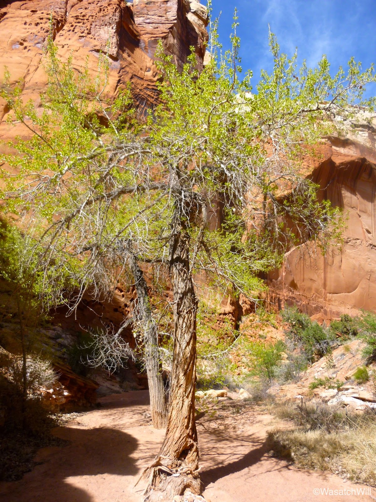
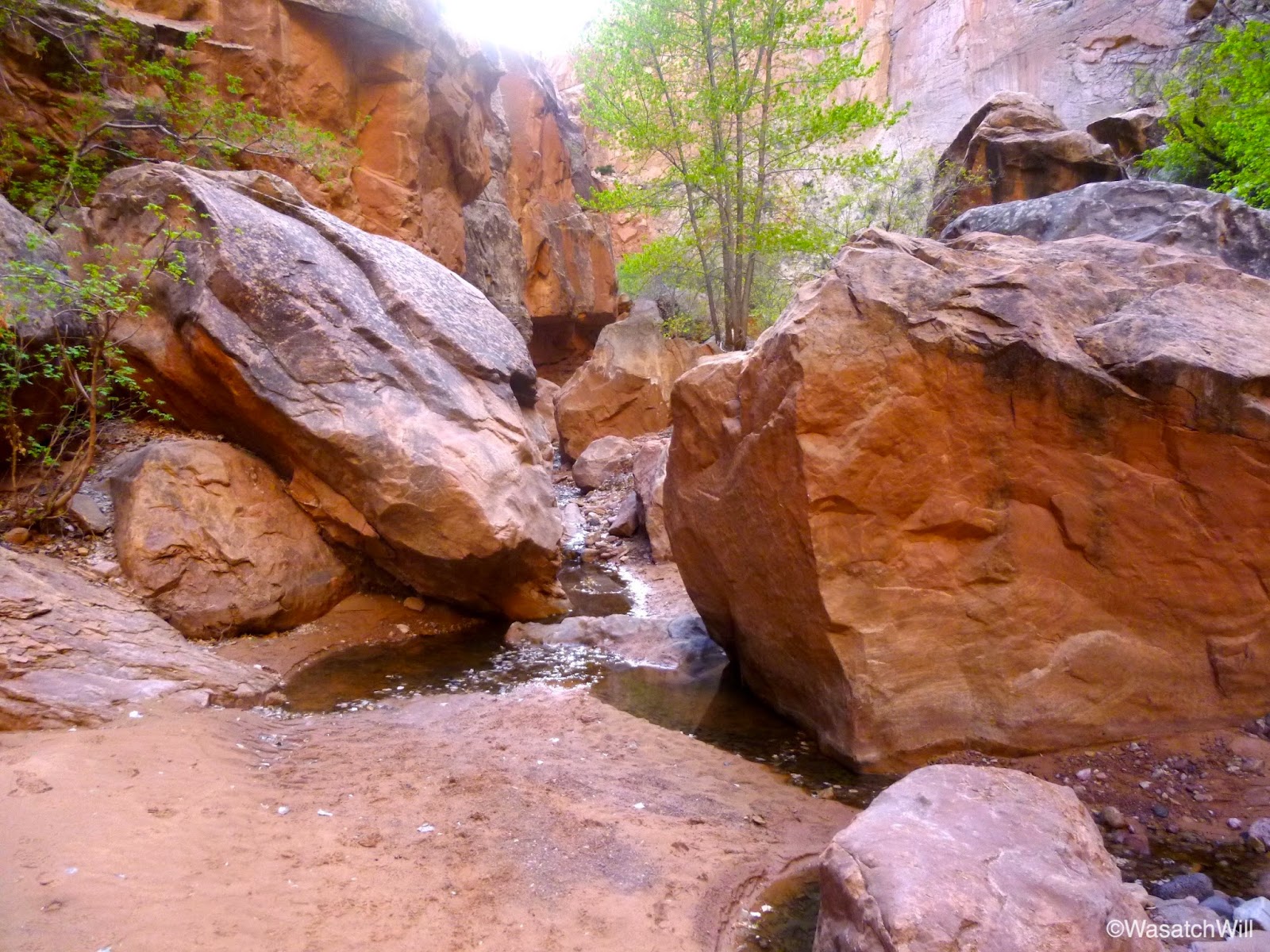
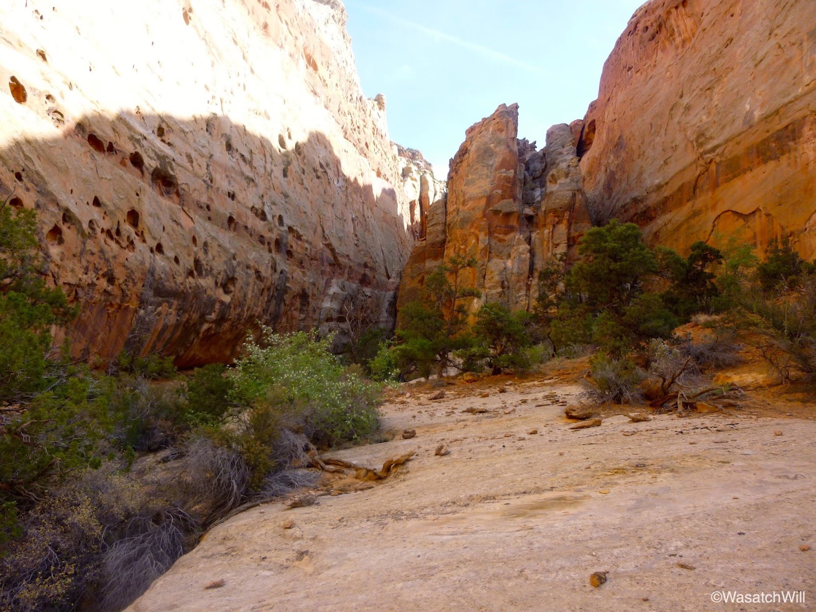
With lots of daylight left, rather than lay back and relax for the remainder of the afternoon and evening, I decided to go out and explore more. I emptied out my pack, keeping only some water, snacks, and other small essentials, and stashed the rest of my gear in a hidden and secluded spot where I would return to set up camp. I then set off to go further down the Frying Pan Trail about another mile or two before turning off to explore both the eastern run of Frying Pan Canyon and the north and south forks of the western end.
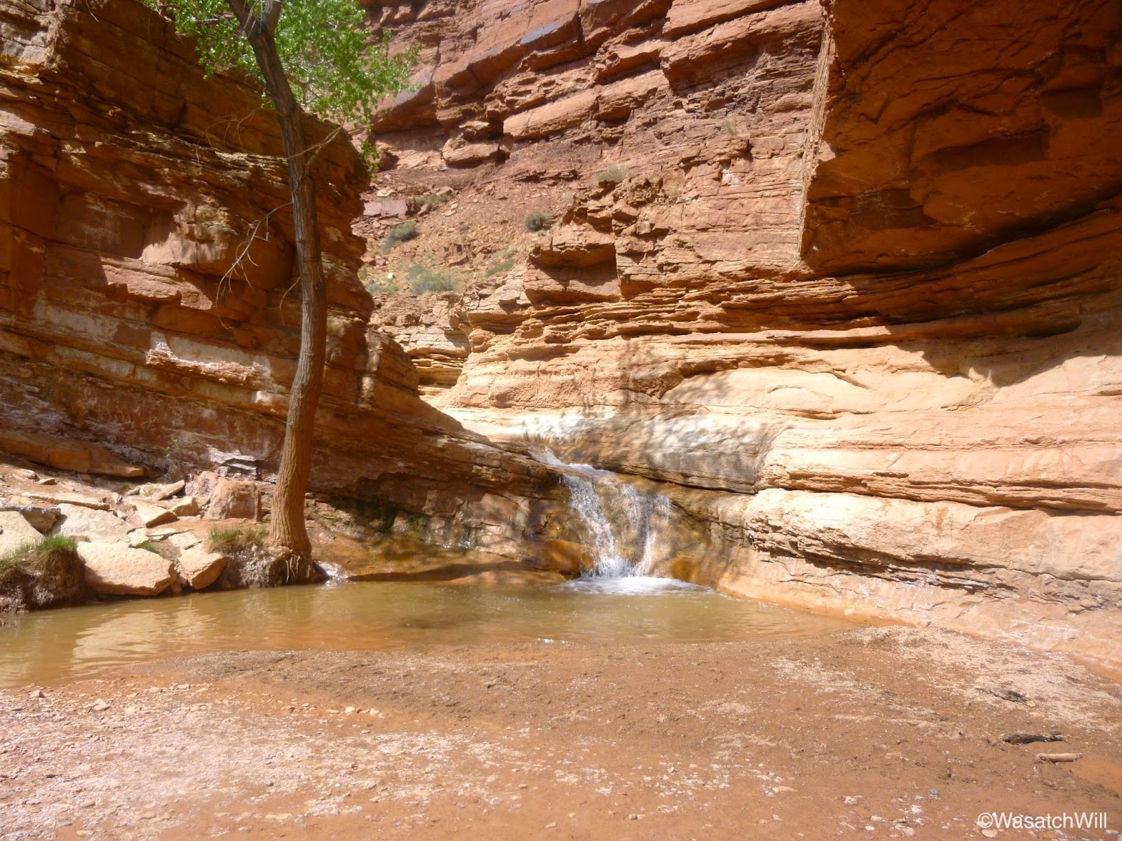
The eastern run came to a dead end a few hundred feet away from the main trail with a dry fall that gave way to a few waterpockets.

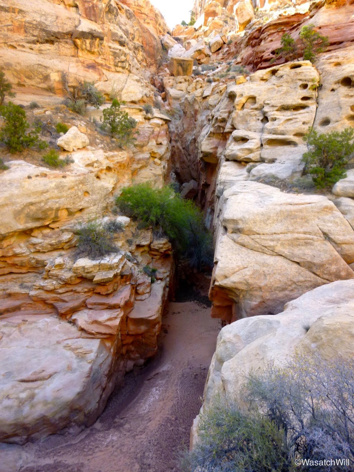
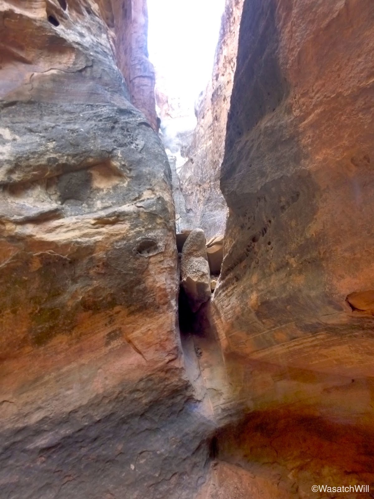
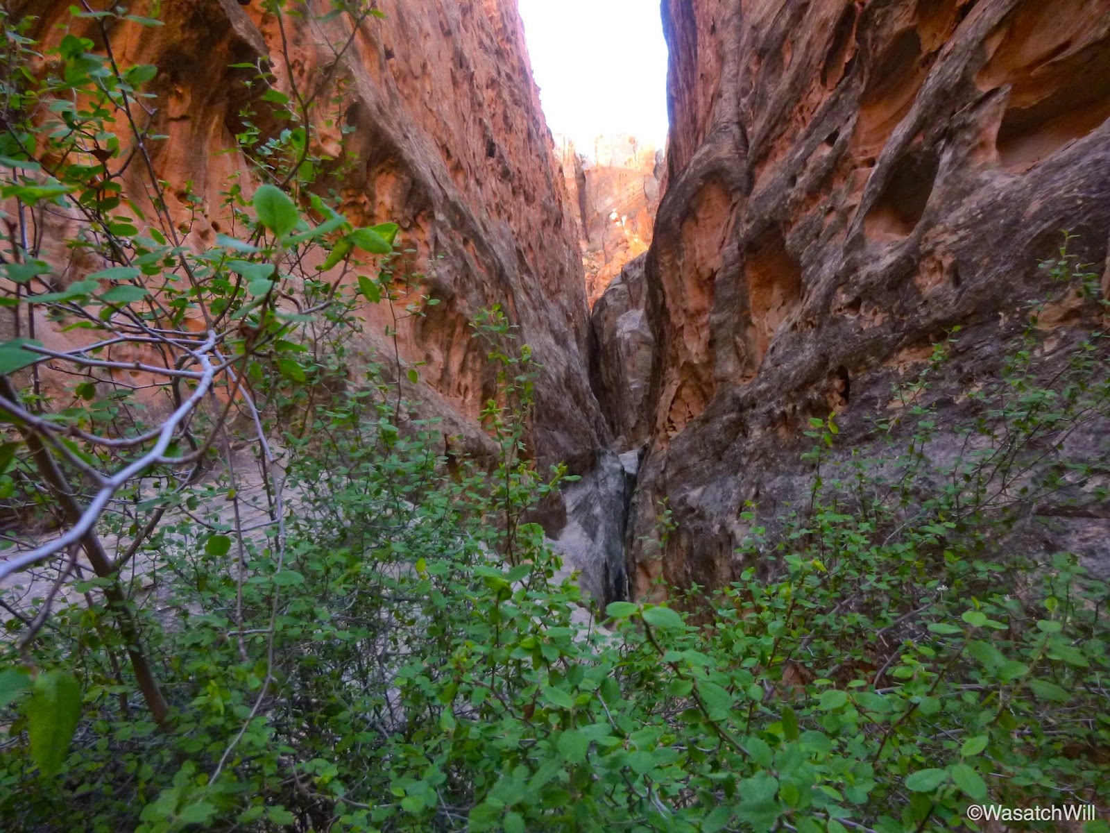
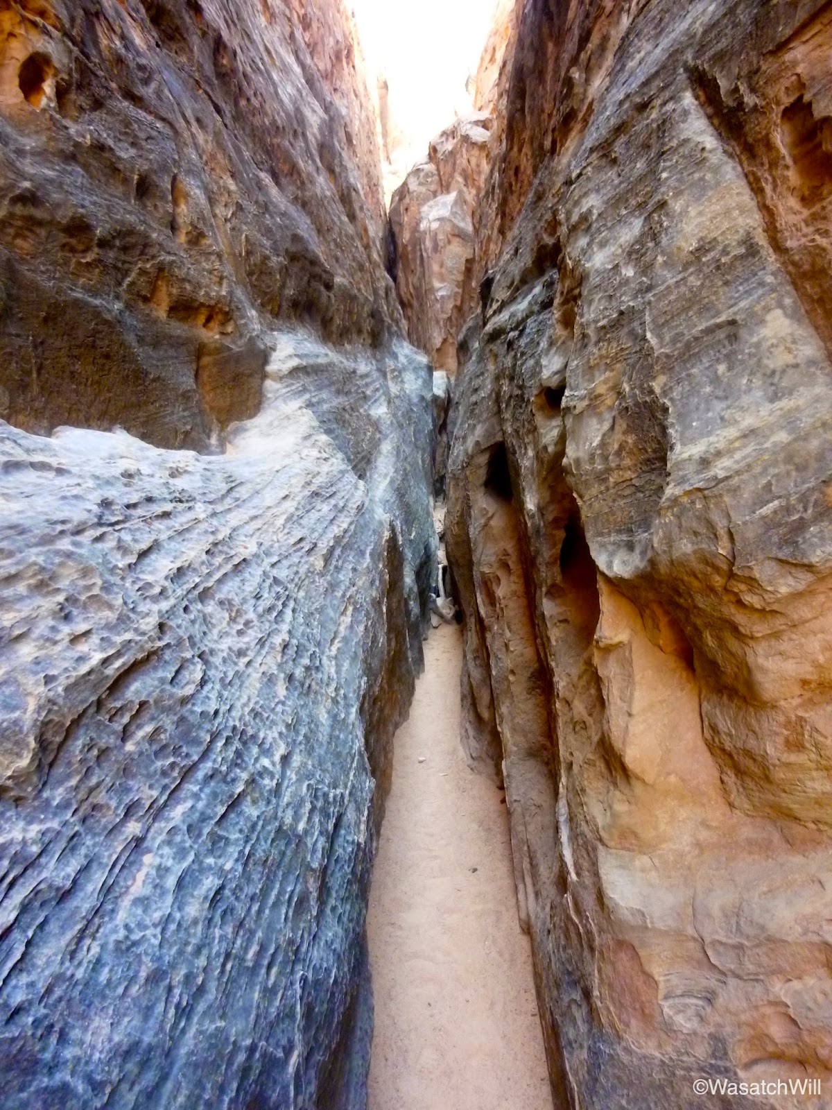
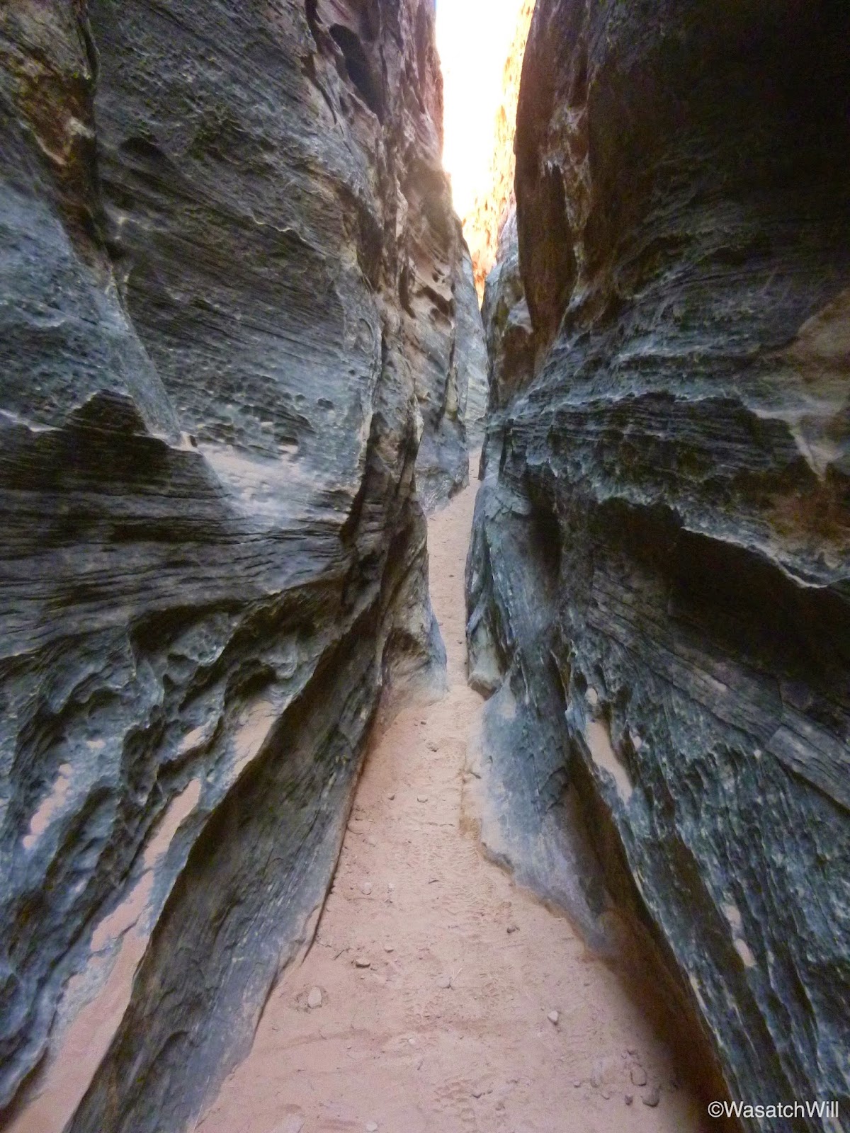
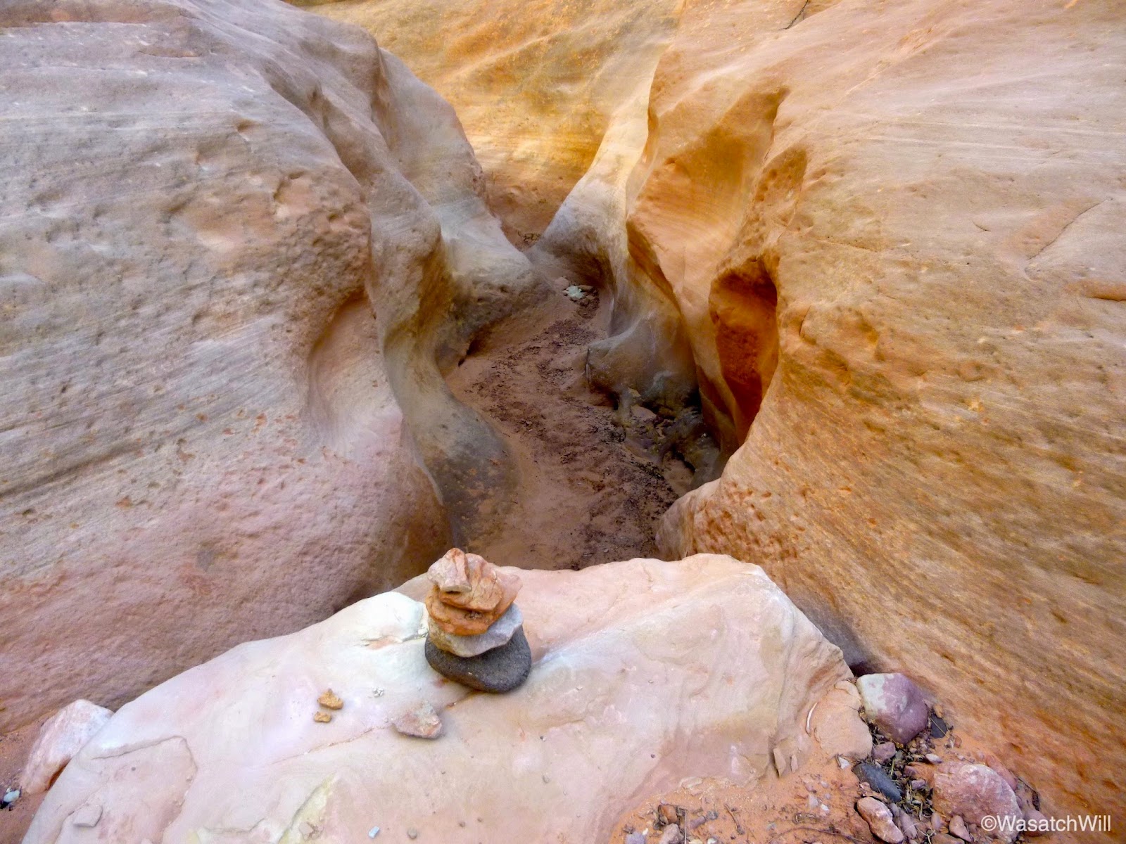
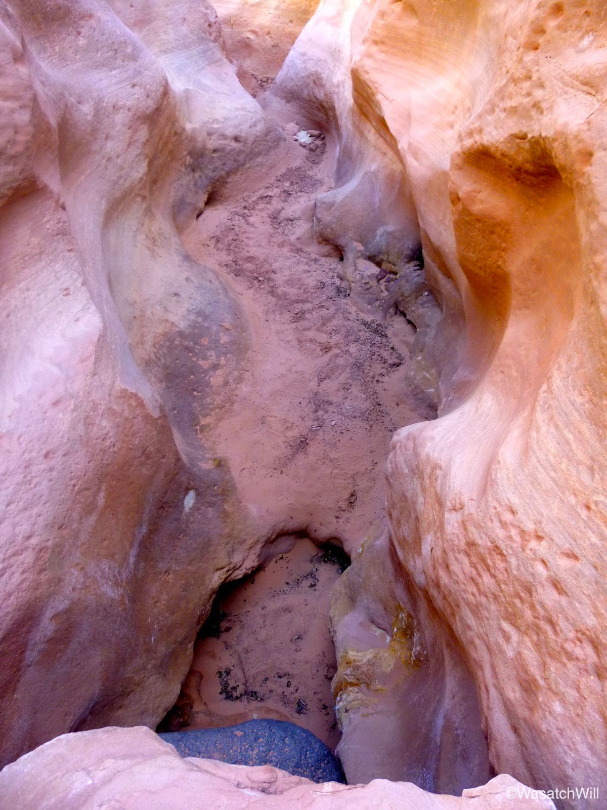
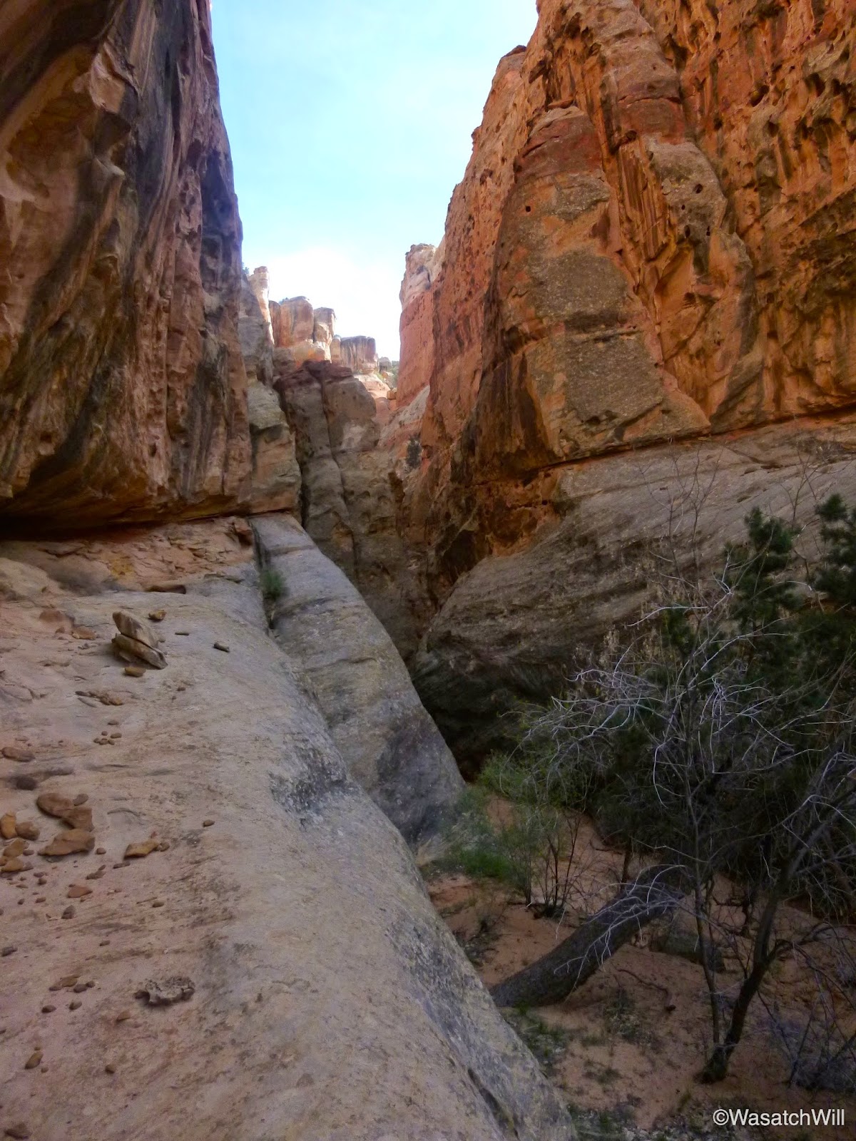
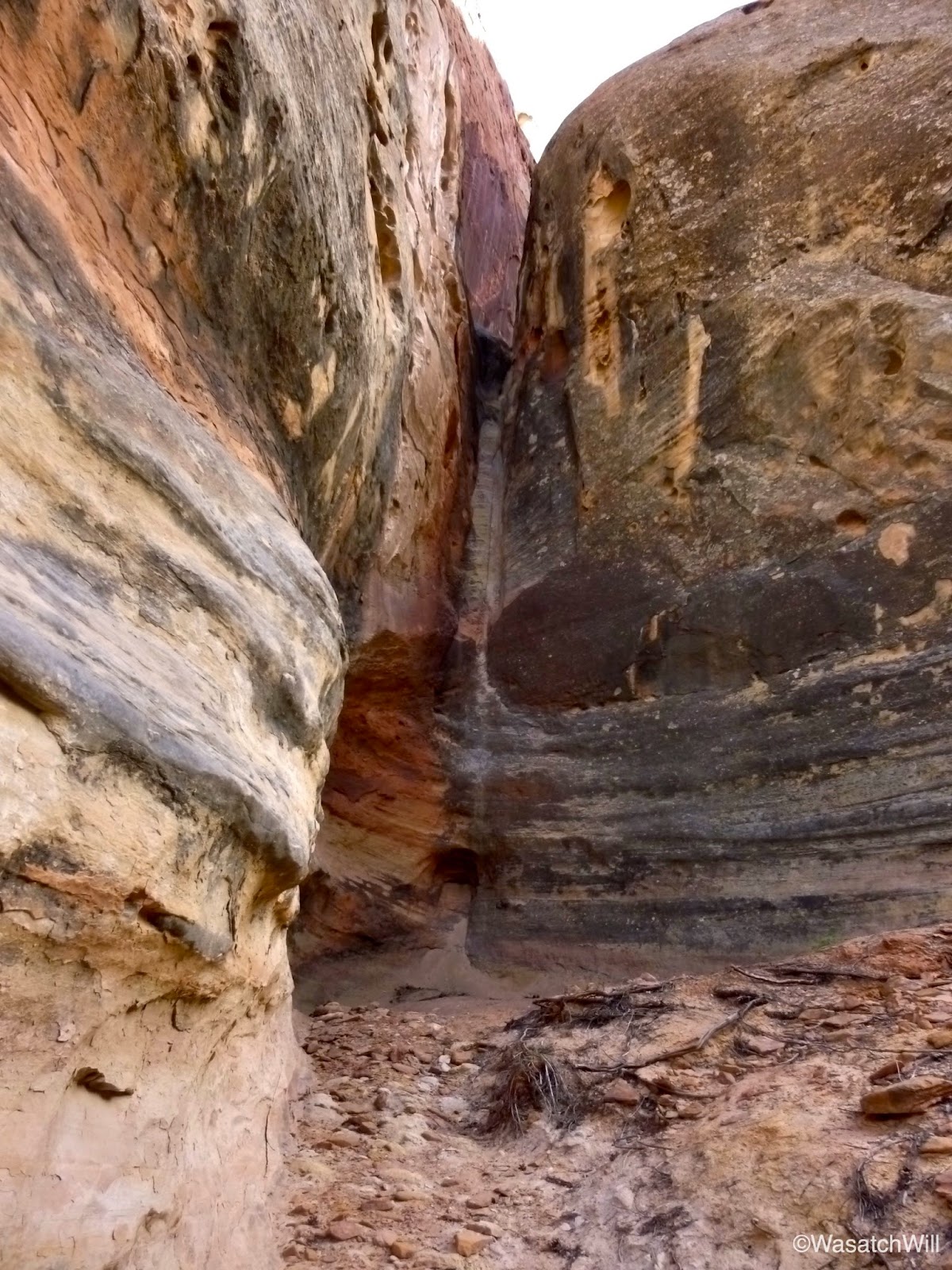
After taking in that view for a few minutes I returned to the trail and ventured up the west forks. The south fork turned into a bit of a slot but I couldn't go very far into it before reaching another pour off that was a bit too high for me to feel comfortable with going up, let alone back down it.


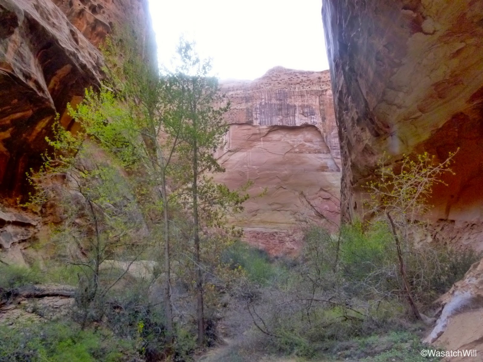
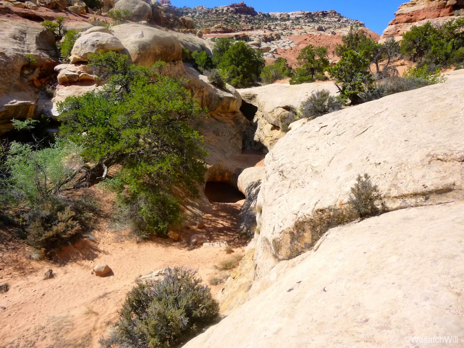
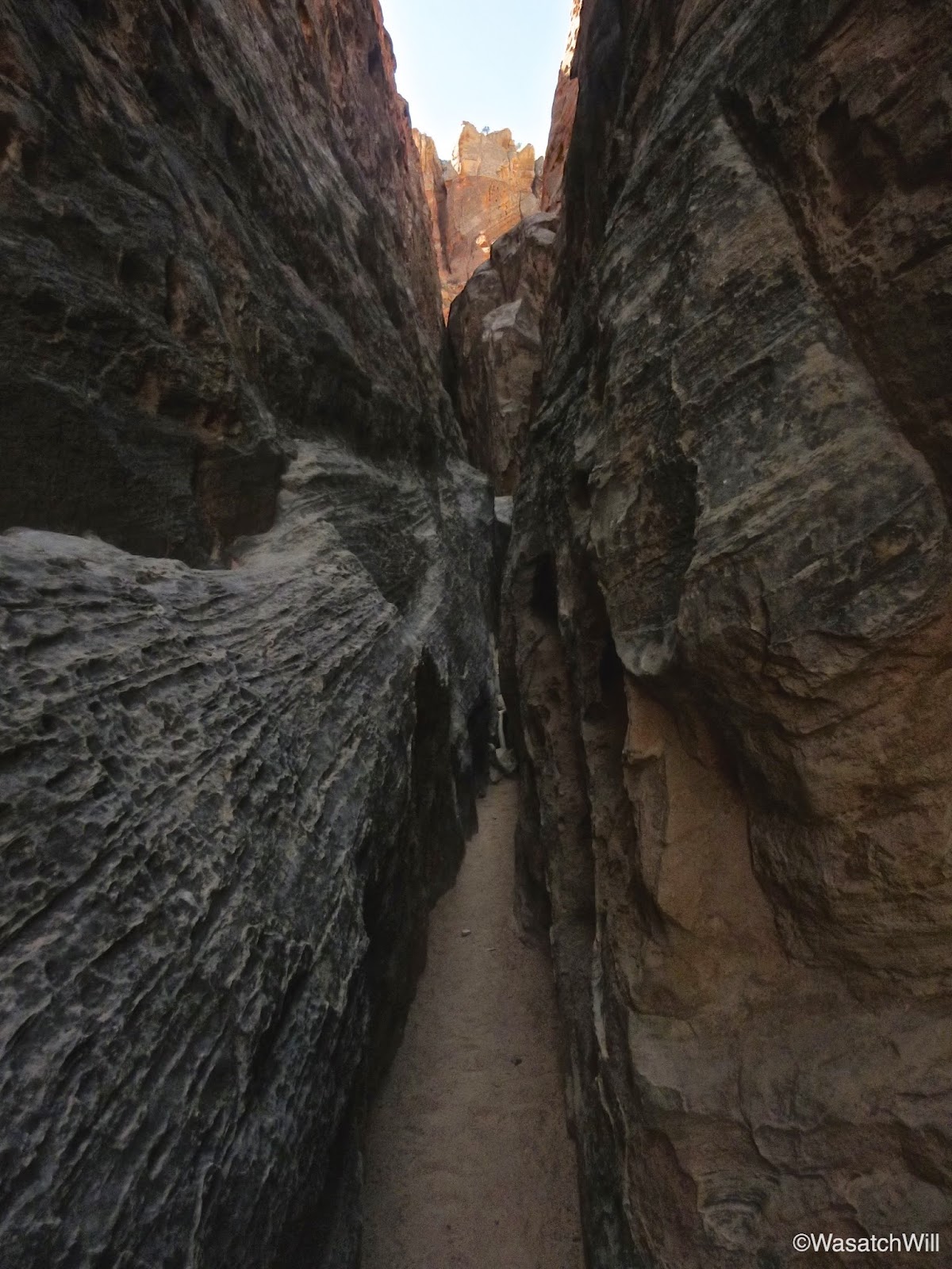
So, back out and up the north fork I went. The north fork had a lot more vegetative growth to cope with. At one point you can look up and see what appears to be a little arch high up.

Eventually you come to a dead end where you hit a wall and find yourself surrounded on three sides by the towering cliffs around you, hundreds of feet high.

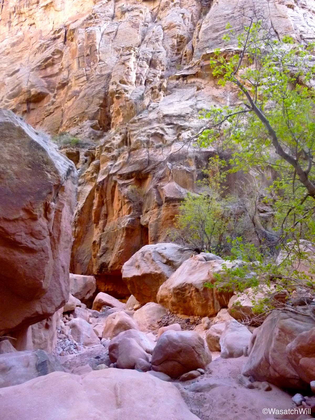
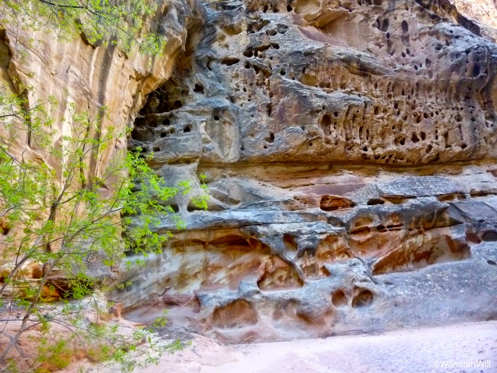
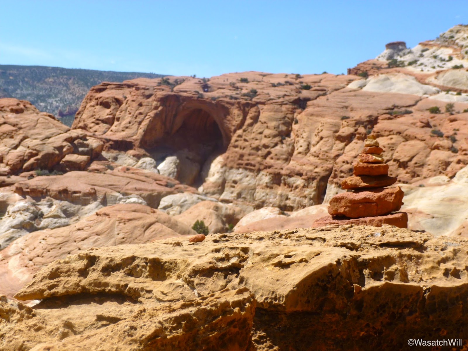
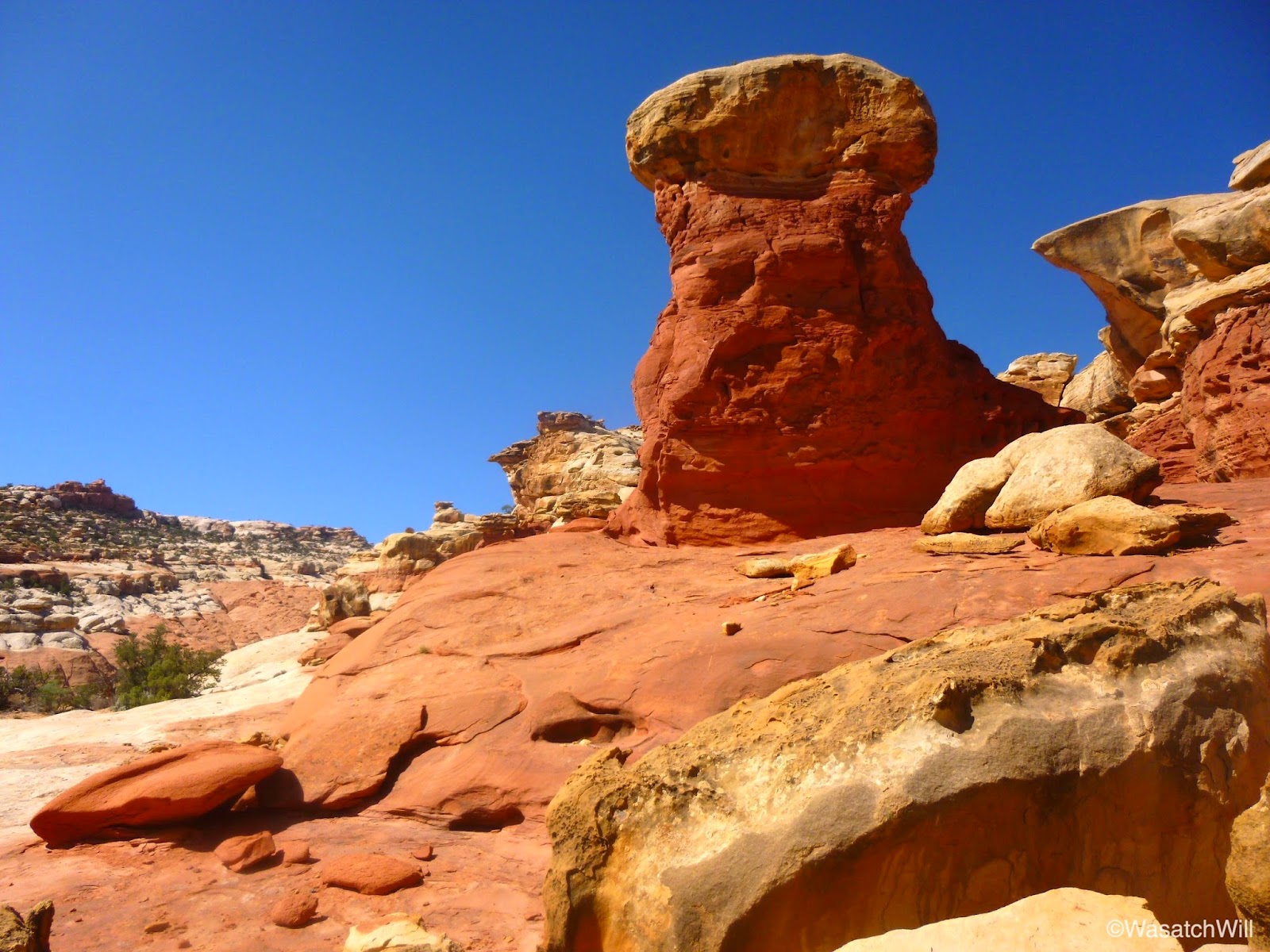
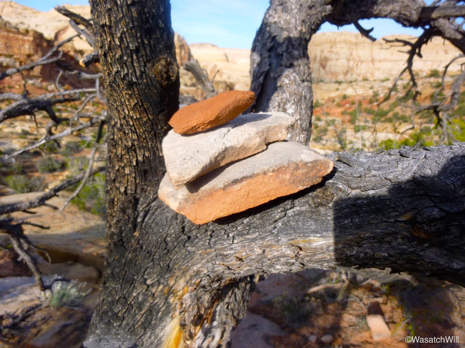
Along the way back I took notice of a monolith covered in holes. This swiss cheese like texture was actually pretty common on rock faces throughout the route. Also observed on the way back was a cairn held up in a tree.


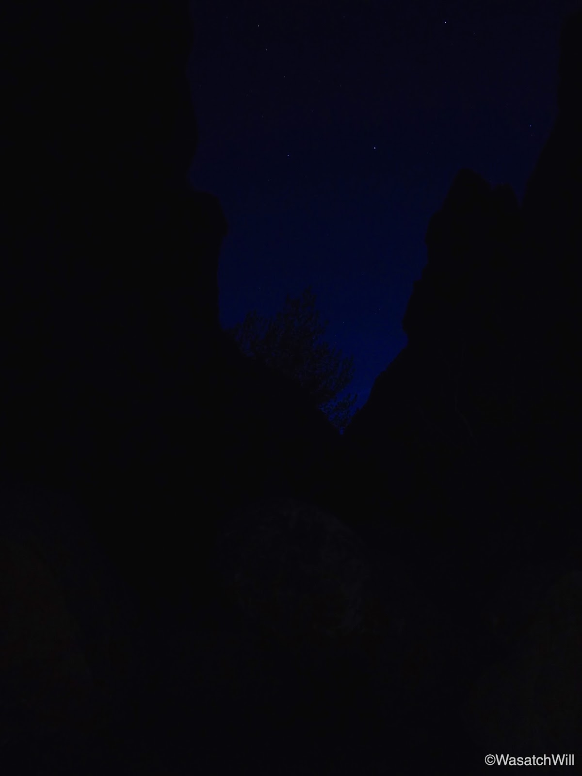
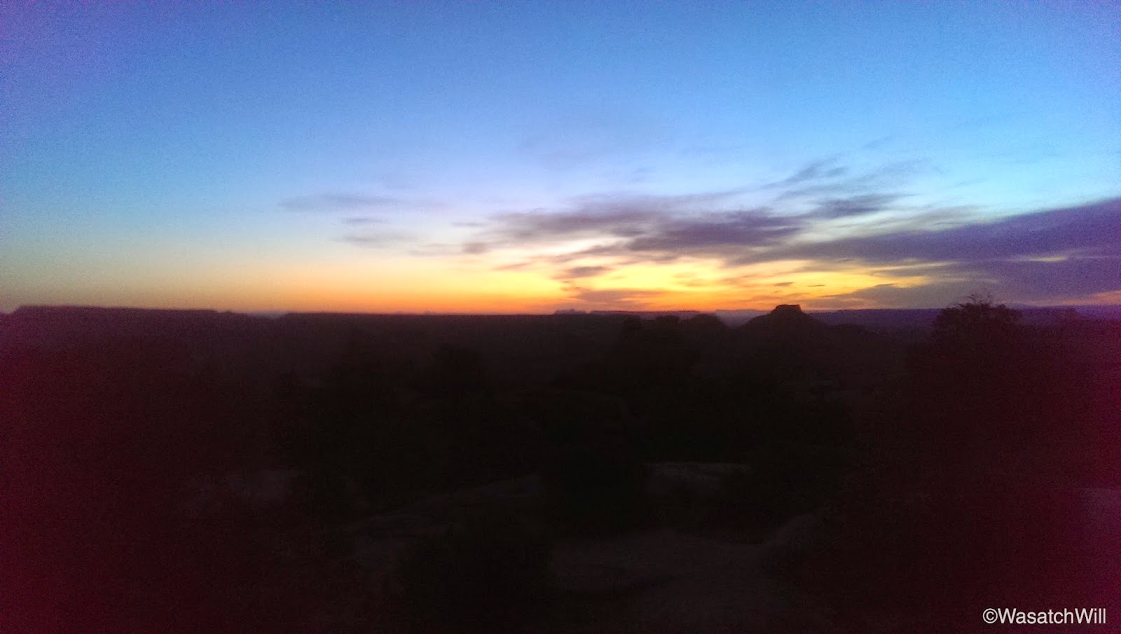
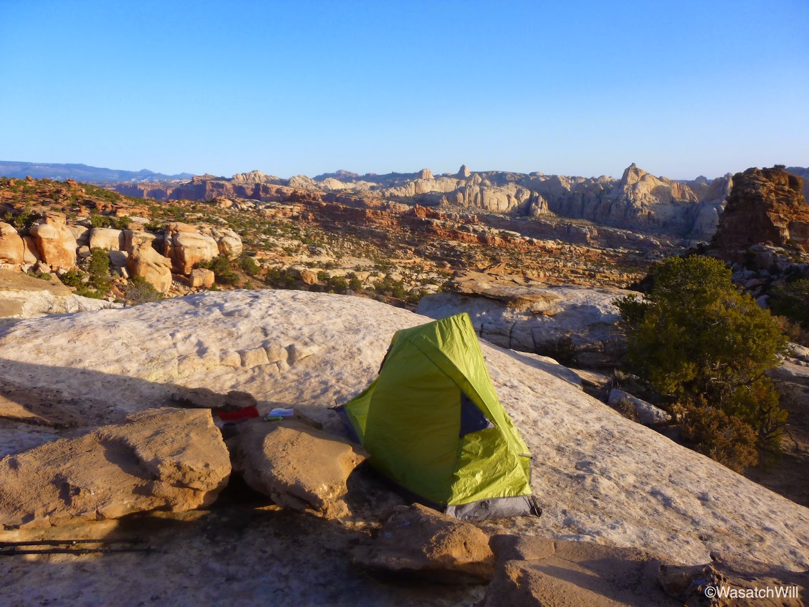
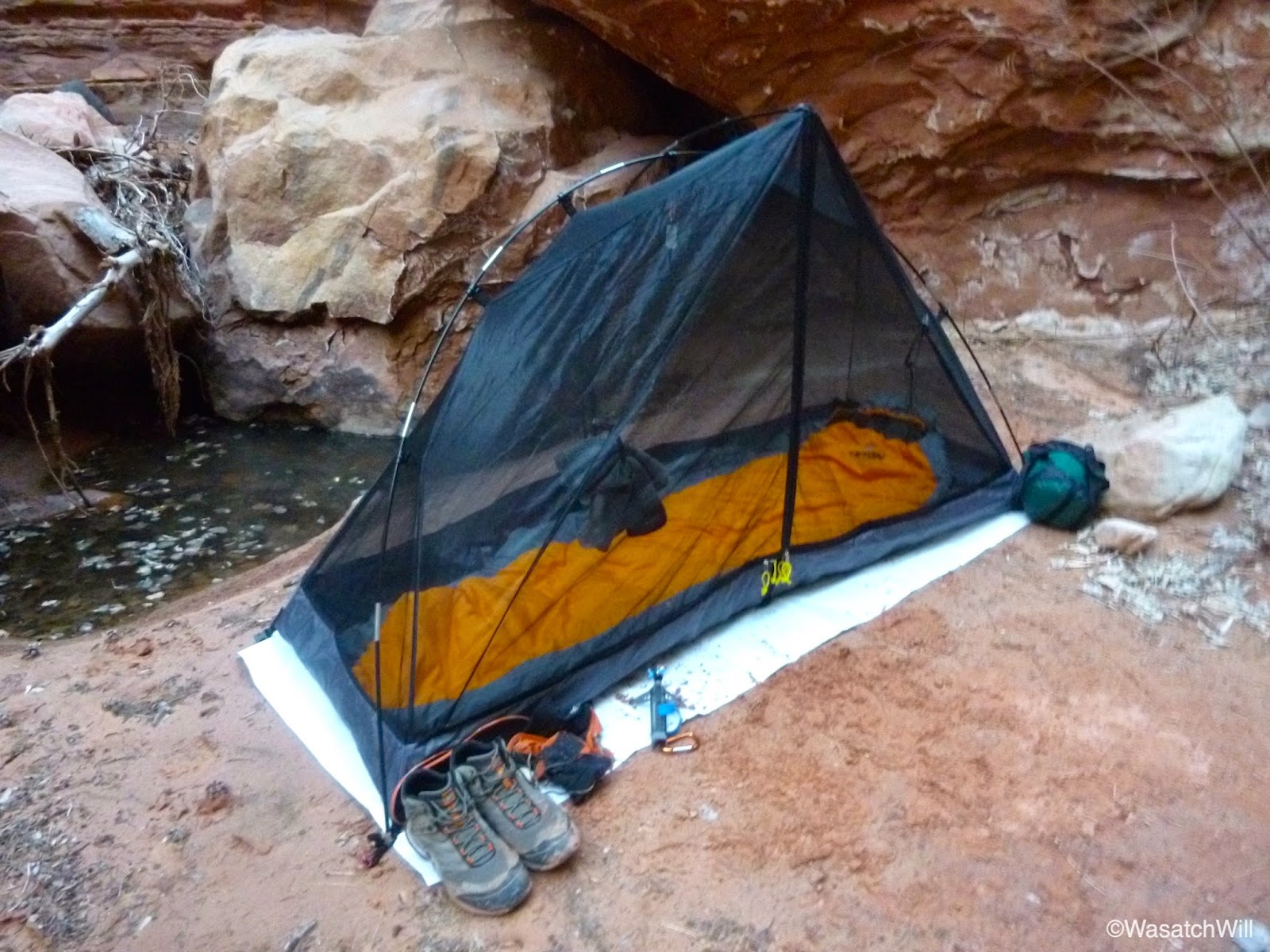
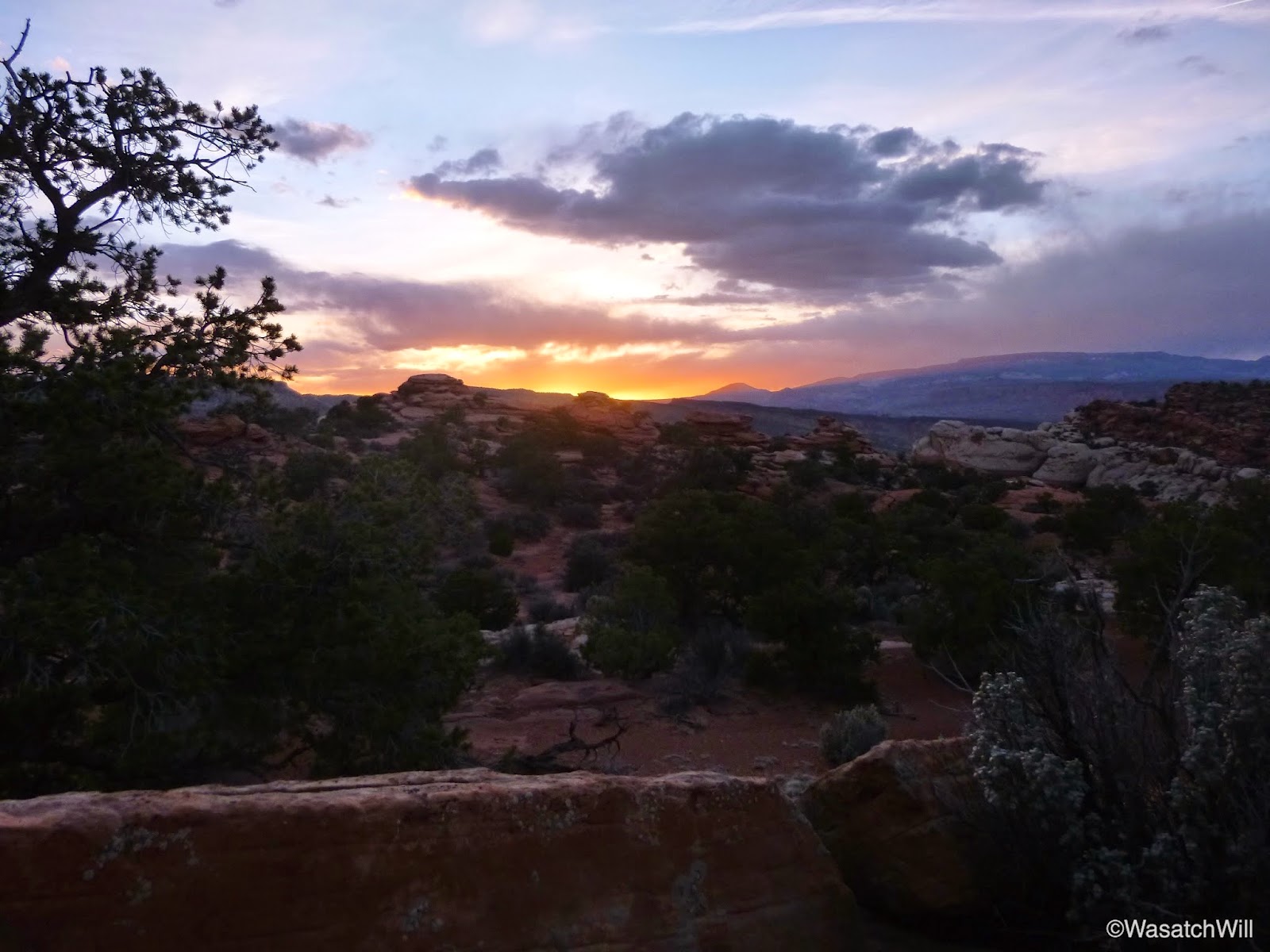
Once back at my camp spot for the night, I set up my bed and kitchen. With the clear skies and the fantastic view surrounding me, I decided it was worth cowboy camping out under the stars, sans a campfire, so I set up my bed out on a large slab of rock in a spot I thought would be somewhat sheltered from the prevailing wind while still leaving much of the view open. The wind was picking up quite a bit though so I thought it was worth setting up the tent nearby for a retreat in case the wind became too much.

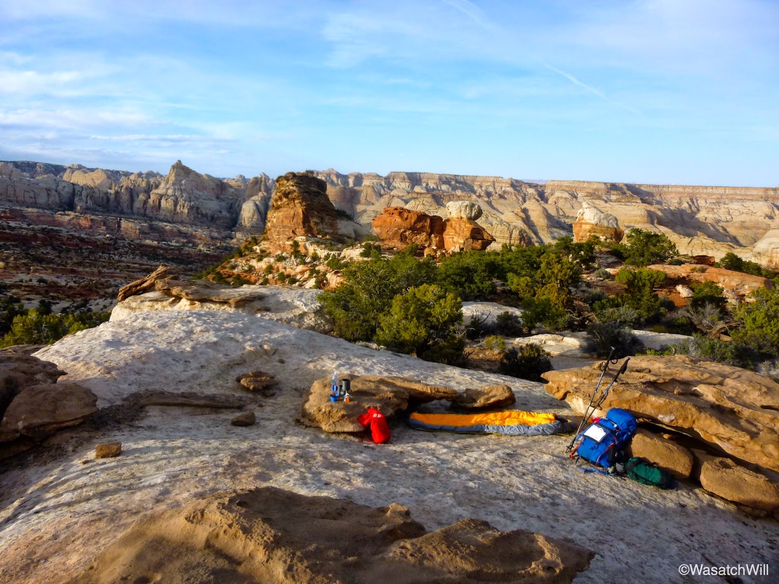
After setting up for the night, I went back out across the trail and found my way up to a small rocky outcropping that delivered views of the western horizon. There I had dinner and awaited the sunset before ultimately calling it a night.

After darkness had settled into the sky and I was getting all settled into my bag to do a bit of reading, I was greeted by a mouse who seemed intent on sneaking into my bag with me, despite having my food sealed up in an Opsak on the other side of the rock and well away from me. Large ants were also running about all around my sleeping bag and a moth the size of bat decided to check out my head lamp. Had it not been for the mouse, I would have stuck it out, but that mouse did not look trustworthy and after several moments of failing to scare off the resilient little creature, I surrendered and ceded the territory. Into my tent I went.
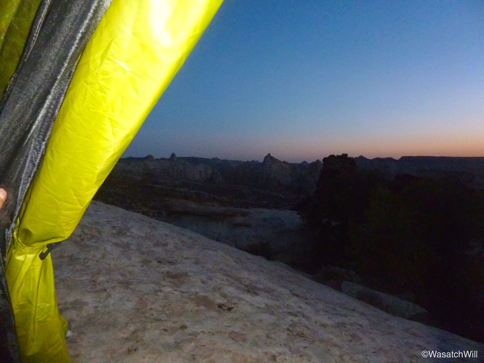
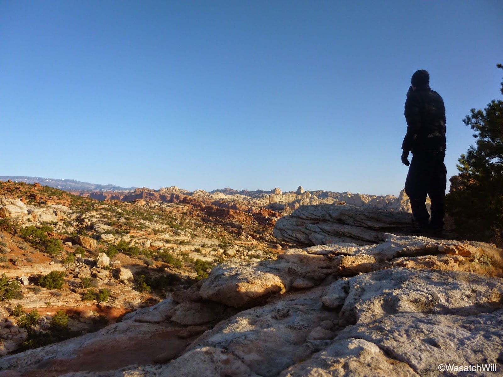
At about 4:00 in the morning, while answering a nature call and disappointed that I surrendered my sunrise view to a mouse, I decided to pick up my tent and move it out onto the rock and reclaim the prized piece of real estate. It took all of about 5 minutes to move the tent and settle back into my bag. Two hours later, I was witnessing the dawn of the new day.
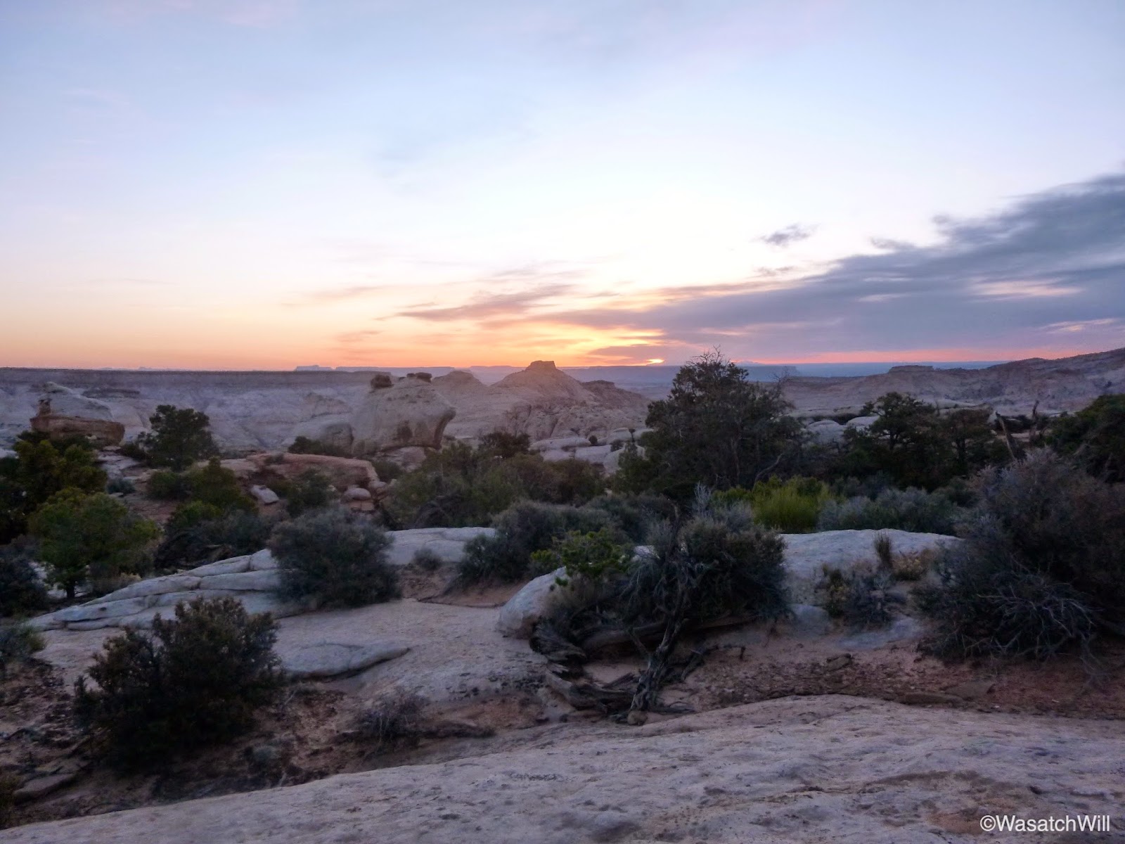

The wind had died back down a bit and again, the temperature remained pleasantly mild. Just chilly enough to warrant wearing my jacket when not bundled up in my bag. While capturing the morning shots, my camera began to flash its low battery warning at me. I had brought along a small little charger that I intended to use to recharge my camera's battery but unfortunately realized that I had neglected to pack along the proprietary cable for it. Thank you, Panasonic, for not keeping life simple with a standard micro USB port. My phone was also nearly dead, despite being powered off during the nights and placed on airplane mode for much of the two days prior. Since I did not have my camera cable, I offered up my pocket charger to my phone.
Wanting to preserve what little battery I had left on my little pocket Panny for a few shots along Cohab Canyon and Sulphur Creek later on in the day, I had to resort to my phone and video camera for capturing any stills for the remainder of the Frying Pan trail leading down into Cohab Canyon. Unfortunately, my phone's camera is very poor at capturing anything close to a crisp clean picture of distant landscapes, even in its dedicated landscape mode. It is really only any good when shooting closer subjects. The video camera does better with landscapes, but I still didn't get any good stills of anything along the rest of the Frying Pan Trail with it that would be worth sharing here, so to get an idea of the scenery for that section of the hike, the video further below will need to be watched.
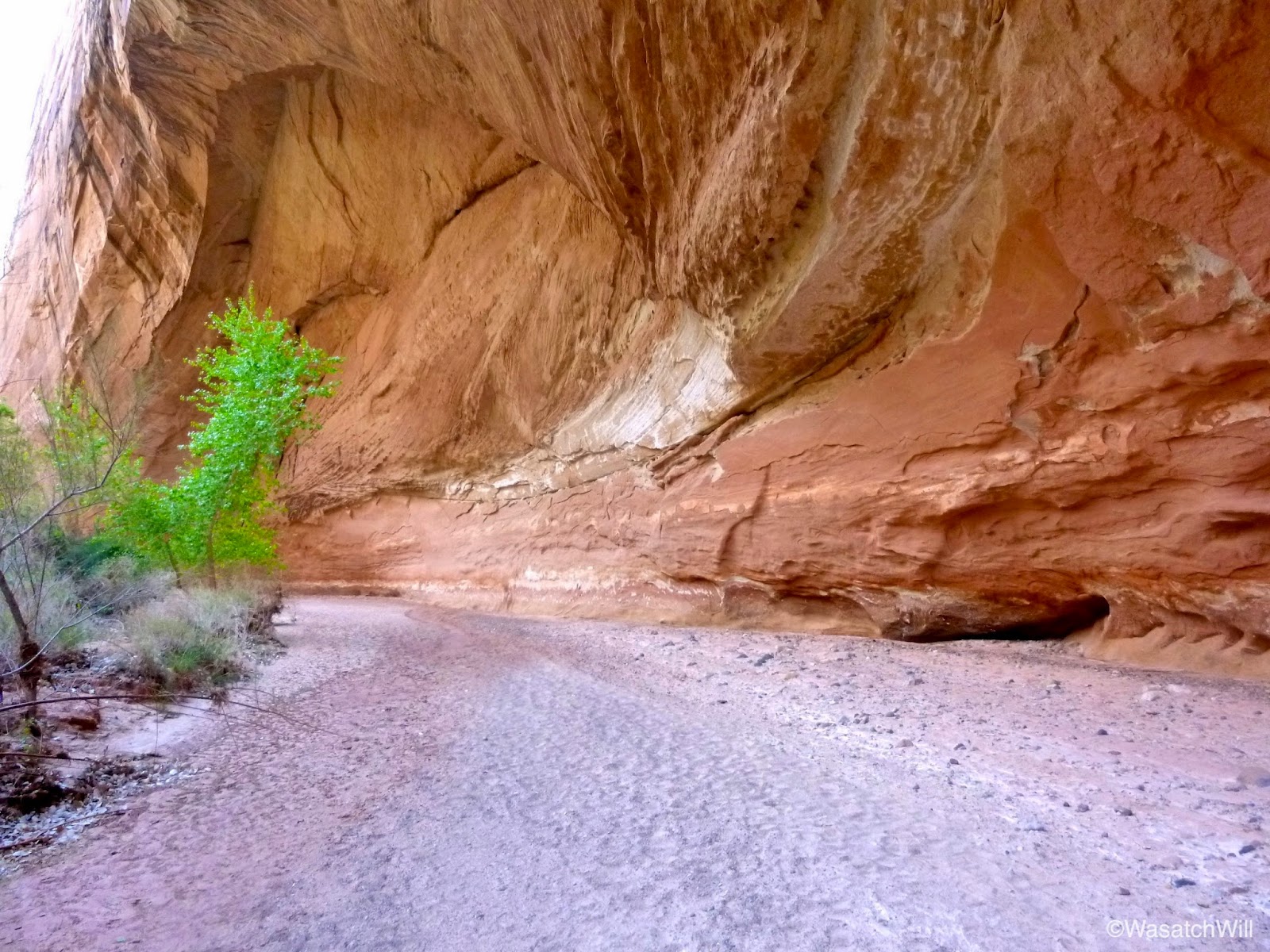
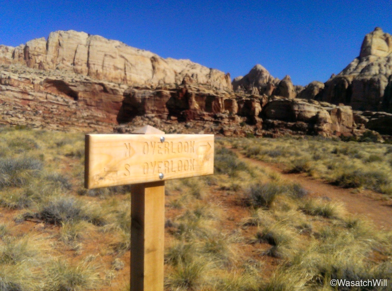
After finishing off the Frying Pan Trail, I reached the junction with Cohab Canyon. I opted to take another brief side trip off the main route to check out the Fruita Overlook points that lie between Cohab Canyon and the highway. I paused for a mid-morning break and snack at the south overlook.

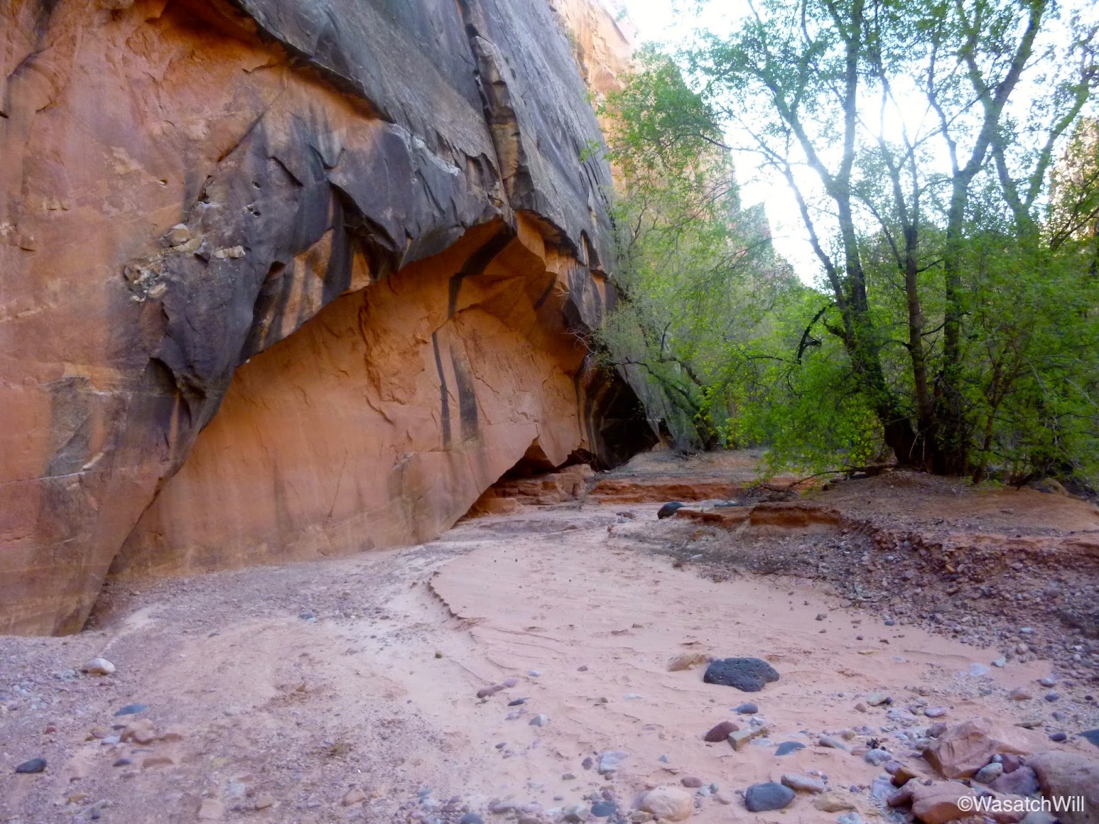
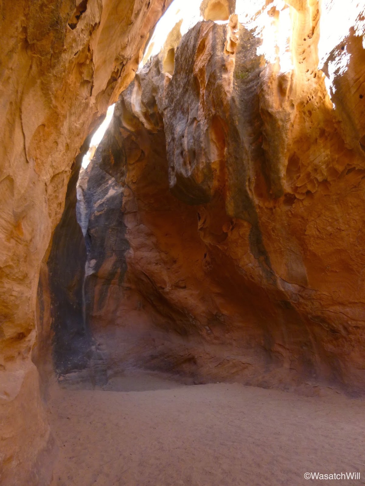
I returned back down into Cohab and set course for the one mile down to Fruita. Of course, I would be distracted along the way by a few of the side slots feeding into Cohab further up trail.


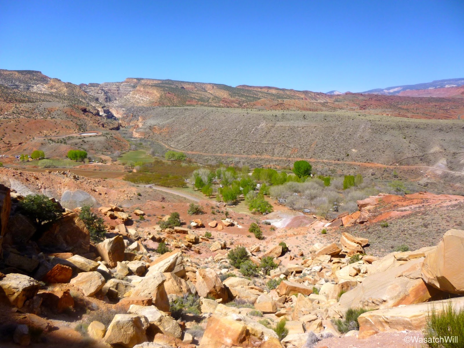
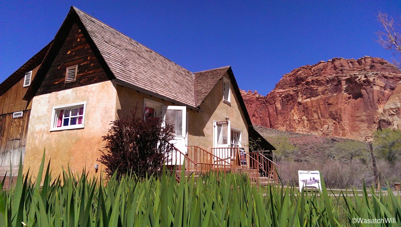
At last, I had reached the western end of Cohab and was again gazing down upon Fruita, the old pioneer settlement named after its many fruit tree orchards and which now serves as the Park's headquarters.
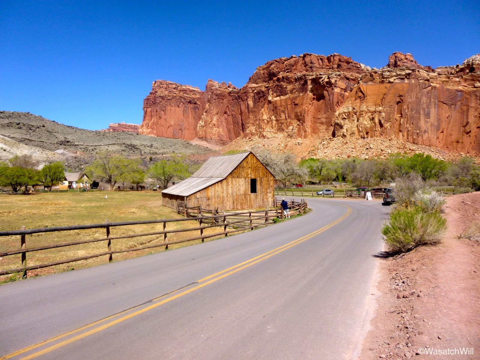
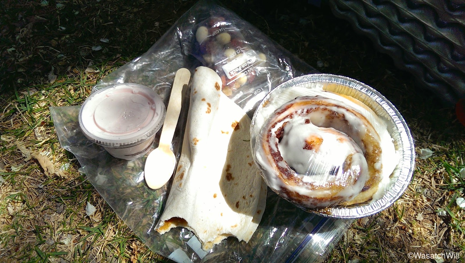
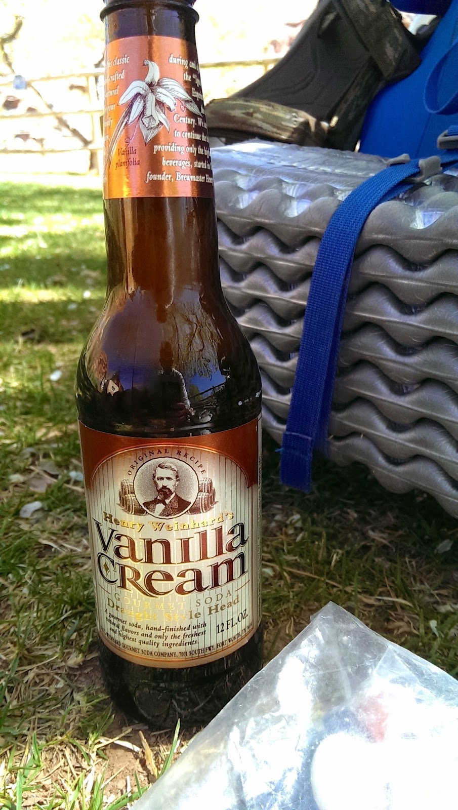
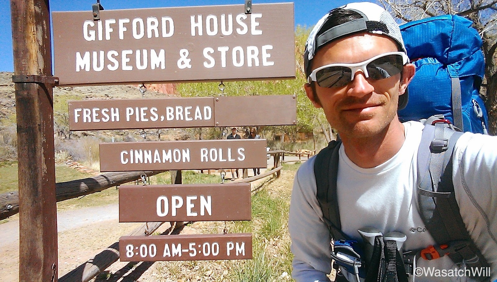
After several switchbacks, I was back into Fruita proper. I planned my timing perfectly. Good thing too, because it was at this point that I finished off the last of the 4+ liters of water I had packed out from my campsite in Spring Canyon the prior morning. It was now lunch time and I was intent on getting some ice cream and other treats down at the old Gifford House homestead. Along with a serving of old fashioned ice cream, I picked up a fresh baked cinnamon roll and a bottle of soda to go along with my final tortilla that I would smear with peanut butter and honey for lunch.


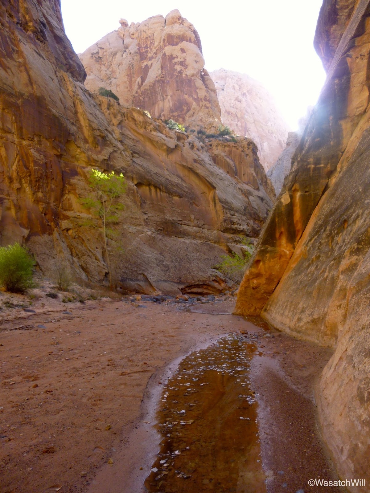
With a belly freshly loaded with carbs and some well rested feet, I picked up and ventured on down back to the Visitor Center. There, I filled up a couple water bottles, purchased a few small gifts for my kids, and exchanged my shoes for my sandals to finish off the last leg of the trip, Sulphur Creek.

Due to the exhausted battery on my still camera, I was only only able to cheat out another picture or so going up Sulphur Creek. At this point, my phone was also reaching the end of its battery life once again, even after being on the pocket charger earlier in the day. This was largely due to trying to obtain a roaming signal for some time just before descending down into Fruita to send my wife some texts letting her know I was still OK and nearing the end of the trek. So, all I really had left for any stills, was my video camera and since I was intent on maintaining its use for video, I did not get many still shots along Sulphur as I would have liked.

At the lower waterfall as pictured above, I encountered a woman with two young children seemingly stranded atop of the falls not knowing how to safely get down. This is where many seem to get stuck for a time and perhaps the trickiest part of the hike whether going up or down. I was able to assist her by having her drop her children down to me along the left side of the falls looking at it from below and then directed her across the creek and over the the shelf along the right side.
Note: I would advise that young children not be taken up or down this section of Sulphur Creek without at least two adults in the group.
For a brief moment, I wondered how that woman and her kids would have fared getting down had I not arrived when I did. However, another group with more adults followed not long after them. Of course, they were not familiar with the best way down either so I was able to offer direction to them as well. Once they were clear, I made my way up and over and surveyed the many other groups I encountered making their way down the creek, especially those with young children, making sure they knew how to get down those lower falls safely. It is a very popular section of the Park to hike, but I found many had not properly read up and done their research on it.
It is amazing how many more people you encounter when traveling up against the direction that most typically hike the creek. Those who have hiked the John Muir Trail northward can probably relate.

Again, to see more of Sulphur, one will just have to watch the video below. More pics taken along Sulphur Creek can also be viewed from a day hike with my wife and daughters last spring here.
Video
Final Thought
I thoroughly enjoyed this route and have been trying to come up with a good name for it. While sections of the hike were full of hikers, others were full of solitude. It was a great way to experience the solitude of solo backpacking for the first time while still being near enough to high traffic trails to signal out for help if needed. Given the proximity of Capitol Reef and this route to the town my in-laws will soon call home, I can see myself hiking this route and various sections of it many times in the years ahead. I look forward to being able to take my wife along it and perhaps other family and friends in the future.
Edit: There was a major typo I had to fix.
Edit #2: Turns out that the pic I thought shows the Castle, is not the castle after all, after looking over my map again. So, I removed that bit so as to not deceive any others.
Featured image for home page:

Background:
When I was dating my wife, her family introduced me to Wayne County, UT and "Capitol Reef Country" during an annual family reunion her dad's family held every year in Torrey and Fruita. Landmarks down in Capitol Reef, such as Pectol's Pyramid and Hickman Bridge are named after ancestors in my wife's family tree: Ephraim Pectol, whom my wife is a direct descendant of, and Joseph Hickman, his brother-in-law. Both are credited with being the fathers of what is now known as Capitol Reef National Park. These and other ancestors of hers are now buried in cemeteries throughout Wayne County. In introducing me to their family history, her family also introduced me to an area rich in natural beauty, and like Ephraim Pectol who had a fond love of nature, I too fell in love with the surrounding landscape.
My in-laws have owned some property in the town of Torrey, just outside the Park, for decades and have now begun to develop it with plans to settle down and retire there over the next year. Needless to say, we now frequently make visits down there and each time I look forward to an opportunity to get out and explore spots I haven't yet been to and re-visit favorites. Last week I was fortunate to hike a route that afforded me the opportunity to do both. Due to my wife being eight months pregnant and opting to stay with our other kids and her parents in Torrey, and having no others available to join along, it would also be my first true solo backpacking trip.
Over the course of 3 days and 2 nights, I pursued a course that took me along unfamiliar trails up above Chimney Rock and through Chimney Canyon, Spring Canyon, Frying Pan Trail, and Cassidy Arch while also embarking along more familiar terrain in Grand Wash, Cohab Canyon, and up Sulphur Creek. After becoming acquainted with the Sulphur Creek between Chimney Rock and the Capitol Reef Visitor Center last spring and learning more about Spring Canyon, I looked for a way to loop together both. In looking over maps this past winter as I was putting together a list of hiking to-do's for this year, Grand Wash and the Frying Pan Trail appeared to be a perfect connector. Once the route was decided upon, it was time to find a place on the calendar for it. It was penciled in for last week, knowing my older kids would have their Spring Break, making it easier for the whole family to have a little get away. Seeing the post and video from @Joey who did a longer version of the route last year after I had begun planning my trip only got me more excited for April to arrive.
Leading up to the time, I was nervous about what the weather might hold in store since the area has a reputation for being notoriously windy and stormy in April. Much to my delight, the weather couldn't have been any better.
Route:
Report:
Day 1
My journey started at the Chimney Rock Trailhead. In order to allow my wife to have the family car and to avoid occupying any space in the trailhead parking lot, which is often filled beyond capacity, I had my wife drop me off with plans for her and her dad to shuttle it back down to the trailhead for me to pick up on the final day.
Since I would be away from my family for a couple days, I wanted to spend the morning with them by taking them to the city park in Torrey and getting some playtime in with them. This meant a late start on the trail, but luckily I had actually planned a short mileage day for the first day, allowing me ample time to get all my miles done in the afternoon.
I had originally planned to hike directly up into Chimney Canyon but upon reaching the fork with the little loop trail that ventures out to an overlook of Chimney Rock and around Mummy Cliff, I decided it would be worth the extra mile to get the views. I paused for a brief lunch break at the Chimney Rock overlook spot.

After lunch it was time to make my way down into Chimney Rock Canyon.


Once into Chimney Canyon, I was greeted with the usual magnificent red sandstone cliffs and formations on either side for which Southern Utah landscapes are so famous for.


After a good couple of miles, I reached the junction with upper and lower Spring Canyon. With lots of daylight left, I opted to drop my pack and take my one empty water bottle along with my filter up the mile or so to the spring in upper Spring Canyon that gives the canyon its namesake.

The spot where the spring emerges was filled with debris. I was glad I brought my filter up with me.

Heading back down upper Spring Canyon to the junction.


Back at the junction I reunited with my pack and made my way down lower Spring Canyon.


After a few miles, I took note of a potential camp site before continuing on for about another mile to scout out for anything better. Nothing else compared so back upstream I went to set up camp and retire for the night.


I was a little nervous about the temperature getting too cold for comfort. After speaking with the ranger when I obtained my permit earlier in the day, he said the lows down in the Park were typically a bit warmer than what was higher up in Torrey and so at the last minute, I opted to plug in a lighter weight sleeping bag in place of a warmer one I had packed. I was also prepared to sleep with my down jacket if needed, but fortunately I was able to keep it stuffed up for a pillow and my bag did just fine as the temperature would stay relatively mild.
Day 2
While I was expecting the temperature to dip down into the mid 30's, my keychain thermometer showed a temperature of just below 50 when I awoke. After breakfast, topping off my water bottles, and packing back up, it was time to finish off the rest of lower Spring Canyon.


Near the end, just prior to reaching the confluence with the Fremont River, I stumbled into some wild turkeys.


At last, I had reached the Fremont River. The sun was getting higher and the air was getting warmer, a nice contrast against what would be a frigid cold river to ford. Fortunately, it wasn't running very high and the icy cold sting across my toes did not have to last long. For a brief moment, it was actually a welcome respite for my sweating feet.


Once on the other side of the river, I swapped my sandals back off for my hiking shoes and made my way up the brief stretch of highway to reach Grand Wash. While hiking along side of the road, several show cars covered in decals whipped past. I didn't get any video or photos because I didn't realize what was going on until I realized one common decal on all the vehicles read "Dustball Rally". Apparently, I was witnessing an annual rally of drivers in the middle of their journey from El Paso to Vegas.
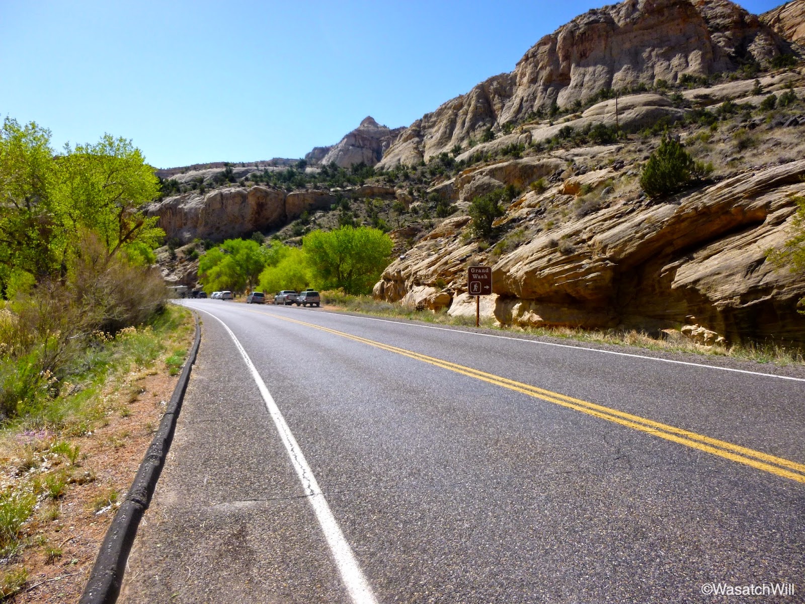
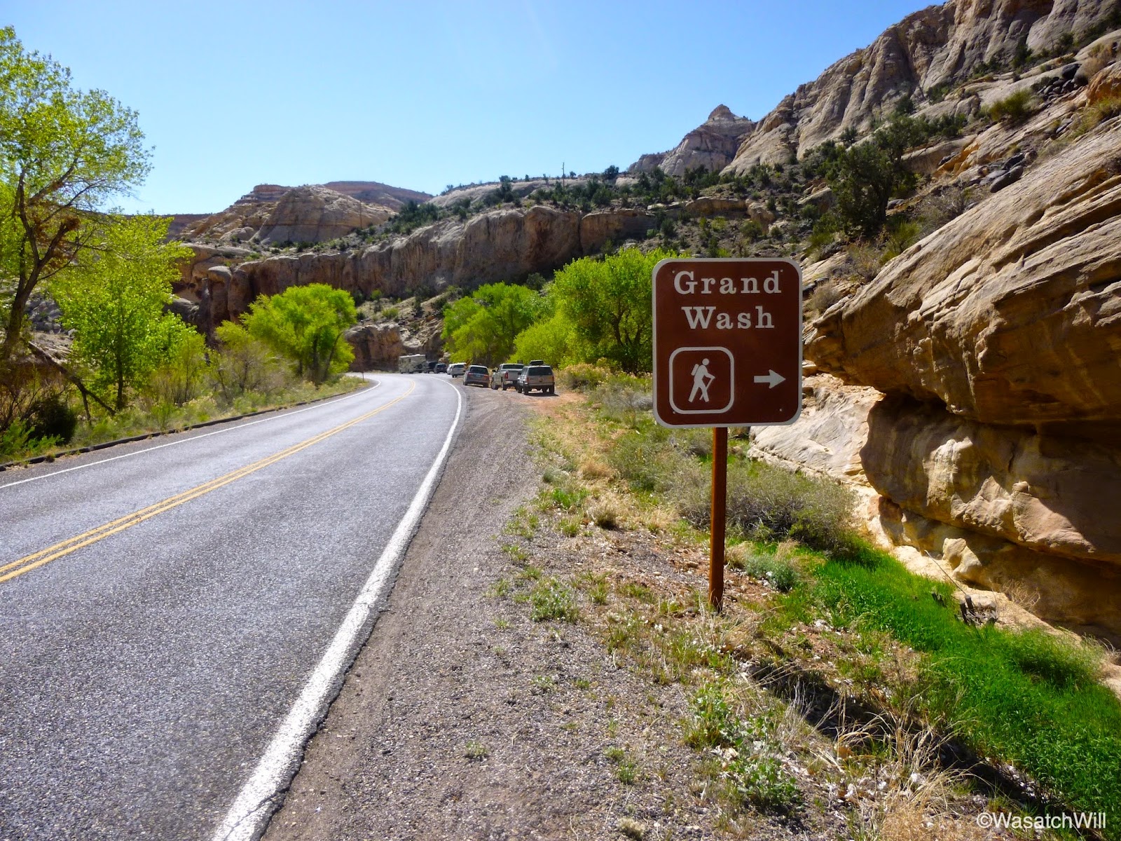
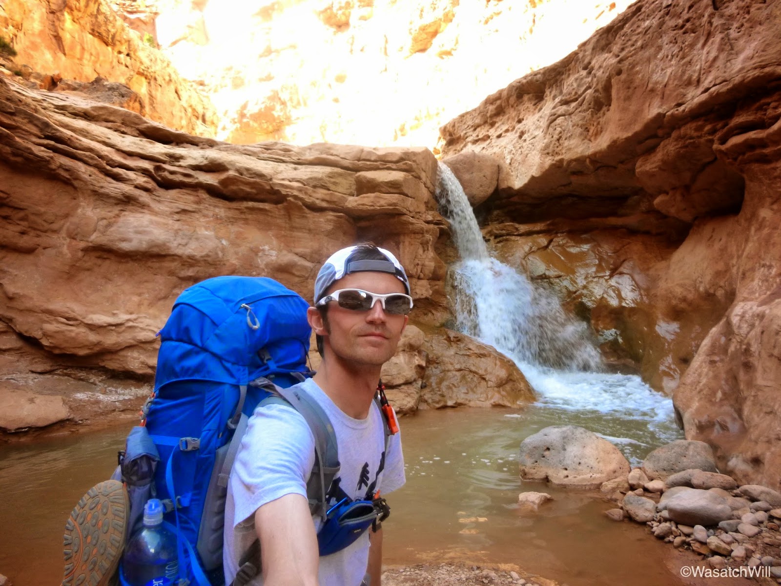
Soon, I was ready to hike Grand Wash en route to picking up the trail that leads up to Cassidy Arch and the Frying Pan Trail.


Once at the junction with the Cassidy Arch trail, I took another brief water break and began my way up another unfamiliar stretch of trail in anticipation of getting to see Cassidy Arch, another popular landmark in the Park I hadn't yet seen. The trail quickly gains elevation, offering fantastic views of Grand Wash and beyond.


After rounding a bend, Cassidy Arch came into view.


A little further on, I reached the turn-off for the arch and made the side trip out to break for lunch. It would be the second day in a row that I would enjoy lunch with such a spectacular view.


A couple hundred feet or so from the arch is a ledge where one can get a view down into the western end of Grand Wash.
After a good long break, it was time to get moving again. Back out to the turn-off and upward and onward along the Frying Pan Trail I went.

Near the area where the trail reaches it's highest point, I stumbled into a spot where it was very tempting to make camp at.


I resisted the urge to drop my pack and set up camp right then and there because I had marked up a handful of other potential spots out west of the trail that I thought would hold great views of Boulder Mountain and Fruita and from where I could watch the sunset over the horizon. When you look at satellite imagery, one would think that the area I had in mind was fairly open and easy to navigate. However, when I went westward, I encountered obstacle after obstacle that were much bigger than what the satellites would have you believe.
After some time making several attempts to find a safe way across and out to the western edge of the plateau, I concluded it wasn't worth pursuing, especially with how much I'd have to climb back up and through to get back to the trail the next morning. So, I returned back to the first spot I stumbled into. I do not regret it. In exchange for a prime sunset viewing spot it promised a prime sunrise spot.
With lots of daylight left, rather than lay back and relax for the remainder of the afternoon and evening, I decided to go out and explore more. I emptied out my pack, keeping only some water, snacks, and other small essentials, and stashed the rest of my gear in a hidden and secluded spot where I would return to set up camp. I then set off to go further down the Frying Pan Trail about another mile or two before turning off to explore both the eastern run of Frying Pan Canyon and the north and south forks of the western end.
The eastern run came to a dead end a few hundred feet away from the main trail with a dry fall that gave way to a few waterpockets.

After taking in that view for a few minutes I returned to the trail and ventured up the west forks. The south fork turned into a bit of a slot but I couldn't go very far into it before reaching another pour off that was a bit too high for me to feel comfortable with going up, let alone back down it.

So, back out and up the north fork I went. The north fork had a lot more vegetative growth to cope with. At one point you can look up and see what appears to be a little arch high up.
Eventually you come to a dead end where you hit a wall and find yourself surrounded on three sides by the towering cliffs around you, hundreds of feet high.

Along the way back I took notice of a monolith covered in holes. This swiss cheese like texture was actually pretty common on rock faces throughout the route. Also observed on the way back was a cairn held up in a tree.


Once back at my camp spot for the night, I set up my bed and kitchen. With the clear skies and the fantastic view surrounding me, I decided it was worth cowboy camping out under the stars, sans a campfire, so I set up my bed out on a large slab of rock in a spot I thought would be somewhat sheltered from the prevailing wind while still leaving much of the view open. The wind was picking up quite a bit though so I thought it was worth setting up the tent nearby for a retreat in case the wind became too much.
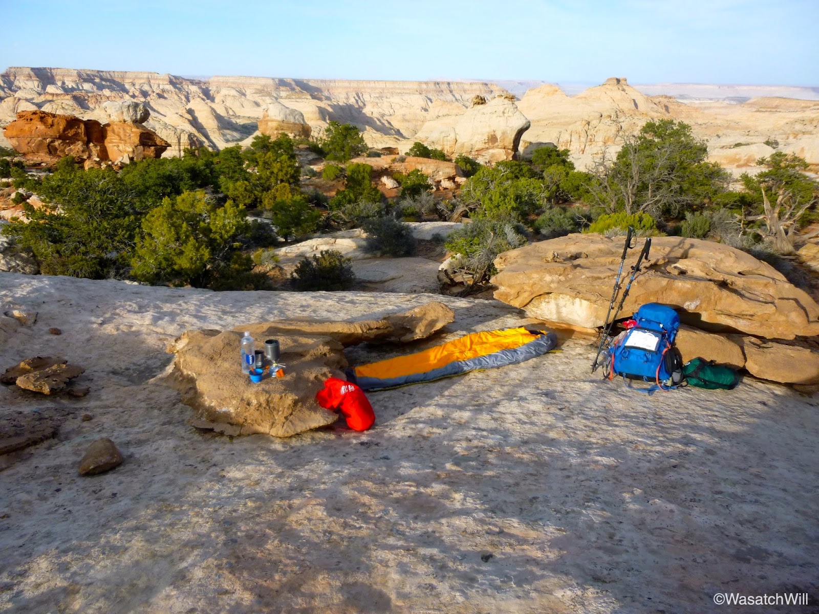

After setting up for the night, I went back out across the trail and found my way up to a small rocky outcropping that delivered views of the western horizon. There I had dinner and awaited the sunset before ultimately calling it a night.

After darkness had settled into the sky and I was getting all settled into my bag to do a bit of reading, I was greeted by a mouse who seemed intent on sneaking into my bag with me, despite having my food sealed up in an Opsak on the other side of the rock and well away from me. Large ants were also running about all around my sleeping bag and a moth the size of bat decided to check out my head lamp. Had it not been for the mouse, I would have stuck it out, but that mouse did not look trustworthy and after several moments of failing to scare off the resilient little creature, I surrendered and ceded the territory. Into my tent I went.
Day 3
At about 4:00 in the morning, while answering a nature call and disappointed that I surrendered my sunrise view to a mouse, I decided to pick up my tent and move it out onto the rock and reclaim the prized piece of real estate. It took all of about 5 minutes to move the tent and settle back into my bag. Two hours later, I was witnessing the dawn of the new day.


The wind had died back down a bit and again, the temperature remained pleasantly mild. Just chilly enough to warrant wearing my jacket when not bundled up in my bag. While capturing the morning shots, my camera began to flash its low battery warning at me. I had brought along a small little charger that I intended to use to recharge my camera's battery but unfortunately realized that I had neglected to pack along the proprietary cable for it. Thank you, Panasonic, for not keeping life simple with a standard micro USB port. My phone was also nearly dead, despite being powered off during the nights and placed on airplane mode for much of the two days prior. Since I did not have my camera cable, I offered up my pocket charger to my phone.
Wanting to preserve what little battery I had left on my little pocket Panny for a few shots along Cohab Canyon and Sulphur Creek later on in the day, I had to resort to my phone and video camera for capturing any stills for the remainder of the Frying Pan trail leading down into Cohab Canyon. Unfortunately, my phone's camera is very poor at capturing anything close to a crisp clean picture of distant landscapes, even in its dedicated landscape mode. It is really only any good when shooting closer subjects. The video camera does better with landscapes, but I still didn't get any good stills of anything along the rest of the Frying Pan Trail with it that would be worth sharing here, so to get an idea of the scenery for that section of the hike, the video further below will need to be watched.
After finishing off the Frying Pan Trail, I reached the junction with Cohab Canyon. I opted to take another brief side trip off the main route to check out the Fruita Overlook points that lie between Cohab Canyon and the highway. I paused for a mid-morning break and snack at the south overlook.


I returned back down into Cohab and set course for the one mile down to Fruita. Of course, I would be distracted along the way by a few of the side slots feeding into Cohab further up trail.


At last, I had reached the western end of Cohab and was again gazing down upon Fruita, the old pioneer settlement named after its many fruit tree orchards and which now serves as the Park's headquarters.


After several switchbacks, I was back into Fruita proper. I planned my timing perfectly. Good thing too, because it was at this point that I finished off the last of the 4+ liters of water I had packed out from my campsite in Spring Canyon the prior morning. It was now lunch time and I was intent on getting some ice cream and other treats down at the old Gifford House homestead. Along with a serving of old fashioned ice cream, I picked up a fresh baked cinnamon roll and a bottle of soda to go along with my final tortilla that I would smear with peanut butter and honey for lunch.


With a belly freshly loaded with carbs and some well rested feet, I picked up and ventured on down back to the Visitor Center. There, I filled up a couple water bottles, purchased a few small gifts for my kids, and exchanged my shoes for my sandals to finish off the last leg of the trip, Sulphur Creek.
Due to the exhausted battery on my still camera, I was only only able to cheat out another picture or so going up Sulphur Creek. At this point, my phone was also reaching the end of its battery life once again, even after being on the pocket charger earlier in the day. This was largely due to trying to obtain a roaming signal for some time just before descending down into Fruita to send my wife some texts letting her know I was still OK and nearing the end of the trek. So, all I really had left for any stills, was my video camera and since I was intent on maintaining its use for video, I did not get many still shots along Sulphur as I would have liked.
At the lower waterfall as pictured above, I encountered a woman with two young children seemingly stranded atop of the falls not knowing how to safely get down. This is where many seem to get stuck for a time and perhaps the trickiest part of the hike whether going up or down. I was able to assist her by having her drop her children down to me along the left side of the falls looking at it from below and then directed her across the creek and over the the shelf along the right side.
Note: I would advise that young children not be taken up or down this section of Sulphur Creek without at least two adults in the group.
For a brief moment, I wondered how that woman and her kids would have fared getting down had I not arrived when I did. However, another group with more adults followed not long after them. Of course, they were not familiar with the best way down either so I was able to offer direction to them as well. Once they were clear, I made my way up and over and surveyed the many other groups I encountered making their way down the creek, especially those with young children, making sure they knew how to get down those lower falls safely. It is a very popular section of the Park to hike, but I found many had not properly read up and done their research on it.
It is amazing how many more people you encounter when traveling up against the direction that most typically hike the creek. Those who have hiked the John Muir Trail northward can probably relate.
Again, to see more of Sulphur, one will just have to watch the video below. More pics taken along Sulphur Creek can also be viewed from a day hike with my wife and daughters last spring here.
Video
Final Thought
I thoroughly enjoyed this route and have been trying to come up with a good name for it. While sections of the hike were full of hikers, others were full of solitude. It was a great way to experience the solitude of solo backpacking for the first time while still being near enough to high traffic trails to signal out for help if needed. Given the proximity of Capitol Reef and this route to the town my in-laws will soon call home, I can see myself hiking this route and various sections of it many times in the years ahead. I look forward to being able to take my wife along it and perhaps other family and friends in the future.
Edit: There was a major typo I had to fix.
Edit #2: Turns out that the pic I thought shows the Castle, is not the castle after all, after looking over my map again. So, I removed that bit so as to not deceive any others.
Featured image for home page:
Last edited:
") .
.
")