- Joined
- Jul 23, 2013
- Messages
- 1,665
What had once been almost an annual tradition for me had been neglected for the last few years: a hike up one of my nearby neighboring mountains, Mount Timpanogos. This year, I sought to renew that tradition in a 'Summit to Summit' fashion by making a loop with the primary trails that lead up to the summit.
Rising to an elevation of 11,749 and a prominence of a little over 5,200 feet, Mount Timpanogos and its summit beckons thousands upon thousands of hikers each year, which may well make it the most sought after peak among the entire Wasatch range for hikers, trail runners, and even mountaineers to summit. Two well developed and mostly maintained trails leads hikers from two primary trailheads up to Timpanogos Basin where they converge into a single trail just below the main saddle on the ridge thereby leading up to the summit. While there are sections of considerable exposure (whereas tripping or stumbling on the trail could result in significant slipping and sliding into a deadly fall) the trail remains primarily class 2 all the way to the summit.
Due to its prominence, the views it offers, its breathtaking and majestic beauty, the abundance of wildlife and wildflowers, its many waterfalls, its proximity to an urban population, it well-trodden trail, its achievable challenge (about 15 miles round trip with 4,400 feet of gain) it is no wonder this mountain, above all other mountains in the wondrous Wasatch range, is so popular for so many hikers and ultra trail runners alike to seek after. Folks from as young as 8 to as old as 80 can often be found between the saddle and the summit during the peak hiking season. It is no wonder why it is nearly impossible to ever find a vacant parking spot at either of the primary trailheads on a summer weekend or holiday morning.
Typically done as a day hike by most, I like to backpack it when I can, but this year, I opted to leave the overnight gear at home. I was also looking to use this hike as a stamina booster in preparation for a unique and more strenuous 4 day "high-route" loop I had planned for the following week in the Uintas. And rather than use just one of the primary trailheads and trails in Timpooneke or Aspen Grove, I chose to start and finish my hike with the Summit Trailhead. This trailhead sits along the summit of the Alpine Loop Highway that wraps around the back (east) side of the mountain, about halfway between Aspen Grove and Timpooneke. While it certainly adds a few extra miles, hiking it this way allows me to enjoy the best of both worlds in one hike.
Wednesday - July 29, 2020
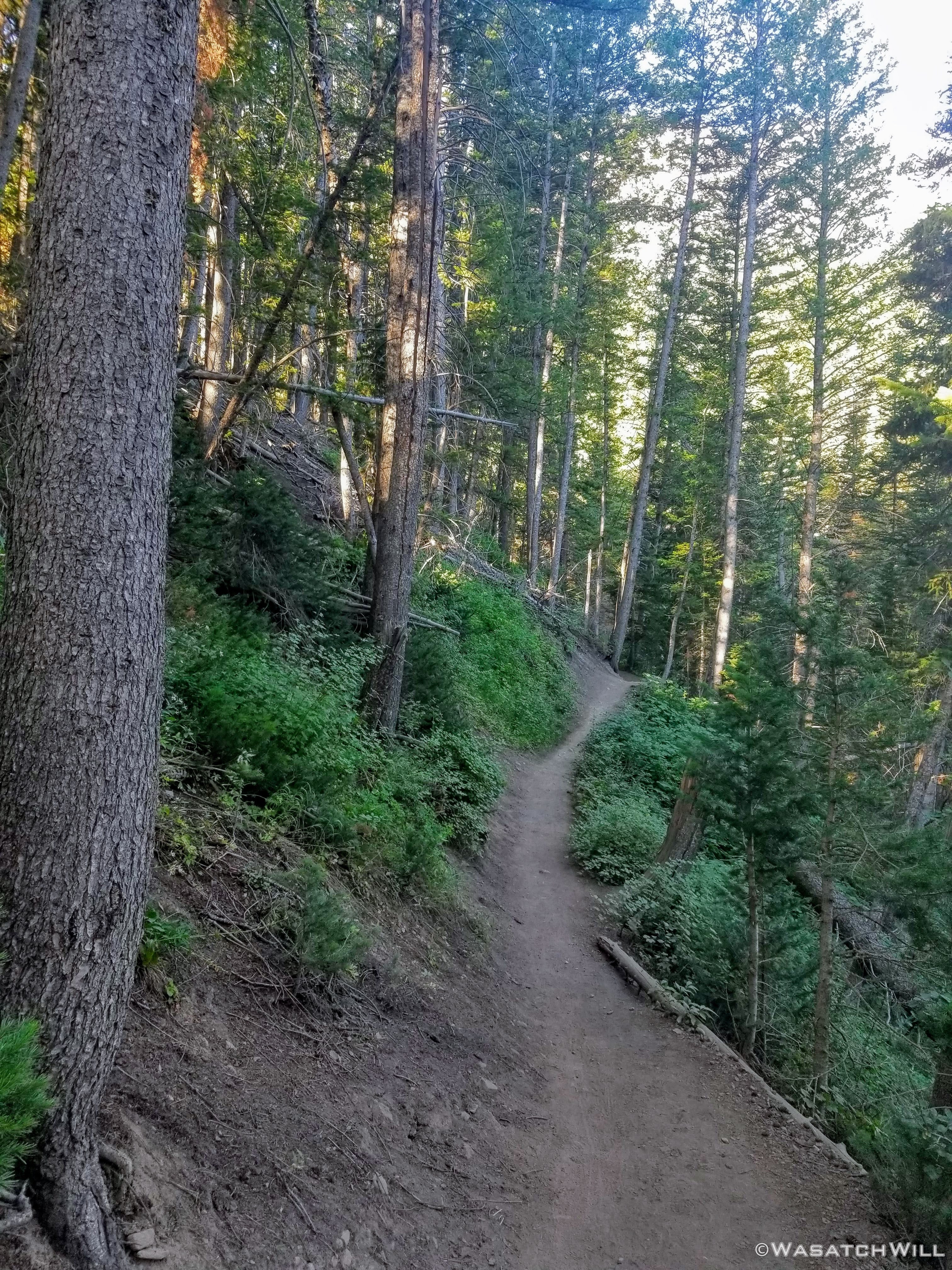
I arrived at my chosen trailhead at about 8 am. The sun was just barely emerging through the trees. The first couple of miles would keep me well within the thicker cover of trees, a healthy mix of quaking aspens and conifers.
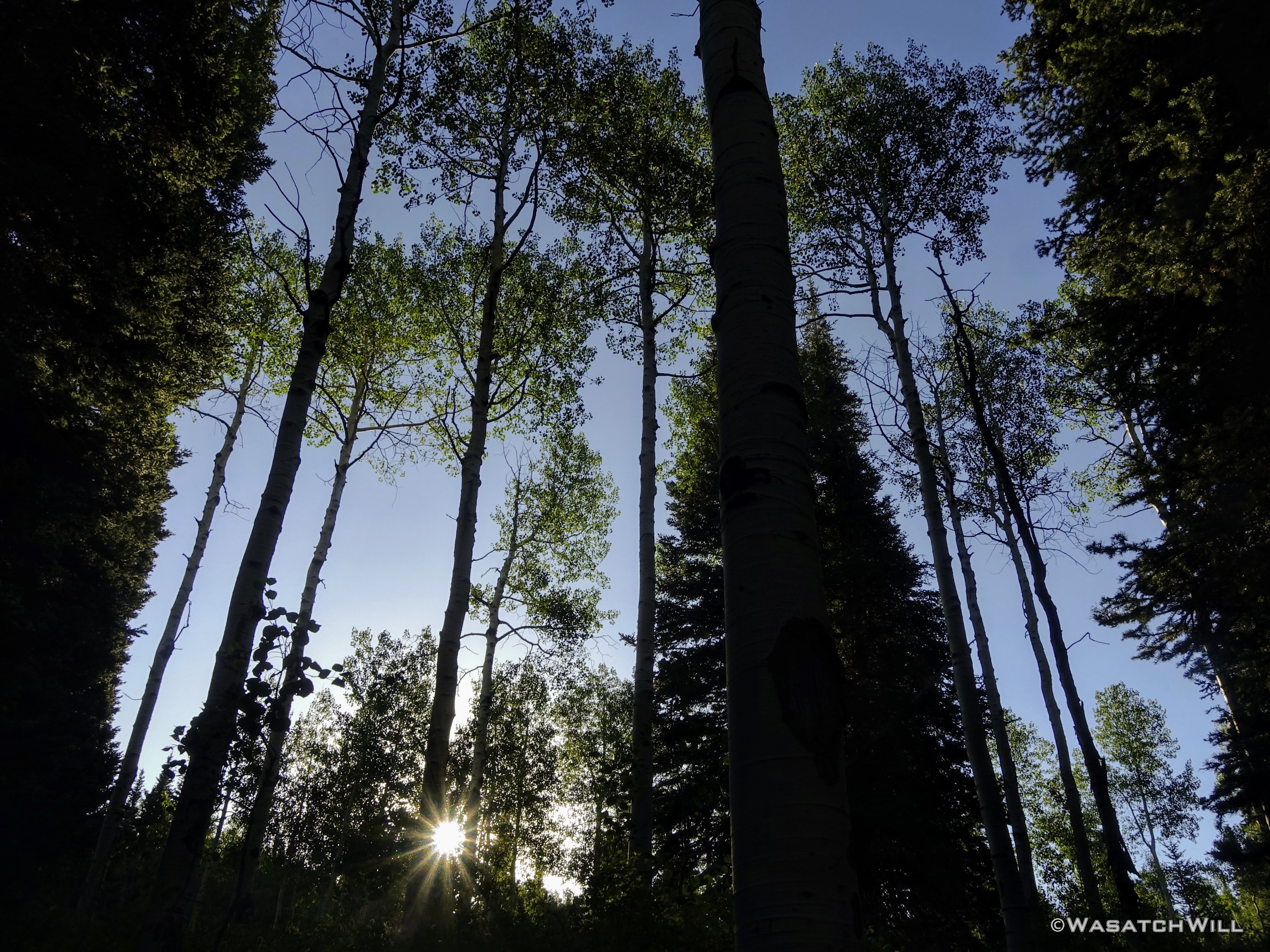
Rising sun
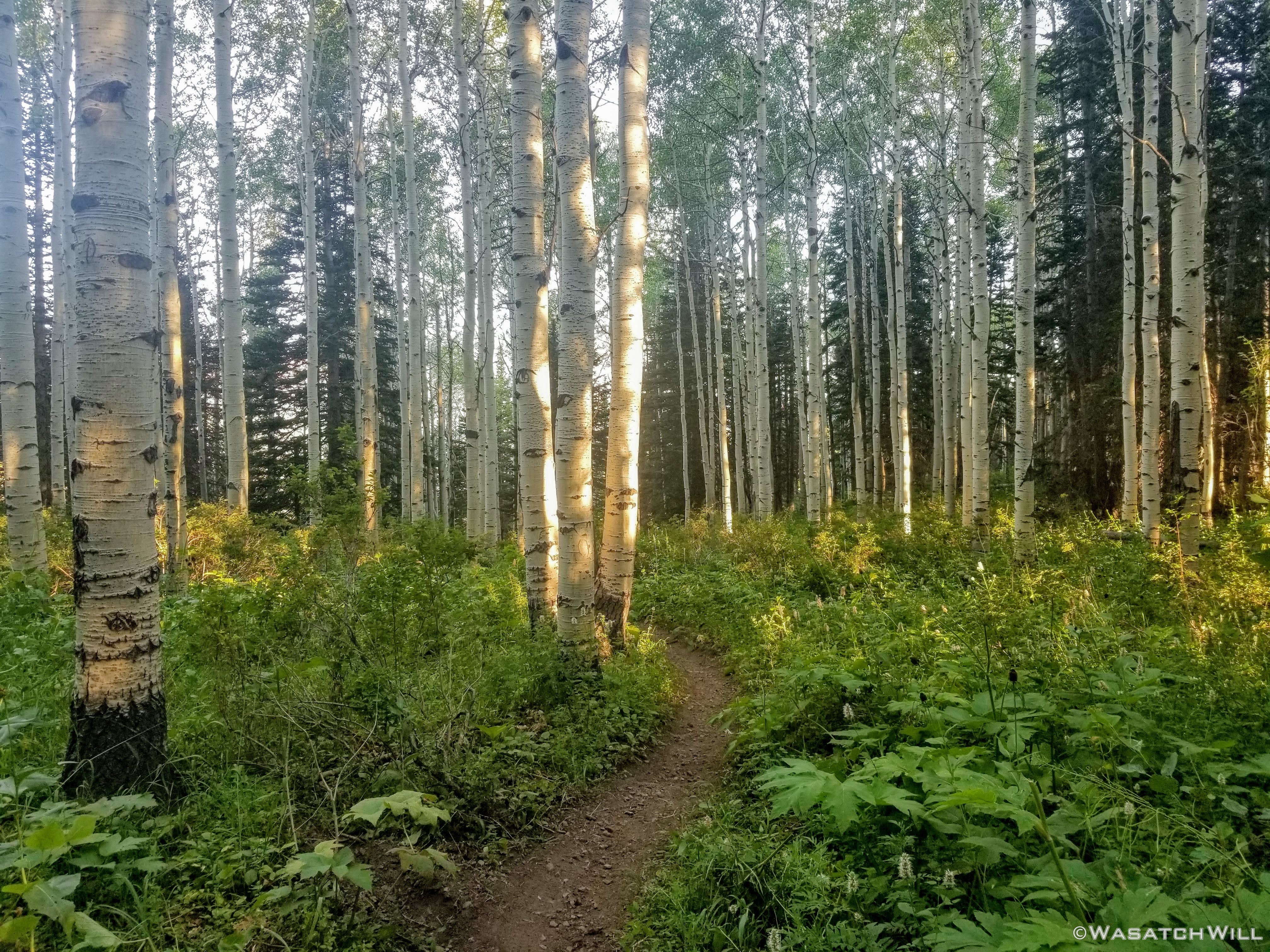
Trail through a grove of aspens
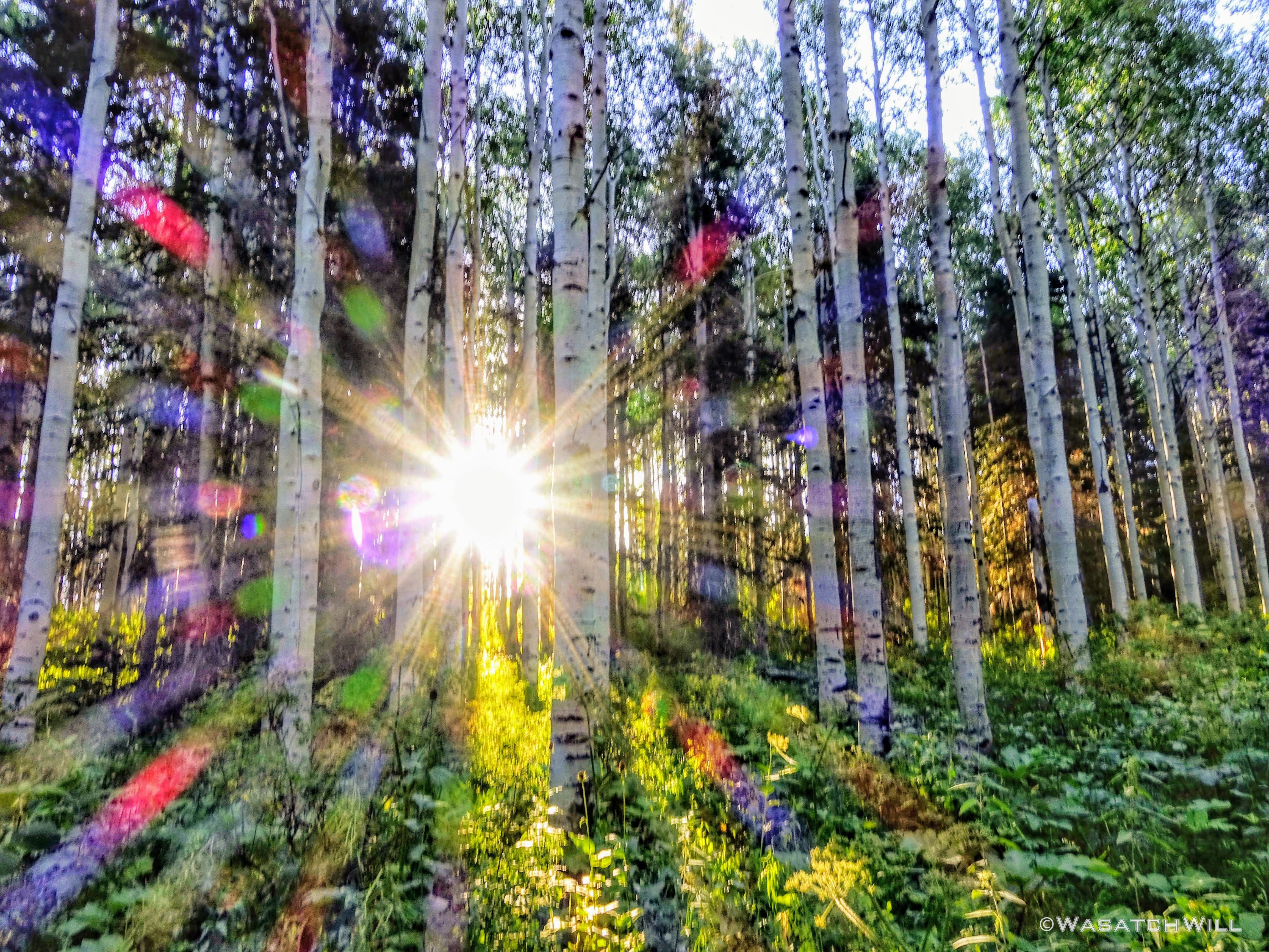
The sun pierces through a grove of aspens
Approaching Timpooneke Trailhead
After about two miles, a bridge was crossed to arrive at Timpooneke Trailhead. I pulled over for a breakfast break and pulled out an energy bar and some other snacks. For a mid-week, routine Wednesday morning, a great majority of the roughly 100 parking spaces at this trailhead had already been filled by 9 AM. Did I mention this mountain is very popular?
Timpooneke is the more popular of the two major trailheads that are primarily used by others who hike "Timp". The Timpooneke trail is a bit less strenuous, offering a bit more gradual approach to the Timpanogos Basin than its Aspen Grove counterpart and from there, a much easier approach to the saddle and summit from its side of the basin than the Aspen Grove approach. It is also a lesser drive for a majority of those living along the Wasatch Front.
The bridge connecting to Timpooneke
After my breakfast break, it was time to hit the trail proper and get going with the elevation gain. Within just a couple hundred feet, the trail would take me into what was officially designated as a protected wilderness area in 1984, one of several officially designated wilderness areas along the Wasatch Range. It was also an amusing reminder of how a large section of the Wasatch Mountains lie within the Uinta National Forest, while a large section of the Uinta Mountains fall within the Wasatch National Forest.

Official wilderness boundary
Morning on the lower end of the Timpooneke Trail
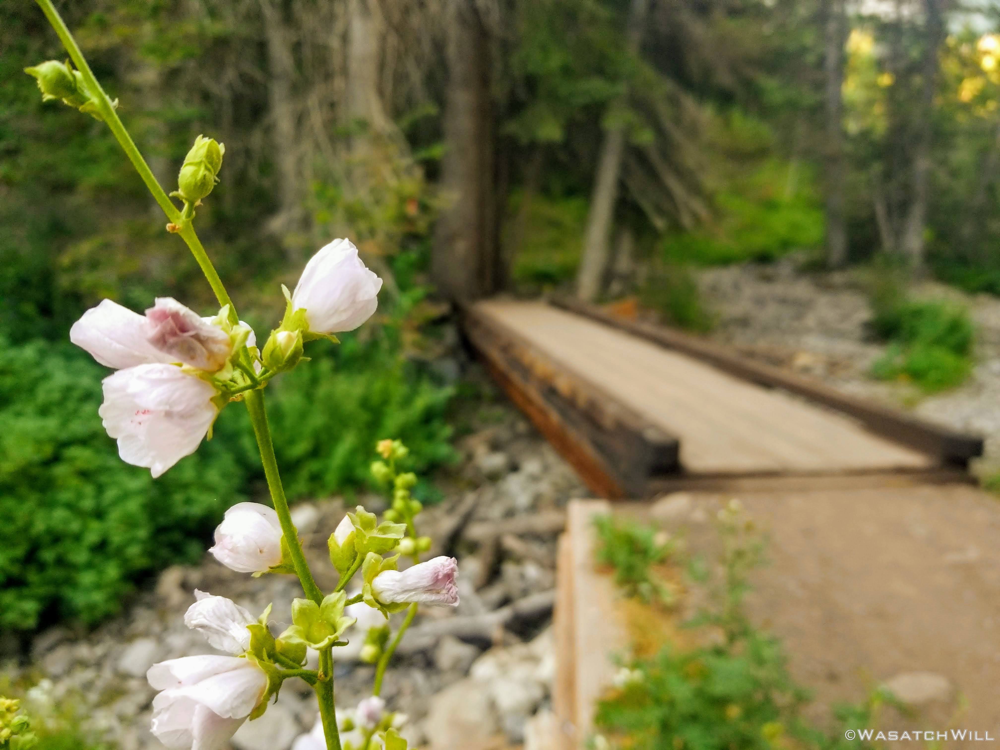
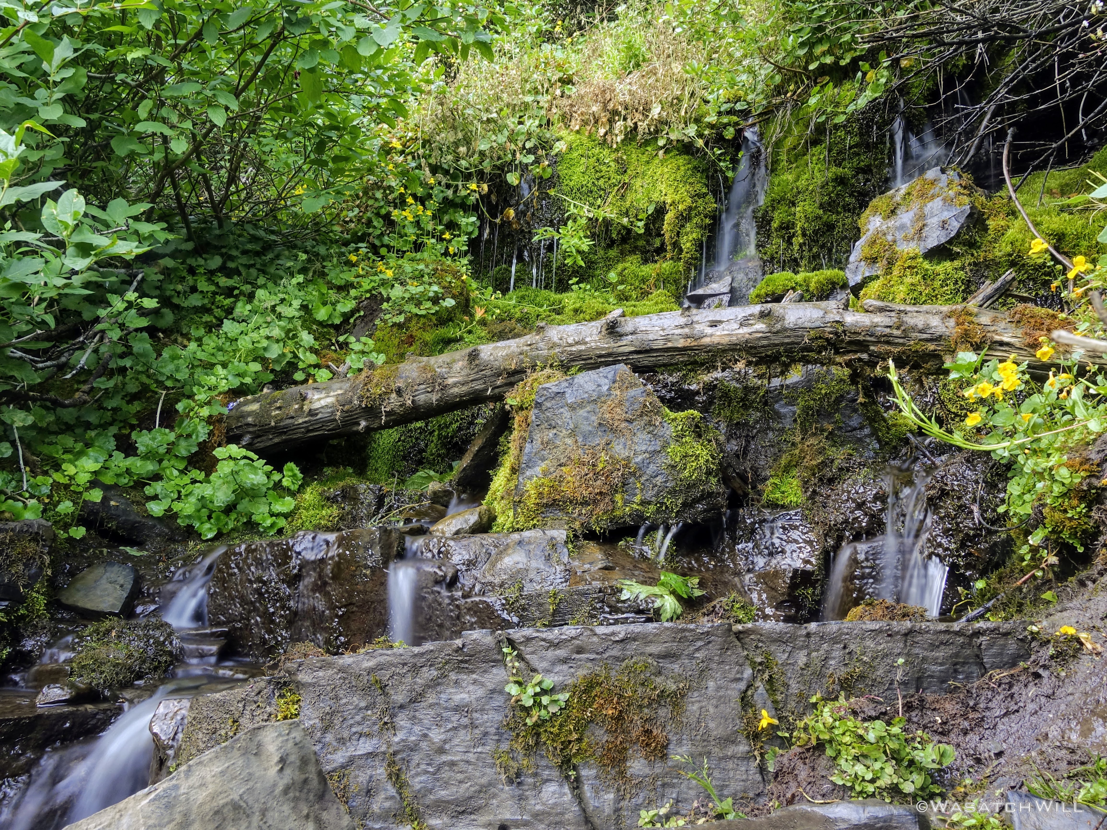
The lower half of this trail features many cascading stream crossings. I like all the greenery and mossy rocks that intimately accompany these streams crossings. They make me feel like I've been transported somewhere back East or in the Northwest.

Cascading stream on the trail
Another series of cascades
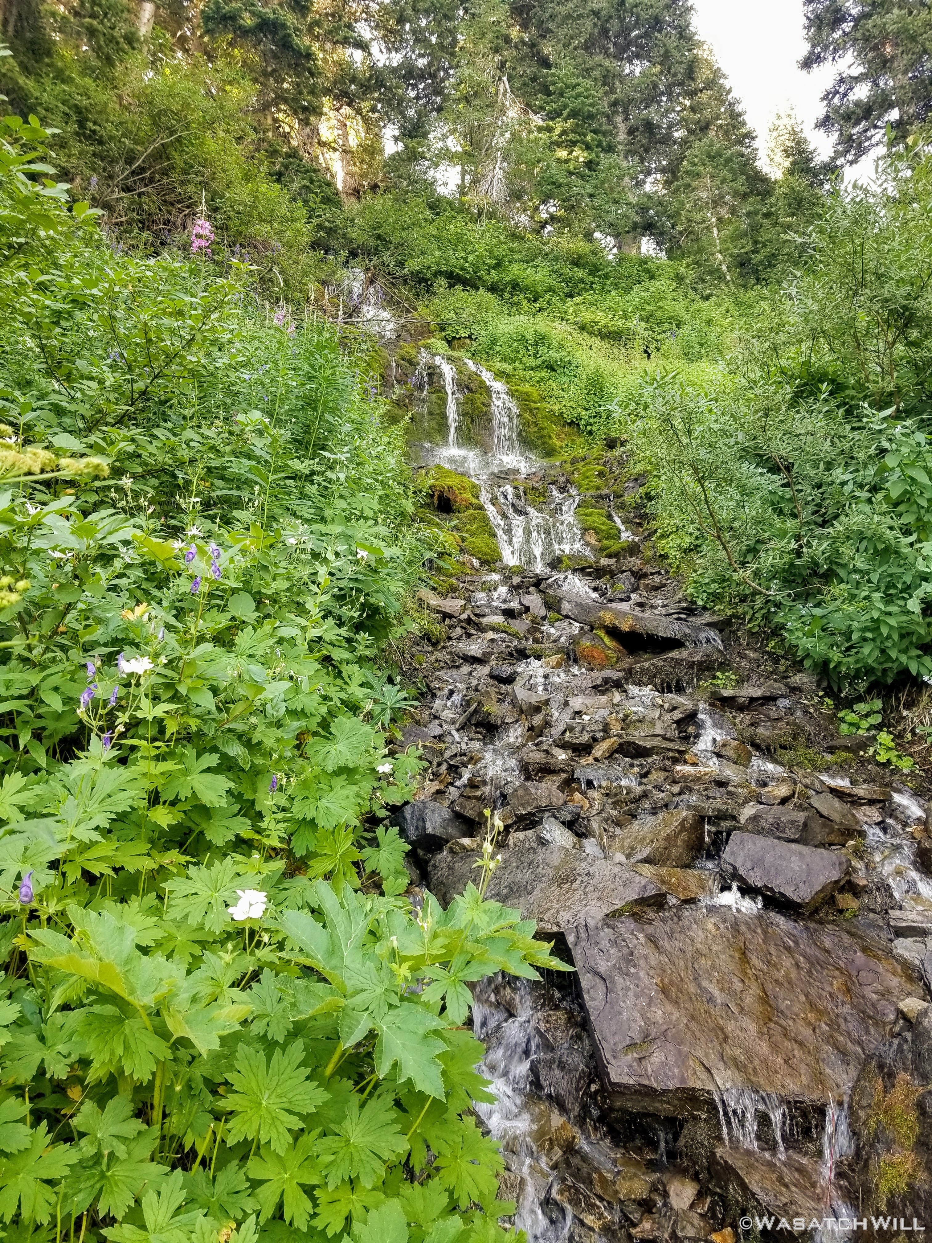
A larger series of cascades
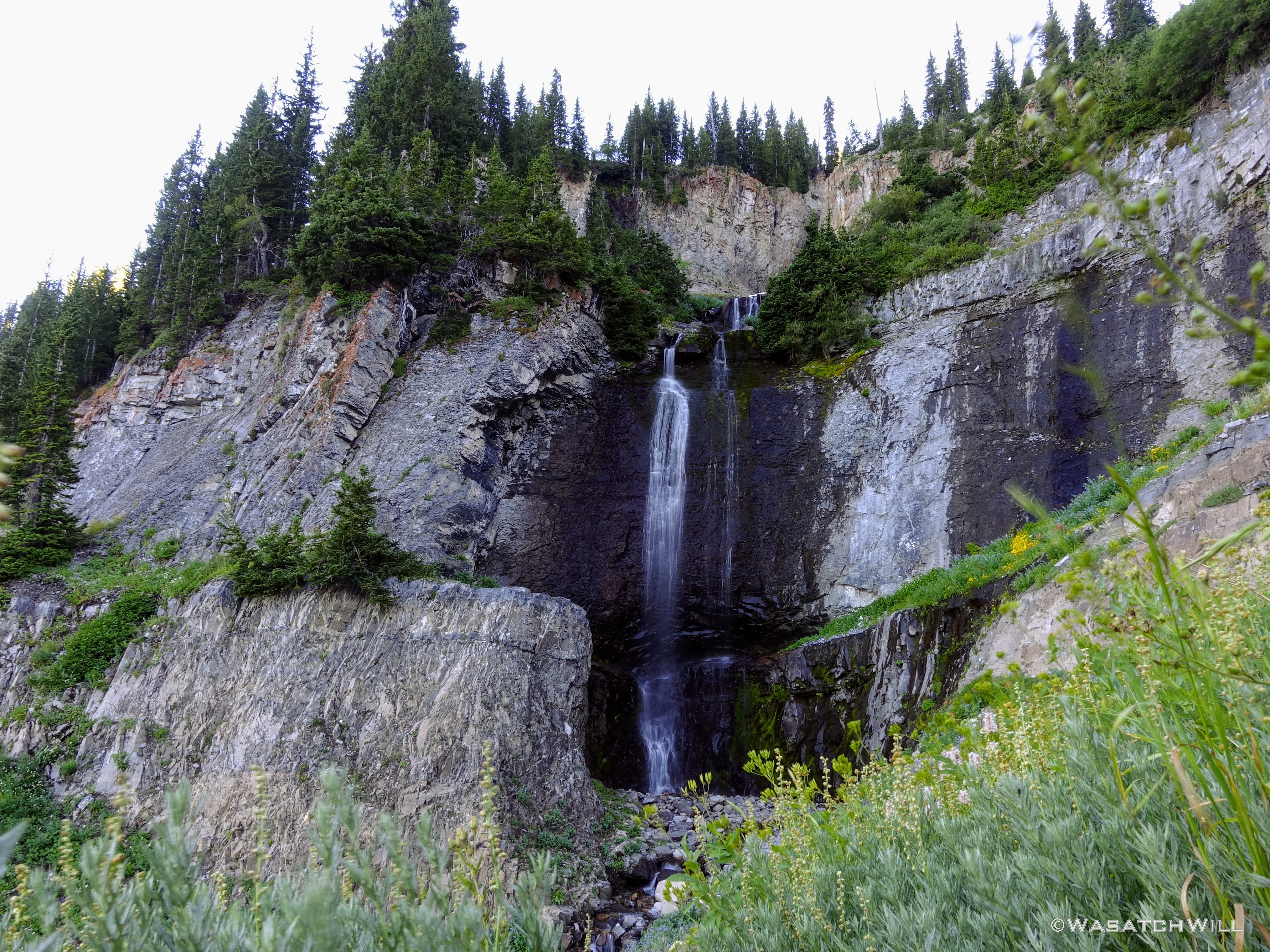
About two miles up Timpooneke lies a little spur trail of a few hundred feet that leads out to Scout Falls.
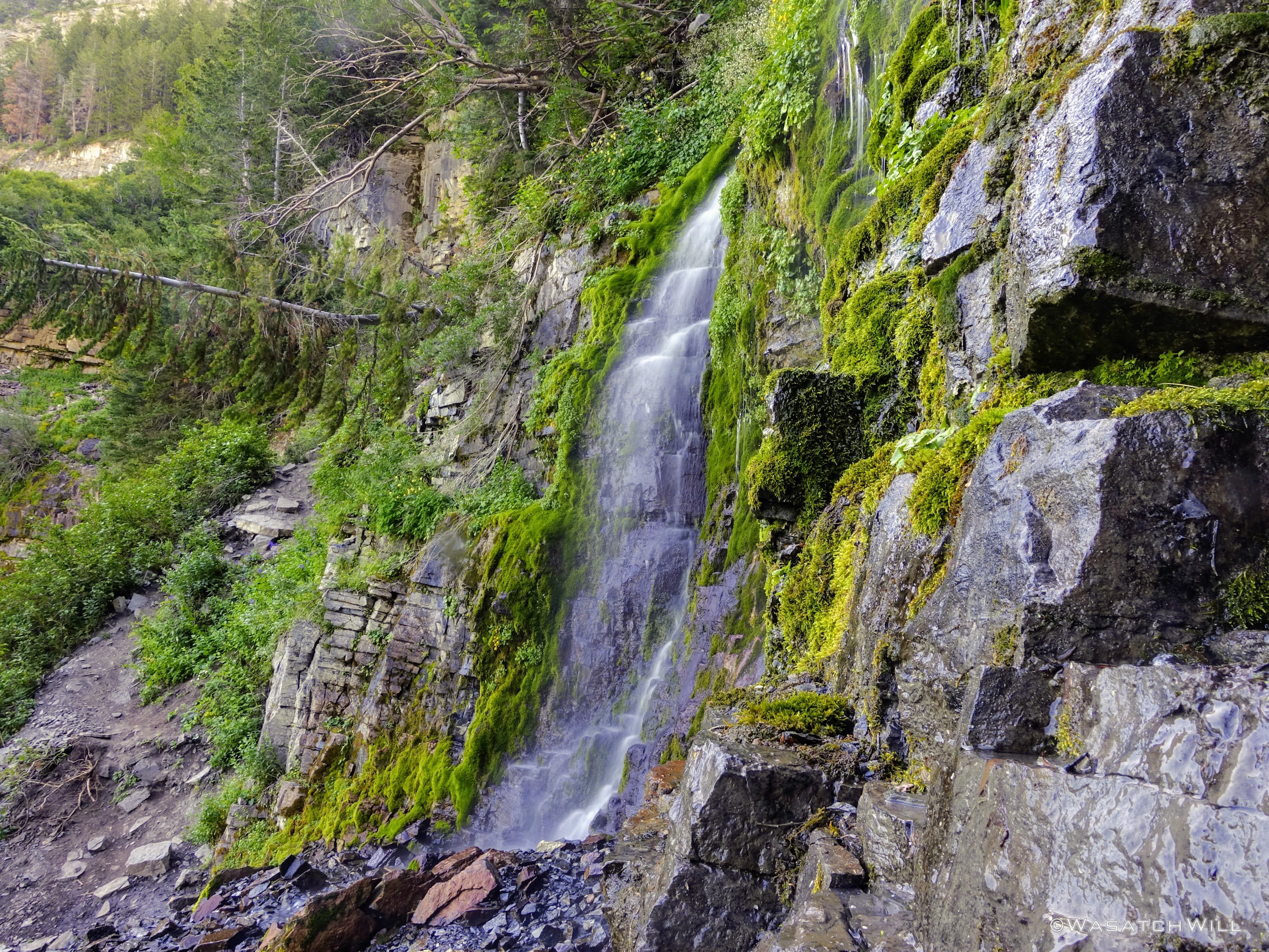
Scout Falls
Back on the main trail and a couple more stream crossings later, I was brought into the big meadow about halfway up to the edge of the basin.
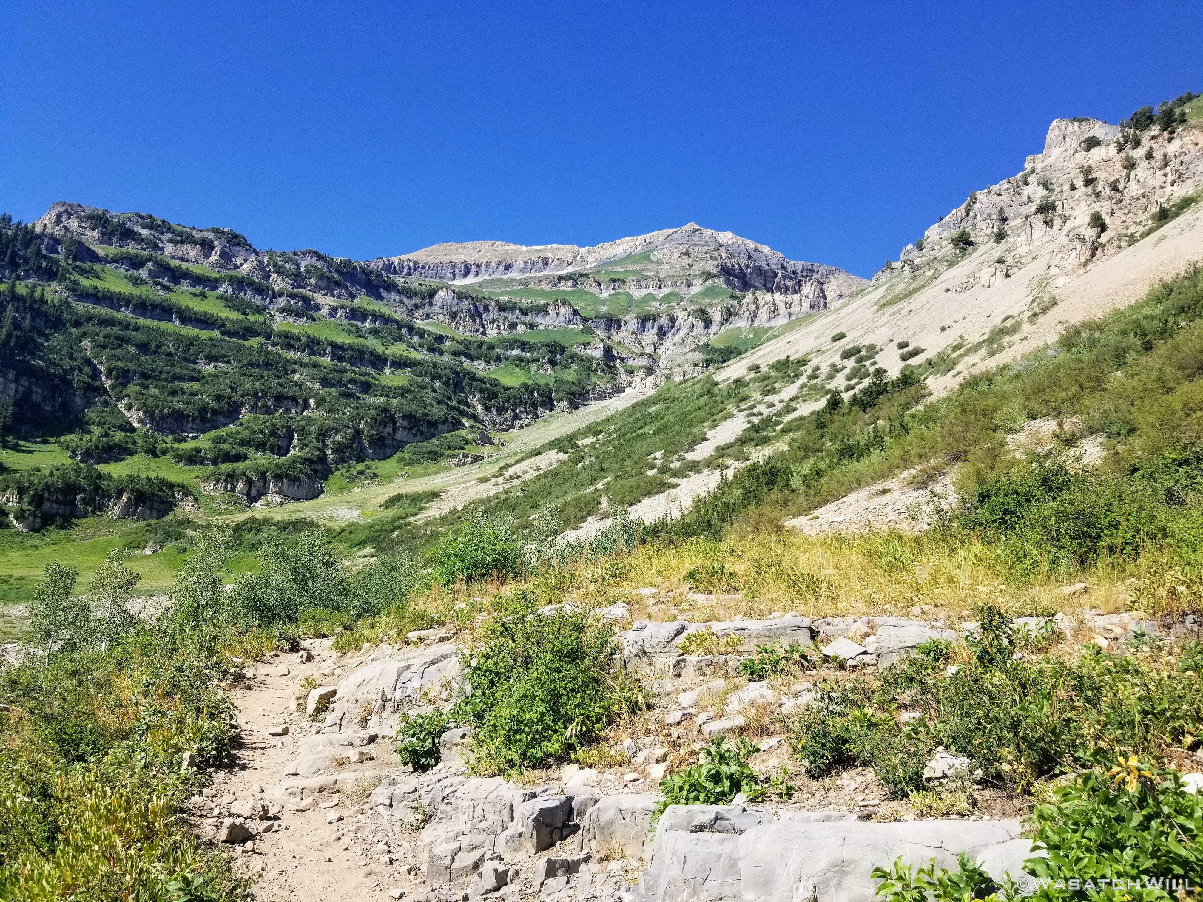
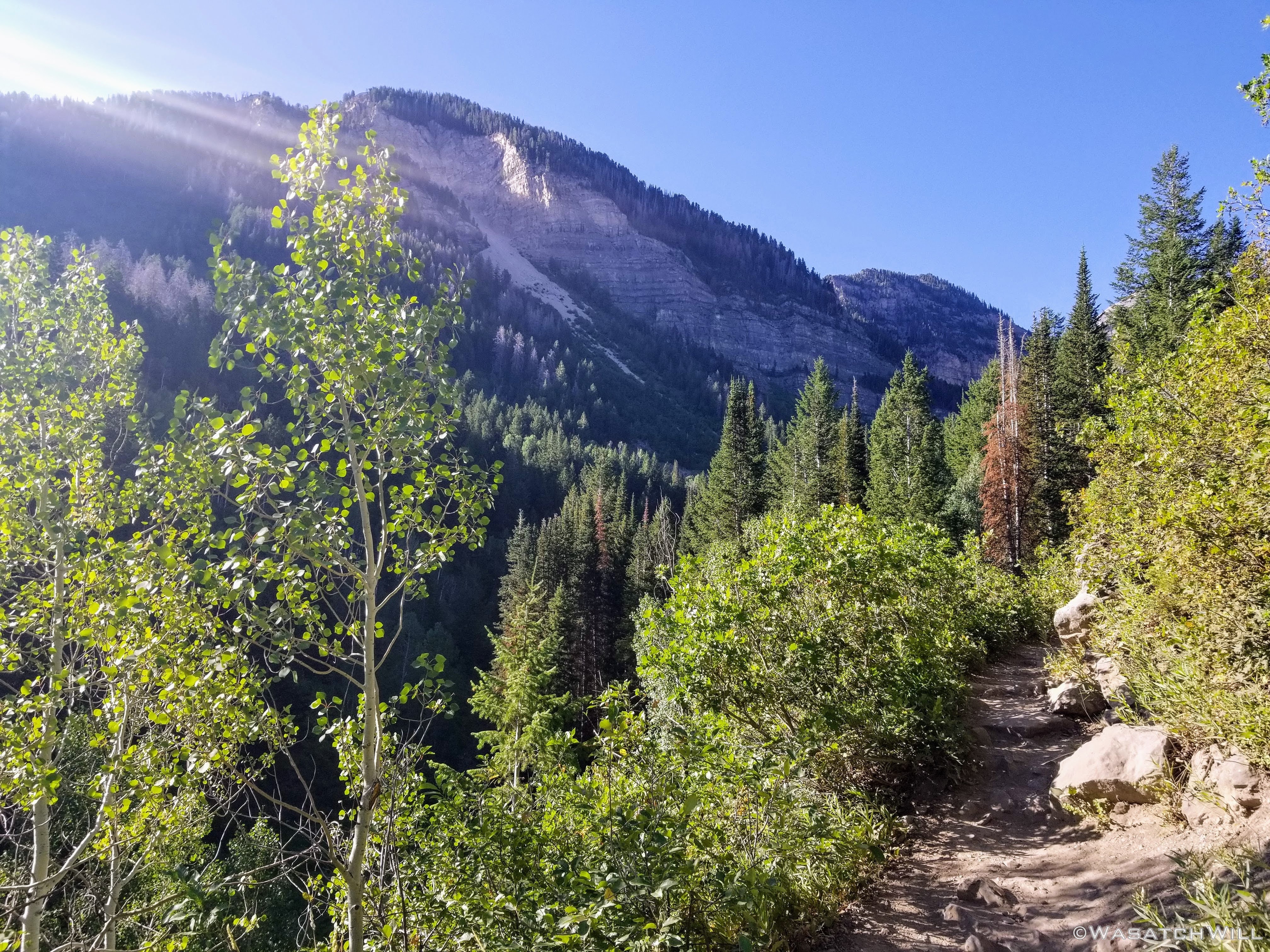
A look up toward Bomber Peak from along Timpooneke Trail
Much of the flowers that could have been found in and below the big meadow had bloomed and dropped already. But gaining ground above the basin, the more alpine terrain began to develop and it was there where flowers in full bloom began to emerge. To start, were several patches of fireweed.
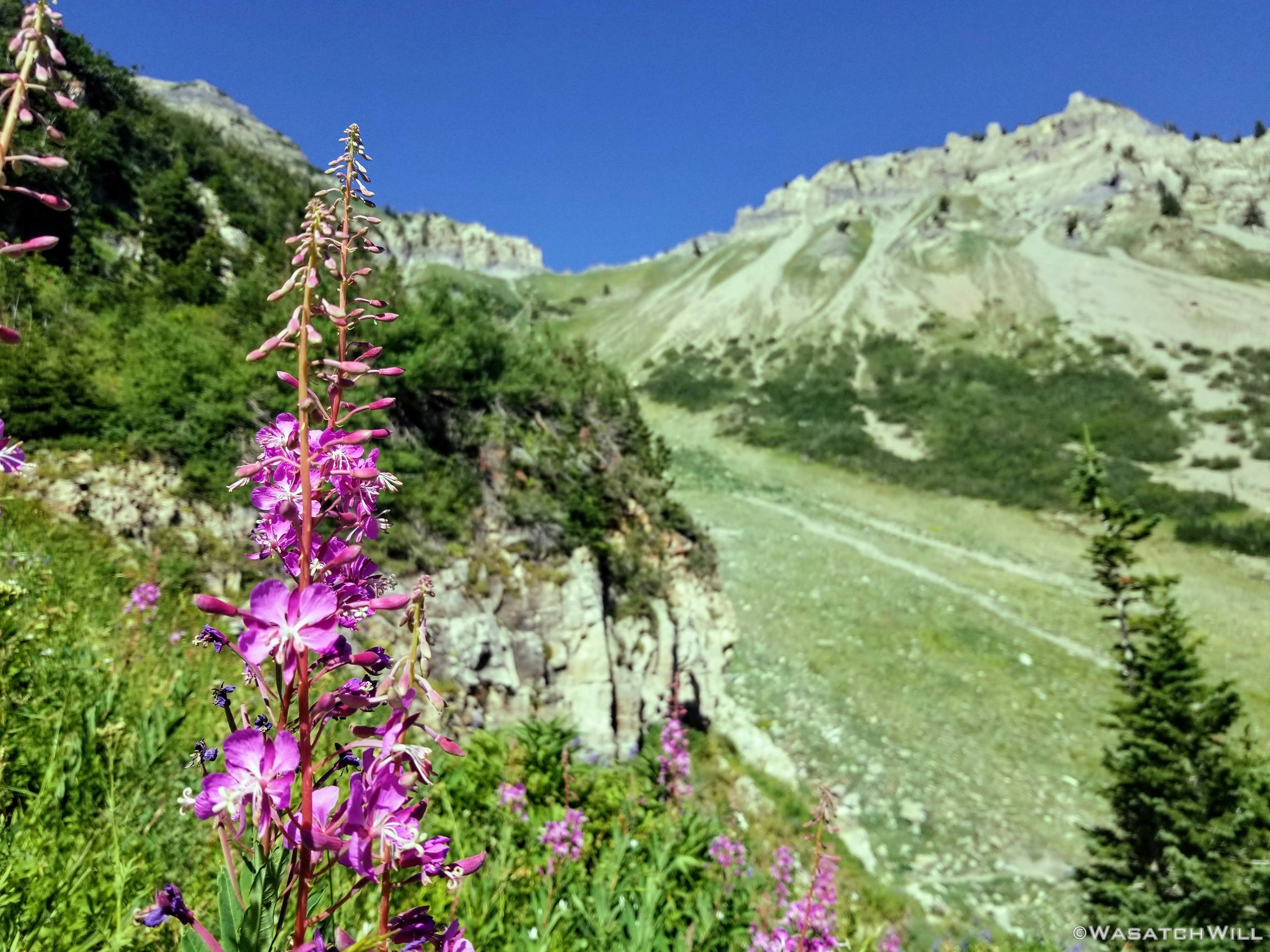
A stalk of fireweed flower with Forgotten Peak above right
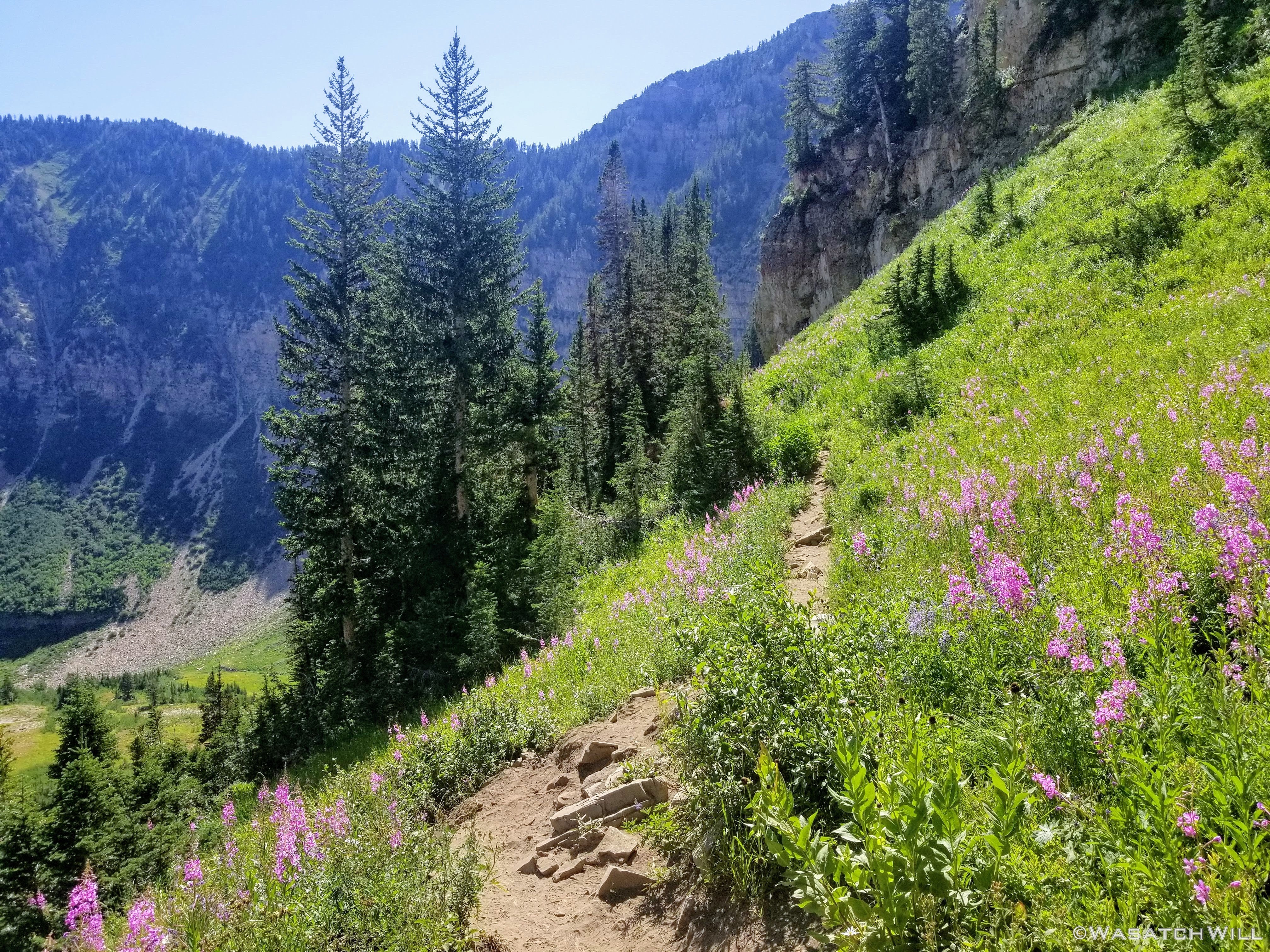
Traversing a slope full of fireweed flowers
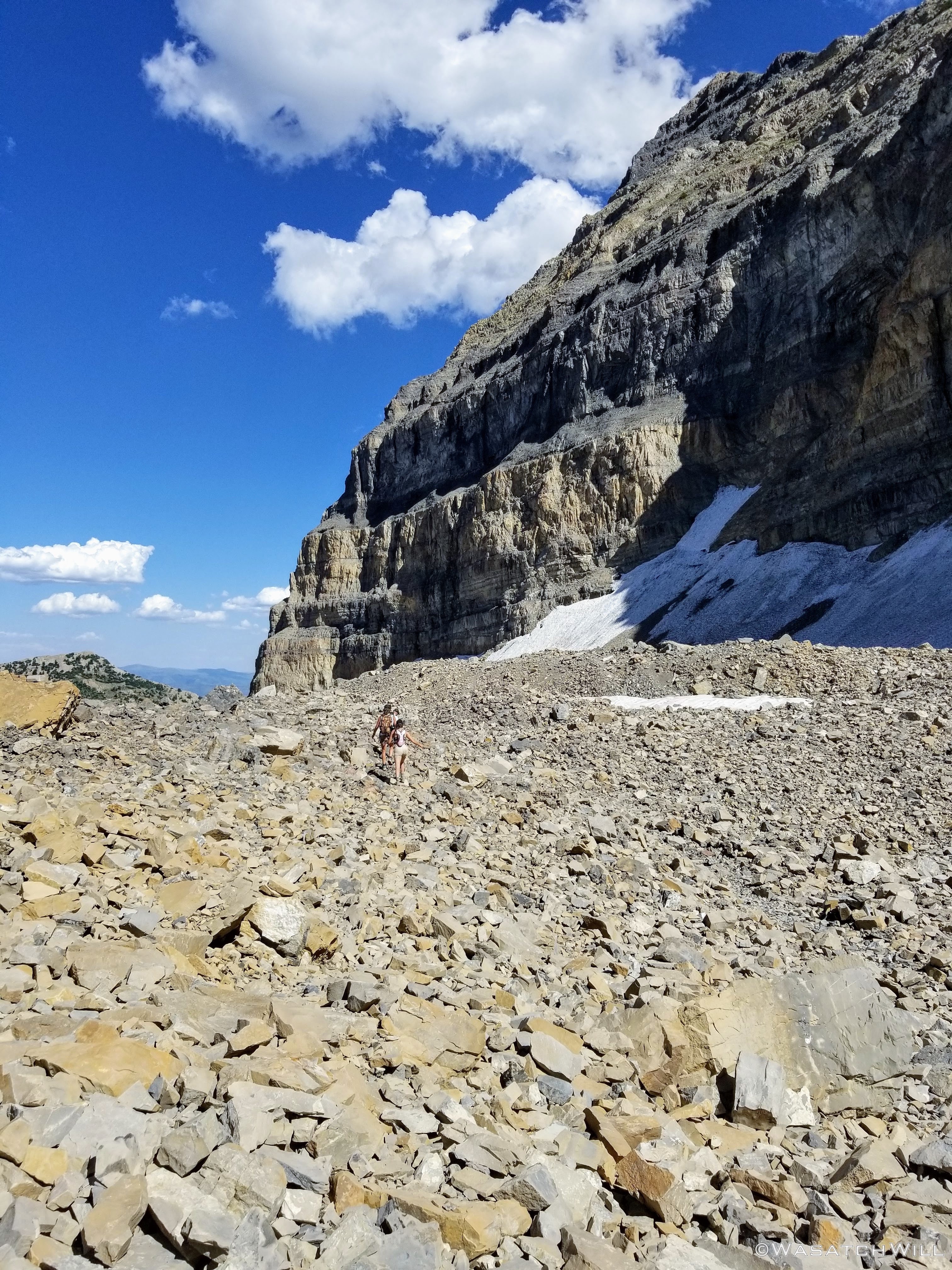
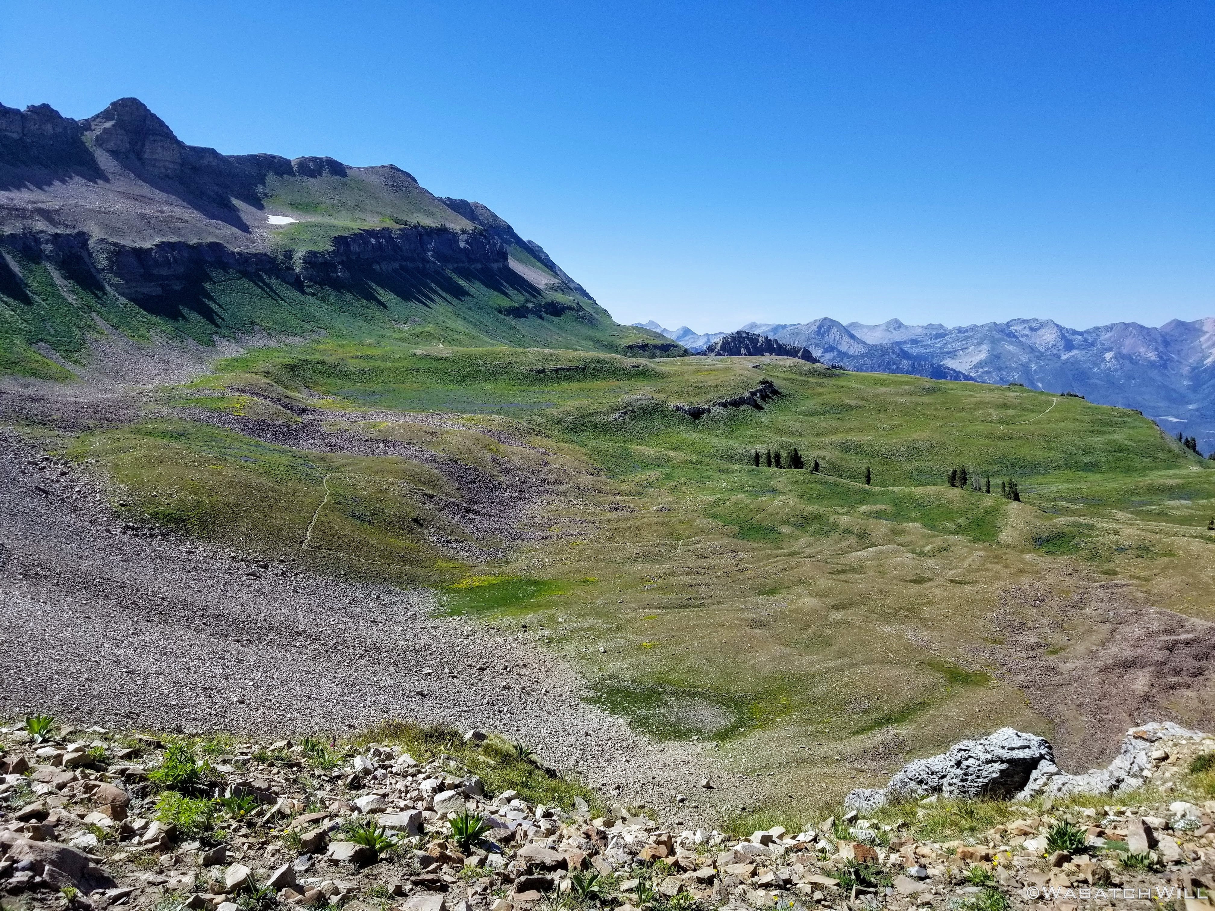
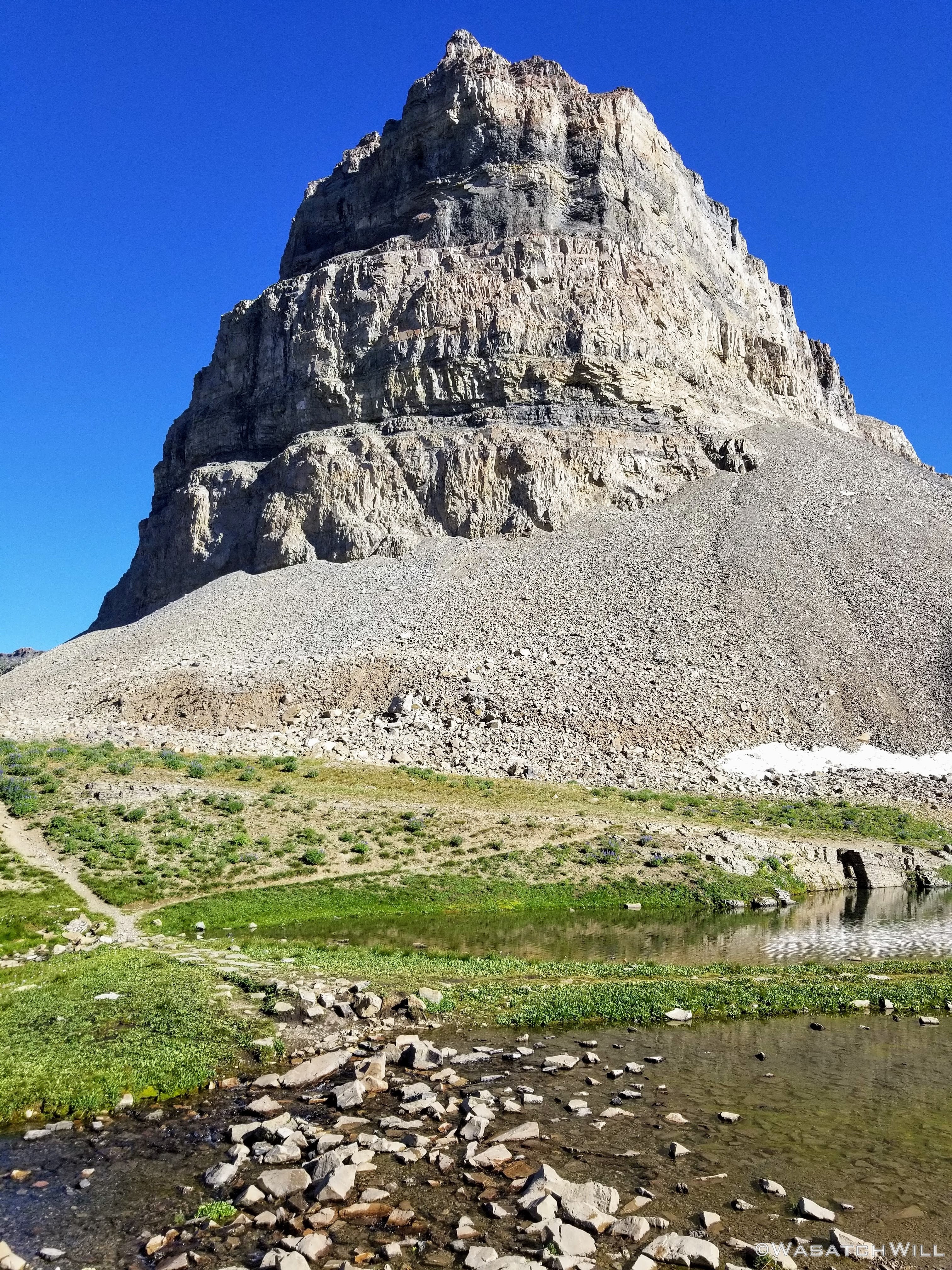
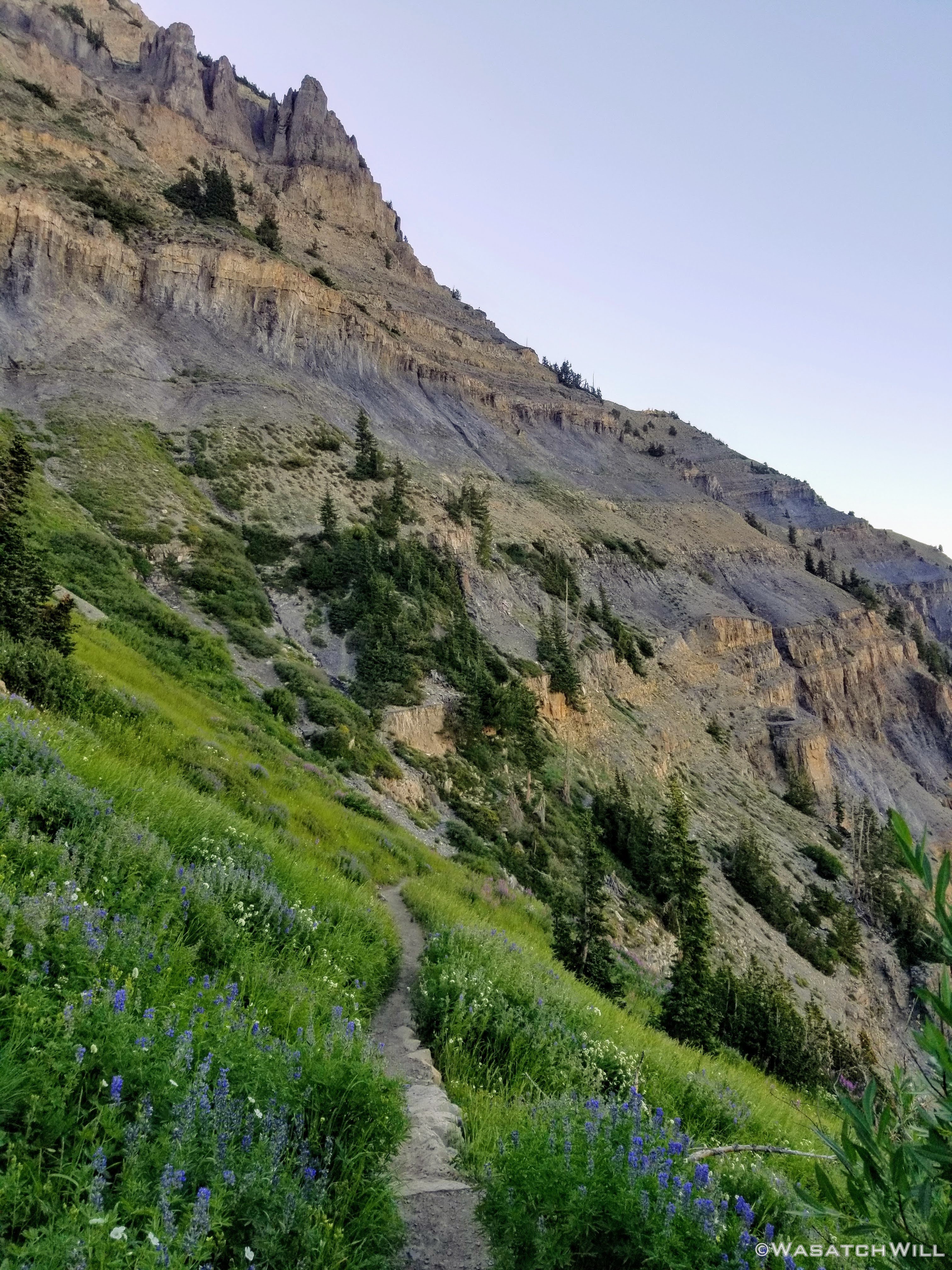
Approaching Timpanogos Basin with the summit block now in view
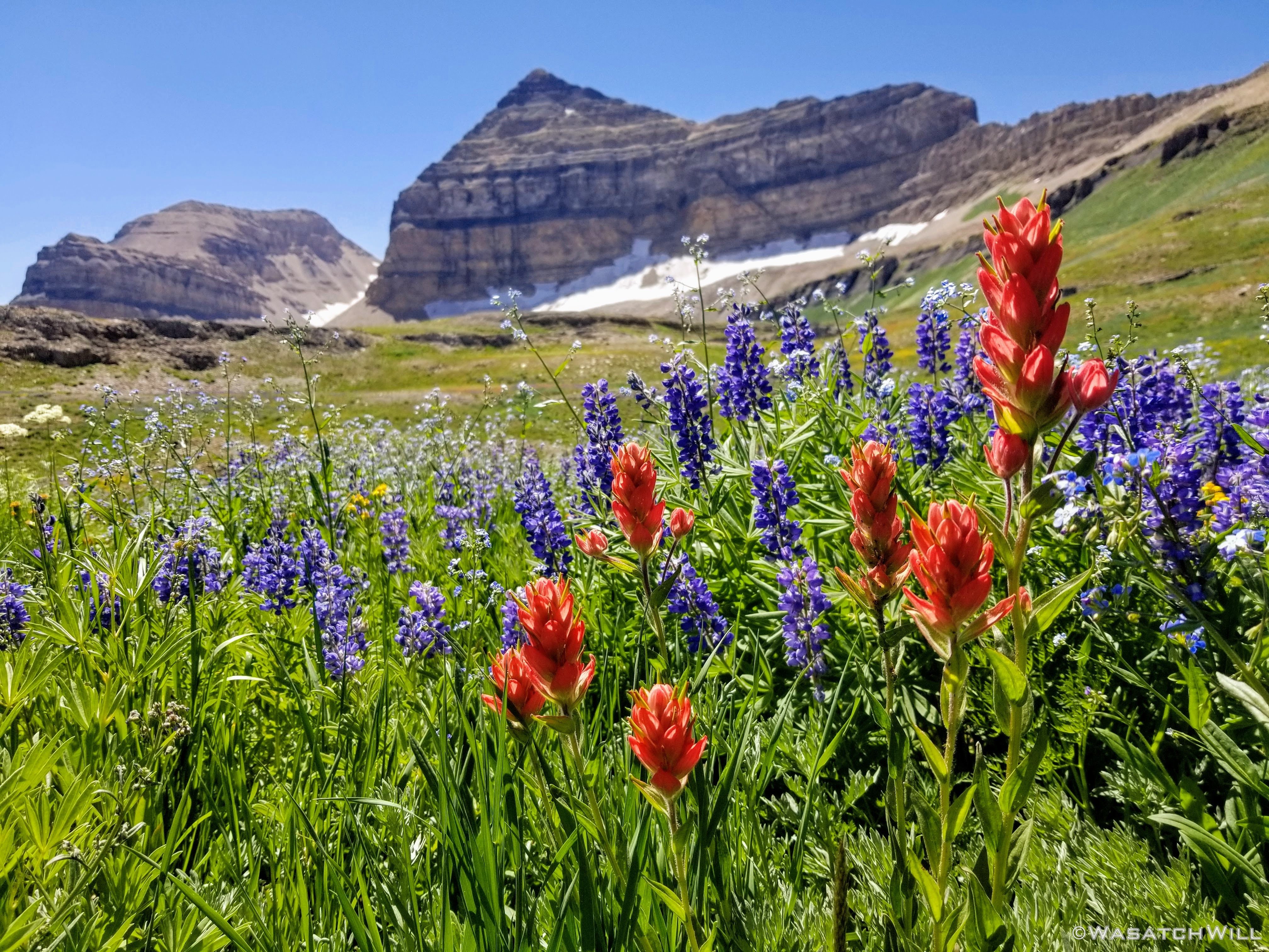
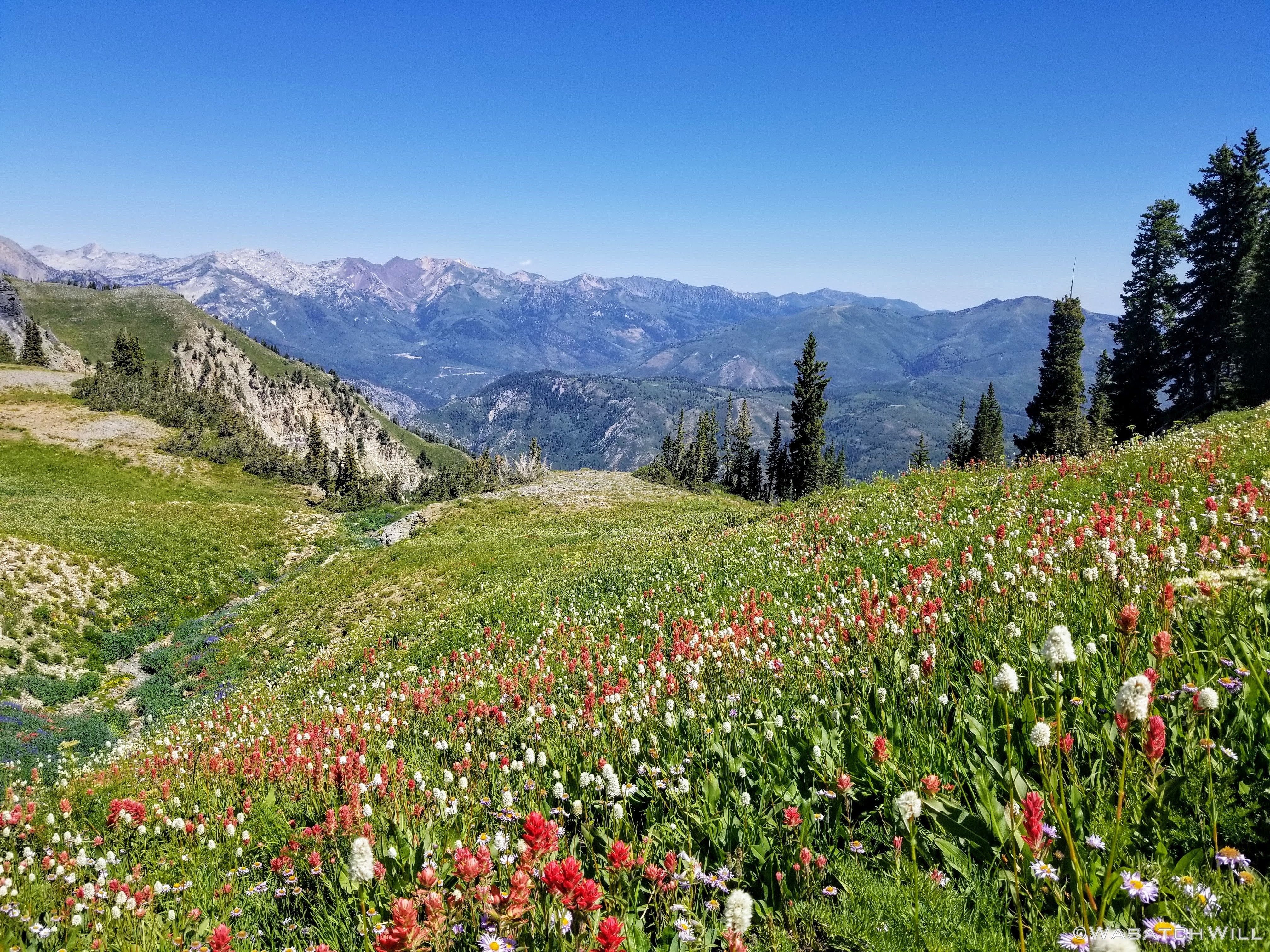
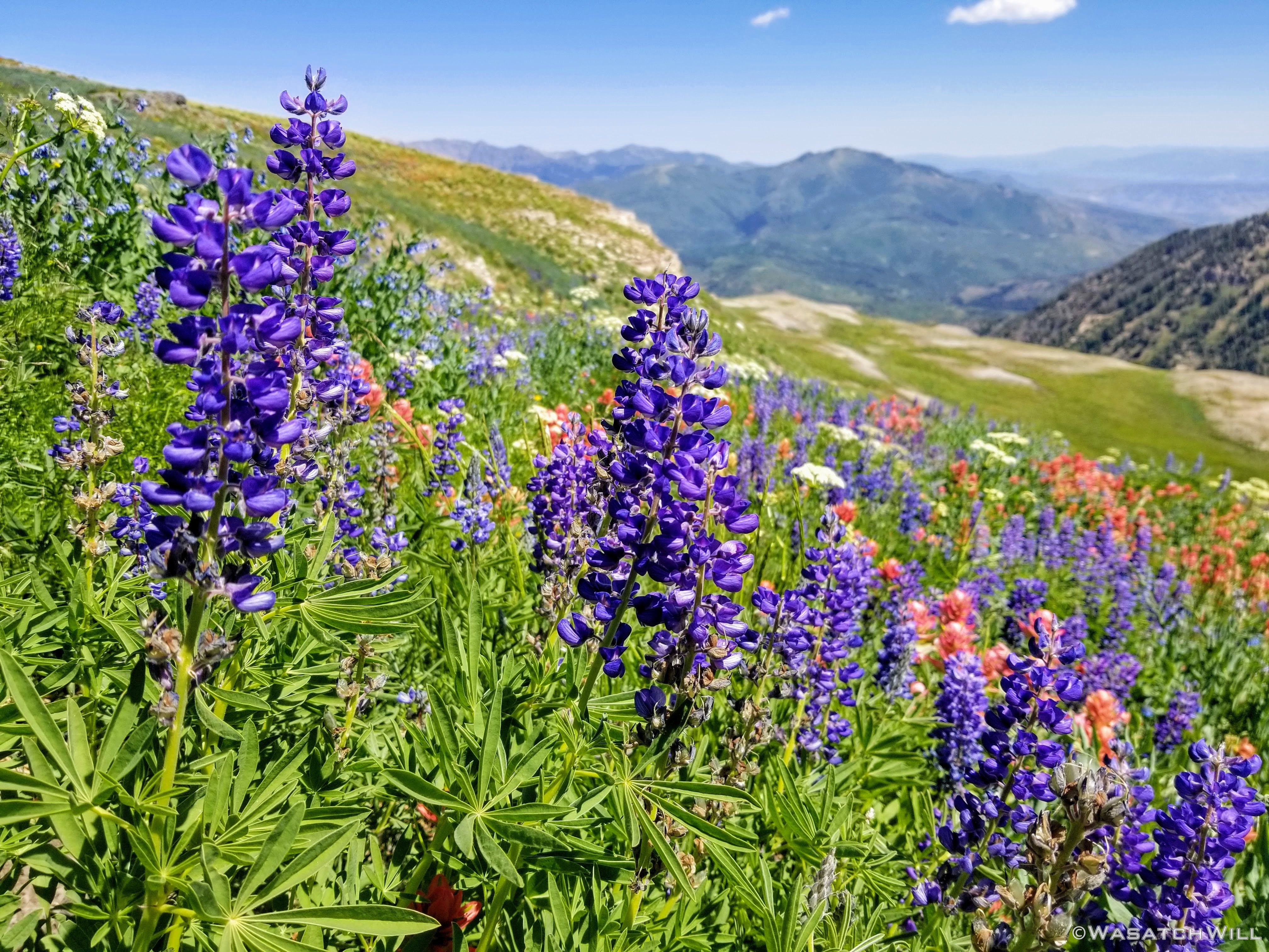
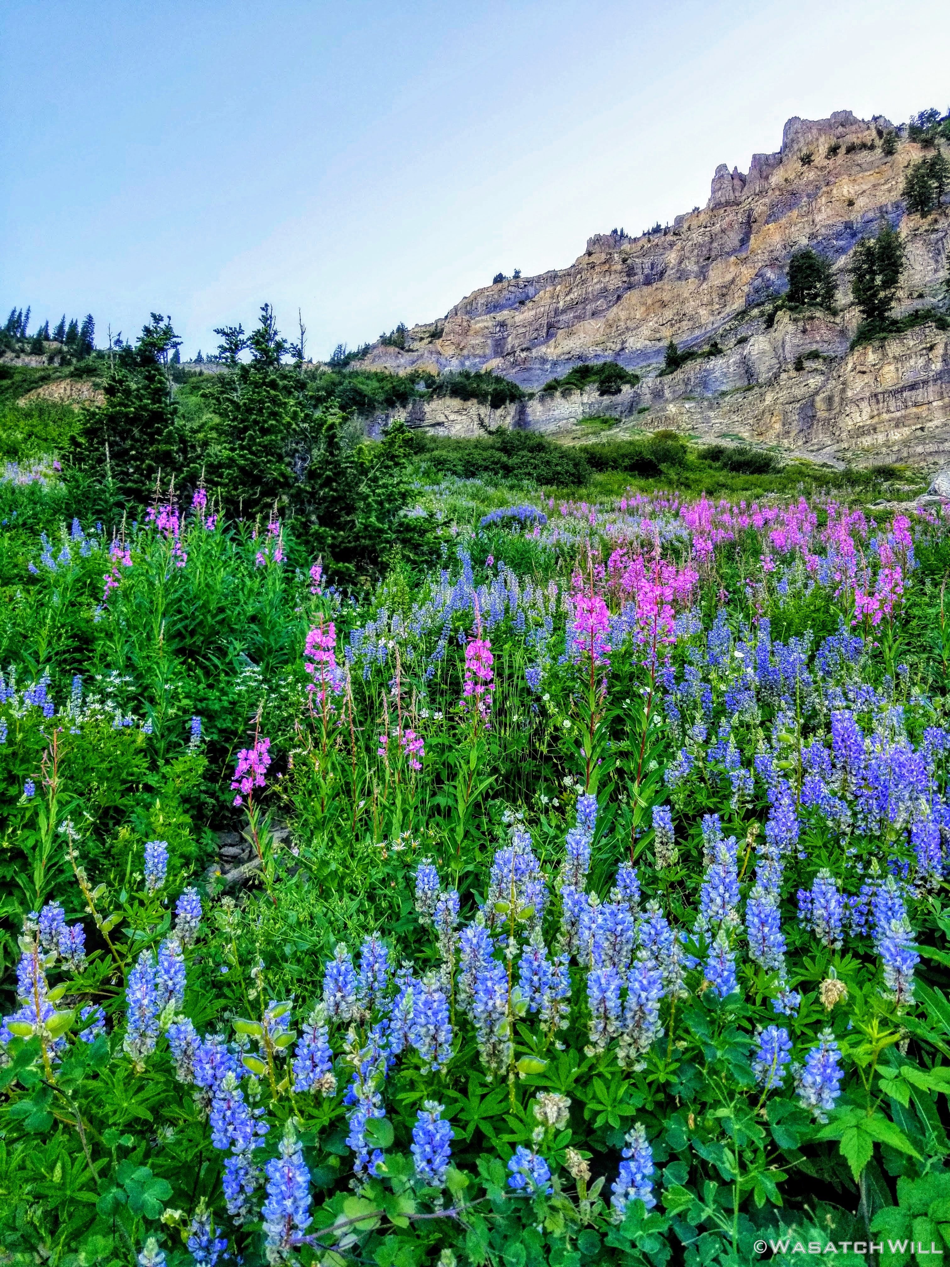
As I got higher and higher nearing the edge of the basin, more varieties of flowers began to appear throughout the mountainside meadows. From daisies, to paintbrush, to lupine and more.

Paintbrush, lupine, and mountain daisies
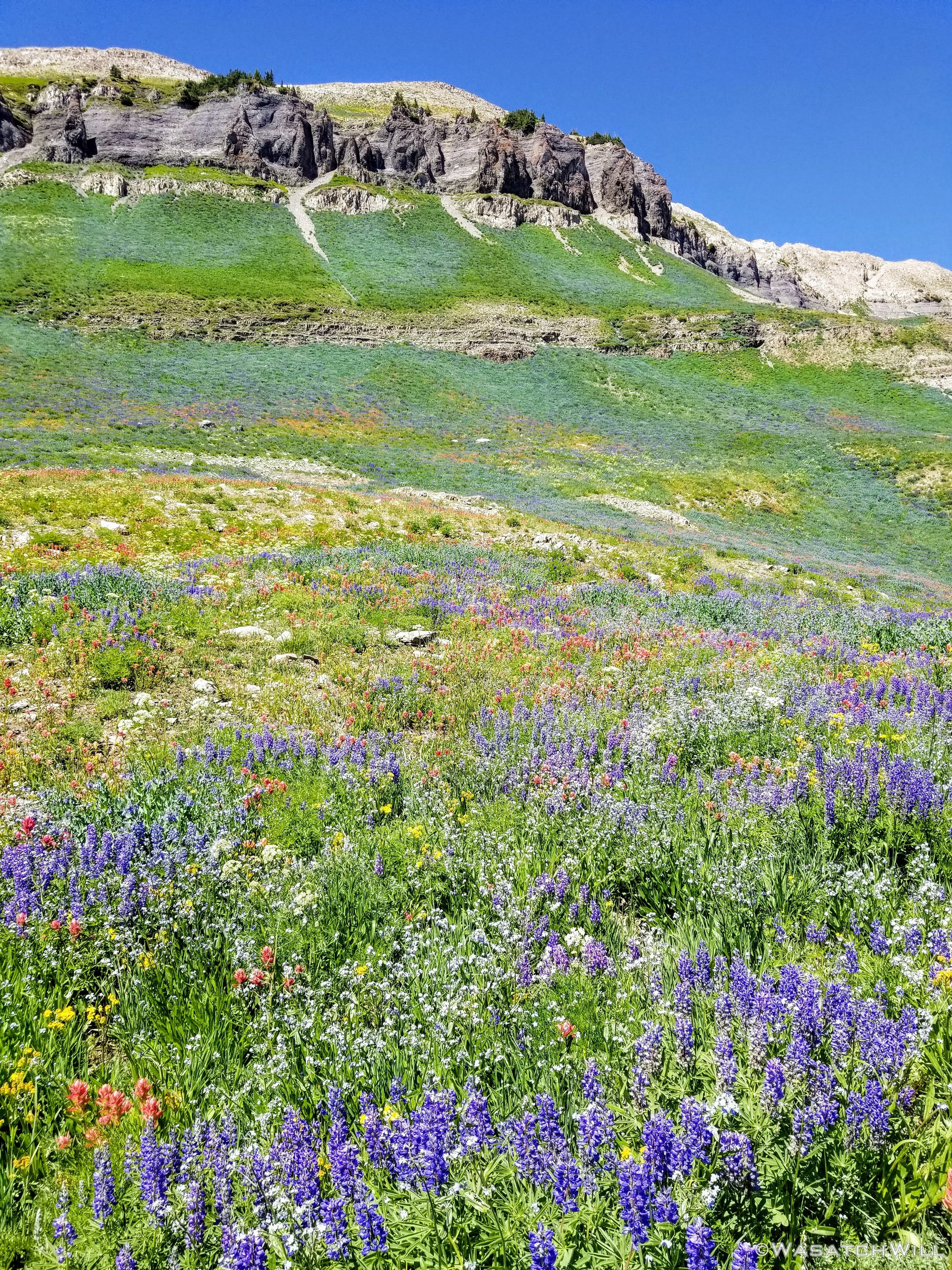
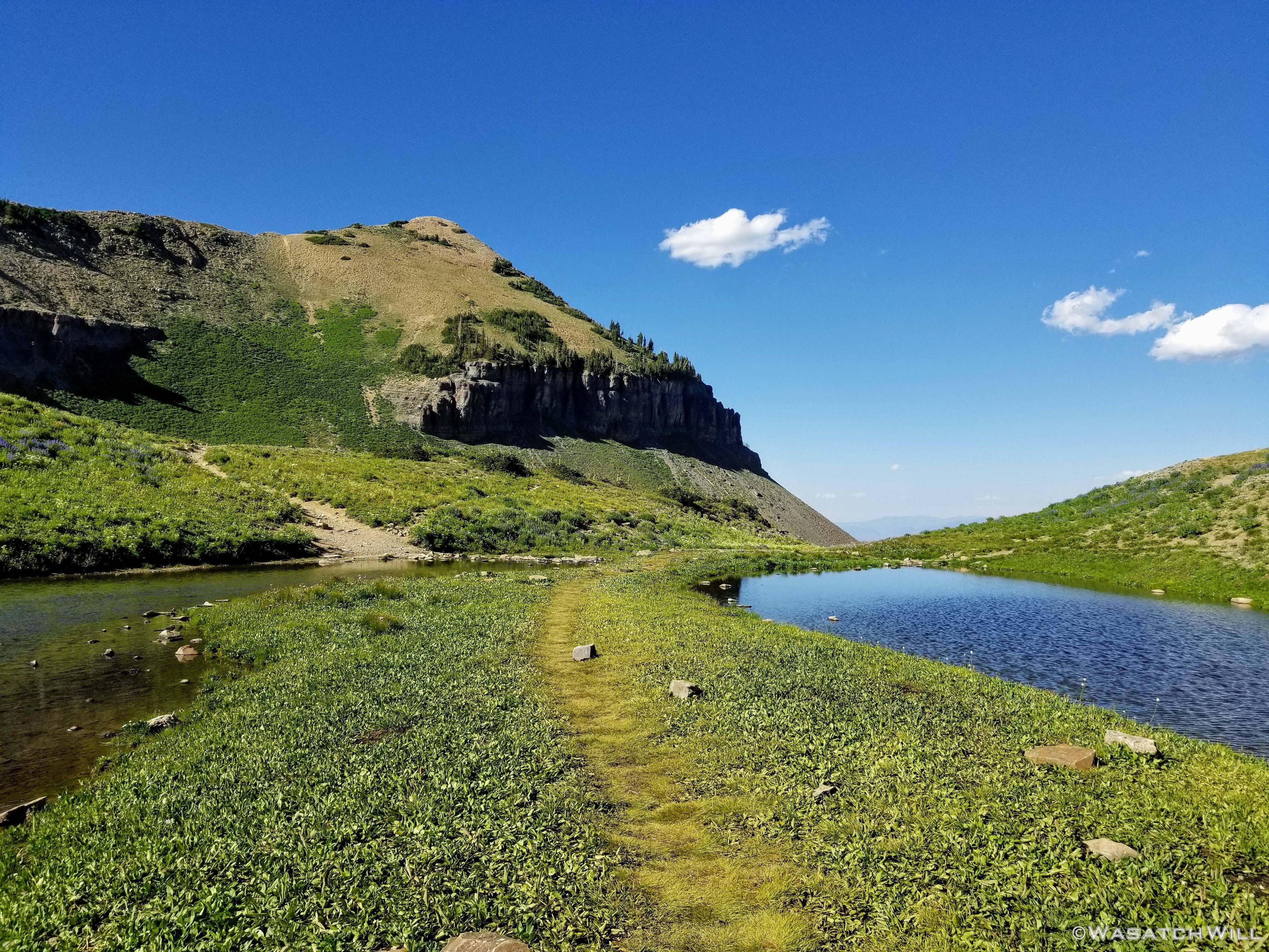
Once I crested into the basin, the flowers really started to the steal the show, providing a brilliant accent to the green carpeted basin floor beneath the iconic eastern face of the Timpanogos summit block.

Entering the basin

Timpanogos Basin

Departing from the main trail
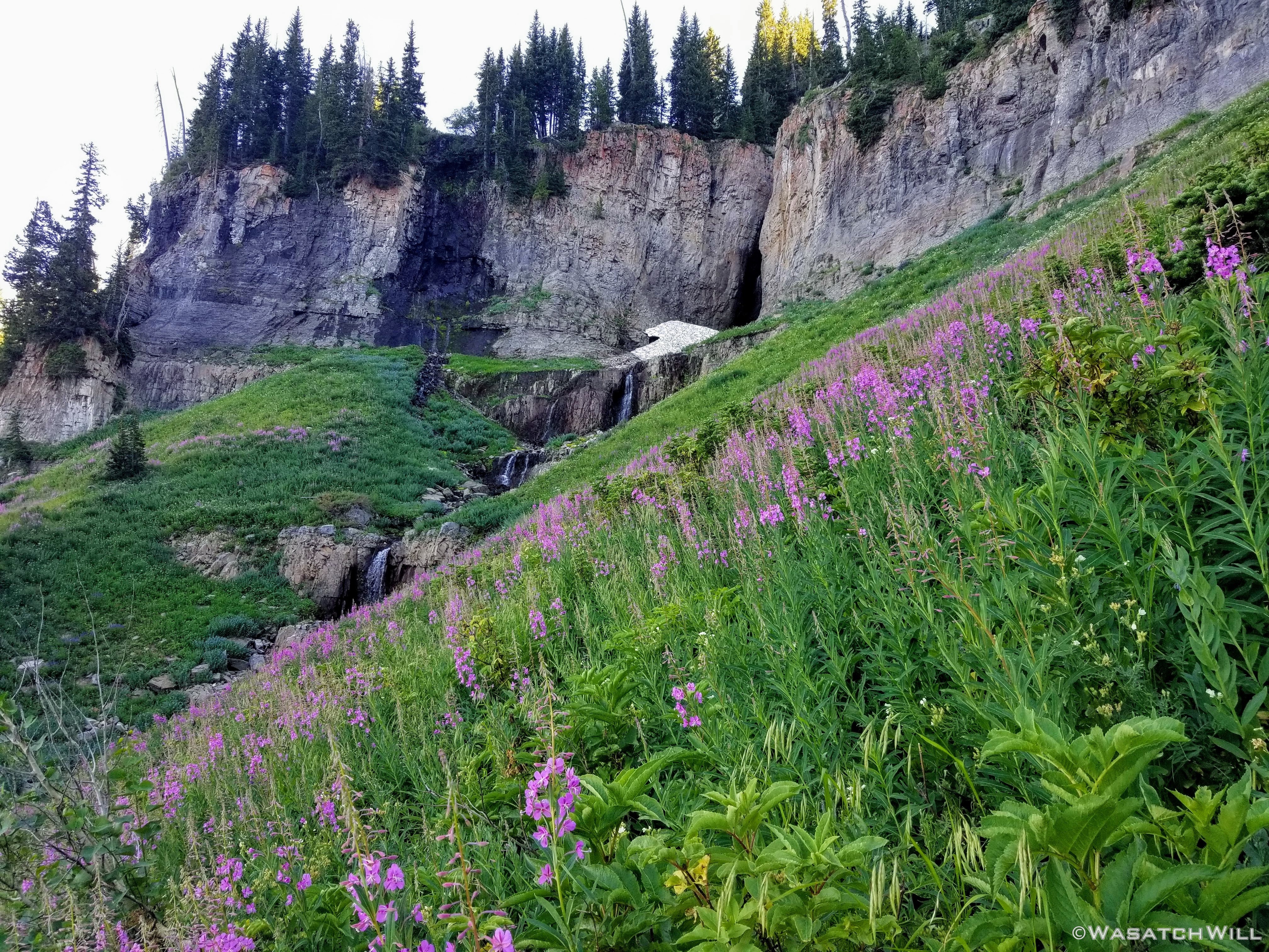
Rather than head straight for the summit, I took a detour to go pay a visit to the B-25 bomber crash site and more importantly, to refill on water which I had just run out of. To pack light, I had brought my water filter along in anticipation of finding some run-off still running in the stream beds draining out of the high basin. It turns out those higher runs were all dry after passing through the big meadow down below. Yet there was still one more potential water source I knew of along the way to the off-trail crash site. However, I was a little bit nervous about the potential of it too being dried up given how little snow had fallen the previous winter. If there was no water to be found there, I was thinking I likely would have to go straight over to Emerald Lake up above and over the other side of the basin, away from the trail I was planning to regain to take me to the saddle and summit. If that had to happen, I likely would have bailed on my plan to also tag the summit.
On my way out to scope out the water source, I would pass by what I call the 'Loo with a View'. It is an old pit toilet that once had a privacy wall built around it several years ago. The elements and perhaps vandalous humans have all gotten the better of it since then. The toilet itself has since been filled to capacity with no servicing since then. Needless to say, it's pretty gross now and these days, I don't dare get any closer than a few feet for a fun picture.
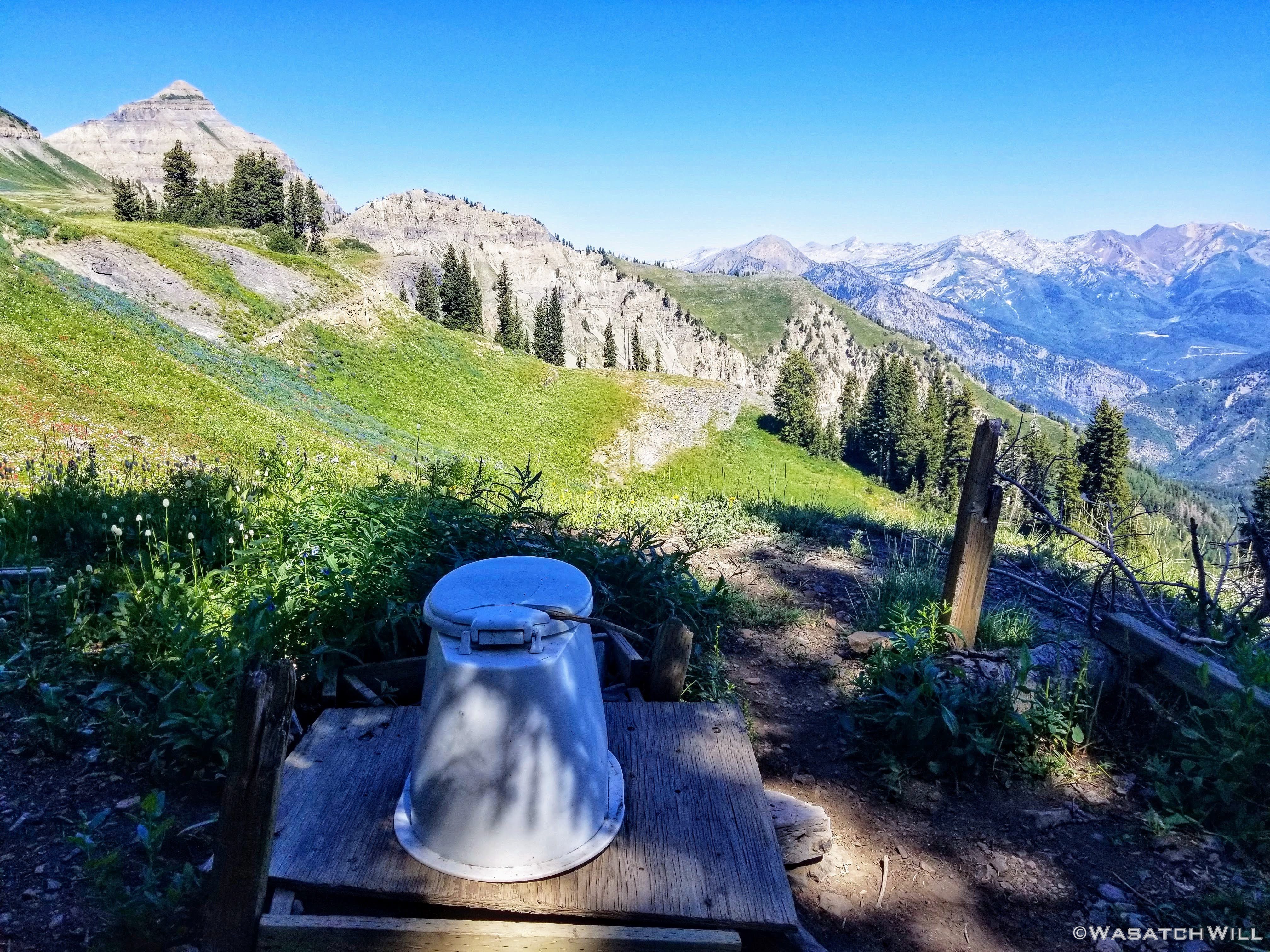
The Loo With a View
Rounding around the hillside from the old neglected toilet, a much lesser trafficked path led me through more blankets of flowers and supreme alpine views, both of the northeastern ridge of Timp and out across the north to the mountainous ridge-lines of the Cottonwood Canyons. Heavenly!

Is this Heaven?
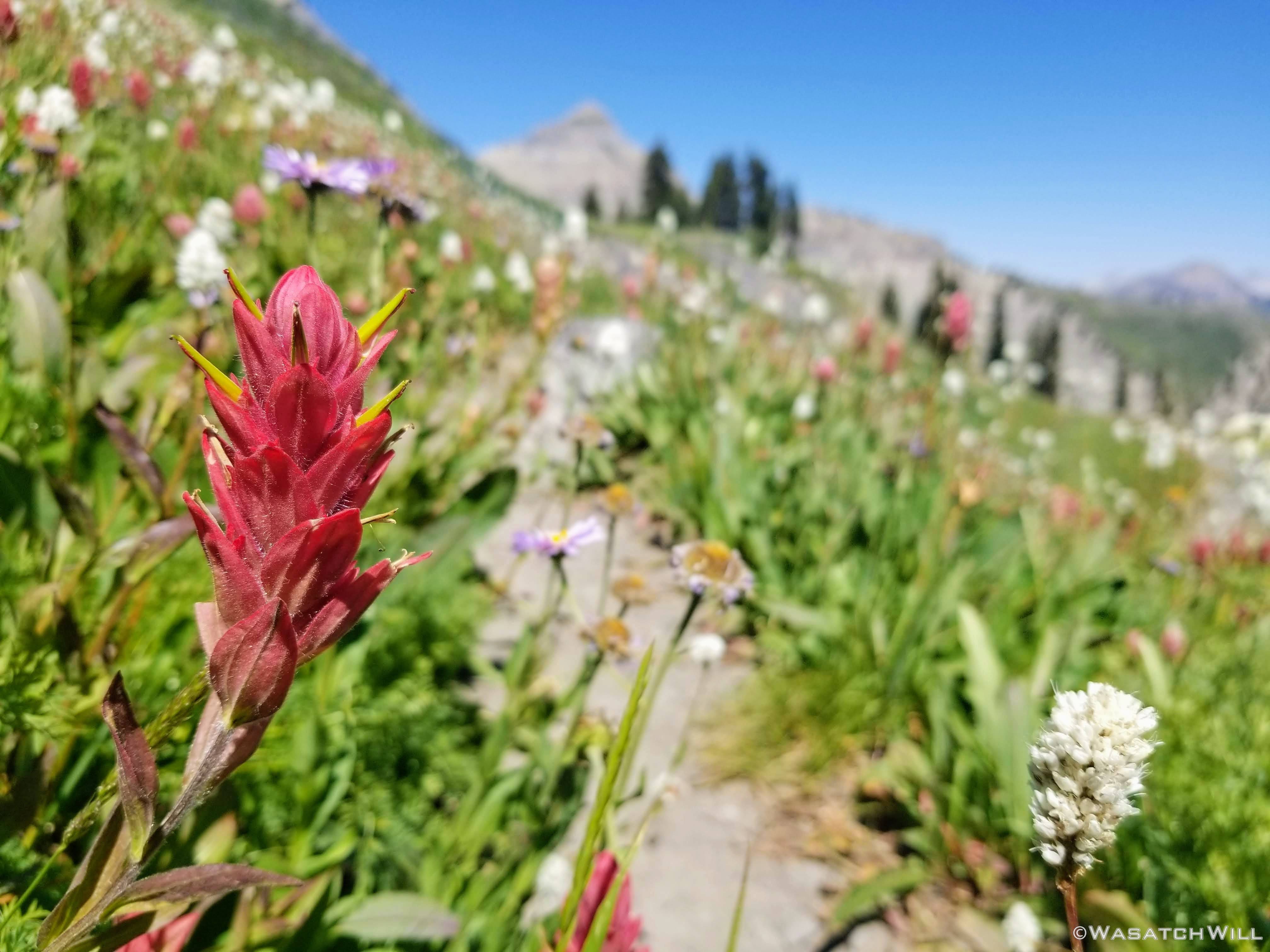
Paintbrush close-up
Northwestern view
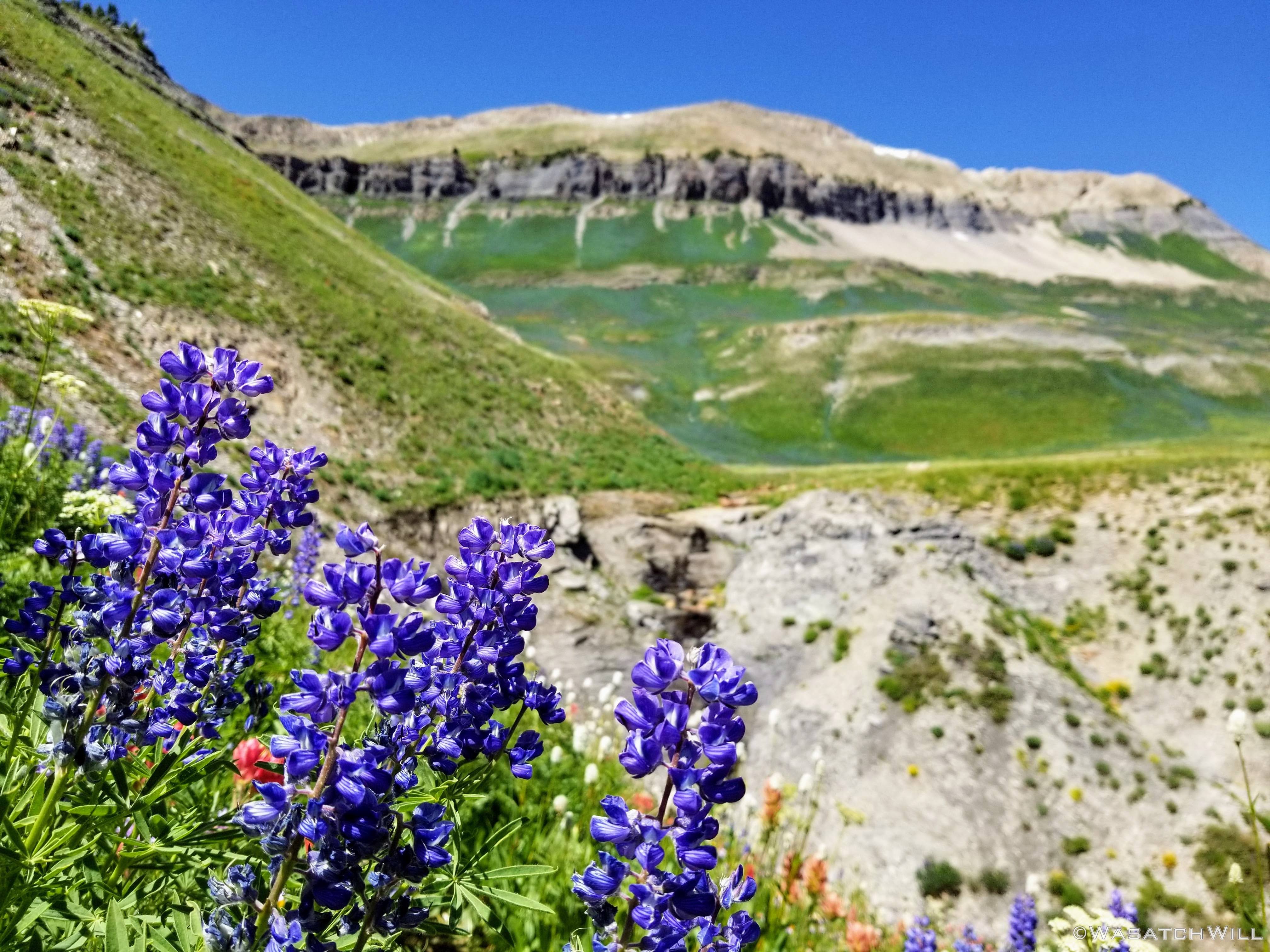
Lupines close-up
Then came the moment of truth as I rounded another bend. Would there be water waiting for me, or would there not?
There was!!! I was saved! Or at least my original plans for the day's hike was now saved thus far...

Approaching my precious water source
After pulling over to top off my water bottle and have another little rest, I set off for the crash site. The use trail vanished at this point and it was now cross country through the flower covered meadows. Had I been with a large group, I would have stayed out on the more routine designated trails, so as to not have so much impact on the lesser trodden
areas. But when with a smaller group, and certainly being solo, I feel that such cross country wandering has no more impact than a moose, elk, or group of deer trotting through. Still...I tried to choose my lines carefully, looking for any game trail to follow or other lines of minimal impact so as to not disturb the flowers too much. They were so lush and beautiful!
Fields of flowers
'Bomber Meadows'
Looking up toward the crash site

Timp's summit block rises above more flowers to the south
More lupines
After a steep gain up a high slope and onto a bench, I arrived at the crash site. Oddly, there was a random contemporary pictograph depicting a bicycle there on a rock to greet me at the site. I'm not sure what that was all about but whatever...

Strange bicycle painted on rock
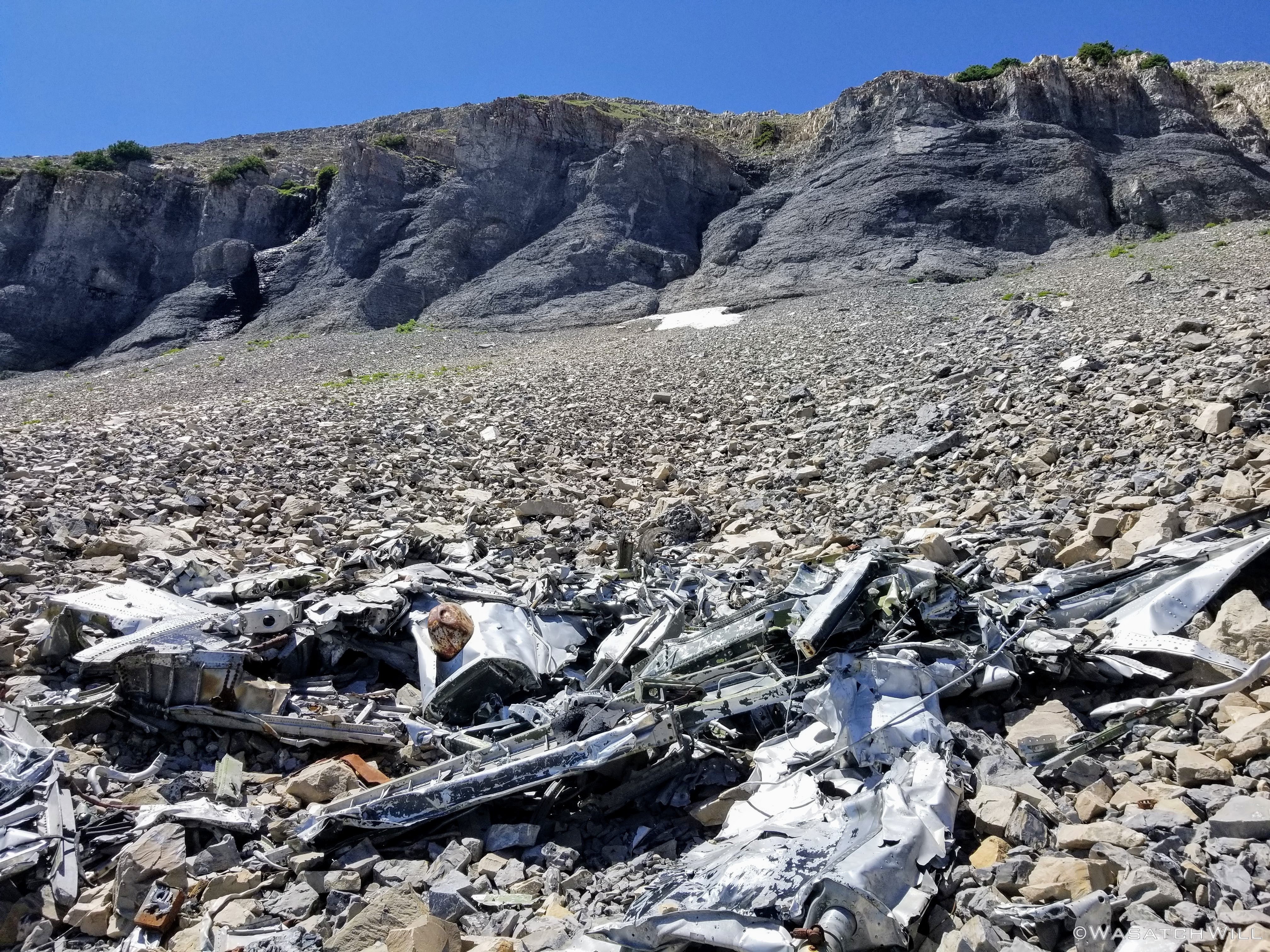
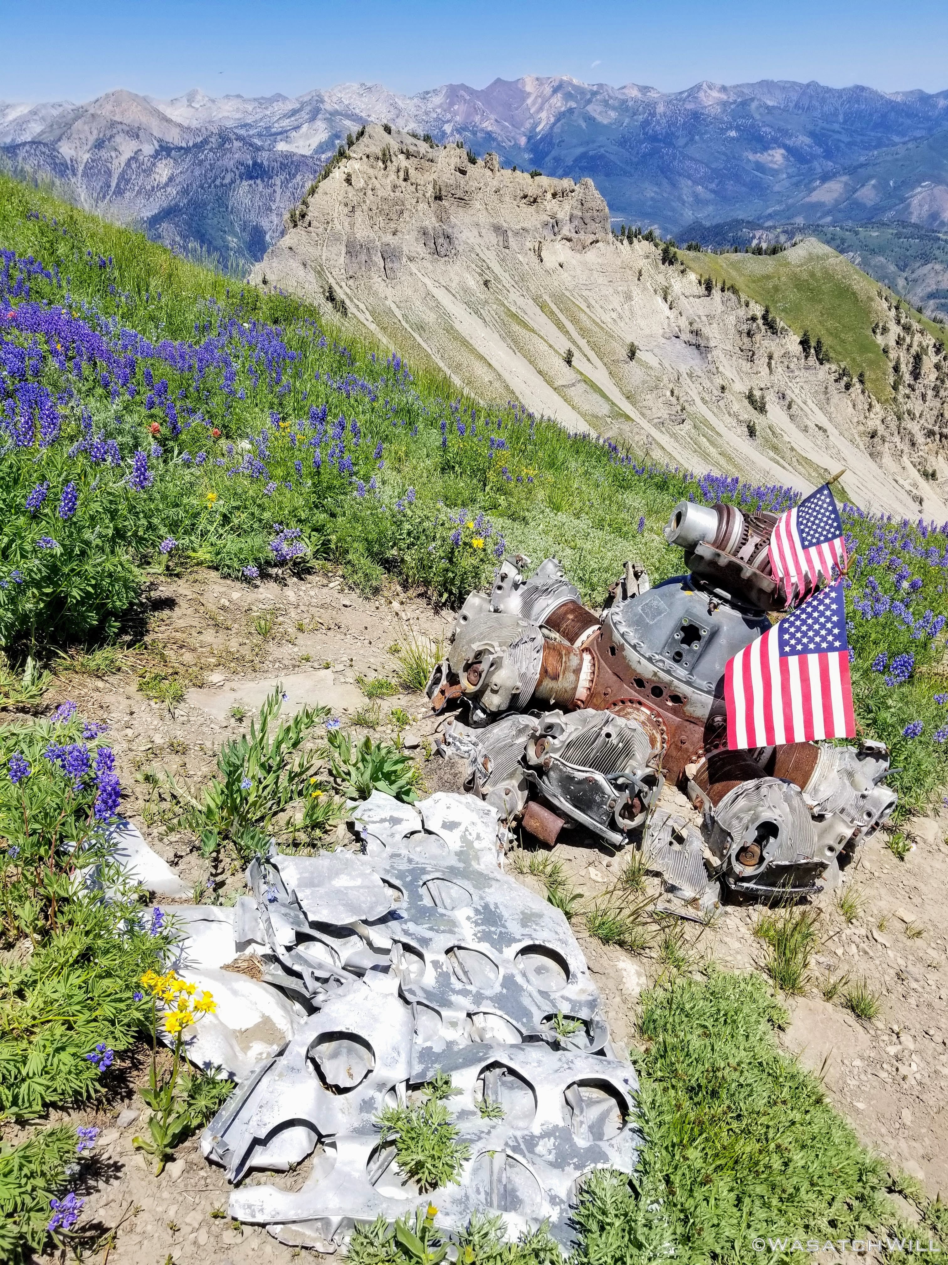
Now surrounding me on a scree slope was the wreckage of the B-25 that tragically crashed here some 65 years before. Only an airplane expert could identify much of the dismantled parts of the plane. Though all the bodies on board were recovered not long after the crash, it still feels like I'm visiting a memorial site each time I visit this spot. My father served in the Air Force and while he was not a pilot himself, I still feel some small connection to anything concerning the Air Force and those who serve in the military due to my childhood upbringing in an Air Force family, having childhood friends whose fathers did fly or otherwise serviced such aircraft.

B-25 wreckage debris
The ridge above the crash site

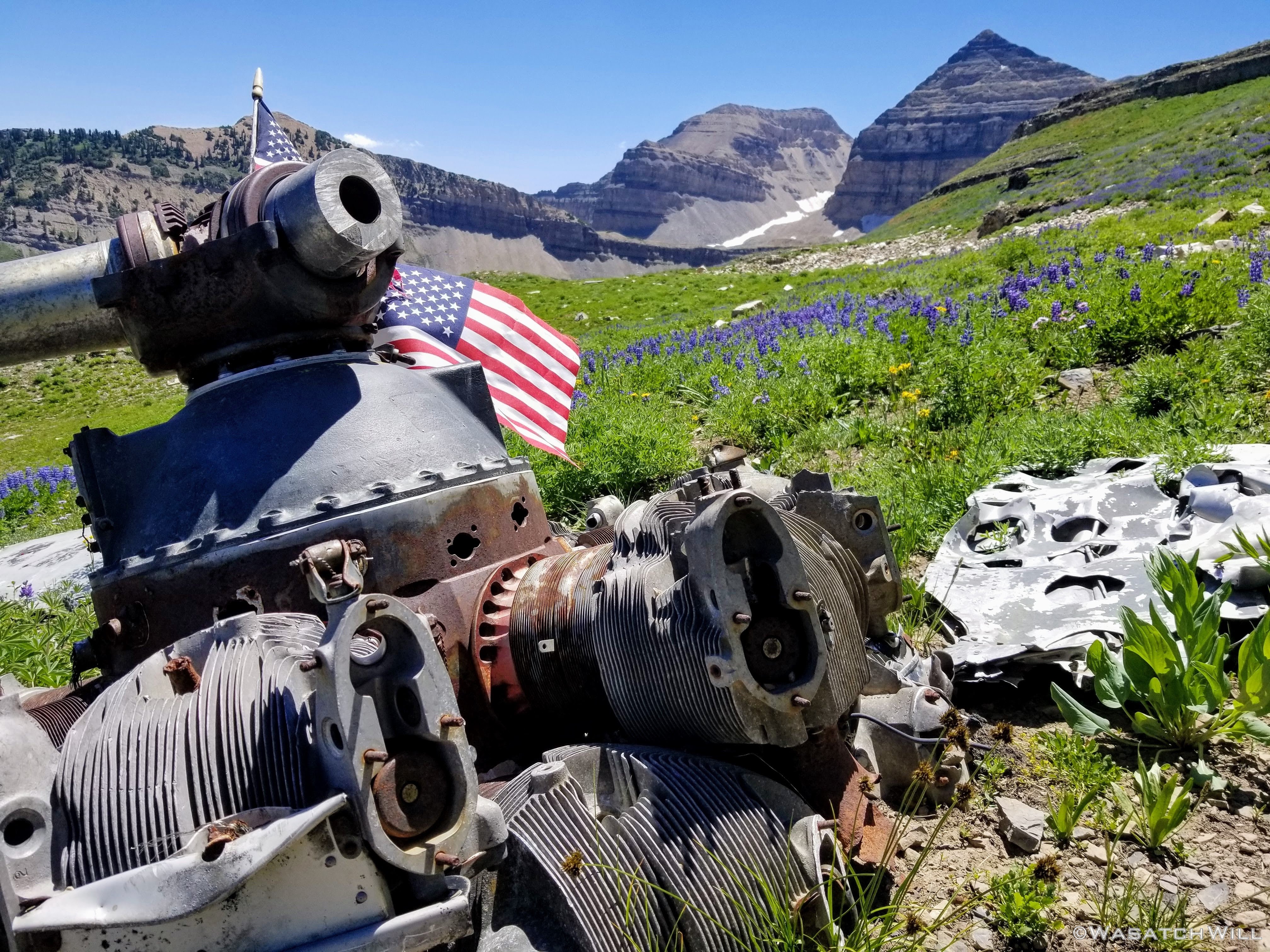
One of the engines
It became apparent that I of course was not the only one who observed this site as a memorial site. Others before me had planted small USA flags at the engines that must have tumbled down the hill at the time of the crash or sometime thereafter. Some flags were aged, tattered, and torn. Others however looked fresh and new. Perhaps they were placed there earlier in the month in observance of Independence Day or prior to that, Memorial Day. Such flags in any condition were not to be found at this site during my previous visits in years past.
The other engine
Looking back north
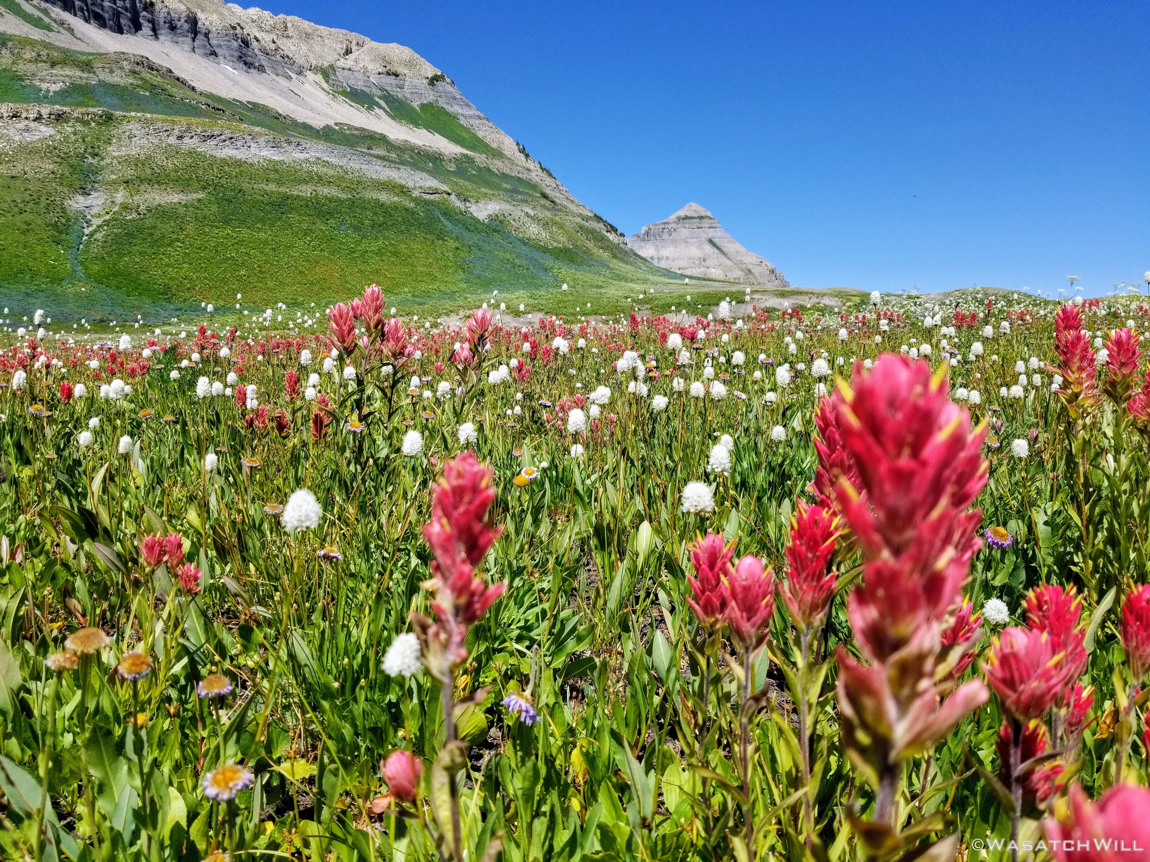
After paying my respects, I moved on and rejoined the main trail and its many other hikers back over in the basin. Flowers continued to show-off.

Back on the trail

Basin flowers
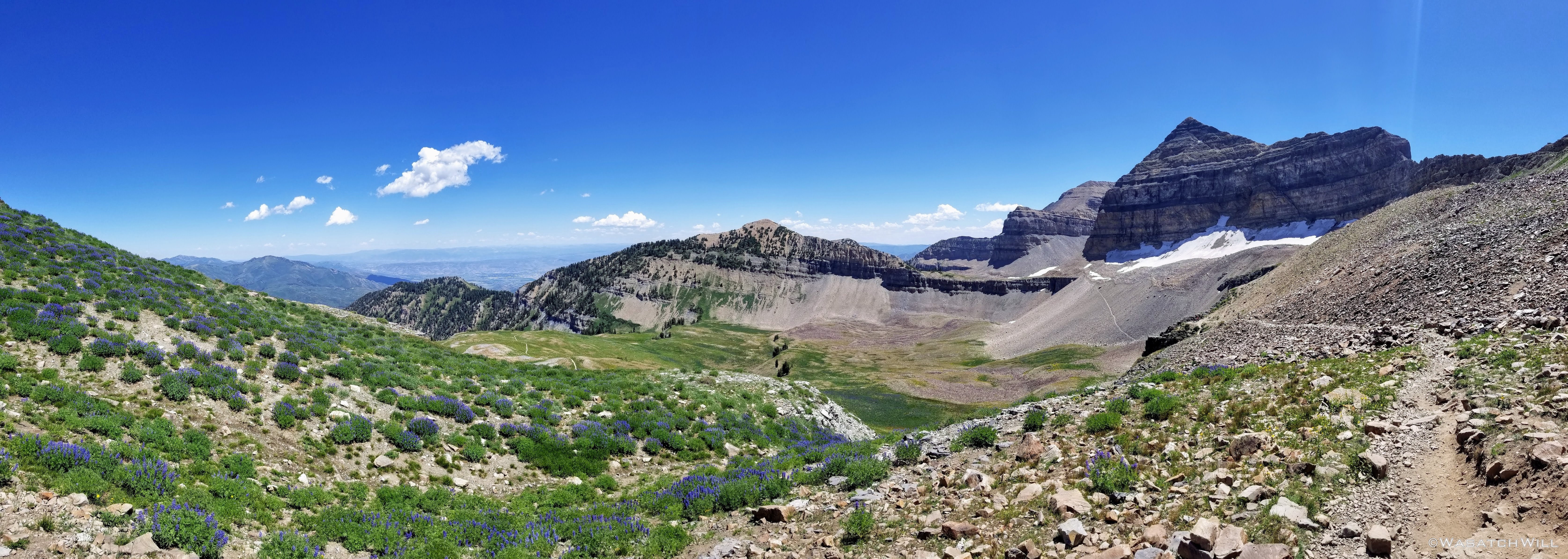
Timpanogos Basin pano
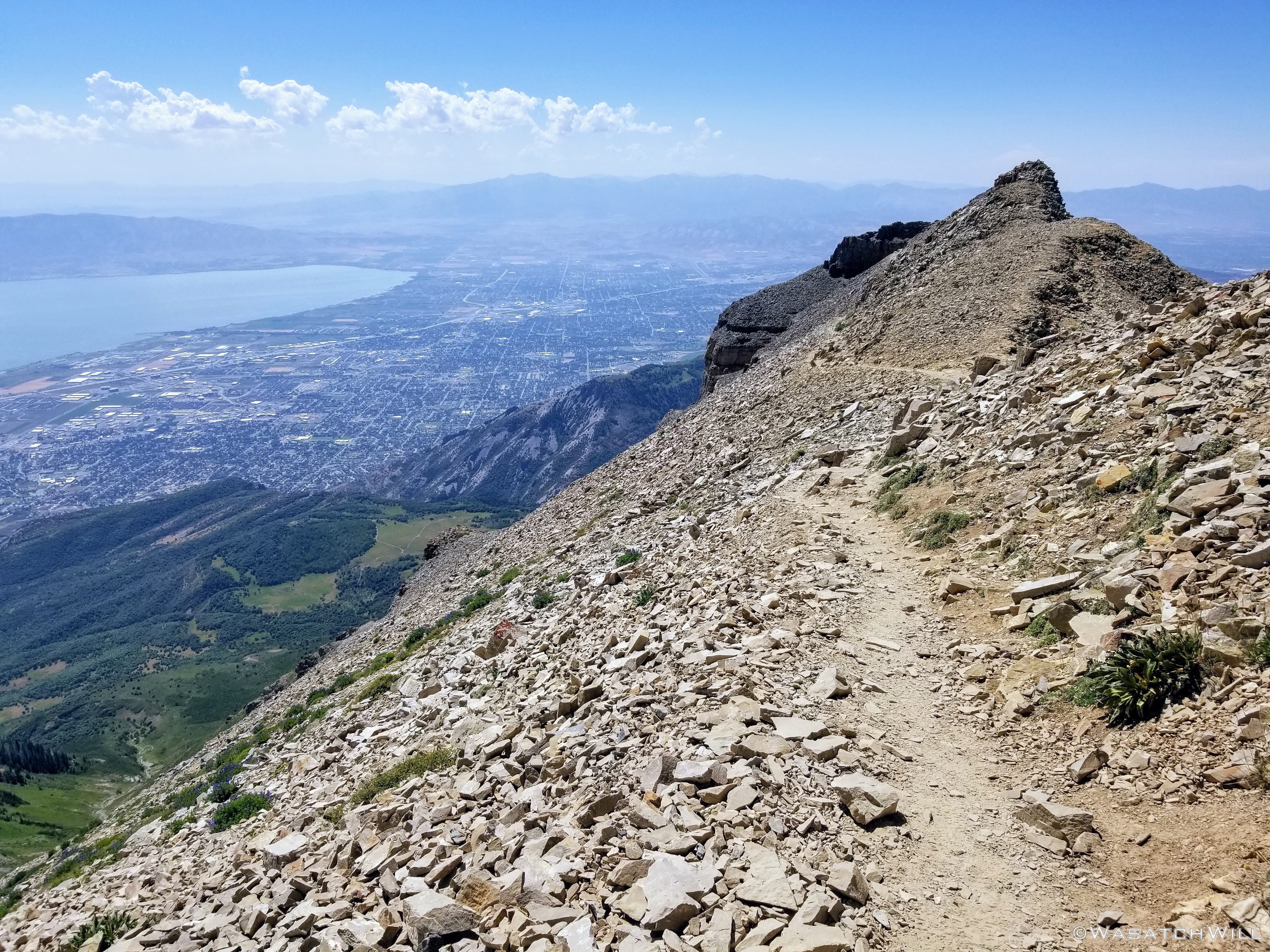
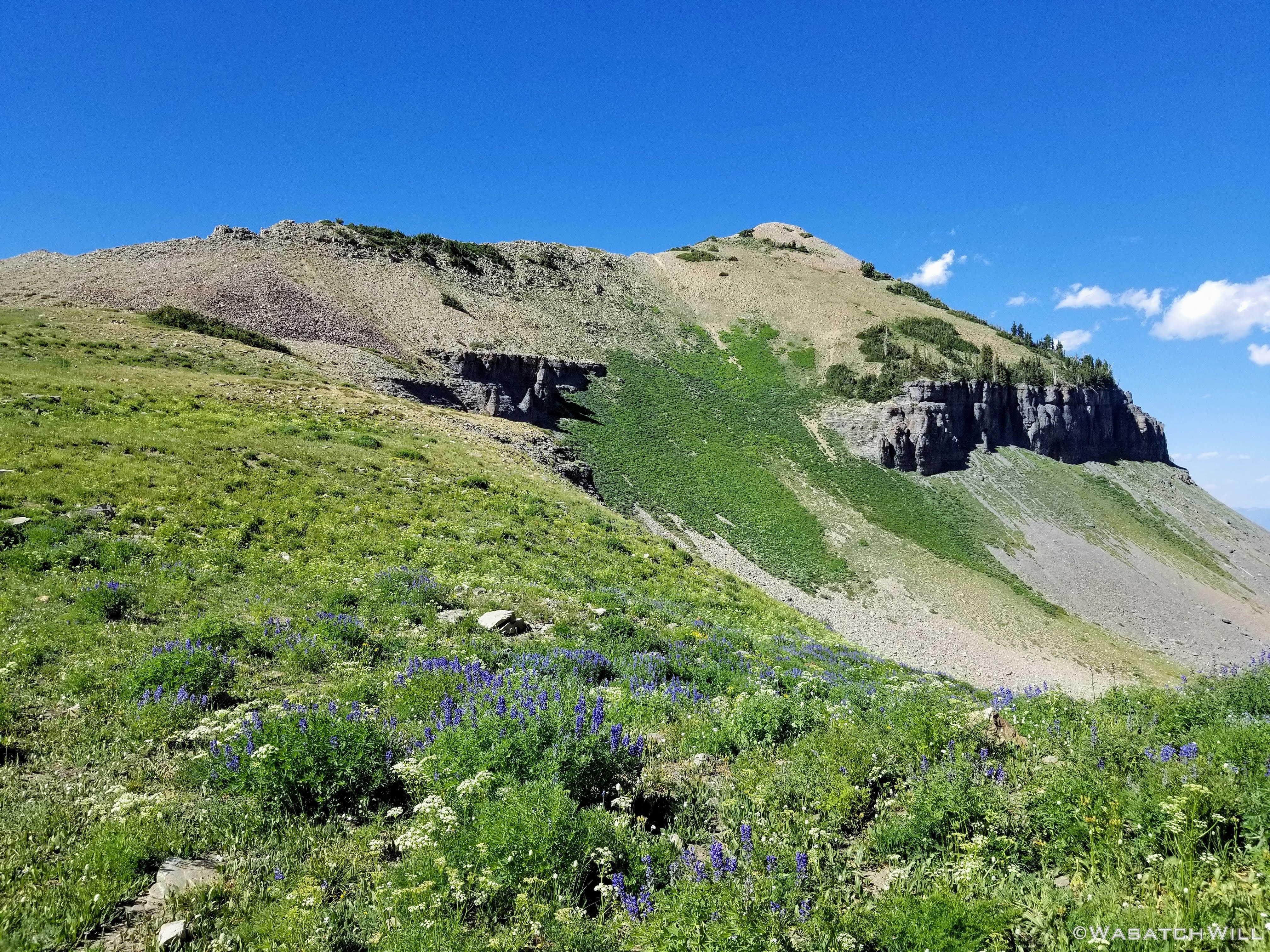
A little while later I had made it up onto the saddle. Shortly before the saddle I had actually passed over a little bit of run-off still flowing over the trail. Turns out there would have been another water source I could have used en route to the summit after all. Skies remained mostly clear. The summit remained a go. Just another 3/4 of a mile.

Looking south to the summit block from the Saddle
A series of short switchbacks en route to the summit
A weakness at the top of the switchbacks to cross over
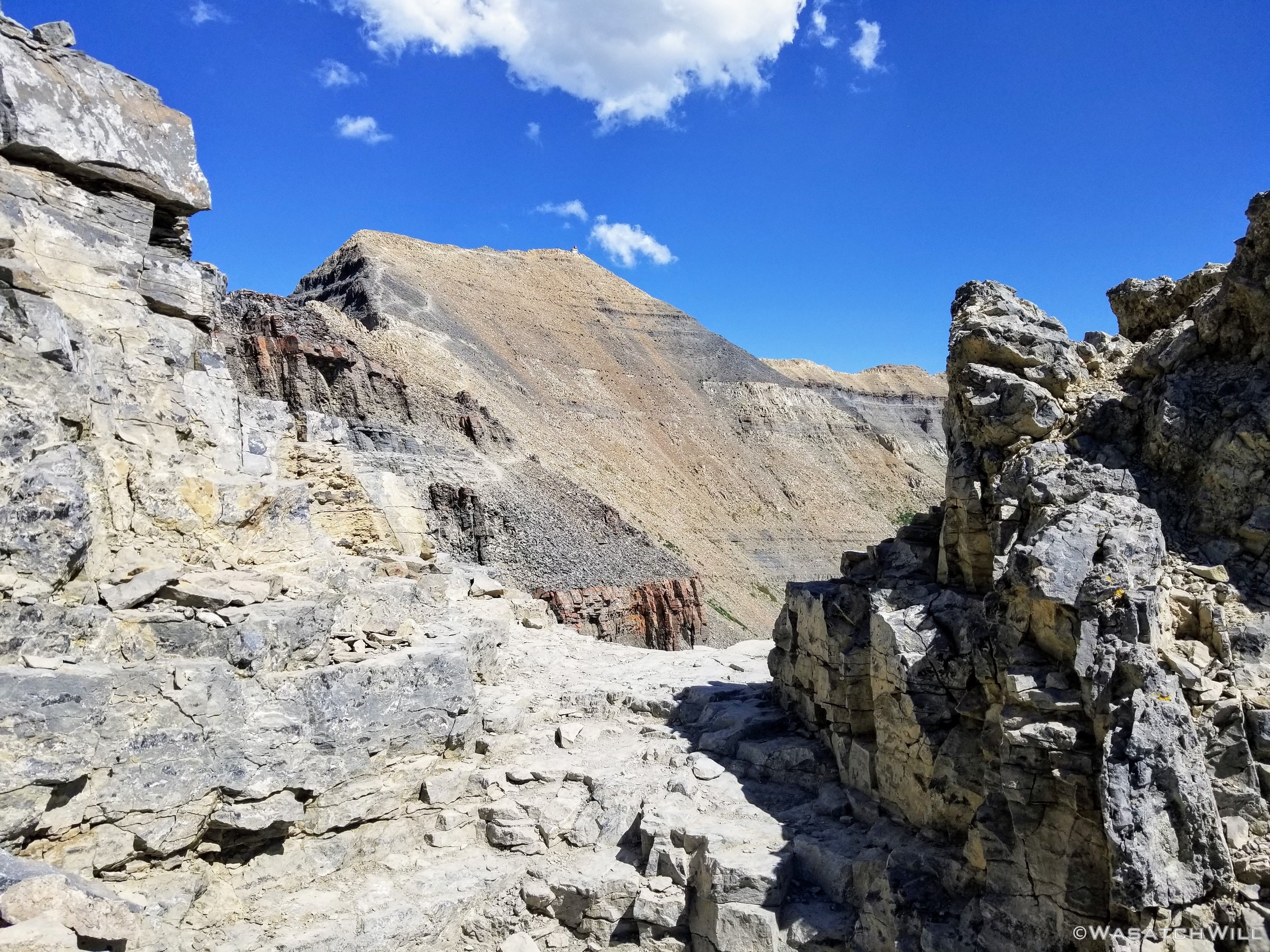
The summit and its shack on top come back into view
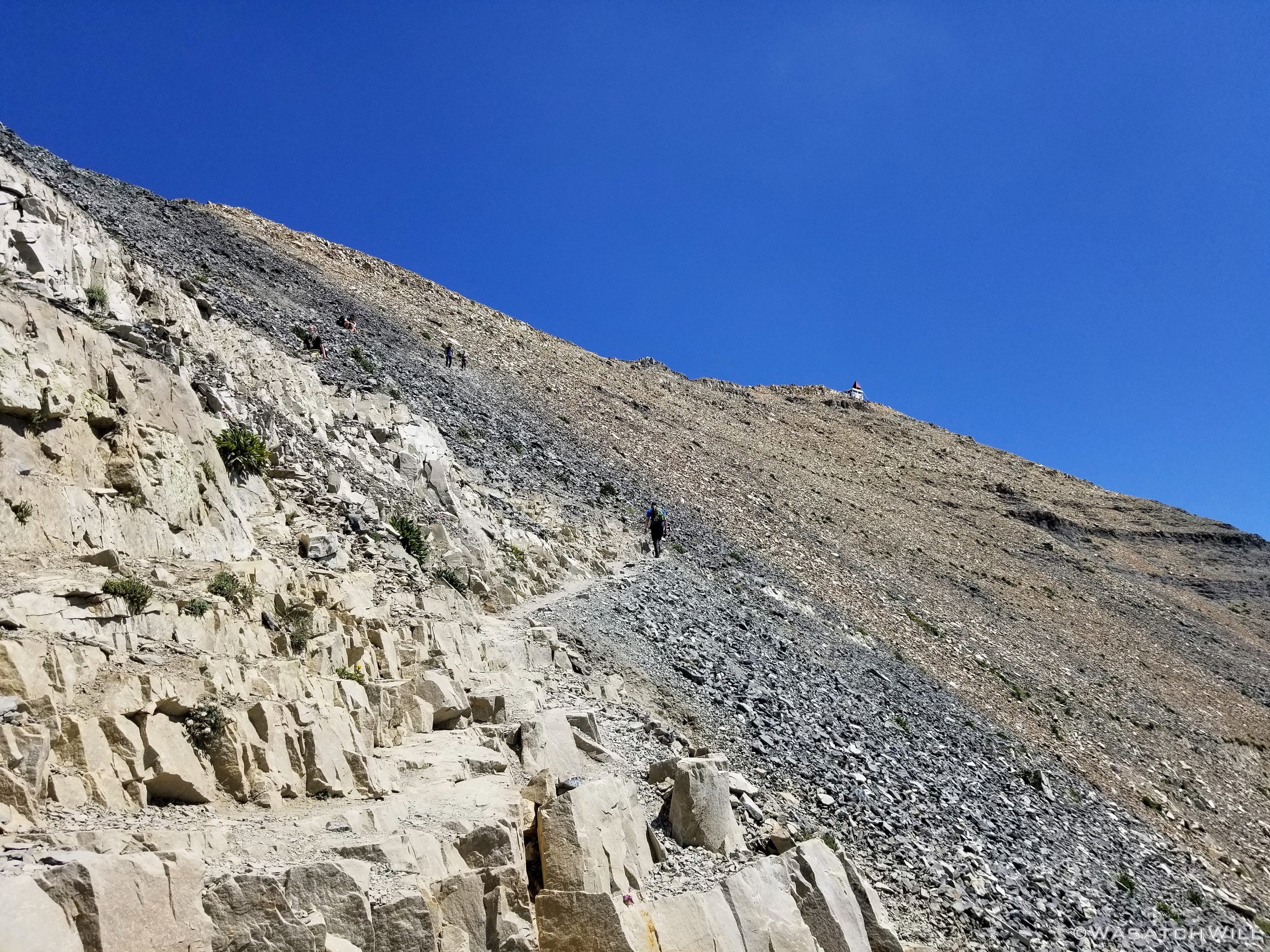
Closing in on the summit
Once at the summit, it was time to join with the others already there to take in the views while enjoying another much deserved rest.
Atop the summit stands the old 'Summit Shack' or what's known to some other old time locals as the 'Glass House'. Made of steel, and erected in 1927 by some local residents from Pleasant Grove, a community at the foot of the mountain, it consists of two sections. The walled section used to frame glass windows and served as an actual sheltered observation deck complete with a telescope for those who dared to venture up the mountain back in those days. The second part is the pyramid shaped structure placed over the shack's roof. It was used historically for a method of geologic surveying called triangulation. Other such pyramid structures were erected on Spanish Fork Peak, West Mountain, and other mountain tops surrounding Utah Valley.
Long since the victim of nearly a century of human vandalism and such, it now seems to serve as more of a big bulletin board or summit register. Better to mark up a pre-wilderness structure with marker and paint than carving into trees or rocks elsewhere.
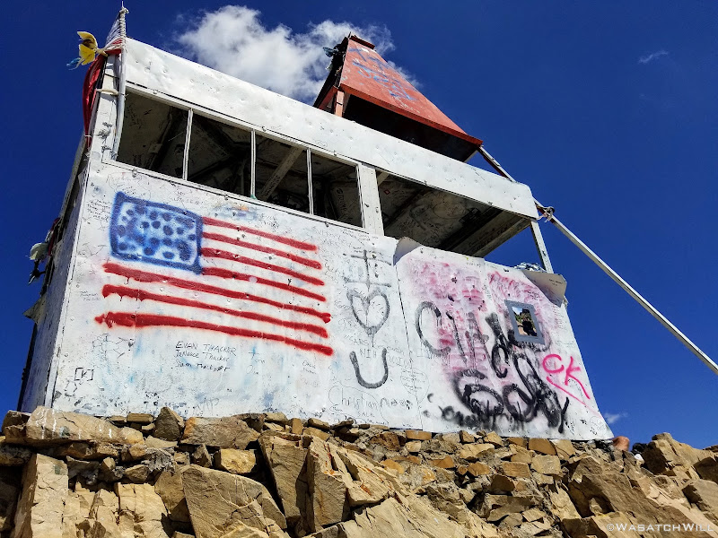
The summit shack
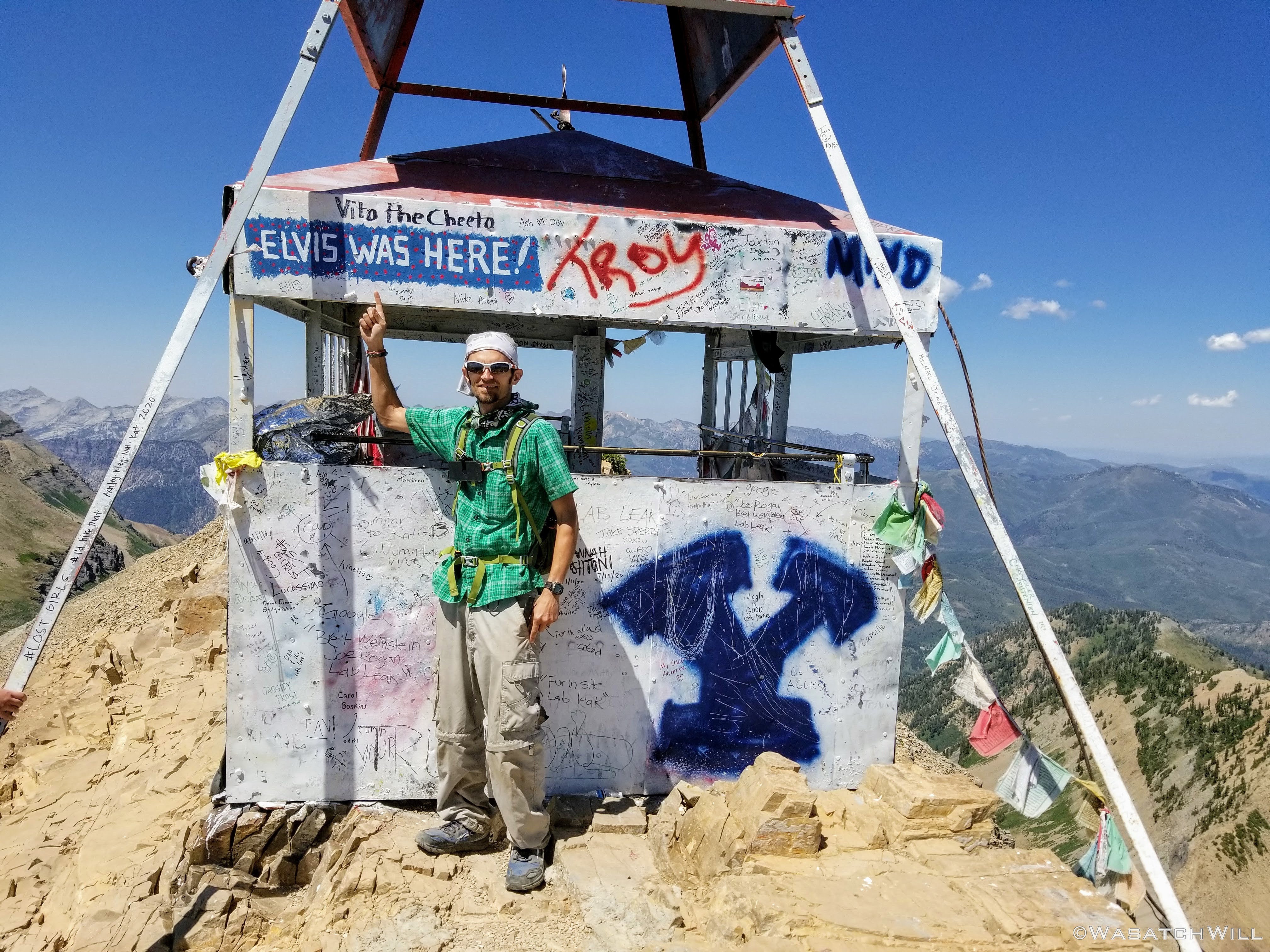
Made it! And so did Elvis some time before, apparently...
Summit pano, from west to east
Emerald Lake below
Peak branding
A view from the shack
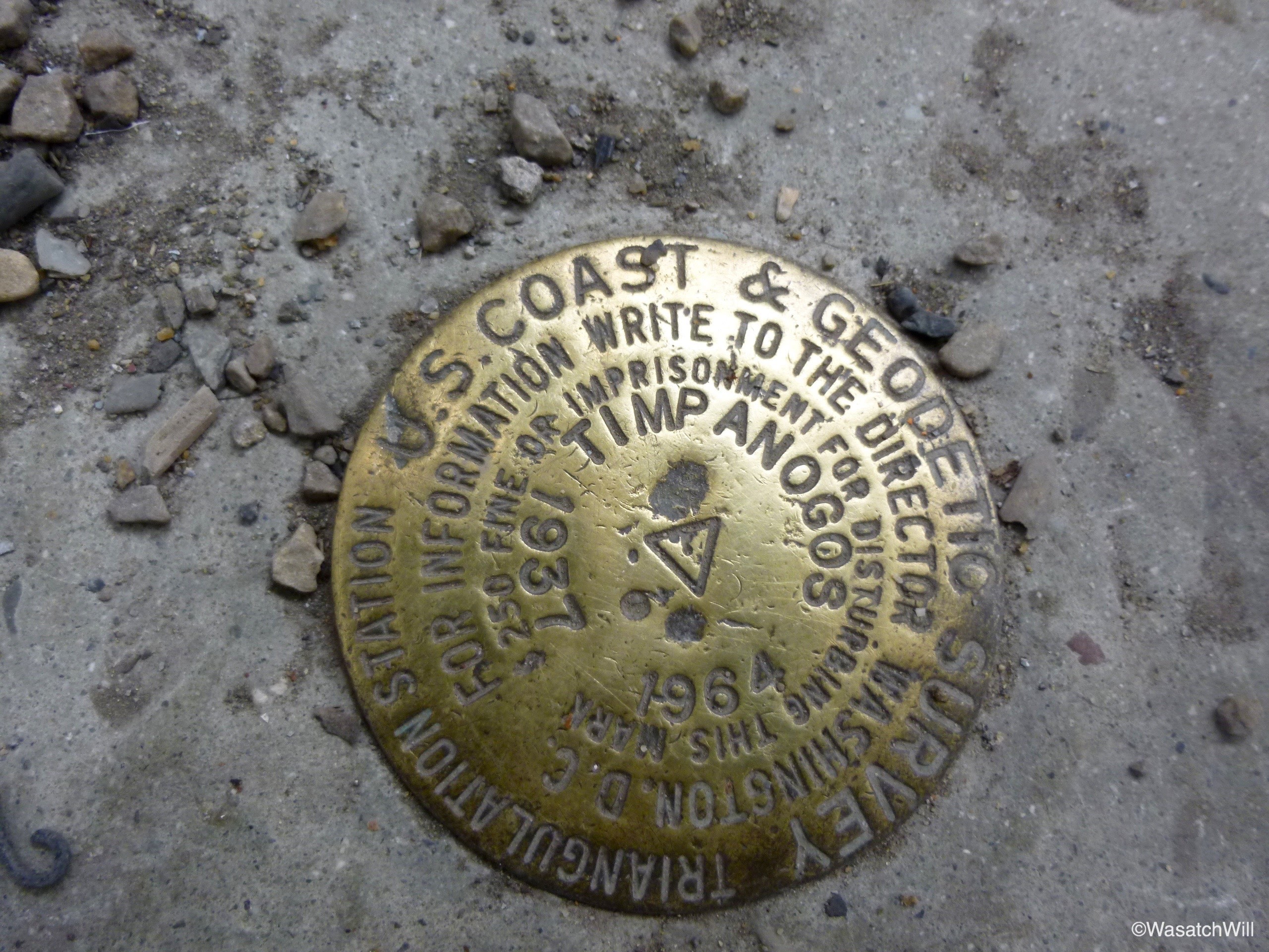
USGS survey marker
It was now time to head back down.
Heading back down
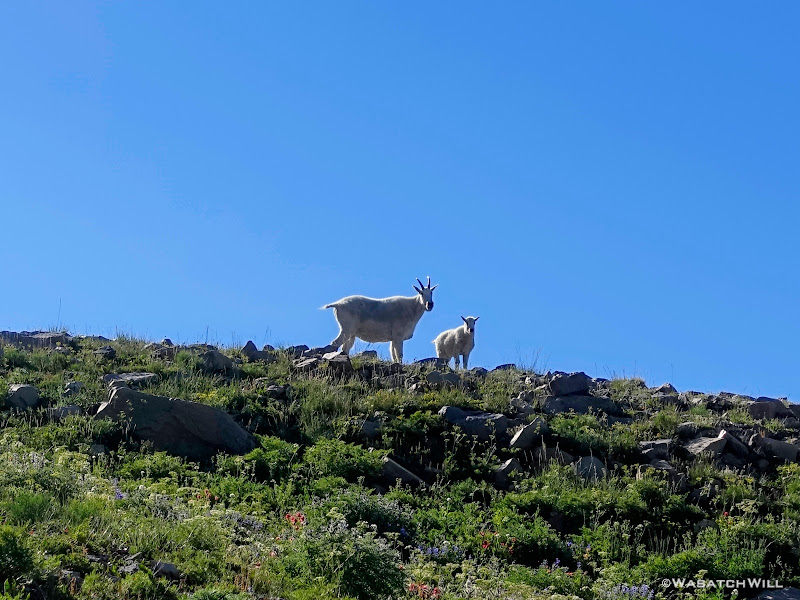
Back at the saddle, a resident mountain goat was there to greet me. My first couple times up the mountain in my youth, I never did spot any of the goats up there. My last few hikes up however have all featured sightings and encounters with these guys.
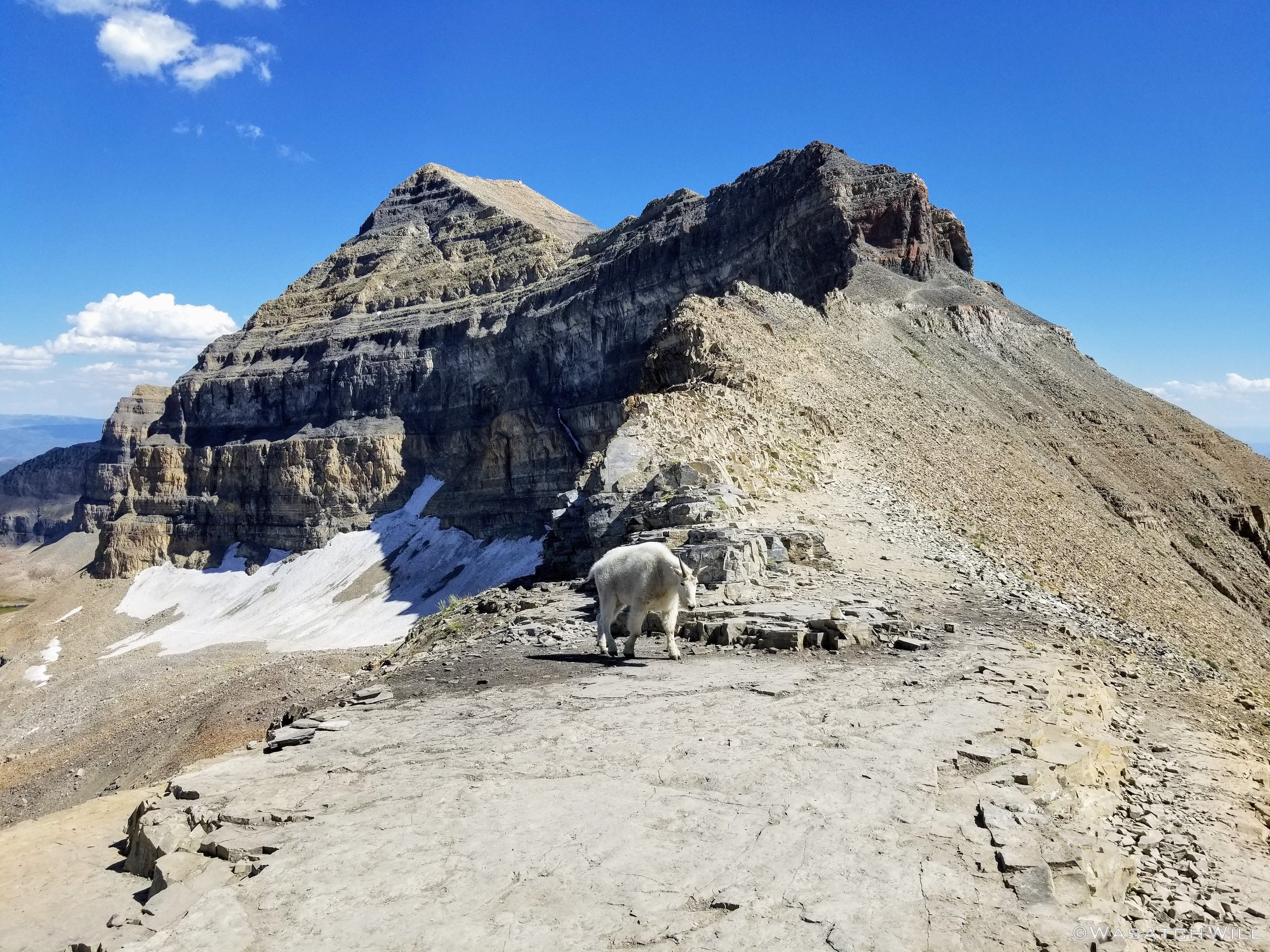
Saddle goat
Crossing over
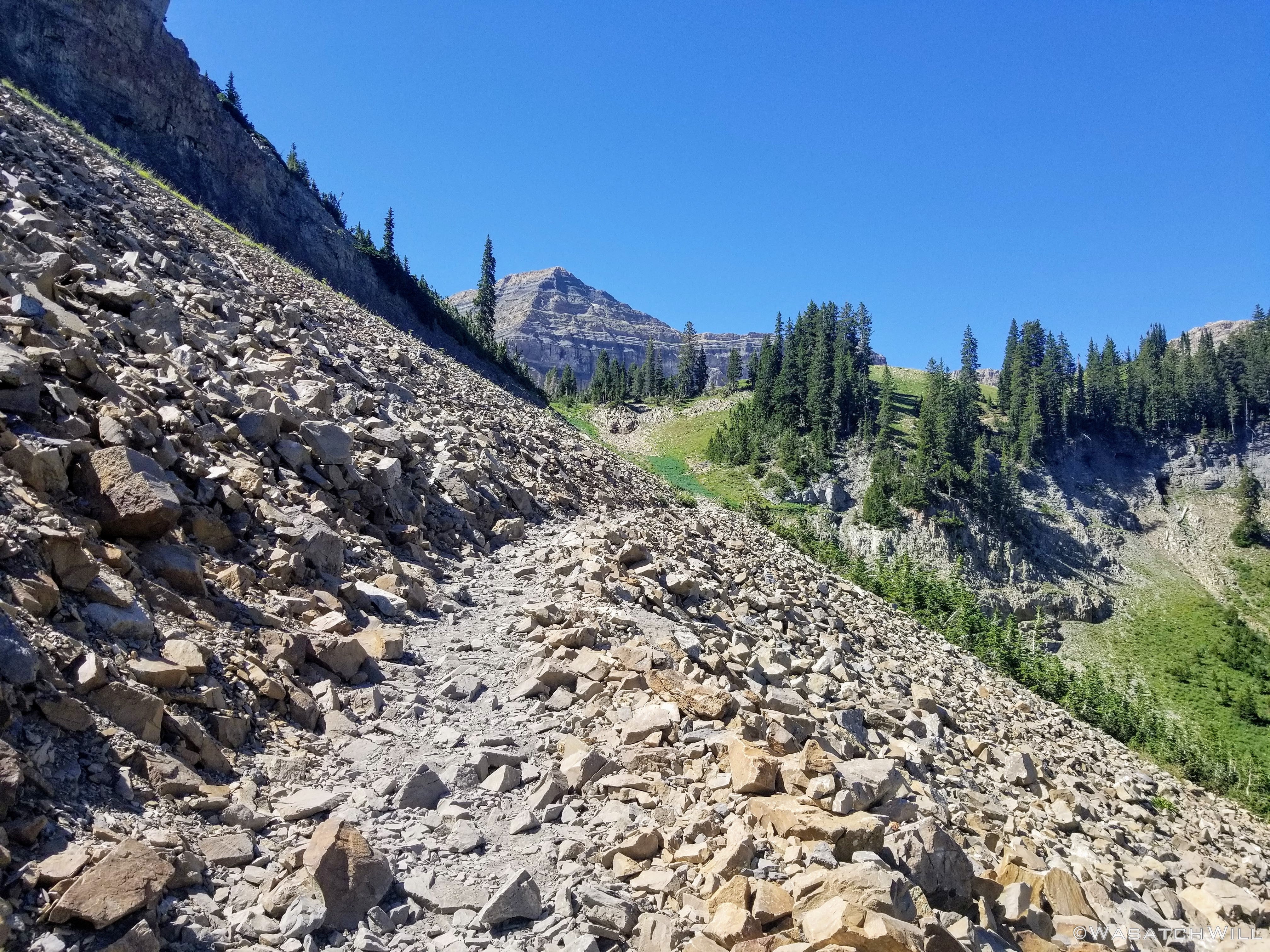
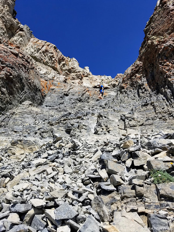
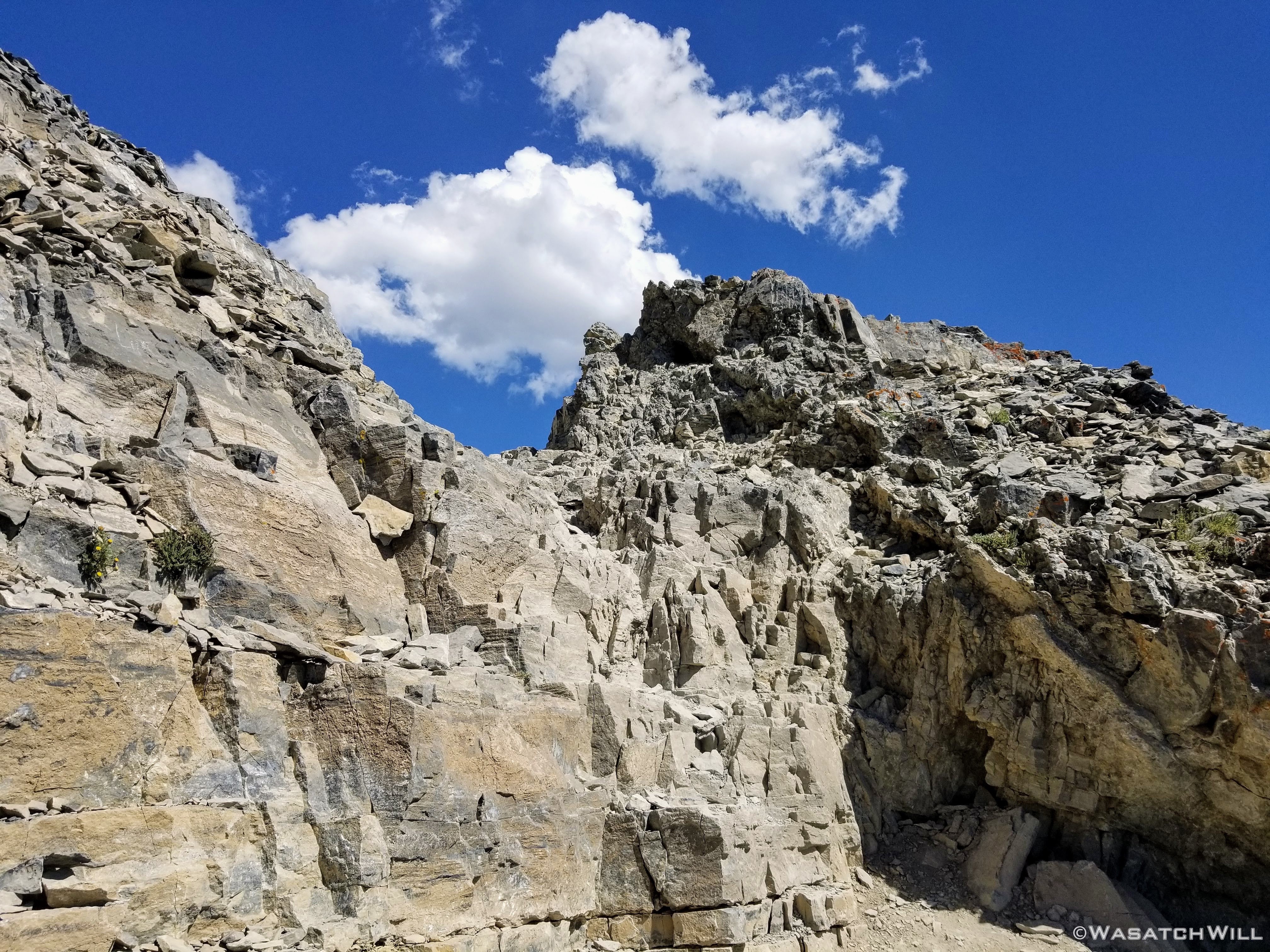
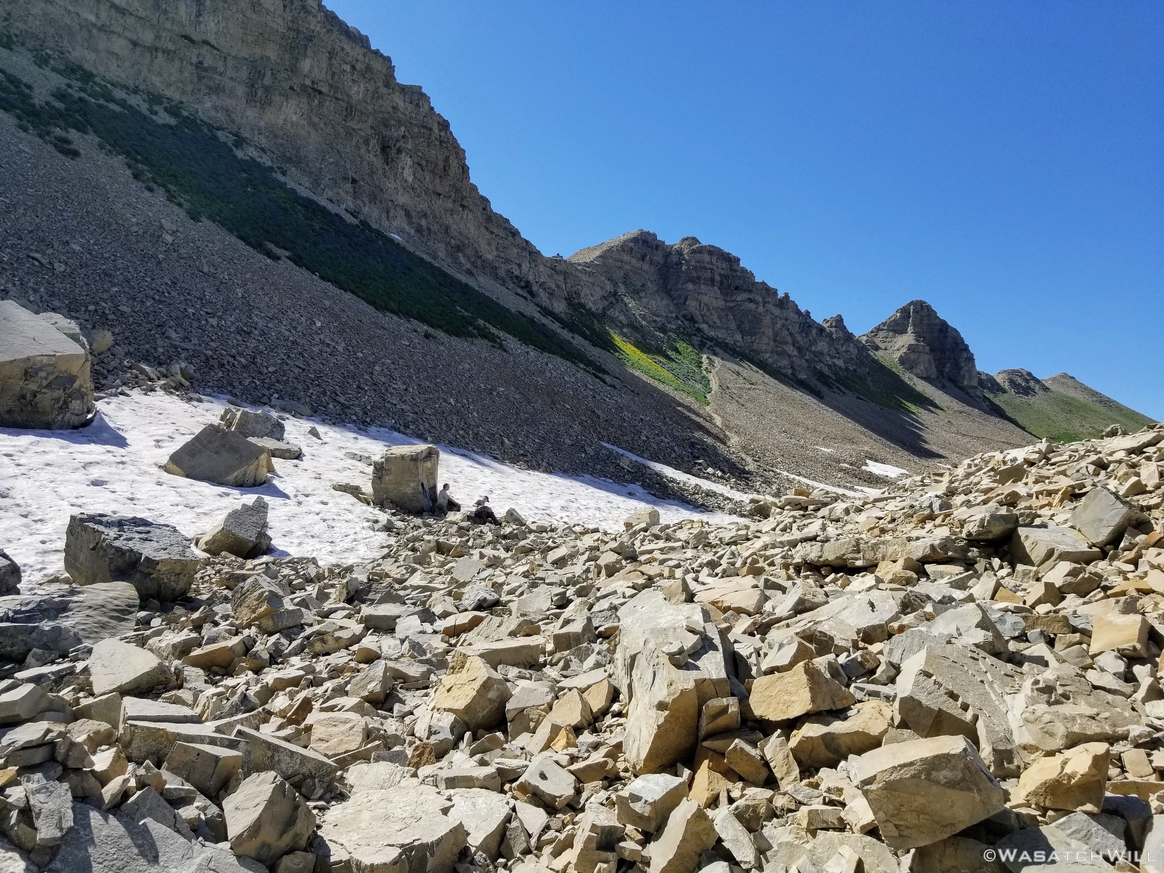
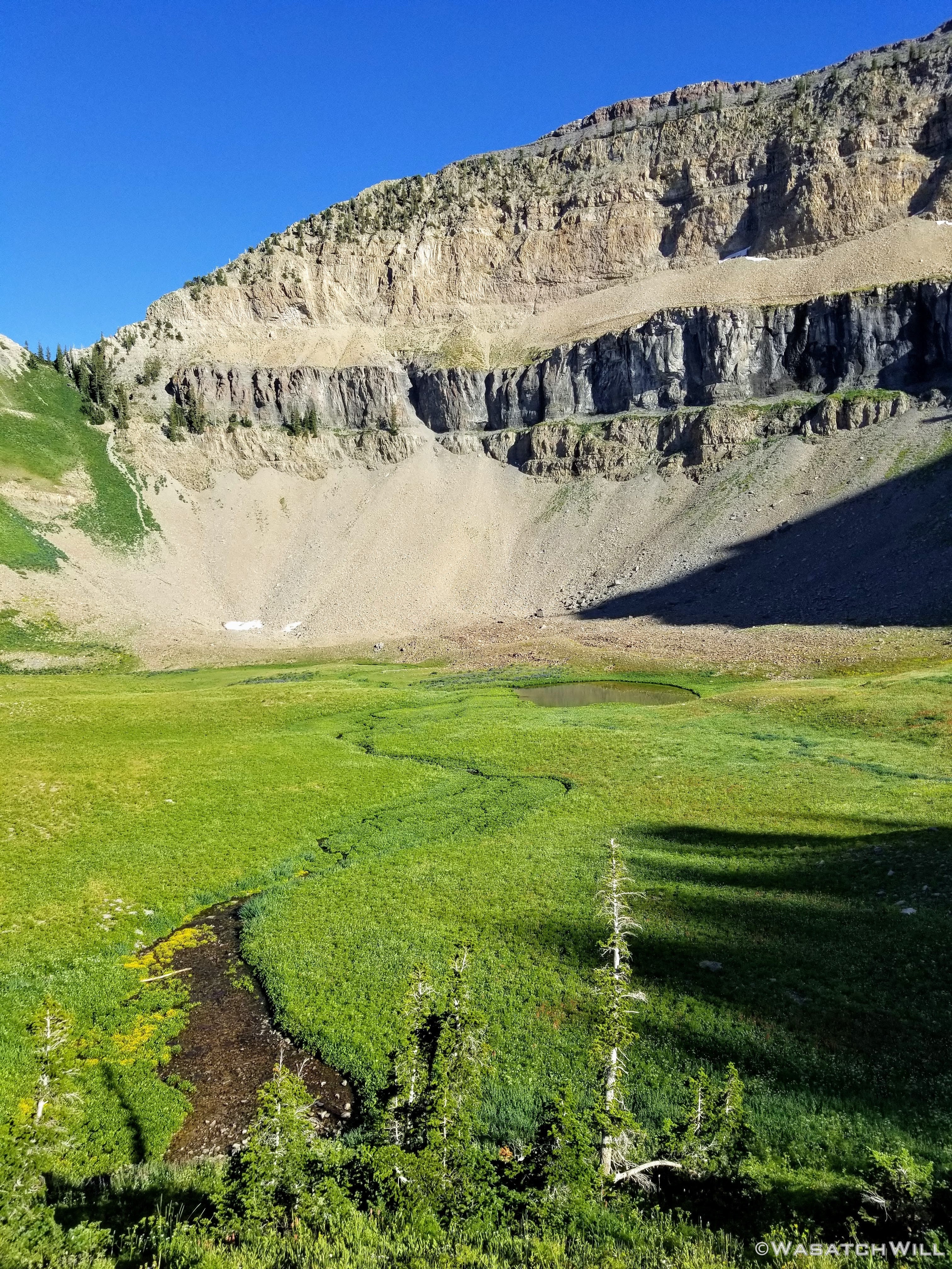
To round out the latter half of the loop I intended to do required that I head over to Emerald Lake from the saddle. To do so required inching my way down a steep and slippery scree and dust covered trail until it mellowed back out into a lengthy talus field with an occasional cairn to guide travelers in the right direction.
Traversing talus
Looking back toward the Saddle
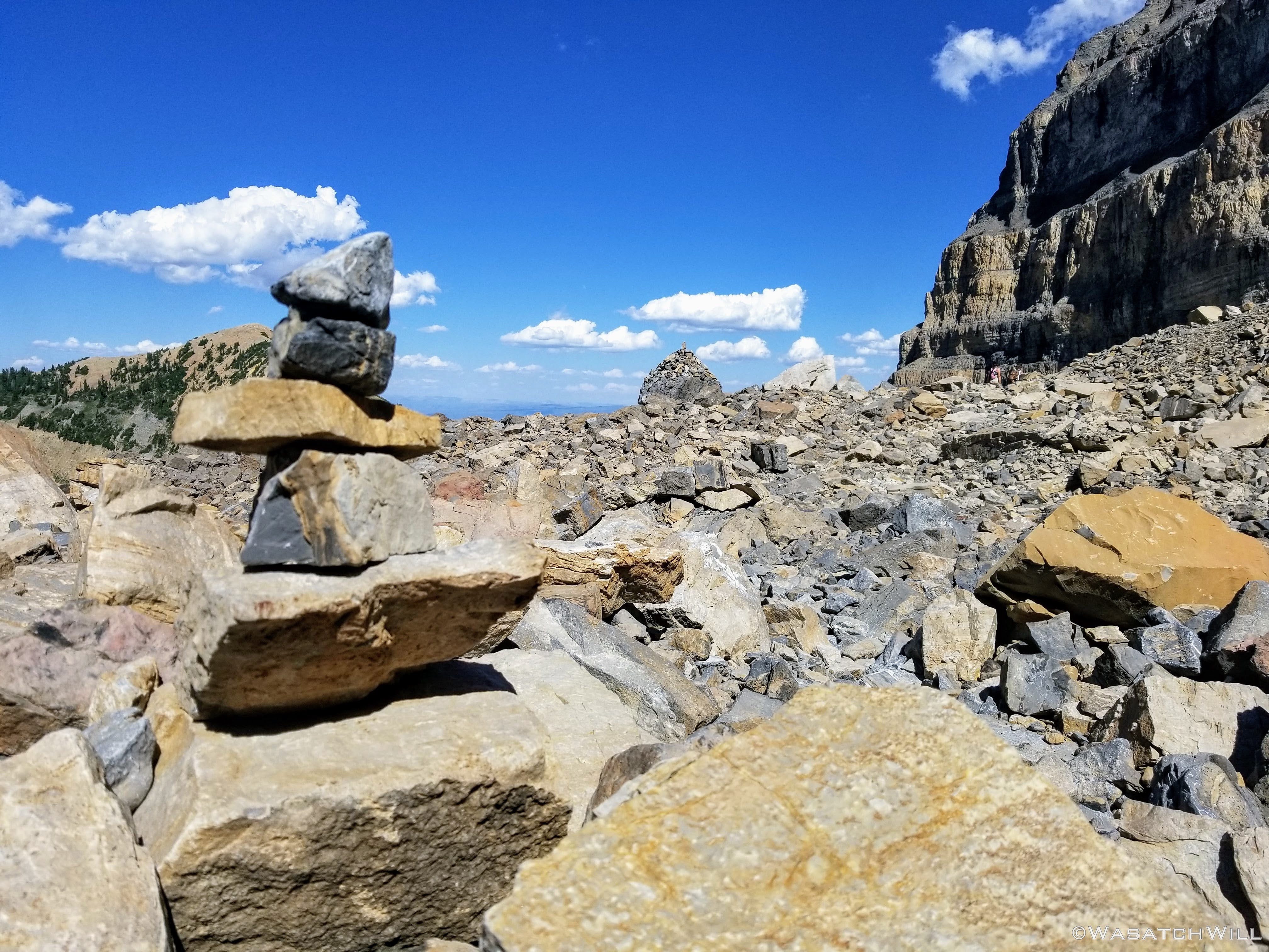
Cairns to follow
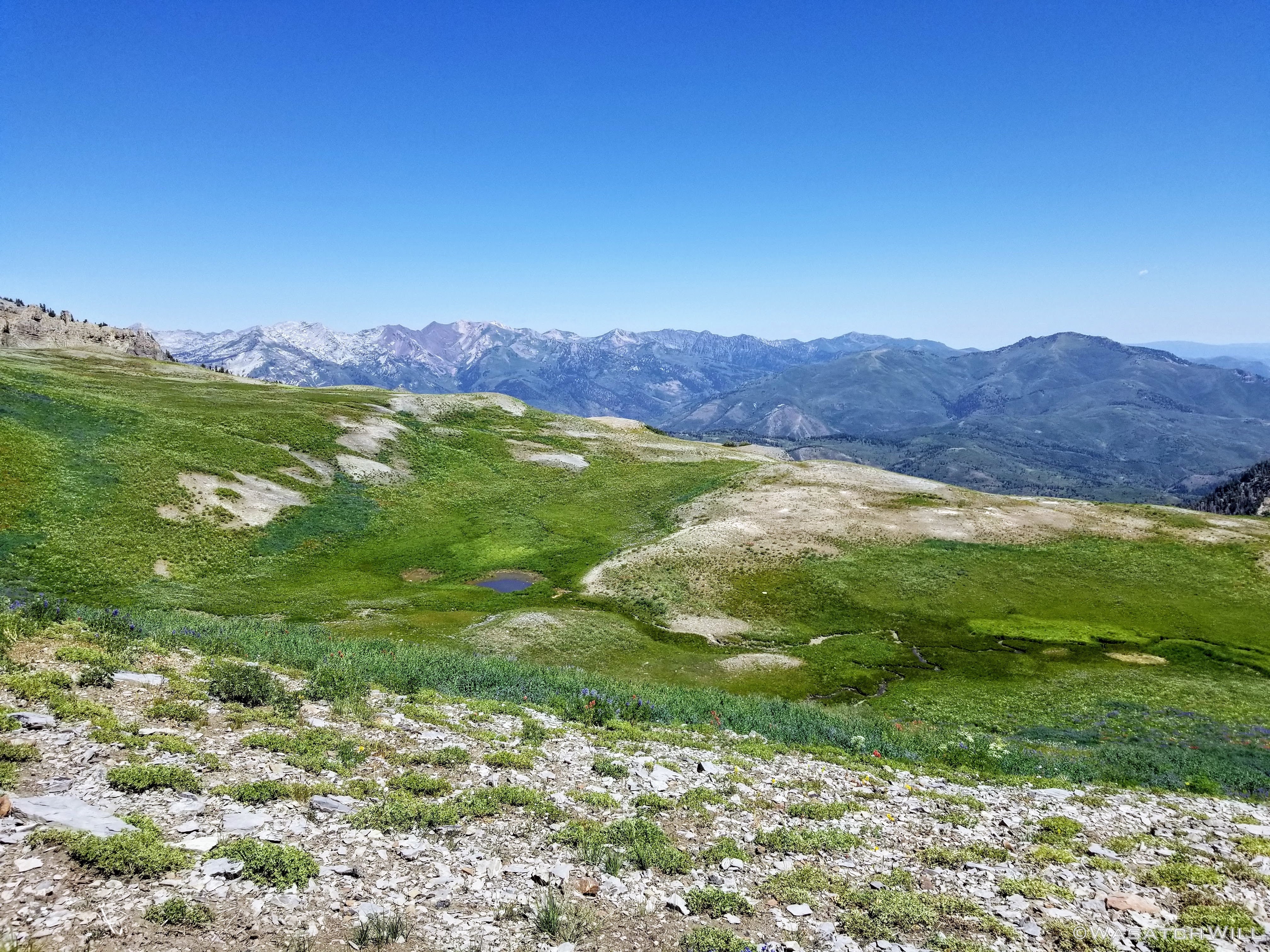
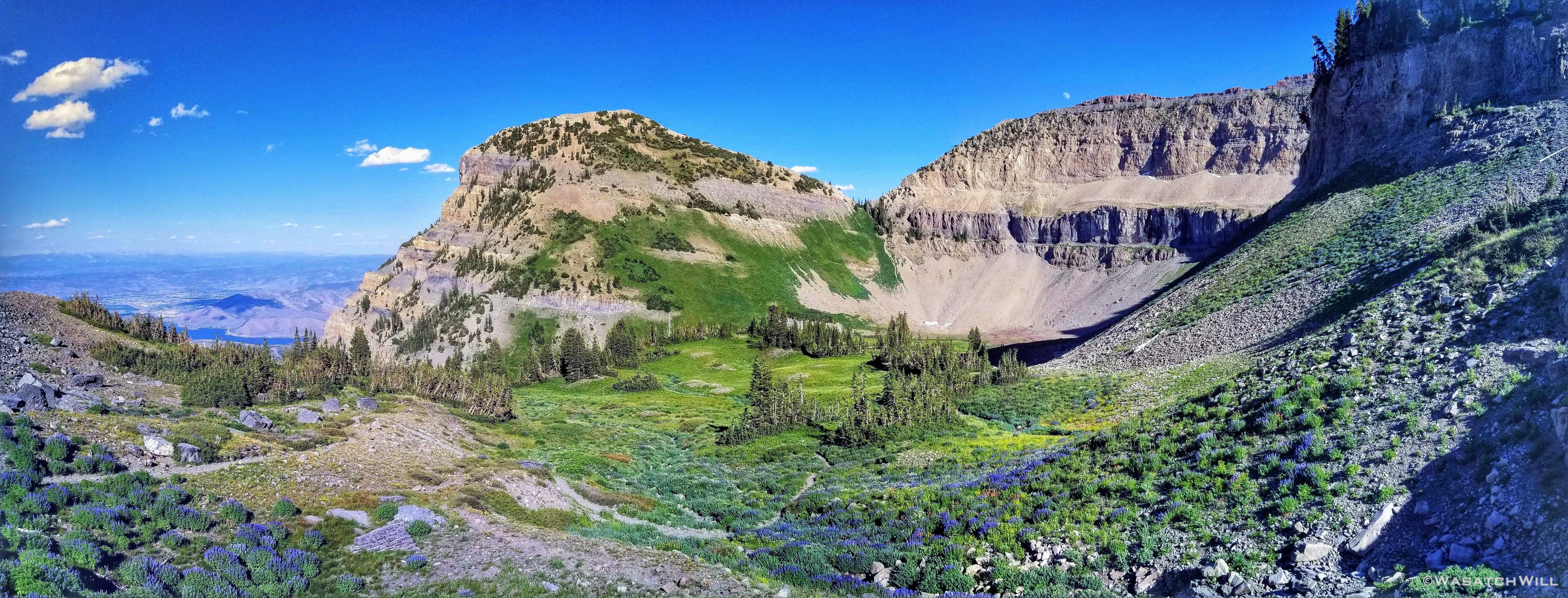
Timp Basin pano looking north
Last look down into Timp Basin
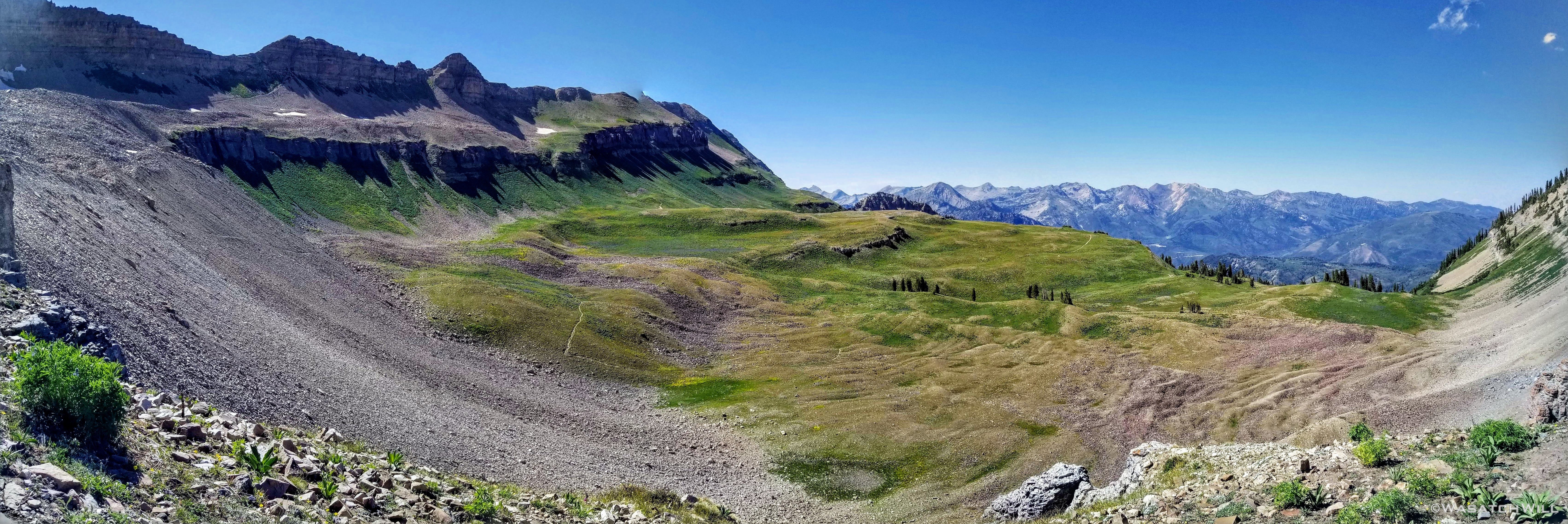
About another 3/4 mile later and I was back on softer alpine terrain and giving brief consideration to another attempt at Robert's Horn to my left, a lower peak that doesn't get nearly as much attention. I had tried it on a previous trip up into here, but turned back after taking a bad line and ended up too far off the high ridge in trying to avoid climbing through some bushes along the top. I decided to save that one for another future time.
Robert's Horn
Rounding another corner, I now had Emerald Lake and its neighboring shelter right before me. This shelter was also a historic construction, built in 1960 to serve as a layover stop complete with fireplace as well as restrooms primarily for those who would participate in what had become an annual communal hike in the early 1900's. This annual community tradition would later cease at the request of the Forest Service due to the growing impacts the ever-growing group sizes were having on the mountain's eco-system from year to year.
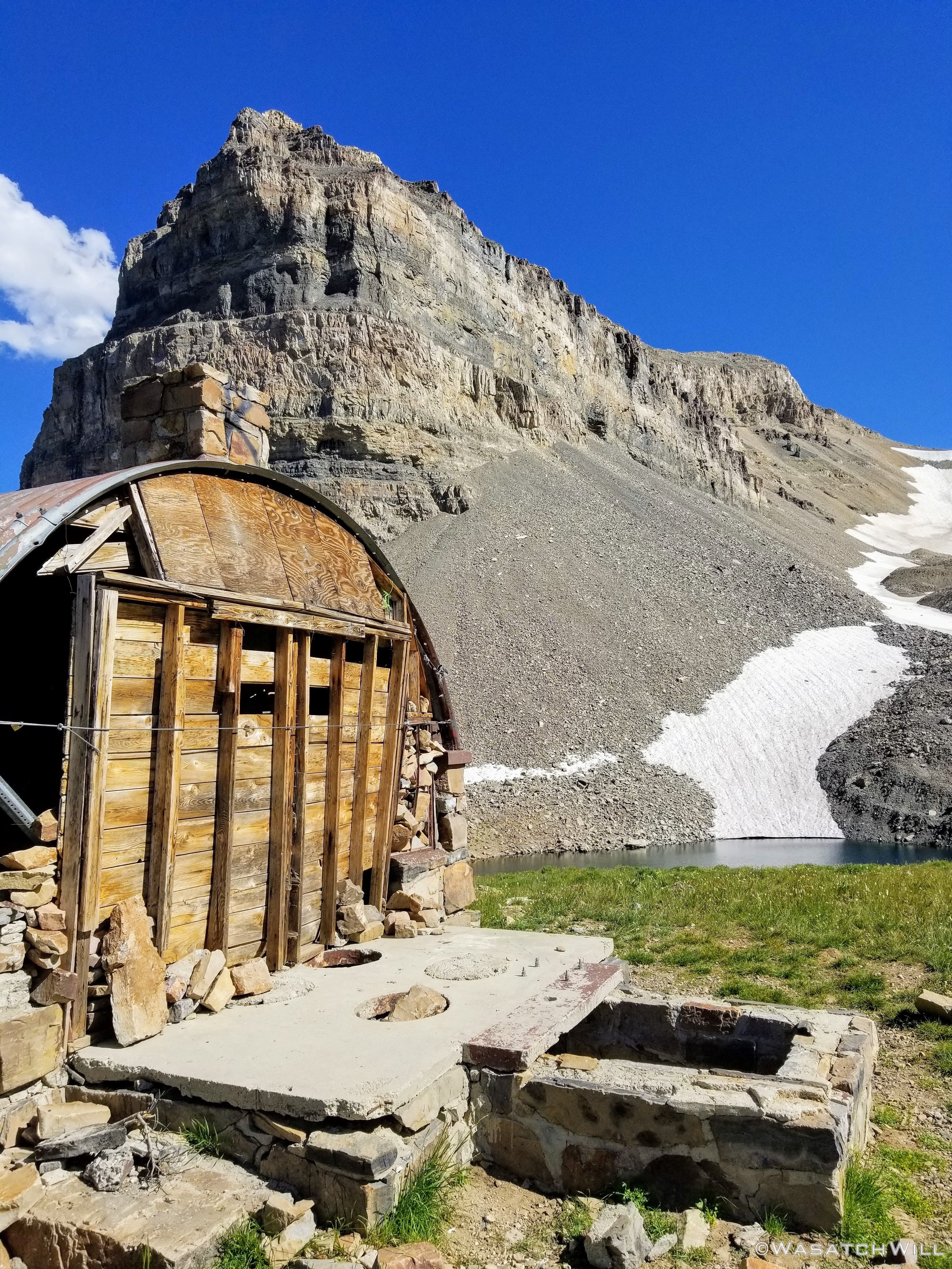
Timp Shelter and Emerald Lake beyond
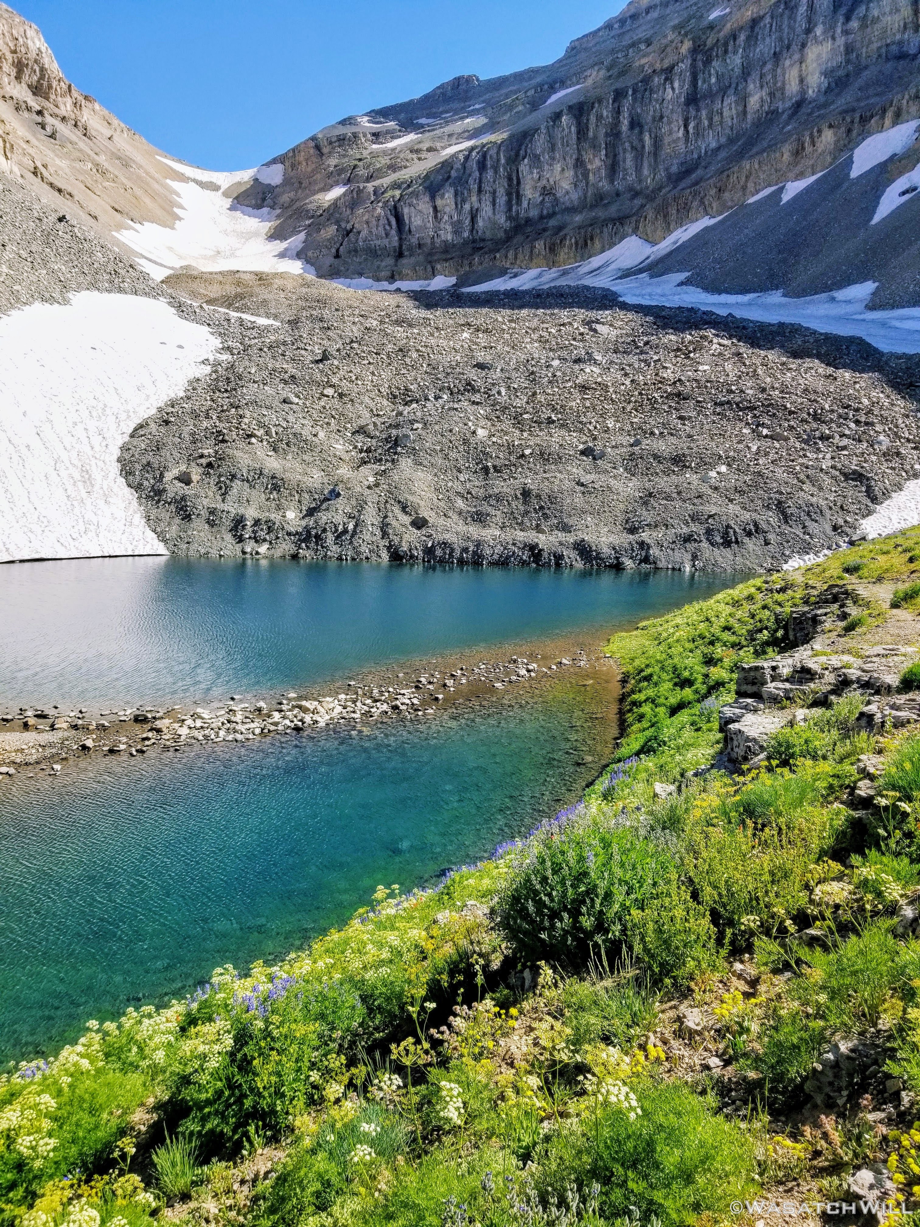
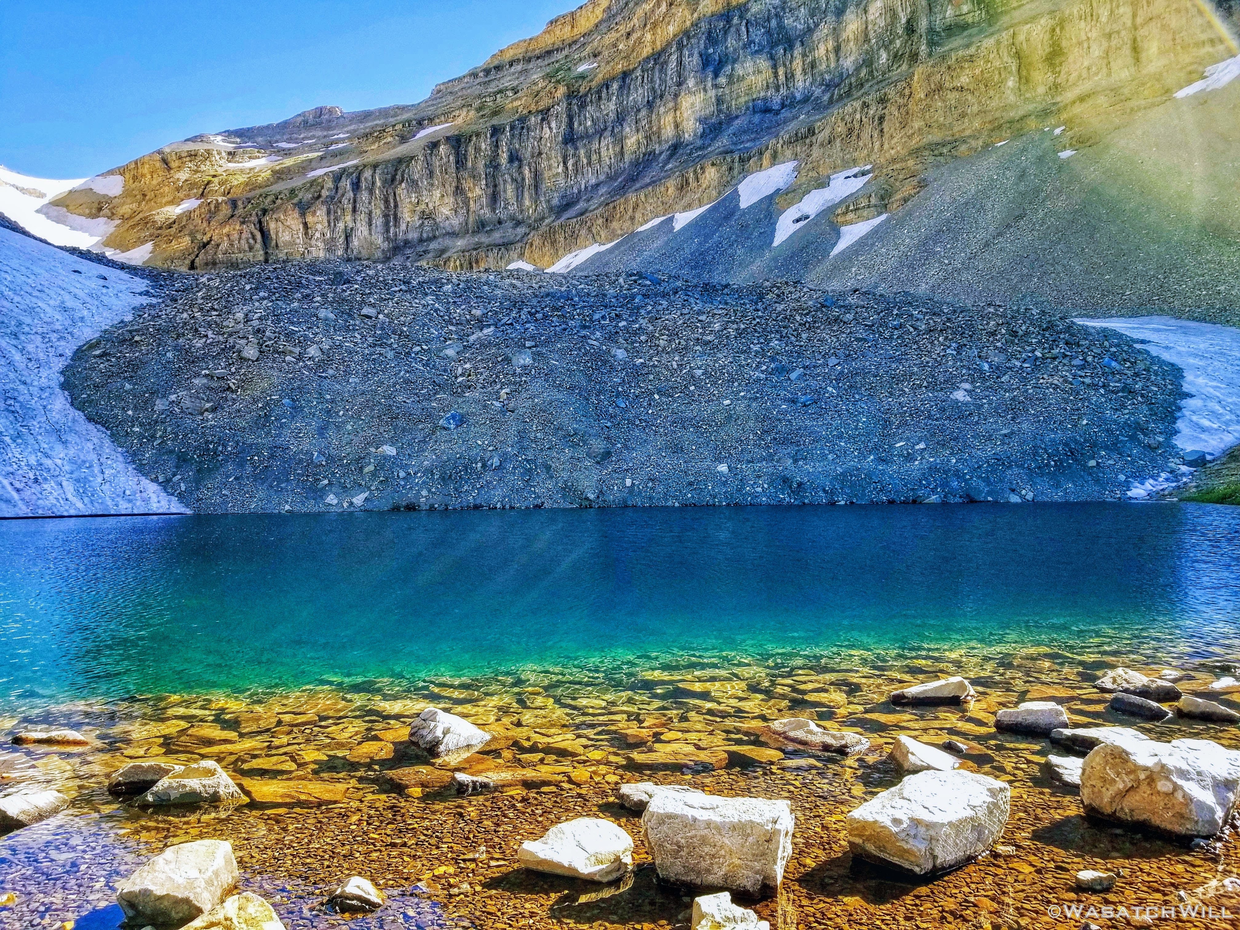
Emerald Lake beneath remnants of a former glacier
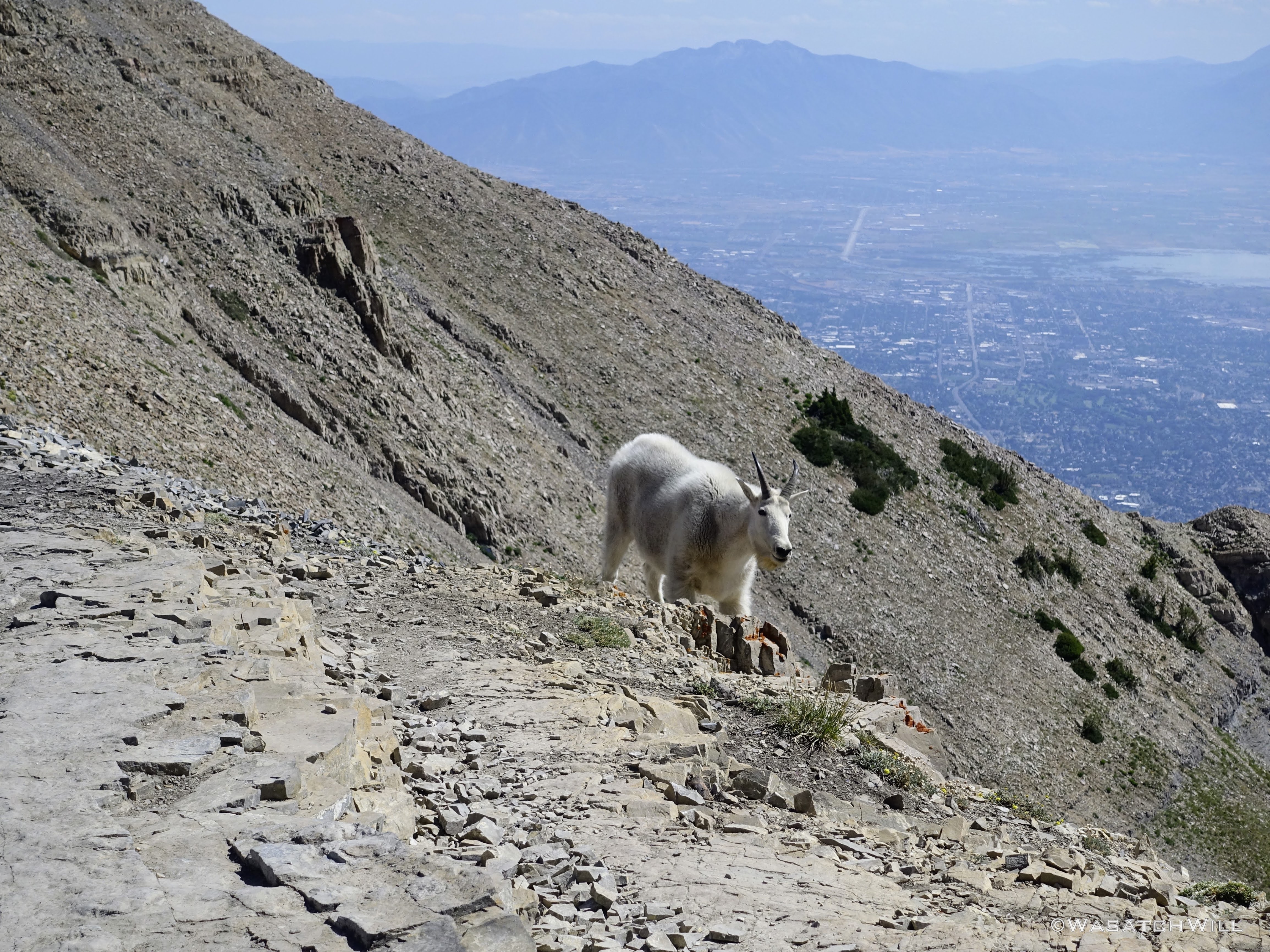
Nearby the lake, more goats including some kids, were out and about grazing.
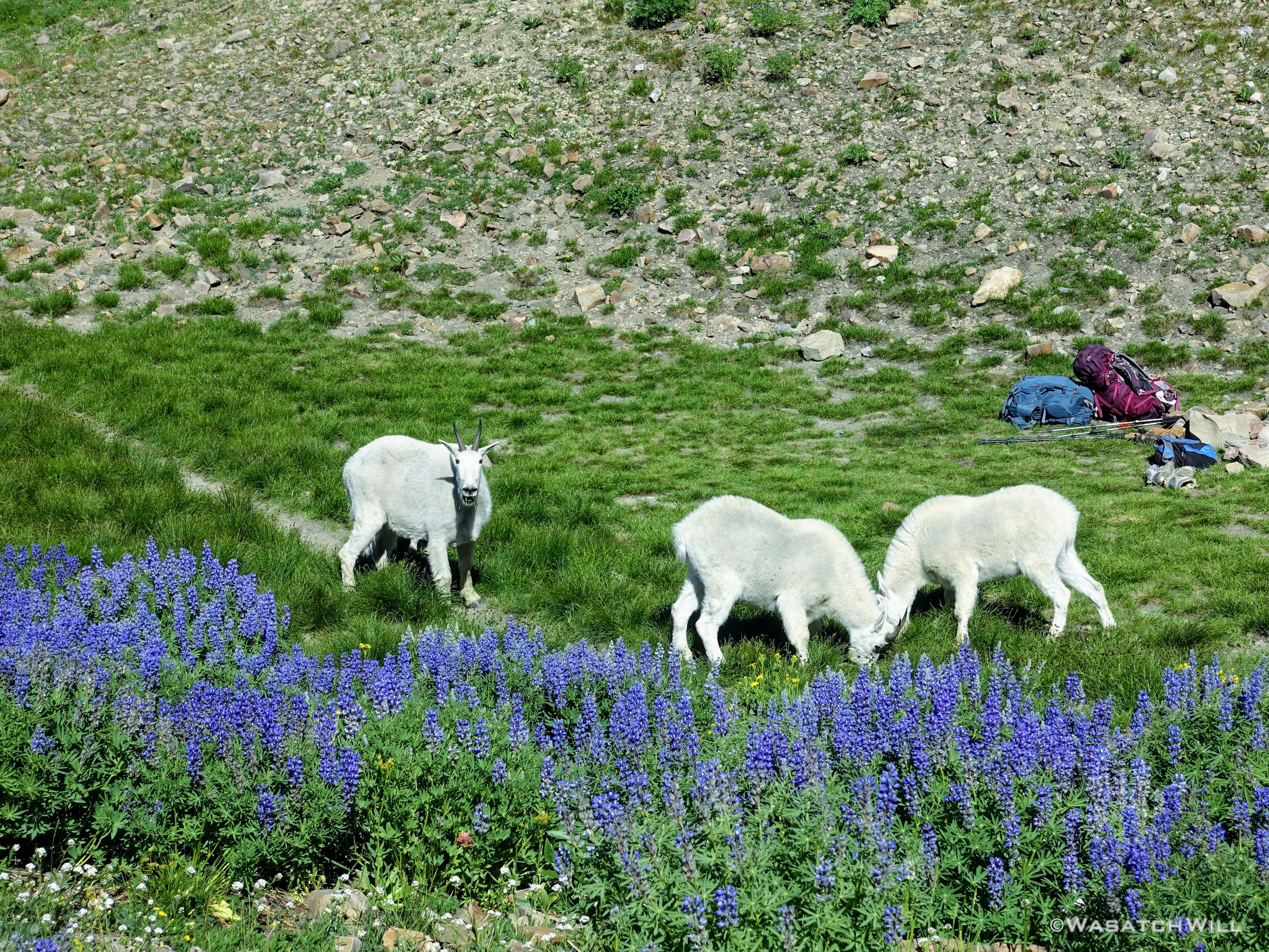
Grazing goats
Mother and kid
I took the liberty of walking out to the edge of the lake to have another snack, dip my feet in the ice cold yet refreshing water, and filter out some water to top off my bottle once more. The sun had descended to just the right angle in the sky to show off why the lake had been named the way it was. A bright glowing emerald hue, due to the high glacial
mineral content was now visible.
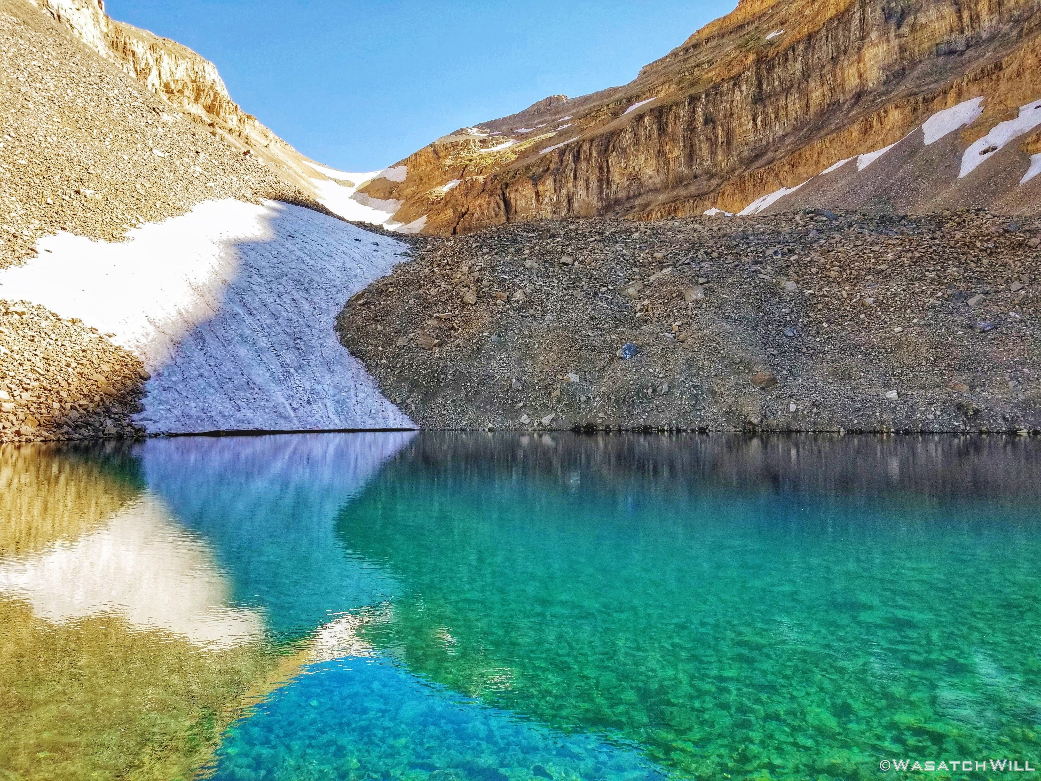
Emerald hues
Is this still the Wasatch?
At this point it was getting late in the day and I knew I needed to head back down now to have a chance at finishing out my hike before dark. This time, instead of descending back down toward Timpooneke, I'd continue to descend down toward Aspen Grove.
As beautiful as it had been to this point, some of the most beautiful parts of the day's hike were still to come.
Departing Emerald Lake
An unnamed pillar of rock stands as a guardian to the lake

The first of many waterfalls (in the shadow) to see on the descent
While the Timpooneke trail takes you into, around, and above the beautiful Timpanogos Basin, the Aspen Grove trail goes through the also stunning Primrose Cirque.
Primrose Cirque pano
The smaller, shallower Hidden Lakes sit within a marshy flat within the cirque
Beginning the many switchbacks down the cliffy cirque
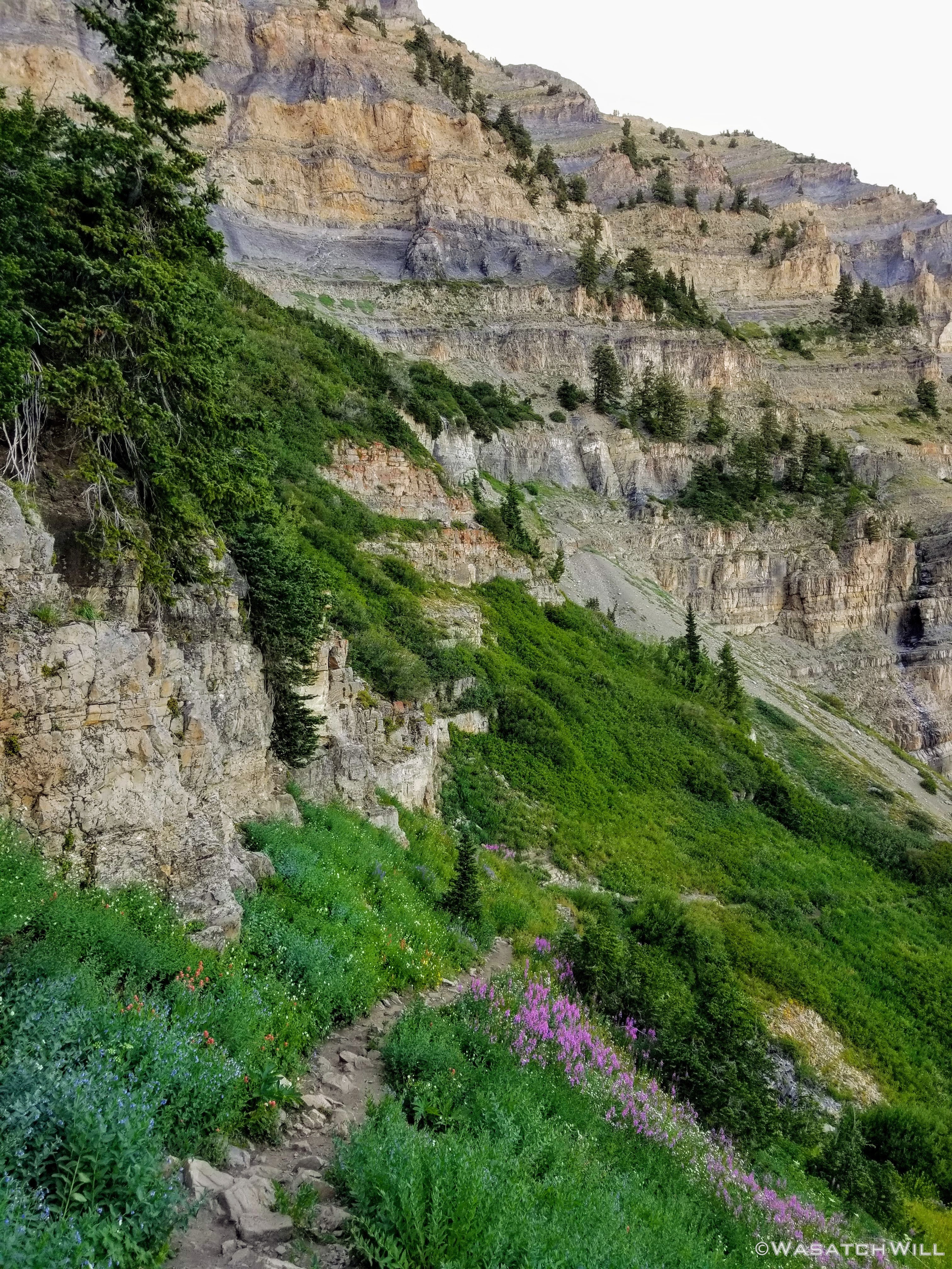
From the Primrose Cirque, the high switchbacks of the Aspen Grove trail descended through many more slopes full of flowers.
Lots more fireweed
At one switchback a size-able rustling in the bushes just off the trail startled me as I must have simultaneously startled whatever it was. Then out popped two coyotes high-tailing it for a bench along a cliff band out in the distance. After the brief fright and recognizing what they were, it was actually really awesome to see them. Once they put about a hundred yards between me and them, they slowed down and kept looking back at me as if to make sure I wasn't going to stalk them any further before eventually disappearing over a nearby ridge.
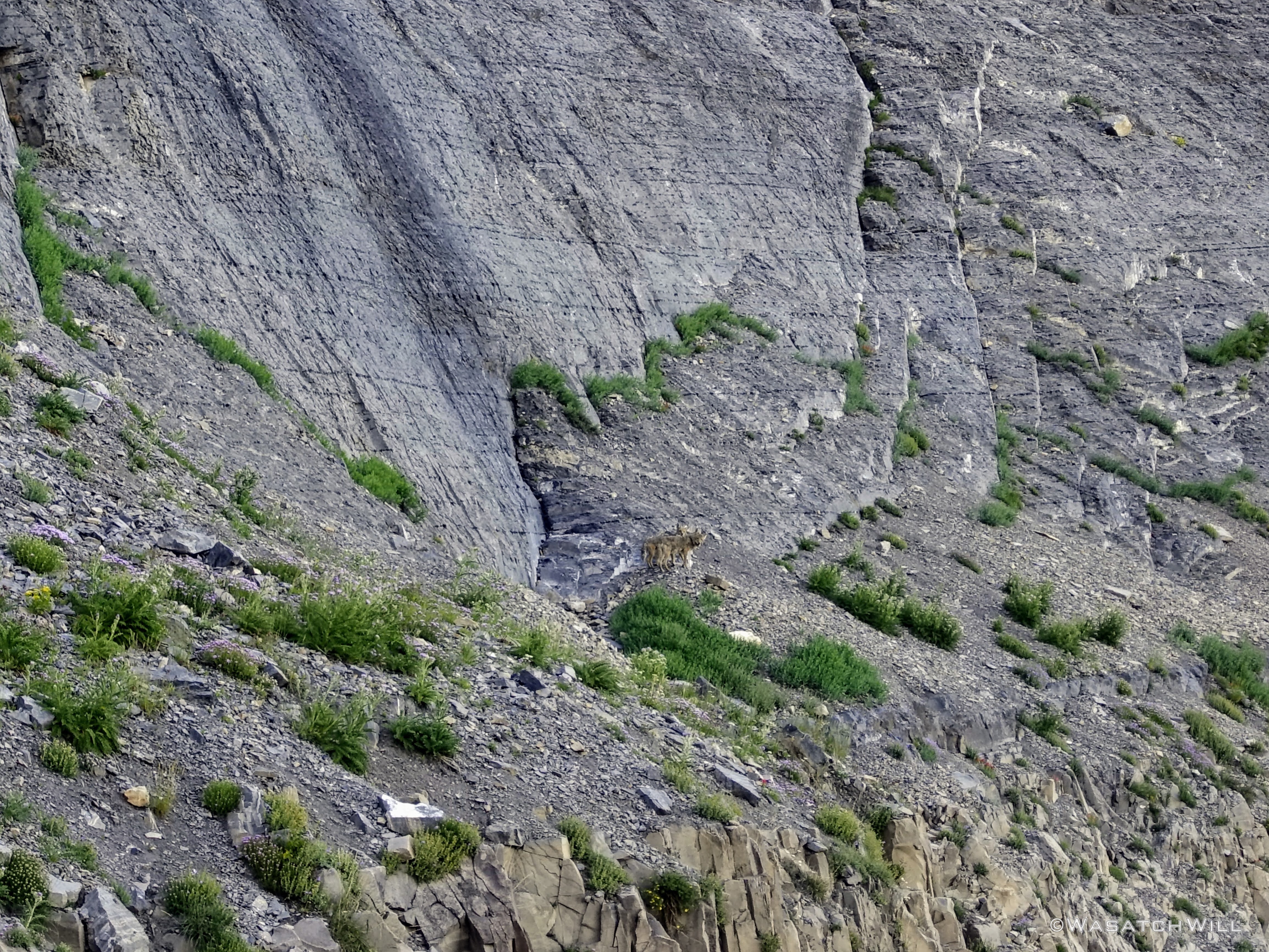
Coyote Couple (center)
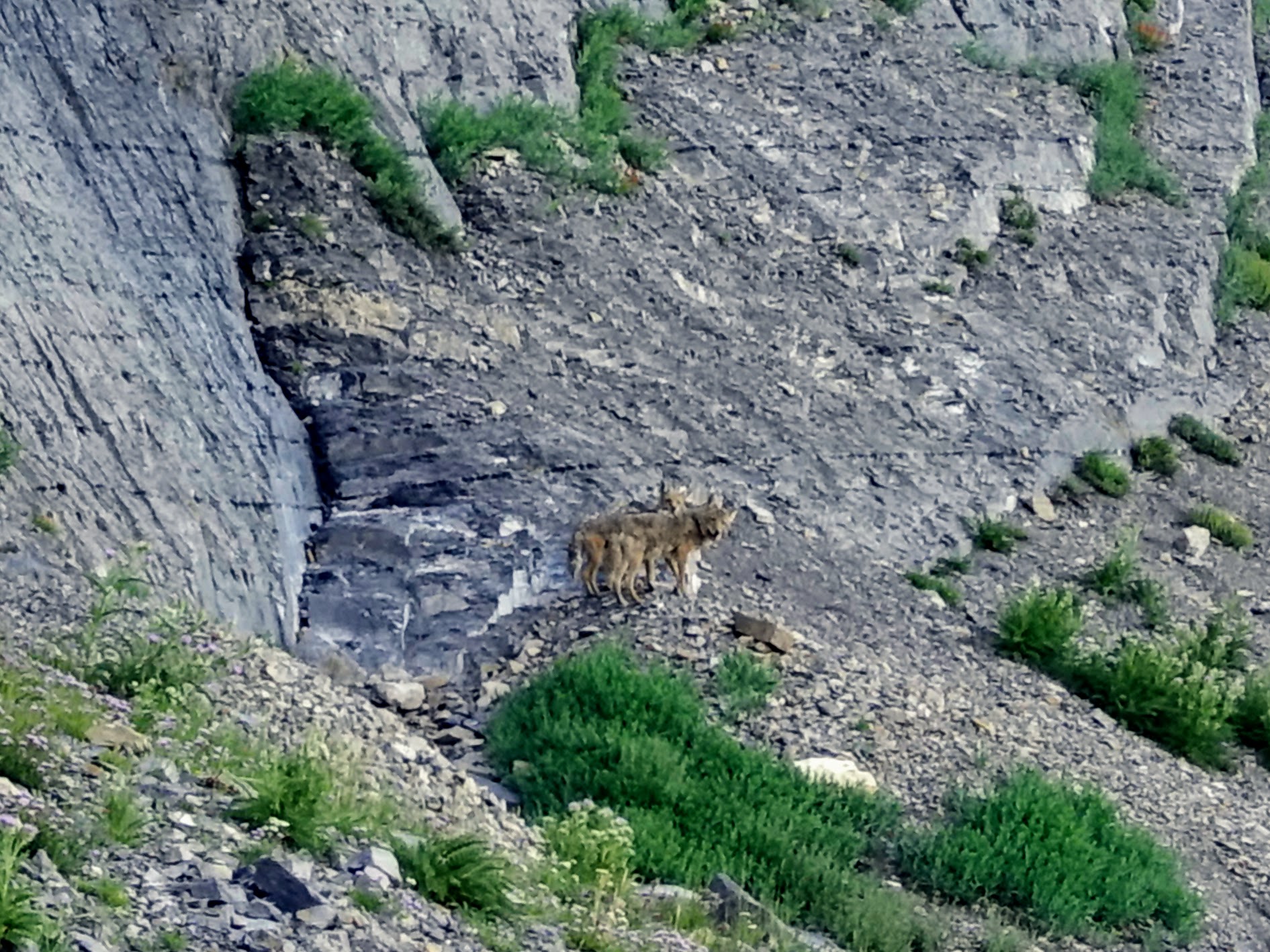
Coyote Couple, cropped
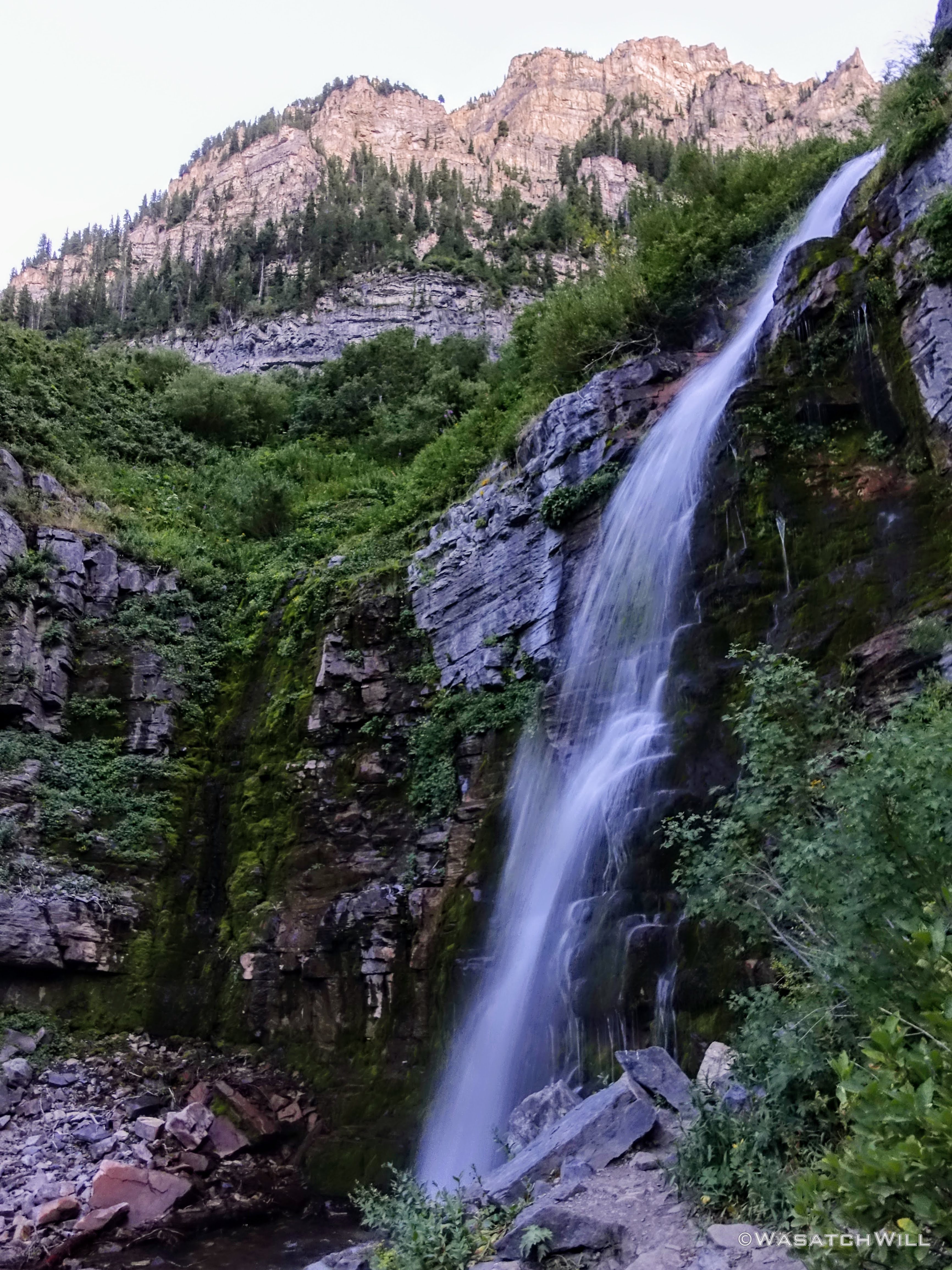
Another common feature along the Aspen Grove trail are waterfalls. There are many!
An enchanting waterfall
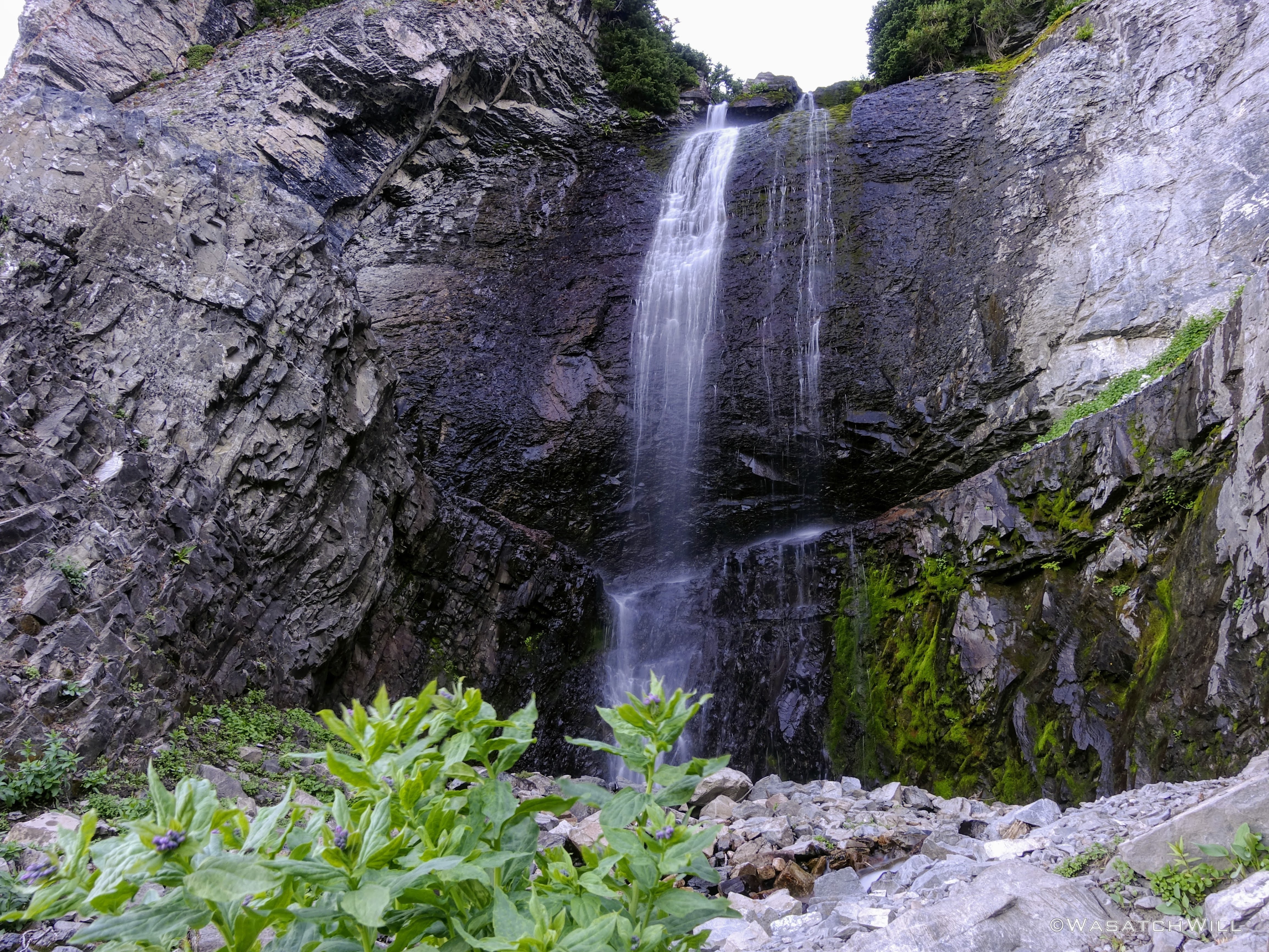
Same enchanting waterfall, closer up

Columbine

More fireweed

And more fireweed
Descending lower through the cliffs
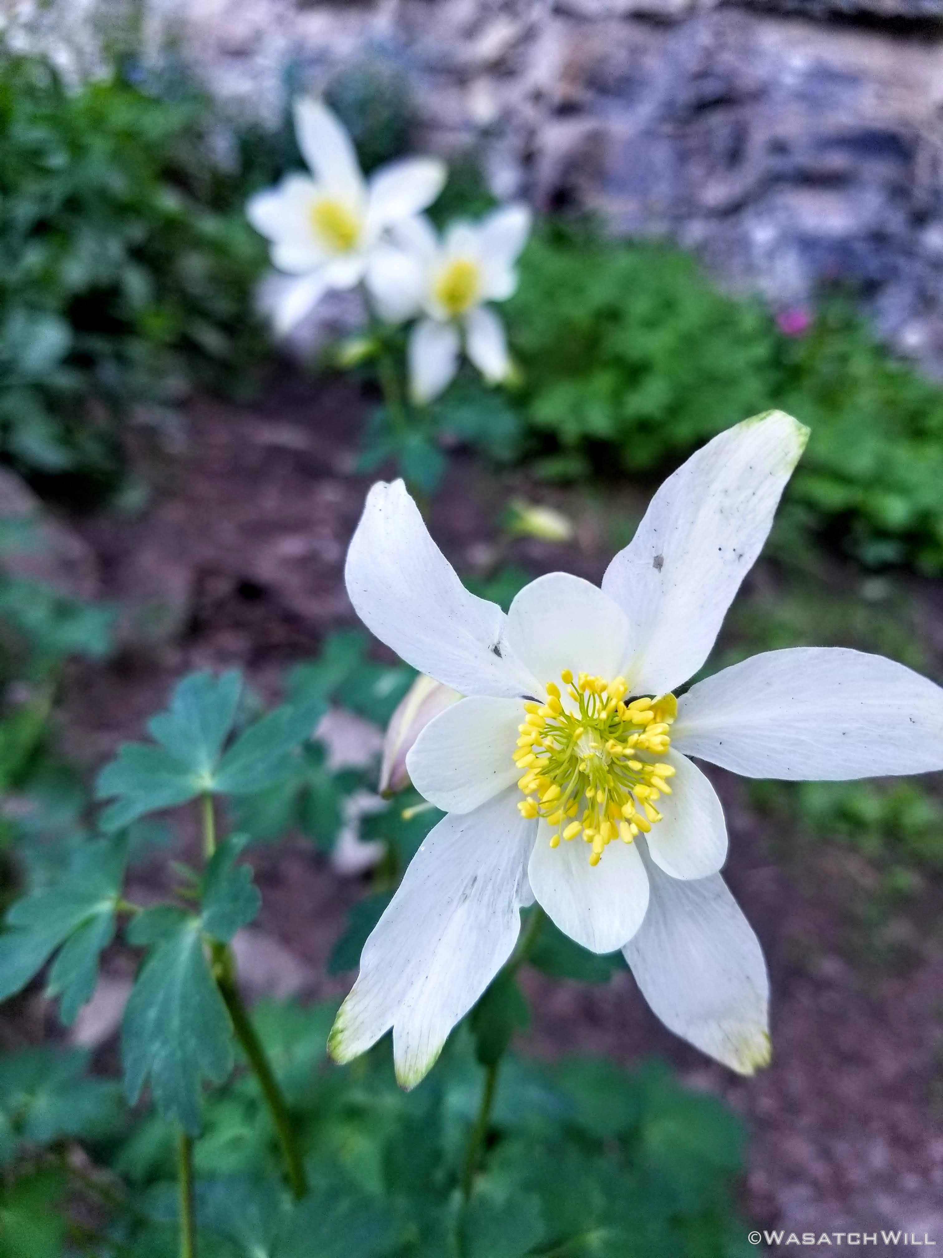
More columbine
And what would Primrose Cirque be without some primrose flowers?
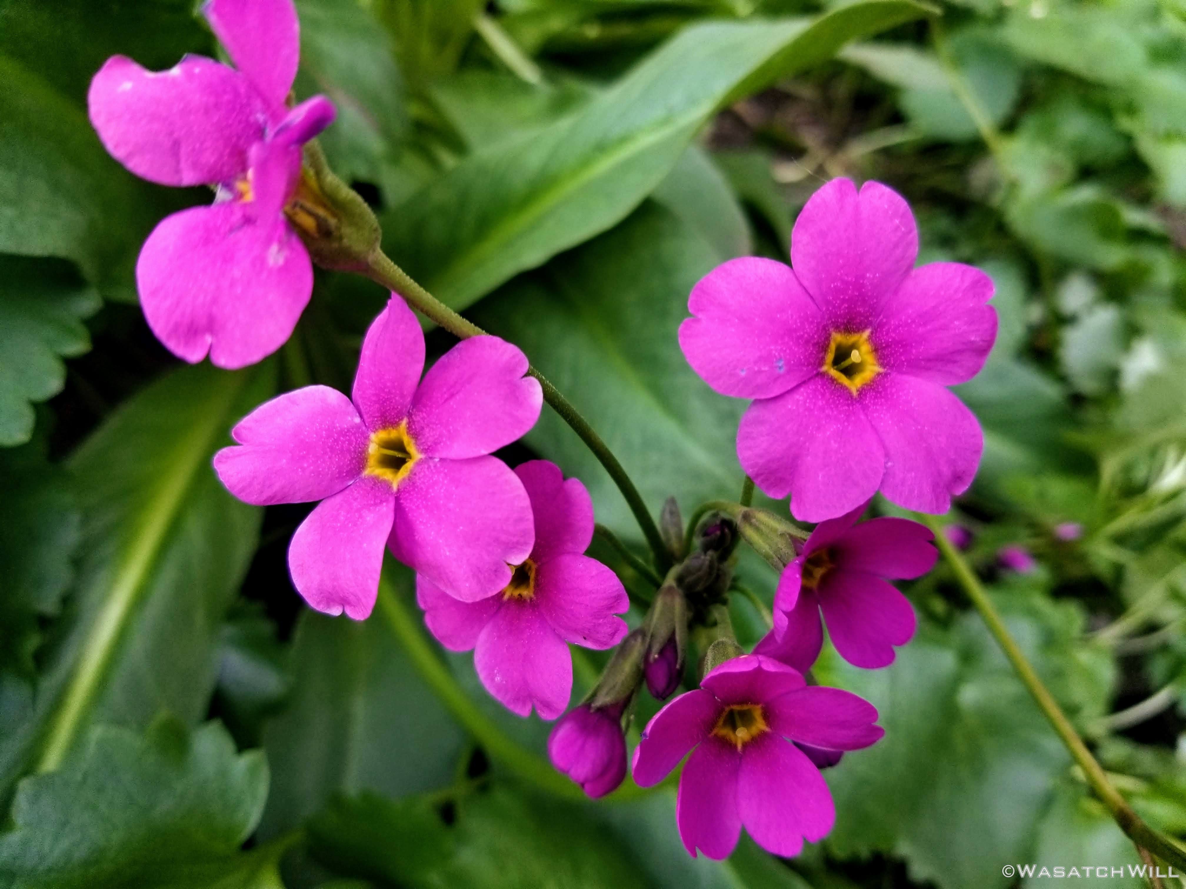
Parrys Primrose
More fireweed and lupines
Through out my hike down, I had been frog-leaping a couple on vacation from Missouri. They had hiked Timp long ago and made it a point to return while staying in the area this year. We hiked down a lengthy stretch together until we reached a point where I was to split apart from them for good, or so I thought.
My plan here was to turn-off the Aspen Grove trail and take a much lesser known use trail of sorts known as the Hartsky cutoff. This would lead me up and over another ridge and drop me down into an area known as Horse Flat from where it was shut a short easy final mile back to my car at Summit Trailhead. It was to be a shortcut that would save me 4 miles of hiking had I stayed true to the Aspen Grove trail all the way down to that trailhead which then would have required me to take a trail called the Lame Horse Trail to return to my car at the Summit Trailhead.
The couple wished me well in my departure from the trail but said if for whatever reason I had to turn back, they'd be willing to offer me a ride back to my car to spare me from hiking in the dark, a sure thing if not for this shortcut. I thanked them for the offer and told them I should be fine.
Well...after about a half mile of relatively easy trotting mixed with a bit of bush-whacking up the old faint cut-off path, I encountered an obstacle I did not expect. There about 100 yards ahead of me, right on the path, was a mother moose and calf.
What to do...what to do?
The slope below the duo was too steep with some minor cliff bands tucked into it to make a safe and worthwhile attempt at passing around them below. The slope above them was way too dense with trees and bushes to make any go at going around them that way.
Dang, dang, dang!
They were slowly progressing toward my direction too. It then clicked in my mind that some compressed spots in some grassy patches my path had just passed through with quite a bit of moose scat lying around must be the current residence for this mother and calf. I then wondered if it was worth pulling up off the path and crouching down behind some trees above in hopes they'd pass by me soon. Nah...they weren't moving fast enough to rely on that happening any time as soon as I'd like, but they were also not showing any signs they'd be leaving or getting off the path either.
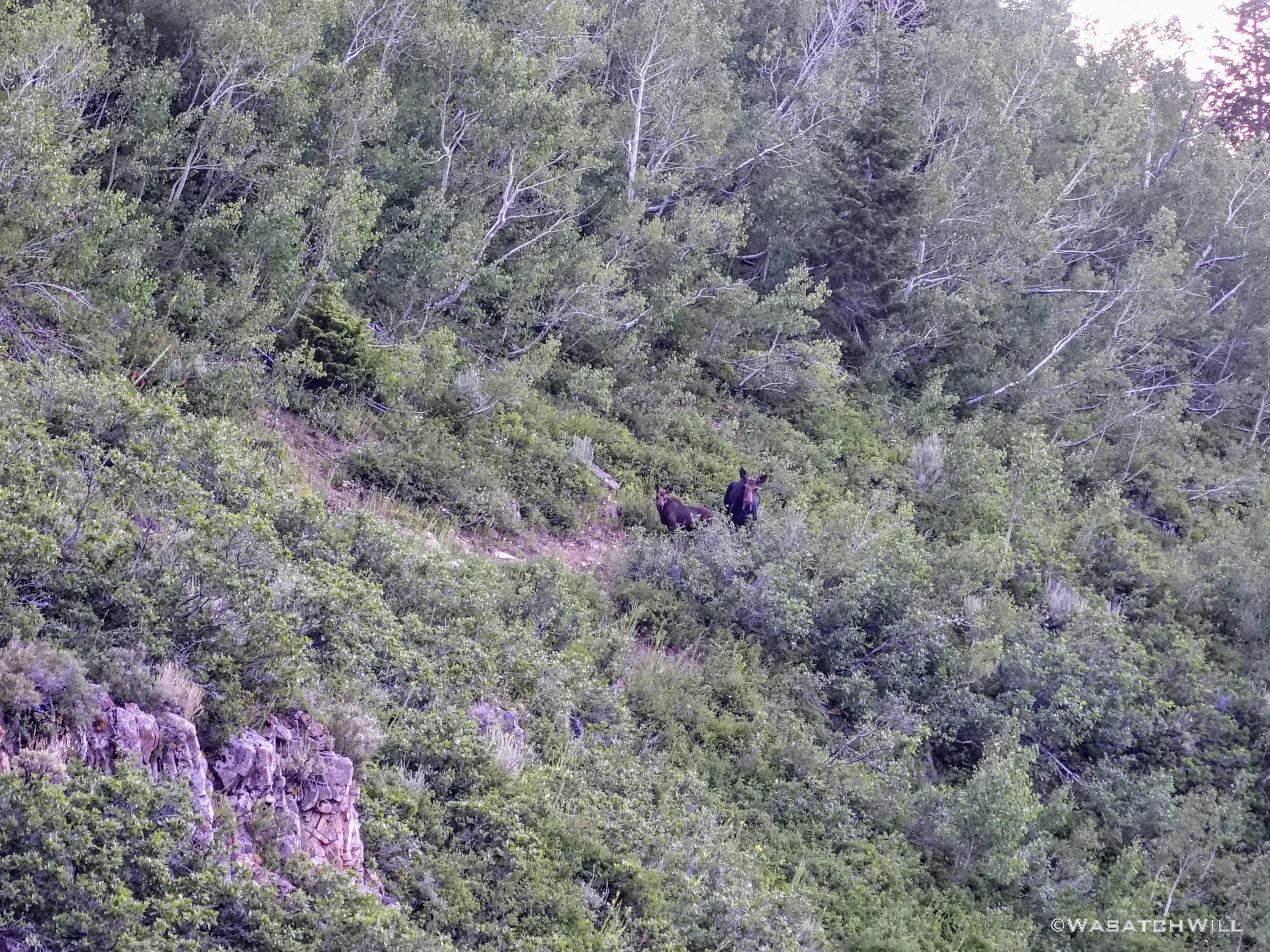
Mother Moose and calf
Ultimately, I conceded the path to the mother and child and surrendered all hopes of employing the strategic shortcut. I turned around and swiftly made my way back down to the
main trail I had just left behind, head lamp out and ready to roll through the dark if needed.
One last waterfall, Aspen Grove Falls
Fortunately, I would catch up with that Missouri couple not far from Aspen Grove Trailhead. I told them about the moose foiling my planned route. They re-extended their offer to grant me a ride back to my car and I gratefully accepted. And with that, my long day on the legendary Mount Timpanogos came to an end. I arrived home safe and sound at 11 pm that night. What a day it had been! And what a privilege to live so close to such a majestic mountain.
 Flowers are fantastic - whoops, I mean your photos of the flowers are fantastic, though without the flowers, the photos wouldn't be as nice, so I guess the flowers actually are fantastic...never mind...need coffee...