- Joined
- Dec 23, 2013
- Messages
- 4,124
I've had this hike on my bucket list for a long time now, and since I had a three day weekend coming up, I decided to finally get it done. I had attempted this route six years ago in April, but an early morning storm had me and my son turning around just after heading out, with our tails between our legs.
I had originally wanted to go on Monday the 21st, but as I kept looking at the forecast, it became apparent that snow was on the menu for Monday, so I switched it to Sunday, until they began to call for a chance of precipitation for Sunday evening. Well, I guess that left me with Saturday to give it a go.
Now a little bit about Fremont Island for the uninitiated:
- The island was named after John C. Fremont, who was an early explorer of the West, as most here probably already know.
- Fremont, and the mountain man Kit Carson were the first explorers of European descent to visit the island in 1843
- While on the island, Carson etched a cross in a rock outcrop just off the summit of the high point of the island called Castle Rock
- In the 1870's precious metal claims for mining were granted.
- In 1886, a man named Uriah Wenner moved his family to the island where they homesteaded for six years until his death in 1891.
- The Wenners (Uriah and his wife Kate) have gravesites on the island. He was buried, while she had her ashes placed next to him when she passed in 1942.
- The island then when through a number of private owners including one who brought in exotic animals to hunt for a fee.
- In September of 2020 the Nature Conservancy purchased the island, and then donated the land to the State of Utah.
4194 is the key. What is 4194 you say? 4194 is the water level in feet by which a sandbar from the Antelope Island Causeway to Fremont Island is exposed. And since the lake level currently sits at 4190' the sandbar is actually more of a wide mudflat that links the two islands now.
My route to Fremont would begin at the marina at Antelope Island, backtrack along the causeway for a mile or so and then head out across the mudflat to Fremont. Once on Fremont, I'd make my way to Castle Rock to check out Kit Carson's cross. I'd then return by the same route back to the marina at Antelope. The roundtrip distance for the hike would be 22.5 miles.
Now a little Scatman info before we get going. First, I had gotten everything ready for my hike the night before except for making myself a peanut butter sandwich, which I planned on making before taking off from my house on Saturday morning. Well, I get up at 4:30 am, make my sandwich, and then place it in a plastic grocery bag. The only problem was that I had two plastic grocery bags, one for my hike, and another with some snacks for when I got back to my car after the hike was completed. As you can guess, I put the sandwich in the wrong bag. My second big mistake happened while I was on the hike, and it occurred while on Castle Peak. When I first got to the summit, I took a few pictures of the surrounding area, and then a sat down to apply some more sunscreen. Well, at some point after finishing, I must have touched my EOS M camera lens, so from that point on all the pictures taken with that camera had what I referred to as the "Sunscreen Effect." Which means that none of the rest of the shots turned out to be any good. I didn't realize this until this morning when I started to download the imagery.
  Fortunately, I had taken four cameras with me, three of which are point-and-shoot cameras, so I was able to have some decent shots upon my return to Antelope Island. My Canon PowerShot SD850 IS battery actually ran out of charge on the way to Fremont due to the cold morning temps.
Like I said before, I woke up at 4:30 am and took off for Antelope Island at 5:25 am. Arriving at the marina at 6:30 am to begin my journey - taking off before sunrise. A brisk 26 degrees at the marina upon my arrival.
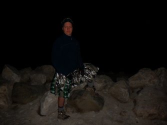
I am just leaving the causeway to head out onto the mudflats.
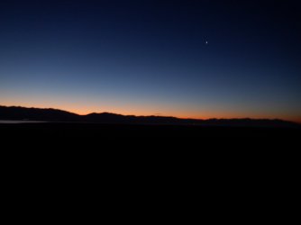
Dawn along the Wasatch as I begin to make my way across the mudflats
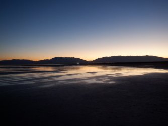
Looking east towards Ogden as I make my way along
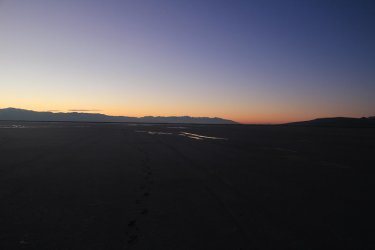
View looking southeast towards Salt Lake City. Lone Peak can be seen at the end of the range.
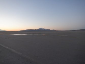
Looking back at Antelope Island in the early morning light. I should probably mention at this point that the mudflat was actually
muddy. The mud was sticking to my boots which made them pretty heavy. It was worse for the first hour of hiking across the flat,
but continued to be problematic periodically all the way to Fremont. My return was a bit better as the sun had dried some of the
mud by the afternoon.
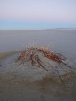
Some life trying to hang on the flats. Fremont Island is in the distance, along with the Promontory
Range.
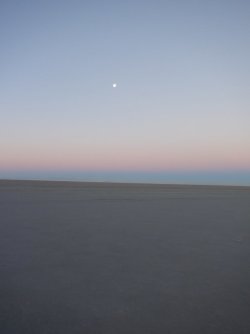
A waning gibbous moon off to the west
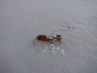
Not sure what we have here. To me, it looks like a WWII bomb, but I'm guessing it has something to do with a boat.
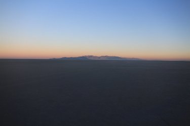
Sunrise on the Promontory Mountains while Fremont Island is still in the shade on the left
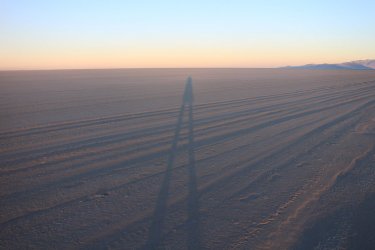
Long legs and a tiny head. That's me!
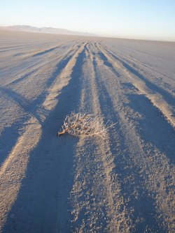
Some dead sage on my way
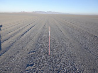
For the first hour and a half, these markers led the way, but after that there were no more.
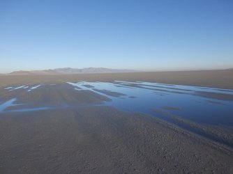
Periodically I would run into wet, as opposed to just damp, areas, where the mud got bad again. Fremont looks like it is getting
closer.
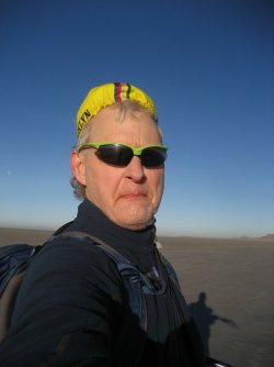
Time to don the bicycle cap
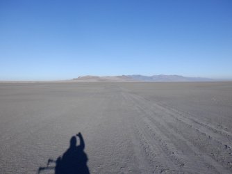
Still long shadows to contend with
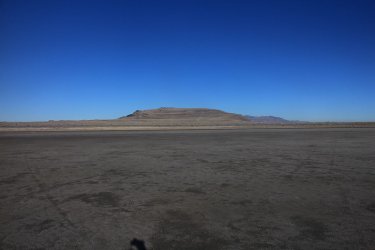
Land ahoy! I'm crossing Wenner Bay at this point
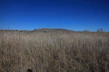
On shore! I had to pass through some very tall, large grass just off the shoreline, with David E. Miller Hill looming above.
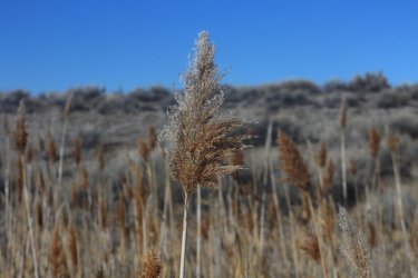
Over my head tall
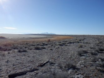
Looking back across Kate's Point towards Antelope Island.
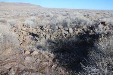
The foundation of the old Wenner Homestead
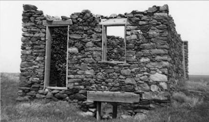
Wenner Homestead - date unknown - courtesy of the Utah Historical Society
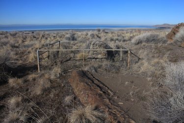
The Wenner's gravesites
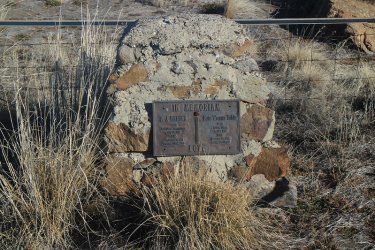
A closeup of the headstone
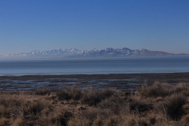
Stansbury Island across the lake, with the Stansbury Range and Deseret Peak beyond.
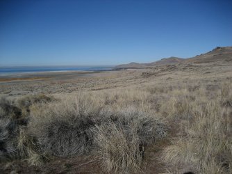
A look to the north towards Beacon Hill and Miller's Point
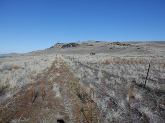
A cabin ahead
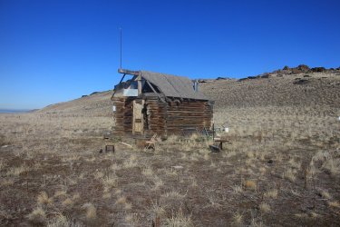
The hunter's cabin
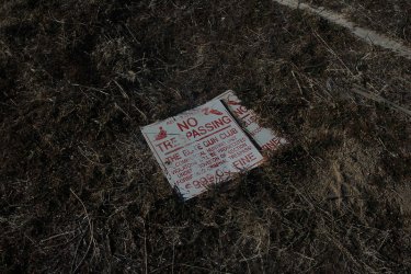
Hmm .............................
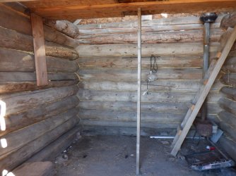
An inside look
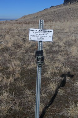
Well this ought to give them something to talk about around the watercooler on Tuesday
morning. "Hey, some guy in a kilt is taking a picture of our camera!"
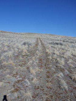
Heading to the top of David E. Miller Hill
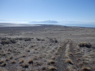
Another look back towards Antelope Island
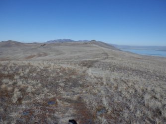
On the ridge, with Castle Rock barely visible
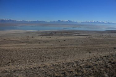
A look down on Kit Carson Bay with Ogden in the distance
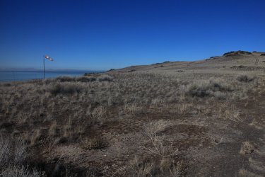
A landing strip on the ridge
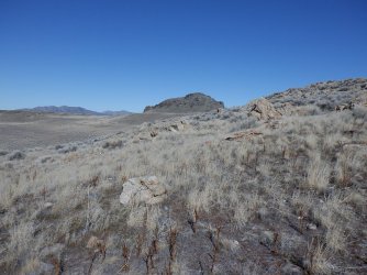
Castle Rock ahead
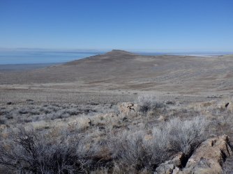
A look to the northwest and Beacon Hill
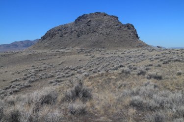
Arriving at the base of Castle Rock
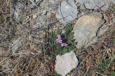
Some common storksbill blooming on the slopes of Castle Rock. The storksbill was the only flower that i saw blooming on the
island
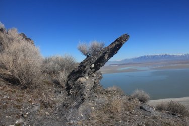
Interesting rock outcrop as I make my way to the summit of Castle Rock
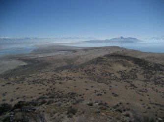
Another view of the southern end of Fremont Island
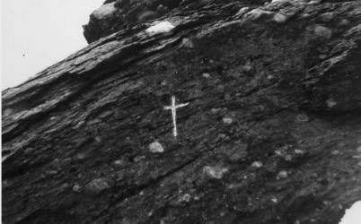
Kit Carson's etched cross back in 1962 - photo courtesy of the Utah Historical Society
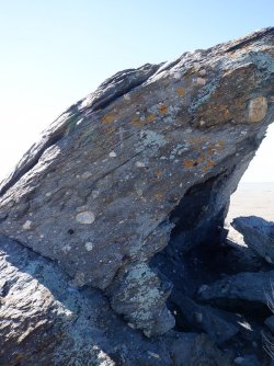
The cross today
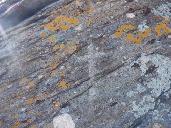
A closeup of the cross
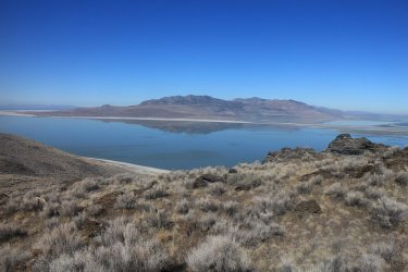
looking north across the lake at the Promontory Range
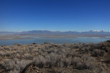
A view to the northeast towards Little Mountain and the Wellsville Range . @swmalone
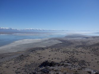
Another shot of Kit Carson Bay from Castle Rock
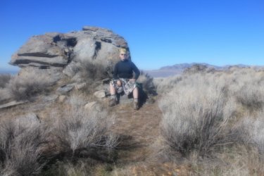
The sunscreen effect.
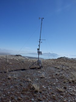
A weather station on David E. Miller Hill on my way back down the ridge
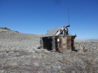
Back at the hunting cabin
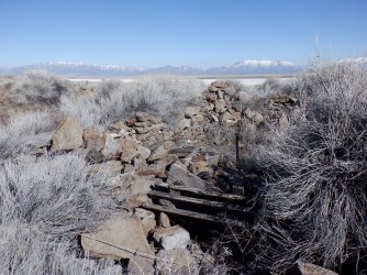
Another look at the homestead ruins with a different sun angle
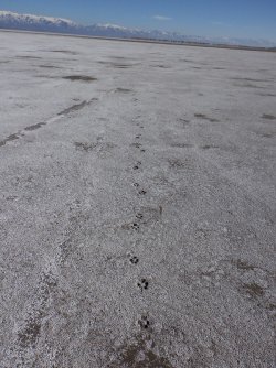
Coyote tracks on the flats
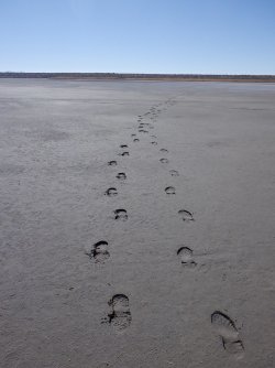
Coming and going through Wenner Bay
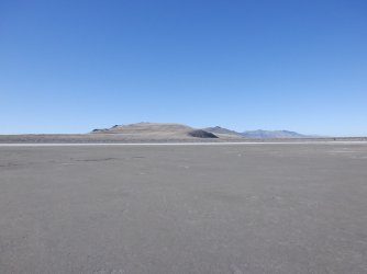
Bye bye Fremont. Not looking forward to the long trek back across the mud.
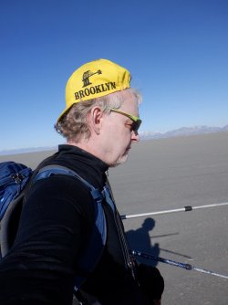
Beginning to hallucinate at this point.
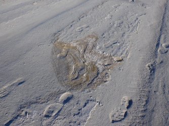
Some interesting shots of dried up pools of water along the way back
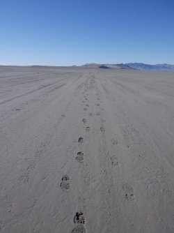
More of my comings and goings
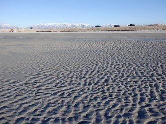
Nice texture in the mud as I approach the causeway
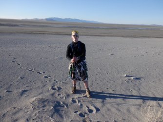
Me and Fremont
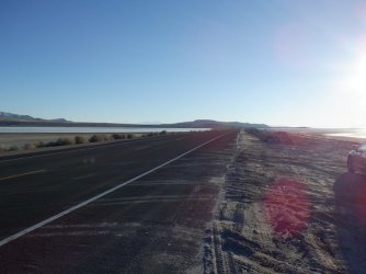
back on the causeway heading for my vehicle
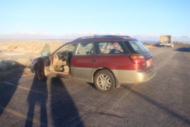
Back at the Subaru - Sunscreen Effect
Other than me pooching the camera lens, of course I didn't know it at the time, it was a fun yet tiring day. A highly recommended
hike for those who have all day to get it done. It will take you between 11 and 12 hours to complete.
The End.
I had originally wanted to go on Monday the 21st, but as I kept looking at the forecast, it became apparent that snow was on the menu for Monday, so I switched it to Sunday, until they began to call for a chance of precipitation for Sunday evening. Well, I guess that left me with Saturday to give it a go.
Now a little bit about Fremont Island for the uninitiated:
- The island was named after John C. Fremont, who was an early explorer of the West, as most here probably already know.
- Fremont, and the mountain man Kit Carson were the first explorers of European descent to visit the island in 1843
- While on the island, Carson etched a cross in a rock outcrop just off the summit of the high point of the island called Castle Rock
- In the 1870's precious metal claims for mining were granted.
- In 1886, a man named Uriah Wenner moved his family to the island where they homesteaded for six years until his death in 1891.
- The Wenners (Uriah and his wife Kate) have gravesites on the island. He was buried, while she had her ashes placed next to him when she passed in 1942.
- The island then when through a number of private owners including one who brought in exotic animals to hunt for a fee.
- In September of 2020 the Nature Conservancy purchased the island, and then donated the land to the State of Utah.
4194 is the key. What is 4194 you say? 4194 is the water level in feet by which a sandbar from the Antelope Island Causeway to Fremont Island is exposed. And since the lake level currently sits at 4190' the sandbar is actually more of a wide mudflat that links the two islands now.
My route to Fremont would begin at the marina at Antelope Island, backtrack along the causeway for a mile or so and then head out across the mudflat to Fremont. Once on Fremont, I'd make my way to Castle Rock to check out Kit Carson's cross. I'd then return by the same route back to the marina at Antelope. The roundtrip distance for the hike would be 22.5 miles.
Now a little Scatman info before we get going. First, I had gotten everything ready for my hike the night before except for making myself a peanut butter sandwich, which I planned on making before taking off from my house on Saturday morning. Well, I get up at 4:30 am, make my sandwich, and then place it in a plastic grocery bag. The only problem was that I had two plastic grocery bags, one for my hike, and another with some snacks for when I got back to my car after the hike was completed. As you can guess, I put the sandwich in the wrong bag.
Like I said before, I woke up at 4:30 am and took off for Antelope Island at 5:25 am. Arriving at the marina at 6:30 am to begin my journey - taking off before sunrise. A brisk 26 degrees at the marina upon my arrival.

I am just leaving the causeway to head out onto the mudflats.

Dawn along the Wasatch as I begin to make my way across the mudflats

Looking east towards Ogden as I make my way along

View looking southeast towards Salt Lake City. Lone Peak can be seen at the end of the range.

Looking back at Antelope Island in the early morning light. I should probably mention at this point that the mudflat was actually
muddy. The mud was sticking to my boots which made them pretty heavy. It was worse for the first hour of hiking across the flat,
but continued to be problematic periodically all the way to Fremont. My return was a bit better as the sun had dried some of the
mud by the afternoon.

Some life trying to hang on the flats. Fremont Island is in the distance, along with the Promontory
Range.

A waning gibbous moon off to the west

Not sure what we have here. To me, it looks like a WWII bomb, but I'm guessing it has something to do with a boat.

Sunrise on the Promontory Mountains while Fremont Island is still in the shade on the left

Long legs and a tiny head. That's me!

Some dead sage on my way

For the first hour and a half, these markers led the way, but after that there were no more.

Periodically I would run into wet, as opposed to just damp, areas, where the mud got bad again. Fremont looks like it is getting
closer.

Time to don the bicycle cap

Still long shadows to contend with

Land ahoy! I'm crossing Wenner Bay at this point

On shore! I had to pass through some very tall, large grass just off the shoreline, with David E. Miller Hill looming above.

Over my head tall

Looking back across Kate's Point towards Antelope Island.

The foundation of the old Wenner Homestead

Wenner Homestead - date unknown - courtesy of the Utah Historical Society

The Wenner's gravesites

A closeup of the headstone

Stansbury Island across the lake, with the Stansbury Range and Deseret Peak beyond.

A look to the north towards Beacon Hill and Miller's Point

A cabin ahead

The hunter's cabin

Hmm .............................

An inside look

Well this ought to give them something to talk about around the watercooler on Tuesday
morning. "Hey, some guy in a kilt is taking a picture of our camera!"

Heading to the top of David E. Miller Hill

Another look back towards Antelope Island

On the ridge, with Castle Rock barely visible

A look down on Kit Carson Bay with Ogden in the distance

A landing strip on the ridge

Castle Rock ahead

A look to the northwest and Beacon Hill

Arriving at the base of Castle Rock

Some common storksbill blooming on the slopes of Castle Rock. The storksbill was the only flower that i saw blooming on the
island

Interesting rock outcrop as I make my way to the summit of Castle Rock

Another view of the southern end of Fremont Island

Kit Carson's etched cross back in 1962 - photo courtesy of the Utah Historical Society

The cross today

A closeup of the cross

looking north across the lake at the Promontory Range

A view to the northeast towards Little Mountain and the Wellsville Range . @swmalone

Another shot of Kit Carson Bay from Castle Rock

The sunscreen effect.

A weather station on David E. Miller Hill on my way back down the ridge

Back at the hunting cabin

Another look at the homestead ruins with a different sun angle

Coyote tracks on the flats

Coming and going through Wenner Bay

Bye bye Fremont.

Beginning to hallucinate at this point.

Some interesting shots of dried up pools of water along the way back

More of my comings and goings

Nice texture in the mud as I approach the causeway

Me and Fremont

back on the causeway heading for my vehicle

Back at the Subaru - Sunscreen Effect
Other than me pooching the camera lens, of course I didn't know it at the time, it was a fun yet tiring day. A highly recommended
hike for those who have all day to get it done. It will take you between 11 and 12 hours to complete.
The End.
Last edited:

