Floating the South Fork Snake River

Nick

-
.
Joined
Aug 9, 2007
Messages
12,949
October 2010

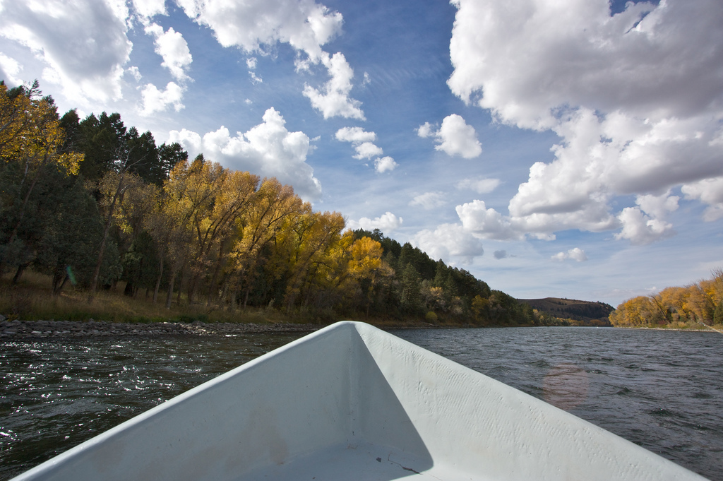
I received a last minute invite to float the South Fork Snake River in Idaho over the weekend. We left Salt Lake well before dawn on Saturday and made it into Swan Valley in time for an AM launch. Aside from a little whitewater day trip near Snowmass when I was a kid, this was my first float trip. I've been dying to get out on a river for a long time and it did not disappoint!

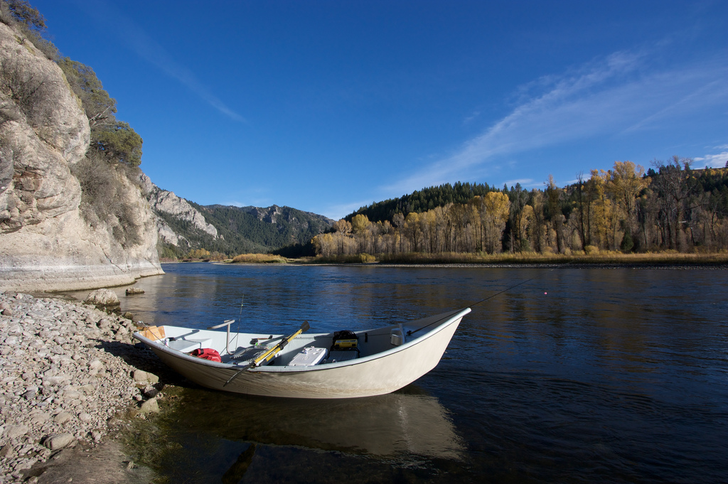
Day 1 we floated Palisade to Conant.
5092118973_bd9205d8fe_b.jpg


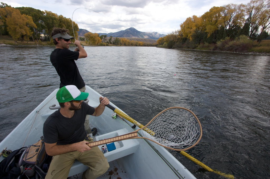
This is Justin reeling one in. He is a guide here in Utah and it showed on this trip. While none of us caught what we'd hoped, he certainly caught the most.
5092118789_21811044ac_b.jpg


An hour or so down the river we stopped and fished some of the channels where the river had more structure.
5092716952_8eee6578ba_b.jpg


Reeling in another...
5092120449_ec098837c3_b.jpg


After that we kept moving down the river. Floating for a while then stopping in places that looked worthwhile. The fishing was generally quite slow and we found out the next morning that the DWR had been shocking the river in recent days in an attempt to kill off the whitefish and rainbow trout so that the native Cutthroat trout could build a stronger population.

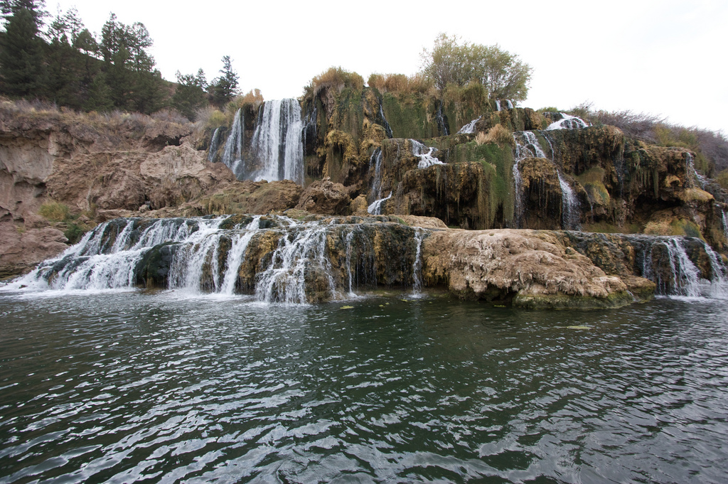
Towards the end of the float we came by this unique waterfall.
5092123767_819b5c9625_b.jpg


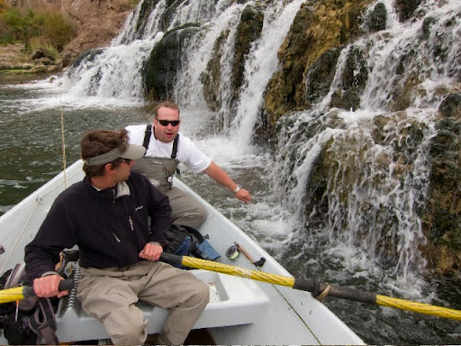
That's me in the back of the boat testing the water. Photo by Collin J.
IMG_1187.jpg


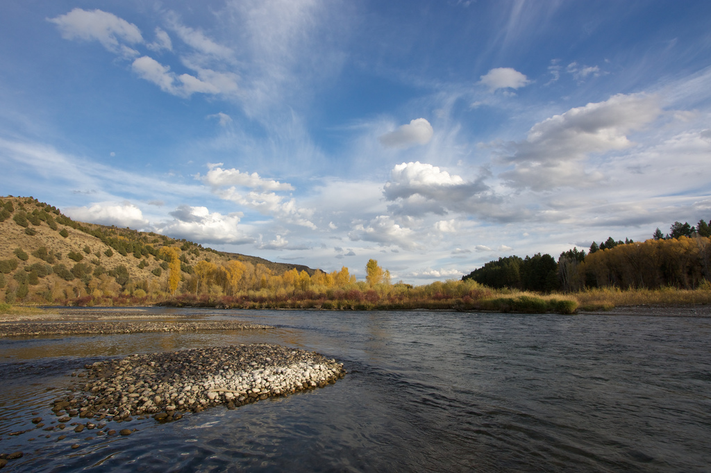
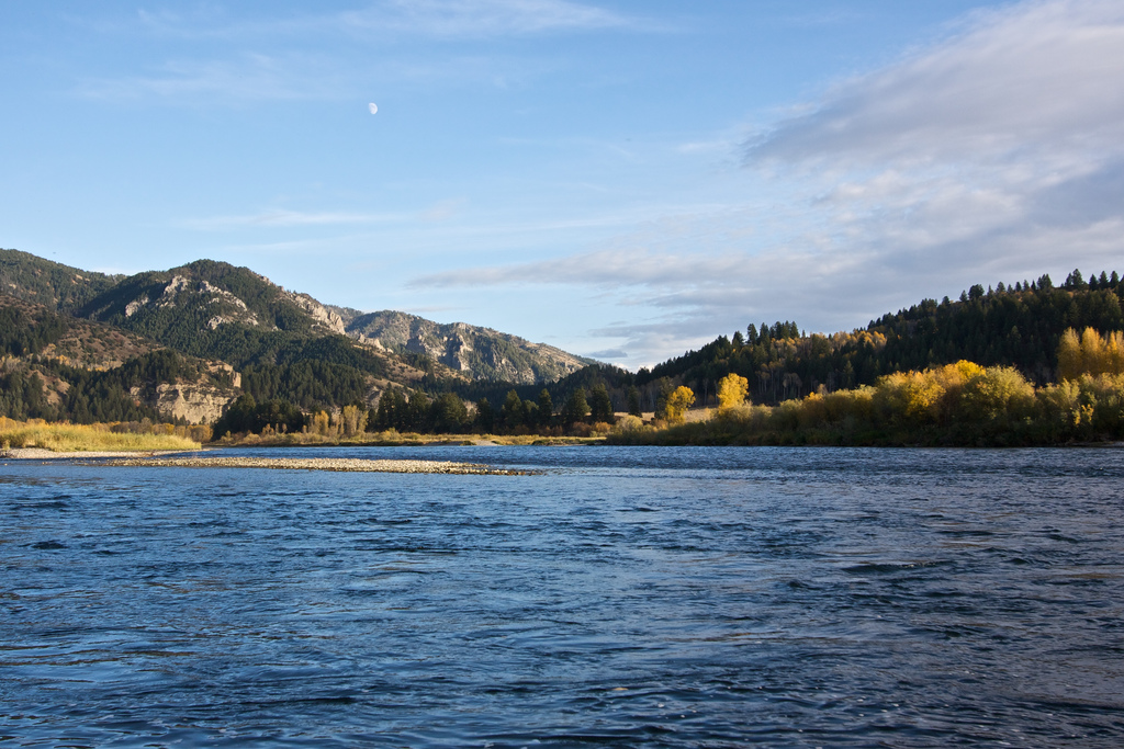
Fall colors, dramatic skies, floating down a river. Life is good.
5092126617_75cd54fd88_b.jpg


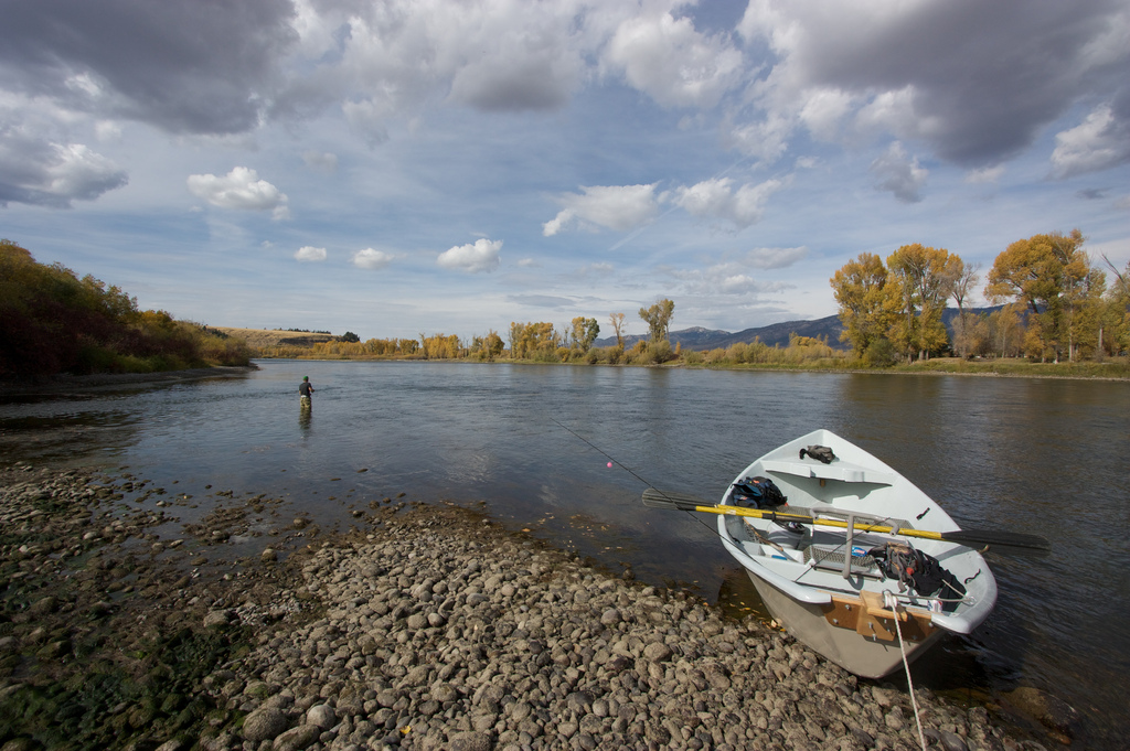
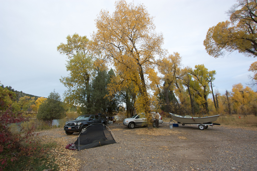
We camped that night back at the Palisade ramp. There's a little campground there right on the shore of the river. Seems like it could get very busy other times of the year but we had it all to ourselves.
5092127595_bf9a8232d4_b.jpg


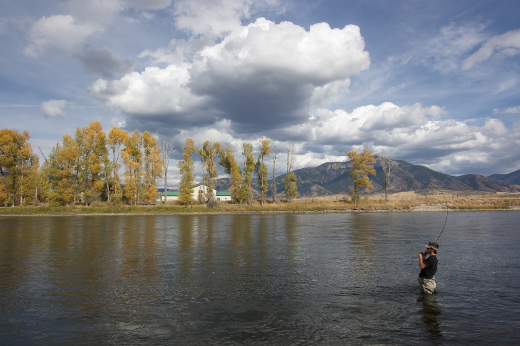
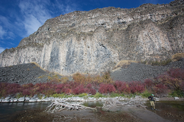
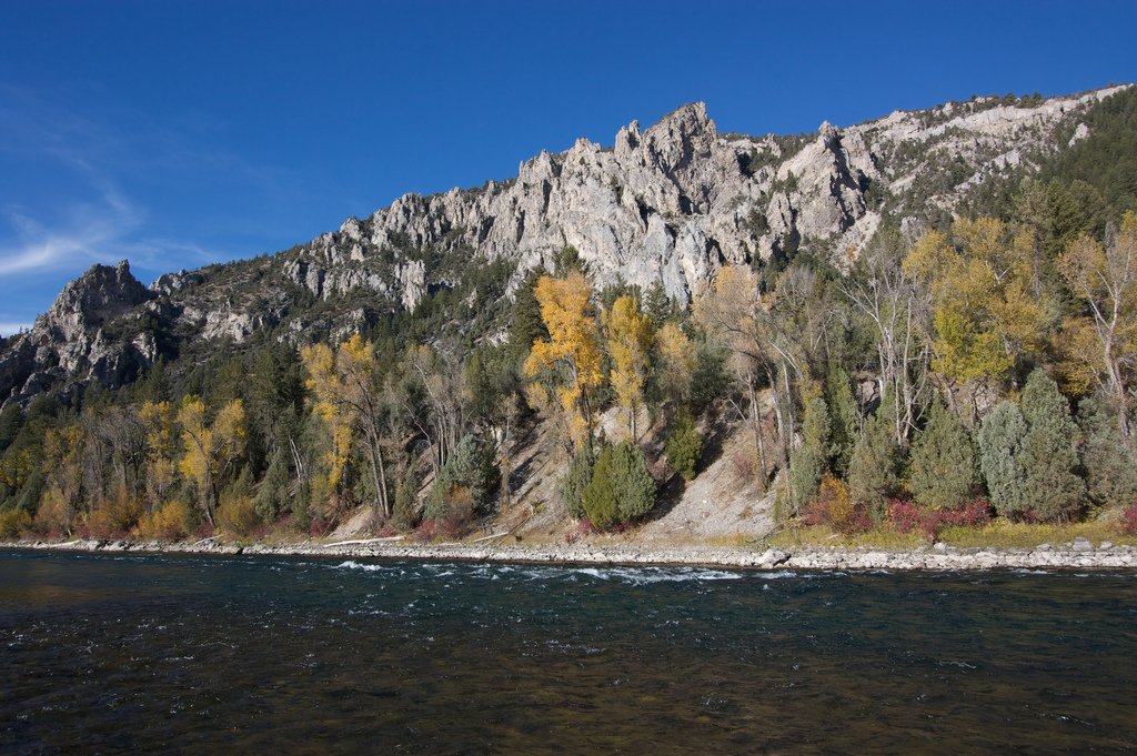
On Day 2 we floated the lower section from Conant to Cottonwood (aka Fulmer). The two days couldn't have been more different. The scenery below Conant was AWESOME. Less floating through people's back yards and much more of a wilderness experience in a pretty nice canyon. This would be a great stretch to do an overnight float trip on.
5092726308_6f7cfc7f22_b.jpg


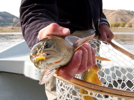
The fishing was a little better too. Still didn't catch a lot but we caught more Cutthroat and very few white fish. Here's a couple shots of a beautiful Cut that Justin caught. Photo by Collin J.
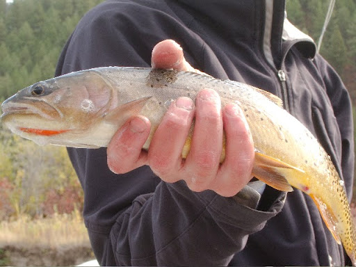
IMG_1224.jpg


Photo by Collin J.
IMG_1219.jpg


One of the spots we stopped to fish. Quite a bit of action in a deep eddie back there. This is also where another branch of the river would have come back in during higher water.
5092728502_82450434f6_z.jpg


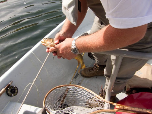
I caught this guy lurking just under the edge of a grassy overhang. What a fun fish to catch, he hit my fly hard! Photo by Collin J.
IMG_1229.jpg


After looking at this photo, Collin suggested we bring a kid with us on future trips to make the fish look bigger. In reality this was probably the largest fish of the trip but my hands are abnormally large and I didn't hold it out in front of me. Sounds like I'm making excuses, doesn't it? Photo by Collin J.
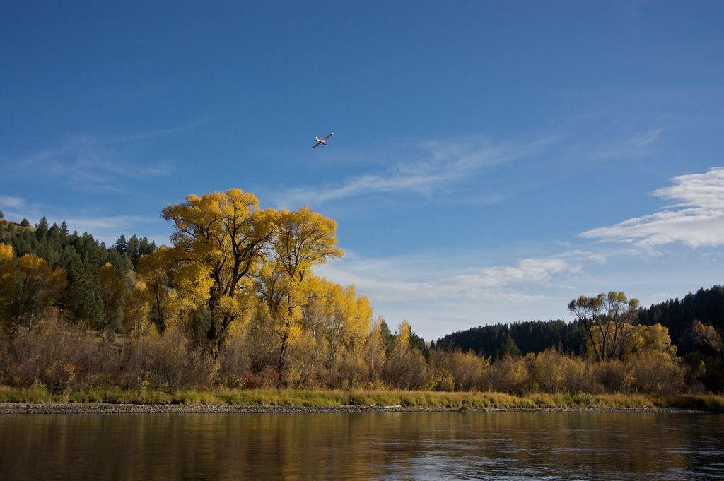
IMG_1230.jpg


Fly by
5092132813_4296033eb6_b.jpg


5092134265_48774d208b_b.jpg


5092134777_964c201584_b.jpg


5092135515_0e785c6c34_b.jpg


We made it back to Fulmer as the sun was going down but we had a long 40 minute drive back to the launch ramp to pickup my truck. Unfortunately the last 15 minutes of that was going the wrong direction. Never fun when you have a 4 hour drive home to look forward to. It was a great trip however and even though I didn't catch a ton of fish I enjoyed every second of it. I hope there are many more rivers in my future.
 
Drop me a note when the flows get right and I'll take you floating. The South Fork is my river.
 
Is there any whitewater, class II+ on this stretch of river? I've read reports of people canoeing through the south fork of snake and wondering how doable it is and when would be best time to go, summer, fall?
 
There were a few spots where it was a little turbulent but I think I'd take my rec kayak or a canoe through there no problem. I'm totally the wrong person to ask though. My experience to this stretch is limited to this one trip and it was one of my first river trips so I wasn't really thinking of it like 'could I do this in a canoe?'. Know what I mean? I think @Duke might know more about it though.
 
There were a few spots where it was a little turbulent but I think I'd take my rec kayak or a canoe through there no problem. I'm totally the wrong person to ask though. My experience to this stretch is limited to this one trip and it was one of my first river trips so I wasn't really thinking of it like 'could I do this in a canoe?'. Know what I mean? I think @Duke might know more about it though.
Thanks,
Looks like late summer, fall is more preferable for lower water flows. I will see if Duke has any input as well.
 
Is there any whitewater, class II+ on this stretch of river? I've read reports of people canoeing through the south fork of snake and wondering how doable it is and when would be best time to go, summer, fall?

there aren't any actual rapids in the South Fork (talking the Idaho section). Since it is a tailwater section it is not so much based on a particular time of year but on the flow. Here, South Fork Flows, is where you can find that info. For me, I prefer floating for fly fishing when it is just under 10k CFS. Spring run off times often exceed 20k, which is really moving. As I type this the flow is around 1800 and the only problem would be that there would be sections too shallow right now, ever for a canoe. I have never floated it in a canoe. I see drift boats and various rafts, including the individual water-otter/buckbag types, floating it. there would be one or two pucker areas by canoe at 8k cfs, but I think you would mostly be able to pick a line and do fine and would be even better just below that flow. the part I can't answer is if you hit a small section with some water bumps....would your canoe get water splashed in it? Depends on what you have. I float in an EMR, low side, drift boat and the gunwales are only 4 inches above the water at the low spots and I never have a problem. However, the rest of the boat is specifically shaped for the river so the bumps don't bother me at all if I take them bow first.

From the dam at palisades down to the big bridge where the road crosses the river is the upper section. Beautiful views of the mountains up there and the best section to see moose. Good road access, at least by dirt road which is often parallel, river left. Most of this section floats through or near some private ground with lots of high priced, summer homes near the water. Below the big bridge is the canyon. 26 miles of between Conant (the South Fork Lodge near the bridge) and Heise with a dirt road access river right about half way down. Large, steep cliffs river left and much more of a wilderness feeling, particularly the first part which has no road access on either side. Nearly everyone floating and camping will camp in the canyon area. Designated sites but still require LNT for fire areas and use of pooh bags. First come first serve on the camp sites and definitely some better than others. I see more Eagles and Osprey in this section than any other......virtually every float. It takes about 5-7 hrs of floating when >10K CFS and 8-10 hrs when slower. Below heise is a section where the river splits up into several channels quite often and each spring they get log jams, changeed to new routes by high water, etc. i dont go there often just because it changes each spring and I like going in the sections I know well.
 
Last edited:
Thanks @Duke. really helpful information. I will check out the flows historical data. I've a prospector design canoe, decent for lakes and good for rivers with high bow/stern and some rocker.
 
@Duke . Does anyone know what the camping is like at high water (between 15-20k)? I've never floated this section but was hoping to this weekend as a 2 or 3 day trip. With the current water level near 20k and the plans for it to drop, I'm wondering if the camps will be under water and/or overly muddy with nasty bugs. Any advice would be greatly appreciated!
 
I doubt any would be under water. They are up out of the typical flood zone for the most part and it is normal flow for this time of year. Keep in mind that I seldom float when it is this high but have never seen them under. No many campers this time of year so I doubt you will have a problem. That will change in about 3 weeks though. Pteronarcys californica will start moving and as soon as they start hatching and emerging the drift boats seem to "hatch" by the dozen also. People from back East start to pack the river for the hatch, which is a spectacular event.

You say a 2-3 day float so you might be going lower than Byington. I am not familiar with any camp areas below there. If you start at the dam and camp one night in the canyon section you will make Byington easily the next day....so it is a one night float. If you are pulling out at Byington the second day then i would recommend just going back and refloating one of the sections again. You can just car camp at the campground across from the Huskey station, which is also a launch.

One thing I would be just a bit cautious about is the Rainbow flush. The F&G will flood the river for a few days each spring to wash away the Rainbow eggs and ruin the redds. I haven't been paying attention and they may have done that already. Unlikely on a weekend.....but just be aware that is usually happens.

For good, up to date info you should visit or call Jimmy at All Season Anglers. They are downtown Idaho Falls and will give great info.
 
Thanks! This is super helpful information. We're planning on two nights -- putting in at the dam, camping at one of the pine creek camps night one and somewhere between Lufkin Bottom and Byington night two (taking off early sunday) but maybe we'll reconsider and just run the section twice.

Any recommendations on good camps? Also, thanks for the tip to contact Jimmy - I'll definitely do that.

Thanks again. Cheers!
 
@Bre Gale I am curious how your trip went. Not only did we have bad weather but in fact the F&G/B of Rec did decide to do the rainbow flush during your visit. I'm sure you still had fun.

From Jimmy's website (All Season Angler):

South Fork 6-14-15
The flush is about over with flow out of Palisades Dam currently at 13800 cfs. In a few days fishing will be back to where it should be for the time of the season. Just around the corner in time the big stonefly activity will begin. We will post its progress here, so keep watching!
 
Bumping this thread.

I'm looking at the Snake from Palisades to Lorenzo - which I believe is about 50 miles.

What's the river like between Byington & Lorenzo or even until it goes parallel to the interstate?
Looks like beautiful country. Is there much hiking along the river?

Thanks
 
Bumping this thread.

I'm looking at the Snake from Palisades to Lorenzo - which I believe is about 50 miles.

What's the river like between Byington & Lorenzo or even until it goes parallel to the interstate?
Looks like beautiful country. Is there much hiking along the river?

Thanks

@Duke is the resident South Fork Snake expert. I didn't hike at all but I think there are some opportunities in the wilderness section (our second day). It was a really nice float. I'd like to go back and camp on it sometime.
 
hey @DrNed I haven't been on here in a while and this is the first time I have seen your current avatar pic. Nice!

Re: Byington to Lorenzo. In my other post you will see that i talked about where the river below the Heise area (Byington) splits up into many smaller sections and tends to change a great deal each year. It flattens out and most of the logjams will settle in this area and not the sections above. It also starts going through/near private land, farm areas. There are hiking options during the float you are talking about, but not much in this section. By far the majority of the hiking options would be in the canyon section (big bridge at conant to byington) and mostly river right. In fact, one time I skied in to a yurt starting in the Rexburg area and was amazed when the snake river and some of my marked river spots started showing up on my GPS. i had no idea that area was just up from the river.

There is one basalt, dry fall that I eyeball every time I float by and wonder why I haven't rappelled it before. :) Keep your eye out for that and perhaps you should hit it! :)

As far as the areas below heise; Twin bridges is in that area and does have a compground....but for my part.....unless you are specifically looking for browns in deep water.....i would do the hiking and camping in the canyon. some beautiful wilderness in there. Keep in mind that about half way down a dirt road will appear river right and from that point down you will have to put up with that road and the motorcycle sounds etc if you leave the river to hike. Better "wilderness" type areas in the first part of the canyon.

Thank you for all the useful comments. I kinda figured there couldn't be anything worth floating because I couldn't find anything online.

Do you know much about the Snake from Jackson Lake to West Table? Ideally I'm looking for a 4+ day float / hike / fish trip.

Thanks again!

Thanks for the avatar comment too. This is the image I use for the scouts I work with - it's our unofficial logo.

No, i stick to the Idaho section.

You may have to just try for a permit on the Salmon. ?? The middle fork is the ultimate, multiday , wilderness float but those are also the most sought after permits. But, there are other sections too. Search it online and you will find plenty. (floating the Salmon that is).
 
@Duke I'd love to do the Salmon! Are there any stretches that don't have III or higher white water?

As part of this we're building skin on frame kayaks. I'd feel comfortable doling Class II+ or less in these
boats but more than that, probably not.

Are there any Idaho rivers you're familiar with that would be suitable for a 4-5 day float / fishing / hiking
that are class II+ or below?

Thank you for your advice and insights.
 
there are stretches. hmm.....not sure about 4 days worth. But, the salmon is what i think you are after.

Another option is the owyhee river. idaho/oregon. now well known so definitely not a permit river. Best on years with good snow for good flows. Look into that one. That is a desert canyon float.
 
Similar threads
Thread starter Title Forum Replies Date
K Floating down South Fork of the Snake (ID) Trip Planning 1
Ugly Floating Island- Utah Trip Planning 8
Outdoors24 Floating Labyrinth Canyon On The Water 7
Jammer Floating the Yampa through Dinosaur On The Water 5
regehr floating East Canyon Creek in a packraft? Trip Planning 3
DrNed Floating The North Platte June 2017 On The Water 5
Nick Floating Glen Canyon On The Water 3
DrNed Floating Smith River in Montana Trip Planning 55
DrNed Floating Through Dinosaur National Monument Trip Planning 9
Nick Floating lower Cataract into Glen Canyon Trip Planning 2
steve Invite Floating the Provo river (Provo Canyon) this Tuesday Meet Up (Members Only) 12
Nick Floating Hite to Lake Powell Trip Planning 2
steve Invite Urban Adventure - floating the Jordan River this Sat, 3.21.15 Meet Up (Members Only) 7
steve Floating the Provo River On The Water 0
DrNed Favorite Places To Explore While Floating Labyrinth Trip Planning 38
steve Floating the San Rafael General Discussion 9
gnwatts Floating through Labyrinth Canyon On The Water 22
mattvogt7 Floating into the Maze Backpacking 10
AustinCronnelly Floating the Smith River, Montana On The Water 13
Mike K Floating the Dirty Devil Trip Planning 12
Nick Time to start floating! Gear 6
Kullaberg63 Suggestions for Escalante east of river, south of Choprock Trip Planning 4
Timber High Sierra - North Lake to South Lake Loop - Layover Day Trip Planning 9
J South Crandall Creek and the Hoodoos Wyoming and Yellowstone? Trip Planning 3
RockyMntCol Trip Planning Younts Peak / South Fork Yellowstone Trip Planning 12
F Thorofare/South Boundary/Wolverine Creek Trip Planning 2
balzaccom South America Everything Else 1
BobFink Yellowstone South Entrance to Fox Creek via Basin Creek Cutoff - Labor Day 2022 Trip Reports 4
scatman South Ridge of City Creek Canyon - January 28, 2023 Hiking & Camping 4
SteveR Coyote Buttes South- New Daily Permit Process Trip Planning 8
wsp_scott Big South Fork Bikepacking Backpacking 1
S Driving to poverty flats (South Coyote Buttes) on AWD Trip Planning 11
P Yellowstone--Heart Lake to South Entrance Backpacking 13
John Goering Tobacco Root Mountains South Meadow Creek Off Road 1
BJett Big South Fork National River & Recreation Area Packraft/Backpack Loop (TN) Backpacking 6
balzaccom South by Southwest from Napa Hiking & Camping 4
Janice Vermillion Cliffs Trip - Part 2 - White Pocket & Coyote Buttes South Hiking & Camping 7
Janice The Wave - and SO MUCH MORE! (Coyote Buttes North, South, White Pocket, Buckskin, Condors, Bighorns...) - Part 1 Hiking & Camping 14
dhertbag Camping at Cottonwood Cove - Coyote Buttes South Trip Planning 11
wsp_scott Honey Creek (Big South Fork) Backpacking 9
Chuck the Mauler Sierra North Lake / South Lake "loop" questions Trip Planning 10
wsp_scott Big South Fork Views Backpacking 14
S Conejos - South San Juan Wilderness Backpacking 2
Jammer Sequoia: Upper Kern and Lake South America Backpacking 12
kwc Chimney Mountain, South Central Adirondacks Hiking & Camping 3
kwc Hiking in the South Central Adirondacks Hiking & Camping 1
I Water in Frisky Creek south of Highway 12 in the Grand Staircase? Trip Planning 0
regehr Dirty Devil South Trip Reports 14
Nick Coyote Buttes South - Jan 18, 2020 Trip Planning 1
TrailScot Quite the Adventure, South of Moab, Across the Colorado Plateau, May 2019 - Part 4 Backpacking 17

Similar threads

Back
Top