IntrepidXJ
ADVENTR
- Joined
- Jan 17, 2012
- Messages
- 3,493
Arizona Strip & Southern Utah Wanderings | Day 4
Tuesday, October 9, 2012
The Original Trip Report on ADVENTR.CO
Since there weren't really any good places nearby to photograph sunrise, we slept in a little later on Tuesday morning. After a little breakfast we packed up camp and took the rough Jeep road to it's end where we would start our hike. Our destination for today would be to the top of Flag Point in the Vermilion Cliffs of the Grand Staircase. Jared and I had wanted to try this hike last year, but were unable to squeeze it in. From what I understand, most people that have made this trek hike up from the base of the cliff and are able to find a way up, however we thought that we would try to hike from the backside. It was probably a longer hike, but it involved less steep climbing.
The view towards Kanab from the top of Flag Point.
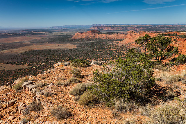
Flag Point View by IntrepidXJ, on Flickr
After visiting the point we started hiking along the rim in search of a dinosaur track site.
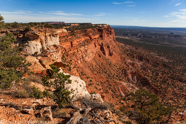
Rim Hiking by IntrepidXJ, on Flickr
Jared taking a photo looking back at Flag Point.
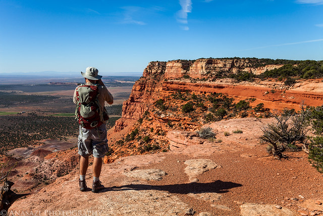
Leaving Flag Point by IntrepidXJ, on Flickr
After hiking a bit and searching we eventually found the awesome dinosaur tracks.
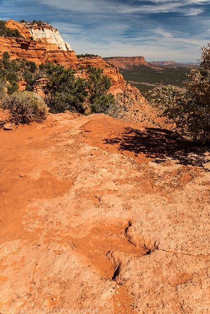
Dino View by IntrepidXJ, on Flickr
There are a few in this photo, but there were plenty more scattered around this area.
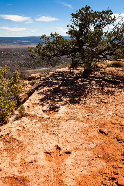
Tracks Over the Edge by IntrepidXJ, on Flickr
Here's two deep tracks that are located under the tree pictured above.
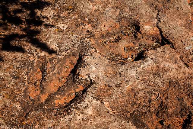
Deep Tracks by IntrepidXJ, on Flickr
An obligatory foot-next-to-the-dinosaur-track-for-size photo. I wear a size 15 boot, in case you were interested...
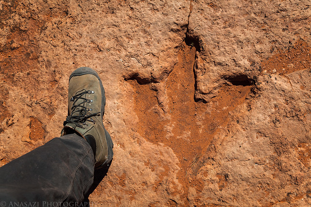
Dino Print Size by IntrepidXJ, on Flickr
After a little more searching nearby we found what I was really looking for on this hike. As far as I know, this may be the only pictograph depicting a dinosaur track! I wonder what kind of myths the Native Americans had about the tracks found at this site, especially since some of them appear to head right off the edge of a 1,000+ foot cliff?
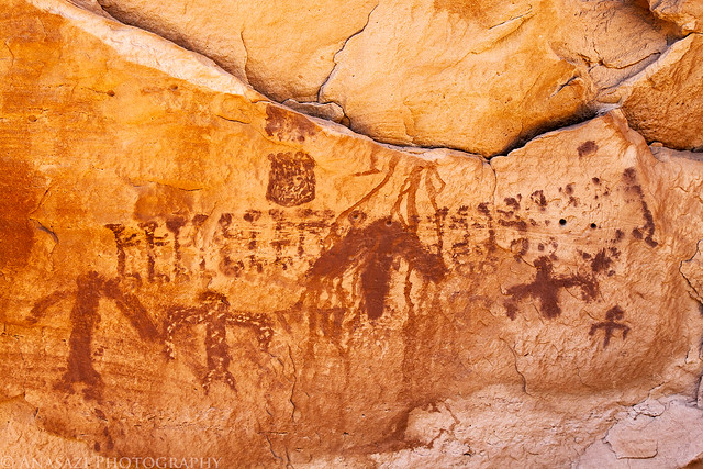
Dinosaur Track Pictograph by IntrepidXJ, on Flickr
There were plenty of other 'typical' pictographs found here, too.
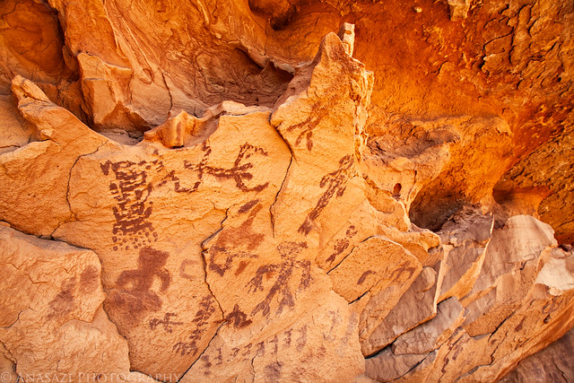
Flag Point Pictographs by IntrepidXJ, on Flickr
After exploring the area some more and taking plenty of photos, we hiked back to the Jeep and drove back to Kanab to grab some dinner before making our way back towards Lake Powell.
After leaving Kanab we took the short side road to the White House trailhead since neither of us had been down it before.
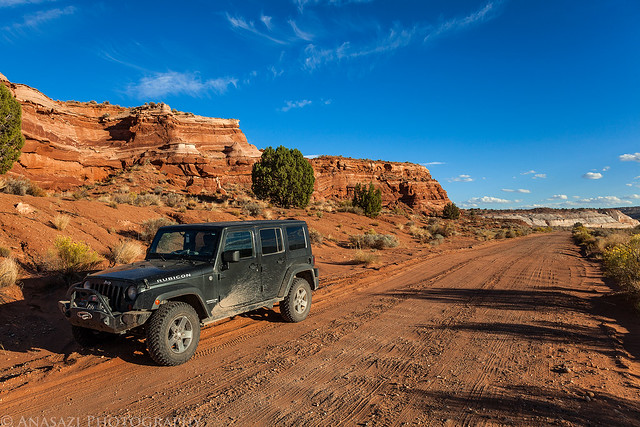
White House Road by IntrepidXJ, on Flickr
We spotted this hoodoo near the road and stopped for a photo.
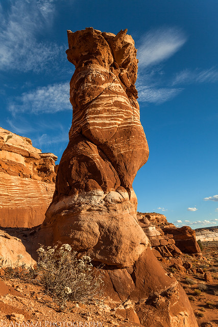
White House Hoodoo by IntrepidXJ, on Flickr
At this point it was getting pretty close to sunset, so we decided to head across the highway and quickly hike out to the Rimrock Toadstools.
Here's one of the smaller hoodoos casting it's shadow on a boulder.
Hoodoo Shadow by IntrepidXJ, on Flickr
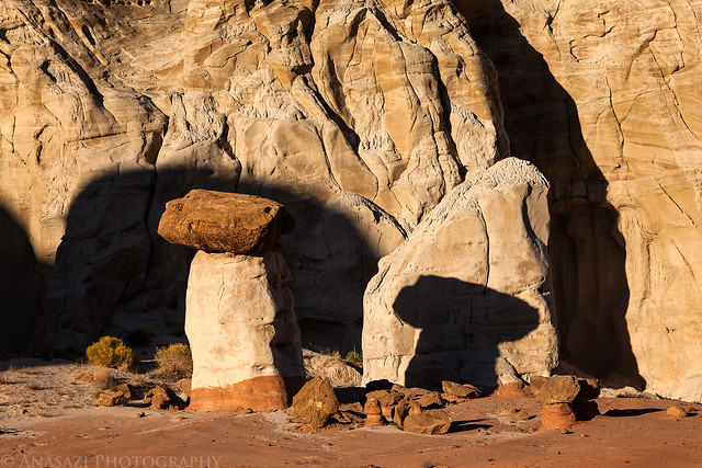
The biggest and most well-known toadstool found here immersed in warm afternoon light.
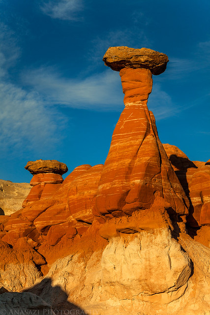
Rimrock Toadstool by IntrepidXJ, on Flickr
This guy always seems to be following me around...
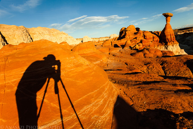
Shadow Photographer by IntrepidXJ, on Flickr
The rocks really lit up just before the sun went down.
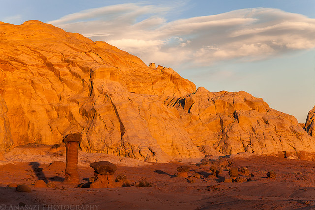
Small Hoodoos by IntrepidXJ, on Flickr
We stuck around after the sun was down and took a few photos in the twilight, which is becoming one of my favorite times to take photos.
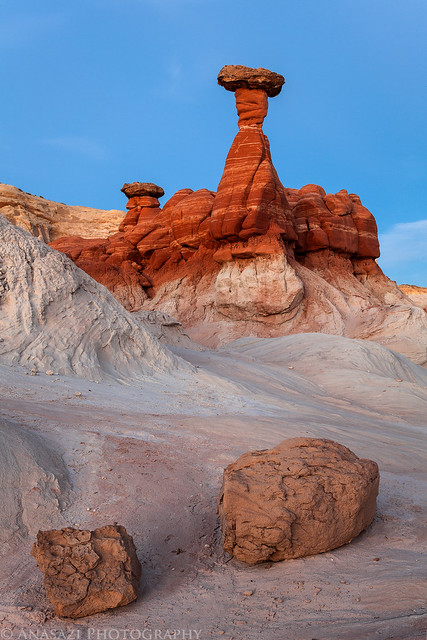
Twilight Toadstool by IntrepidXJ, on Flickr
When the light was all gone we hiked back to the Jeep in the dark and started driving further east towards Lake Powell. We decided to camp out on Alstrom Point so that we could catch the sunrise there in the morning. When we reached the point, we quickly setup camp, took a few night photos (which didn't turn out for me), and went to bed. It was a perfect night, so I setup my tentcot without the tent and slept under the stars.
>> Flag Point Photo Gallery
Featured image for home page:

Tuesday, October 9, 2012
The Original Trip Report on ADVENTR.CO
Since there weren't really any good places nearby to photograph sunrise, we slept in a little later on Tuesday morning. After a little breakfast we packed up camp and took the rough Jeep road to it's end where we would start our hike. Our destination for today would be to the top of Flag Point in the Vermilion Cliffs of the Grand Staircase. Jared and I had wanted to try this hike last year, but were unable to squeeze it in. From what I understand, most people that have made this trek hike up from the base of the cliff and are able to find a way up, however we thought that we would try to hike from the backside. It was probably a longer hike, but it involved less steep climbing.
The view towards Kanab from the top of Flag Point.
Flag Point View by IntrepidXJ, on Flickr
After visiting the point we started hiking along the rim in search of a dinosaur track site.
Rim Hiking by IntrepidXJ, on Flickr
Jared taking a photo looking back at Flag Point.
Leaving Flag Point by IntrepidXJ, on Flickr
After hiking a bit and searching we eventually found the awesome dinosaur tracks.
Dino View by IntrepidXJ, on Flickr
There are a few in this photo, but there were plenty more scattered around this area.
Tracks Over the Edge by IntrepidXJ, on Flickr
Here's two deep tracks that are located under the tree pictured above.
Deep Tracks by IntrepidXJ, on Flickr
An obligatory foot-next-to-the-dinosaur-track-for-size photo. I wear a size 15 boot, in case you were interested...
Dino Print Size by IntrepidXJ, on Flickr
After a little more searching nearby we found what I was really looking for on this hike. As far as I know, this may be the only pictograph depicting a dinosaur track! I wonder what kind of myths the Native Americans had about the tracks found at this site, especially since some of them appear to head right off the edge of a 1,000+ foot cliff?
Dinosaur Track Pictograph by IntrepidXJ, on Flickr
There were plenty of other 'typical' pictographs found here, too.
Flag Point Pictographs by IntrepidXJ, on Flickr
After exploring the area some more and taking plenty of photos, we hiked back to the Jeep and drove back to Kanab to grab some dinner before making our way back towards Lake Powell.
After leaving Kanab we took the short side road to the White House trailhead since neither of us had been down it before.
White House Road by IntrepidXJ, on Flickr
We spotted this hoodoo near the road and stopped for a photo.
White House Hoodoo by IntrepidXJ, on Flickr
At this point it was getting pretty close to sunset, so we decided to head across the highway and quickly hike out to the Rimrock Toadstools.
Here's one of the smaller hoodoos casting it's shadow on a boulder.
Hoodoo Shadow by IntrepidXJ, on Flickr
The biggest and most well-known toadstool found here immersed in warm afternoon light.
Rimrock Toadstool by IntrepidXJ, on Flickr
This guy always seems to be following me around...
Shadow Photographer by IntrepidXJ, on Flickr
The rocks really lit up just before the sun went down.
Small Hoodoos by IntrepidXJ, on Flickr
We stuck around after the sun was down and took a few photos in the twilight, which is becoming one of my favorite times to take photos.
Twilight Toadstool by IntrepidXJ, on Flickr
When the light was all gone we hiked back to the Jeep in the dark and started driving further east towards Lake Powell. We decided to camp out on Alstrom Point so that we could catch the sunrise there in the morning. When we reached the point, we quickly setup camp, took a few night photos (which didn't turn out for me), and went to bed. It was a perfect night, so I setup my tentcot without the tent and slept under the stars.
>> Flag Point Photo Gallery
Featured image for home page:
")