- Joined
- Jan 4, 2015
- Messages
- 2,901
In June of 2020, I did a little exploratory meander on Boulder Mountain in south-central Utah. Boulder Mountain is a bit of a misnomer, as it's actually a high plateau, which tops out just above 11,000 feet. I'd hiked through here previously on my 2019 Route In Between, but record-shattering snow forced me down onto a lower, less scenic route. So in 2020, I decided to hike through the area again. My goal was not only to see what I'd missed the previous year, but also to provide a more-informed recommendation for long-distance hikers looking to hike through the area.
Boy am I glad I did. Boulder Top made for a wonderful trip.
Day 1
I parked near Bicknell Bottom between Bicknell and Torrey, following the Great Western Trail (GWT) on an OHV track around Teasdale Mountain. At the Government Creek crossing, I left the GWT, following the faint Government Point Trail up toward Government Lake. A few minutes into the steep climb, I met a pair of mountain bikers, sitting on the ground with confused looks on their faces. Apparently they were not prepared for this trail to be steep, laden with rocks, and invisible in places. I'm not quite sure what they were doing here in the first place, as this trail was clearly not suitable for bikes. After conversing for a few minutes, they decided to head back down to the GWT. Good choice.
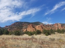
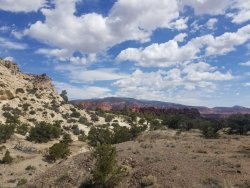
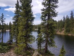
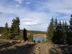
Shortly after passing Government Lake (a pretty pathetic puddle, I must say), I turned onto the Wildcat Trail. While extant, the Wildcat Trail had a ton of steep up-and-down, constantly diving down into drainages and then climbing back up again. A wildfire had ripped through this area a few years ago, so the scenery kind of sucked. But after a few miles, I exited the burn area and leveled out. There were still quite a few rocks, but the trail was more distinct and those sub-alpine lakes nestled in the pines were quite pretty. I camped for the night in a tiny rock-free spot between a pair of lakes at 10,000 feet. After having spent several months at low elevation (thanks, Covid!), getting to sleep that night at 10,000 feet was... interesting.
Day 2:
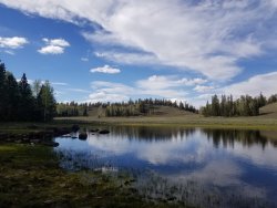
What a great day! I continued along the Wildcat Trail, just below the "rim" of Boulder Mountain, past a series of wonderful lakes. The most notable/popular lake in the area, Blind Lake, was gorgeous. There were a few established campsites along the edge of the lake, but I saw nobody. It must have been a weekday. I passed about half a dozen lakes before the trail ended at a jeep road. After a few tenths on the jeep road, I turned onto another segment of GWT. I was a bit nervous about this stretch, because I didn't realllly know whether it existed or not. @JulieKT had reported (thanks for the beta!) there was something on the ground through here, but I didn't know whether it would be maintained. And, given that it climbed through some really steep terrain to get atop the rim of Boulder Mountain proper, I really needed it to exist. Hence the scouting mission before I recommend it Route In Between to other hikers.
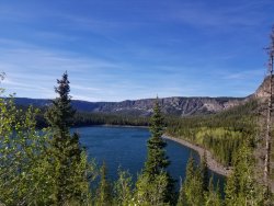
I'm happy to say that it did exist. The trail climbed gradually at first through some thick timber. It's obviously been a while since it was maintained, but with a few gymnastics I was able to negotiate a few problematic blowdowns. As the trail got steeper, it broke through treeline (ish - nothing is truely alpine around here, but steep and north-facing stuff is mostly treeless) and entered a gully that drained the top of the plateau. It was a marvel that the trail existed at all - high-angle dirt, ill-defined in places, and obviously shoehorned into the gulch - but extant. And the gully was beautiful! I passed a few waterfalls on the climb. It was tough to tell if my gasps were from the thin air or the marvelous scenery.
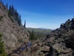
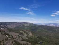
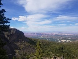
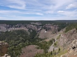
As things leveled out atop the plateau, I lunched and then turned down the Rim "Trail" - which really does not exist at all, aside from the occasional cut log or two-rock cairn. The trail follows the north edge of the plateau, with fantastic views of Thousand Lakes Mountain, the entire Capitol Reef area, and the Henry Mountains beyond. Progress was slow as I made my way along the edge, spending far too much time looking for a trail that really just didn't exist. Travel wasn't too bad despite the lack of trail though, as the vegetation pretty sparse.
I made camp near Chokecherry Point. My tent's zipper had failed the previous night (too many nights on it, I suppose), so I was grateful that the bugs weren't out in force quite yet. The snow was still melting. In another few weeks, I'm sure they would have been nasty.
Day 3:
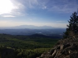
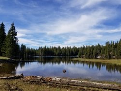
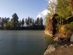
I continued along the non-existant Rim Trail, now enjoying views to the south toward the Escalante and Navajo Mountain beyond. After a few miles, I rejoined another section of GWT. I passed Meeks Lake, the first of a series of beautiful lakes I'd encounter in this section. While none of the topographical features up here are huge (it is a plateau after all - it's flat on top), the lakes were nestled below small and picturesque cliff bands. It's not dissimilar to what you'd find in the Uintas - but on a smaller scale of course. I really enjoyed this section.
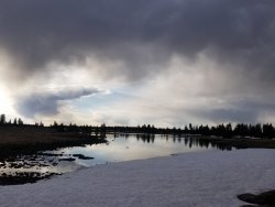
The trail appeared and disappeared at will, and I just followed the path of least resistance in the right direction. I did a brief stretch on a jeep road and a stretch of "off-trail" where I was surprised to find a well-cairned social trail that was in better shape that many of the official trails I'd been following. I encountered quite a bit of snow in the Horsethief Lake area - those aforementioned terrain features and dense timber preserved the snowpack rather well. I mostly just made my way across the snowy landscape - a flashback to the previous May where I had struggled to make progress through deep, fresh snow.
It's hard to describe what was so marvelous about this area. Boulder Mountain is remote and seldom-traveled. If there are trails, they're faint. You do really feel like you're exploring something for the first time, and the topography and vegetation combine to allow you to go anywhere you want without too much hassle. It may not be "iconic" like the Sawtooths, the Winds, or the Grand Canyon, but it's a different kind of amazing. It's a wanderer's paradise.
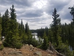
I reached Spectacle Lake in the late afternoon, just as the clouds broke up after a passing shower. I had a decision to make. I'd planned to be out here for 5-6 days, but the forecast for Day 5 was looking truly horrific - NWS had already begun warning of severe thunderstorms. Mountains are bad in a thunderstorm, but a plateau is worse. At least in the mountains, you can descend down to a safe elevation if you see a storm coming. On a plateau, where everything around you is at a uniform height, there's nowhere to hide. I wanted no part of being at 11k on a plateau in severe thunderstorms. So I decided to cut the trip short, turning north (rather than my intended direction, south) and making my way back to my car.
After an hour on a still-snowbound dirt road, I made camp for the night in a truly pathetic grove of stunted trees.
Day 4
The day dawned beautiful, and I finally made some decent time along a dirt road. I'm sure this would normally be a subpar walk with trucks passing and sheep bleating, but it was too early yet - snow still blocked the road in many places. I stopped to tag Bluebell Knoll, Wayne County's highpoint (and the highest point on the Boulder). Atop the knoll, I spotted signs of life below! A white pickup (not Forest Service) was contending with a drift as the road ascended toward my location. But even the F250 was no match for the drift, and after a few minutes of obvious frustration, he turned tail and headed back down the way he came. I wish I could say I felt bad for him, but I really didn't. This brief period, a couple weeks sandwiched between spring and summer, was a lovely place on the Boulder. It was accessible by foot, but only by foot. It was a lovely Boulder. It was a quiet Boulder. It was my Boulder.
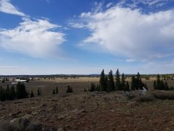
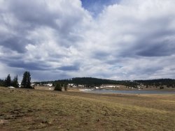
It was also a chilly Boulder, despite the warm sunshine. I took a very, very quick dip in a lovely lake and headed out on a little side trip toward Donkey Point just to take a look-see. Those plans were cut short, though, by the gathering clouds. I turned around and headed west down the dirt road toward Cook Lake and the relative safety of the trees. Just as I got below treeline, thunder started exploding all around me. Just in time!
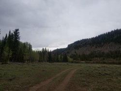
After a couple miles, I rejoined trail, the Government Point Trail, steadily losing elevation as I dropped below the rim. I briefly crossed paths with my route from Day 1 before veering onto a trail that's called the "Lost Lake Trail" on the map, but I'm pretty sure it's mislabeled because the Lost Lake Trail goes to Bullberry Lakes and the Bullberry Lakes trail goes to Lost Lake. At any rate, the trail was terrible. Erosion has scoured deep new gullies in the area, the trail is gone, and trees are laying like giant pickup sticks. At one point, I lost all sight of the trail and ended up doing some pretty unpleasant thrashing. To complicate matters, I wanted to get out of the burn area before the sun went down so I wouldn't have to camp under 15 widowmakers - but progress was slow enough to make it a real race.
I finally made it down to where the trail ended on a jeep road and found a place to make camp. I'd waited too long to get water, though and found the water down here to be really scummy. It didn't taste bad per se, but i had to clear a thick layer of pond scum out of the way before dipping my bottle. Not exactly appetizing, but good enough.
Day 5
I woke early to beat the heat now that I was at lower elevation and followed a bunch of nondescript jeep roads back down to Bicknell Bottom and my waiting car. I made it back by mid-morning. A few hours later, a series of nasty storms blew in. I was glad I'd made the right call.
General Observations:
I'm sure none of this is news to most folks on this site, but just a few comments on the Boulder:
Boy am I glad I did. Boulder Top made for a wonderful trip.
Day 1
I parked near Bicknell Bottom between Bicknell and Torrey, following the Great Western Trail (GWT) on an OHV track around Teasdale Mountain. At the Government Creek crossing, I left the GWT, following the faint Government Point Trail up toward Government Lake. A few minutes into the steep climb, I met a pair of mountain bikers, sitting on the ground with confused looks on their faces. Apparently they were not prepared for this trail to be steep, laden with rocks, and invisible in places. I'm not quite sure what they were doing here in the first place, as this trail was clearly not suitable for bikes. After conversing for a few minutes, they decided to head back down to the GWT. Good choice.


Shortly after passing Government Lake (a pretty pathetic puddle, I must say), I turned onto the Wildcat Trail. While extant, the Wildcat Trail had a ton of steep up-and-down, constantly diving down into drainages and then climbing back up again. A wildfire had ripped through this area a few years ago, so the scenery kind of sucked. But after a few miles, I exited the burn area and leveled out. There were still quite a few rocks, but the trail was more distinct and those sub-alpine lakes nestled in the pines were quite pretty. I camped for the night in a tiny rock-free spot between a pair of lakes at 10,000 feet. After having spent several months at low elevation (thanks, Covid!), getting to sleep that night at 10,000 feet was... interesting.

Day 2:
What a great day! I continued along the Wildcat Trail, just below the "rim" of Boulder Mountain, past a series of wonderful lakes. The most notable/popular lake in the area, Blind Lake, was gorgeous. There were a few established campsites along the edge of the lake, but I saw nobody. It must have been a weekday. I passed about half a dozen lakes before the trail ended at a jeep road. After a few tenths on the jeep road, I turned onto another segment of GWT. I was a bit nervous about this stretch, because I didn't realllly know whether it existed or not. @JulieKT had reported (thanks for the beta!) there was something on the ground through here, but I didn't know whether it would be maintained. And, given that it climbed through some really steep terrain to get atop the rim of Boulder Mountain proper, I really needed it to exist. Hence the scouting mission before I recommend it Route In Between to other hikers.

I'm happy to say that it did exist. The trail climbed gradually at first through some thick timber. It's obviously been a while since it was maintained, but with a few gymnastics I was able to negotiate a few problematic blowdowns. As the trail got steeper, it broke through treeline (ish - nothing is truely alpine around here, but steep and north-facing stuff is mostly treeless) and entered a gully that drained the top of the plateau. It was a marvel that the trail existed at all - high-angle dirt, ill-defined in places, and obviously shoehorned into the gulch - but extant. And the gully was beautiful! I passed a few waterfalls on the climb. It was tough to tell if my gasps were from the thin air or the marvelous scenery.

As things leveled out atop the plateau, I lunched and then turned down the Rim "Trail" - which really does not exist at all, aside from the occasional cut log or two-rock cairn. The trail follows the north edge of the plateau, with fantastic views of Thousand Lakes Mountain, the entire Capitol Reef area, and the Henry Mountains beyond. Progress was slow as I made my way along the edge, spending far too much time looking for a trail that really just didn't exist. Travel wasn't too bad despite the lack of trail though, as the vegetation pretty sparse.
I made camp near Chokecherry Point. My tent's zipper had failed the previous night (too many nights on it, I suppose), so I was grateful that the bugs weren't out in force quite yet. The snow was still melting. In another few weeks, I'm sure they would have been nasty.


Day 3:
I continued along the non-existant Rim Trail, now enjoying views to the south toward the Escalante and Navajo Mountain beyond. After a few miles, I rejoined another section of GWT. I passed Meeks Lake, the first of a series of beautiful lakes I'd encounter in this section. While none of the topographical features up here are huge (it is a plateau after all - it's flat on top), the lakes were nestled below small and picturesque cliff bands. It's not dissimilar to what you'd find in the Uintas - but on a smaller scale of course. I really enjoyed this section.

The trail appeared and disappeared at will, and I just followed the path of least resistance in the right direction. I did a brief stretch on a jeep road and a stretch of "off-trail" where I was surprised to find a well-cairned social trail that was in better shape that many of the official trails I'd been following. I encountered quite a bit of snow in the Horsethief Lake area - those aforementioned terrain features and dense timber preserved the snowpack rather well. I mostly just made my way across the snowy landscape - a flashback to the previous May where I had struggled to make progress through deep, fresh snow.
It's hard to describe what was so marvelous about this area. Boulder Mountain is remote and seldom-traveled. If there are trails, they're faint. You do really feel like you're exploring something for the first time, and the topography and vegetation combine to allow you to go anywhere you want without too much hassle. It may not be "iconic" like the Sawtooths, the Winds, or the Grand Canyon, but it's a different kind of amazing. It's a wanderer's paradise.

I reached Spectacle Lake in the late afternoon, just as the clouds broke up after a passing shower. I had a decision to make. I'd planned to be out here for 5-6 days, but the forecast for Day 5 was looking truly horrific - NWS had already begun warning of severe thunderstorms. Mountains are bad in a thunderstorm, but a plateau is worse. At least in the mountains, you can descend down to a safe elevation if you see a storm coming. On a plateau, where everything around you is at a uniform height, there's nowhere to hide. I wanted no part of being at 11k on a plateau in severe thunderstorms. So I decided to cut the trip short, turning north (rather than my intended direction, south) and making my way back to my car.
After an hour on a still-snowbound dirt road, I made camp for the night in a truly pathetic grove of stunted trees.
Day 4
The day dawned beautiful, and I finally made some decent time along a dirt road. I'm sure this would normally be a subpar walk with trucks passing and sheep bleating, but it was too early yet - snow still blocked the road in many places. I stopped to tag Bluebell Knoll, Wayne County's highpoint (and the highest point on the Boulder). Atop the knoll, I spotted signs of life below! A white pickup (not Forest Service) was contending with a drift as the road ascended toward my location. But even the F250 was no match for the drift, and after a few minutes of obvious frustration, he turned tail and headed back down the way he came. I wish I could say I felt bad for him, but I really didn't. This brief period, a couple weeks sandwiched between spring and summer, was a lovely place on the Boulder. It was accessible by foot, but only by foot. It was a lovely Boulder. It was a quiet Boulder. It was my Boulder.


It was also a chilly Boulder, despite the warm sunshine. I took a very, very quick dip in a lovely lake and headed out on a little side trip toward Donkey Point just to take a look-see. Those plans were cut short, though, by the gathering clouds. I turned around and headed west down the dirt road toward Cook Lake and the relative safety of the trees. Just as I got below treeline, thunder started exploding all around me. Just in time!

After a couple miles, I rejoined trail, the Government Point Trail, steadily losing elevation as I dropped below the rim. I briefly crossed paths with my route from Day 1 before veering onto a trail that's called the "Lost Lake Trail" on the map, but I'm pretty sure it's mislabeled because the Lost Lake Trail goes to Bullberry Lakes and the Bullberry Lakes trail goes to Lost Lake. At any rate, the trail was terrible. Erosion has scoured deep new gullies in the area, the trail is gone, and trees are laying like giant pickup sticks. At one point, I lost all sight of the trail and ended up doing some pretty unpleasant thrashing. To complicate matters, I wanted to get out of the burn area before the sun went down so I wouldn't have to camp under 15 widowmakers - but progress was slow enough to make it a real race.
I finally made it down to where the trail ended on a jeep road and found a place to make camp. I'd waited too long to get water, though and found the water down here to be really scummy. It didn't taste bad per se, but i had to clear a thick layer of pond scum out of the way before dipping my bottle. Not exactly appetizing, but good enough.

Day 5
I woke early to beat the heat now that I was at lower elevation and followed a bunch of nondescript jeep roads back down to Bicknell Bottom and my waiting car. I made it back by mid-morning. A few hours later, a series of nasty storms blew in. I was glad I'd made the right call.
General Observations:
I'm sure none of this is news to most folks on this site, but just a few comments on the Boulder:
- I'm glad I took this trip, both for scouting purposes and just for general enjoyment. The Boulder is beautiful and really open - as mentioned earlier, it's a wanderer's paradise. Maybe it's not quite as otherworldly as its neighbors - Capitol Reef and the Escalante - but it's massive, feels very remote, and you will not be disappointed by the scenery.
- Boulder Mountain is a perfect solution to what I call the June Conundrum: June is kind of a hard season in the mid-latitudes West. The desert is scorching already, but the mountains are still largely snowbound. But a high plateau is perfect. Because everything is mostly level, even if you have to do a little snow travel, it's still plenty doable without need for an ice axe or spikes, and level terrain tends to melt out faster than mountainous terrain because there's no north side to harbor snow. Plus, the remaining snow keeps the jeeps and the sheeps out, so the only people you'll see are the ones hardy enough to hike up there. Aside from the misplaced mountain bikers and the futile Ford, I saw nobody for five days.
- Holy smokes do our public lands need funding. Boulder Mtn isn't a major tourist destination. It doesn't have well-maintained "corridor" trails. It's got a great network of trails, but that network is slowly falling apart as fire, erosion, and just general neglect take their toll. This is happening in a million places just like Boulder across the country - places that aren't written up in the glossy tourism magazines, but places that are vitally important for locals, for those who are looking to get off the beaten path, and for long-distance hikers. If we don't continue to maintain our trails and the health of our forests, we are slowly letting our investment go to waste.


