- Joined
- Oct 30, 2016
- Messages
- 991
With snow putting an end to the Colorado alpine backpacking with which I have so recently and completely fallen in love, I thought I'd take a few days and see what backpacking in Utah had to offer. I've never visited Utah before at all, so when I saw a nice stretch of weather forecasted between here and the Cedar Mesa area I took some last minute time off and got permits for a buddy and I to try a 3 day/2 night loop through the Fish creek and Owl creek canyons down in Cedar Mesa.
I started off very excited to get out there, then as the time to leave grew closer my enthusiasm waned. My buddy had to drop out at the last minute due to being called in to work. I also forgot to pack a lot of things which is unusual and, looking back, probably another sign that I really wasn't in to the trip. Among the things I forgot to bring were a coat to wear during the very cold evenings I planned to bang around in Grand Junction before and after the hike, various toiletries, and as I discovered on the trail I forgot the map I had printed out with ruin locations marked.
Nonetheless time off is time off and there are worse ways to spend it than driving through Colorado and Utah and spending some time in a tent. I split the 8 hour drive to the trailhead and spent the night in Grand Junction where I had a nice dinner and got some pre-trip intel from @IntrepidXJ . From there it was a few hours drive to the Kane Gulch ranger station to watch the mandatory 'how to behave like a good hiker' movie, pick up my permit and get info on water availability in the canyons. I brought two gallons with me hoping not to have to haul it all in and, based on the week old info the rangers had to share, I decided to carry in half of it just to be safe.
The rangers also shared that someone reported seeing bear tracks in the canyon, something they thought highly unlikely but figured they would pass along the info anyway.
The trailhead is a file mile dirt road drive from the ranger station. I chose to drop in on the Fish side, so I headed off for a mile and a half hike to the rim.
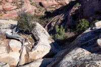
You pick your poison when it comes to entering and exiting the loop. Exiting via Owl is a sure thing. Exiting via Fish requires being able to climb up the 15 foot dihedral-ish section seen below. The rangers advised entering via Owl and climbing out Fish, but I'd take a 'sure thing' exit when tired and beat down over hoping that I'd be able to climb out with a pack on and facing doing the entire route in reverse to get out if I couldn't.
I had brought some rope of my own, but someone had tied off a length and left it. I wouldn't have trusted this at all had I not arrived in time to see a group of five kids using it to come up out of the canyon. These were the only people I'd see for the duration of the trip.
Once past the tricky bit it was a game of 'spot the cairns' and picking a path around the larger drop offs where there was no obvious trail to follow. Some very pretty fall colors greeted me at the canyon floor.
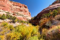
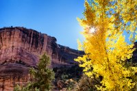
The ranger intel was still accurate. Ample water for nearly the entire length of Fish canyon till the confluence with Owl creek.
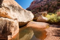
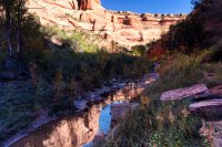
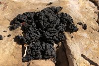
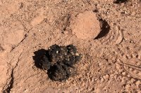
I also saw evidence that the bear report was accurate indeed. I came across a few scat piles loaded with pine nuts and juniper berries as I hiked.
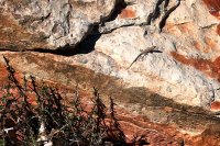
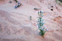
I had seen some pictures of the loop, but for some reason I had it in my head that the scenery was going to be mostly baked and blasted a la the Grand Canyon. This was anything but that. Some sections were sandy and barren, but mostly it was a very lush environment full of trees and plants of all types. I saw many different birds and more chameleons than I could count.
I had hoped to camp at the confluence. My original plan was to then spend the next day hunting around for ruins in the leg of Fish canyon that continues south, but having forgotten my map this was a non-starter. If I learned one thing about Utah backpacking on this trip it's that if you're looking for ruins, every pile of rocks up on the cliffs looks like ruins and probably isn't.
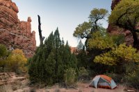
Around 6:00 I called it a day and tried to find a serviceable spot to set up camp for the night. I had put in just under 11 miles total. Slow going overall. There is no trail to speak of, so I took the creek bed where it was the easiest way forward and bushwhacked my way along side it where necessary.
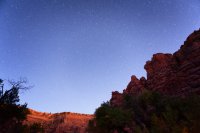
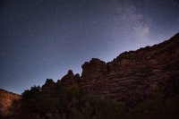
The sun wasn't even set completely before I got my first glimpse of what true dark skies areas have to offer:
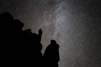
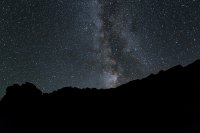
And once it had completely set, the real show began.
I hoped a good night's sleep would refresh my spirit, but I woke up and just immediately started calculating how long it might take to complete the loop and drive back to GJ. I really can't put my finger on it, but my heart just wasn't in it for some reason and if you're not having fun then what's the point?
All research I had done showed this to be a 15 mile loop. I knew I had tracked a little extra mileage the day before wandering around, but I figured it should be no more than 7 miles from camp to the trailhead. I started hiking down to the confluence, which turned out to be about another mile and a half from where I had stopped the night before.
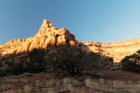
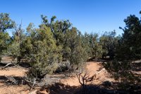
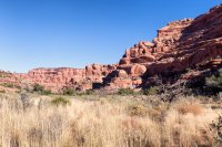
Heading back up Owl canyon would prove to be an entirely more difficult exercise in route finding. The picture below shows a random section of 'the trail'. I would walk a while, stop and check my map, head in the direction where the trail should be (or give up and jump back in to the creek bed). For the most part the trail is overgrown.
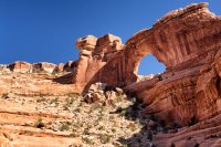
Neville's Arch
More fall colors as I moved further up Owl canyon.
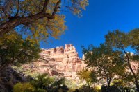
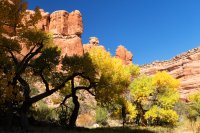
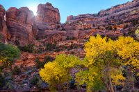
When I passed 7 miles and the map still showed another 3 or 4 to go, I knew I was in for a long slog. The last half of the Owl canyon hike was the toughest hiking I have ever done. Very easy to miss what few cairns have been set up along the way, and following the creek bed is no longer a viable option as it becomes filled with impassable obstacles and deep pools of water. At one point I ended up doing a stretch of straight up slab climbing which I last did while roped up in Kentucky a few years ago, but I could see no other way forward and the map insisted this was the route to take. Only when I had gotten on top of the ridge could I look back down and see one small cairn perched atop a series of large boulders that were apparently the preferred route.
I did finally get to see some ruins near the exit.
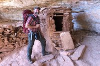
I backtracked from here to find the route up and out. It's a scramble up a long slickrock pour off followed by a steep bit of rough trail and then finally an easy quarter mile hike over a field of slab back to the trailhead. I was pretty well beat and while I shot some more video, apparently I didn't take a single picture of anything along the way.
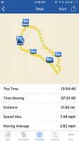
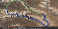
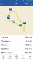
Can't blame the trail for my lack of enthusiasm, but effort vs reward for this one definitely skews towards the 'effort' side of things. The suggestion to do it in three days would certainly make it easier to tackle, and carrying a map of the ruin locations would make for much better 'reward'. My gps also showed it to be a significantly longer hike than advertised (even taking in to account some aimless wandering), though I've started to question the accuracy of the tracks on the inReach and have a support case open with Garmin so I don't know what to believe.
Trip video:
I started off very excited to get out there, then as the time to leave grew closer my enthusiasm waned. My buddy had to drop out at the last minute due to being called in to work. I also forgot to pack a lot of things which is unusual and, looking back, probably another sign that I really wasn't in to the trip. Among the things I forgot to bring were a coat to wear during the very cold evenings I planned to bang around in Grand Junction before and after the hike, various toiletries, and as I discovered on the trail I forgot the map I had printed out with ruin locations marked.
Nonetheless time off is time off and there are worse ways to spend it than driving through Colorado and Utah and spending some time in a tent. I split the 8 hour drive to the trailhead and spent the night in Grand Junction where I had a nice dinner and got some pre-trip intel from @IntrepidXJ . From there it was a few hours drive to the Kane Gulch ranger station to watch the mandatory 'how to behave like a good hiker' movie, pick up my permit and get info on water availability in the canyons. I brought two gallons with me hoping not to have to haul it all in and, based on the week old info the rangers had to share, I decided to carry in half of it just to be safe.
The rangers also shared that someone reported seeing bear tracks in the canyon, something they thought highly unlikely but figured they would pass along the info anyway.
The trailhead is a file mile dirt road drive from the ranger station. I chose to drop in on the Fish side, so I headed off for a mile and a half hike to the rim.

You pick your poison when it comes to entering and exiting the loop. Exiting via Owl is a sure thing. Exiting via Fish requires being able to climb up the 15 foot dihedral-ish section seen below. The rangers advised entering via Owl and climbing out Fish, but I'd take a 'sure thing' exit when tired and beat down over hoping that I'd be able to climb out with a pack on and facing doing the entire route in reverse to get out if I couldn't.
I had brought some rope of my own, but someone had tied off a length and left it. I wouldn't have trusted this at all had I not arrived in time to see a group of five kids using it to come up out of the canyon. These were the only people I'd see for the duration of the trip.

Once past the tricky bit it was a game of 'spot the cairns' and picking a path around the larger drop offs where there was no obvious trail to follow. Some very pretty fall colors greeted me at the canyon floor.


The ranger intel was still accurate. Ample water for nearly the entire length of Fish canyon till the confluence with Owl creek.


I also saw evidence that the bear report was accurate indeed. I came across a few scat piles loaded with pine nuts and juniper berries as I hiked.


I had seen some pictures of the loop, but for some reason I had it in my head that the scenery was going to be mostly baked and blasted a la the Grand Canyon. This was anything but that. Some sections were sandy and barren, but mostly it was a very lush environment full of trees and plants of all types. I saw many different birds and more chameleons than I could count.


I had hoped to camp at the confluence. My original plan was to then spend the next day hunting around for ruins in the leg of Fish canyon that continues south, but having forgotten my map this was a non-starter. If I learned one thing about Utah backpacking on this trip it's that if you're looking for ruins, every pile of rocks up on the cliffs looks like ruins and probably isn't.
Around 6:00 I called it a day and tried to find a serviceable spot to set up camp for the night. I had put in just under 11 miles total. Slow going overall. There is no trail to speak of, so I took the creek bed where it was the easiest way forward and bushwhacked my way along side it where necessary.
The sun wasn't even set completely before I got my first glimpse of what true dark skies areas have to offer:


And once it had completely set, the real show began.


I hoped a good night's sleep would refresh my spirit, but I woke up and just immediately started calculating how long it might take to complete the loop and drive back to GJ. I really can't put my finger on it, but my heart just wasn't in it for some reason and if you're not having fun then what's the point?

All research I had done showed this to be a 15 mile loop. I knew I had tracked a little extra mileage the day before wandering around, but I figured it should be no more than 7 miles from camp to the trailhead. I started hiking down to the confluence, which turned out to be about another mile and a half from where I had stopped the night before.

Heading back up Owl canyon would prove to be an entirely more difficult exercise in route finding. The picture below shows a random section of 'the trail'. I would walk a while, stop and check my map, head in the direction where the trail should be (or give up and jump back in to the creek bed). For the most part the trail is overgrown.

Neville's Arch

More fall colors as I moved further up Owl canyon.


When I passed 7 miles and the map still showed another 3 or 4 to go, I knew I was in for a long slog. The last half of the Owl canyon hike was the toughest hiking I have ever done. Very easy to miss what few cairns have been set up along the way, and following the creek bed is no longer a viable option as it becomes filled with impassable obstacles and deep pools of water. At one point I ended up doing a stretch of straight up slab climbing which I last did while roped up in Kentucky a few years ago, but I could see no other way forward and the map insisted this was the route to take. Only when I had gotten on top of the ridge could I look back down and see one small cairn perched atop a series of large boulders that were apparently the preferred route.
I did finally get to see some ruins near the exit.

I backtracked from here to find the route up and out. It's a scramble up a long slickrock pour off followed by a steep bit of rough trail and then finally an easy quarter mile hike over a field of slab back to the trailhead. I was pretty well beat and while I shot some more video, apparently I didn't take a single picture of anything along the way.
Can't blame the trail for my lack of enthusiasm, but effort vs reward for this one definitely skews towards the 'effort' side of things. The suggestion to do it in three days would certainly make it easier to tackle, and carrying a map of the ruin locations would make for much better 'reward'. My gps also showed it to be a significantly longer hike than advertised (even taking in to account some aimless wandering), though I've started to question the accuracy of the tracks on the inReach and have a support case open with Garmin so I don't know what to believe.

Trip video:
Last edited:

