Favorite map resources

fossana

Member
Joined
Jan 11, 2018
Messages
876
That's pretty much the same list for me - though I don't find myself using Backcountry Navigator much currently and I'm still hanging onto Gaia for now - mostly for snow/winter layers.

I spend way too much time on CalTopo. :lol:

EDIT: I also use InciWeb for fire/smoke info.
 
Last edited:
For trip planning: Caltopo, Waymarked Trails, and GoogleEarth are my primary tools. Each has pluses and minuses. Caltopo has a lot of different map sources, fire history, slope angle shading and so forth. It also has the handy "snap to" feature for laying down potential routes following OpenStreetMap lines. Until extremely recently, it did not have nested folders for organizing your maps; they just added that feature which is very useful. A major downside is editing individual track points is very tedious. It is easy to use street-view in CT and I do that a lot to help determine whether things shown in the map are actually there on the ground, stores for instance, or whether a potential trail access point is public or blocked by a private gate. CT also allows you to cut and join route segments, which inexplicably, GoogleEarth does not.

Waymarked Trails is a very good source for finding established routes in Europe, but less so in the US. You can download gpx tracks easily from the site.

I use GoogleEarth for vetting planned routes. Its Terrain view of satellite imaginary an be very helpful in planning fine details on routes, particularly in making educated guesses as to whether an off-trail route might go or not. It is very easy to edit points in GE and they have long supported nested folder data organization. GE also has historic satellite imagery which is useful as sometimes current imagery of a potential route may be cloud or snow covered.
When designing a route, I primarily use both CT and GE, transferring files back and forth between the two applications as I refine the data to my satisfaction.

In the field, we mostly use Gaia as our basic navigational tool, but rarely use it for planning purposes. Its download maps to track feature is very handy for quickly and easily building a multi-hundred mile route as an off-line database to carry with you in the field.
 
I spend way too much time on CalTopo. :lol:
Same. I am glad they recently added folders, so I can tame the map sprawl. It gets worse or better, depending on who you ask. I keep an outdoor backlog of pre-planned trips with links to my CalTopo maps, point forecasts, USGS flow rates, trailhead driving time, shuttle/permit info, route details, and seasons.
 
Big fan of CalTopo, been using it for many years. I spend a ton of time on it.

Google Earth is pretty handy also, though I often now just use the Google Satellite layer in Caltopo because I can switch seamlessly between a satellite and topo/other map view at a given location, which I have found very effective.

On a mobile device, I still find Gaia GPS to be the most handy, but that's probably because I have also been using it for a long time.
 
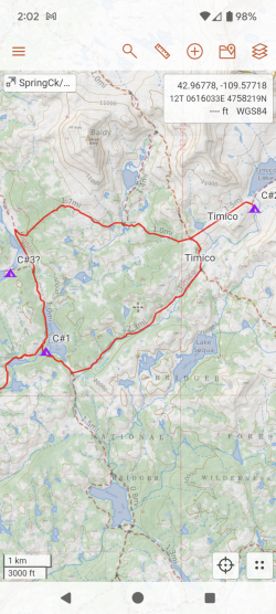
Caltopo and Google Earth for planning. Photos in Google Earth sometimes give me ideas for new views to check out. Download GPS Caltopo map to phone and use Avenza. Only wish I could produce a GPS map in Caltopo using the phone interface, but either not possible or I haven't figured it out yet!
 
I'm also a big fan of CalTopo (my browser has a perpetually open CalTopo tab!). One piece of information I find helpful with Caltopo is overlaying Strava heatmap data in CalTopo to get an idea of potentially interesting off-trail routing. While it's a bit finicky to get this working, I find it worth the effort.
 
Caltopo and Google Earth for planning. Photos in Google Earth sometimes give me ideas for new views to check out. Download GPS Caltopo map to phone and use Avenza. Only wish I could produce a GPS map in Caltopo using the phone interface, but either not possible or I haven't figured it out yet!
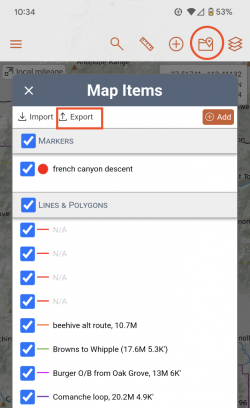
Are you trying to download a GPX file? If so, on the Android app you open the map, then hit the icon that looks like a folder with a pin. The very top of the window has an export option, similar to the web browser interface.

Screenshot_20240202-103450.png
 
Caltopo and Google Earth all you need
 
Are you trying to download a GPX file? If so, on the Android app you open the map, then hit the icon that looks like a folder with a pin. The very top of the window has an export option, similar to the web browser interface.

View attachment 129121
Same question.....Mine only shows to import pics, no maps. Export Burton is grayed out.
 
Same question.....Mine only shows to import pics, no maps. Export Burton is grayed out.
1. Do you have one of your "maps" loaded when you tried? The export is grayed out if there are no data points to export. CalTopo calls a set of user-configured routes, shapefiles, and waypoints a "map", and what one would think of a map a "layer" (e.g. USGS Topos). If you have a map loaded, you will see this icon with the name of your map:

Screen Shot 2024-02-02 at 4.03.26 PM.png


2. What CalTopo plan are you using? It could be a paid feature. I'm on the $20/yr legacy plan. The pricing page is somewhat vague about the exact features.
 
Last edited:
Like most: Caltopo and GE.

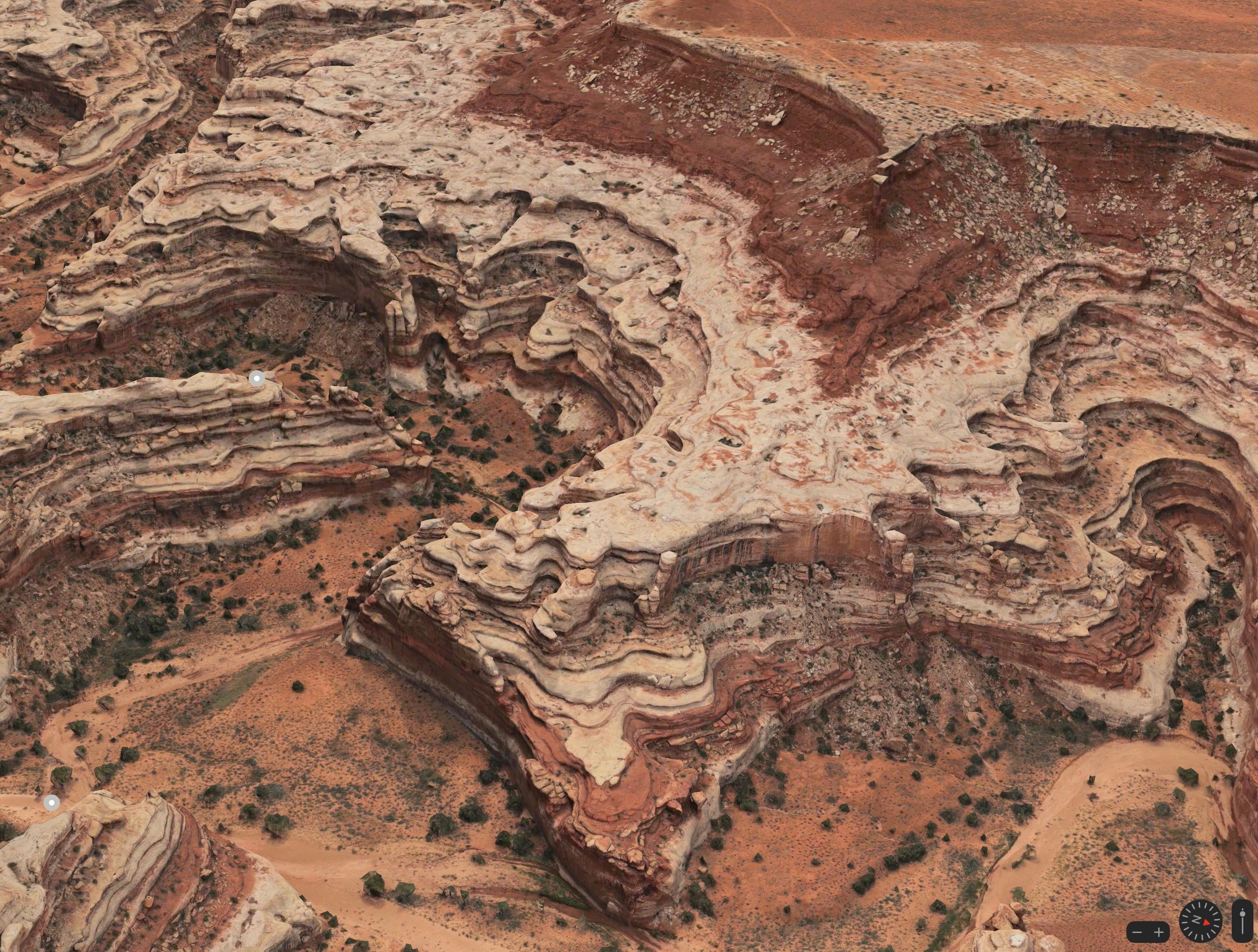
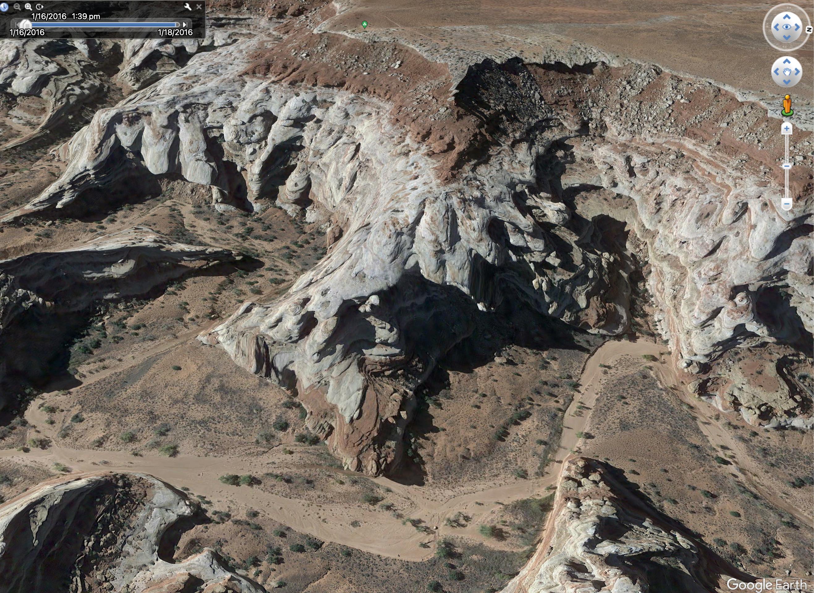
However if you're going to areas where Apple Maps feature their upgraded 3d resolution, use it! It's almost like cheating for route feasibility in the canyons.

Here's a comparison of the Maze Overlook

STuk7ag.jpeg


hGHInwm.jpeg
 
at home, Google Earth and CalTopo, like everyone else

in the field I use OsmAnd, it's the only app I've found that will load up my gigantic KML of routes and points and stuff that I've accumulated over the years in GE, it's more than 50 MB of stuff. I don't love the OsmAnd interface but the other apps I've tried choke on all that KML. If any of you knows for sure of an app that can accept this much KML/GPX, I'm all ears.
Why don't you save in regions instead of all one
 
Like most: Caltopo and GE.

However if you're going to areas where Apple Maps feature their upgraded 3d resolution, use it! It's almost like cheating for route feasibility in the canyons.

Here's a comparison of the Maze Overlook

STuk7ag.jpeg


hGHInwm.jpeg
Wow - this Apple Maps 3D is terrific. I had no idea. Thanks so much!
 
Are you trying to download a GPX file? If so, on the Android app you open the map, then hit the icon that looks like a folder with a pin. The very top of the window has an export option, similar to the web browser interface.
I missed your response. Thanks! I am unable to generate a geo-enabled map for reading into Avenza from the phone. On the PC/Chrome browser it's Print/Generate Geospatial PDF. The print option is not available on the phone/Chrome Browser. So, I end up having to find a library.

PC:
PC_caltopo.png
Android Phone:
Phone_caltopo.png
 
@Bob, now I see what you are trying to do. You're right, that's not an option on mobile web or the mobile app. I even tried configuring a printer on my Pixel to rule that out.
 
Similar threads
Thread starter Title Forum Replies Date
forest dweller Favorite backpacking foods...convenient, easy, delicious, nutritious? General Discussion 20
Ellen What are your favorite spots to hike and camp in December? Trip Planning 10
montanaclimber Americans: where was your favorite international backpacking trip? Trip Planning 25
Mikjik86 Favorite location with no cell phone service General Discussion 56
U Favorite sites in Glacier in North Fork, Lake McDonald or Cole/Nyack? Looking at mid july Trip Planning 2
U Favorite Yellowstone Gallatin Mtn Area Campsite? Looking at WD5, WE7 and that area Trip Planning 5
J Three of my Favorite Things: Hiko Springs, NV. Narrows, peaks, petroglyph hike Hiking & Camping 0
Strawsome Favorite 2-3 day backpacking trip. Trip Planning 8
Parma Favorite Maze Campsites General Discussion 1
D Greetings from Missouri! What are your favorite Hikes in the Sawtooths? Noobs: Introduce yourself! 4
Strawsome What is your favorite hike in the Escalante/Hole in the rock road area? General Discussion 6
RussRDH Returning to my favorite past-time Noobs: Introduce yourself! 1
Nick Album Your favorite shots from 2015 Photography 126
DrNed Your Most Important or Favorite Wilderness Skill General Discussion 42
L Favorite food in the woods General Discussion 6
Nick Album Your favorite shots of 2014 Photography 49
Parma New Favorite Toy General Discussion 2
DrNed Favorite Places To Explore While Floating Labyrinth Trip Planning 38
steve Where are your favorite primitive camping spots near Capitol Reef/Torrey? General Discussion 6
IntrepidXJ My Ten Favorite Photos of 2013 Photography 0
Nick Album Your favorite shots of 2013 Photography 47
Nick Favorite Trips of 2012 General Discussion 9
Dan What's your favorite recipe for cooking backcountry fish? General Discussion 15
Seldom Seen Anderson Favorite Books General Discussion 21
Deadeye008 What's your favorite backcountry lens? Photography 16
W Paper map for Teton Wilderness (Younts Peak) Gear 4
Bob Smoke Map ........ 2023 Trip Planning 24
J Needles Dist 2022 BC Zone Map Resource Discussions 1
kansas Good map of Grand Canyon-Parashant National Monument? Trip Planning 5
Bob Drought map General Discussion 6
fossana Anyone know what happened to the USGS topo map API? General Discussion 12
Bob Map Download for Avenza Trip Planning 0
blueeyes What does this mean on a map? Trip Planning 9
3 Grand Canyon Traverse - Map? Trip Planning 0
N Caltopo map scale for backpacking trip Resource Discussions 7
Artemus Grizzly Bear Expansion Map General Discussion 23
Mike Jones Built a Custom Map Board for protecting my maps while hiking Gear 9
Nick New Snotel Map Resource General Discussion 4
DrNed Map for Coyote Gulch Trip Planning 6
Jammer Across Utah Map Trip Planning 7
Aldaron Trimble Map/Battery Gear 6
Noun Sequitur Weird Map Stuff General Discussion 69
Aldaron Open Street Map General Discussion 5
Nick Uintas Mega Map Trip Planning 28
uintahiker Map Exchange Trip Planning 1
intuitive cat Escalante River System Springs & Surface Water Map Trip Planning 6
wsp_scott GYE resources Trip Planning 42
andyjaggy wildflower resources. General Discussion 2
Bob Resources Section General Discussion 0
Nick New BCP Resources Section General Discussion 11

Similar threads

Back
Top