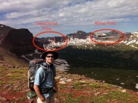
Eric Robinson found at Allsop Lake

Many of the navigation challenges were due to the absolutely decrepit state of the trails and signage of the Highline at this point. The Forest Service has a multi-billion dollar backlog on maintenance and it shows. The second problem is that in the high alpine cirques the trail is completely illegible due to the dozens of sheep trails and lack of vegetation due to thousand plus sheep herds in the alpine that are allowed to proliferate due to lack of range resource enforcement. Quite literally there was no Highline Trail in three or four alpine drainages due this problem. I have documented this and complained to the Forest multiple times.
 
So, after the sheriff's SAR leader sent all the rest of his teams in and the bird was coming back out I told him I was ready to fly in. I had three days of supplies and the wherewithal to search Lambert meadows where some of the worst navigation challenges were and which was my guess as to the most likely problem area but he balked! He wouldn't fly me in and leave me there. He said he had to follow a policy of not allowing anyone to be dropped off in the high country alone. I busted out laughing and reminded him of my just-finished crossing and credentials. So I told him I could spend a day and half trudging up there with my full pack and then he would have only a day of me looking (I only had three days to spare at that point) or he could fly me in and he would get 2 and a half days of my looking.

He called it in to his boss, the sheriff, and they compromised by sending me in with two armed deputies and a promise to be careful. It was my only helicopter flight and I was so glad to ride that elevator back up that steep drainage to my precious high country again. We got out, myself and the two deputies, and were going to look around for a few hours, but they were called nearly immediately to get flown right back out again. They kept grilling me as to why I would stay in such a dangerous place by myself and why I enjoyed such places. They were pretty spooked (understandable maybe since we were looking for a lost soul) and by the time they lifted off they started getting me a little spooked. ;)
 
Last edited:
Anyway, I spent awhile searching Lambert Meadows, found a 1200 head sheep herd ruining the upper hidden cirque (I know because I met the Peruvian shepherds and could get that much info out out of them) and ran up to Squaw pass with no sign of Eric. I was exhausted and a little dejected by then so I limped out down the drainage.

I was stopped on the trail trying to get up enough energy to pump water and finish the hike when I heard voices coming down the trail. It was trail runners and it turned out it was my friend and his two companions. They had been airlifted in a day or two after me and ran the south side of Lambert Meadows in the timber looking for Eric and were just running out.

Warmed me up and energized me to see my friend, and all the community for that matter, rally to look for this lost soul. Rest in peace Mr. Robinson and "be well" his wife and daughter whom I can no longer remember their names.

I really hope I meet my end in the High and Wild this way instead of in my cubicle. I hope he didn't suffer much.
 
Last edited:
Here is a panoramic photo taken from Allsop Pass by the Provo Bros on I believe August 17, 2011. It's not particularly high resolution as a flash file, but it gives the best idea of what it was like, though at least a week if not 10 days after Eric would have crossed.

There was even snow on top of Allsop Pass.

https://dl.dropboxusercontent.com/u/35623148/greatbasin_ridge_pano_out.swf
 
Glad they finally found him. Certainly off route out there for sure. Nice work Dan. You helped give his family closure.

One theory I have not seen entertained, and this is just from my avy training, is how dangerous wind cornices are. If he happened to try to cross one on that ridge and he was in the soft zone of the cornice, it could have collapsed and sent him to his death. I have been on ridges where the wind has put up 15 foot tall wind cornices, and they will not support your weight. I wonder if one of these played a factor in his fall? I know how deep the snow was 10/11 season. We were riding until the 4th of July on the boards that year. So you know how big the cornices were that year as well. Just a thought, and for sure if he went too far out on one of those, it would have been fatal if that was over one of those cliff bands. #2cents
 
An interesting email I received following publication of my KSL story last weekend (posted with permission of the author):

My brother-in-law and I started on the Highline Trail at Chepeta Lake the day before Robinson did in 2011. We stuck to the trail, going over Red Knob Pass. We went up Dead Horse pass a couple of days before Robinson must have arrived at the base of the pass. Going up Dead Horse pass was perhaps the most terrifying thing I have ever done. The trail was completely covered in snow and we didn’t see the trail until we stumbled across it near the very top of the pass. The only way up the pass was to use our hiking sticks like ice axes and go straight up the snow field. We weren’t equipped for snow, so it was terrifying. So it seems likely to me that your speculation was correct—Robinson probably saw that snow field and didn’t think he could make it up Dead Horse and decided to go over Allsop pass instead.

The snow on the high passes created several terrifying experiences on that trip. Coming down off of Anderson pass was almost as scary as going up Dead Horse. We ultimately weren’t even able to finish. Rocky Sea Pass, the westernmost pass on the Highline Trail, was so thoroughly covered in snow that we had go south out of the drainage on the east side of Rocky Sea and hitchhike our way back to Salt Lake.

All the best,

John Morley
Professor of Law
Yale Law School
John Morley! My brother was/is good friends with that guy. Small world.
 
....we didn’t see the trail until we stumbled across it near the very top of the pass. The only way up the pass was to use our hiking sticks like ice axes and go straight up the snow field. We weren’t equipped for snow, so it was terrifying. So it seems likely to me that your speculation was correct—Robinson probably saw that snow field and didn’t think he could make it up Dead Horse and decided to go over Allsop pass instead.

Fascinating. Also surprising to hear that Rocky Sea was even worse. Wild.
 
So you know how big the cornices were that year as well. Just a thought, and for sure if he went too far out on one of those, it would have been fatal if that was over one of those cliff bands. #2cents

Seems very unlikely given the convex and broad nature of Allsop Pass. There is obviously a small cornice that formed on the east side of Allsop in 2011, but not significant from the Provo Bros photo, with zero chance of exposure. The cliffs he likely fell from were probably 200 vertical feet below the actual saddle, and wouldn't be capable of wind loading that would build a cornice. It is possible the couloir still had snow in it though, which again just complicates the potential decisions.
 
Seems very unlikely given the convex and broad nature of Allsop Pass. There is obviously a small cornice that formed on the east side of Allsop in 2011, but not significant from the Provo Bros photo, with zero chance of exposure. The cliffs he likely fell from were probably 200 vertical feet below the actual saddle, and wouldn't be capable of wind loading that would build a cornice. It is possible the couloir still had snow in it though, which again just complicates the potential decisions.

Interesting. If you think he was descending a snow filled couloir, and it was late in the day, maybe he was flushed by a wet avalanche. I think no matter what, the late snow pack we had that year had to have something to do with it either altering his route or caused an accident. My friends were skinning Mt Watson on July 10th that year and they said there was a ton of cornice falls and wet avalanches. So the potential was there.
 
Not sure I follow. I am not suggesting he went down the couloir at all. His backpack was found at the base of the cliffs a few hundred yards north of the couloir. Most likely scenario is he was trying to find a route down through the cliffs when he fell, there is no evidence to suggest there was a catastrophic snow event like a cornice break or avalanche.
 
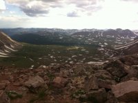
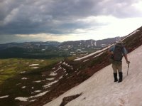
Follow up from my previous email post... Adam Stewart and John Morley sent along some photos showing what the conditions looks like in WFBF at about the same time Eric would have passed through. There's a pretty good cap of snow on top of Allsop Pass.

Dead Horse Pass looks like a straight-up nightmare.

image.jpeg image.jpeg image.jpeg
 
Back
Top