Dripping Canyon to Grand Gulch, Cedar Mesa, Utah - March 2022

TrailScot

Member
.
Joined
Dec 2, 2019
Messages
137
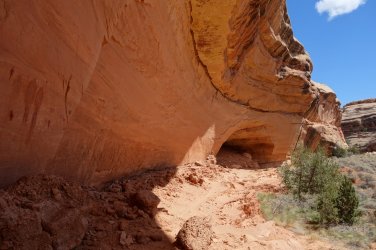
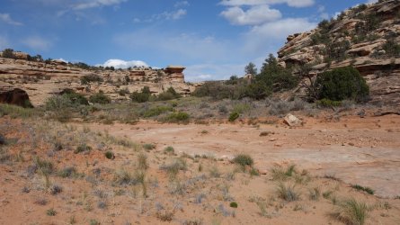
I recently used Dripping Canyon on Cedar Mesa to access some interesting rock-art panels and archaeological sites close to Grand Gulch. I parked next to Highway 276 and hiked cross-country across the mesa. I then descended into Dripping Canyon via a small side-drainage, and then hiked to Grand Gulch. I later exited Dripping Canyon by a different small drainage, and crossed Cedar Mesa to get back to my vehicle. I did this as a long day-hike.

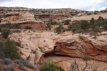
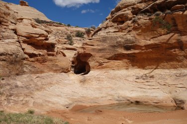
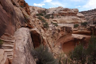
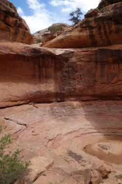
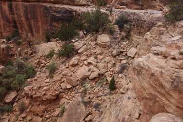
I wasn't entirely sure that Dripping Canyon would provide access to Grand Gulch, due to the pour-offs in the main drainage. However, the final 'impassable' dry-fall, one mile from the Gulch is, in fact, crossable via a narrow exposed ledge and a steep, but secure, rubble slope. The 3 feet wide ledge initially looks intimidating, but it is short and relatively easy to navigate, with care. The other pour-offs, further up the canyon, are easily bypassed.

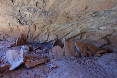
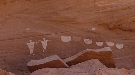
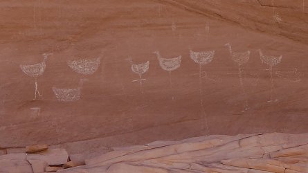
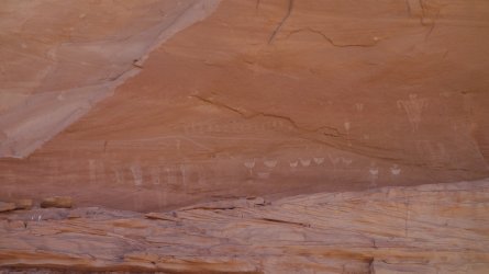
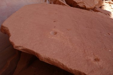
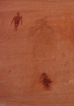
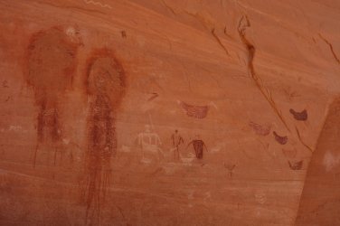
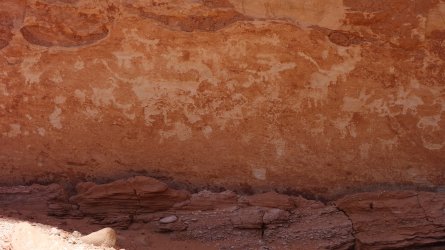
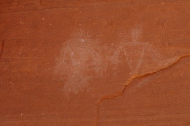
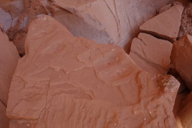
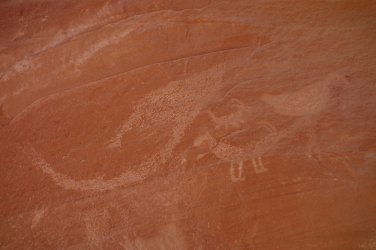
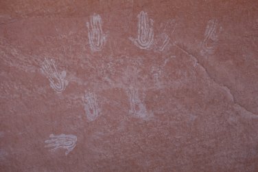
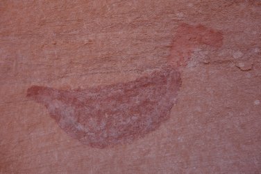
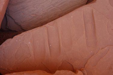
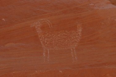
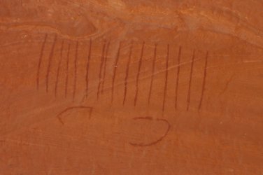
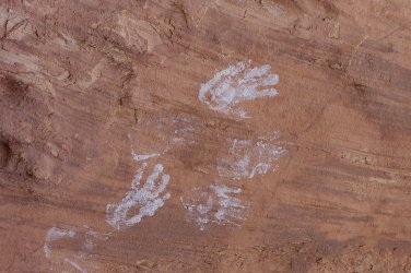
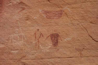
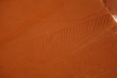
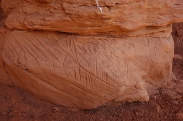
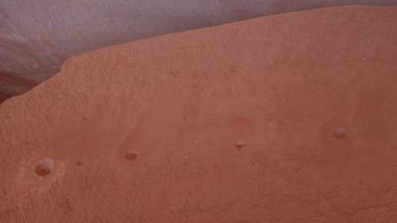
The main site I visited was fascinating, with several panels comprising numerous petroglyphs and pictographs on a steep rock-face. The large rocks at the base of the cliff were covered in many scratches, gouges, grooves, and notches. The most interesting was perhaps a flat rock with several metate-like 'smoothed' areas, each with a gouged hole, that were joined together by narrow scraped lines. There is such a plethora of things to see at this site, that perhaps it was visited by different groups of the Ancient Ones at different times, over the centuries. And, if this is the case, why here, at this particular cliff-face, I wonder ?

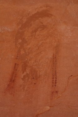
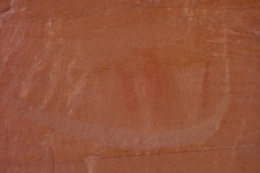
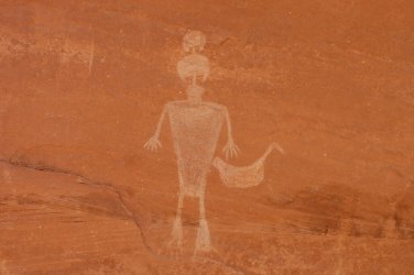
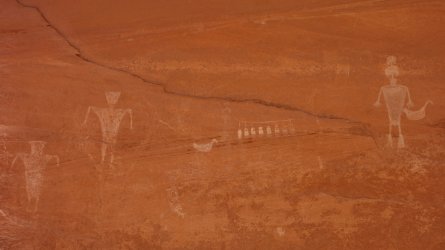
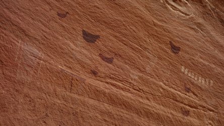
Also fascinating were 4 large pictographs that appear to have possibly been crudely 'covered-up' at a later point. It's difficult to be certain, but it appears that at least 2 of these images contained jewelry or head-dress adornments. I wonder if it possible that these 4 images were originally in the style of the 'Faces' pictographs (of which there are several in the Needles District of Canyonlands National Park) but were literally defaced by later visitors. I don't know Grand Gulch particularly well, but I'm not sure that there are any typical 'Faces' pictographs in this area. Why would they want to partially destroy these images ? It is, as always, one of the wonderful mysteries of the South-West and its original inhabitants.


Dripping Canyon
DSC00153_20pc.JPG
.
.

Obstacle #1
DSC00147_20pc.JPG
.
.

Obstacle #2 - deep pot-holes
DSC00144_20pc.JPG
.
.

Ledge and steep rubble slope next to final high pour-off
DSC00133_20pc.JPG
.
.

Exposed ledge
DSC00131_20pc.JPG
.
.

Pour-off
DSC00127_20pc.JPG
.
.

DSC06197_20pc.JPG
.
.

DSC06203_20pc.JPG
.
.

DSC06214_20pc.JPG
.
.

DSC06220_20pc.JPG
.
.

Gouged holes in flattened surfaces on rock, with scratched lines joining the holes
DSC00047_20pc.JPG
.
.

As above
DSC00071_20pc.JPG
.
.

Defaced (?) pictographs
DSC00083edit.jpg...DSC00038_20pc.JPG
.
.

More 'damaged' panels
DSC00041_20pc.JPG
.
.

DSC00012_20pc.JPG
.
.

DSC00020_20pc.JPG
.
.

DSC00056_20pc.JPG

.
.

DSC00044_20pc.JPG
.
.

DSC00059_20pc.JPG
.
.

DSC00068_20pc.JPG
.
.

DSC00074_20pc.JPG
.
.

DSC00080_20pc.JPG
.
.

DSC00078_20pc.JPG
.
.

DSC00086_20pc.JPG
.
.

DSC00091_20pc.JPG
.
.

DSC00101_20pc.JPG
.
.

DSC09983_20pc.JPG
.
.

DSC09995_20pc.JPG
.
.

DSC09992_20pc.JPG
.
.

DSC09964_20pc.JPG
.
.

DSC09953_20pc.JPG
.
.

DSC09908_20pc.JPG
.
.

DSC09998_20pc.JPG
.
.

DSC00107_20pc.JPG
 
Very cool, so much great stuff to see in that area! Congrats on making a plan that worked and finding such an interesting assortment of rock art.
 
Green mask in GG is similar to the "Faces" ... only one I really know of.
 
Nice GG plan! I bet that ledge got your attention :eek:. I had trouble just watching the ledge photo, ha! Thanks for sharing.
 
Last edited:
Nice GG plan! I bet that ledge got your attention :eek:. I had trouble just watching the ledge photo, ha! Thanks for sharing.

Thanks ... hee, hee :lol: ... yes, I definately did have to think twice about traversing that ledge ... I am no fan of exposre, at all ... but, since I was so close to reaching Grand Gulch, the adrenaline kicked in, and I had to go for it ... then, a few minutes later you remember that you need to return the same way, later in the day :) ... but, honestly, it really isn't that bad ...
 
Hi TrailScot,

It's cool to see photos of this remote canyon I love and visit each year! I have worked in the Bears Ears region since 2012, and have seen a lot of people seeking obscure rock art and structures in far-remote canyons because of photos they've seen online. I've noticed, and rangers I work have confirmed an increase in looting in the past few years, and trails forming to ancestral sites where more carful footsteps (on slickrock or in non-crypto drainages) would keep the sites more hidden. In light of this, I'm writing to request that you take down your photos of rock art in the area.

I think it's fine to post route-finding photos and to say that there is rock art in the area. I also know that the combined communities land managers, non-native guides (like myself), and native people who use this land see that increased photography online is not contributing to increased care for the land. On the contrary, as visitors increase, we see a struggle to educate people on how to care well for fragile historical and ecological elements of the land. I hope you'll consider that for some of these magical-feeling places like hidden structures and rock art alcoves, part of the joy is in the mystery, and that removing photographs of cultural pieces of the landscape can help protect the land and its history.

Thank you for your consideration!
Jeff
 
Sorry, my feeling/opinion is this is another..... This is a private viewing museum..for only those in the know. More traffic is inevitable as the Earth's population increases. A pic does not say where it's located. The actual monument, park or wilderness designation does a lot more bringing in additional people than pics. I think you'll find on this forum most pics do not give away much...

I'll give you, that you asked without the usual hard a** way.. that is appreciated. But in the end it is the people's land as well, we are all Americans...

As for me don't ask me to remove things.... I won't. What others do is up to them.... My 2cents.
 
Similar threads
Thread starter Title Forum Replies Date
CavalryRoadie Hey, from Dripping Springs, Texas... Noobs: Introduce yourself! 1
J Reflection Canyon Trip Planning 3
fossana Found: prescription glasses near the top of the Flipoff Canyon approach General Discussion 5
Spud Salt Creek Canyon question Trip Planning 11
B Buckskin gulch/Pariah canyon Carpool Trip Planning 0
TractorDoc Paintbrush Canyon / Cascade Canyon Loop -- Grand Teton NP September 11, 2023 Hiking & Camping 9
Kullaberg63 15 day canyon route Backpacking 13
Titans Tricked in the canyon! Hiking & Camping 5
TrailScot Dayhiking the Under-the-Rim Trail - Bryce Canyon NP - October 2023 Hiking & Camping 4
Janice Such a GRAND Canyon - Deer Creek / Tapeats / Thunder River Backpacking 21
M Mee/Knowles Canyon Loop, Grand Junction Colorado Backpacking 4
OldBill Short hike at the Grand Canyon of Pennsylvania Hiking & Camping 1
S Paria Canyon- Whitehouse to Lees Ferry, Oct 18 to 21, 2023 Trip Reports 0
scatman Yellowstone's Thorofare, Headwaters of Thorofare Creek, Majo Pass, Younts Peak, Bob's Canyon, and Cub Creek - August 9, 2023 - Days 7 through 10 Backpacking 34
scatman Yellowstone's Thorofare, Headwaters of Thorofare Creek, Majo Pass, Younts Peak, Bob's Canyon, and Cub Creek - August 9, 2023 - Days 1 through 6 Backpacking 56
A Bowdie Canyon Trip Planning 10
TheMountainRabbit Silas Canyon (Popo Agie Wilderness) - August 2023 Backpacking 3
J Paria Canyon - One Day Trail Trip Planning 10
Bob The New Grand Canyon Trip Planning 1
WhozWutz Invite Horse Canyon Needles Meet Up (Members Only) 1
BJett Part 3 - Tour de Canyon Country. Lower Escalante Loop Hiking & Camping 0
BJett Part 2 - Tour de Canyon Country. Swell Times Hiking & Camping 0
BJett Part 1 - Tour de Canyon Country. Cedar Mesa. Hiking & Camping 8
Gretchen Millward Trachyte Creek via Woodruff Canyon, April 2023 Backpacking 9
F Grand Canyon hermits rest to granite rapids to bright angel Trip Planning 10
gnwatts Stillwater Canyon On The Water 11
shredhiker Kings Canyon July 2022 Kearsarge, Rae, & Sixty Lakes Backpacking 8
J Info needed: Bown's Canyon, Long Canyon Trip Planning 8
Gretchen Millward Cheesebox Canyon, Oct. 2022 Backpacking 14
Stickerbumper Fold Canyon Middle Exit Trip Planning 9
Janice Professor Creek / Mary Jane Canyon - mid April? Trip Planning 0
D Horseshoe Canyon or San Rafael Swell? Trip Planning 9
scatman North Ridge of City Creek Canyon - February 4, 2023 Hiking & Camping 17
scatman South Ridge of City Creek Canyon - January 28, 2023 Hiking & Camping 4
NorthwestWanderer 8 Day High Sierra trek : Humphreys Basin, Star Col, Granite Park, Lake Italy & Piute Canyon 6/25-7/2/22 Backpacking 7
T Amazing Discovery in Utah-Glen Canyon Trip Planning 65
Titans What’s your unfinished business? Hard canyon access, mtn peak, you name it! General Discussion 54
SteveR Big Spring-Elephant Canyon dayhike. With free bonus vacation pix! Hiking & Camping 13
Stephanie B Dirty Devil River Impassible at Poison Springs Canyon Off Road 0
LarryBoy Is there anything technical in White Canyon above the Black Hole? Trip Planning 16
dennisrodman A week in the Grand Canyon / Boucher / Hermit / Tonto Trail Trip Planning 4
XID_AZ Kanab Creek Wilderness - Sowats Canyon - Mountain Sheep Spring Trip Planning 6
travel2walk Yellowstone: Bechler Canyon, Aug 12-15 2022 Backpacking 21
balzaccom Mok Canyon Solitude for my birthday Backpacking 0
XID_AZ FiftyMile Canyon Sand slide Trip Planning 8
chandlerwest Hells Canyon - Jet Boat On The Water 0
futurafree Grand Canyon norovirus General Discussion 6
H location of thirteen faces-horse canyon Utah Hiking & Camping 4
Bob Teton Canyon Bear General Discussion 3
scatman Big Willow Canyon - June 11, 2022 Hiking & Camping 33

Similar threads

Back
Top