Kullaberg63
Member
- Joined
- Mar 6, 2014
- Messages
- 659
Inspired by our late fall walk of Allen’s Escalante Overland we designed a route of similar scope centered around the Dirty Devil river. 125 miles long it took twelve days from hwy 95 just south of Hanksville to end of the Orange Cliff’s road near Hite.
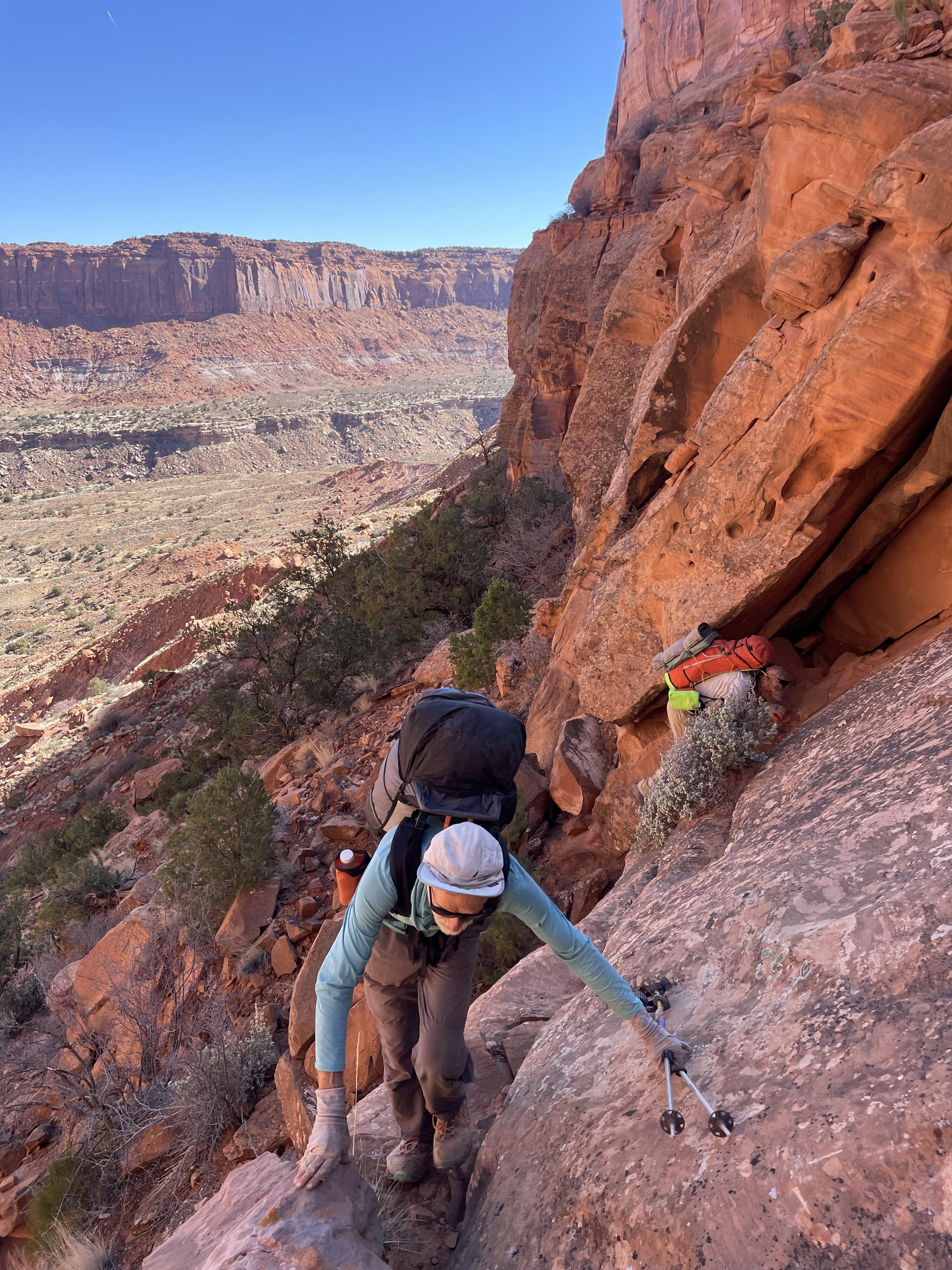
The desert ‘overland’ idea as seen in Allen’s classic Escalante version is fundamentally to work against the natural flow of the terrain, ie crossing canyons instead of hiking along their bottoms to achieve the greater goal of a point-to-point along a major feature - here a river. This is more challenging on all levels: Pre-planning, on the ground navigation, steeper terrain, more exposure, slow going with potential rope work. But also far more rewarding for those inclined to adventure.
We used portions of Allen’s DD North and South, plus plenty of home grown bits and pieces. From the barren clay hills up north into the Roost’s white slickrock and onwards to the deep canyons of No Man, Larry, Twin and Sam’s to finally enter the overwhelmingly big terrain around Happy and the Blocks, this route was as varied of terrain as possible, and full of difficult passages. Typical speed was around 1-2 miles per hour, and we saw nobody else until road walking at the end of day 11.
By following the overland ethos one limits travel at the straight forward river level. In the layered geology of Utah canyons the hiker needs to access the mid level benches, exposed and narrow, to assemble a pure overland route. In this area these ledges are mostly found between the towering Wingate walls below and the huge alcoves of the Navajo domes. In one segment we traveled on such a bench for almost 24 hours including an overnight camp. They are seldom the cruiser slrickrock highways of the Escalante region, but altogether not too bad,
Water availability was a never ending concern the entire length but became pretty serious approaching the southern end, despite rain and snow early on in the trip. It could have gone bad was it not for some really good luck pared with careful planning based on many prior trips with little water.
It rained/snowed a decent amount during three nights in the beginning or else we probably would have bailed for lack of water. Some days we stopped and camped around midday because we found water and feared the next source would be ten hours or more away.
This region is much drier with shallow quick drying potholes compared to the Escalante from Moody south. Each of us had the capacity to carry a gallon - while more would have helped the added weight to already heavy packs seemed untenable in this kind of terrain
Gear:
We had about 18-22 lbs of food each, and 8 lbs for the dog of which he carried four at most. Only brought isobutane for 50% percent of the cooking, relying on twig stoves for the rest.
I sustained fine on 3250 cal/1.45lbs per day, which focused on stuff I like over a perfect fat/protein/carb balance. Highlights included 16 oz of heavy cream powder, Fritos and Digestives. Dinners were identical all 11 nights, which I know doesn’t bother me: 80g couscous, 35g soy nuts, 10g nutritional yeast, 30g butter, 3g salt and red peppers, 10 gram red miso gel
We used 70’ of thin 5mm line to haul packs and dog plus some belaying.
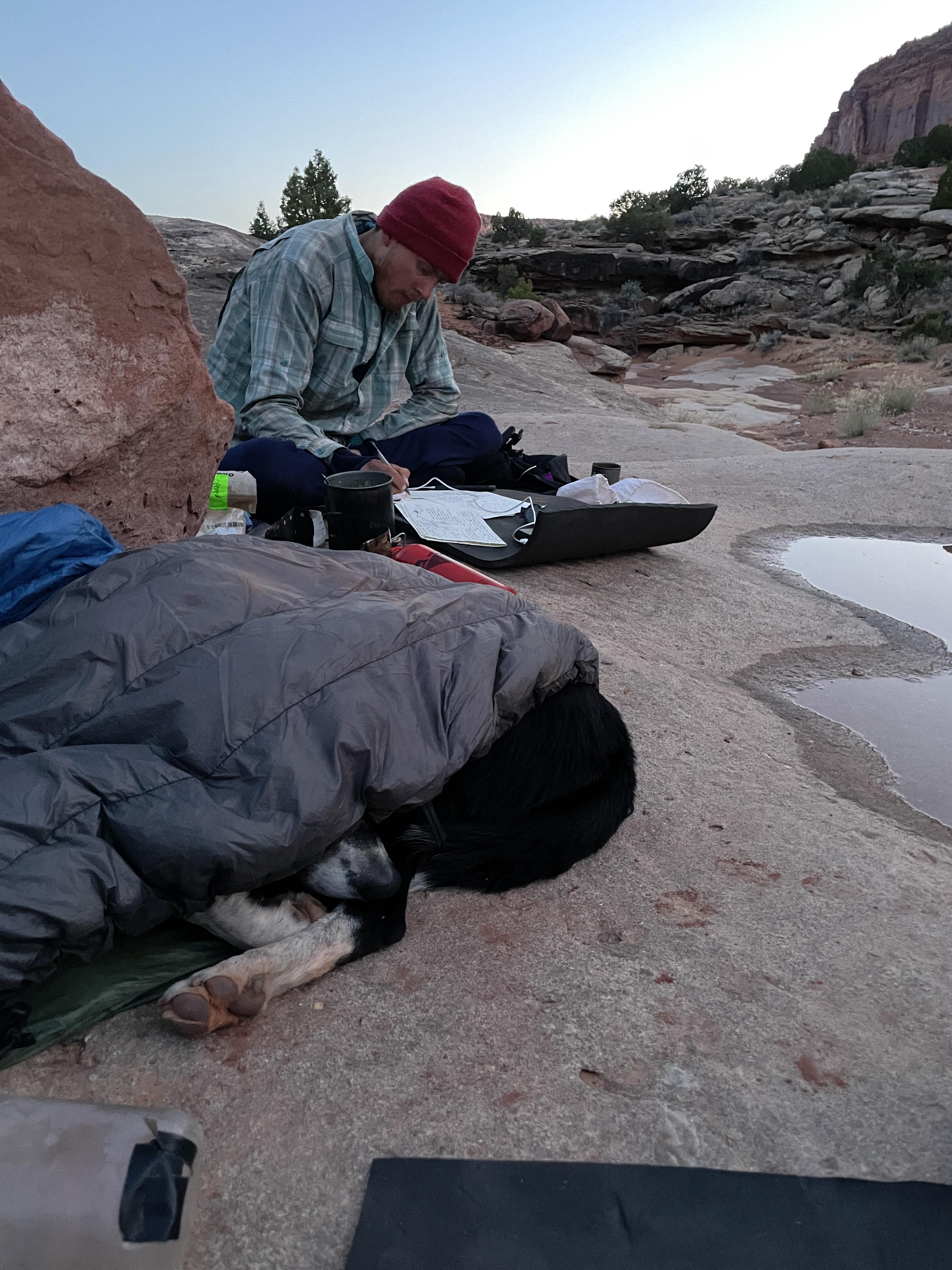
The three of us and the dog shared a 9x9 floor-less silnylon mid to keep the weight down. Still the packs were 40-44 lbs plus on day one.
It was 28°F one night, otherwise mid thirties. We all used hood-less and zipper-less down bags of our own make. As light but warmer than equivalent quilts we have now for many seasons come to appreciate the draft free sleep and minimal fiddling and rearranging of fully enclosed bags. Adjusting these to a wide variety of conditions is simple to achieve by layering clothes
On this trip we experimented with VBL liners, both traditional and sewn-in. One of us to push a 45°F/12 oz bag to its limits, another because they are a cold sleeper. We also used a hooded bivy overbag of simple DWR ripstop lined with 60 GSM Alpha Direct to mitigate dew, dampness and top entry drafts when cowboy camping. Interesting data points were logged.
By now I’m set on the utility of a 3mm foam pad combined with an inflatable in the ground insulation system but frustrated with the overall durability of the available options. Last summer we sourced a higher density 3mm version made of genuine Evazote EV50 which has proved amazing. The weight penalty is minimal while the rebound and tear strength is many fold improved. Having this tough and light (120g) pad as ground protection for the inflatable is great in the floorless tents I use, and for cowboy camping. It’s handy to pull out for lunch breaks and naps, and for sitting around cooking at night.
Our packs were the latest interpretations of the ‘plateau pack’, a concept we have been improving for routes lying between the Hayduke and technical canyoneering: Rugged and sturdy; a rigid and more supportive carrying system than is typically needed in the UL world; strong haul loops; big focus on water access and balanced distribution while keeping bottles in place when tossing the packs around. 65 liters is the sweet spot for long trips and 1500-1600g empty is acceptable given the benefits.
Fabric durability again showed Cordura outperforming Ultra Weave, despite theoretical numbers tempting to assume the opposite. Pack bottom and pockets receive most of the abuse but we now have the details worked out to increase the longevity in these areas.
Alpha Direct garments are here to stay with their unbeatable warmth to weight ratio. Again for the third ten day plus trip I enjoyed my Alpha lined wind shell pullover of about 7 ounces, but this time it was too mild to bring the equally high utility pants of the same design.
The dog is doing well on these outings, no doubt due to learned experience: at ten years old he’s logged hundreds of days in backcountry. He trusts we will keep him safe when lowering and hauling on steep cliffs; and knows how to tip toe thru fields of cacti. His paw pads can get tender from abrasive slickrock, but I know how to tape them instead of using clumsy booties.
More pics and short video segments here
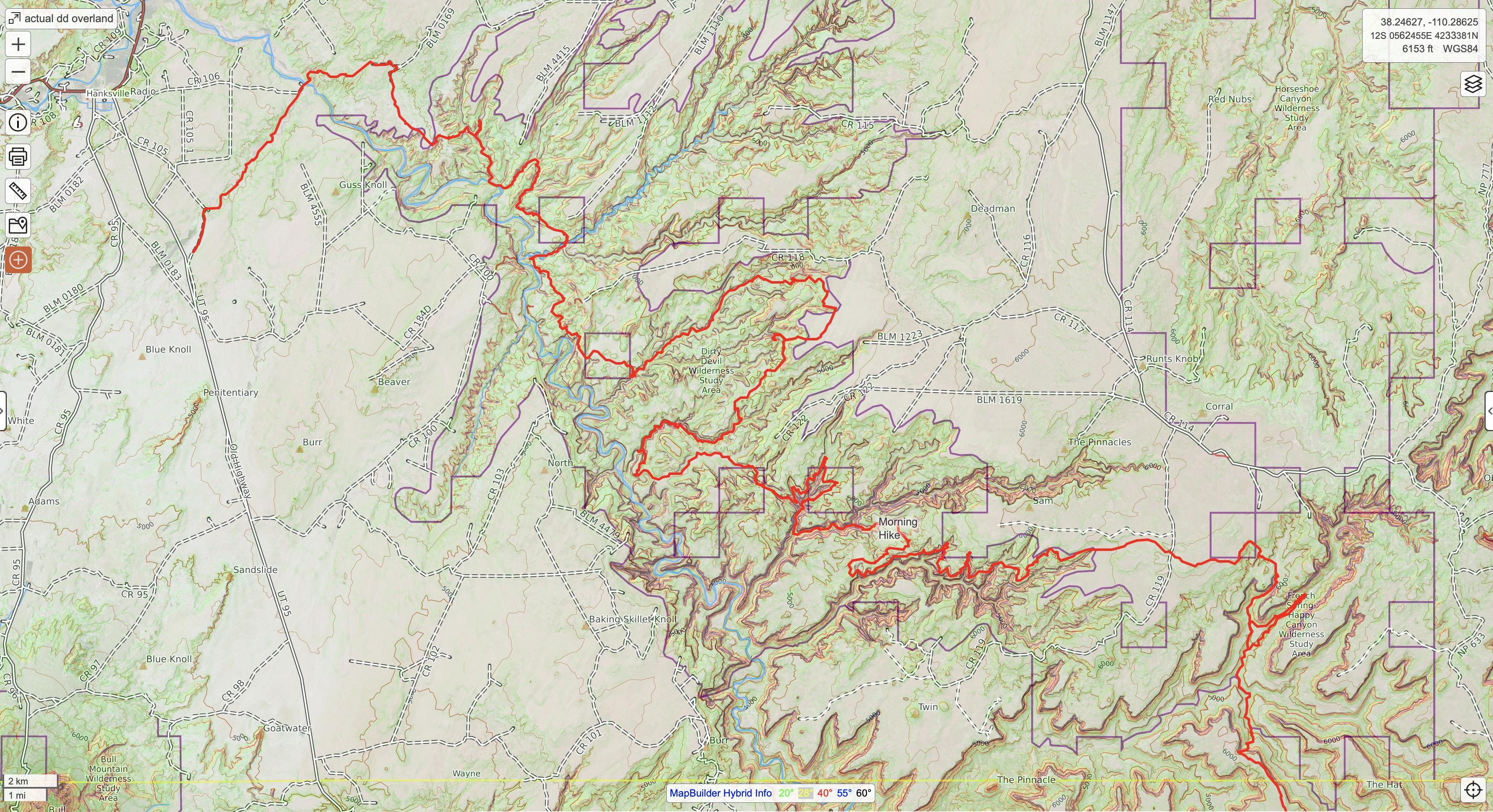
Northern Half
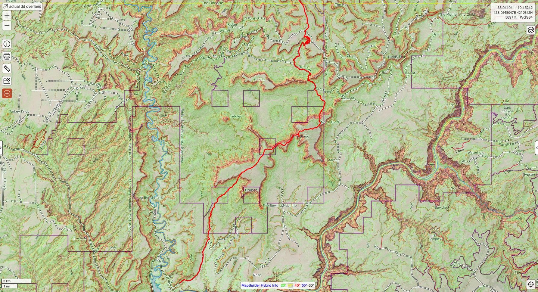
Southern part
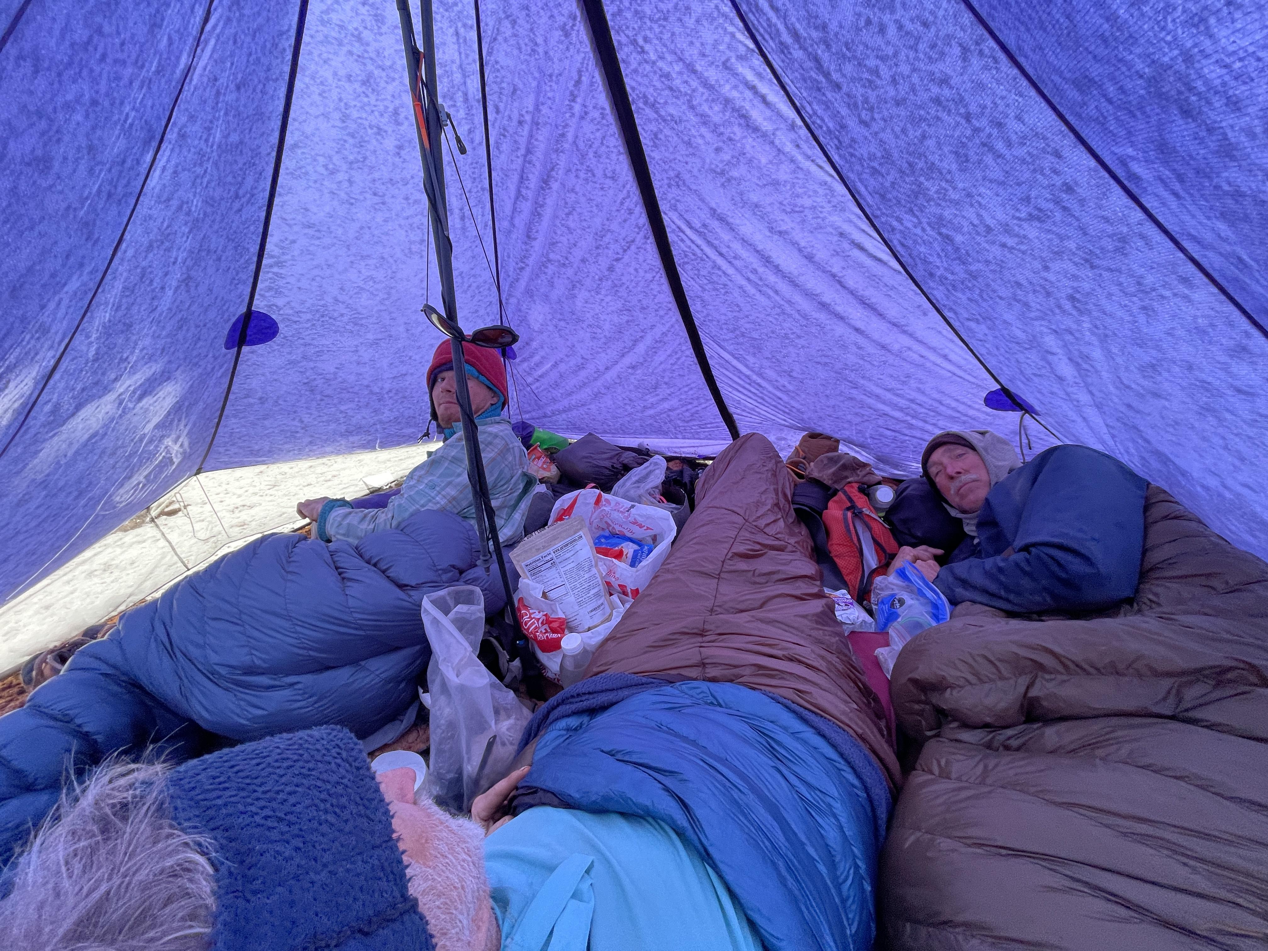
Late start on a snowy morning
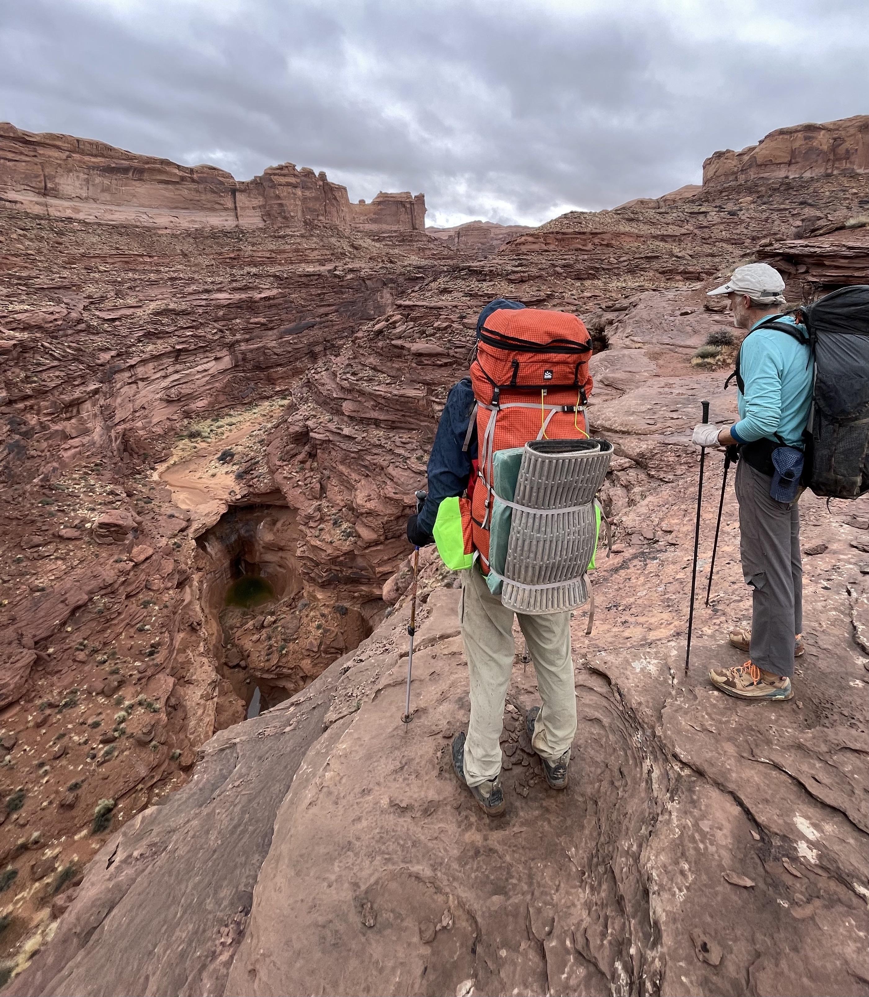
Larry cny
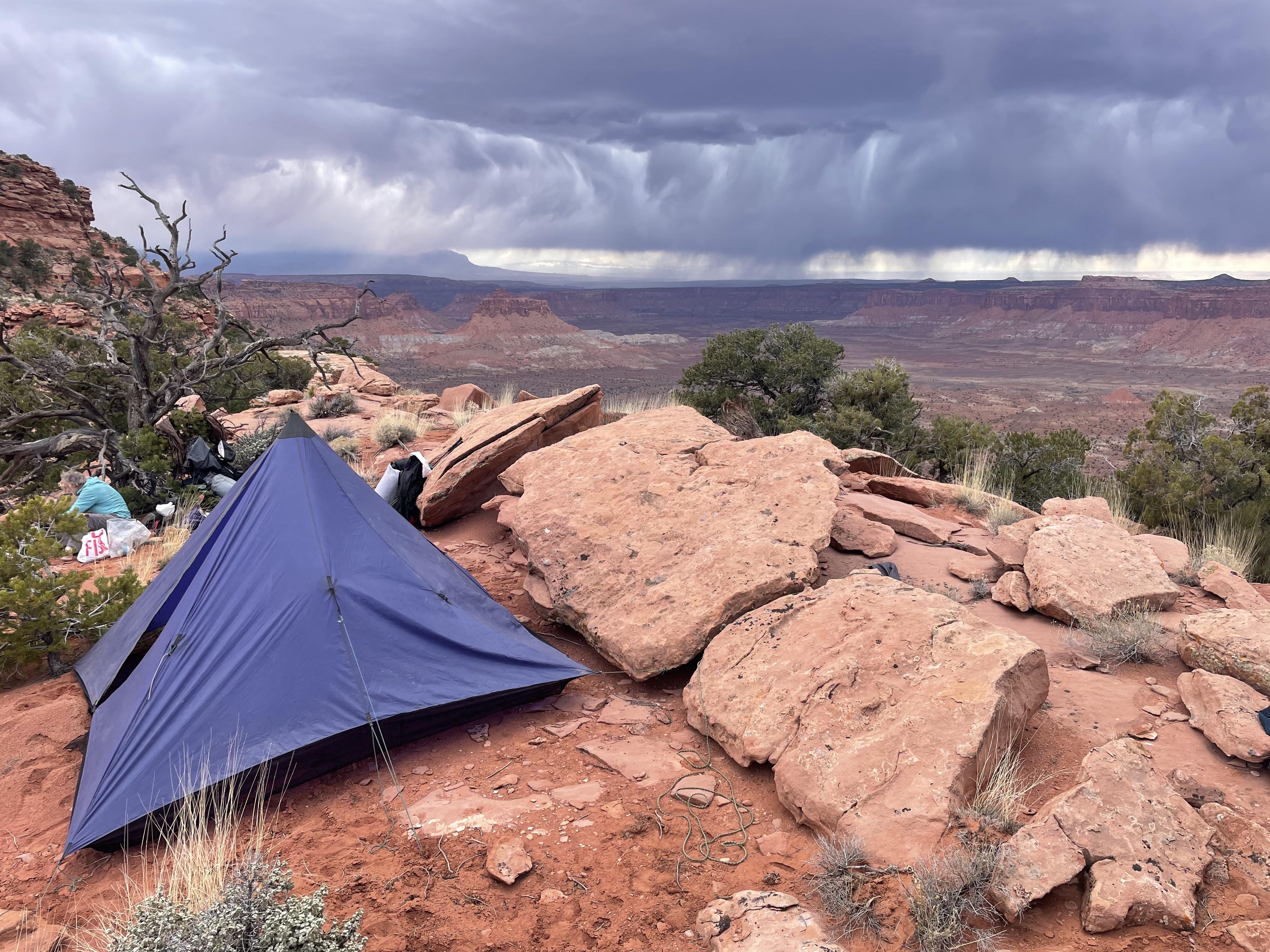
Virga then later the real deal
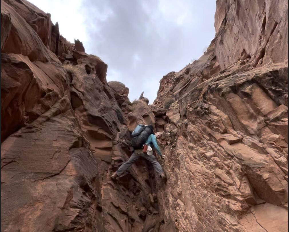
Lots of this
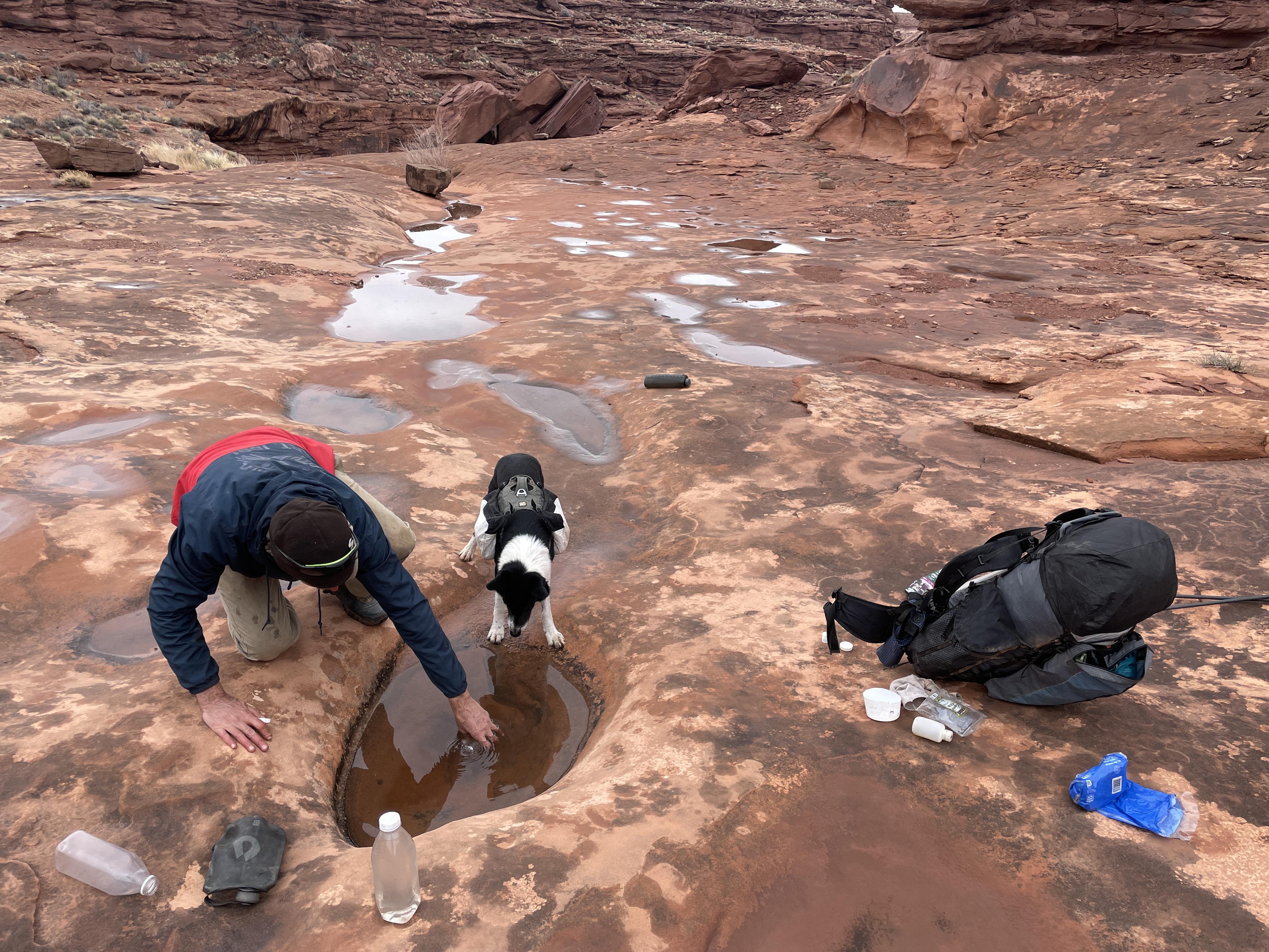
After rain
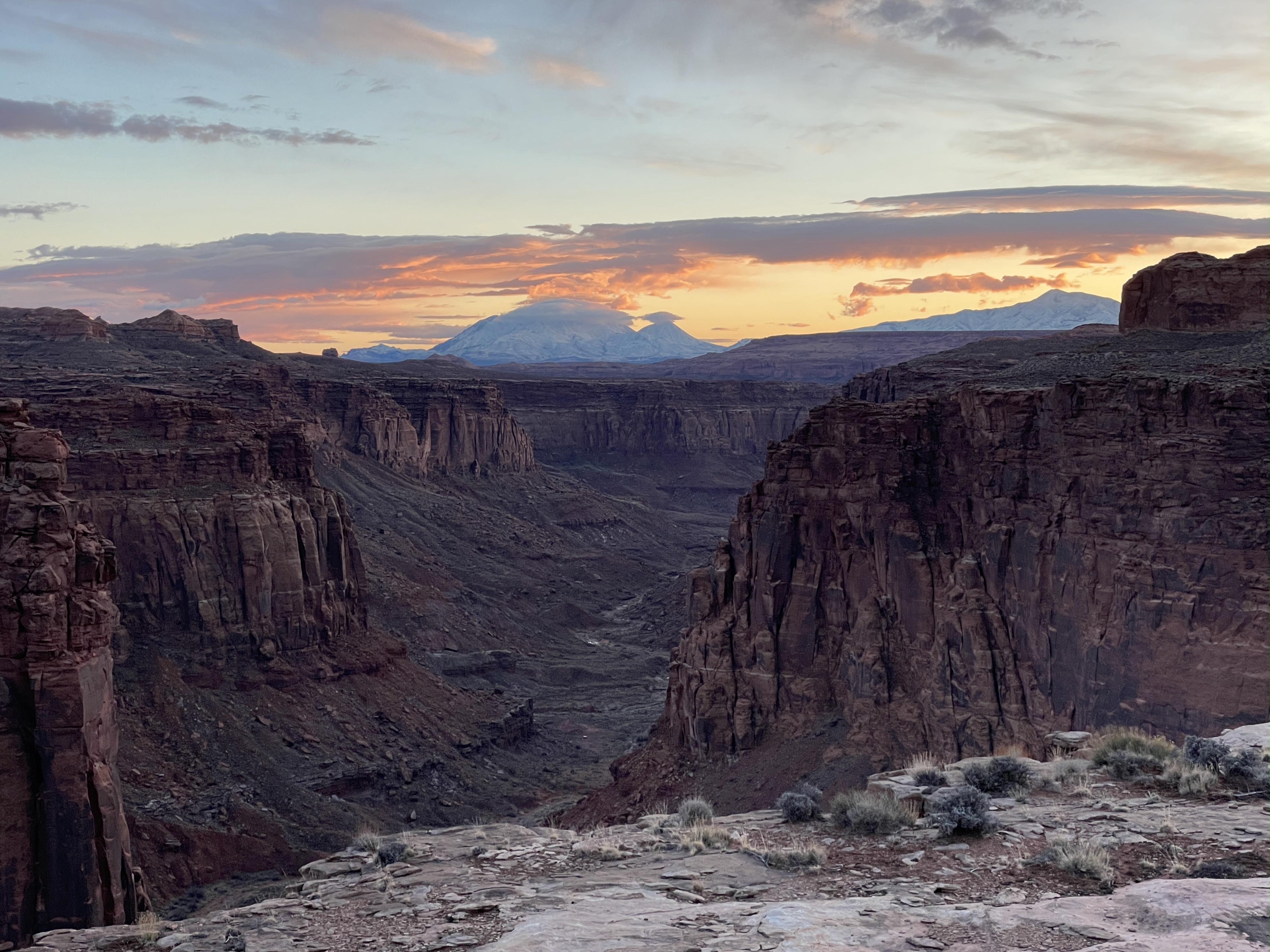
Sams
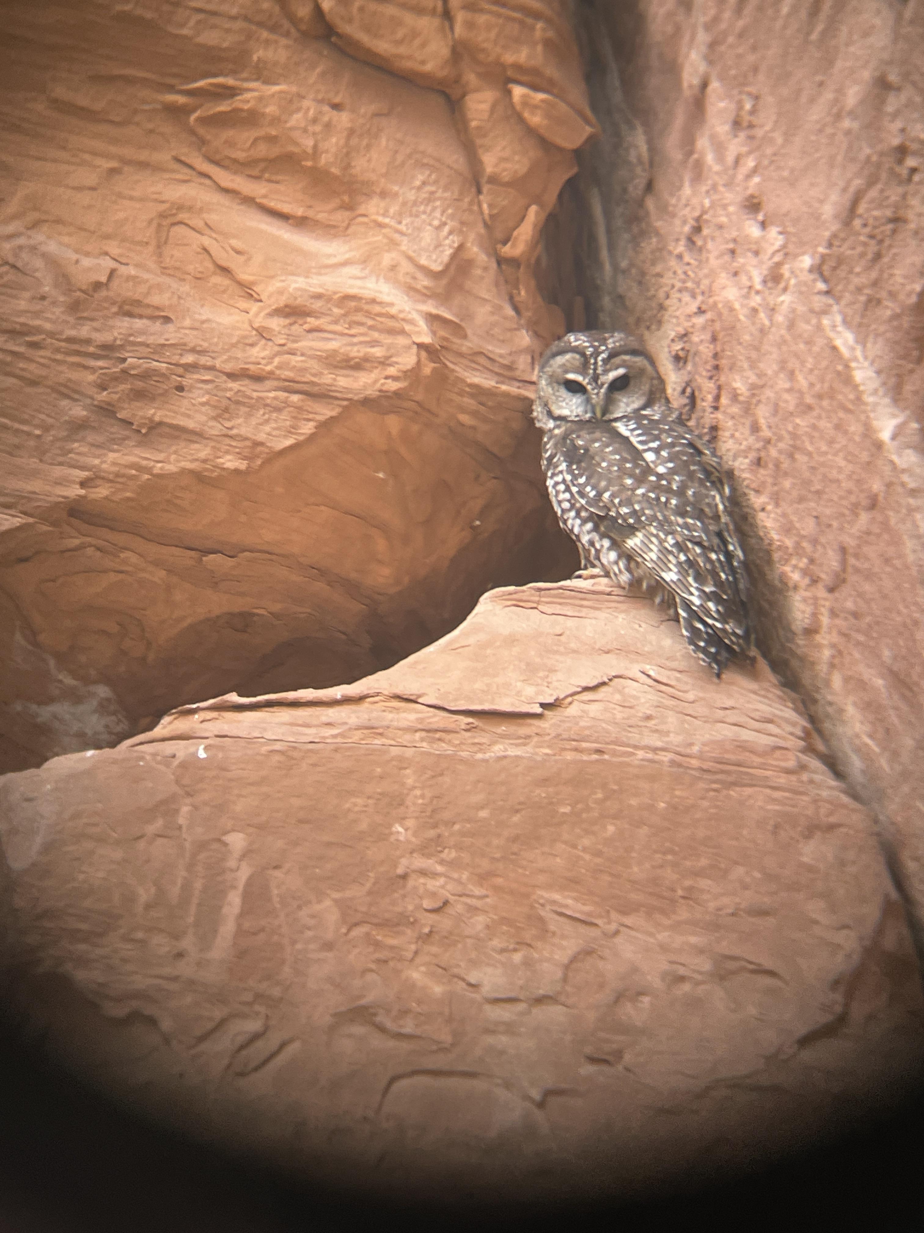
Mexican Spotted phone pic thru bino lens
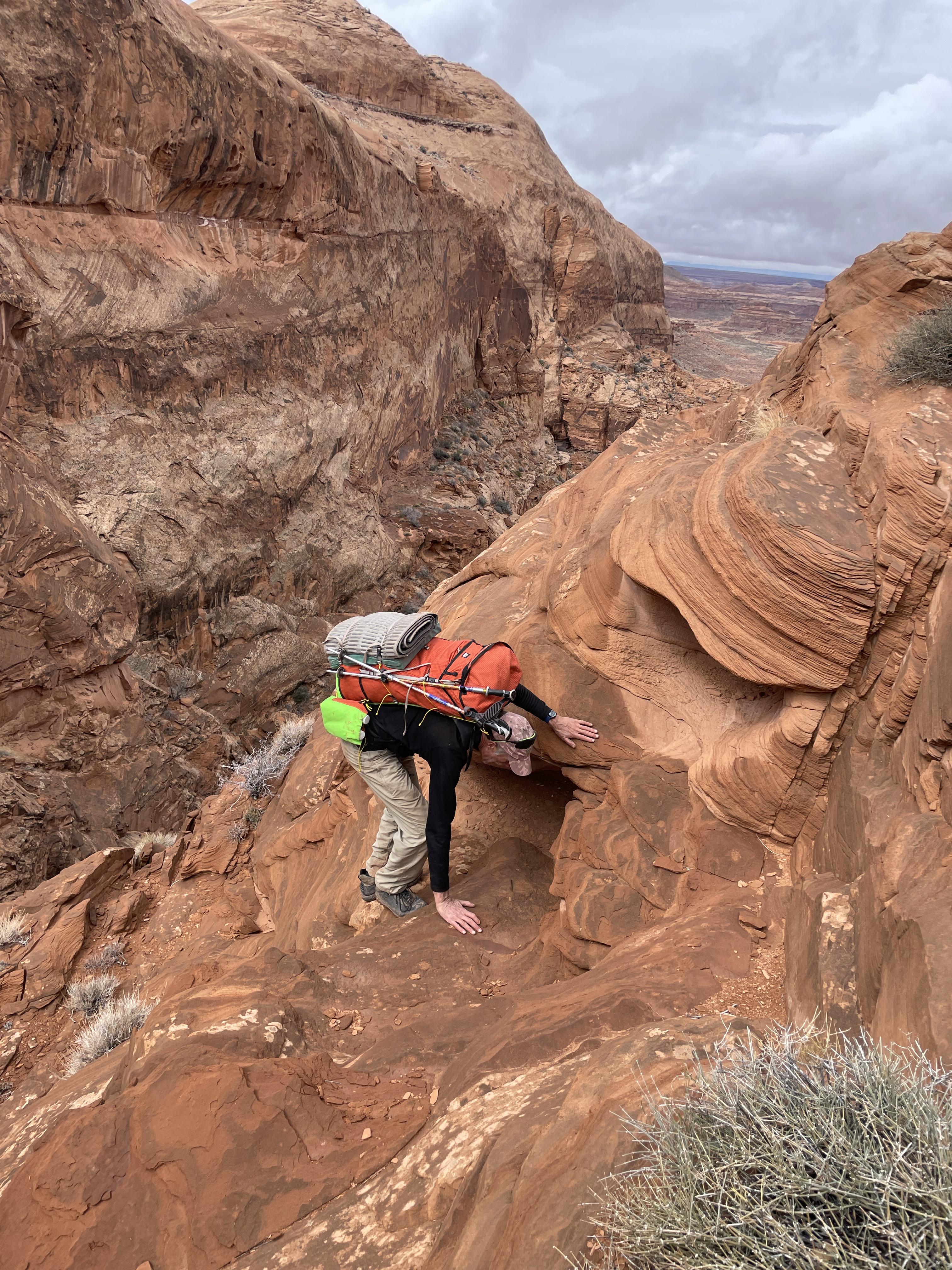
A unique fault line provides a 'shortcut' from Bull Pasture to Twin Corral
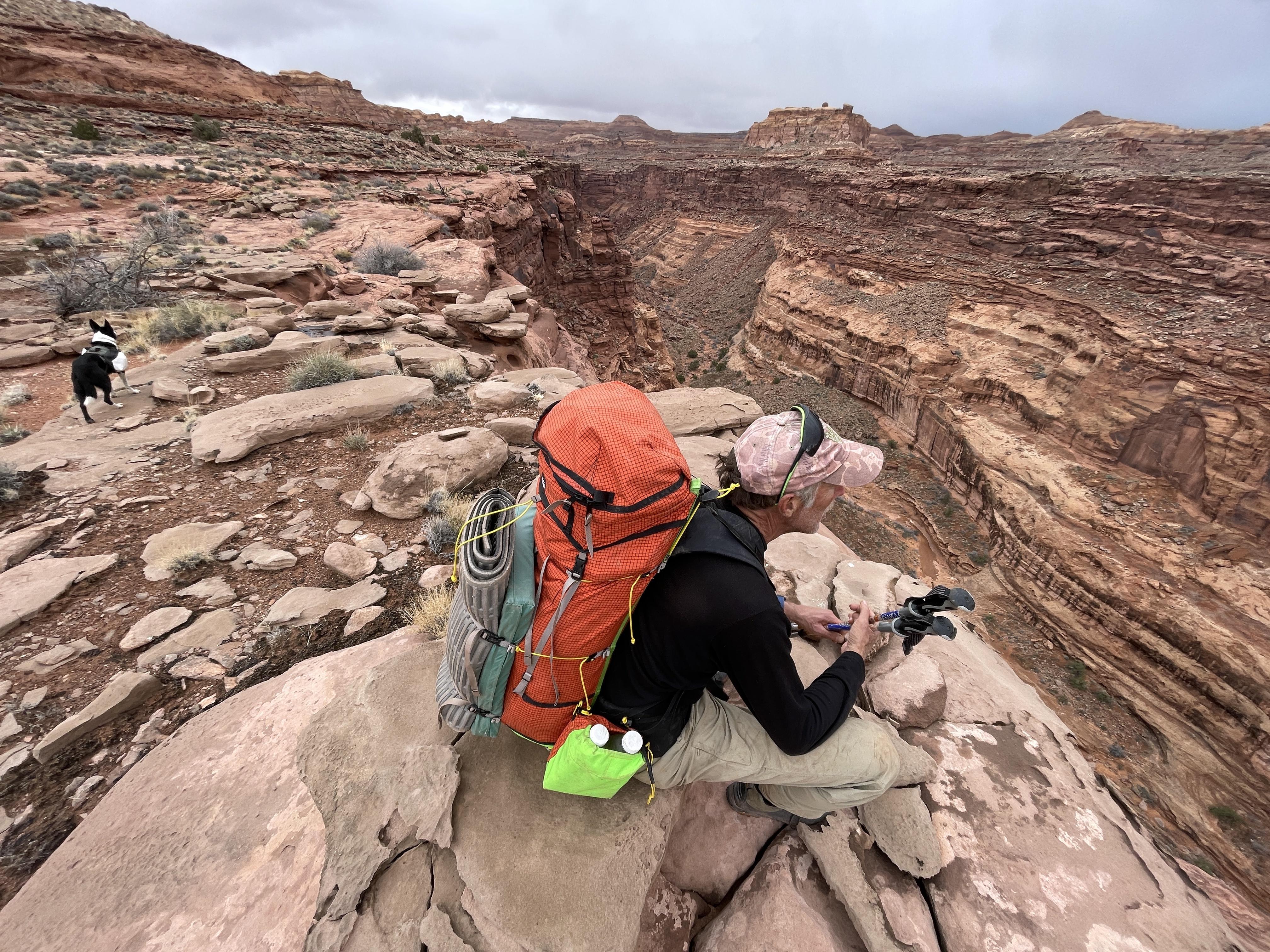
Staying at this level we will be on the other side tomorrow
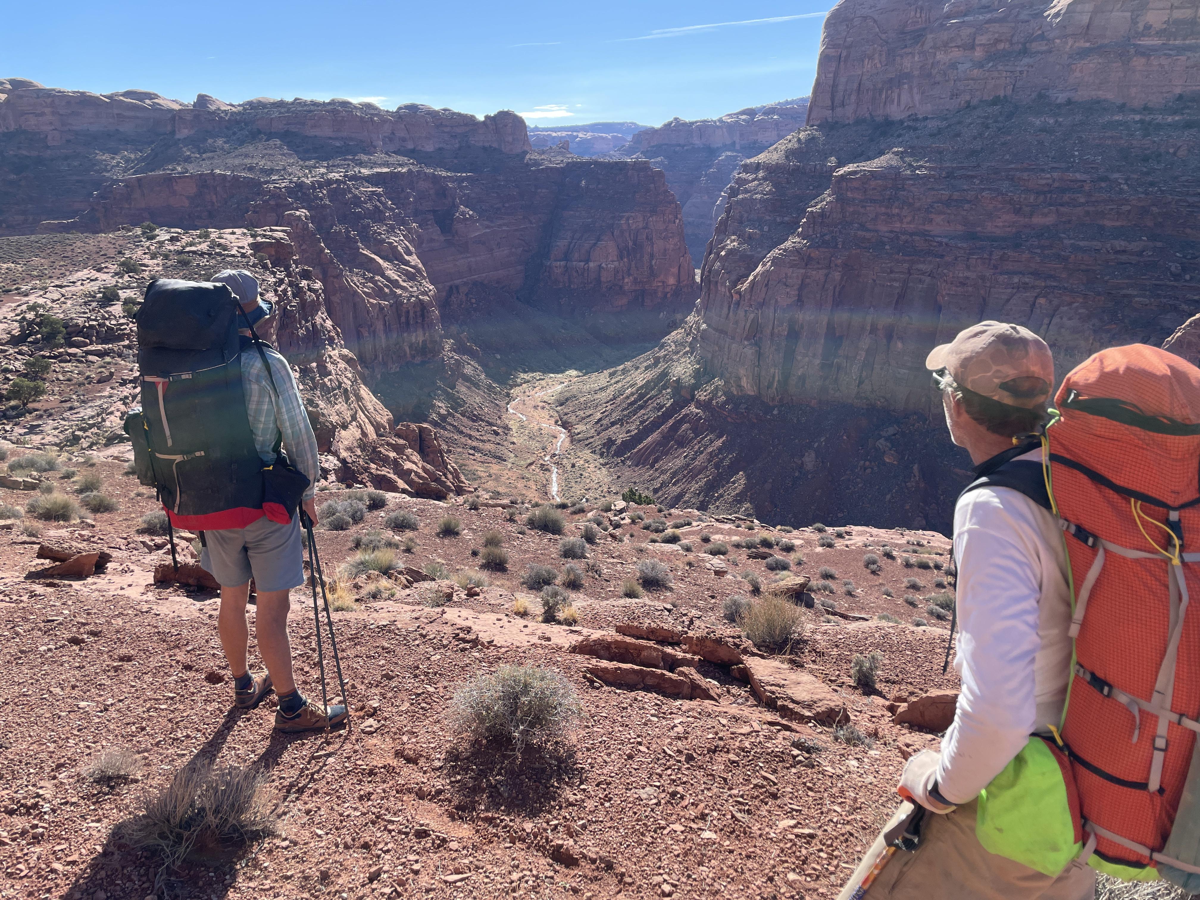
This bench above Sams, also seen in upper right hand of the image, took 12 hours of walking to traverse
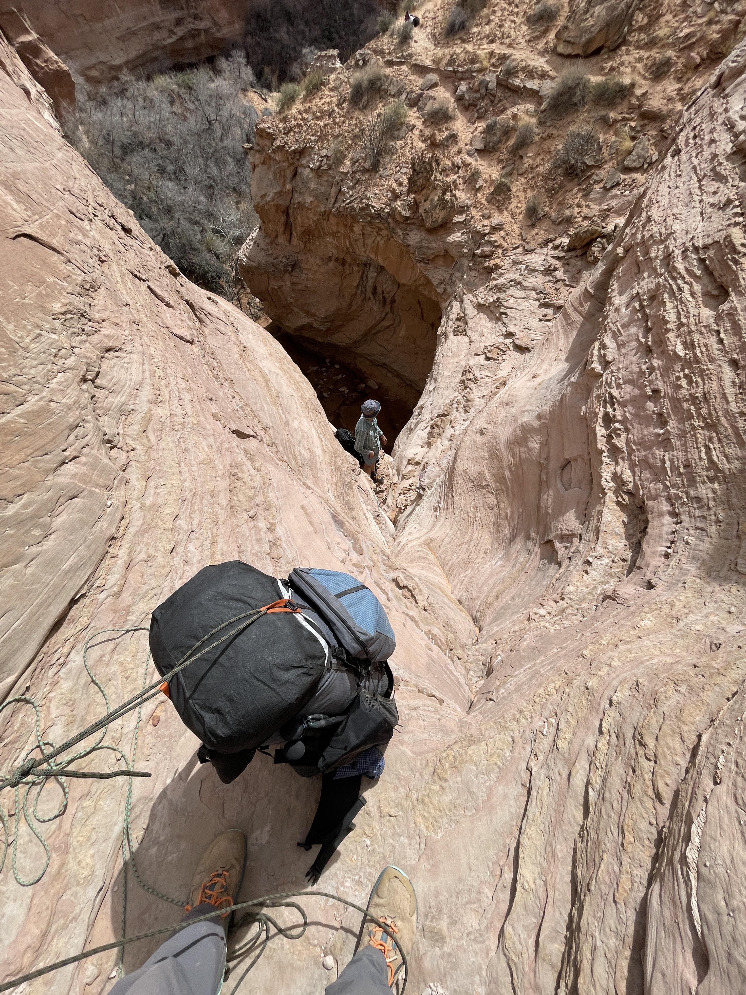
This kind of stuff takes time, with the dog and all.
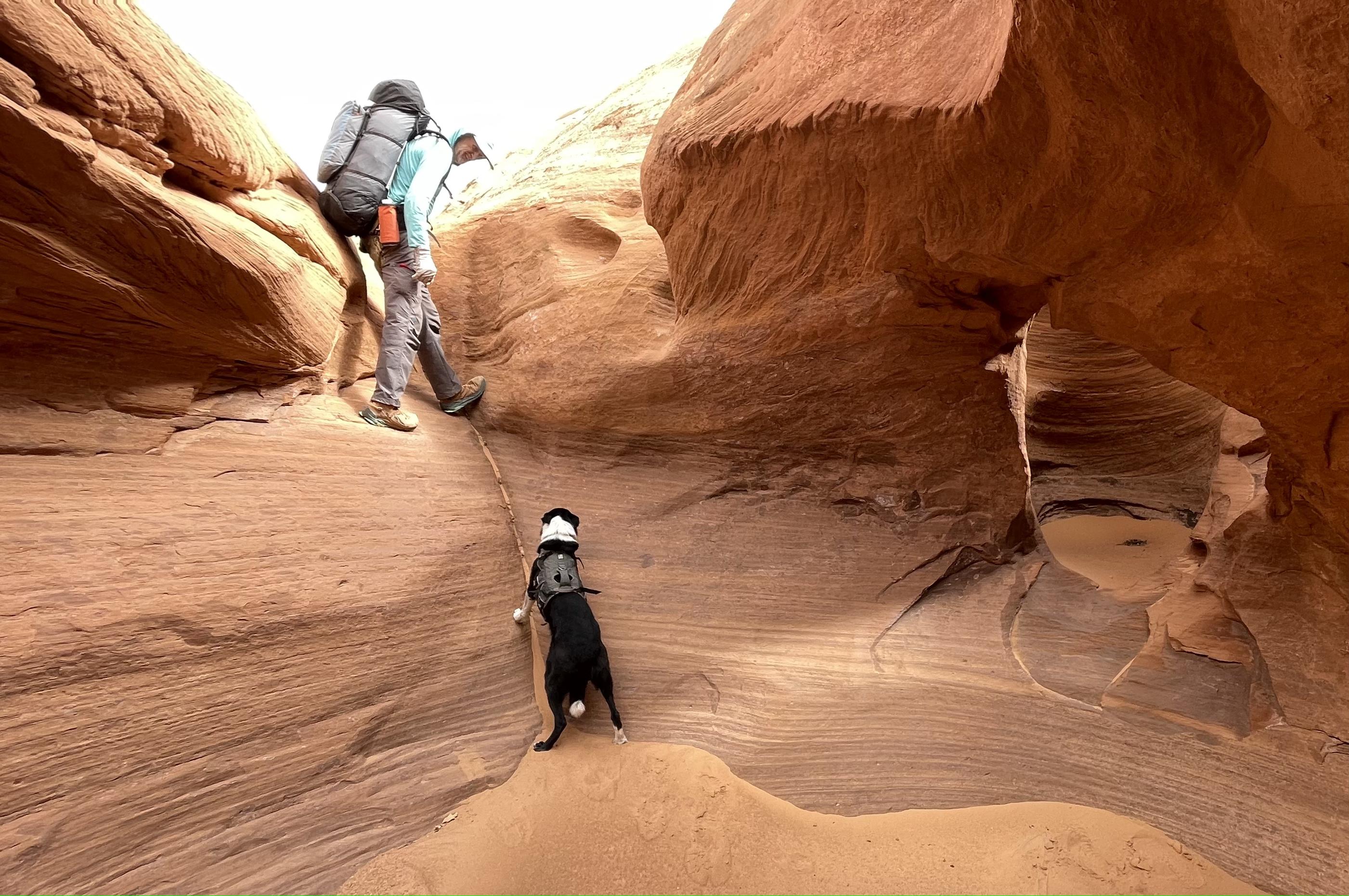
The great Allen exit from upper No Mans
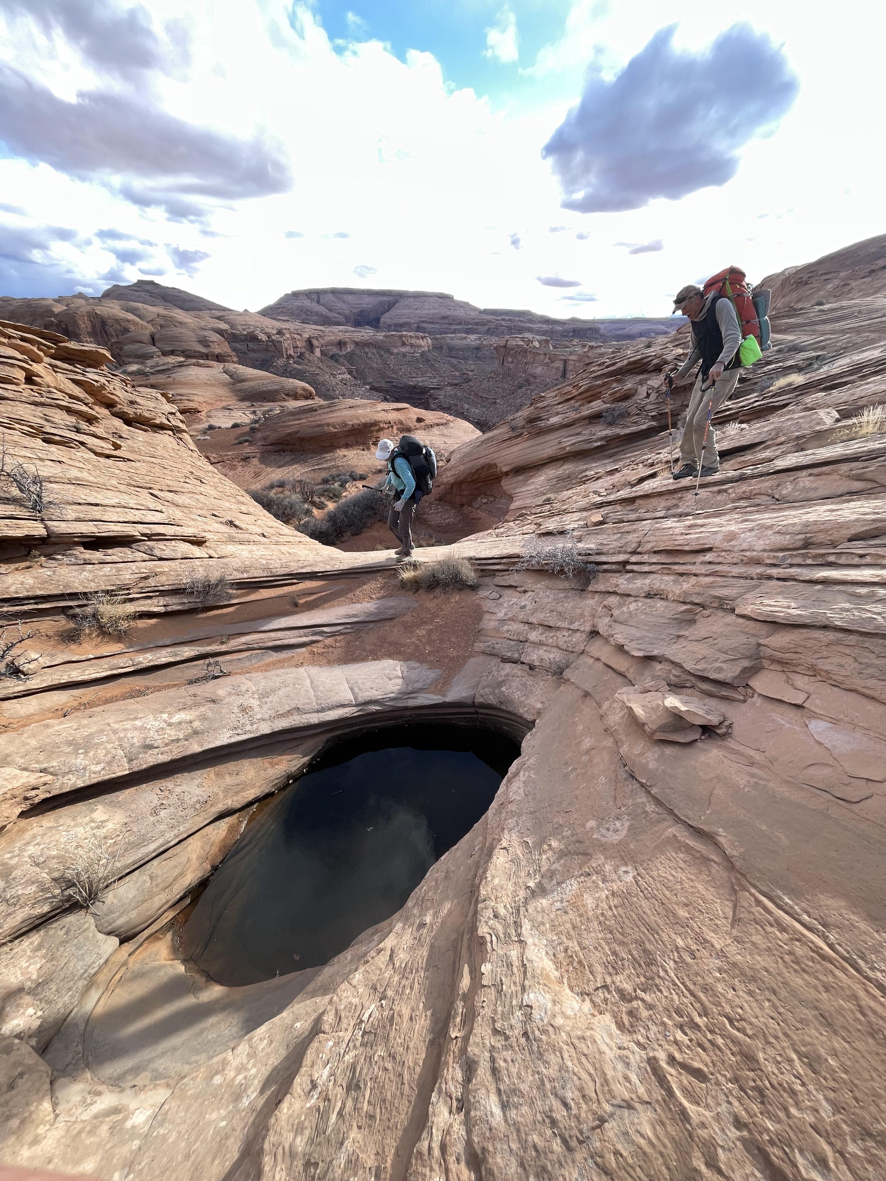
Found this pothole en route to Larry's against all odds after 9 hours of no water
The desert ‘overland’ idea as seen in Allen’s classic Escalante version is fundamentally to work against the natural flow of the terrain, ie crossing canyons instead of hiking along their bottoms to achieve the greater goal of a point-to-point along a major feature - here a river. This is more challenging on all levels: Pre-planning, on the ground navigation, steeper terrain, more exposure, slow going with potential rope work. But also far more rewarding for those inclined to adventure.
We used portions of Allen’s DD North and South, plus plenty of home grown bits and pieces. From the barren clay hills up north into the Roost’s white slickrock and onwards to the deep canyons of No Man, Larry, Twin and Sam’s to finally enter the overwhelmingly big terrain around Happy and the Blocks, this route was as varied of terrain as possible, and full of difficult passages. Typical speed was around 1-2 miles per hour, and we saw nobody else until road walking at the end of day 11.
By following the overland ethos one limits travel at the straight forward river level. In the layered geology of Utah canyons the hiker needs to access the mid level benches, exposed and narrow, to assemble a pure overland route. In this area these ledges are mostly found between the towering Wingate walls below and the huge alcoves of the Navajo domes. In one segment we traveled on such a bench for almost 24 hours including an overnight camp. They are seldom the cruiser slrickrock highways of the Escalante region, but altogether not too bad,
Water availability was a never ending concern the entire length but became pretty serious approaching the southern end, despite rain and snow early on in the trip. It could have gone bad was it not for some really good luck pared with careful planning based on many prior trips with little water.
It rained/snowed a decent amount during three nights in the beginning or else we probably would have bailed for lack of water. Some days we stopped and camped around midday because we found water and feared the next source would be ten hours or more away.
This region is much drier with shallow quick drying potholes compared to the Escalante from Moody south. Each of us had the capacity to carry a gallon - while more would have helped the added weight to already heavy packs seemed untenable in this kind of terrain
Gear:
We had about 18-22 lbs of food each, and 8 lbs for the dog of which he carried four at most. Only brought isobutane for 50% percent of the cooking, relying on twig stoves for the rest.
I sustained fine on 3250 cal/1.45lbs per day, which focused on stuff I like over a perfect fat/protein/carb balance. Highlights included 16 oz of heavy cream powder, Fritos and Digestives. Dinners were identical all 11 nights, which I know doesn’t bother me: 80g couscous, 35g soy nuts, 10g nutritional yeast, 30g butter, 3g salt and red peppers, 10 gram red miso gel
We used 70’ of thin 5mm line to haul packs and dog plus some belaying.
The three of us and the dog shared a 9x9 floor-less silnylon mid to keep the weight down. Still the packs were 40-44 lbs plus on day one.
It was 28°F one night, otherwise mid thirties. We all used hood-less and zipper-less down bags of our own make. As light but warmer than equivalent quilts we have now for many seasons come to appreciate the draft free sleep and minimal fiddling and rearranging of fully enclosed bags. Adjusting these to a wide variety of conditions is simple to achieve by layering clothes
On this trip we experimented with VBL liners, both traditional and sewn-in. One of us to push a 45°F/12 oz bag to its limits, another because they are a cold sleeper. We also used a hooded bivy overbag of simple DWR ripstop lined with 60 GSM Alpha Direct to mitigate dew, dampness and top entry drafts when cowboy camping. Interesting data points were logged.
By now I’m set on the utility of a 3mm foam pad combined with an inflatable in the ground insulation system but frustrated with the overall durability of the available options. Last summer we sourced a higher density 3mm version made of genuine Evazote EV50 which has proved amazing. The weight penalty is minimal while the rebound and tear strength is many fold improved. Having this tough and light (120g) pad as ground protection for the inflatable is great in the floorless tents I use, and for cowboy camping. It’s handy to pull out for lunch breaks and naps, and for sitting around cooking at night.
Our packs were the latest interpretations of the ‘plateau pack’, a concept we have been improving for routes lying between the Hayduke and technical canyoneering: Rugged and sturdy; a rigid and more supportive carrying system than is typically needed in the UL world; strong haul loops; big focus on water access and balanced distribution while keeping bottles in place when tossing the packs around. 65 liters is the sweet spot for long trips and 1500-1600g empty is acceptable given the benefits.
Fabric durability again showed Cordura outperforming Ultra Weave, despite theoretical numbers tempting to assume the opposite. Pack bottom and pockets receive most of the abuse but we now have the details worked out to increase the longevity in these areas.
Alpha Direct garments are here to stay with their unbeatable warmth to weight ratio. Again for the third ten day plus trip I enjoyed my Alpha lined wind shell pullover of about 7 ounces, but this time it was too mild to bring the equally high utility pants of the same design.
The dog is doing well on these outings, no doubt due to learned experience: at ten years old he’s logged hundreds of days in backcountry. He trusts we will keep him safe when lowering and hauling on steep cliffs; and knows how to tip toe thru fields of cacti. His paw pads can get tender from abrasive slickrock, but I know how to tape them instead of using clumsy booties.
More pics and short video segments here

Northern Half

Southern part

Late start on a snowy morning

Larry cny

Virga then later the real deal

Lots of this

After rain

Sams

Mexican Spotted phone pic thru bino lens

A unique fault line provides a 'shortcut' from Bull Pasture to Twin Corral

Staying at this level we will be on the other side tomorrow

This bench above Sams, also seen in upper right hand of the image, took 12 hours of walking to traverse

This kind of stuff takes time, with the dog and all.

The great Allen exit from upper No Mans

Found this pothole en route to Larry's against all odds after 9 hours of no water
Last edited:

