- Joined
- Aug 9, 2007
- Messages
- 12,960
Last year we did a Glen Canyon trip over my birthday in early July. We went pretty far out but we had no shortage of people nearby, some of whom left me feeling like I could never go back in the peak season and be totally fine with that. But there's something about this place that I can't keep away from. So once again we set out on a Glen Canyon trip for my birthday, but this time we would do it right. If there was any place we might find solitude on Lake Powell in July, it would be the San Juan.
We drove down to Wahweap in the morning and launched the boat in time to head up lake to West Canyon for our first night. We found a little beach away from the crowds and had a wonderful evening with the dogs. The weather was perfect so we didn't need a tent. In fact, we never setup a tent on this entire trip!
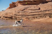
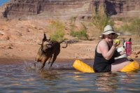

The next day was my birthday and what a great day it was. We continued north, stopping by Dangling Rope on the way to top of our gas tank for the long journey into the San Juan. For those unfamiliar, Dangling Rope is a remote, boat-accessed marina about 45 miles up the lake. It's about 10 miles before Rainbow Bridge. After you pass Rainbow Bridge, traffic drops off dramatically.
The slopes of Navajo Mountain are always a treat to see on the drive through.

Eventually we made out way up into the San Juan. We first checked Wilson and Shoot The Chute canyons but all the campsites were taken by houseboats. Our next stop was Desha, and again, no campsites but there was a really nice looking slickrock beach at the top where the reservoir ended. I drooled over it for a minute, thinking how awesome it would be to camp there and just be able to hike up right from camp. There was a bit of sand that we could anchor to, but no place for a tent. As we turned around and motored away, we started coming up with all the reasons why we don't need a tent. It didn't take long for me to say "SOLD!". I turned the boat around and went back to the top of Desha.
First order of business, a birthday soak session.
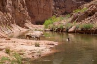
Aquatic Therapy! Nikita just keeps getting worse and worse, but she still lights up and has a blast when we take her to the lake. She had a very active day, doing a bit of swimming and even hiking up this canyon about as far as you can see and back. That's a long way for her in her condition. Toward the end of this trip, I was more convinced than ever that this might be her last, but at this very moment we are preparing for yet another trip to the lake with her.
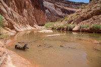
Ball therapy for Sage.
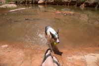
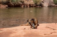
And stick therapy for Patina.
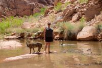
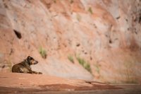
Patina thinking about following Nikita and Audra up canyon.
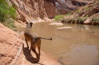
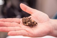
Anyone have any idea what kind of animal this came from? It was right on top of a boulder.
Camp 2.
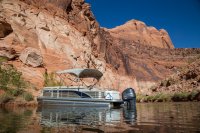
The perfect summer site in Glen Canyon - late shade in the morning and early shade at night! And strangely we had 3G here. Must have bounced off the walls from Navajo Mountain just right.
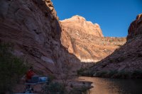
That night I prepared a day pack before going to bed. When I woke up, Sage, Patina and I snuck off to walk up canyon. I didn't want to get Nikita worked up by seeing us leave.
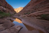
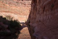
It was a beautiful canyon. All of these pictures are below the high water mark.

There was a little bush whacking and boulder climbing here and there.
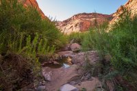
This boulder obstacle was surmountable, but it would have been wet and tricky by myself and with Patina (she is not very cooperative).
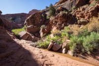
I checked out this possible bypass on the left but it didn't go. Seeing the bushwhack ahead confirmed my decision to turn back here. This is about where the high water mark of the lake is in Desha. If you keep going around the corner, there are some large pools and dryfalls that have to be bypassed. Beyond that is a long section of canyon that is solid stone and looks very pretty from the photos I've seen. I'd like to go back with friends sometime.

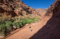
Walking back to the boat.
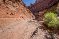
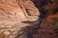
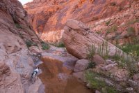
Something like 70 feet below the high water mark here but you you'd never know if it weren't for the bathtub ring. These canyons really can spring back fast.
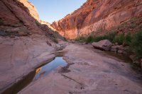
Audra had camp packed up when I got back. It's pretty easy when there's no tent to deal with. We pulled anchors and continued up the San Juan toward Great Bend. Since the houseboats in Wilson and Shoot The Chute, we have not seen a single boat. After checking for campsites in Piute/Neskahi Bay, we continued on into the bend. It's beautiful up here with the exception of the trash patches that float around. The knee jerk reaction would be to blame the boaters on Lake Powell, but almost all of this comes down the San Juan River from communities up stream. If it didn't get caught in Lake Powell, it would in Lake Mead. It can be tricky to negotiate at times.
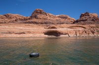
And then we struck gold. A perfect campsite on Great Bend!!! Usually there are not any places I could tie up my boat in here, but this was just perfect. And to make it even better, there was a cairned route running through camp with burrow poop along it. We had seen some wild burrows up here last year and this must be an old cattle trail that they use to get down to the water. This would make for a good walk later on.

After securing our campsite, we went for a cruise up Great Bend. The spot where we were camping was about as far as we came last year, so this was all unexplored territory for us. The lake was about 17 feet higher than the previous year so we expected to be able to make it all the way around the huge bend.
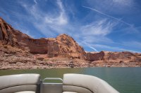
As we started around the bend, the depth of the water became much more shallow and incredible consistent. At our camp we were about 80 feet deep, on the other side it went to about 22 feet and seemed to never change. This is due to the heavy silt load that has dropped in this area. Every now and then we would cross the river channel where the San Juan has cut down through that silt and the depth would shoot up to 35+ feet.
We took a quick turn into San Juan/Navajo Canyon to help scout a route for a friend. This Great Blue Heron greeted us near the mouth.

Continuing on, we hit a very large patch of debris and trash. Mostly trees, sticks and muck this time around.
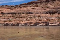
Finally we made it all the way around Great Bend and into the wide open spaces beyond. The water was only about 13 feet deep now and it was totally brown. This stuff is extremely nerve wracking to boat in because you really don't know what kind of hazards are ahead. As we got to this point, two jet skis were on their way back. They stopped and talked to us at our camp at Great Bend. They told us they had kept going about 4 miles to the San Juan River. They said if I was brave enough, I could drive my boat right into the river and 'surf it'. Ummm... ok. On we go.
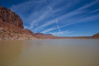
On and on we went and the more tense I got. At this point, we are now 85 miles ONE-WAY from the marina. Since finding our camp in Desha, we have seen the two jet skis, one fishing boat near Piute Canyon and one anchored houseboat near Neskahi Wash - all 20+ miles back from where we are now.

Zero water clarity.
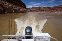
And it's getting really shallow.
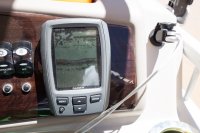
As the bushes and trees started popping up all around us, my nerves couldn't take it so we turned around. We made it to the edge of Zahn Bay. I bet we could have gone another half mile or more before reaching the river. I tried to follow the historical river channel on my topo/GPS but the channel through the silt proved to be quite different. Every now and then we would hit it, but it was hard to stick to.
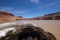
The turn around point.

Back on Great Bend, we pulled into Bend Canyon.
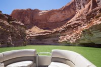
This breathtaking entrance to Bend Canyon made me want to hop off and hike BAD.
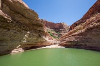
We went back to camp for a while and I read about Bend Canyon in Kelsey's Lake Powell book. Now I REALLY wanted to go hike it, so we hopped in the boat and went to see if there was any possible place to tie up the boat. There was nothing, so I gently motored the boat into the ledge and left it in gear. The slight forward momentum does a good job of keeping the boat pinned in place through mild wind. Audra kept an eye on things while I took a quick walk up the canyon.
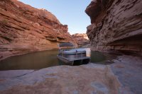
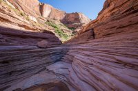
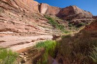
I didn't go far at all, and it was so beautiful. This is all well under the high water mark.
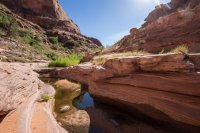
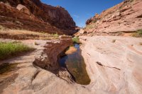
I went back to the boat and watched it while Audra walked up the canyon. One of these days I'm going to figure out the ultimate Glen Canyon exploring method where we can both go and leave the boat(s) safely. I think I know how after this trip, I just need to acquire a few things.
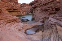
After that we puttered around Great Bend. This is really one of my favorite places that I've been on Lake Powell. The walls are high and incredibly beautiful with massive alcoves. It's reminiscent of Glen Canyon between Bowns and the Escalante, but with no people and narrower.
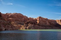
Checking out the side canyons. I want to come back and walk every one of these.

This was a sad one. We went to check out Alcove Canyon, and maybe get lucky and find a place to park the boat and walk. Unfortunately, the trash/debris patch (aka FLOTSAM), had blown in and filled the canyon.
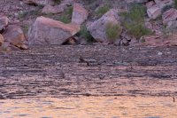
Again, this stuff is from upriver communities, not from boaters. Not defending boaters, because many of them are total asshats, but this area sees few visitors.
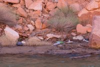
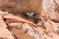
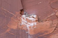
On the way back to camp I noticed this nest upwards of 300 feet high on the walls of Great Bend.
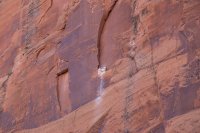
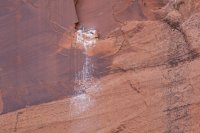
Zoomed in/cropped. Are those adolescent Great Blue Herrons? They're big and don't seem to have developed full wings yet.
A turkey vulture feasting on a fish nearby camp.

We got back to camp and I spent the rest of the evening on a pool noodle watching the light fade on the canyon walls of Great Bend.

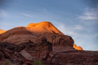
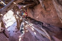
The next day we packed up camp. On the way out, we tried following the cairn line that went through camp. With everything else going on, I never walked it to see where it went! As we cruised the shoreline, Audra spotted an unusual pile of sticks that looked a bit like a ruin, so we turned around and beached the boat again so I could go check it out.
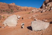
My understanding is that this trail is likely part of an old cattle trail, likely used by Navajo people (this is all on the reservation side of the reservoir). I'm guessing this structure was originally used by them.
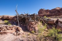
It has since grown and been converted into a shit pile of boater trash. I guess some people think this is neat, but I just think it's disrespectful.
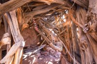
As much as I love the sentiment that it's 5 o'clock somewhere, please keep the trash on the houseboat next time. There were two containers full of notes that people have left here over the years.
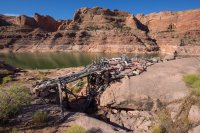
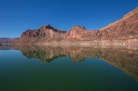
Back on the water. Is this a 10, @Artemus? Well other than the FLOTSAM patch over there in the distance...
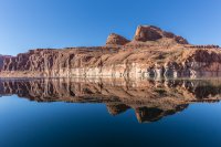
Heading out of Great Bend toward Neskahi.
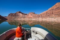
When we got out into the bay, we checked the weather forecast. We were still debating where to camp for the last night. The forecast for the next day was a red flag warning with sustained 30mph winds and gusts into the 50's. Our trip had been perfect so far, so it was an easy decision to just head back. We usually only do 4 day trips anyway, and we were already there. The drive back was uneventful, as was the drive home. Camping in a new place every night on this trip was a real treat. Can't wait to get back.
We drove down to Wahweap in the morning and launched the boat in time to head up lake to West Canyon for our first night. We found a little beach away from the crowds and had a wonderful evening with the dogs. The weather was perfect so we didn't need a tent. In fact, we never setup a tent on this entire trip!


The next day was my birthday and what a great day it was. We continued north, stopping by Dangling Rope on the way to top of our gas tank for the long journey into the San Juan. For those unfamiliar, Dangling Rope is a remote, boat-accessed marina about 45 miles up the lake. It's about 10 miles before Rainbow Bridge. After you pass Rainbow Bridge, traffic drops off dramatically.
The slopes of Navajo Mountain are always a treat to see on the drive through.

Eventually we made out way up into the San Juan. We first checked Wilson and Shoot The Chute canyons but all the campsites were taken by houseboats. Our next stop was Desha, and again, no campsites but there was a really nice looking slickrock beach at the top where the reservoir ended. I drooled over it for a minute, thinking how awesome it would be to camp there and just be able to hike up right from camp. There was a bit of sand that we could anchor to, but no place for a tent. As we turned around and motored away, we started coming up with all the reasons why we don't need a tent. It didn't take long for me to say "SOLD!". I turned the boat around and went back to the top of Desha.
First order of business, a birthday soak session.

Aquatic Therapy! Nikita just keeps getting worse and worse, but she still lights up and has a blast when we take her to the lake. She had a very active day, doing a bit of swimming and even hiking up this canyon about as far as you can see and back. That's a long way for her in her condition. Toward the end of this trip, I was more convinced than ever that this might be her last, but at this very moment we are preparing for yet another trip to the lake with her.

Ball therapy for Sage.

And stick therapy for Patina.


Patina thinking about following Nikita and Audra up canyon.

Anyone have any idea what kind of animal this came from? It was right on top of a boulder.

Camp 2.


The perfect summer site in Glen Canyon - late shade in the morning and early shade at night! And strangely we had 3G here. Must have bounced off the walls from Navajo Mountain just right.

That night I prepared a day pack before going to bed. When I woke up, Sage, Patina and I snuck off to walk up canyon. I didn't want to get Nikita worked up by seeing us leave.

It was a beautiful canyon. All of these pictures are below the high water mark.

There was a little bush whacking and boulder climbing here and there.

This boulder obstacle was surmountable, but it would have been wet and tricky by myself and with Patina (she is not very cooperative).

I checked out this possible bypass on the left but it didn't go. Seeing the bushwhack ahead confirmed my decision to turn back here. This is about where the high water mark of the lake is in Desha. If you keep going around the corner, there are some large pools and dryfalls that have to be bypassed. Beyond that is a long section of canyon that is solid stone and looks very pretty from the photos I've seen. I'd like to go back with friends sometime.


Walking back to the boat.


Something like 70 feet below the high water mark here but you you'd never know if it weren't for the bathtub ring. These canyons really can spring back fast.


Audra had camp packed up when I got back. It's pretty easy when there's no tent to deal with. We pulled anchors and continued up the San Juan toward Great Bend. Since the houseboats in Wilson and Shoot The Chute, we have not seen a single boat. After checking for campsites in Piute/Neskahi Bay, we continued on into the bend. It's beautiful up here with the exception of the trash patches that float around. The knee jerk reaction would be to blame the boaters on Lake Powell, but almost all of this comes down the San Juan River from communities up stream. If it didn't get caught in Lake Powell, it would in Lake Mead. It can be tricky to negotiate at times.

And then we struck gold. A perfect campsite on Great Bend!!! Usually there are not any places I could tie up my boat in here, but this was just perfect. And to make it even better, there was a cairned route running through camp with burrow poop along it. We had seen some wild burrows up here last year and this must be an old cattle trail that they use to get down to the water. This would make for a good walk later on.

After securing our campsite, we went for a cruise up Great Bend. The spot where we were camping was about as far as we came last year, so this was all unexplored territory for us. The lake was about 17 feet higher than the previous year so we expected to be able to make it all the way around the huge bend.

As we started around the bend, the depth of the water became much more shallow and incredible consistent. At our camp we were about 80 feet deep, on the other side it went to about 22 feet and seemed to never change. This is due to the heavy silt load that has dropped in this area. Every now and then we would cross the river channel where the San Juan has cut down through that silt and the depth would shoot up to 35+ feet.
We took a quick turn into San Juan/Navajo Canyon to help scout a route for a friend. This Great Blue Heron greeted us near the mouth.


Continuing on, we hit a very large patch of debris and trash. Mostly trees, sticks and muck this time around.

Finally we made it all the way around Great Bend and into the wide open spaces beyond. The water was only about 13 feet deep now and it was totally brown. This stuff is extremely nerve wracking to boat in because you really don't know what kind of hazards are ahead. As we got to this point, two jet skis were on their way back. They stopped and talked to us at our camp at Great Bend. They told us they had kept going about 4 miles to the San Juan River. They said if I was brave enough, I could drive my boat right into the river and 'surf it'. Ummm... ok. On we go.

On and on we went and the more tense I got. At this point, we are now 85 miles ONE-WAY from the marina. Since finding our camp in Desha, we have seen the two jet skis, one fishing boat near Piute Canyon and one anchored houseboat near Neskahi Wash - all 20+ miles back from where we are now.

Zero water clarity.

And it's getting really shallow.

As the bushes and trees started popping up all around us, my nerves couldn't take it so we turned around. We made it to the edge of Zahn Bay. I bet we could have gone another half mile or more before reaching the river. I tried to follow the historical river channel on my topo/GPS but the channel through the silt proved to be quite different. Every now and then we would hit it, but it was hard to stick to.

The turn around point.

Back on Great Bend, we pulled into Bend Canyon.

This breathtaking entrance to Bend Canyon made me want to hop off and hike BAD.

We went back to camp for a while and I read about Bend Canyon in Kelsey's Lake Powell book. Now I REALLY wanted to go hike it, so we hopped in the boat and went to see if there was any possible place to tie up the boat. There was nothing, so I gently motored the boat into the ledge and left it in gear. The slight forward momentum does a good job of keeping the boat pinned in place through mild wind. Audra kept an eye on things while I took a quick walk up the canyon.


I didn't go far at all, and it was so beautiful. This is all well under the high water mark.


I went back to the boat and watched it while Audra walked up the canyon. One of these days I'm going to figure out the ultimate Glen Canyon exploring method where we can both go and leave the boat(s) safely. I think I know how after this trip, I just need to acquire a few things.

After that we puttered around Great Bend. This is really one of my favorite places that I've been on Lake Powell. The walls are high and incredibly beautiful with massive alcoves. It's reminiscent of Glen Canyon between Bowns and the Escalante, but with no people and narrower.

Checking out the side canyons. I want to come back and walk every one of these.

This was a sad one. We went to check out Alcove Canyon, and maybe get lucky and find a place to park the boat and walk. Unfortunately, the trash/debris patch (aka FLOTSAM), had blown in and filled the canyon.

Again, this stuff is from upriver communities, not from boaters. Not defending boaters, because many of them are total asshats, but this area sees few visitors.

On the way back to camp I noticed this nest upwards of 300 feet high on the walls of Great Bend.


Zoomed in/cropped. Are those adolescent Great Blue Herrons? They're big and don't seem to have developed full wings yet.


A turkey vulture feasting on a fish nearby camp.

We got back to camp and I spent the rest of the evening on a pool noodle watching the light fade on the canyon walls of Great Bend.


The next day we packed up camp. On the way out, we tried following the cairn line that went through camp. With everything else going on, I never walked it to see where it went! As we cruised the shoreline, Audra spotted an unusual pile of sticks that looked a bit like a ruin, so we turned around and beached the boat again so I could go check it out.

My understanding is that this trail is likely part of an old cattle trail, likely used by Navajo people (this is all on the reservation side of the reservoir). I'm guessing this structure was originally used by them.

It has since grown and been converted into a shit pile of boater trash. I guess some people think this is neat, but I just think it's disrespectful.

As much as I love the sentiment that it's 5 o'clock somewhere, please keep the trash on the houseboat next time. There were two containers full of notes that people have left here over the years.


Back on the water. Is this a 10, @Artemus? Well other than the FLOTSAM patch over there in the distance...

Heading out of Great Bend toward Neskahi.

When we got out into the bay, we checked the weather forecast. We were still debating where to camp for the last night. The forecast for the next day was a red flag warning with sustained 30mph winds and gusts into the 50's. Our trip had been perfect so far, so it was an easy decision to just head back. We usually only do 4 day trips anyway, and we were already there. The drive back was uneventful, as was the drive home. Camping in a new place every night on this trip was a real treat. Can't wait to get back.

