Navigation
Install the app
How to install the app on iOS
Follow along with the video below to see how to install our site as a web app on your home screen.
Note: This feature may not be available in some browsers.
More options
Style variation
You are using an out of date browser. It may not display this or other websites correctly.
You should upgrade or use an alternative browser.
You should upgrade or use an alternative browser.
Album Deserts
- Thread starter westy
- Start date

- Joined
- Apr 20, 2013
- Messages
- 1,538
Kings of Leon sing a song about the Cold Desert.

When you wear the kids out on the climb out.


The nephew said he likes the desert now more than the mountains. I still say it is seasonal. He got a good taste though in the short sunshine hours we had.
When you wear the kids out on the climb out.
The nephew said he likes the desert now more than the mountains. I still say it is seasonal. He got a good taste though in the short sunshine hours we had.

- Joined
- Apr 20, 2013
- Messages
- 1,538
Good on you for exposing those kids to the great outdoors, and for tiring them out!
As we dog people say: "a tired dog is a happy dog" and we took that to heart many years ago with our two teens.
I knew that spot looked very familiar.
That is a good eye!
yeah, when they have to spend half the day in the tent. It is best to run them ragged during the light and warm parts of the day... well, I guess that is true any time of year.
- Joined
- Apr 20, 2013
- Messages
- 1,538
The previous were the iphone pics, here are a few more to make one feel warmer.
Just some old rocks


I like the silhouette's of pinyons and junipers.

.jpg")

This should also make you feel warmer. When we arrived at the park at 9am, the temp was 12d F in the sun.

Just some old rocks
I like the silhouette's of pinyons and junipers.
This should also make you feel warmer. When we arrived at the park at 9am, the temp was 12d F in the sun.
jholmes01
Member
- Joined
- Nov 10, 2020
- Messages
- 226
We were just at the location of your third photo in early October.Kings of Leon sing a song about the Cold Desert.
View attachment 127608
When you wear the kids out on the climb out.
View attachment 127609
View attachment 127610
View attachment 127607
The nephew said he likes the desert now more than the mountains. I still say it is seasonal. He got a good taste though in the short sunshine hours we had.

- Joined
- Apr 20, 2013
- Messages
- 1,538
We were just at the location of your third photo in early October.
Did the overcast make some of the shallow ones easier to spot?
It felt like we could see the tracks easier from one direction than the other, since the sun is so low in November.
jholmes01
Member
- Joined
- Nov 10, 2020
- Messages
- 226
I'll admit we looked pretty extensively and weren't sure we actually saw any of the tracks...Did the overcast make some of the shallow ones easier to spot?
It felt like we could see the tracks easier from one direction than the other, since the sun is so low in November.
- Joined
- Aug 18, 2018
- Messages
- 1,821
I'll admit we looked pretty extensively and weren't sure we actually saw any of the tracks...
It took us a while before we noticed the consistent track pattern.


Notice the circle of several holes drilled out in one of the tracks


jholmes01
Member
- Joined
- Nov 10, 2020
- Messages
- 226
I'm 99% certain we walked by these without noticing them. It helps to have a more specific idea of what to look for. Thanks!It took us a while before we noticed the consistent track pattern.
View attachment 128131
View attachment 128132
Notice the circle of several holes drilled out in one of the tracks
View attachment 128133
View attachment 128134
View attachment 128135
View attachment 128136
- Joined
- Apr 20, 2013
- Messages
- 1,538
I'm 99% certain we walked by these without noticing them. It helps to have a more specific idea of what to look for. Thanks!
Once you see the patterns or find the therapod tracks, you can see there are quite a few.
They are not as distinct as the tracks in some other places, like this one over by Moab.
(after a rain storm)

Yvonne
I lava it!!!
- Joined
- Jan 19, 2012
- Messages
- 4,175
In September, I extensively explored the Kaʻu Desert of Hawaiʻi Volcanoes NP.
I wanted to return, but they closed the entire area due to volcanic and seismic unrest. So I have to wait.
But I got a few nice desert impressions with some golden Peleʻs Hair, a volcanic glass collecting downwind from the crater.
I wanted to return, but they closed the entire area due to volcanic and seismic unrest. So I have to wait.
But I got a few nice desert impressions with some golden Peleʻs Hair, a volcanic glass collecting downwind from the crater.
Yvonne
I lava it!!!
- Joined
- Jan 19, 2012
- Messages
- 4,175
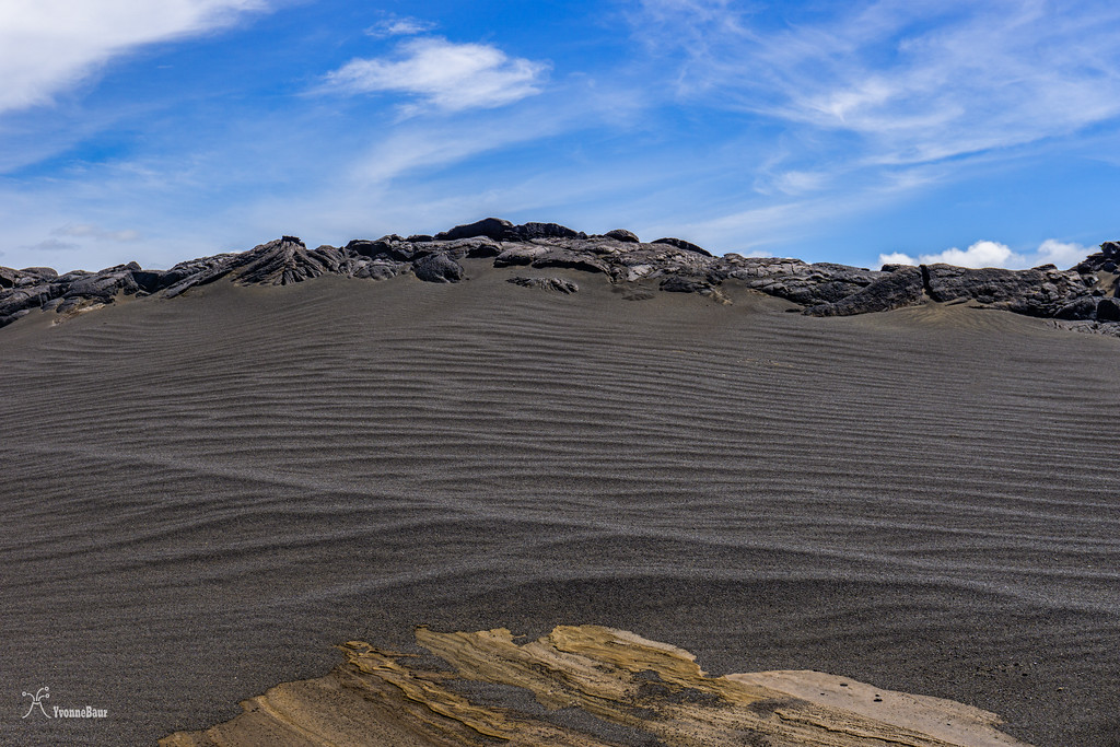
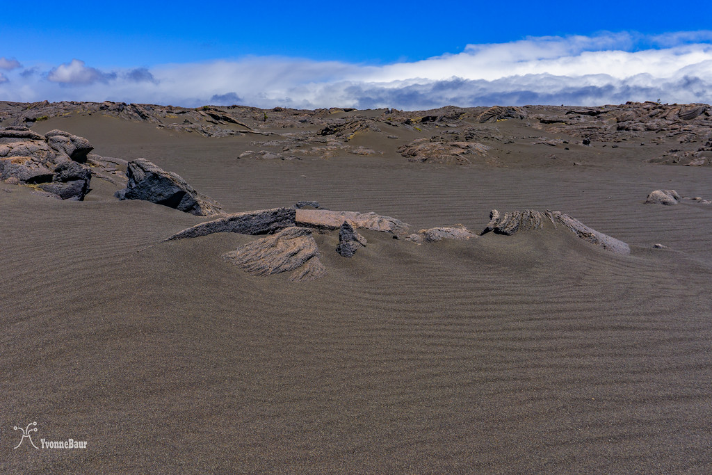
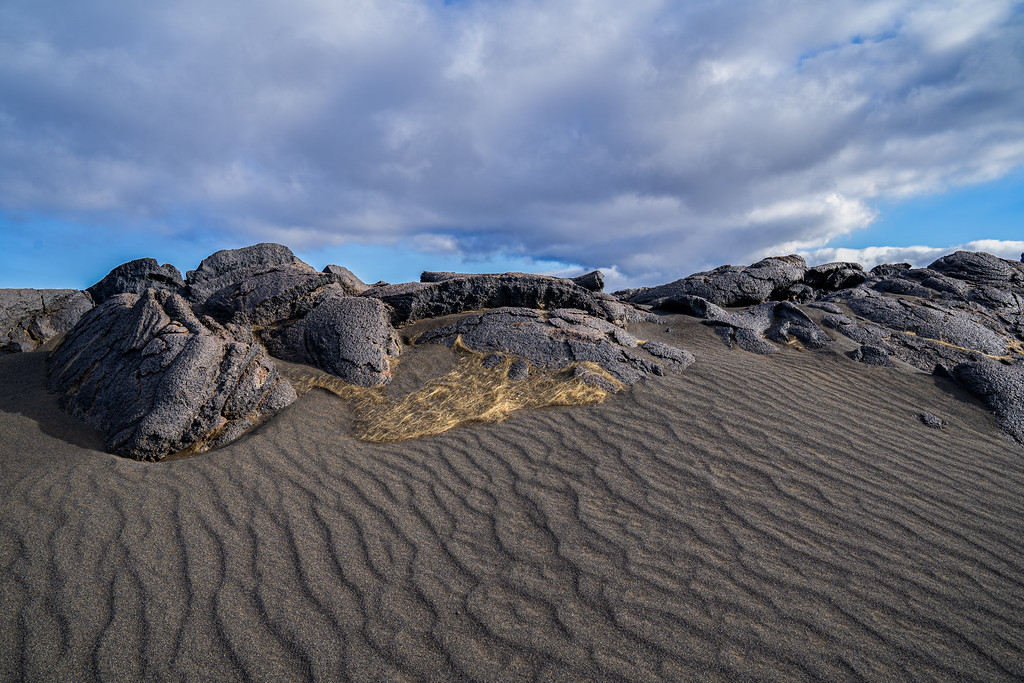
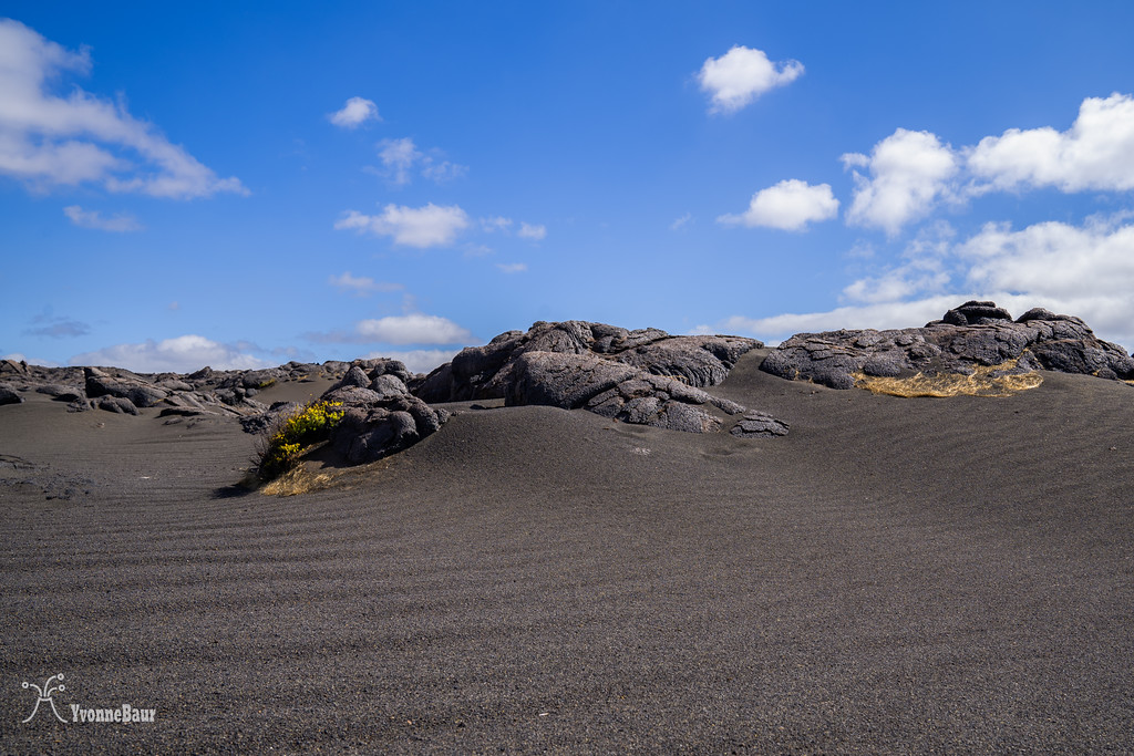
I went again and explored the Kaʻu Desert in Hawaiʻi Volcanoes NP.
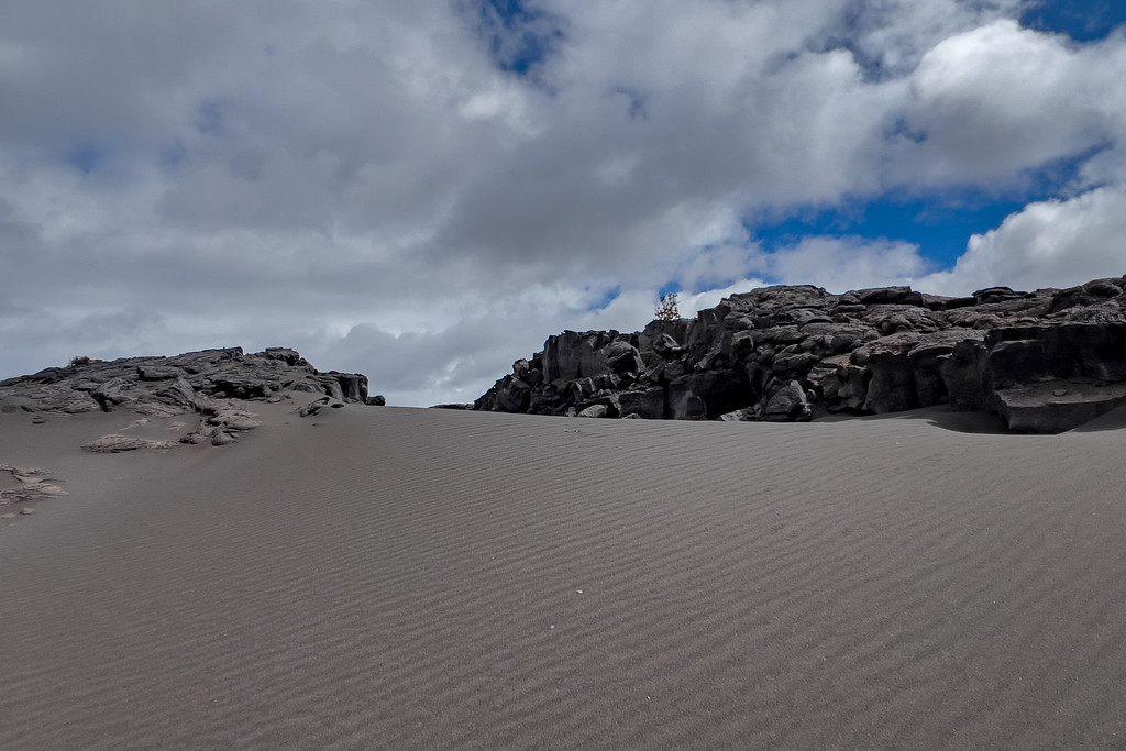
This barren landscape covered with several lava flows, Peleʻs hair, and volcanic sand and ash from historic explosive events is really fun to explore.
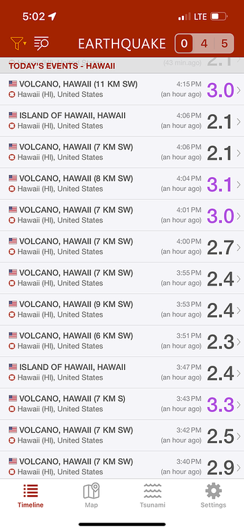
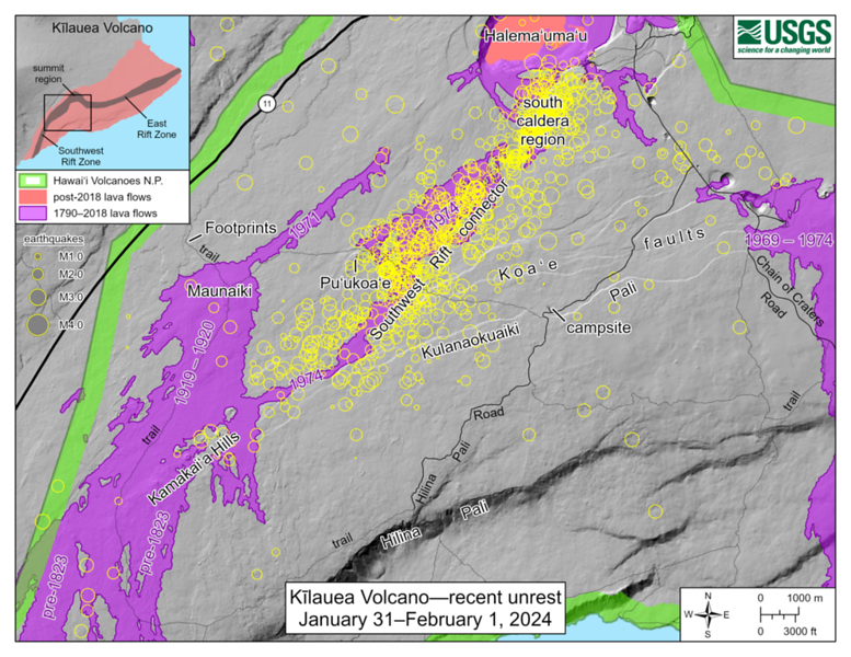
I went on January 31, and a massive magma intrusion happened in the area that day. An enormous earthquake swarm accompanied the magma intrusion, and every 2-5 minutes, a shallow earthquake in the magnitude range of magnitude 2.7 to magnitude 3.5 rattled the area. It does not sound like much, but you feel them all when the earthquakes are only between 0.4 and 0.6 miles below the surface.
It did not bother me too much at all.
After living through the 80K earthquakes during the Leilani eruption in 2018, it was sort of normal to me.
The weirdest part of the magma intrusion was the opening of new ground cracks while exploring the area, and some of the cracks emitted warm air. That was sort of new to me and a couple of times I had to go back and place my hand into the crack so I could confirm that the warm air was coming from there and not from the surrounding area.
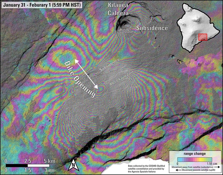
While I was exploring the area that day, the whole area was uplifted by 20 inches, and 40 million cubic yards of magma migrated from the crater at the summit into the area during the intrusion. That is about 12,232 Olympic -Size Swimming Pools full of magma in a day!!
It was definitely one of the coolest explorations I ever had in the park.
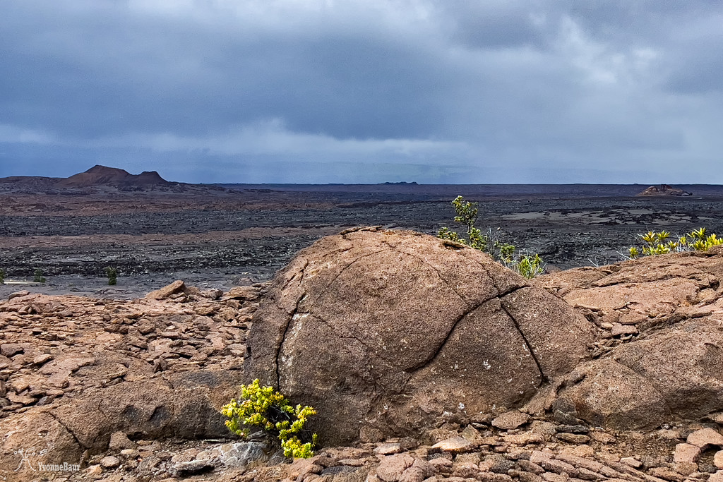
Accretionary Lava Ball and Puʻu Koaʻe in the upper left corner
The area I explored is part of the Koaʻe Fault system, one of the most active fault systems and the southwest rift zone of Kilauea runs right through the area.
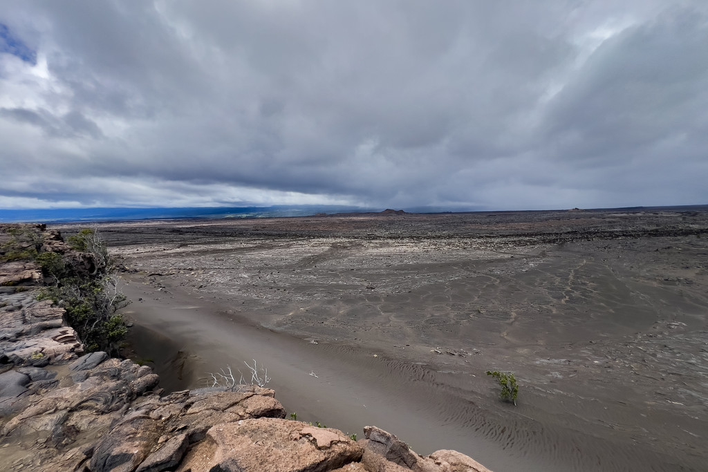 the view from top of the normal fault down to the sand dunes
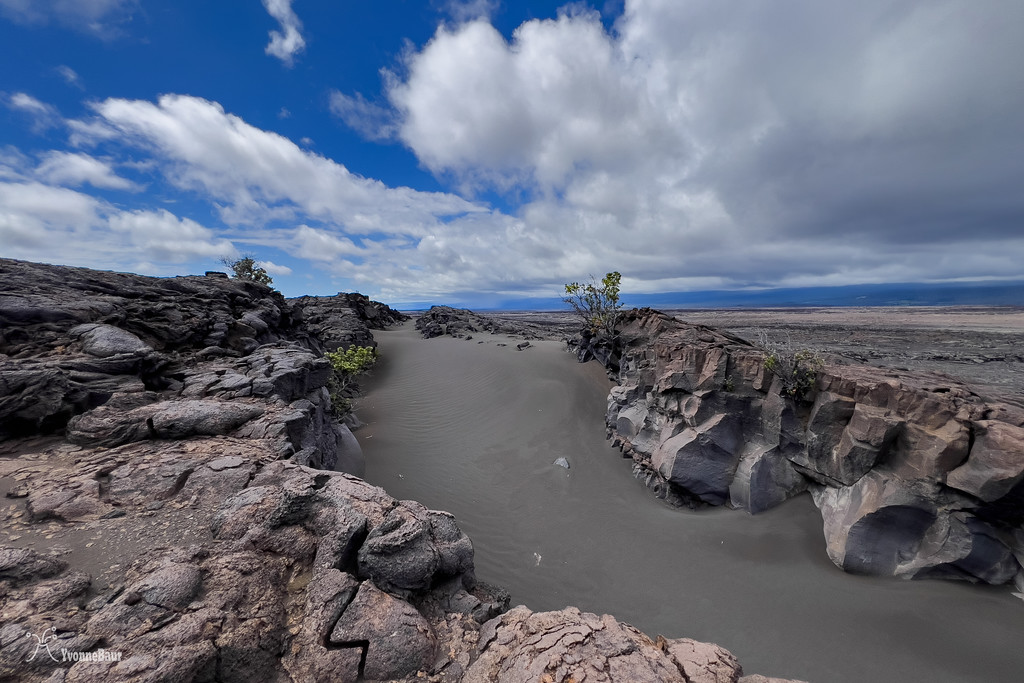
View from below to the fault system: the Koaʻe Fault dropped down about 50-60 feet
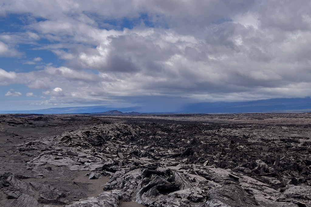
Shelly Pahoehoe of the 1974 lava flow, Kamakaiʻa Hills in the distance
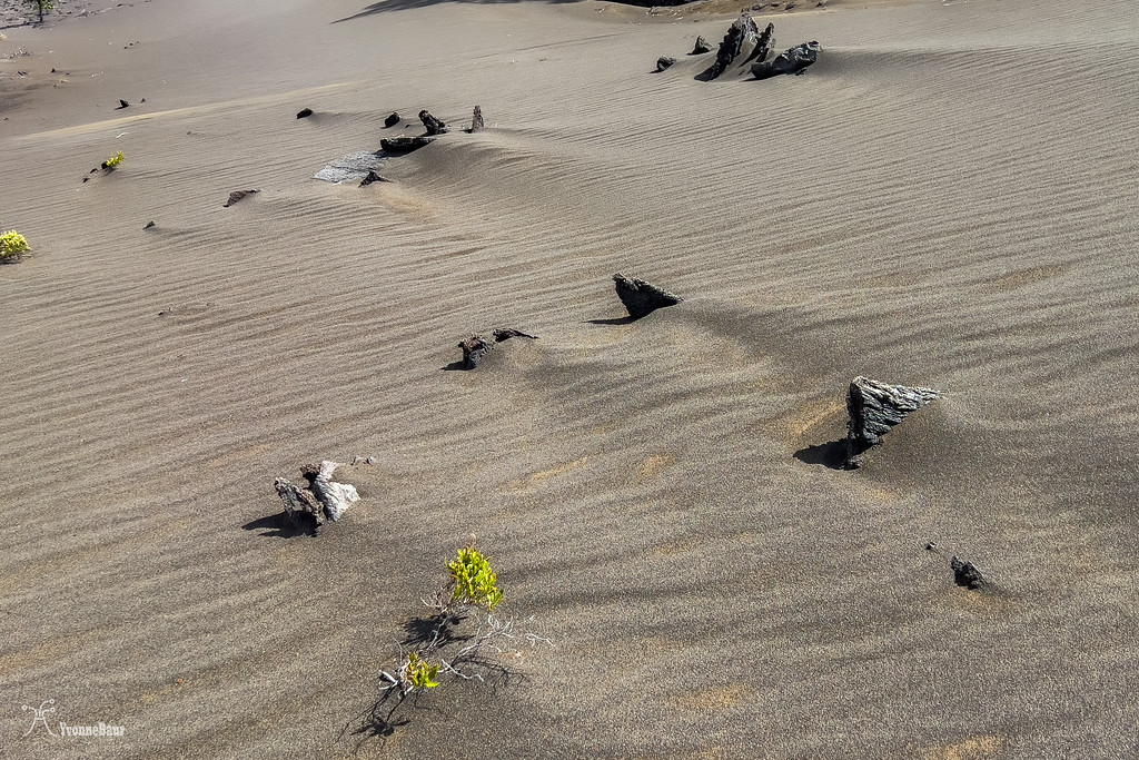
welcome to Mars
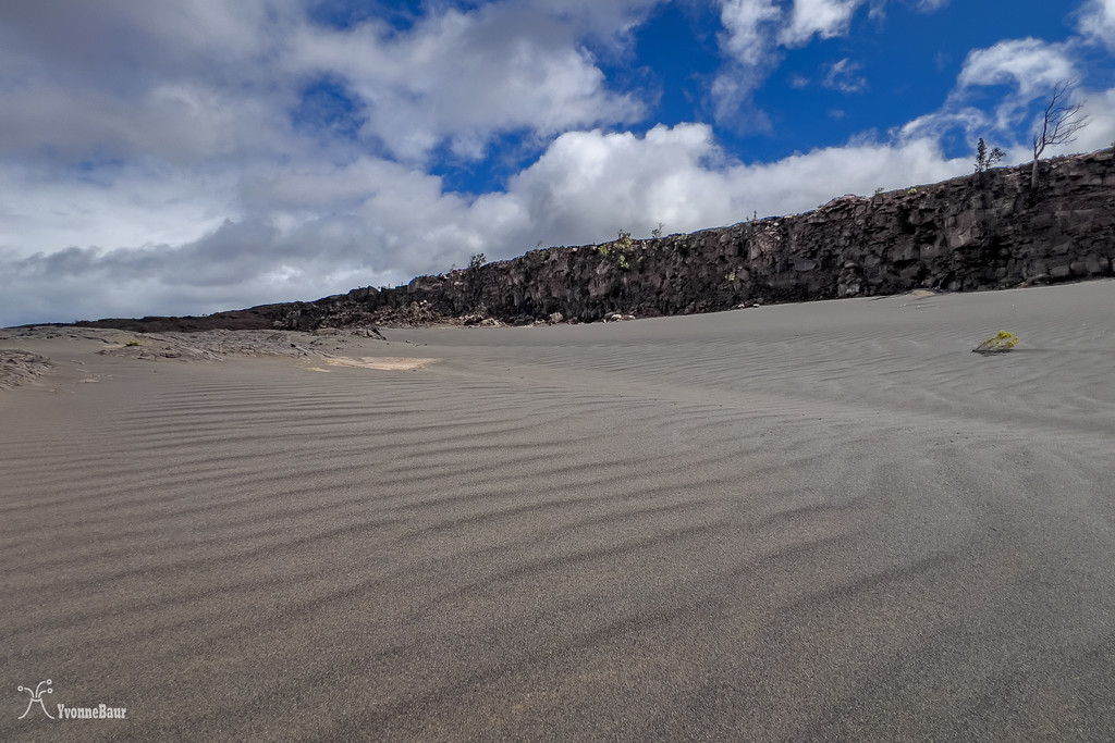
view towards the fault
Some of the earthquakes while I was exploring:
The INSAR satellite image from the uplift a few days later:
I will be going back on Tuesday because I want to hunt for new ground cracks from all the crazy earthquake activity and uplift. This will be a lot of fun.
This barren landscape covered with several lava flows, Peleʻs hair, and volcanic sand and ash from historic explosive events is really fun to explore.
I went on January 31, and a massive magma intrusion happened in the area that day. An enormous earthquake swarm accompanied the magma intrusion, and every 2-5 minutes, a shallow earthquake in the magnitude range of magnitude 2.7 to magnitude 3.5 rattled the area. It does not sound like much, but you feel them all when the earthquakes are only between 0.4 and 0.6 miles below the surface.
It did not bother me too much at all.
After living through the 80K earthquakes during the Leilani eruption in 2018, it was sort of normal to me.
The weirdest part of the magma intrusion was the opening of new ground cracks while exploring the area, and some of the cracks emitted warm air. That was sort of new to me and a couple of times I had to go back and place my hand into the crack so I could confirm that the warm air was coming from there and not from the surrounding area.
While I was exploring the area that day, the whole area was uplifted by 20 inches, and 40 million cubic yards of magma migrated from the crater at the summit into the area during the intrusion. That is about 12,232 Olympic -Size Swimming Pools full of magma in a day!!
It was definitely one of the coolest explorations I ever had in the park.
Accretionary Lava Ball and Puʻu Koaʻe in the upper left corner
The area I explored is part of the Koaʻe Fault system, one of the most active fault systems and the southwest rift zone of Kilauea runs right through the area.
View from below to the fault system: the Koaʻe Fault dropped down about 50-60 feet
Shelly Pahoehoe of the 1974 lava flow, Kamakaiʻa Hills in the distance
welcome to Mars
view towards the fault
Some of the earthquakes while I was exploring:
The INSAR satellite image from the uplift a few days later:
I will be going back on Tuesday because I want to hunt for new ground cracks from all the crazy earthquake activity and uplift. This will be a lot of fun.
- Joined
- Apr 20, 2013
- Messages
- 1,538
Snow and Slicrock and stuff.


Home for the night.
No stars, only clouds.
At night there was an owl, during the day there were some canyon wrens with their calls that sound like they are running out of gusto or battery power by the end.

Home for the night.
No stars, only clouds.
At night there was an owl, during the day there were some canyon wrens with their calls that sound like they are running out of gusto or battery power by the end.

