- Joined
- Aug 9, 2007
- Messages
- 12,955
June 2007
Ahhh Death Hollow, my favorite. I've accessed Death Hollow a multitude of ways, this time around we started at the Boulder Mail Trailhead hiked west overland into Death Hollow, south to the Escalante River, east to Sand Creek and then east again to the Highway 12 Bridge at the Escalante River.
The plan was to leave SLC around 3:00. Naturally we didn't make it out until closer to 5:30. I really suck at packing for these things. We intended to car camp the first night just outside of Boulder but due to our late departure we ended up camping between Scipio and Aurora, very near the same place Nate and I camped last year on our way to Escalante.
We got out of Salt Lake late in the afternoon so we stopped at a nice spot outside of Scipio to camp. We've used this spot a few times before. In the morning we were able to appreciate the scenic drive through Torrey and Boulder.
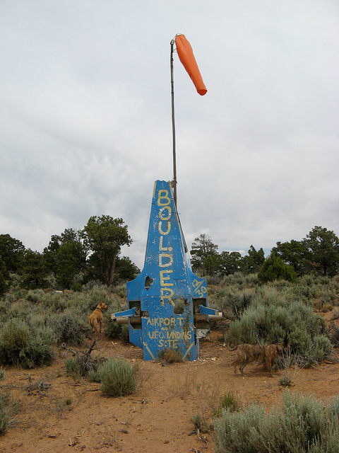
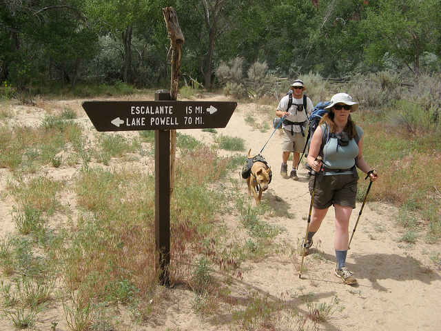
We arrived at the trailhead a little after noon. The idea was to drop all the gear off and one of us would drive to the destination trailhead and hitch hike back. Nate being the nicest looking of the two of us took that responsibility once again. The trailhead was very near the Boulder air strip. Not our typical small town airport... take a look. This is the only marker of any sort near the air strip.
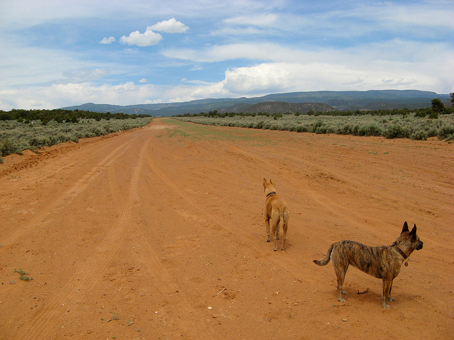
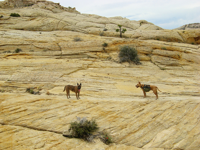
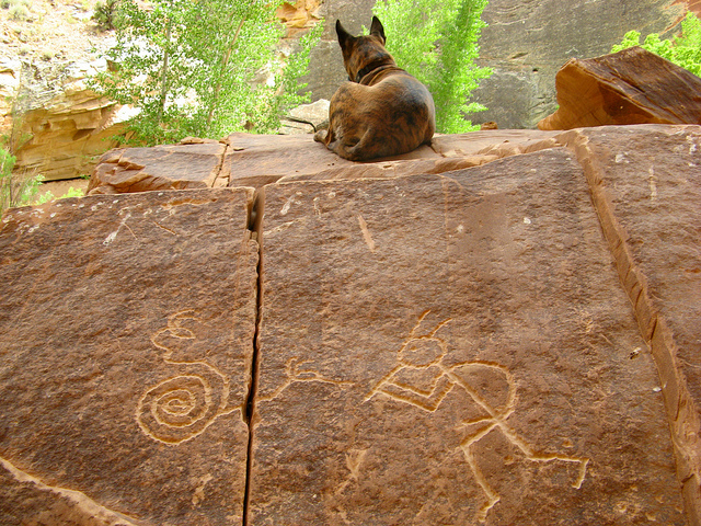
I figured we would only spend 40 minutes to an hour waiting for Nate to get back from dropping off the vehicle so we went for a walk. The dogs didn't know quite what to think of the Boulder Air Strip. The last time I was here there was actually a plane parked at the end of this. How would it be...
So we waited... and waited.
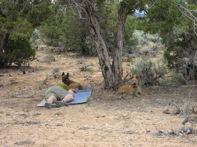
And waited. I was drugged up on Benadryl for my allergies so a nap under a tree was a necessity. It took Nate a whopping three hours to get back to the trailhead. No one would pick him up so he ended up going back to town and hiring a shuttle. Damn tourists. What happened to the days when it was okay to pick up hitch hikers in the middle of the desert?!
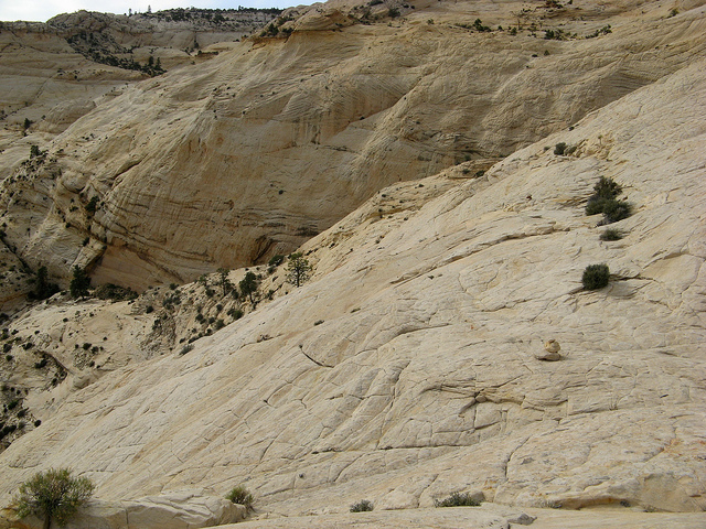
So around 3pm Nate showed up and we were off. The plan was to hike overland via the Boulder Mail Trail into Death Hollow then down to the Escalante River and out to the Highway 12 Bridge. Below is a shot of the first portion of the Boulder Mail Trail. Good thing it was overcast. This would have been nasty on a hot sunny day.
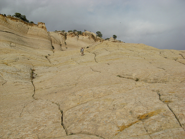
After a mile or so the trail turns into a great slickrock expanse in which cairns guide your way. The dogs seemed to like it.
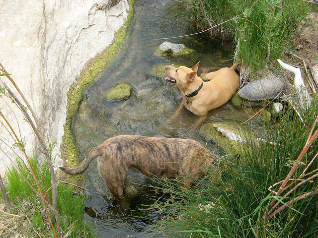
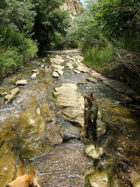
A few miles in we ran into our first water crossing, the upper reaches of Sand Creek. The dogs definitely liked this.
After Sand Creek we started the ascent to the top of what is known as 'The Slickrock Saddle' before descending into Death Hollow.
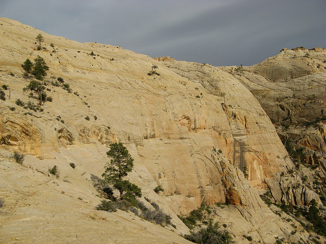
It's a hot, dry hike and any every bit of shade was more than welcome.
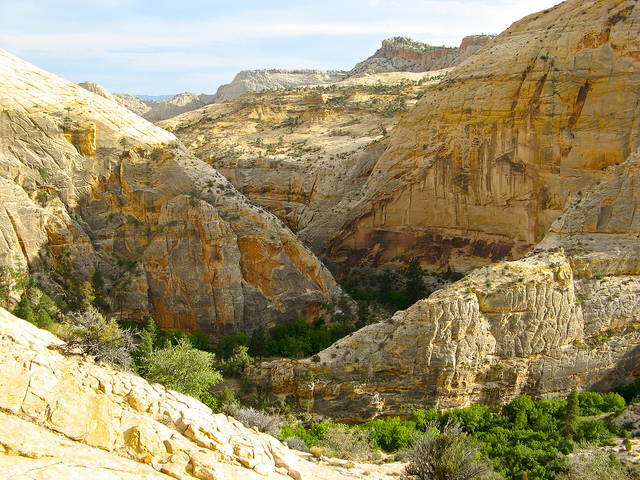
The first glimpse of Death Hollow in the distance.
6 miles into the hike we started the descent into Death Hollow. This was definitely one of the best highlights of the trip. A 700+ foot descent down a slickrock wall. Nikita leads the way...
This is where it gets a little scary. Notice the line of bushes on the right side of this photo, that is our trail down the wall.
Looking back up at Nate during the descent.
Looking into Death Hollow from the descent trail. We will camp at the bend in the center of this picture tonight.
Remember that line of bushes that I said was the trail? Look at it from this angle, top left.
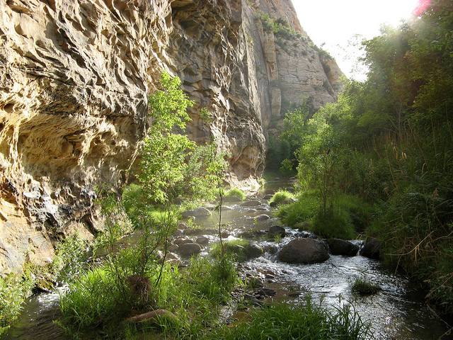
After some extra careful footsteps we made it to the bottom of Death Hollow. It's amazing to go from the baren, hot desert to such a lush, green oasis like this.
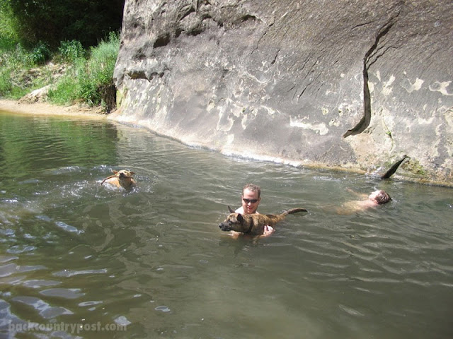
This was a lot deeper than I remembered, Nikita was not pleased. It turns out some beavers had setup a dam just around the bend.
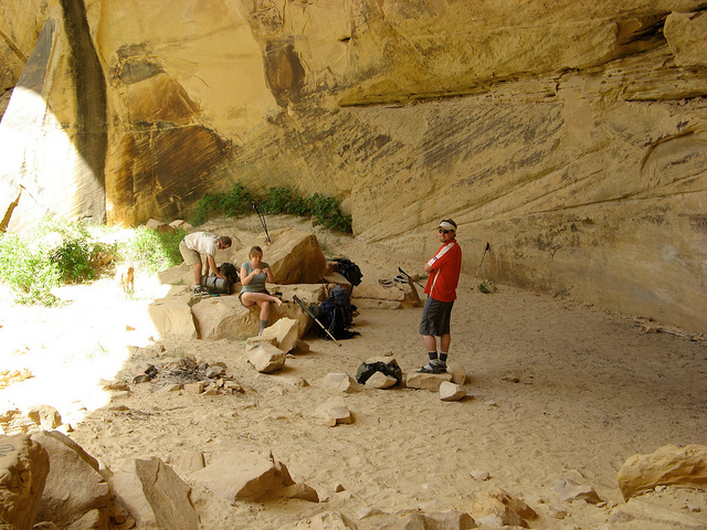
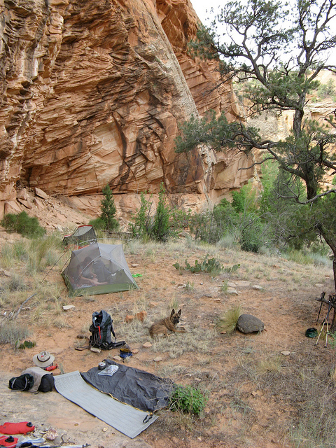
We spent our first night on the backpacking portion of this trip at the big fin campsite when you first enter Death Hollow, I will call it Camp #2 however. I somehow screwed up and managed not to take a photo of camp but this is pretty close to it. The camp itself is wide open with a lot of big trees around. A couple of years ago Nate, Taylor and I walked through here and caught two guys sun bathing butt naked by the river. Yikes.
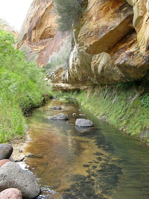
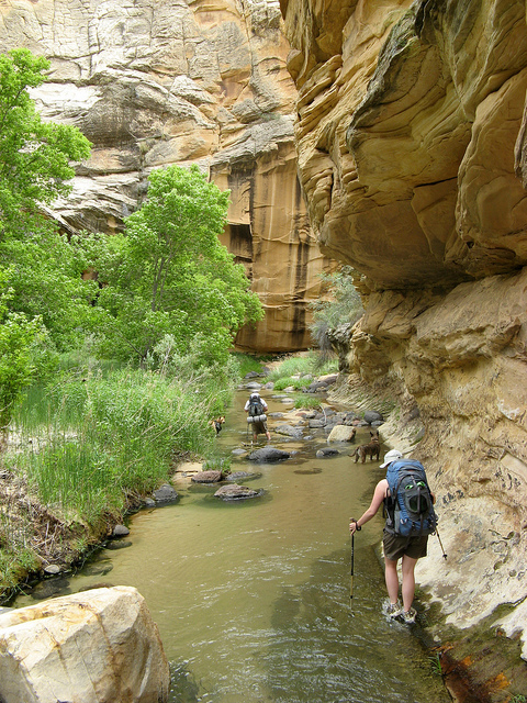
On down the canyon. Notice how clear the water is, pretty uncommon for spring time in the desert.
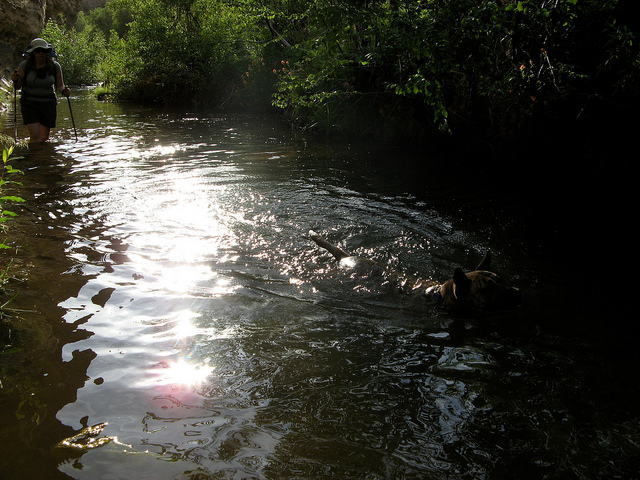
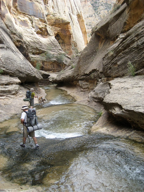
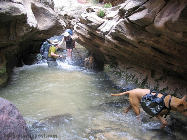
Nate and Audra sloshing down the canyon. The majority of our 24 miles will be spent in the water like this.
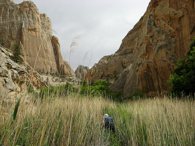
Every now and then we hop out of the water and cut a river bend on dry ground. Notice how tall the grass is here.
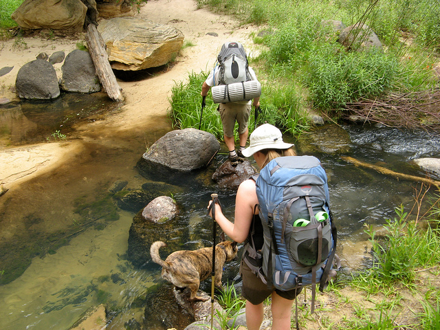
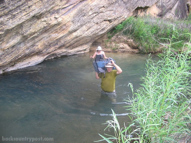
A little further down the canyon we ran into yet another beaver dam. This time the dam was huge. It backed up the river for about a half mile. When we reached the damn it was about 10-12' high and made the river uncrossable for a pretty good stretch. This is a shot of me shuttling over Audra's pack well before we hit the dam.
Audra crossing the dam as it started to rain. Notice how low the water is on the right compared to the left.
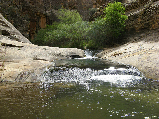
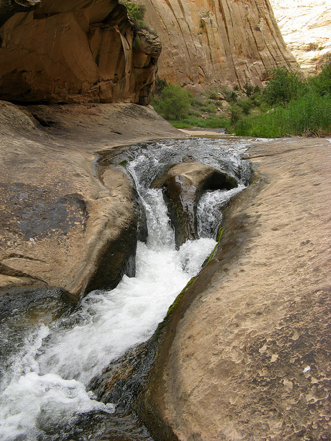
A little further down we ran into one of the finest swimming holes in Death Hollow. A nice slickrock pot hole with a double waterfall. It doesn't get much better than this.
A little further down the river chokes up a bit and drops into the narrows of Death Hollow. Not the most grand set of narrows I've been through but impressive none the less. This is a shot of the river where it first starts its descent.
Baby slot in the narrows.
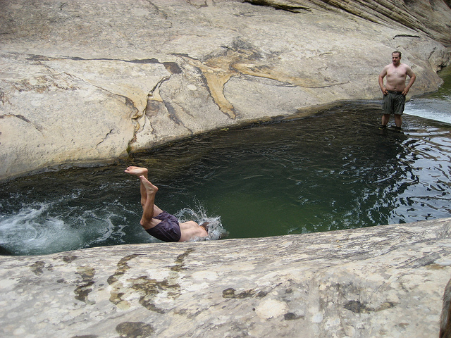
It got pretty tight in there. Nate caught this shot of me helping Audra around this pot hole.
So then the surprise... we make it out of the narrows... we're booking it downstream to our campsite... We're walking on a trail through some pretty dense foliage and all of the sudden I hear 'Nikka!'. I look over and there is Taylor sitting under a tree. I had to sit there and think about it before I decided I was actually seeing him. Taylor was going to come on this trip when we had originally planned it back in May. Unfortunately he wasn't able to get the time off of work for the June version of the trip. Despite all of that he decided to drive all the way down and speed hike something like 14 miles in a day to meet up with us just to hike back out the next day and make it back to work.
Camp 3 - Nate and I stayed here last year. Great spot.
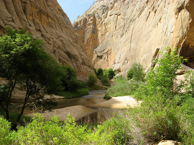
The spectacular view down Death Hollow from our camp.
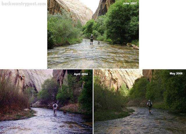
We had banked on staying at this spot for two nights. Not only is it a nice camp spot but when we were here last year it had a beautiful beach with a deep pool to swim in. This year it was gone.... vanished... filled with sand I suppose. Below are some before and after pictures.
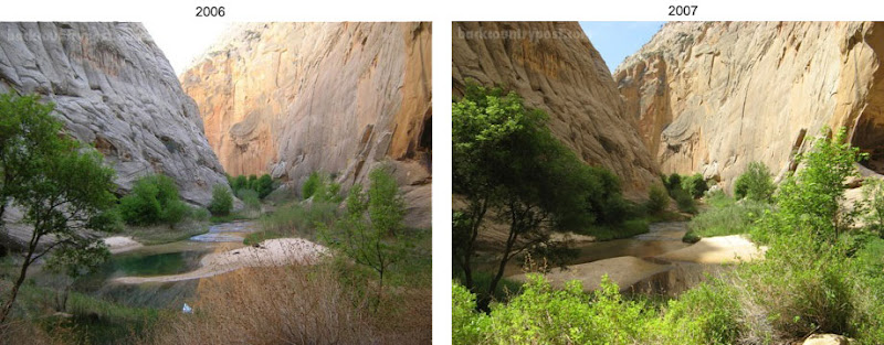
Last year this was a prime beach with a huge, deep swimming hole.
Another before and after
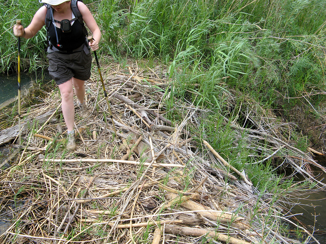
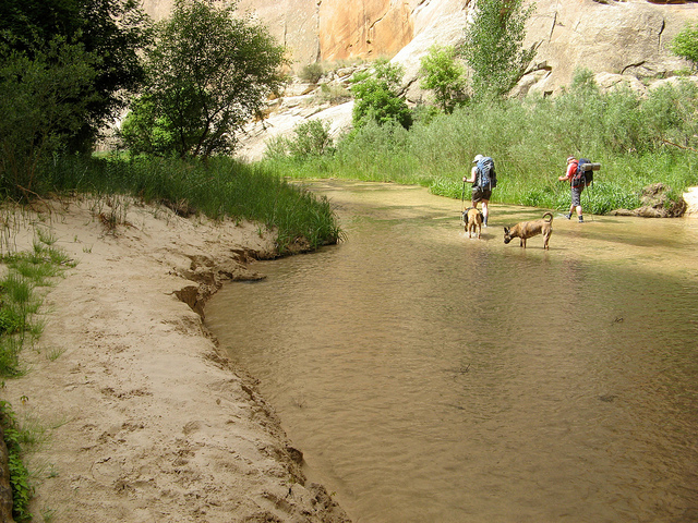
So we only spent one night at that camp due to the lack of a swimming hole. Fortunately we found this nice one on the way out the next day.
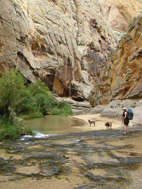
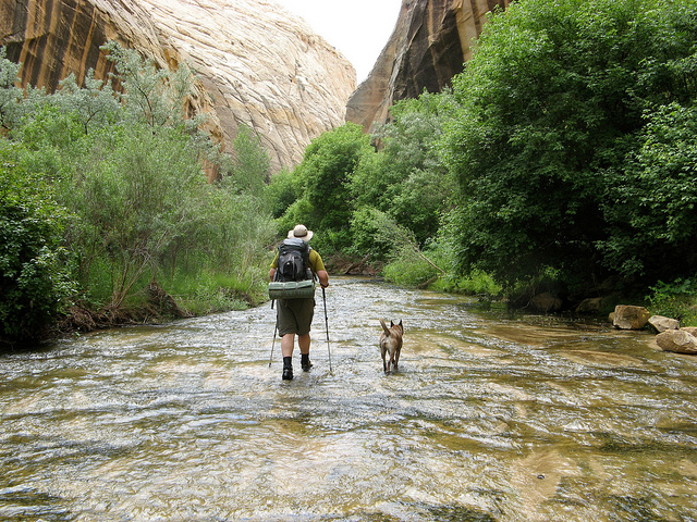
Nikita and I walking down Death Hollow near the confluence with The Escalante River.
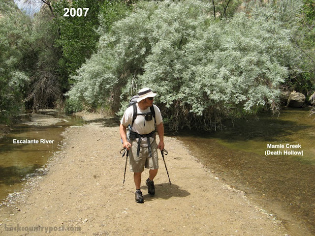
I've walked out of the bottom portion of Death Hollow three times now. Being the dumbass that I am I felt compelled to keep this going...
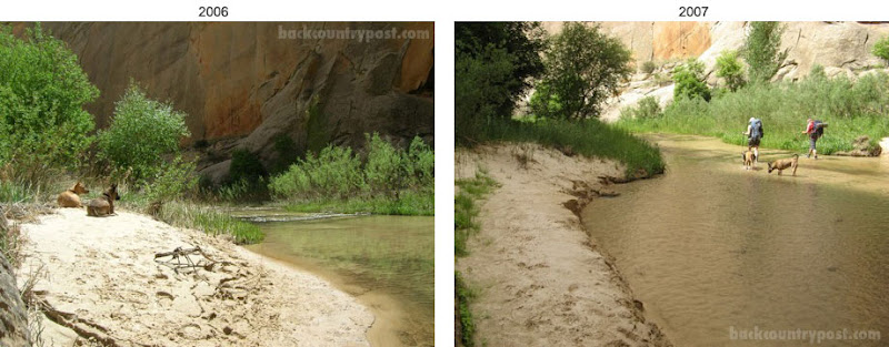
When we reached the confluence with the Escalante River we couldn't help but notice some other big changes from last year. The Escalante was practically dry... and clear. Every time I've been in the area it has had a good milky brown flow to it.
The confluence last year.
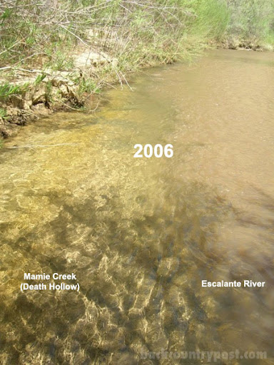
The Escalante lower and more clear than ever before. Last year this was 2 feet of muddy water. It was still brutal on the ankles though.
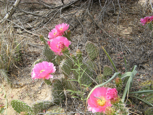
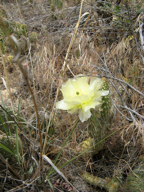
The hike down the Escalante yielded plenty of blooming Prickly Pear.
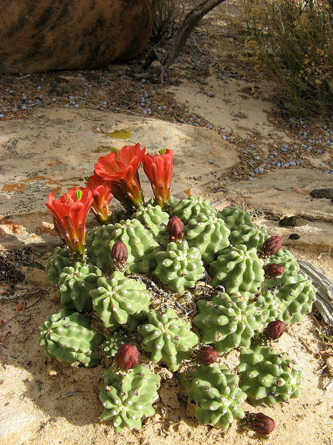
And some Barrel Cactus from the first day.
Once into Sand Creek we found our way into som Anasazi Ruins. Nate and I found this last year but we didn't have the time or energy to check it out.
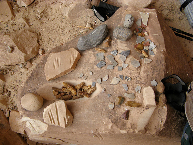
700 year old corncobs, arrowhead chunks and pottery. I think the grooves in the rock were used to grind things.
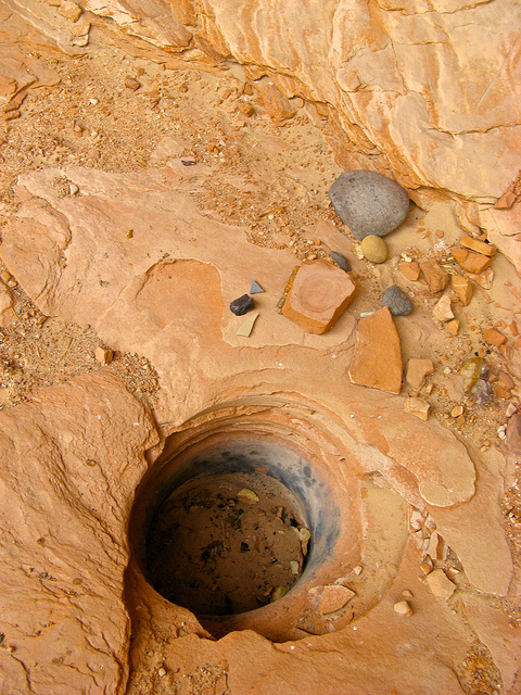
This is an interesting little fire pit in the ruins. The ground around this had clearly been worn heavily from use and it was oddly flat enough to sleep on comfortably.
Camp 4 - We ended up camping on a ledge above the canyon. It was a bit tricky hiking to it but it was worth it. We found a lot of flint and other unusual stones here too. It was just around the corner from the Anasazi site.
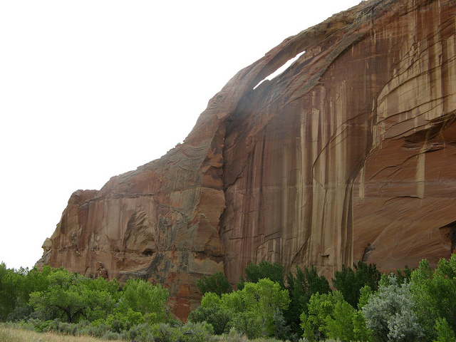
An arch on the hike down the Escalante on our last day.
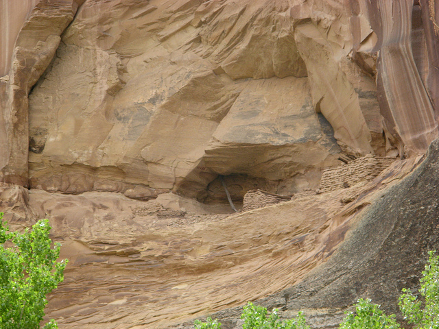
An Anasazi cliff dwelling well above reach.
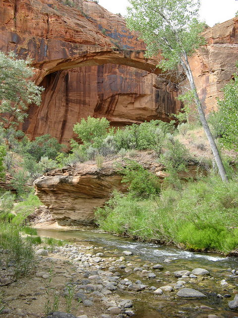
The Escalante Natural Bridge. It still amazes me that the water is as clear as it is this year.
And we're out. This was the end of the 24th mile and 4th day. This was also Audra's first BIG trip and may I just say, she did pretty dang good... mile after mile of sand slogging and boulder hopping. And of course this shot was immediately followed by an hour and a half of drinking and eating at the trailhead.
Featured image for slideshow:

Ahhh Death Hollow, my favorite. I've accessed Death Hollow a multitude of ways, this time around we started at the Boulder Mail Trailhead hiked west overland into Death Hollow, south to the Escalante River, east to Sand Creek and then east again to the Highway 12 Bridge at the Escalante River.
The plan was to leave SLC around 3:00. Naturally we didn't make it out until closer to 5:30. I really suck at packing for these things. We intended to car camp the first night just outside of Boulder but due to our late departure we ended up camping between Scipio and Aurora, very near the same place Nate and I camped last year on our way to Escalante.
- trip date: 6/1 thru 6/5/07
- distance: 24 Miles
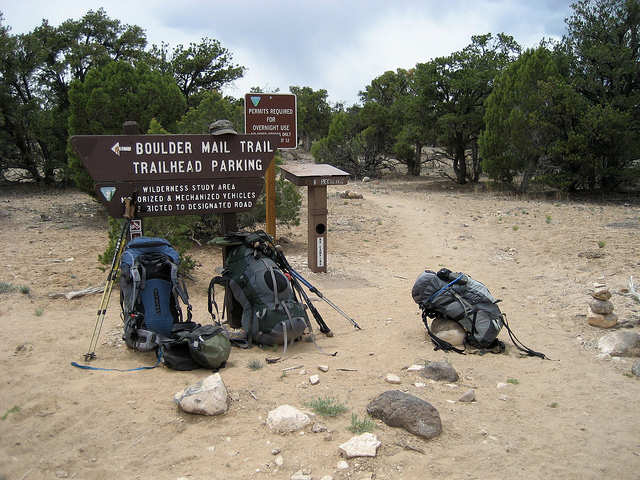
- starting point: Boulder Mail Trail Trailhead near the Boulder Air Strip
- ending point: Highway 12 Escalante River Trailhead
- elevations: 6,760' at the Mail Trail Trailhead, 5,200' at the Highway 12 Trailhead
We got out of Salt Lake late in the afternoon so we stopped at a nice spot outside of Scipio to camp. We've used this spot a few times before. In the morning we were able to appreciate the scenic drive through Torrey and Boulder.
We arrived at the trailhead a little after noon. The idea was to drop all the gear off and one of us would drive to the destination trailhead and hitch hike back. Nate being the nicest looking of the two of us took that responsibility once again. The trailhead was very near the Boulder air strip. Not our typical small town airport... take a look. This is the only marker of any sort near the air strip.
I figured we would only spend 40 minutes to an hour waiting for Nate to get back from dropping off the vehicle so we went for a walk. The dogs didn't know quite what to think of the Boulder Air Strip. The last time I was here there was actually a plane parked at the end of this. How would it be...
So we waited... and waited.
And waited. I was drugged up on Benadryl for my allergies so a nap under a tree was a necessity. It took Nate a whopping three hours to get back to the trailhead. No one would pick him up so he ended up going back to town and hiring a shuttle. Damn tourists. What happened to the days when it was okay to pick up hitch hikers in the middle of the desert?!
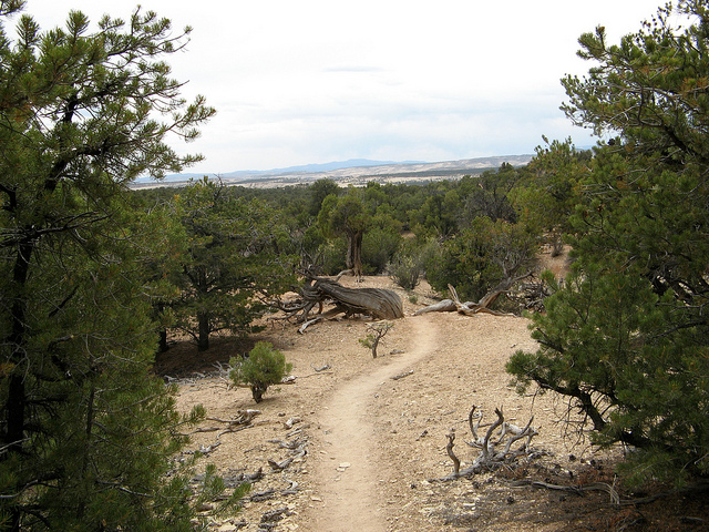
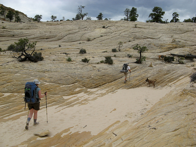
So around 3pm Nate showed up and we were off. The plan was to hike overland via the Boulder Mail Trail into Death Hollow then down to the Escalante River and out to the Highway 12 Bridge. Below is a shot of the first portion of the Boulder Mail Trail. Good thing it was overcast. This would have been nasty on a hot sunny day.
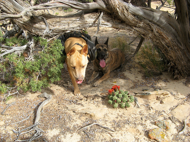
After a mile or so the trail turns into a great slickrock expanse in which cairns guide your way. The dogs seemed to like it.
A few miles in we ran into our first water crossing, the upper reaches of Sand Creek. The dogs definitely liked this.
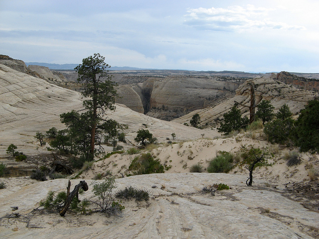
After Sand Creek we started the ascent to the top of what is known as 'The Slickrock Saddle' before descending into Death Hollow.
It's a hot, dry hike and any every bit of shade was more than welcome.
The first glimpse of Death Hollow in the distance.
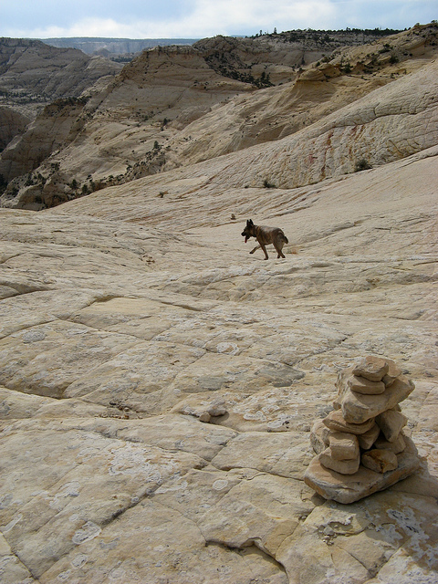
6 miles into the hike we started the descent into Death Hollow. This was definitely one of the best highlights of the trip. A 700+ foot descent down a slickrock wall. Nikita leads the way...
This is where it gets a little scary. Notice the line of bushes on the right side of this photo, that is our trail down the wall.
Looking back up at Nate during the descent.
Looking into Death Hollow from the descent trail. We will camp at the bend in the center of this picture tonight.
Remember that line of bushes that I said was the trail? Look at it from this angle, top left.
After some extra careful footsteps we made it to the bottom of Death Hollow. It's amazing to go from the baren, hot desert to such a lush, green oasis like this.
This was a lot deeper than I remembered, Nikita was not pleased. It turns out some beavers had setup a dam just around the bend.
We spent our first night on the backpacking portion of this trip at the big fin campsite when you first enter Death Hollow, I will call it Camp #2 however. I somehow screwed up and managed not to take a photo of camp but this is pretty close to it. The camp itself is wide open with a lot of big trees around. A couple of years ago Nate, Taylor and I walked through here and caught two guys sun bathing butt naked by the river. Yikes.
On down the canyon. Notice how clear the water is, pretty uncommon for spring time in the desert.
Nate and Audra sloshing down the canyon. The majority of our 24 miles will be spent in the water like this.
Every now and then we hop out of the water and cut a river bend on dry ground. Notice how tall the grass is here.
A little further down the canyon we ran into yet another beaver dam. This time the dam was huge. It backed up the river for about a half mile. When we reached the damn it was about 10-12' high and made the river uncrossable for a pretty good stretch. This is a shot of me shuttling over Audra's pack well before we hit the dam.
Audra crossing the dam as it started to rain. Notice how low the water is on the right compared to the left.
A little further down we ran into one of the finest swimming holes in Death Hollow. A nice slickrock pot hole with a double waterfall. It doesn't get much better than this.
A little further down the river chokes up a bit and drops into the narrows of Death Hollow. Not the most grand set of narrows I've been through but impressive none the less. This is a shot of the river where it first starts its descent.
Baby slot in the narrows.
It got pretty tight in there. Nate caught this shot of me helping Audra around this pot hole.
So then the surprise... we make it out of the narrows... we're booking it downstream to our campsite... We're walking on a trail through some pretty dense foliage and all of the sudden I hear 'Nikka!'. I look over and there is Taylor sitting under a tree. I had to sit there and think about it before I decided I was actually seeing him. Taylor was going to come on this trip when we had originally planned it back in May. Unfortunately he wasn't able to get the time off of work for the June version of the trip. Despite all of that he decided to drive all the way down and speed hike something like 14 miles in a day to meet up with us just to hike back out the next day and make it back to work.
Camp 3 - Nate and I stayed here last year. Great spot.
The spectacular view down Death Hollow from our camp.
We had banked on staying at this spot for two nights. Not only is it a nice camp spot but when we were here last year it had a beautiful beach with a deep pool to swim in. This year it was gone.... vanished... filled with sand I suppose. Below are some before and after pictures.
Last year this was a prime beach with a huge, deep swimming hole.
Another before and after
So we only spent one night at that camp due to the lack of a swimming hole. Fortunately we found this nice one on the way out the next day.
Nikita and I walking down Death Hollow near the confluence with The Escalante River.
I've walked out of the bottom portion of Death Hollow three times now. Being the dumbass that I am I felt compelled to keep this going...
When we reached the confluence with the Escalante River we couldn't help but notice some other big changes from last year. The Escalante was practically dry... and clear. Every time I've been in the area it has had a good milky brown flow to it.
The confluence last year.
The Escalante lower and more clear than ever before. Last year this was 2 feet of muddy water. It was still brutal on the ankles though.
The hike down the Escalante yielded plenty of blooming Prickly Pear.
And some Barrel Cactus from the first day.
Once into Sand Creek we found our way into som Anasazi Ruins. Nate and I found this last year but we didn't have the time or energy to check it out.
700 year old corncobs, arrowhead chunks and pottery. I think the grooves in the rock were used to grind things.
This is an interesting little fire pit in the ruins. The ground around this had clearly been worn heavily from use and it was oddly flat enough to sleep on comfortably.
Camp 4 - We ended up camping on a ledge above the canyon. It was a bit tricky hiking to it but it was worth it. We found a lot of flint and other unusual stones here too. It was just around the corner from the Anasazi site.
An arch on the hike down the Escalante on our last day.
An Anasazi cliff dwelling well above reach.
The Escalante Natural Bridge. It still amazes me that the water is as clear as it is this year.
And we're out. This was the end of the 24th mile and 4th day. This was also Audra's first BIG trip and may I just say, she did pretty dang good... mile after mile of sand slogging and boulder hopping. And of course this shot was immediately followed by an hour and a half of drinking and eating at the trailhead.
Featured image for slideshow:
")