- Joined
- May 31, 2015
- Messages
- 3,354
May 5-8, 2017
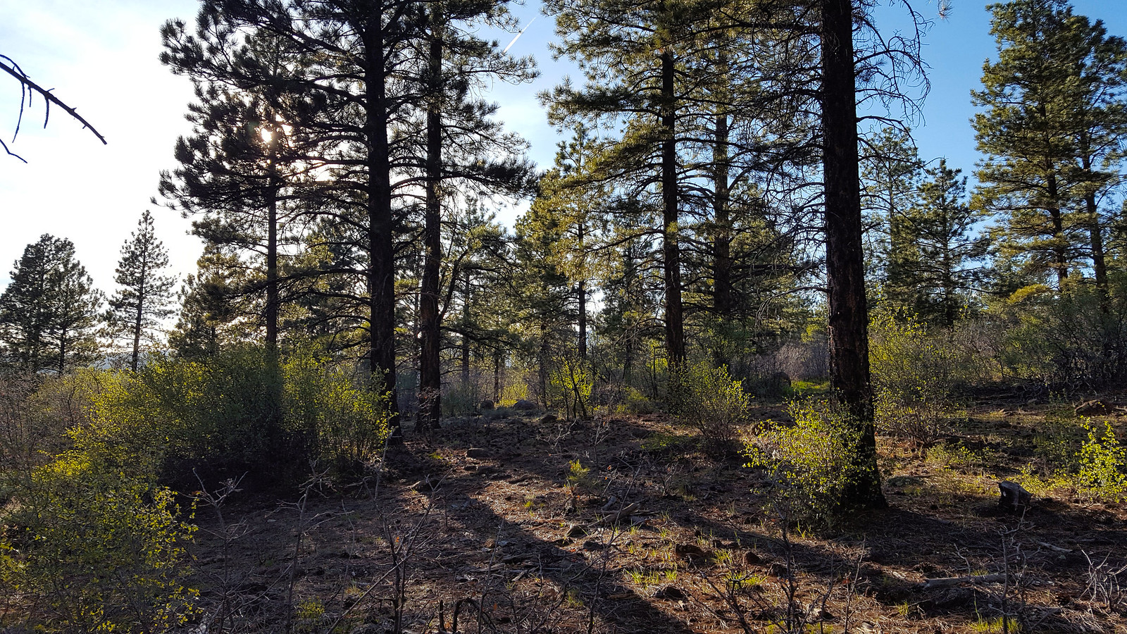
I finished my last exam and I was free. I got together with two friends and we headed down for a weekend of camping and backpacking. We stopped in Torrey for dinner at Slackers, then we headed to find camp for the night on Boulder Mountain. Fortunately, all of the lower reaches were snow free, so we found a great spot pretty close to the town of Boulder. We got the tent set up and checked out our surroundings. I love being in the ponderosa pine forest. Those trees are awesome.
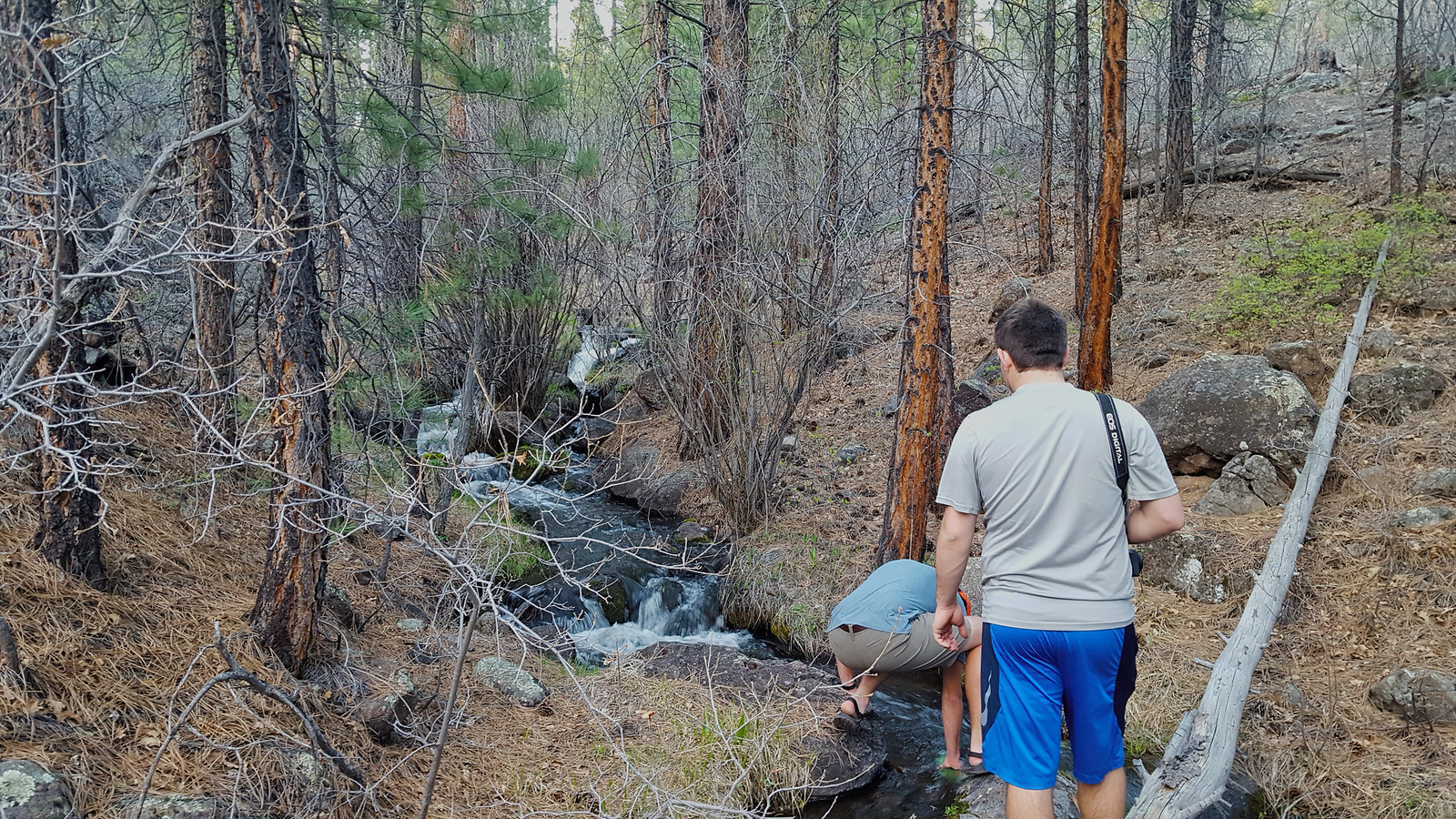
We found this nice stream where we topped off our water.
On our way back to camp, we realized there was a cow carcass about 75 yards from our camp site. Very decayed. I refrained from taking any pictures.
The sun went down and the mosquitoes came out. They were pretty fierce. I was surprised they were already out in such force.
The morning was the biggest challenge, for me anyway. We got up and broke camp. Then, we headed down to the Boulder airstrip. We had brought my road bike to do a shuttle of sorts. So I took Mike's car with my road bike on the back, left Mike and Gavin at the airstrip trailhead, and went down to drop the car at the bridge over the Escalante and ride back. I haven't ridden much since high school, so in spite of it only being around 10 miles, that was one tough ride. Pretty good incline. Better to do it on the first day than the last day though.
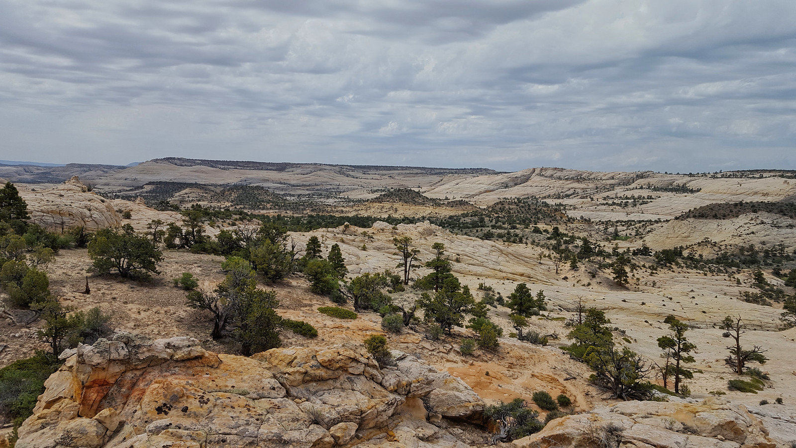
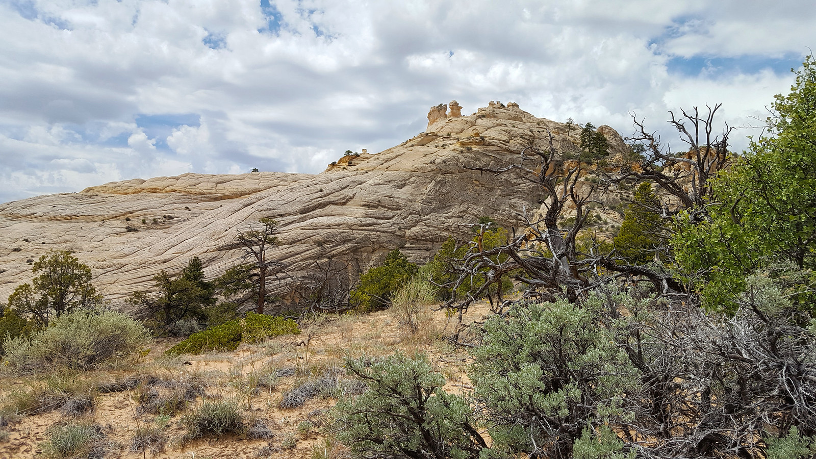
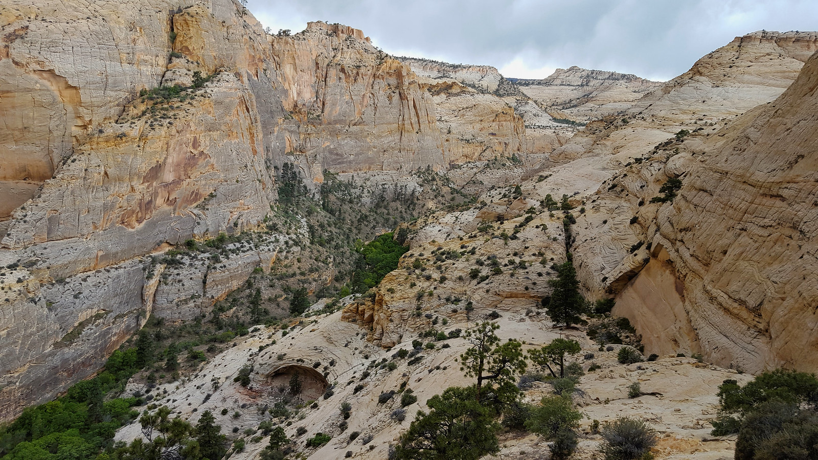
So I got back to the trailhead very tired, but feeling accomplished. Locked up the bike and we set out. I love big slickrock expanses.
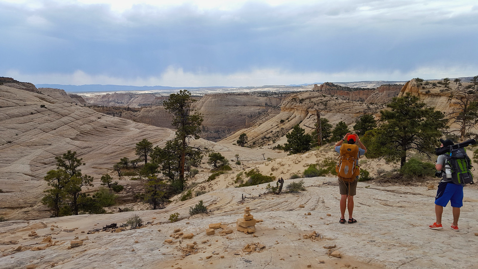
It was only 75 that day, but the sun really sucked the energy out of us.
We got closer to the drop into Death Hollow, and a storm was blowing in.
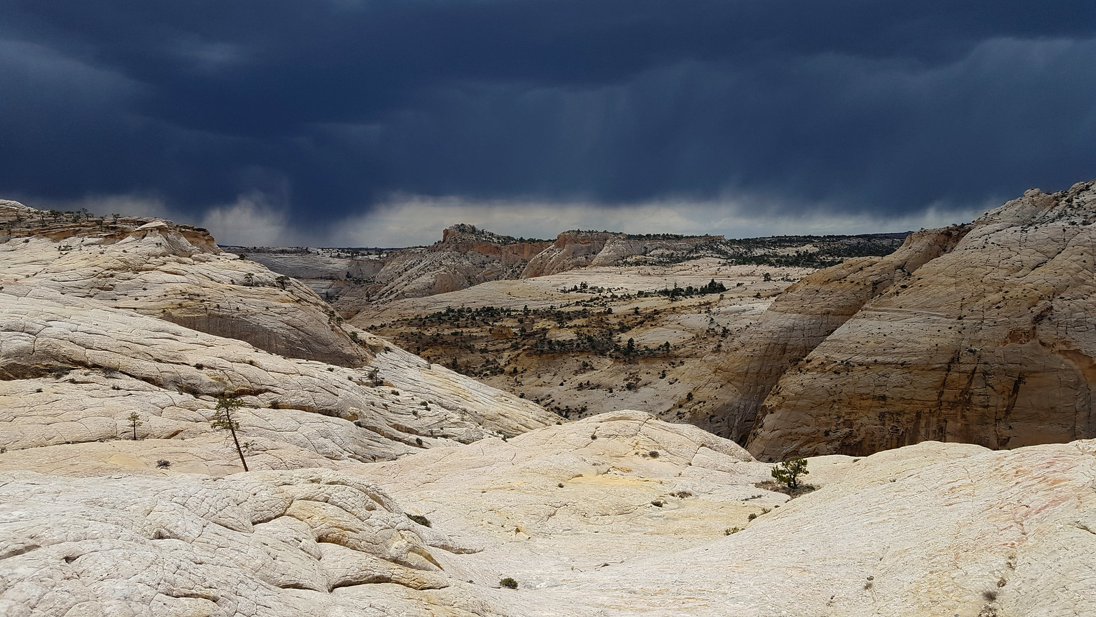
The clouds got darker (I didn't darken them here).
Then, of course, the storm hit us while we were descending. I hustled to get down. The wind was throwing sand and other debris in my face, and the rain started to come down pretty heavily as we got down closer to the canyon bottom.
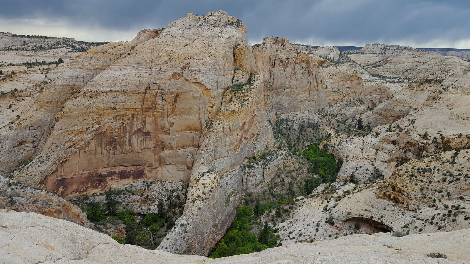
We took refuge in the big alcove and just relaxed for 45 minutes or so as the storm blew over. We inspected the Twitchell inscription and mused about how cowboys etched such neat letters into sandstone. I don't know why I failed to photograph it.
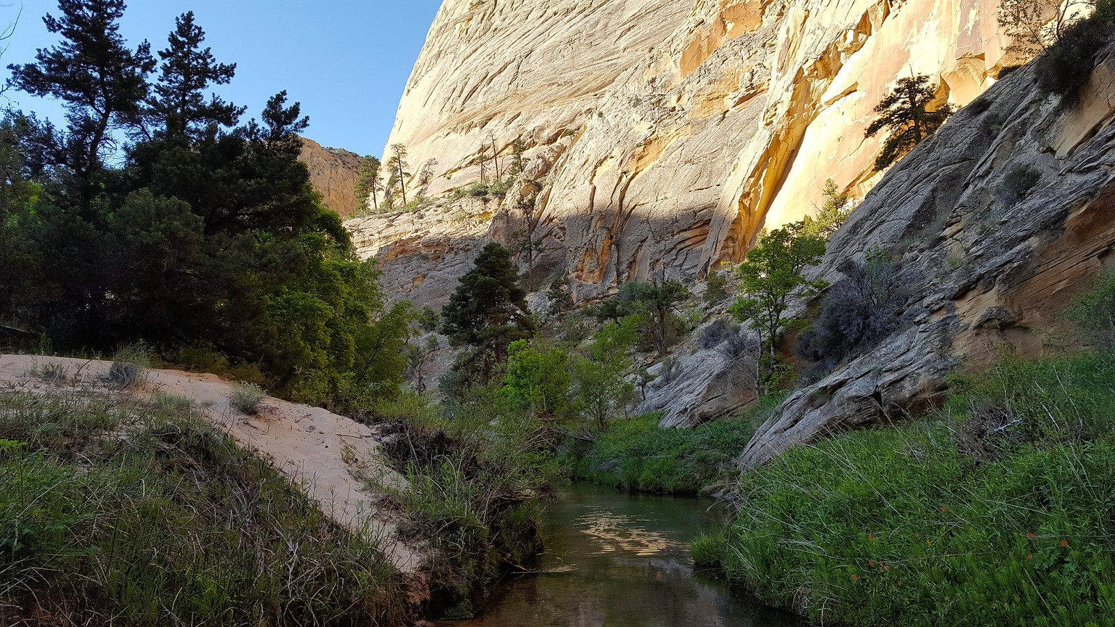
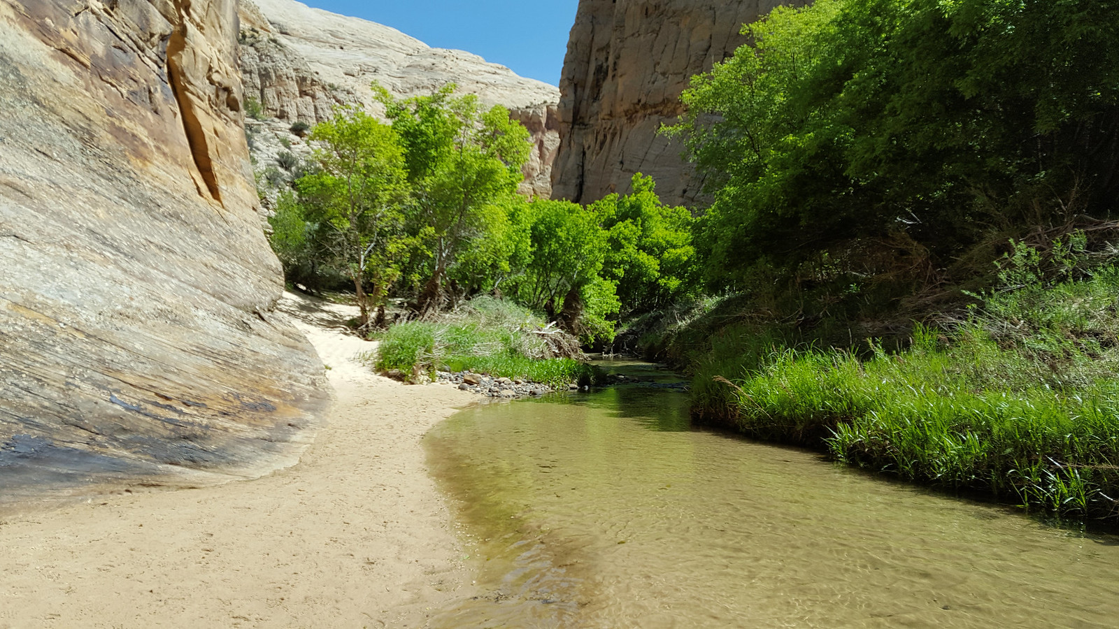
After the sun came back out, we headed out and went straight for the creek. Wading through was excellent. It helped me keep out of the poison ivy, which is good because my skin reacts pretty badly when it comes in contact with the leaves. I didn't take any pictures until we got to camp because I didn't want to ruin my camera in the water.
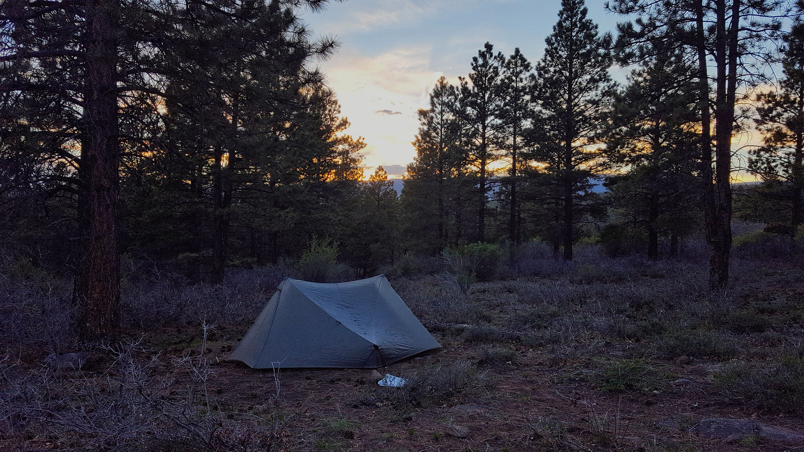
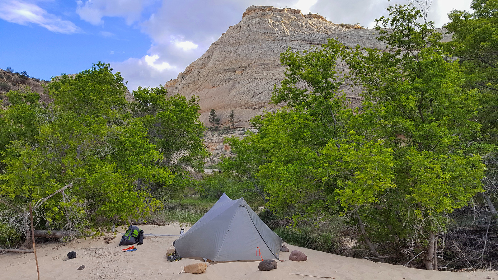
We found a great camp site in the white sand. It was very windy that evening, and it looked like it could rain sometime overnight. We had planned on cowboy camping, and I had brought a tent in case of rain, but no one else had. Since there were three of us, I had the chance to really put my StratoSpire 2 to the test. We pitched it without stakes since the sand was so loose, and since the 3 of us wouldn't fit in the mesh insert, we pitched it without the insert. It turned out to be pretty a pretty hardy shelter.
We ate, hung out until it was pretty dark, and then we went to bed. It didn't rain overnight, but there were some strong gusts. We were glad we had the tent.
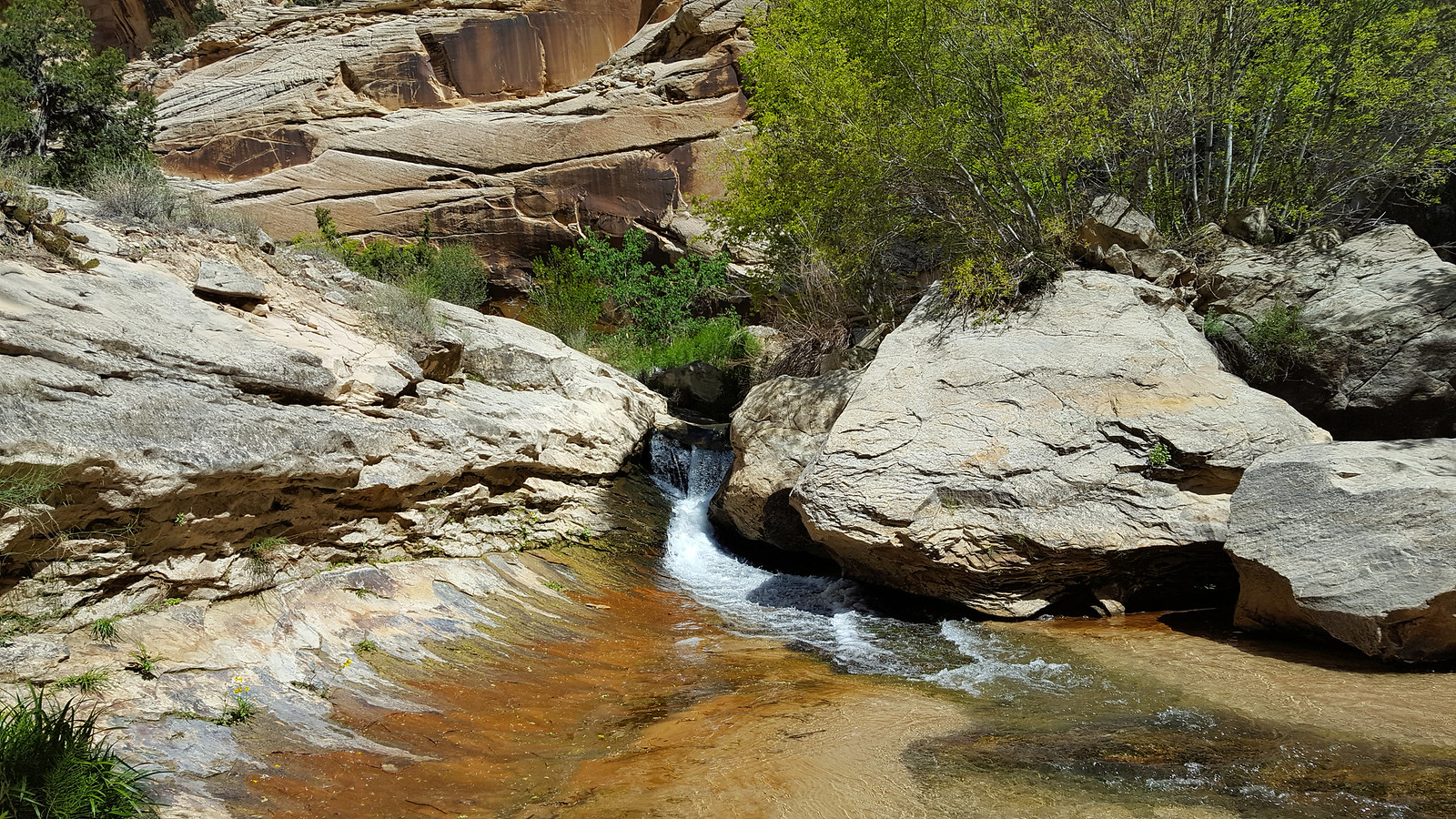
In the morning, we got going pretty early. It was nice wading for quite a ways, and we moved pretty quickly through. We stopped periodically throughout the day to dump sand out of our shoes.
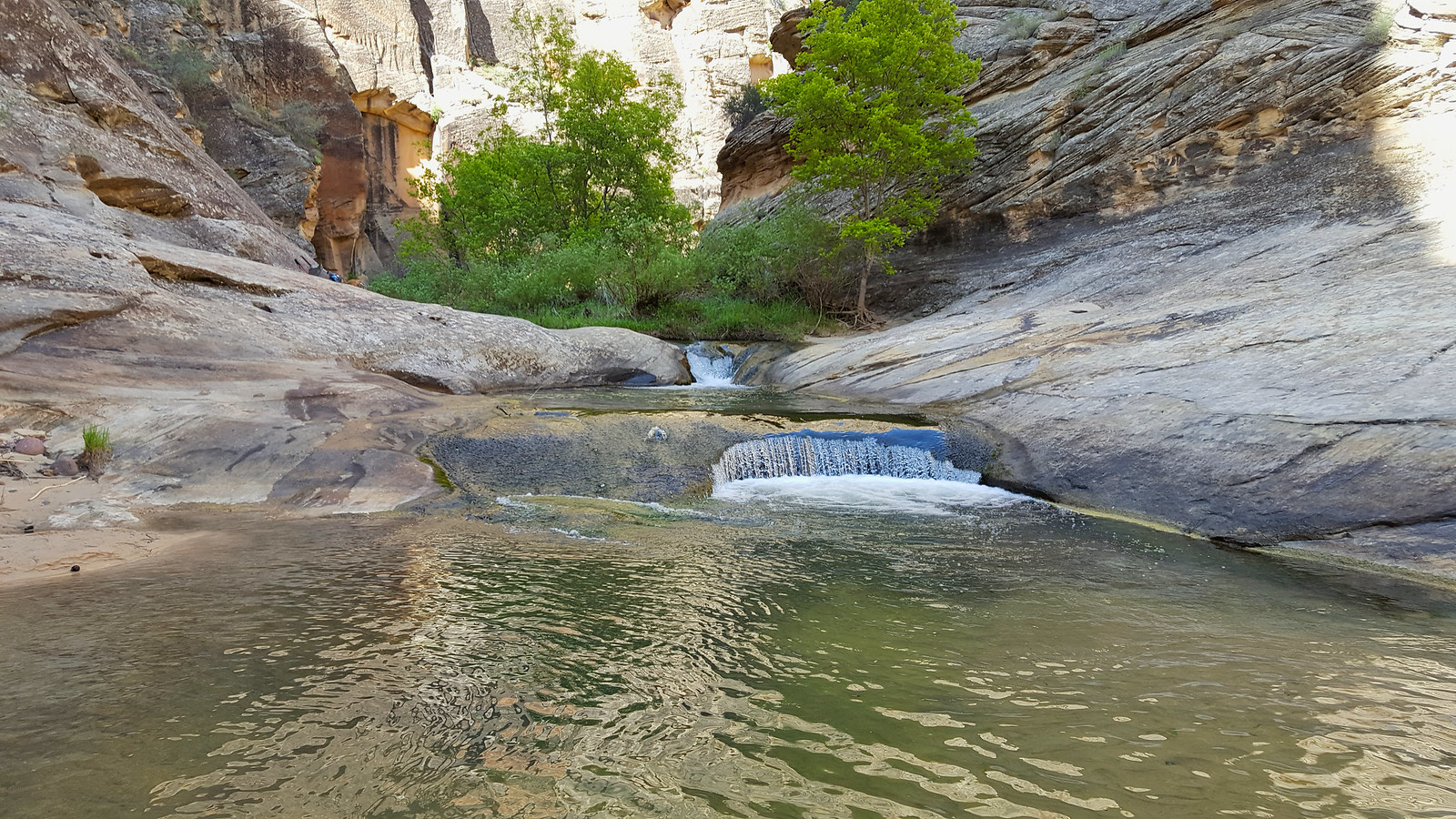
We made it to a pool, but it was in the shade and the day was still fairly cool. Gavin and I jumped in a few times anyway. That water was frigid, but I don't regret it.
We got moving again.
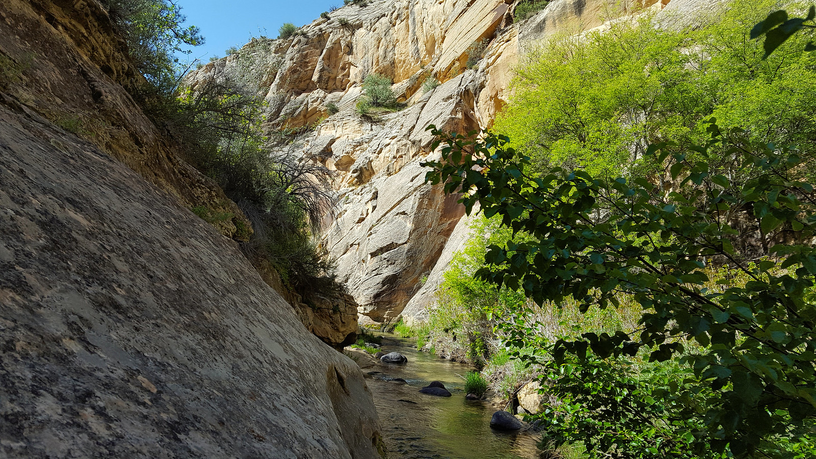
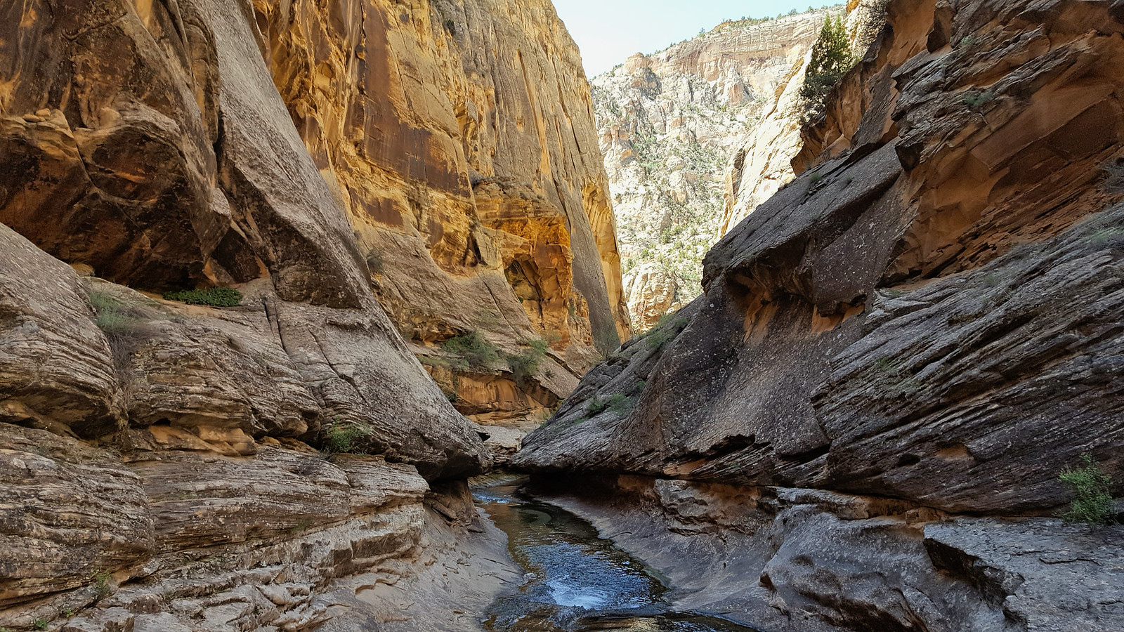
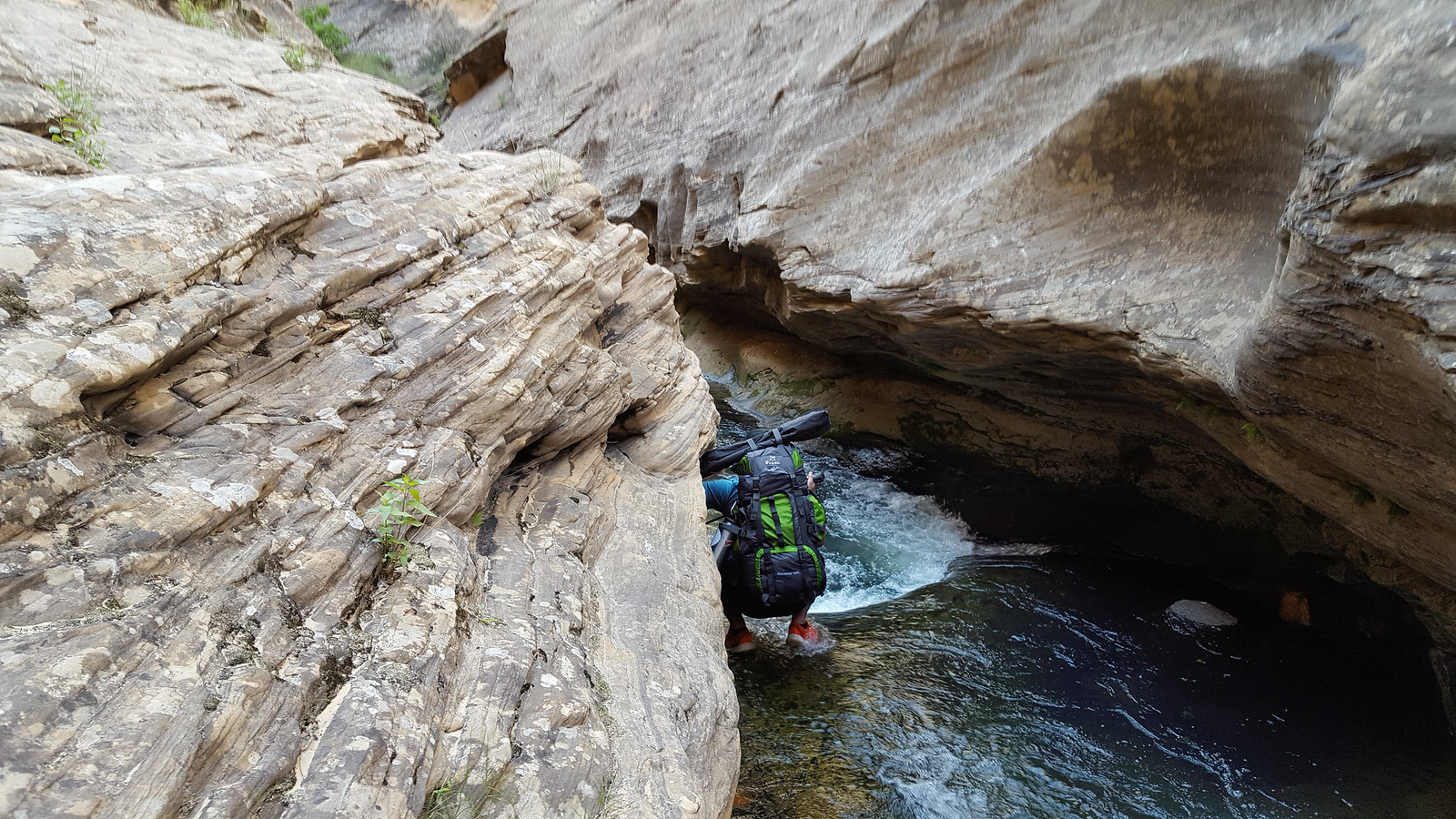
Then we reached the narrows. Going around the deep sections was more difficult than I anticipated, but it was very enjoyable.
We carried on, passing through the very pretty lower section of the canyon, and, once again, I didn't take any pictures. There were so many cool pools and potholes and such. We passed a few groups who had come in from Highway 12.
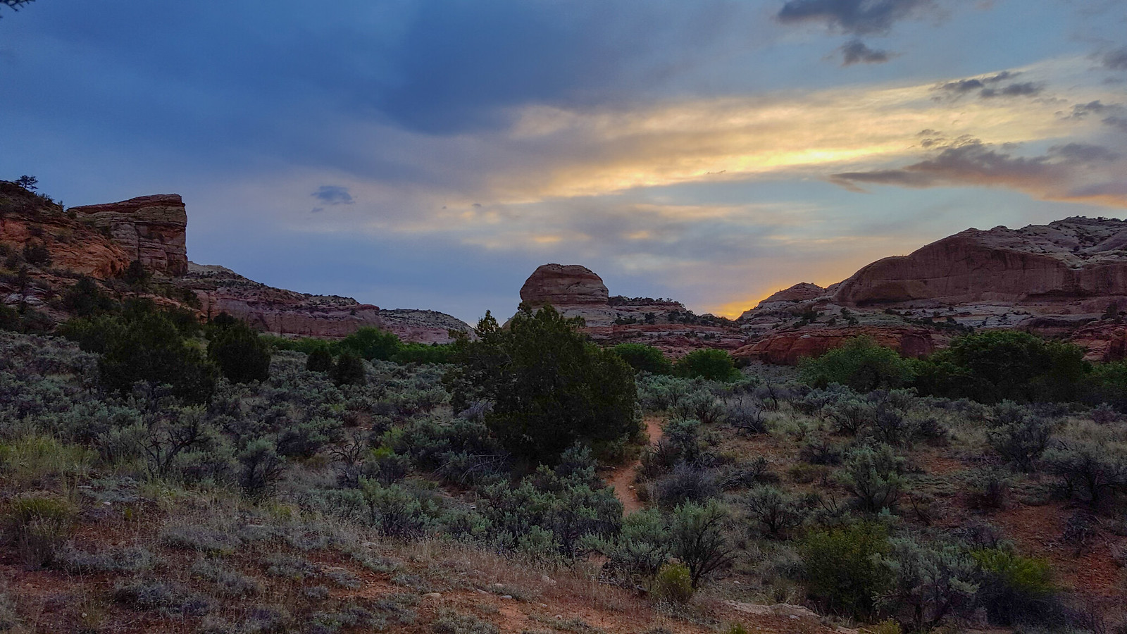
We reached the Escalante and headed east. We started looking for a camp site after a while, and we settled on a spot maybe 5 miles from the trailhead. We ate and lounged around, tired from the day's walk. The skies started getting dark, and the wind picked up. Looked like another storm was headed our way. We had seen in the forecast that there was a chance that it would get cold and storm on and off that night (with snow possibly falling in Boulder), and that started to weigh on our minds. We asked ourselves whether we'd rather chance it and camp or whether we'd rather just hike out and head home. Once the thunder got closer and the temperature started to drop, we opted to hike out. So we packed quickly and headed for the bridge. We made pretty good time, and because of the clouds, the sunset was pretty cool. The mosquitoes came out and crashed the party, so we put on some bug spray and booked it outta there.
On the drive out, we saw lots of lightning headed for where we would've been, so we tried using that convince ourselves we made the right call. Either way, it was an awesome trip.
I finished my last exam and I was free. I got together with two friends and we headed down for a weekend of camping and backpacking. We stopped in Torrey for dinner at Slackers, then we headed to find camp for the night on Boulder Mountain. Fortunately, all of the lower reaches were snow free, so we found a great spot pretty close to the town of Boulder. We got the tent set up and checked out our surroundings. I love being in the ponderosa pine forest. Those trees are awesome.
We found this nice stream where we topped off our water.
On our way back to camp, we realized there was a cow carcass about 75 yards from our camp site. Very decayed. I refrained from taking any pictures.
The sun went down and the mosquitoes came out. They were pretty fierce. I was surprised they were already out in such force.
The morning was the biggest challenge, for me anyway. We got up and broke camp. Then, we headed down to the Boulder airstrip. We had brought my road bike to do a shuttle of sorts. So I took Mike's car with my road bike on the back, left Mike and Gavin at the airstrip trailhead, and went down to drop the car at the bridge over the Escalante and ride back. I haven't ridden much since high school, so in spite of it only being around 10 miles, that was one tough ride. Pretty good incline. Better to do it on the first day than the last day though.
So I got back to the trailhead very tired, but feeling accomplished. Locked up the bike and we set out. I love big slickrock expanses.
It was only 75 that day, but the sun really sucked the energy out of us.
We got closer to the drop into Death Hollow, and a storm was blowing in.
The clouds got darker (I didn't darken them here).
Then, of course, the storm hit us while we were descending. I hustled to get down. The wind was throwing sand and other debris in my face, and the rain started to come down pretty heavily as we got down closer to the canyon bottom.
We took refuge in the big alcove and just relaxed for 45 minutes or so as the storm blew over. We inspected the Twitchell inscription and mused about how cowboys etched such neat letters into sandstone. I don't know why I failed to photograph it.
After the sun came back out, we headed out and went straight for the creek. Wading through was excellent. It helped me keep out of the poison ivy, which is good because my skin reacts pretty badly when it comes in contact with the leaves. I didn't take any pictures until we got to camp because I didn't want to ruin my camera in the water.
We found a great camp site in the white sand. It was very windy that evening, and it looked like it could rain sometime overnight. We had planned on cowboy camping, and I had brought a tent in case of rain, but no one else had. Since there were three of us, I had the chance to really put my StratoSpire 2 to the test. We pitched it without stakes since the sand was so loose, and since the 3 of us wouldn't fit in the mesh insert, we pitched it without the insert. It turned out to be pretty a pretty hardy shelter.
We ate, hung out until it was pretty dark, and then we went to bed. It didn't rain overnight, but there were some strong gusts. We were glad we had the tent.
In the morning, we got going pretty early. It was nice wading for quite a ways, and we moved pretty quickly through. We stopped periodically throughout the day to dump sand out of our shoes.
We made it to a pool, but it was in the shade and the day was still fairly cool. Gavin and I jumped in a few times anyway. That water was frigid, but I don't regret it.
We got moving again.
Then we reached the narrows. Going around the deep sections was more difficult than I anticipated, but it was very enjoyable.
We carried on, passing through the very pretty lower section of the canyon, and, once again, I didn't take any pictures. There were so many cool pools and potholes and such. We passed a few groups who had come in from Highway 12.
We reached the Escalante and headed east. We started looking for a camp site after a while, and we settled on a spot maybe 5 miles from the trailhead. We ate and lounged around, tired from the day's walk. The skies started getting dark, and the wind picked up. Looked like another storm was headed our way. We had seen in the forecast that there was a chance that it would get cold and storm on and off that night (with snow possibly falling in Boulder), and that started to weigh on our minds. We asked ourselves whether we'd rather chance it and camp or whether we'd rather just hike out and head home. Once the thunder got closer and the temperature started to drop, we opted to hike out. So we packed quickly and headed for the bridge. We made pretty good time, and because of the clouds, the sunset was pretty cool. The mosquitoes came out and crashed the party, so we put on some bug spray and booked it outta there.
On the drive out, we saw lots of lightning headed for where we would've been, so we tried using that convince ourselves we made the right call. Either way, it was an awesome trip.
Last edited:
") Awesome to see how your Stratosphere worked out for 3 people and no stakes.
Awesome to see how your Stratosphere worked out for 3 people and no stakes. , but then it probably would have made me tear up too. Lol