Blake Merrell
Life Elevated - Rising Higher
- Joined
- Feb 25, 2013
- Messages
- 600
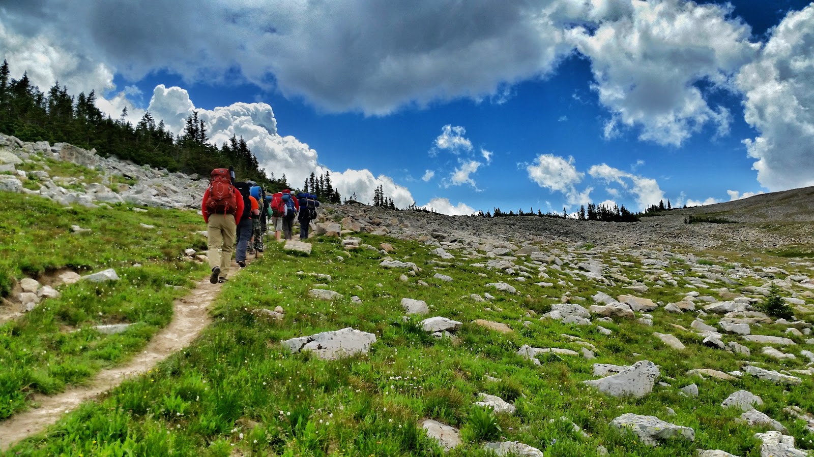
This is what happens when you leave it up to me to plan a 3 day backpacking trip for 12 year old scouts! The orginal plan was to get dropped off at Payson Lakes and then have the boys backpack over Loafer Mountain, through Snell Canyon and then just walk home. That would have been a 15+ mile hike and probably would have soured the kids to backpacking for the rest of their lives. No way I wanted that to happen, so the more I thought about it, the more I realized I wanted to introduce the scouts to some amazing scenery, with some short sections of backpacking, and try and include a good mountain summit. Do something that is amazing, but not to hard.
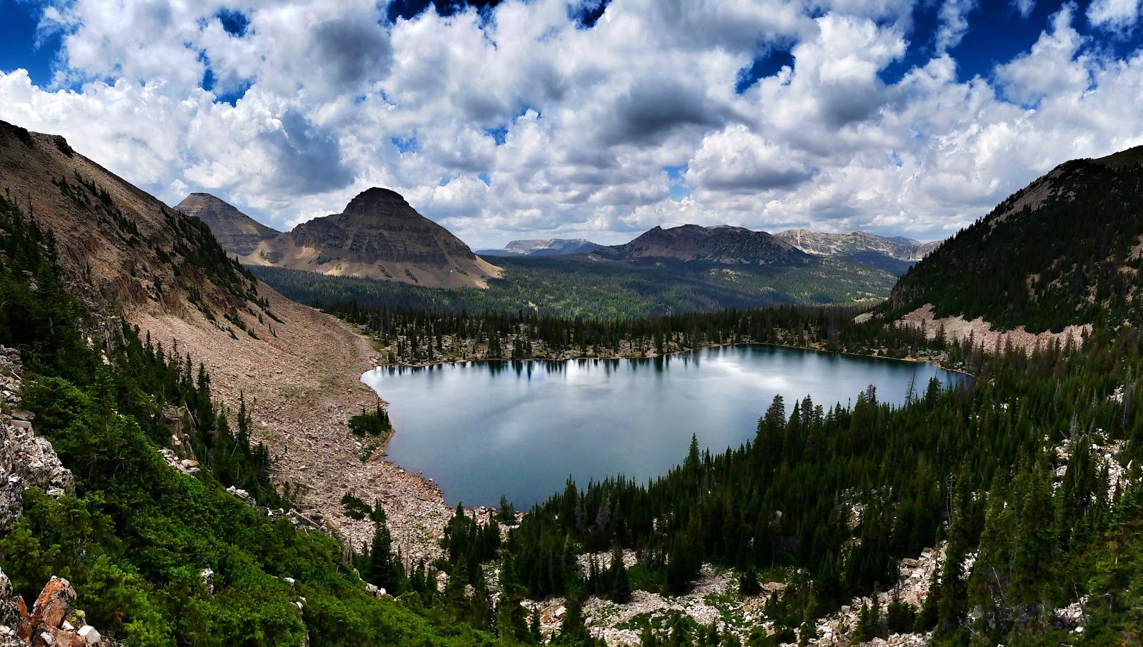
After a bit of searching, I found a potential route in the Cuberant and Kamas lake area of the High Uintas.
The beginning of this hike was pure torture! The scouts left on Thursday night, instead of the usual Friday evening. This meant that I had to be at work on Friday while they were traipsing across the wilderness. I was super jealous. To ease the pain, though, I sent the Scoutmaster with a Spot GPS tracker and I was able to follow them with the aid of GPS tech and Google Earth! Every 10 minutes I a GPS track would show up on the Google Earth map. It was fun to see them making progress. On Friday, when I saw that the team made it to the top of Mount Marsell I cheered in my seat at work. I was thrilled to see that the group made the climb! If I couldn't be there in person, I guess following them with the SPOT is the next best thing
")

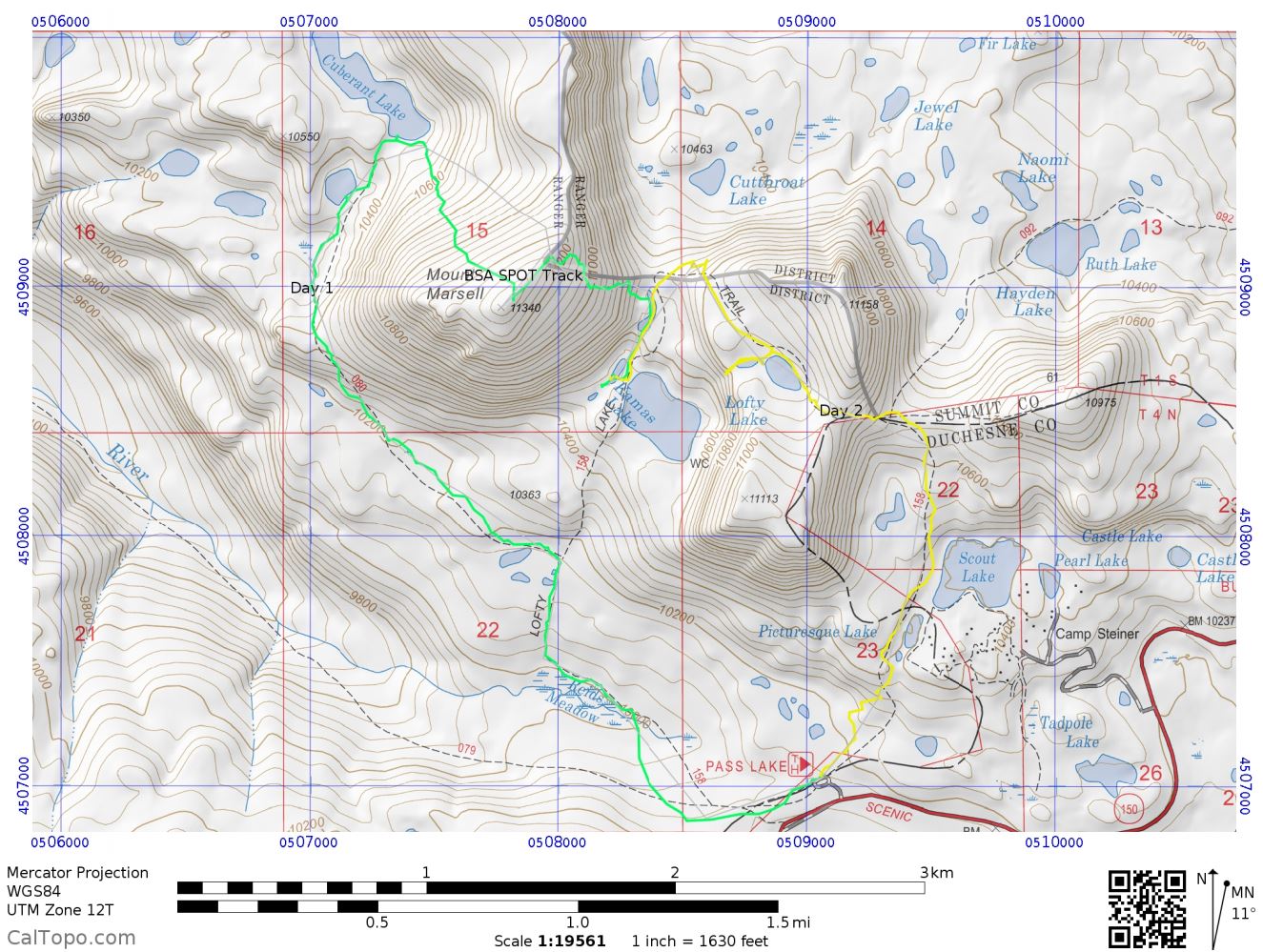
Over the course of 3 days, the scouts trekked 6.9 miles. Over the course of those 6.9 miles they gained and lost 2215' of elevation.
Day 1 & 2

Day 3

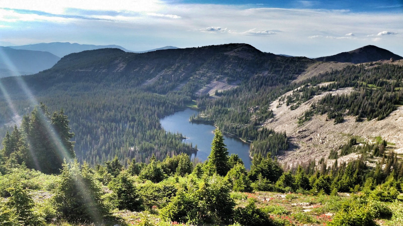
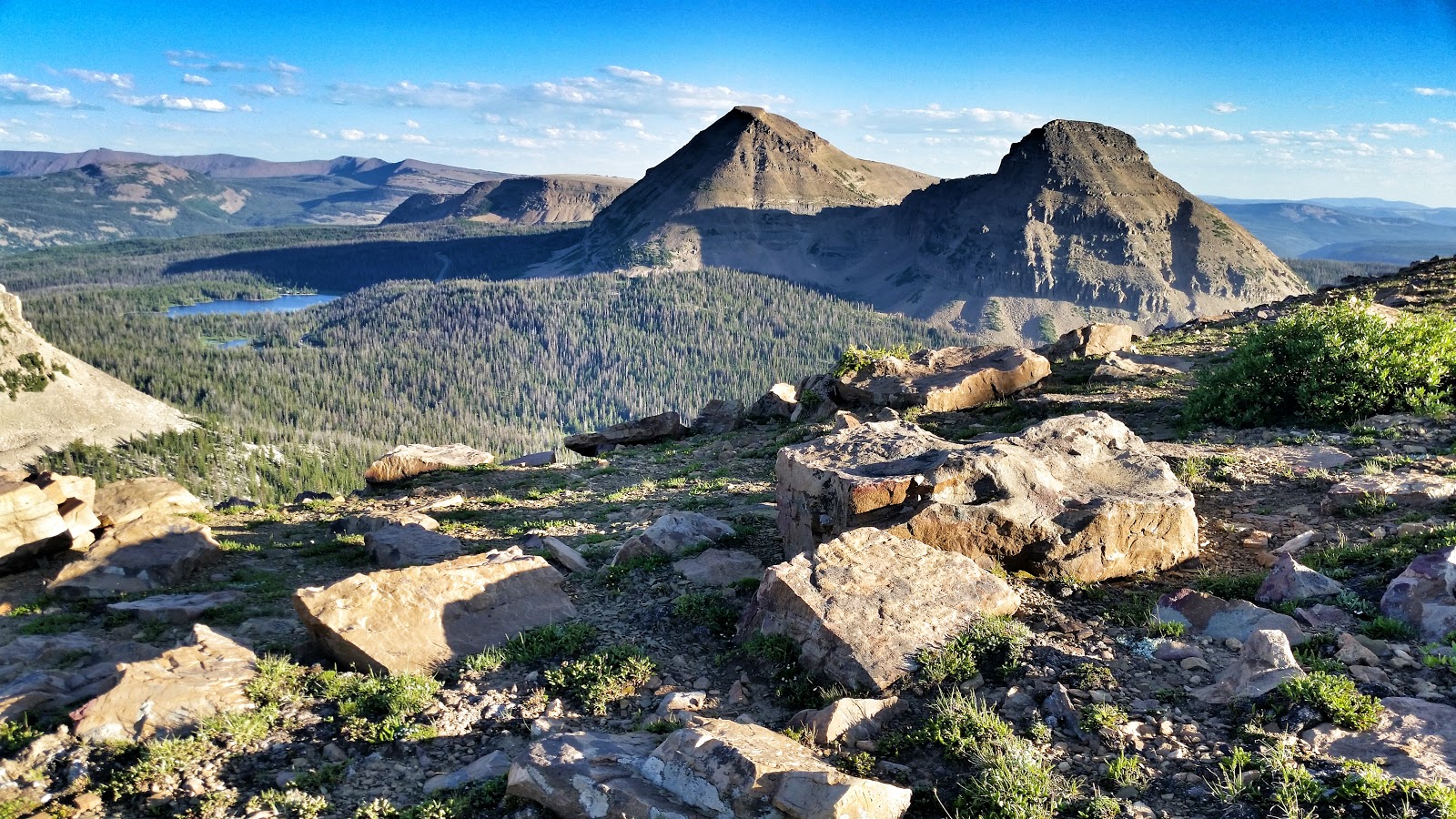
I tell you what, those 6.9 miles are some of the highest quality miles I have hiked. Maybe I suffer from short term memory bias, but the views seen along this loop are some of the best I have seen. I enjoyed the many lakes, meadows, and streams that were encountered. and the summit up and over Mount Marsell was incredible. My breath was literally swept away as I walked to the top of Mount Marsell. Anyway, I am getting a bit ahead of myself....sorry
The scouts took 3 days to do this trip. I really wanted to join them for all 3 days, but opted to spend my friday with my family instead. However, I didn't want to miss out on such a cool trip, so I decided I would leave Friday after work, and catch up to them. There were a few ways to do this (some options were much shorter and easier), but I wanted to see everything they saw, so I followed their exact trail. I convinced a co-worker of mine to come with, and he and I embarked on this trip as soon as we could.
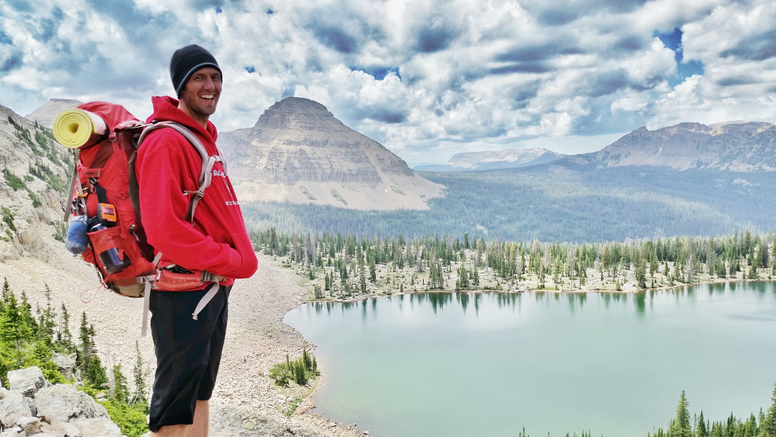
A bit about my co-worker. Jimmy Graves is his name, and he is an avid outdoorsman. Many of our conversations involve hiking, or backpacking, and we both enjoy talking about and using new gear. As I was telling him about this trip, he too had been looking to scout out the exact same area, so when he offered to come with me, I was thrilled. I needed a hiking partner, and who better to have with you than a fellow gearhead and friend! Jimmy is in super good shape, and I knew we would be able to make good time. It was nice to be backpacking with Jimmy.

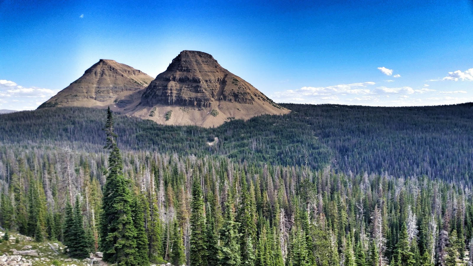
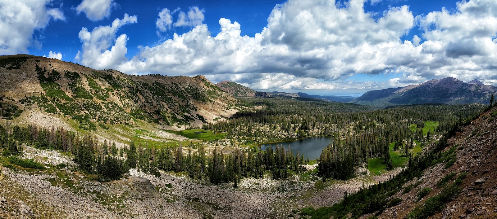
The first leg of the trail was from Pass Lake TH to Cuberant Lake. This section is about 2.5 - 3 miles (depending on which lake you camp at). The hike to Cuberant lake is very scenic. I loved the views from Reid's Meadow. Bald Mountain and Reids Peak are very prominent and stand out majestically! You get even better views of those two peaks as you ascend up toward the lake. for a moment you escape the veil of pine trees, only to witness Bald and Reids peak surrounded by their evergreen carpet. Beautiful!
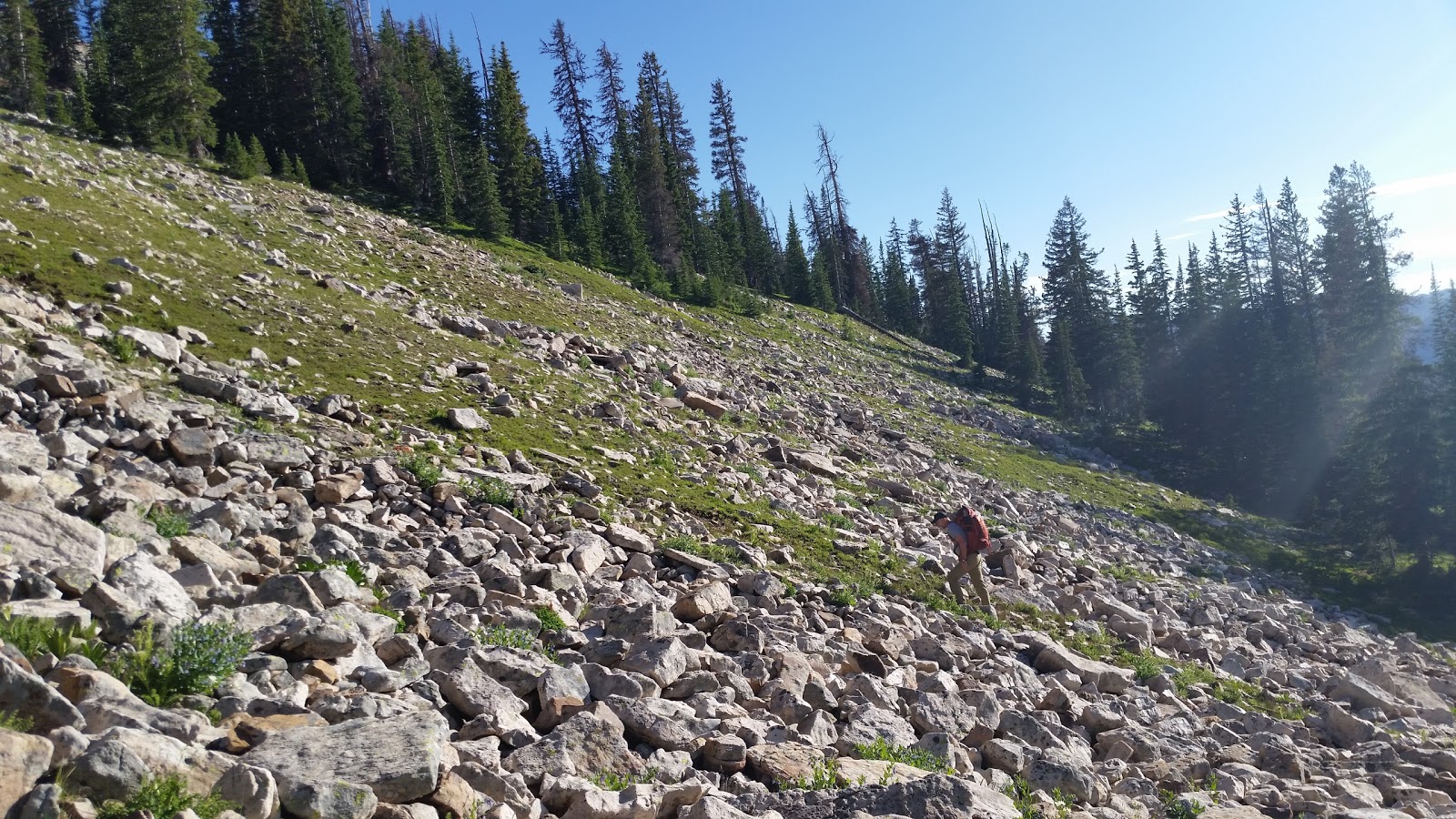
It took Jimmy and I about one hour to make it to Cuberant Lake. I don't remember the last time I hiked at a 3 MPH pace, but we for sure made good time. 90 minutes later we would find ourselves coming down Mount Marsell and walking into camp! In, under 3 hours we hiked the 4 miles necessary to meet up with the scouts, and gained about 2k feet in elevation. It was a good evening exercise!
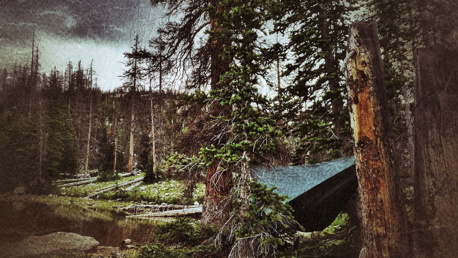
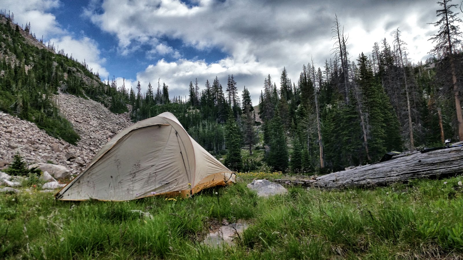
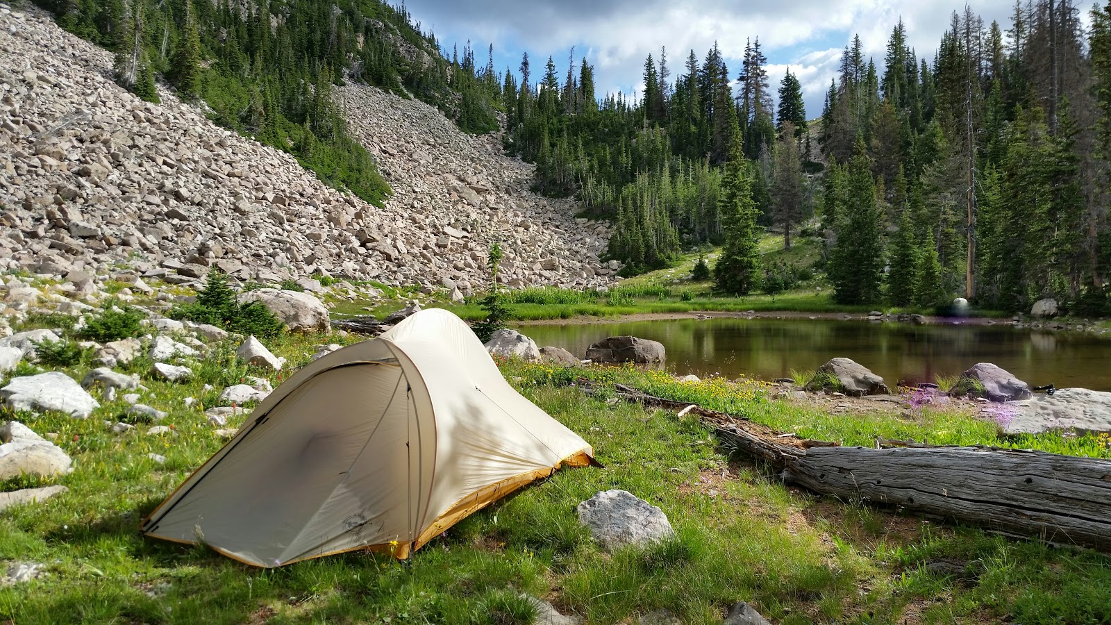
Camp at Kamas Lake was very nice. The scouts found a decent area in a dry lake bed. Once we rolled into camp, Jimmy and I just had to set up camp and cook up evening desert. It was nice to be at camp. It was fun to see all the boys and tell them how proud I was of them for doing what they did. The hike up Mount Marsell is NOT easy. I was thrilled that all of them made the climb! Even more proud that they did it with backpacks on!
The next day we finished the trip. Once camp was picked up, we took up our packs and trekked onward to Lofty Lake. Lofty lake is part of a popular loop hike and we saw lots of day hikers and backpackers on this trail. It is very pretty, and I can't say I blame everyone for wanting to see what you see on this trail.
We stopped at Lofty for a while and went fishing and swimming. We all got skunked when it came to fishing, but the 3 of us who went swimming had a fun time. Just something special about swimming in ice cold mountain lakes.
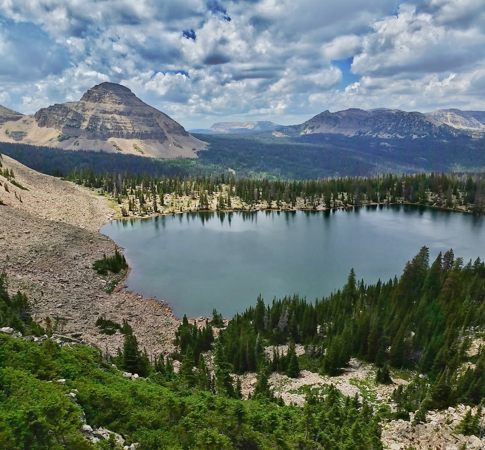
All to soon, we were all on our way back down to the cars. The only redeeming factor for the reality of hiking home, was that the views getting down to the TH were amazing! If we were going to have to finish this trip, this was a good way to do it. From the top of the Lofty Lake trail, you can see Scout Lake and Hayden Peak dominating the mountain scene. It was beautiful to behold.
All in all the trip was wonderful. I love seeing the boys get out on trips like this, but mostly I just love getting out and seeing beautiful places like this! I am very grateful I am friends with people who do these kind of things! Huge shout out to Scoutmaster Josh for always being willing to go where I tell him to go (haha) and to the scouts dads who made it possible for the scouts to do a 3 day trip instead of a 2 day'er. And special thanks to my friend Jimmy, for taking time out of his weekend to be my hiking partner.


Featured image for home page:


.jpg")
.jpg")