IntrepidXJ
ADVENTR
- Joined
- Jan 17, 2012
- Messages
- 3,493
Friday - Monday, November 8-11, 2013
The Original Trip Report on ADVENTR.CO
Last November I said that I was going to be taking a little break from visiting the Paria Plateau, and I have. However, almost exactly a year later I was ready to go back for another visit and managed to get another permit for Coyote Buttes North. I was only able to get one permit this time around, so it was a good weekend for me to take a solo trip. If I had to choose a month, I think November is probably my favorite time of the year to visit this area. This is the third year in a row that I have visited Coyote Buttes North in November and it seems like I usually have good conditions this time of the year. Even though this was the first year that I had clear blue skies all day with no dynamic weather, I still managed to come back home with many new images. Feel free to check out my previous November trip reports from 2011 and 2012.
I left work on Friday afternoon to begin my three day weekend and started my drive through Utah. I stopped for a delicious burger at Milt's in Moab for dinner, fueled up my Jeep, then drove a little further south to find a campsite on Hart's Point in the dark. After quickly setting up camp, I spent a little time photographing the night sky before getting to bed.
My simple campsite under the Big Dipper.
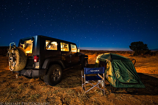
Harts Point Camp by IntrepidXJ, on Flickr

Under the Stars by IntrepidXJ, on Flickr
On Saturday morning I had a quick breakfast and then set out to find and photograph some new ruins and rock art before continuing my drive south to Arizona.

Shield by IntrepidXJ, on Flickr

Man in a Circle by IntrepidXJ, on Flickr
This is a very nice panel of petroglyphs. It was in the shade when when I first arrived, but I took this photo just as the sun came up over the cliffs and lit it up.

Flautist by IntrepidXJ, on Flickr
Here's a different view of the same panel so you can get a sense of where it's located.

Slot Panel by IntrepidXJ, on Flickr

Powerful Shaman by IntrepidXJ, on Flickr

Open Arms by IntrepidXJ, on Flickr
I've been looking for this site for a while and was glad to finally visit it on this trip. The petroglyphs below this small granary are pretty amazing.

Crosscreek Ruin by IntrepidXJ, on Flickr

Crosscreek Petroglyphs by IntrepidXJ, on Flickr
There were even a couple of pictographs nearby, too.

Lichen & Pictographs by IntrepidXJ, on Flickr

Kangaroo by IntrepidXJ, on Flickr

Corner Petroglyphs by IntrepidXJ, on Flickr

Alone by IntrepidXJ, on Flickr
After driving through Blanding, Bluff and Kayenta, I eventually reached Page a few hours later. I needed to get out of the Jeep and stretch my legs after the drive, so I hiked the short Hanging Gardens Trail in the Glen Canyon National Recreation Area. It's a short interpretive trail that leads to a lush riparian oasis under the shoulder of a row of buttes overlooking Lake Powell.
The well-defined trail to the Hanging Garden.
Slickrock Trail by IntrepidXJ, on Flickr
The hanging garden growing the the back of this shallow alcove.
Hanging Garden by IntrepidXJ, on Flickr
There were a few yellow leaves still hanging on around here.
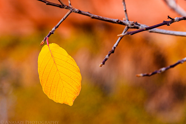
Single by IntrepidXJ, on Flickr
While I was in town I also stopped at the Glen Canyon Dam Overlook since I'd never been there before.
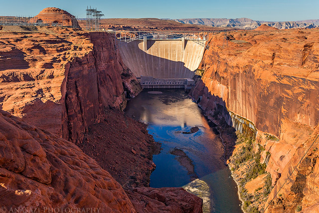
Glen Canyon Dam by IntrepidXJ, on Flickr
Looking down at the Colorado River from the overlook.
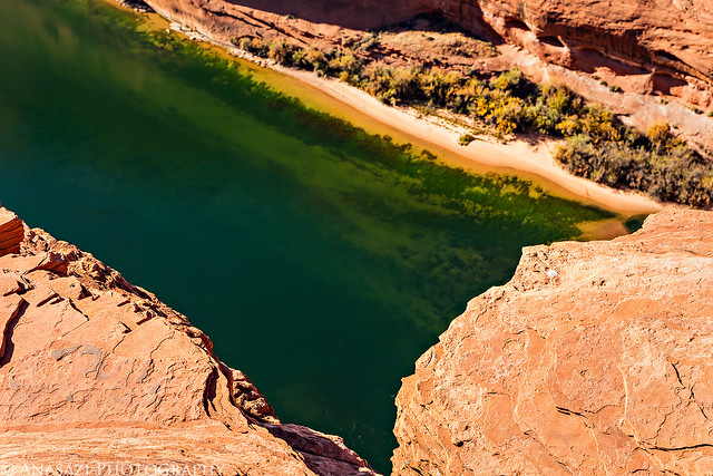
Emerald River by IntrepidXJ, on Flickr
After a quick dinner in Page I continued my journey to the Stateline Campground where I setup my camp for the next two nights and then got to bed early. I woke up well before sunrise on Sunday, drove over to the Wire Pass trailhead and started my hike in the dark.
Just as I was hiking over the pass the pre-dawn glow lit up the sandstone all around me. It was a beautiful sight.
Pre-Dawn Glow by IntrepidXJ, on Flickr
Dawn Hike by IntrepidXJ, on Flickr
Pass by IntrepidXJ, on Flickr
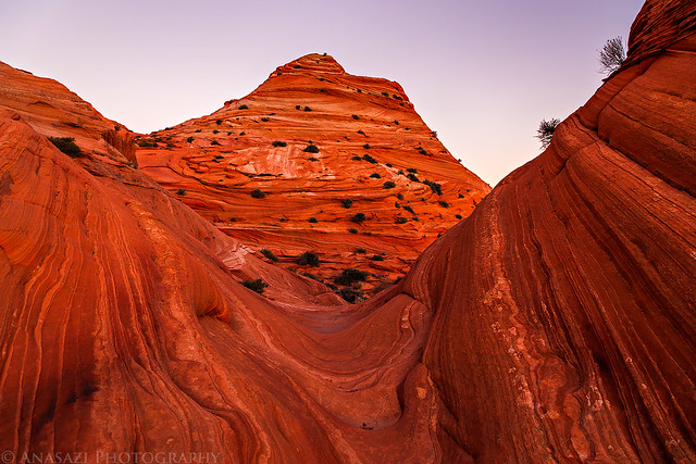
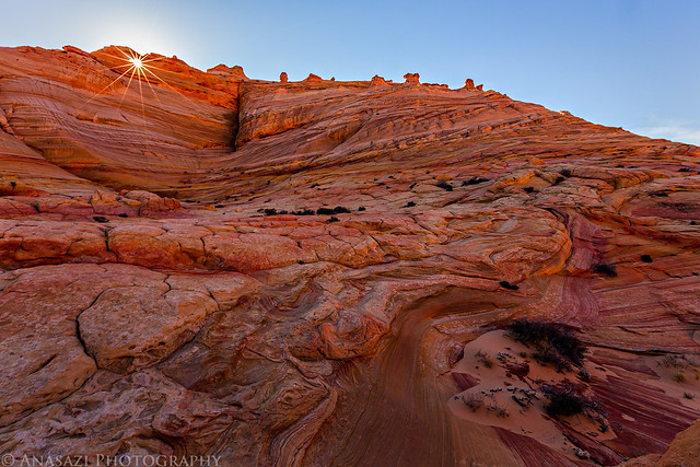
Then the first light of the day struck the top of the Coyote Buttes in the distance.
Sandstone Light by IntrepidXJ, on Flickr
Light on the Butte by IntrepidXJ, on Flickr
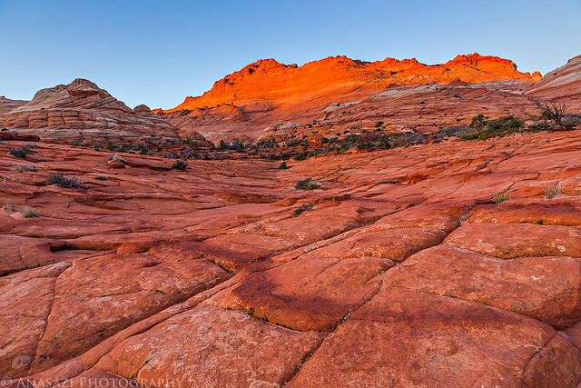
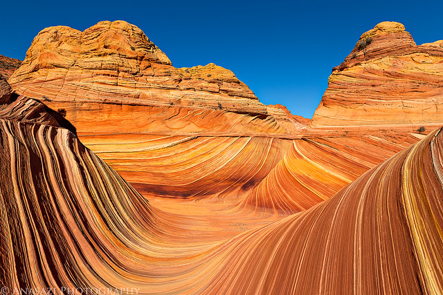
Is there anything nicer than warm sunlight on colorful sandstone first thing in the morning?
Coyote Buttes Sunrise by IntrepidXJ, on Flickr
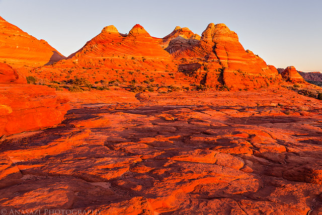
Morning Sandstone by IntrepidXJ, on Flickr
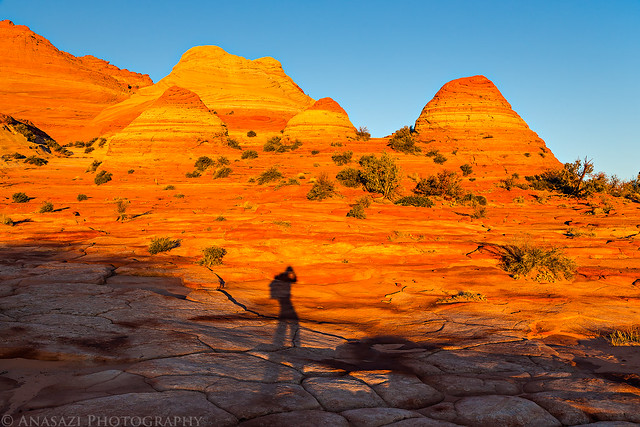
Sunrise Shadow by IntrepidXJ, on Flickr
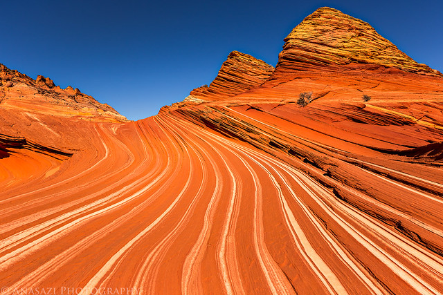
Soon I made it to the entrance of The Wave.
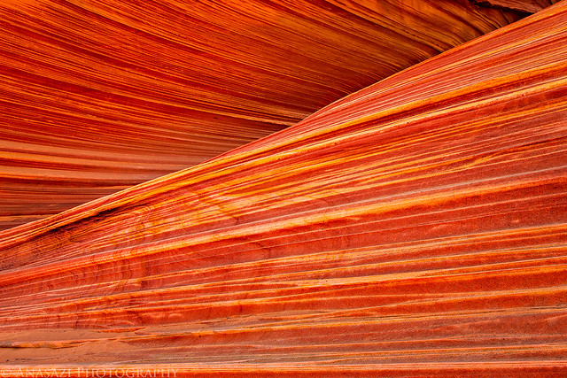
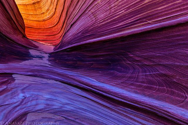
Countercurrent by IntrepidXJ, on Flickr
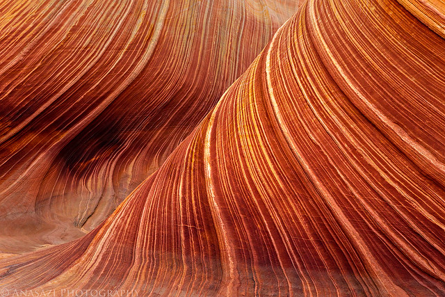
Wave Detail by IntrepidXJ, on Flickr
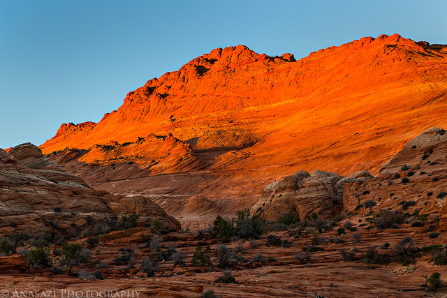
The early morning light bouncing off of the Coyote Buttes really added some amazing color to this section below the Black Crack of Top Rock.
Below the Crack by IntrepidXJ, on Flickr
Track by IntrepidXJ, on Flickr
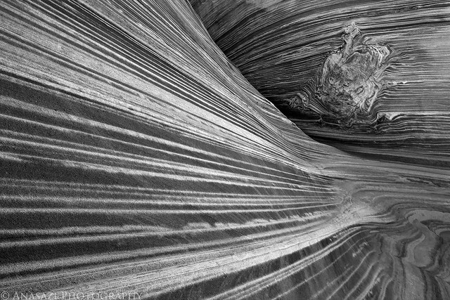
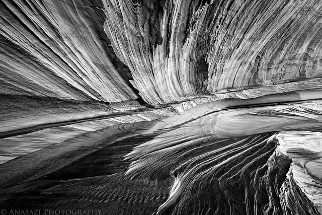
Interesting geology in black and white.
To the Spot by IntrepidXJ, on Flickr
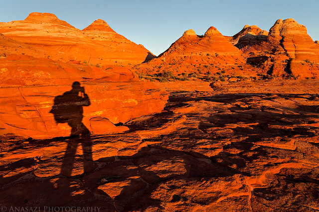
I climbed up to a higher vantage point to take in the views on this beautiful morning.
On Top by IntrepidXJ, on Flickr
There was even a little standing water to be found above The Wave.
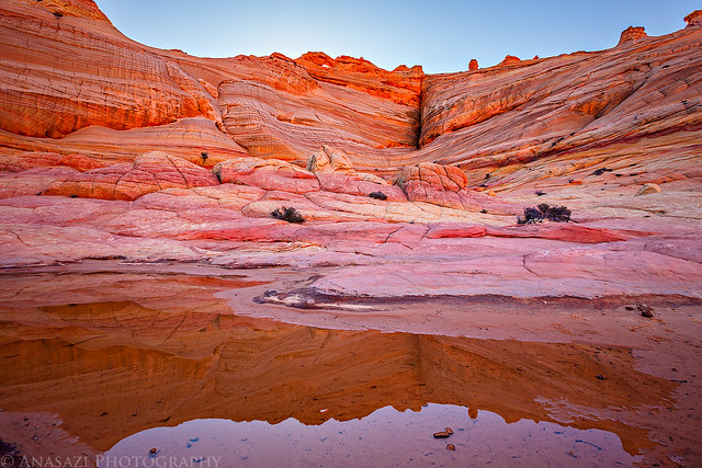
Top Rock Reflection by IntrepidXJ, on Flickr
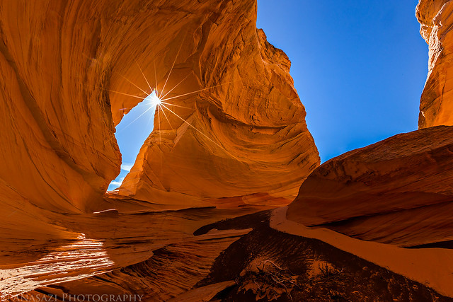
Sunburst through Top Rock Arch.
Top Rock Arch Sunburst by IntrepidXJ, on Flickr
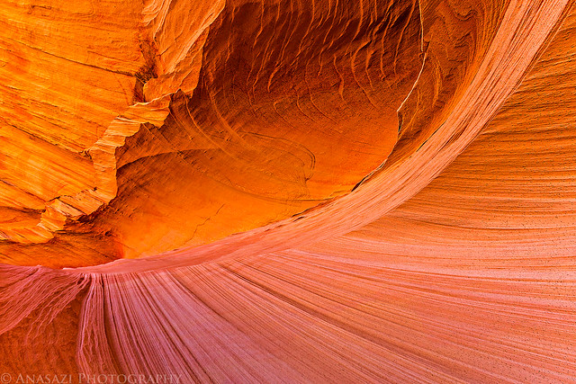
I spent a little time photographing The Passage.
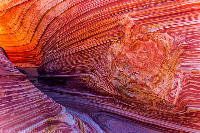
Anomaly by IntrepidXJ, on Flickr
Twist by IntrepidXJ, on Flickr
Passage Glow by IntrepidXJ, on Flickr
An obligatory Wave photo, but I didn't stick around here very long.
Just Another Wave Photo by IntrepidXJ, on Flickr
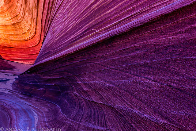
When other hikers started to show up at The Wave it was time for me to go. I made my way up to the top of Top Rock where I could find a little more solitude.
Falling to Pieces by IntrepidXJ, on Flickr
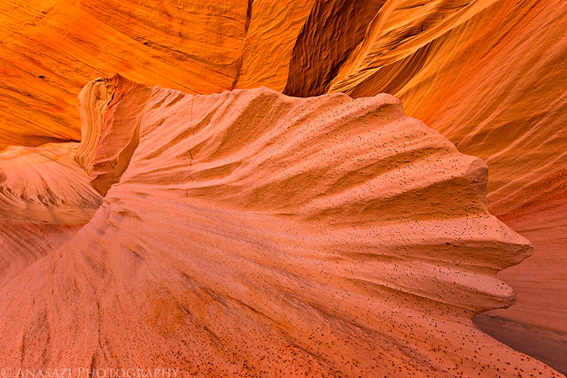
I made sure to visit the Sand Dune Alcove.
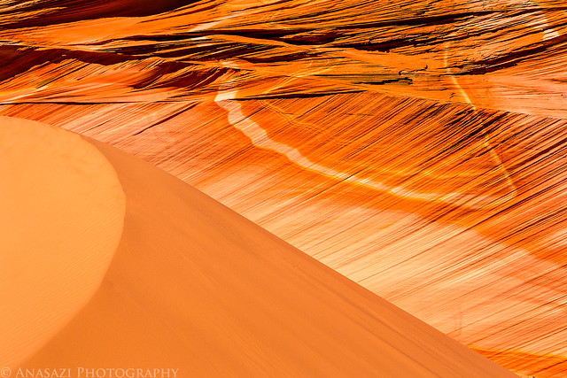
Sand & Stone by IntrepidXJ, on Flickr
The reflected light in The Alcove was nice as usual.
Rockfall by IntrepidXJ, on Flickr
Alcove Lines by IntrepidXJ, on Flickr
Fin by IntrepidXJ, on Flickr
Here's the previous image in black and white. Which do you like better?
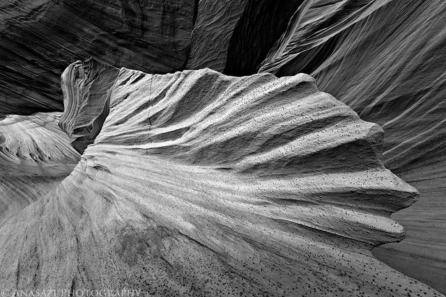
Fin B&W by IntrepidXJ, on Flickr
I already have plenty of color photos from this location, so I tried this one in black and white.
Alcove B&W by IntrepidXJ, on Flickr
After relaxing in The Alcove for a while I climbed up above for an expansive view of the area.
View from the Top by IntrepidXJ, on Flickr
I had never visited Top Rock Arch before, so I made sure to stop by.
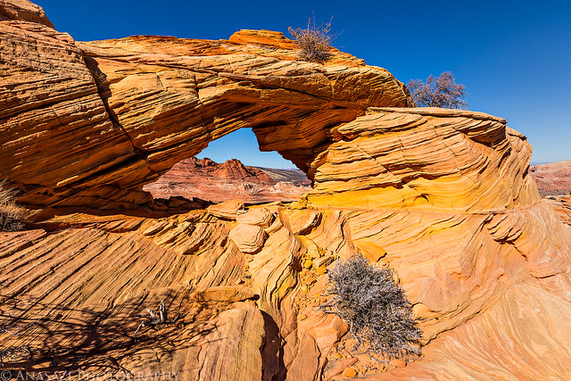
Top Rock Arch by IntrepidXJ, on Flickr
I caught this sunburst through Top Rock Window, too.
Top Rock Window by IntrepidXJ, on Flickr
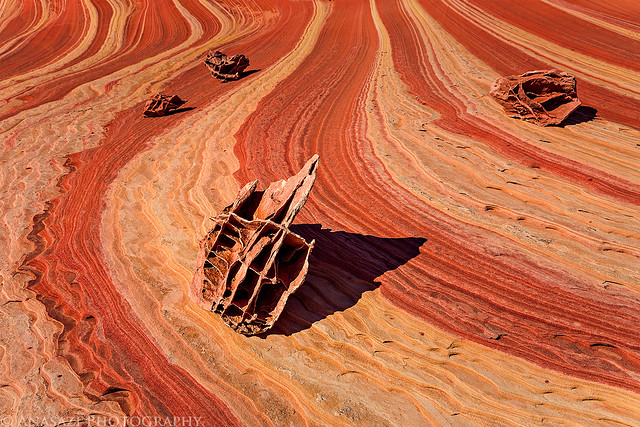
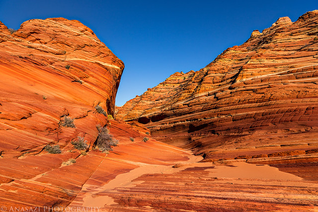
When I was done exploring Top Rock I descended down near the Second Wave and then to the Sand Cove area.
Racetrack by IntrepidXJ, on Flickr
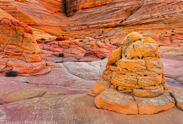
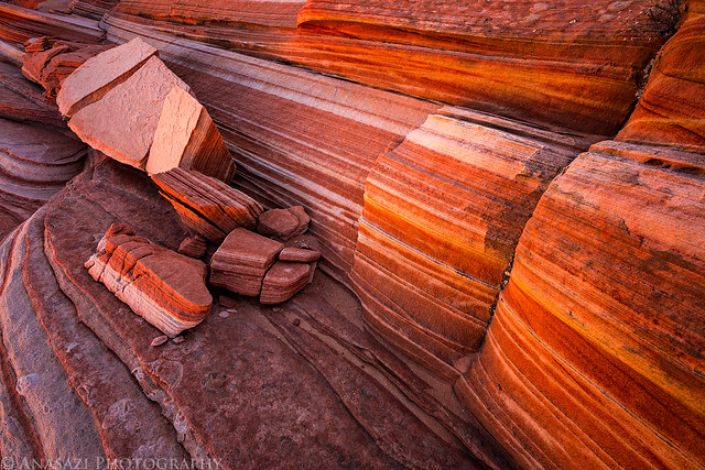
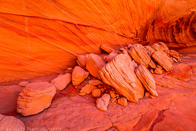
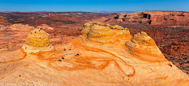
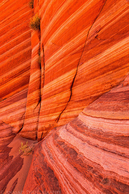
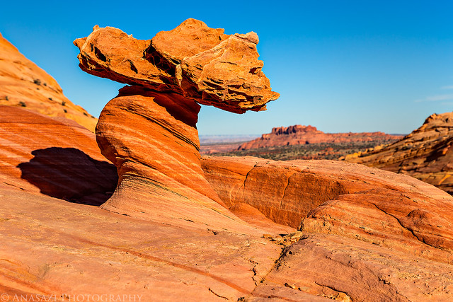
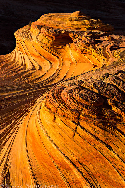
For some reason I had never made it to The Boneyard on my previous trips to Coyote Buttes North, so I made sure to stop by this time...even if the light wasn't great at this time of the day. The rocks around here are very unique.
Boneyard by IntrepidXJ, on Flickr
Interesting striations can be found just about anywhere around here.
Corner by IntrepidXJ, on Flickr
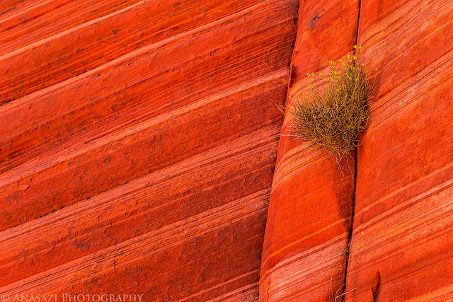
Growing in the Crack by IntrepidXJ, on Flickr
Just a small hoodoo that I hiked by.
Hoodoo by IntrepidXJ, on Flickr
Shadow by IntrepidXJ, on Flickr
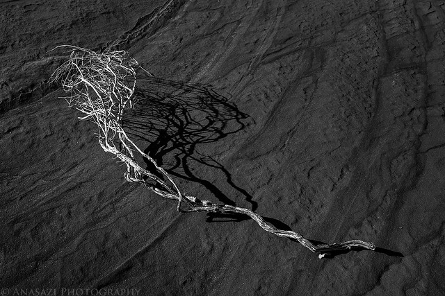
Sand Wash by IntrepidXJ, on Flickr
Another pool of water...another reflection.
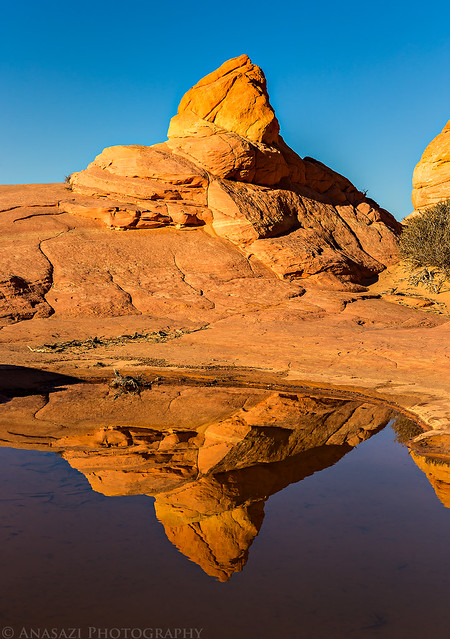
Reflection by IntrepidXJ, on Flickr
I caught the sun through Top Rock Arch in the morning and then managed to catch the moon through it in the afternoon.
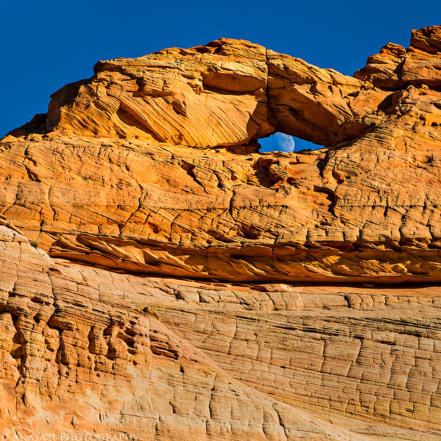
Moon Through Top Rock Arch by IntrepidXJ, on Flickr
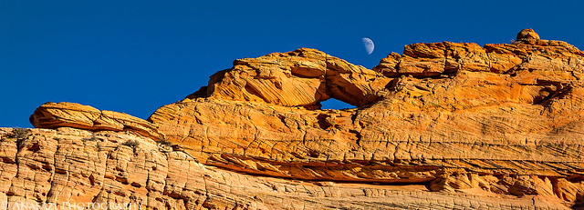
Moon Over Arch by IntrepidXJ, on Flickr
Last light on the Second Wave.
Second Wave by IntrepidXJ, on Flickr
The last of the days light on the sandstone above me as I hiked back to my Jeep at the trailhead. I started my day in the dark and would be ending it the same way.
End of Light by IntrepidXJ, on Flickr
I returned back to my site at the Stateline Campground well after dark. I had some dinner, read a book and turned in early since I was pretty tired from getting up early and hiking about 14 miles today.
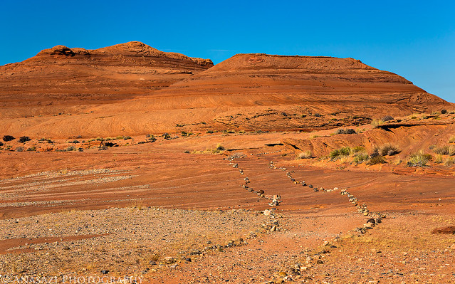
Monday morning arrived and it was time for me to start my journey back home. I slept in just a little bit later than the previous day and then had to decided where to go? I had thought about hiking up to Yellow Rock this morning, but with the clear skies above I thought a slot canyon might be a better place to take some photos today. Bull Valley Gorge and Willis Creek were my planned destinations when I left Arizona behind. Since I was heading that direction anyway, I figured it might be nice to stop for breakfast at Nedra's Too in Kanab. The food was great as always and I soon found myself heading north through Johnson Canyon to Skutumpah Road. I parked next to Bull Valley Gorge and started my hike along the rim of the canyon to an access point into the canyon. Unfortunately, what I ended up finding was a very slick down-climb into the gorge that I was not prepared to try by myself. I'm sure I could have made it down OK, but I'm not so sure I would have been able to get back out by myself. Better safe than sorry. Another time.
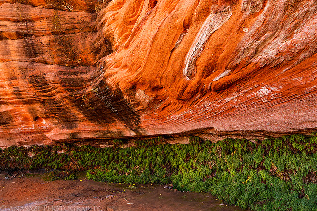
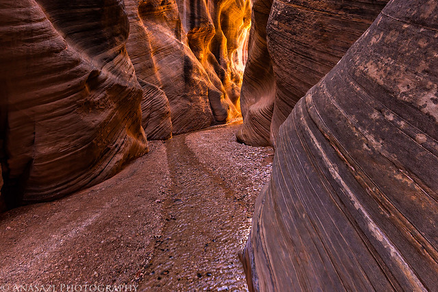
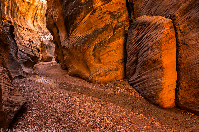
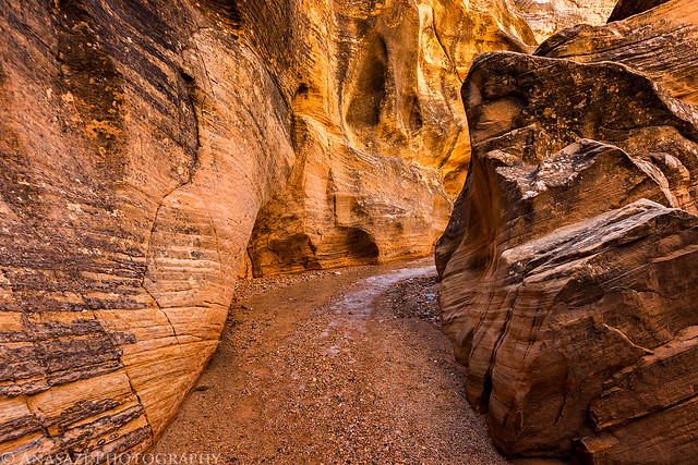
I hiked back to my Jeep and made my way a little further up the road to the Willis Creek trailhead. I grabbed my camera, backpack and tripod and started hiking down the canyon. It was a beautiful hike and I had a lot of fun photographing the amazing colors created by the reflected light in the sections of narrow canyon. I hiked all the way down to Sheep Creek and then returned to my vehicle. I seemed to have better light on my way down the canyon the first time than on the return hike. I didn't run into anyone else until I was almost back to the trailhead. I'm glad I had got an earlier start to the hike since I had the canyon to myself and there were a lot of people starting the hike when I returned.
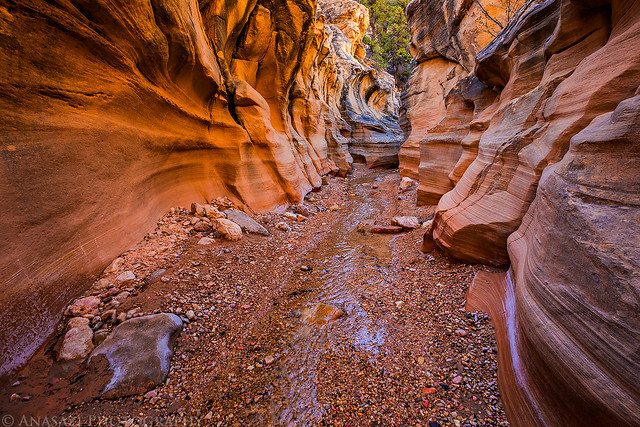
Shallow Canyon by IntrepidXJ, on Flickr
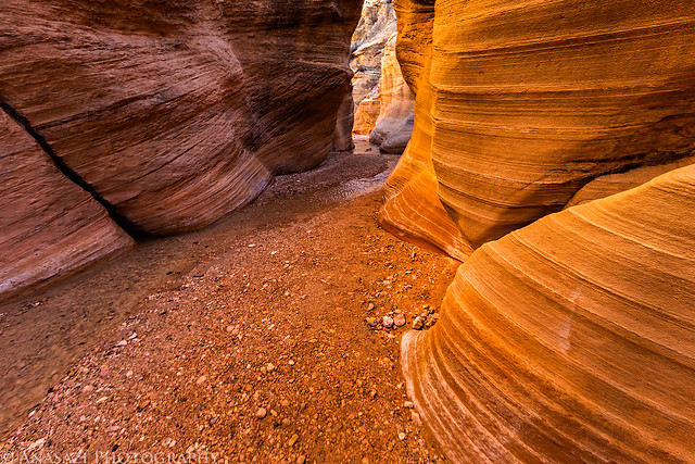
Striped Wall by IntrepidXJ, on Flickr
Willis Creek by IntrepidXJ, on Flickr
The light bouncing off the canyon wall here was just stunning.
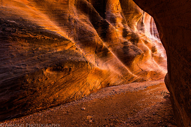
Golden Wall by IntrepidXJ, on Flickr
Willis Creek Bend by IntrepidXJ, on Flickr
Around the Corner by IntrepidXJ, on Flickr
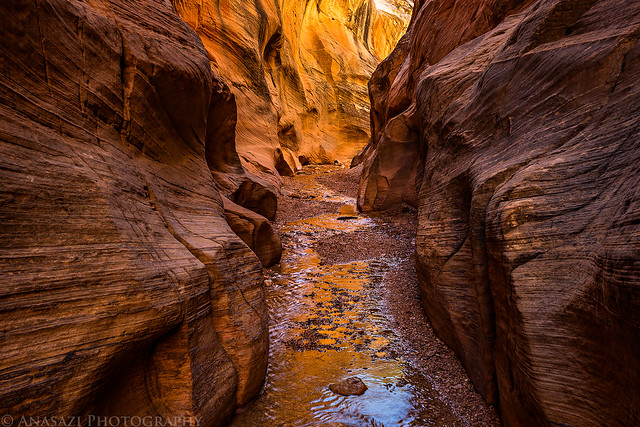
Creek Reflection by IntrepidXJ, on Flickr
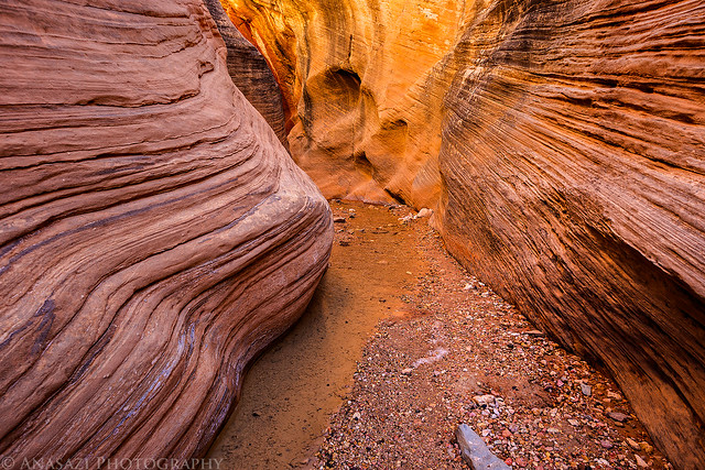
Willis Narrows by IntrepidXJ, on Flickr
From Willis Creek I made my way further east and north on scenic Highway 12. I turned off onto the Burr Trail when I reached Boulder and made my way to Capitol Reef National Park. I was hoping to find a new petroglyph panel along the way.
Peek-a-boo Arch came into view as I reached the Waterpocket Fold and Upper Muley Twist Canyon.
Peek-a-boo Arch by IntrepidXJ, on Flickr
I managed to find the petroglyphs I was looking for.

Designs by IntrepidXJ, on Flickr
Sure looks like a moose to me?

Moose Panel by IntrepidXJ, on Flickr

Hands by IntrepidXJ, on Flickr

Couple by IntrepidXJ, on Flickr
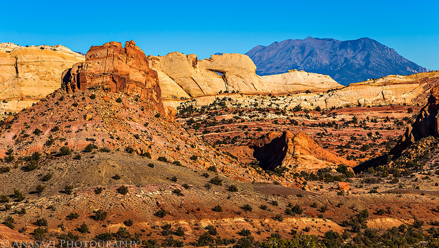
View towards the Henry Mountains as I descended the switchbacks of the Burr Trail.
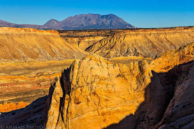
Burr View by IntrepidXJ, on Flickr
My Jeep parked in one of the switchbacks.
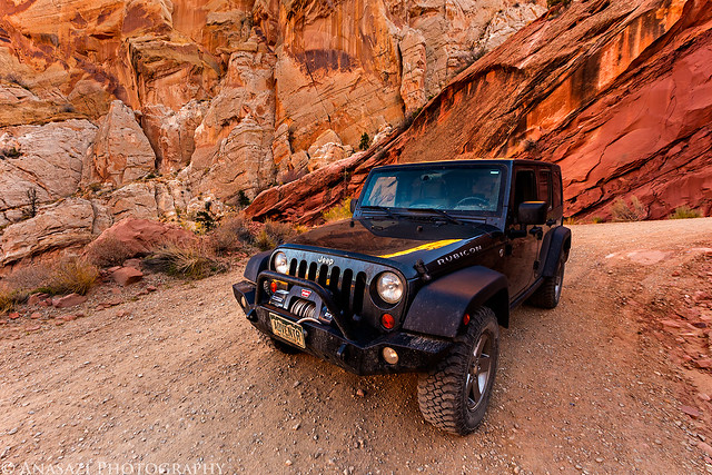
Burr Switchback by IntrepidXJ, on Flickr
One last photo towards the Henry Mountains taken near Notom.
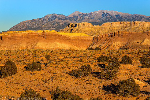
Notom View by IntrepidXJ, on Flickr
When I reached the bottom of the switchbacks I took the Notom Road back to Highway 12 and then finished my drive home on pavement. It was an incredible long weekend that I won't soon forget!
>> Coyote Buttes North & Willis Creek Photo Gallery
Featured image for home page:

The Original Trip Report on ADVENTR.CO
Last November I said that I was going to be taking a little break from visiting the Paria Plateau, and I have. However, almost exactly a year later I was ready to go back for another visit and managed to get another permit for Coyote Buttes North. I was only able to get one permit this time around, so it was a good weekend for me to take a solo trip. If I had to choose a month, I think November is probably my favorite time of the year to visit this area. This is the third year in a row that I have visited Coyote Buttes North in November and it seems like I usually have good conditions this time of the year. Even though this was the first year that I had clear blue skies all day with no dynamic weather, I still managed to come back home with many new images. Feel free to check out my previous November trip reports from 2011 and 2012.
I left work on Friday afternoon to begin my three day weekend and started my drive through Utah. I stopped for a delicious burger at Milt's in Moab for dinner, fueled up my Jeep, then drove a little further south to find a campsite on Hart's Point in the dark. After quickly setting up camp, I spent a little time photographing the night sky before getting to bed.
My simple campsite under the Big Dipper.
Harts Point Camp by IntrepidXJ, on Flickr
Under the Stars by IntrepidXJ, on Flickr
On Saturday morning I had a quick breakfast and then set out to find and photograph some new ruins and rock art before continuing my drive south to Arizona.
Shield by IntrepidXJ, on Flickr
Man in a Circle by IntrepidXJ, on Flickr
This is a very nice panel of petroglyphs. It was in the shade when when I first arrived, but I took this photo just as the sun came up over the cliffs and lit it up.
Flautist by IntrepidXJ, on Flickr
Here's a different view of the same panel so you can get a sense of where it's located.
Slot Panel by IntrepidXJ, on Flickr
Powerful Shaman by IntrepidXJ, on Flickr
Open Arms by IntrepidXJ, on Flickr
I've been looking for this site for a while and was glad to finally visit it on this trip. The petroglyphs below this small granary are pretty amazing.
Crosscreek Ruin by IntrepidXJ, on Flickr
Crosscreek Petroglyphs by IntrepidXJ, on Flickr
There were even a couple of pictographs nearby, too.
Lichen & Pictographs by IntrepidXJ, on Flickr
Kangaroo by IntrepidXJ, on Flickr
Corner Petroglyphs by IntrepidXJ, on Flickr
Alone by IntrepidXJ, on Flickr
After driving through Blanding, Bluff and Kayenta, I eventually reached Page a few hours later. I needed to get out of the Jeep and stretch my legs after the drive, so I hiked the short Hanging Gardens Trail in the Glen Canyon National Recreation Area. It's a short interpretive trail that leads to a lush riparian oasis under the shoulder of a row of buttes overlooking Lake Powell.
The well-defined trail to the Hanging Garden.
Slickrock Trail by IntrepidXJ, on Flickr
The hanging garden growing the the back of this shallow alcove.
Hanging Garden by IntrepidXJ, on Flickr
There were a few yellow leaves still hanging on around here.
Single by IntrepidXJ, on Flickr
While I was in town I also stopped at the Glen Canyon Dam Overlook since I'd never been there before.
Glen Canyon Dam by IntrepidXJ, on Flickr
Looking down at the Colorado River from the overlook.
Emerald River by IntrepidXJ, on Flickr
After a quick dinner in Page I continued my journey to the Stateline Campground where I setup my camp for the next two nights and then got to bed early. I woke up well before sunrise on Sunday, drove over to the Wire Pass trailhead and started my hike in the dark.
Just as I was hiking over the pass the pre-dawn glow lit up the sandstone all around me. It was a beautiful sight.
Pre-Dawn Glow by IntrepidXJ, on Flickr
Dawn Hike by IntrepidXJ, on Flickr
Pass by IntrepidXJ, on Flickr
Then the first light of the day struck the top of the Coyote Buttes in the distance.
Sandstone Light by IntrepidXJ, on Flickr
Light on the Butte by IntrepidXJ, on Flickr
Is there anything nicer than warm sunlight on colorful sandstone first thing in the morning?
Coyote Buttes Sunrise by IntrepidXJ, on Flickr
Morning Sandstone by IntrepidXJ, on Flickr
Sunrise Shadow by IntrepidXJ, on Flickr
Soon I made it to the entrance of The Wave.
Countercurrent by IntrepidXJ, on Flickr
Wave Detail by IntrepidXJ, on Flickr
The early morning light bouncing off of the Coyote Buttes really added some amazing color to this section below the Black Crack of Top Rock.
Below the Crack by IntrepidXJ, on Flickr
Track by IntrepidXJ, on Flickr
Interesting geology in black and white.
To the Spot by IntrepidXJ, on Flickr
I climbed up to a higher vantage point to take in the views on this beautiful morning.
On Top by IntrepidXJ, on Flickr
There was even a little standing water to be found above The Wave.
Top Rock Reflection by IntrepidXJ, on Flickr
Sunburst through Top Rock Arch.
Top Rock Arch Sunburst by IntrepidXJ, on Flickr
I spent a little time photographing The Passage.
Anomaly by IntrepidXJ, on Flickr
Twist by IntrepidXJ, on Flickr
Passage Glow by IntrepidXJ, on Flickr
An obligatory Wave photo, but I didn't stick around here very long.
Just Another Wave Photo by IntrepidXJ, on Flickr
When other hikers started to show up at The Wave it was time for me to go. I made my way up to the top of Top Rock where I could find a little more solitude.
Falling to Pieces by IntrepidXJ, on Flickr
I made sure to visit the Sand Dune Alcove.
Sand & Stone by IntrepidXJ, on Flickr
The reflected light in The Alcove was nice as usual.
Rockfall by IntrepidXJ, on Flickr
Alcove Lines by IntrepidXJ, on Flickr
Fin by IntrepidXJ, on Flickr
Here's the previous image in black and white. Which do you like better?
Fin B&W by IntrepidXJ, on Flickr
I already have plenty of color photos from this location, so I tried this one in black and white.
Alcove B&W by IntrepidXJ, on Flickr
After relaxing in The Alcove for a while I climbed up above for an expansive view of the area.
View from the Top by IntrepidXJ, on Flickr
I had never visited Top Rock Arch before, so I made sure to stop by.
Top Rock Arch by IntrepidXJ, on Flickr
I caught this sunburst through Top Rock Window, too.
Top Rock Window by IntrepidXJ, on Flickr
When I was done exploring Top Rock I descended down near the Second Wave and then to the Sand Cove area.
Racetrack by IntrepidXJ, on Flickr
For some reason I had never made it to The Boneyard on my previous trips to Coyote Buttes North, so I made sure to stop by this time...even if the light wasn't great at this time of the day. The rocks around here are very unique.
Boneyard by IntrepidXJ, on Flickr
Interesting striations can be found just about anywhere around here.
Corner by IntrepidXJ, on Flickr
Growing in the Crack by IntrepidXJ, on Flickr
Just a small hoodoo that I hiked by.
Hoodoo by IntrepidXJ, on Flickr
Shadow by IntrepidXJ, on Flickr
Sand Wash by IntrepidXJ, on Flickr
Another pool of water...another reflection.
Reflection by IntrepidXJ, on Flickr
I caught the sun through Top Rock Arch in the morning and then managed to catch the moon through it in the afternoon.
Moon Through Top Rock Arch by IntrepidXJ, on Flickr
Moon Over Arch by IntrepidXJ, on Flickr
Last light on the Second Wave.
Second Wave by IntrepidXJ, on Flickr
The last of the days light on the sandstone above me as I hiked back to my Jeep at the trailhead. I started my day in the dark and would be ending it the same way.
End of Light by IntrepidXJ, on Flickr
I returned back to my site at the Stateline Campground well after dark. I had some dinner, read a book and turned in early since I was pretty tired from getting up early and hiking about 14 miles today.
Monday morning arrived and it was time for me to start my journey back home. I slept in just a little bit later than the previous day and then had to decided where to go? I had thought about hiking up to Yellow Rock this morning, but with the clear skies above I thought a slot canyon might be a better place to take some photos today. Bull Valley Gorge and Willis Creek were my planned destinations when I left Arizona behind. Since I was heading that direction anyway, I figured it might be nice to stop for breakfast at Nedra's Too in Kanab. The food was great as always and I soon found myself heading north through Johnson Canyon to Skutumpah Road. I parked next to Bull Valley Gorge and started my hike along the rim of the canyon to an access point into the canyon. Unfortunately, what I ended up finding was a very slick down-climb into the gorge that I was not prepared to try by myself. I'm sure I could have made it down OK, but I'm not so sure I would have been able to get back out by myself. Better safe than sorry. Another time.
I hiked back to my Jeep and made my way a little further up the road to the Willis Creek trailhead. I grabbed my camera, backpack and tripod and started hiking down the canyon. It was a beautiful hike and I had a lot of fun photographing the amazing colors created by the reflected light in the sections of narrow canyon. I hiked all the way down to Sheep Creek and then returned to my vehicle. I seemed to have better light on my way down the canyon the first time than on the return hike. I didn't run into anyone else until I was almost back to the trailhead. I'm glad I had got an earlier start to the hike since I had the canyon to myself and there were a lot of people starting the hike when I returned.
Shallow Canyon by IntrepidXJ, on Flickr
Striped Wall by IntrepidXJ, on Flickr
Willis Creek by IntrepidXJ, on Flickr
The light bouncing off the canyon wall here was just stunning.
Golden Wall by IntrepidXJ, on Flickr
Willis Creek Bend by IntrepidXJ, on Flickr
Around the Corner by IntrepidXJ, on Flickr
Creek Reflection by IntrepidXJ, on Flickr
Willis Narrows by IntrepidXJ, on Flickr
From Willis Creek I made my way further east and north on scenic Highway 12. I turned off onto the Burr Trail when I reached Boulder and made my way to Capitol Reef National Park. I was hoping to find a new petroglyph panel along the way.
Peek-a-boo Arch came into view as I reached the Waterpocket Fold and Upper Muley Twist Canyon.
Peek-a-boo Arch by IntrepidXJ, on Flickr
I managed to find the petroglyphs I was looking for.
Designs by IntrepidXJ, on Flickr
Sure looks like a moose to me?
Moose Panel by IntrepidXJ, on Flickr
Hands by IntrepidXJ, on Flickr
Couple by IntrepidXJ, on Flickr
View towards the Henry Mountains as I descended the switchbacks of the Burr Trail.
Burr View by IntrepidXJ, on Flickr
My Jeep parked in one of the switchbacks.
Burr Switchback by IntrepidXJ, on Flickr
One last photo towards the Henry Mountains taken near Notom.
Notom View by IntrepidXJ, on Flickr
When I reached the bottom of the switchbacks I took the Notom Road back to Highway 12 and then finished my drive home on pavement. It was an incredible long weekend that I won't soon forget!
>> Coyote Buttes North & Willis Creek Photo Gallery
Featured image for home page:
")