IntrepidXJ
ADVENTR
- Joined
- Jan 17, 2012
- Messages
- 3,493
Monday, December 29, 2014
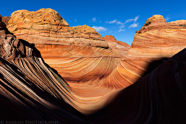
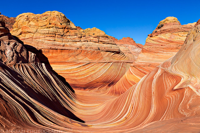
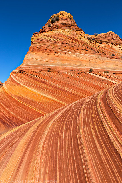
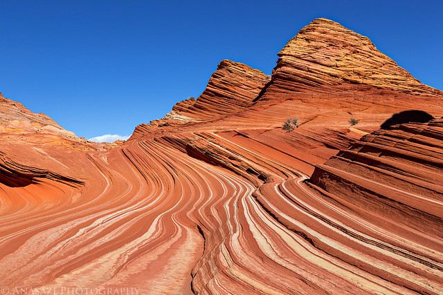
On Monday morning we got an early start and drove back to the Wire Pass trailhead so we could spend the day in Coyote Buttes North and visit the Wave. While I have been here plenty of times over the past couple of years and had no intentions of returning this year, Diane had never been here before and really wanted to visit the Wave. I managed to get a pair of permits for today and that's the main reason we planned this end of the year trip to Page. The last few times I have been to Coyote Buttes North I barely stopped by the Wave and instead I explored other areas that are less visited, but this time we hiked straight to the Wave and waited until it was in good light. While waiting for the sun to crest over Top Rock and light up the Wave I explored more of the area above and took a few photos under Top Rock Arch. While the temperature outside wasn't too cold this morning, it was pretty windy all day and that kept us pretty chilled, especially when we were in the shade.
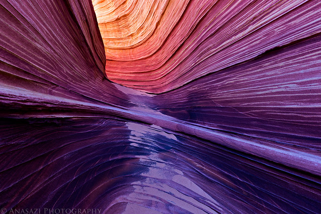
Entering the Wave. We were the first ones here today.
Entrance by IntrepidXJ, on Flickr
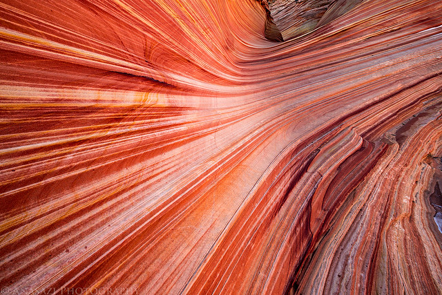
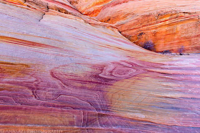
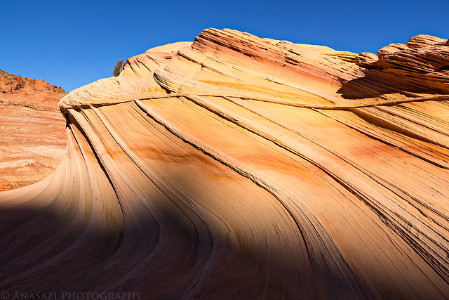
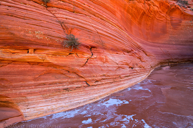
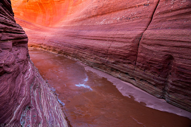
There are some really great colors in the sandstone up above the Wave and below the Black Crack. The colors are especially nice when the sandstone is in the shade and there is light reflecting off of the buttes across Sand Cove Wash.
Ledge Light by IntrepidXJ, on Flickr
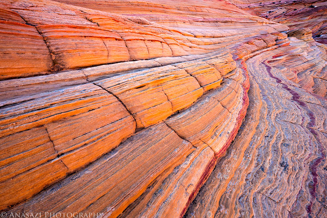
I'm calling this area Crazy Corner, named after Crazy Hill in the Valley of Fire State Park that also has a lot of color.
Crazy Corner by IntrepidXJ, on Flickr
Crazy Color by IntrepidXJ, on Flickr
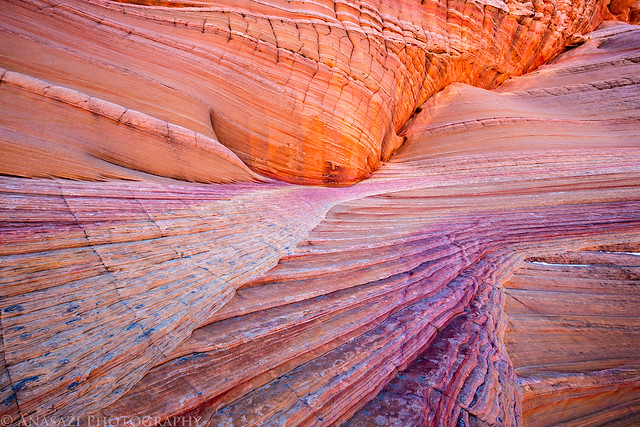
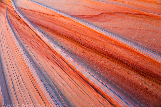
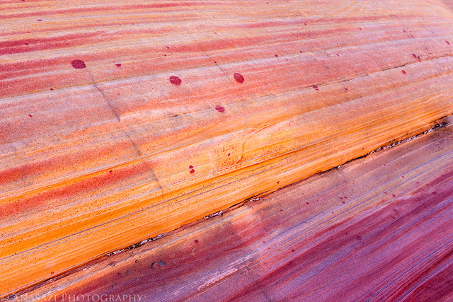
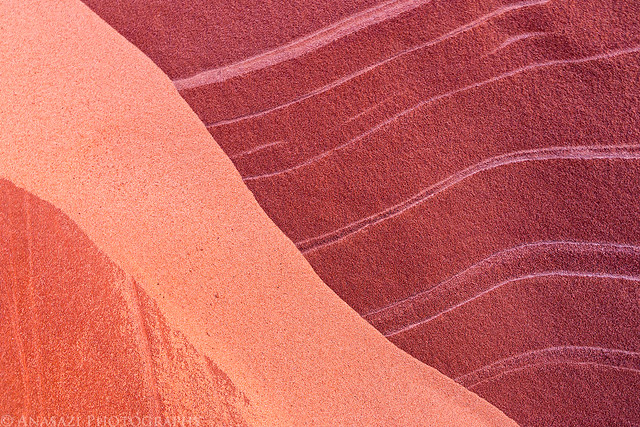
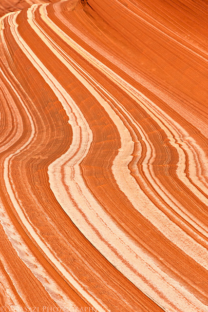
More interesting designs and colors. Such a great place to explore the little details.
Colors by IntrepidXJ, on Flickr
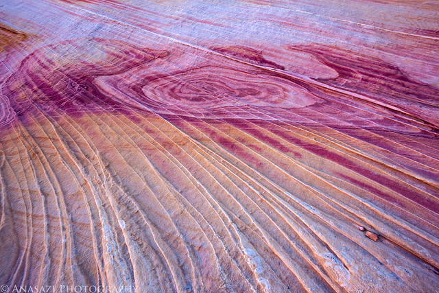
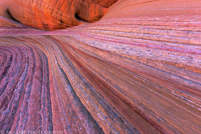
Swirl by IntrepidXJ, on Flickr
Gradient by IntrepidXJ, on Flickr
Quilt by IntrepidXJ, on Flickr
Before the Wave was all in the light, I made sure to check out the reflected light in the Passage.
Glow by IntrepidXJ, on Flickr
Enter by IntrepidXJ, on Flickr
In The Passage by IntrepidXJ, on Flickr
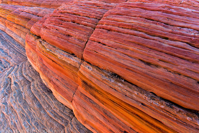
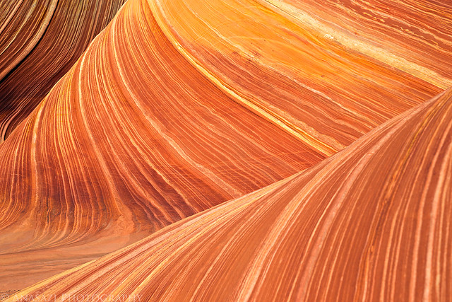
Striations and color everywhere you look.
Around the Corner by IntrepidXJ, on Flickr
It was pretty cold in the shade, especially when the wind was blowing. Diane made sure to keep bundled up and warm.
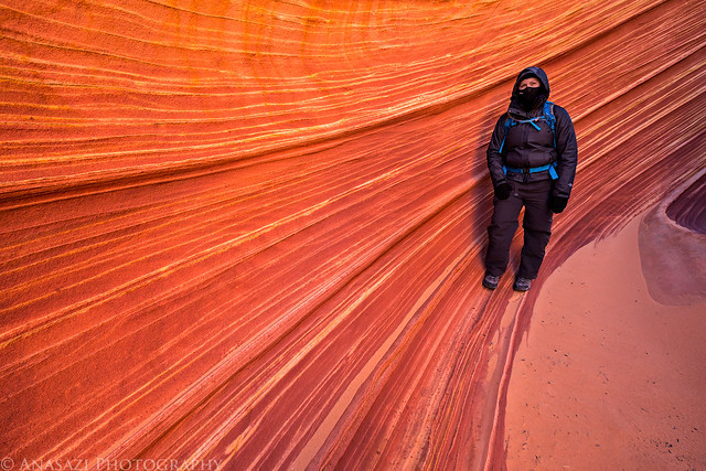
Cold by IntrepidXJ, on Flickr
Into the Passage by IntrepidXJ, on Flickr
Almost out of the shadows.
Shadow Wave by IntrepidXJ, on Flickr
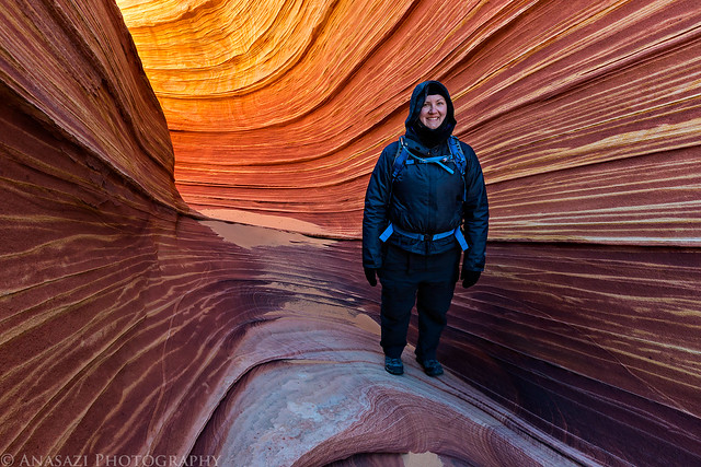
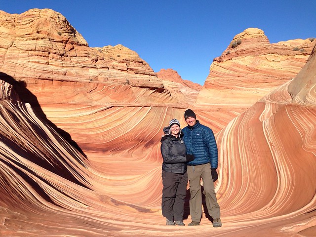
Diane in the Wave when the shadows finally disappeared.
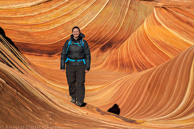
Diane in The Wave by IntrepidXJ, on Flickr
Just another classic Wave photo.
Classic Wave by IntrepidXJ, on Flickr
An iPhone picture of Diane and I taken by another friendly visitor. Even though I counted about 30 people in Coyote Buttes North today (including Diane and myself...where's a BLM Ranger when you want one around?), pretty much everyone we ran into was very nice and friendly, which is better than I can say about some of my other visits.
Diane and I in The Wave by IntrepidXJ, on Flickr
After taking a few photos of the Wave we decided to head over to the Second Wave so Diane could see it and so I could see if it would be in the light this early.
On the way I took this photo, which is probably my favorite from the entire day. I love the warm tones that are reflected from across the canyon contrasting with the cool tones on the top of the ridges.
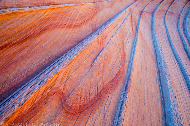
Soft Lines by IntrepidXJ, on Flickr
The Second Wave was just emerging from the shadows when we arrived.
Second Wave Top by IntrepidXJ, on Flickr
Flowing by IntrepidXJ, on Flickr
After hiking around in the shade for a little while, Diane was happy to be in the warm sunlight again!
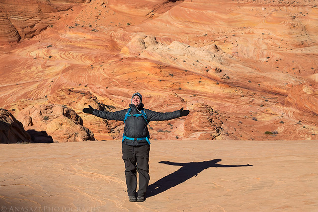
Sunlight! by IntrepidXJ, on Flickr
Reflections on the ice.
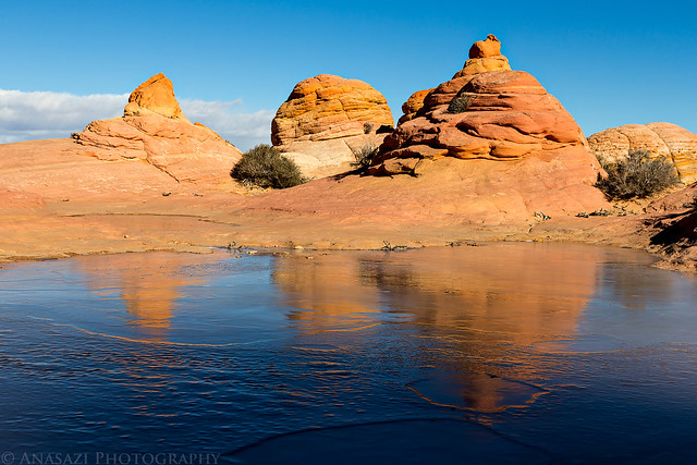
Icy Reflection by IntrepidXJ, on Flickr
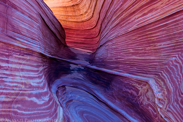
Next, we went back down through the Wave so we could hike up Sand Cove Wash and visit part of Sand Cove. We hadn't been gone very long and already the left side was in the shadows. You don't get a long period of time without shadows at this time of the year.
Core of The Wave by IntrepidXJ, on Flickr
Another Classic by IntrepidXJ, on Flickr
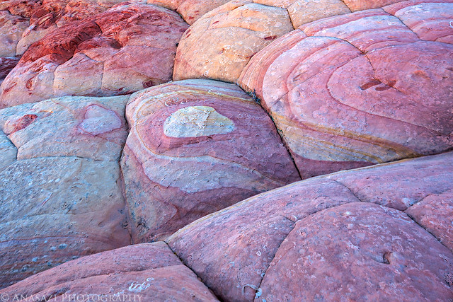
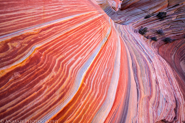
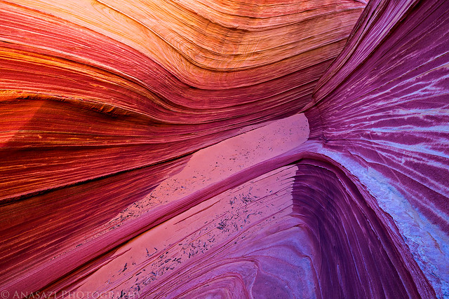
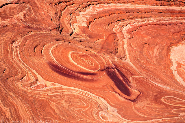
Such vibrant colors!
Painted Rock by IntrepidXJ, on Flickr
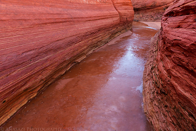
Sand Cove Wash was a sheet of ice through the narrow section, but enough sand had been blown onto it that it was easy to walk across without slipping.
Rock & Ice by IntrepidXJ, on Flickr
Ice by IntrepidXJ, on Flickr
Icy Slot by IntrepidXJ, on Flickr
Sand & Stone by IntrepidXJ, on Flickr
I thought this sandfall (sand + waterfall) was interesting.
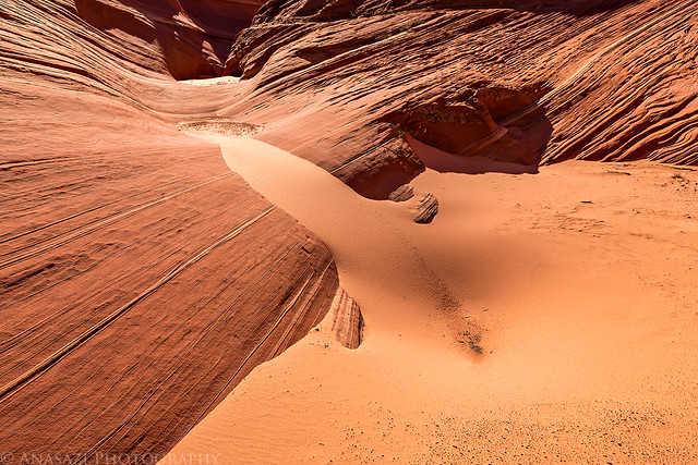
Sandfall by IntrepidXJ, on Flickr
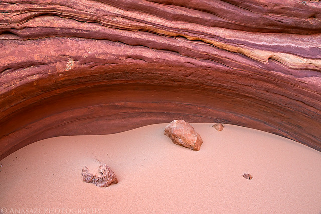
Rock Garden by IntrepidXJ, on Flickr
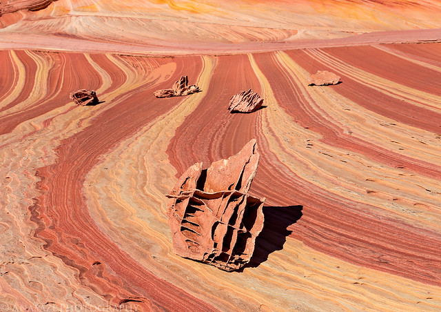
We hiked as far as The Racetrack before starting our hike back to the trailhead.
Racetrack by IntrepidXJ, on Flickr
Stripes by IntrepidXJ, on Flickr
Of course, we made sure to go back a different way from Sand Cove so Diane could experience as much of the area as possible. We started out by climbing up to The Boneyard.
Boneyard by IntrepidXJ, on Flickr
Diane says this looks like a ham bone.
Ham Bone by IntrepidXJ, on Flickr
We stopped to find the dinosaur tracks.
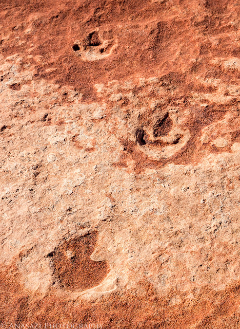
Dinosaur Tracks by IntrepidXJ, on Flickr
As always, plenty of beautiful scenery all around.
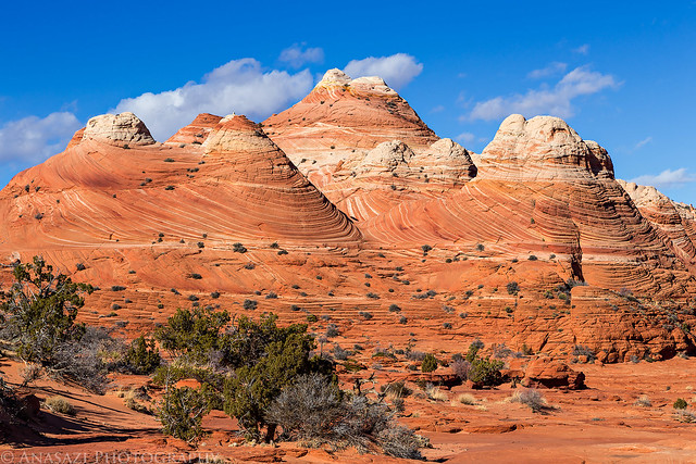
Sandstone Temples by IntrepidXJ, on Flickr
Before finishing the hike back out to the trailhead, we made a detour to High Heel Arch since it's a place I had not visited before. I'm glad we did since this arch appears to have suffered from a recent partial collapse. Who knows how much longer it will survive? I think I like the look of the arch now as opposed to before the collapse.
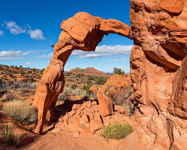
High Heel Arch by IntrepidXJ, on Flickr
Not much left holding it up there now!
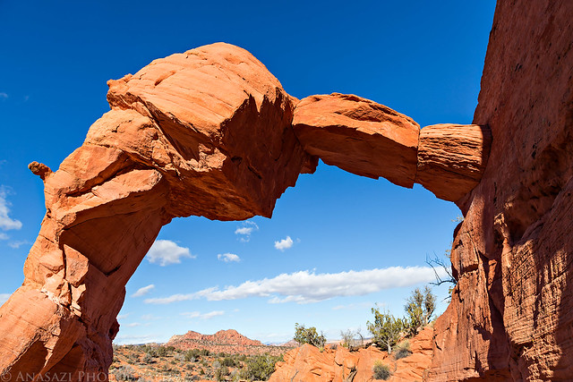
What's Left by IntrepidXJ, on Flickr
After reaching the trailhead we drove back to Page, had some dinner and then relaxed in our hotel room for the rest of the night. It had been a good day and Diane was happy to finally visit Coyote Buttes North and the Wave.
>> Coyote Buttes North Tour Photo Gallery
>> The Original Trip Report on ADVENTR.CO
Featured image for home page:

On Monday morning we got an early start and drove back to the Wire Pass trailhead so we could spend the day in Coyote Buttes North and visit the Wave. While I have been here plenty of times over the past couple of years and had no intentions of returning this year, Diane had never been here before and really wanted to visit the Wave. I managed to get a pair of permits for today and that's the main reason we planned this end of the year trip to Page. The last few times I have been to Coyote Buttes North I barely stopped by the Wave and instead I explored other areas that are less visited, but this time we hiked straight to the Wave and waited until it was in good light. While waiting for the sun to crest over Top Rock and light up the Wave I explored more of the area above and took a few photos under Top Rock Arch. While the temperature outside wasn't too cold this morning, it was pretty windy all day and that kept us pretty chilled, especially when we were in the shade.
Entering the Wave. We were the first ones here today.
Entrance by IntrepidXJ, on Flickr
There are some really great colors in the sandstone up above the Wave and below the Black Crack. The colors are especially nice when the sandstone is in the shade and there is light reflecting off of the buttes across Sand Cove Wash.
Ledge Light by IntrepidXJ, on Flickr
I'm calling this area Crazy Corner, named after Crazy Hill in the Valley of Fire State Park that also has a lot of color.
Crazy Corner by IntrepidXJ, on Flickr
Crazy Color by IntrepidXJ, on Flickr
More interesting designs and colors. Such a great place to explore the little details.
Colors by IntrepidXJ, on Flickr
Swirl by IntrepidXJ, on Flickr
Gradient by IntrepidXJ, on Flickr
Quilt by IntrepidXJ, on Flickr
Before the Wave was all in the light, I made sure to check out the reflected light in the Passage.
Glow by IntrepidXJ, on Flickr
Enter by IntrepidXJ, on Flickr
In The Passage by IntrepidXJ, on Flickr
Striations and color everywhere you look.
Around the Corner by IntrepidXJ, on Flickr
It was pretty cold in the shade, especially when the wind was blowing. Diane made sure to keep bundled up and warm.
Cold by IntrepidXJ, on Flickr
Into the Passage by IntrepidXJ, on Flickr
Almost out of the shadows.
Shadow Wave by IntrepidXJ, on Flickr
Diane in the Wave when the shadows finally disappeared.
Diane in The Wave by IntrepidXJ, on Flickr
Just another classic Wave photo.
Classic Wave by IntrepidXJ, on Flickr
An iPhone picture of Diane and I taken by another friendly visitor. Even though I counted about 30 people in Coyote Buttes North today (including Diane and myself...where's a BLM Ranger when you want one around?), pretty much everyone we ran into was very nice and friendly, which is better than I can say about some of my other visits.
Diane and I in The Wave by IntrepidXJ, on Flickr
After taking a few photos of the Wave we decided to head over to the Second Wave so Diane could see it and so I could see if it would be in the light this early.
On the way I took this photo, which is probably my favorite from the entire day. I love the warm tones that are reflected from across the canyon contrasting with the cool tones on the top of the ridges.
Soft Lines by IntrepidXJ, on Flickr
The Second Wave was just emerging from the shadows when we arrived.
Second Wave Top by IntrepidXJ, on Flickr
Flowing by IntrepidXJ, on Flickr
After hiking around in the shade for a little while, Diane was happy to be in the warm sunlight again!
Sunlight! by IntrepidXJ, on Flickr
Reflections on the ice.
Icy Reflection by IntrepidXJ, on Flickr
Next, we went back down through the Wave so we could hike up Sand Cove Wash and visit part of Sand Cove. We hadn't been gone very long and already the left side was in the shadows. You don't get a long period of time without shadows at this time of the year.
Core of The Wave by IntrepidXJ, on Flickr
Another Classic by IntrepidXJ, on Flickr
Such vibrant colors!
Painted Rock by IntrepidXJ, on Flickr
Sand Cove Wash was a sheet of ice through the narrow section, but enough sand had been blown onto it that it was easy to walk across without slipping.
Rock & Ice by IntrepidXJ, on Flickr
Ice by IntrepidXJ, on Flickr
Icy Slot by IntrepidXJ, on Flickr
Sand & Stone by IntrepidXJ, on Flickr
I thought this sandfall (sand + waterfall) was interesting.
Sandfall by IntrepidXJ, on Flickr
Rock Garden by IntrepidXJ, on Flickr
We hiked as far as The Racetrack before starting our hike back to the trailhead.
Racetrack by IntrepidXJ, on Flickr
Stripes by IntrepidXJ, on Flickr
Of course, we made sure to go back a different way from Sand Cove so Diane could experience as much of the area as possible. We started out by climbing up to The Boneyard.
Boneyard by IntrepidXJ, on Flickr
Diane says this looks like a ham bone.
Ham Bone by IntrepidXJ, on Flickr
We stopped to find the dinosaur tracks.
Dinosaur Tracks by IntrepidXJ, on Flickr
As always, plenty of beautiful scenery all around.
Sandstone Temples by IntrepidXJ, on Flickr
Before finishing the hike back out to the trailhead, we made a detour to High Heel Arch since it's a place I had not visited before. I'm glad we did since this arch appears to have suffered from a recent partial collapse. Who knows how much longer it will survive? I think I like the look of the arch now as opposed to before the collapse.
High Heel Arch by IntrepidXJ, on Flickr
Not much left holding it up there now!
What's Left by IntrepidXJ, on Flickr
After reaching the trailhead we drove back to Page, had some dinner and then relaxed in our hotel room for the rest of the night. It had been a good day and Diane was happy to finally visit Coyote Buttes North and the Wave.
>> Coyote Buttes North Tour Photo Gallery
>> The Original Trip Report on ADVENTR.CO
Featured image for home page: