Tyler
^^^^^^^^^^^^^^^^^^^^^^^^^^^^^^^^^^^^
- Joined
- Jan 18, 2012
- Messages
- 464
Late last fall Alene put in for permits for Coyote Buttes North (aka "The Wave") and we found out about a month or so later that we were selected for late February. Ever since I had seen our friend Clint's photo's from his trip there with his wife in 2007, I've wanted to get down there and see what it was like in person.
We had 6 passes and they were instantly taken up by pinecone /@Summit and Alene's friend James from her work and his wife Amber. FourisTheNewOne came along as well, but he was just going to do some other hikes in the area while we went in, but he was able to score a walk-in pass that night before.
We met up at the parking area for the Notch trail and set up our camp there. The weather had been forecasted to be cold and rainy with heavier chances of snow later in the evening. This was the first time Alene and I had set up camp in the back of our truck, which has a shell on it. I really liked it because you don't have to set up a tent and it was quite warm in there.
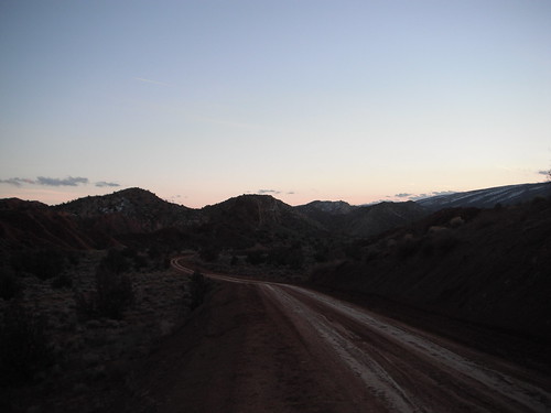
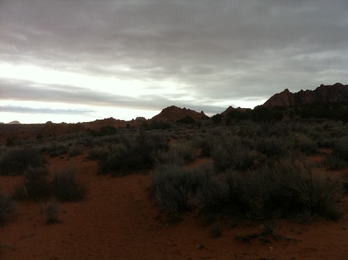
House Rock road driving in
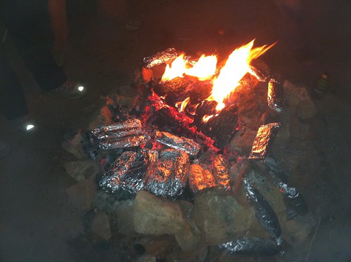
That evenings dinner consisted of a "burritoff" that Bill had suggested. We all brought our own burritos to warm up over the fire and extras to cook so we could share with others. We would then vote for who had the best tasting burrito. As everyone started to explain the ingredients in their burrito's, I was ready to throw in the towel, but I had loaded mine with LOTS of cheese and used a Jalapeno Cheddar tortilla (which I think helped put me over the top). I won the contest and the $5 each pot, however I relinquished the winnings due to bad advice I would give the next day (more of that to come).
Burritos on the coals (the best way to make a burrito)
Me, overlooking our campsite (photo by William Church)

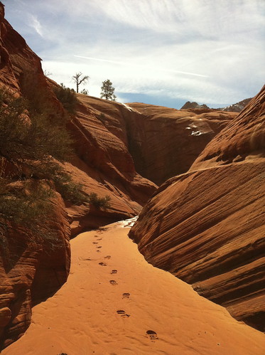
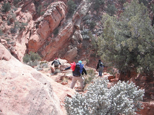
The next morning we drove about 3 miles north to the Wire Pass trail head and departed. The hike in was awesome and started off in a dry river bed, then split off to higher ground and it was there that you began to see some awesome scenery.
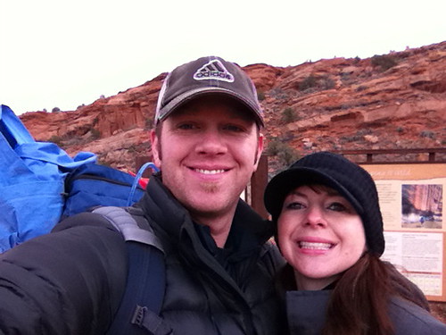
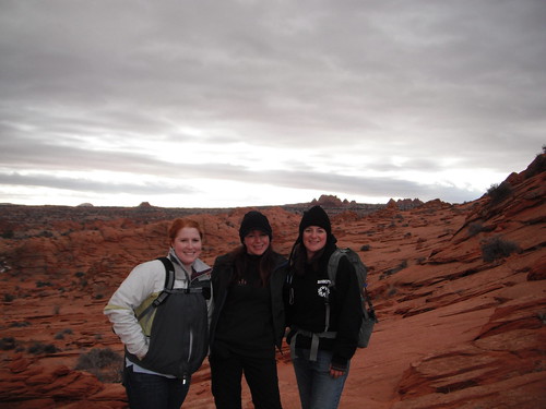
Alene and I at the trail head
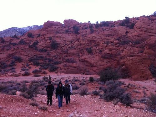
Heading up out of the dry wash to Coyote Buttes
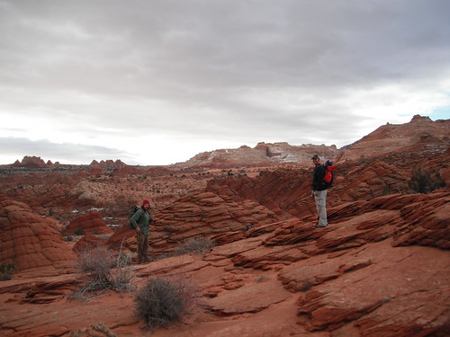
Scenery begins to change a bit (see the pointy buttes in the background)
At about 1/3 of the way there, this is a video view. You can get a bit of foreshadowing with the sound of the wind picking up.
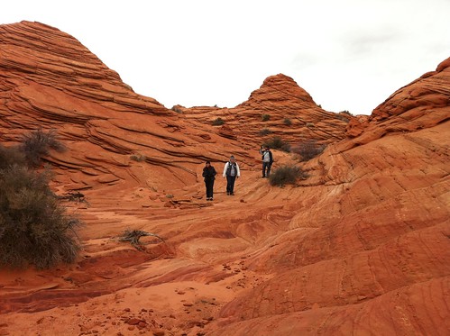
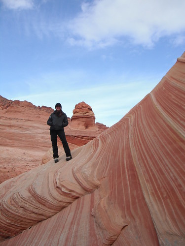
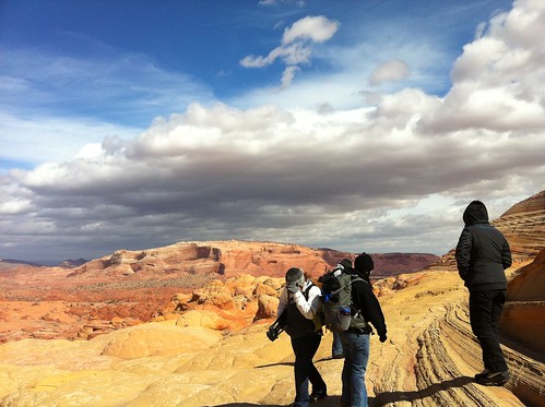
From here the hike in was due south and the best bearing was this HUGE crack you see in the mountain range directly south. Aim for that and it takes you right up to the Wave.
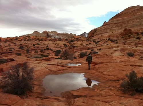
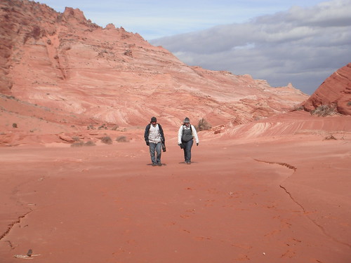
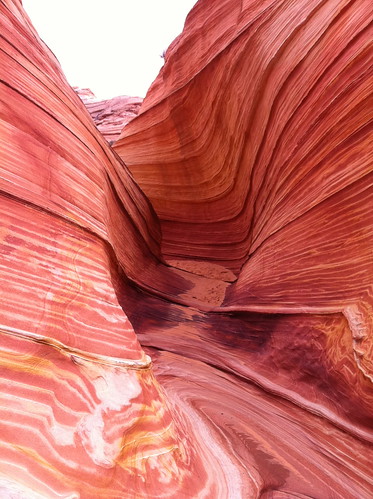
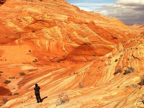
Pictures of our hike on the way toward the wave (note any views you see of a darker spot on the sandstone cliffs in the background)
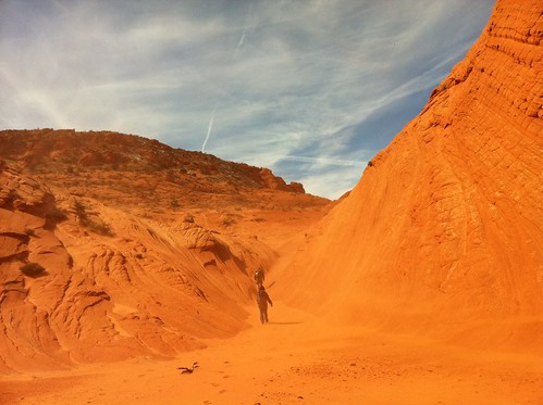
The worst part of the hike in is crossing this large area of sand, then a hike up a somewhat long mound of sand before you enter the wave. It was here that we started to get a taste of sand blowing in our faces.
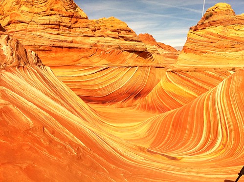
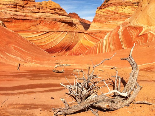
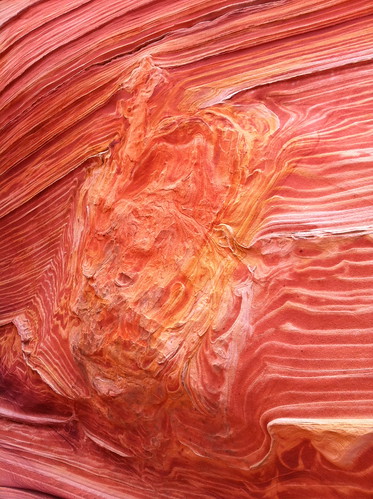
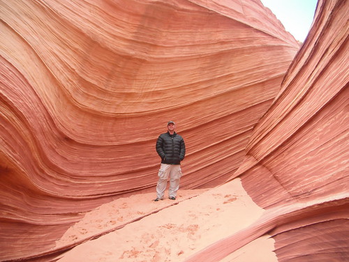
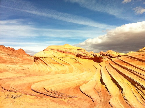
Here is the first thing you see when you approach the wave
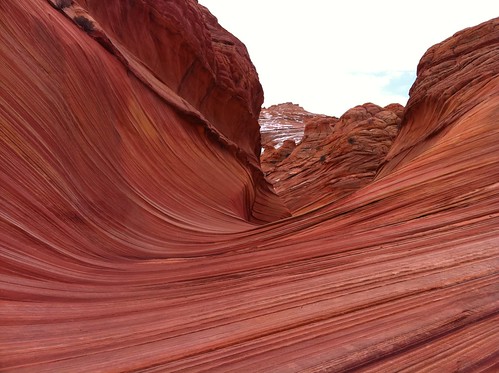
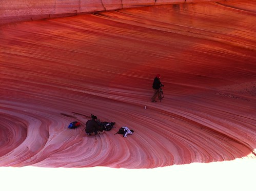
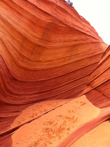
When we arrived there, there were 3 photographers there already. On our way in we also passed a family of 4. The wave was a surprisingly small area with 3 "chambers" that you get the photos from. We loved every minute being there, especially when the light would hit the sandstone just right. These pictures were taken with both my wife's camera and my iphone.
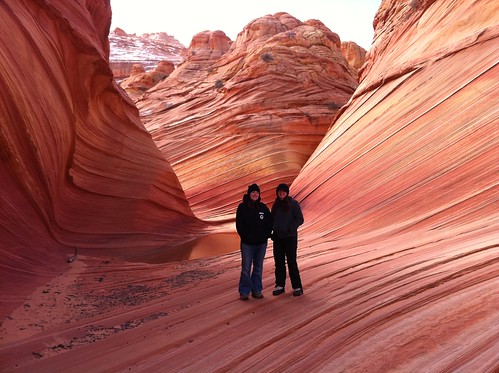
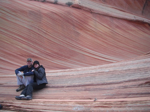
Alene and I (taken by William Church)

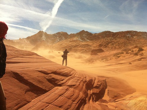
After an hour or so the wind really started to pick up. We had started to hike back to what we thought was a cove and we thought we could seek a bit of protection from the wind storm while it blew through, but after arriving, we found it had no protection. I had this genius idea to head up over this area called "the notch", which, on the Kelsey guide I was carrying, showed it being right above our campsite. We all pretty much agreed it would be best to get back to camp, then two of us would hike the 3 miles north back to pick up the vehicles. This turned out to be a disaster as the winds never let down and the trail going back was very hard to find. We ended up just route finding our way over and by the time we made it down the other side of the mountain, we were almost back at our cars (we had followed a wash that lead us north, back toward our cars, rather than due West, to the campsite).
Every time a gust of sandy wind would come, we would stop, turn our backs, and wait it out.
Stopped by the 2nd wave on our way out
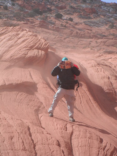
I shielded my face with the Kelsye guide book as the sand blew in
Another gust of wind/sand
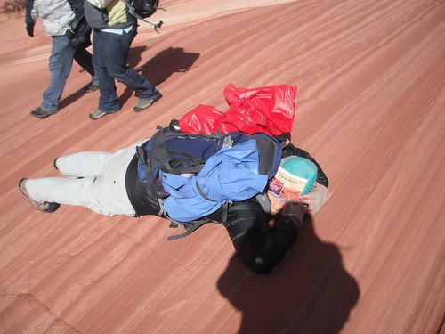
I got knocked over by a gust, so I stayed down to ride it out while James and Amber looked on.
Alene and I riding out another gust
This is my favorite shot of the gust
The sand cove. Not much cove going on here, but it was kind of cool
Heading out over that mountain to our campsite
Getting toward the top
Going down the other side. It was sketchy at times, but we made it
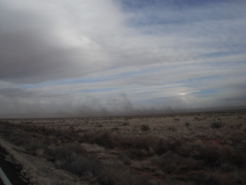
As I said before, our hike back took twice as long as it would have if we had just opted to go back the way we came. I felt really guilty for suggesting this, but it did turn out to be a bit of an adventure, but it certainly sucked. After getting back to camp, we decide to ditch the bad weather and head into Page, AZ to get a hotel. On our way there we see this awesome dust storm blowing in.
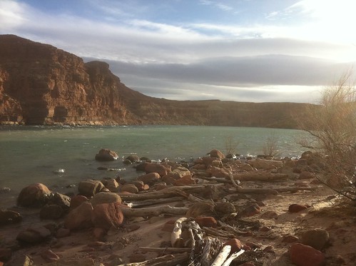
We made a quick stop at Lee's Ferry
Then drove up and out of the lower river bed, on up toward Page. I took this picture of the storm heading our way
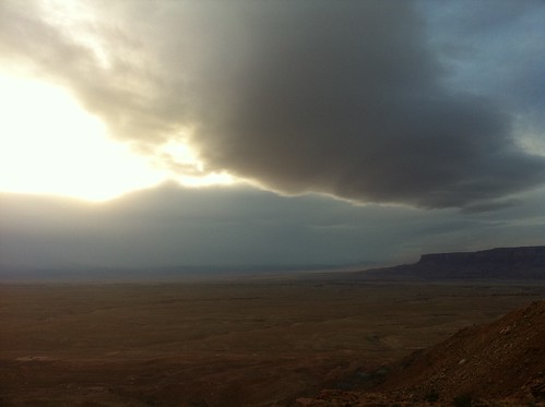
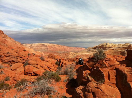
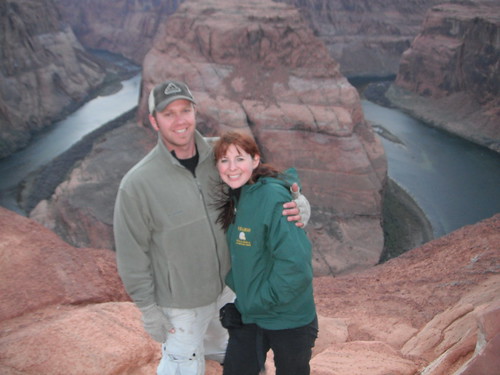
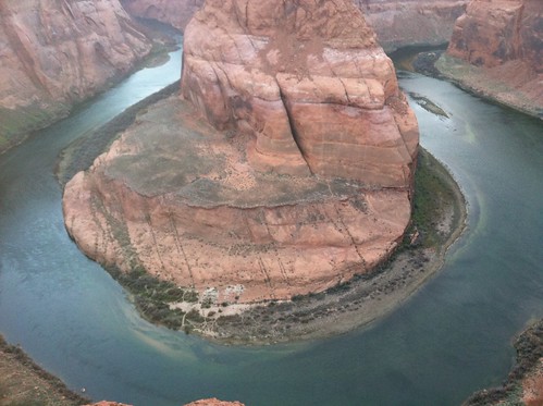
We made it to Horseshoe bend just at sunset, but the clouds were obviously covering most of that. The view from up here was awesome.
We checked into Page, Arizona's finest hotel, showered most of the sand off us and all ran out to eat. It was actually quite nice, but we were so beat from the hike out earlier that day.
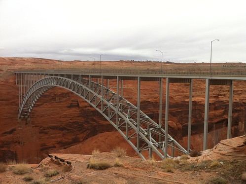
The next day was very uneventful due to horrible weather. We stopped by the Glen Canyon dam and the bridge to check it out. The bridge is an engineering trip to look at.
The dam, whether you believe it was right to build it or not, is still something amazing to look at.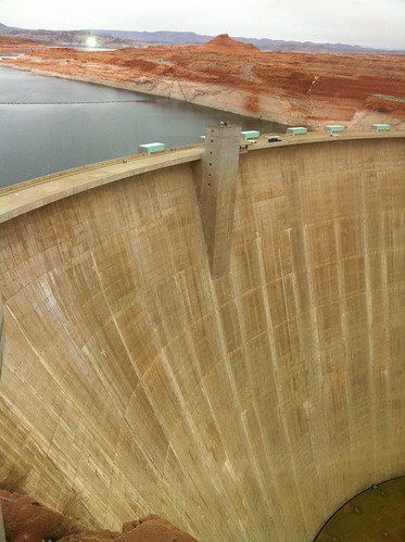
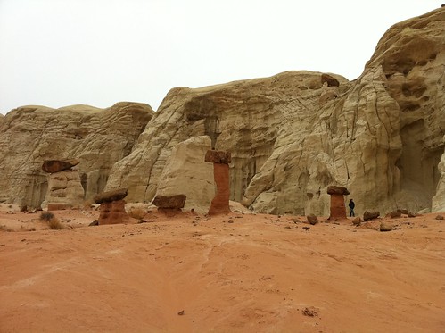
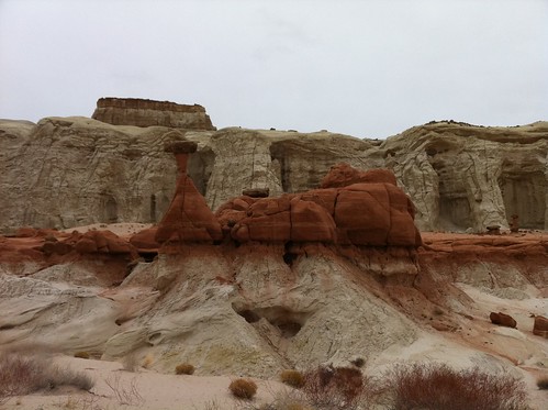
From here we opted to begin our drive toward Bryce Canyon, where we had originally booked a hotel (as a part of our plan). On our way back we stopped off at the Paria Toadstools. Regrettably, we did not know that there were more in the area to see, so we only saw the first few you see when you get there.
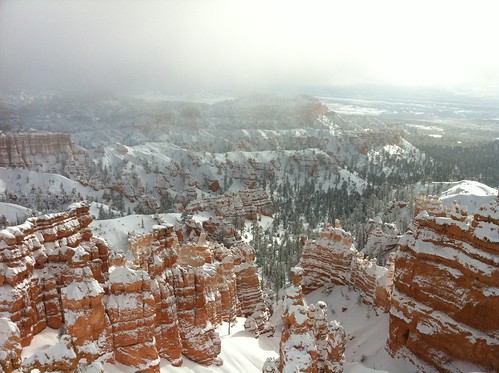
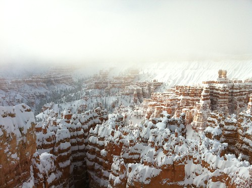
When we arrived at Bryce, they had white-out conditions and the snow was piling up like crazy. They were experiencing unusual snowfall, so we spent our evening at the lodge. We did have fun hitting up the hot tub and watching Clint and April jump into the cold pool, then back into the hot tub. This was the time we experimented with the water proof camera and it's video qualities (it was April's camera, but we have the same one).
The next day we headed out into the park to see what we could see. All the trails were pretty much shut down or inaccessible due to snow, so we were only able to access the view points.
As much as it sucked not being able to do more hiking (especially since we didn't have the kids on this trip), it was still awesome to see the Wave and make the most of our situation. I loved the hint of Bryce Canyon and can't wait to go back there with the kids.
We had 6 passes and they were instantly taken up by pinecone /@Summit and Alene's friend James from her work and his wife Amber. FourisTheNewOne came along as well, but he was just going to do some other hikes in the area while we went in, but he was able to score a walk-in pass that night before.
We met up at the parking area for the Notch trail and set up our camp there. The weather had been forecasted to be cold and rainy with heavier chances of snow later in the evening. This was the first time Alene and I had set up camp in the back of our truck, which has a shell on it. I really liked it because you don't have to set up a tent and it was quite warm in there.
House Rock road driving in
That evenings dinner consisted of a "burritoff" that Bill had suggested. We all brought our own burritos to warm up over the fire and extras to cook so we could share with others. We would then vote for who had the best tasting burrito. As everyone started to explain the ingredients in their burrito's, I was ready to throw in the towel, but I had loaded mine with LOTS of cheese and used a Jalapeno Cheddar tortilla (which I think helped put me over the top). I won the contest and the $5 each pot, however I relinquished the winnings due to bad advice I would give the next day (more of that to come).
Burritos on the coals (the best way to make a burrito)
Me, overlooking our campsite (photo by William Church)
The next morning we drove about 3 miles north to the Wire Pass trail head and departed. The hike in was awesome and started off in a dry river bed, then split off to higher ground and it was there that you began to see some awesome scenery.
Alene and I at the trail head
Heading up out of the dry wash to Coyote Buttes
Scenery begins to change a bit (see the pointy buttes in the background)
At about 1/3 of the way there, this is a video view. You can get a bit of foreshadowing with the sound of the wind picking up.
From here the hike in was due south and the best bearing was this HUGE crack you see in the mountain range directly south. Aim for that and it takes you right up to the Wave.
Pictures of our hike on the way toward the wave (note any views you see of a darker spot on the sandstone cliffs in the background)
The worst part of the hike in is crossing this large area of sand, then a hike up a somewhat long mound of sand before you enter the wave. It was here that we started to get a taste of sand blowing in our faces.
Here is the first thing you see when you approach the wave
When we arrived there, there were 3 photographers there already. On our way in we also passed a family of 4. The wave was a surprisingly small area with 3 "chambers" that you get the photos from. We loved every minute being there, especially when the light would hit the sandstone just right. These pictures were taken with both my wife's camera and my iphone.
Alene and I (taken by William Church)
After an hour or so the wind really started to pick up. We had started to hike back to what we thought was a cove and we thought we could seek a bit of protection from the wind storm while it blew through, but after arriving, we found it had no protection. I had this genius idea to head up over this area called "the notch", which, on the Kelsey guide I was carrying, showed it being right above our campsite. We all pretty much agreed it would be best to get back to camp, then two of us would hike the 3 miles north back to pick up the vehicles. This turned out to be a disaster as the winds never let down and the trail going back was very hard to find. We ended up just route finding our way over and by the time we made it down the other side of the mountain, we were almost back at our cars (we had followed a wash that lead us north, back toward our cars, rather than due West, to the campsite).
Every time a gust of sandy wind would come, we would stop, turn our backs, and wait it out.
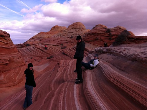
Stopped by the 2nd wave on our way out
I shielded my face with the Kelsye guide book as the sand blew in
Another gust of wind/sand
I got knocked over by a gust, so I stayed down to ride it out while James and Amber looked on.
Alene and I riding out another gust
This is my favorite shot of the gust
The sand cove. Not much cove going on here, but it was kind of cool
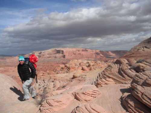
Heading out over that mountain to our campsite
Getting toward the top
Going down the other side. It was sketchy at times, but we made it
As I said before, our hike back took twice as long as it would have if we had just opted to go back the way we came. I felt really guilty for suggesting this, but it did turn out to be a bit of an adventure, but it certainly sucked. After getting back to camp, we decide to ditch the bad weather and head into Page, AZ to get a hotel. On our way there we see this awesome dust storm blowing in.
We made a quick stop at Lee's Ferry
Then drove up and out of the lower river bed, on up toward Page. I took this picture of the storm heading our way
We made it to Horseshoe bend just at sunset, but the clouds were obviously covering most of that. The view from up here was awesome.
We checked into Page, Arizona's finest hotel, showered most of the sand off us and all ran out to eat. It was actually quite nice, but we were so beat from the hike out earlier that day.
The next day was very uneventful due to horrible weather. We stopped by the Glen Canyon dam and the bridge to check it out. The bridge is an engineering trip to look at.
The dam, whether you believe it was right to build it or not, is still something amazing to look at.
From here we opted to begin our drive toward Bryce Canyon, where we had originally booked a hotel (as a part of our plan). On our way back we stopped off at the Paria Toadstools. Regrettably, we did not know that there were more in the area to see, so we only saw the first few you see when you get there.
When we arrived at Bryce, they had white-out conditions and the snow was piling up like crazy. They were experiencing unusual snowfall, so we spent our evening at the lodge. We did have fun hitting up the hot tub and watching Clint and April jump into the cold pool, then back into the hot tub. This was the time we experimented with the water proof camera and it's video qualities (it was April's camera, but we have the same one).
The next day we headed out into the park to see what we could see. All the trails were pretty much shut down or inaccessible due to snow, so we were only able to access the view points.
As much as it sucked not being able to do more hiking (especially since we didn't have the kids on this trip), it was still awesome to see the Wave and make the most of our situation. I loved the hint of Bryce Canyon and can't wait to go back there with the kids.
