Bryan Harwood
Member
- Joined
- Mar 24, 2016
- Messages
- 26

3 da, 32 mile loop. half trail- half- trek. June 2015
So... What to say about the Cloud Peak Wilderness... Its a small wilderness situated on the main crest of the Bighorn Mountains in north central Wyoming. Its a pure gem. Its intimate and "easily" traversed. By that I mean, its not so overwhelmingly massive that a major portion of the wilderness can be seen in only one trip. I took 5 trips into the Cloud Peak, and I have seen a damn good amount of it. This trip being my first, was the longest and hardest. I bit off alot, but I managed to chew it up and swallow it... without choking.. to death anyway.
The road to my access point, Paintrock Lake, is a godaweful rutted, muddy, washboarded, steep, gravelly, narrow, outsloped piece of 30 mile crap. But this is the most remote way of getting into the main Cloud Peak Summit area, and probably the least utilized for that purpose. The main attraction fro this spot is the Solitude Trail that traverses the entire Wilderness from East/West to South. However which way you wanna look at it.

I worked on The Bighorn NF the summer of 2015, as the trail crew leader for the Porcupine Falls trail construction project, which I can post about later.., so the Cloud Peak was my backyard.

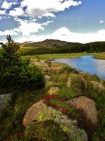
A pretty creek scene as the Alpine approaches in sight

This is Teepee Flats. Its a junction for the main trails. It is a gorgeous spot, but the bugs can get really bad.

Very beautiful granite boulders, which are actually a mofo to trek over!

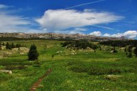
An exceptionally remarkable meadow beneath the gentle slopes of the alpine high country

and theres me

This is Lake Solitude. This is a very pretty lake. There are alot of moose out here. I had one step on my tent during the night, and it scared the hell out of me so bad. This is looking East toward the inlet.

Alpine sunset on Lake Solitude

The Next day, I trekked up and over this drainage to meet up the the main approach to Cloud Peak. This is Lake Solitude from the drainage above to the East.

Going Up

Alpine Camera Timer is my hiking partner most of the time

Alpine Pools of glorious Colors.

Sweet Cliffs that look like Castle Walls

B&W

There is the Cloud Peak Summit and the talos field of death.

A Closer look at the neat profile of the Cloud PEak

Going UP!!! Man im gettin high.

Sweet!!!!! Almost There.

The Top. This is the View looking West into the drainage of unnamed lakes. The Top of Cloud Peak has a HUGE surface. To get a 360 degree view, you have to hop over thousands of rocks so I just decided to hang out here. The other views were good to though, just not as dramatic.

Heading back down. A long ways back to camp... Im already burnt out..

Alpine flowers

Sweet day, but it is far from over... 6 more miles of traversing hard bouldered country

Sweet Ponds everywhere

I love these kind of shots!

So The next day was a long haul back to the Trailhead.
I finished off the loop on a trail that pretty much siezed to exist once I got deeper away from the high use areas...

sweet areas though. I had to do some major navigation. I got a bit confused of my where- abouts, but luckily I am pretty savy on map reading.

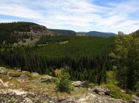
characteristic of the Bighorn Mountains
The Cloud Peak Wilderness is a sweet ass place. Just know that once above timberline and trekking in the alpine, the boulders are so agonizingly large that you should plan on maybe shortening your mileage plans between destination points, atleast when trekking trailless territory. other than that the trails are in good shape, in the high use areas.
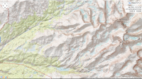
here is the map. its too big to fit it all so This is the main stuff

