uintahiker
Adventure Guru
- Joined
- Jan 20, 2012
- Messages
- 719
One of the longer hikes I've done recently. Originally posted on my blog.

Over Labor Day we went to the Chiricahuas to visit Chiricahua National Monument once more. Our oldest kept asking to go, so when we had the long weekend it made for a great destination about 2 hours from Sierra Vista. We arrived a little late on Friday night and snared the last campsite available in the campground. On Saturday morning we woke up, then after breakfast headed to the visitor center and arranged a ride with the shuttle to drop us off at the top.

This was out third visit to the Chiricahuas and we wanted to do something different from our last visits when we had hiked to the Sugarloaf Fire Lookout Tower, the Faraway Ranch, and the Grotto. We strung a few trails together and left from the Echo Canyon Parking lot and hiked down the canyon to the Visitor Center. The trails we took were the Echo Canyon Trail (1.6 miles), the Upper Rhyolite Canyon Trail (1.1 miles) , and the Lower Rhyolite Canyon Trail (1.5 miles) for a total distance of about 4.2 miles.

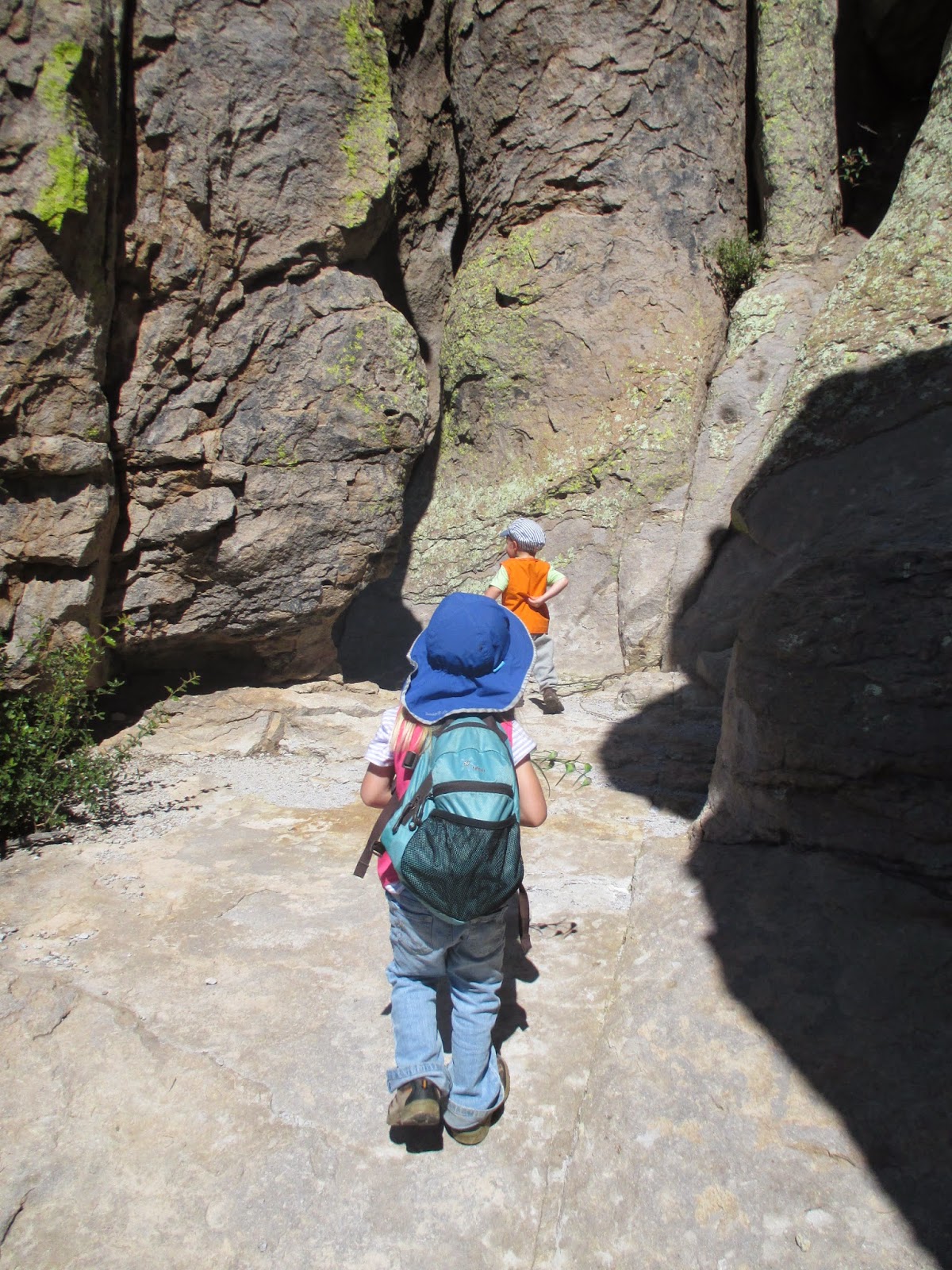
We hiked to the Echo Canyon Grotto, then played there in the shade for 10-15 minutes before hiking on. Another 1/4 to 1/2 mile down the trail was "Wall Street", a spot where the trail goes through several rocks that rise abruptly along each side of the trail. It got narrow enough that I was able to put myself in the gap and chimney up off of the trail. Almost slot canyon like!

Our next fun discovery was some pokeberries growing alongside the trail. We didn't know what they were, but the spear covered in blue and green berries sure was pretty. We didn't eat them. Eating something you can't positively identify is never a good idea. When we showed the picture to a ranger at the visitor center to ask about them, they told us that they are pokeberries and are poisonous.

Before long we were in Echo Park, a small forested meadow down in the middle of the formations. There's a small stream that proved ideal spot to take off our shoes and wade. We took a snack break as well. I think the stream in Echo Park was the kids' favorite part of the hike!

Shortly before the trail intersection with the Upper Rhyolite Canyon Trail, you have a beautiful view of the formations from below. Actually, the first 1/3 of the hike (the Echo Canyon Trail) was the best part of the hike. We then branched off onto the Upper Rhyolite Canyon Trail.

I was surprised how little use this part of the trail got. There were several spots that just didn't seem like they ever see much traffic. We got down to the streambed and had a few spots that had some pretty nifty stonework at the (mostly dry) creek crossing.

The rest of the hike was all a downhill descent through Rhyolite Canyon. It went pretty quickly- especially since we motivated the younger hikers with gummy bears, and counting the number of lizards along the way. We finally made it to the visitor center about 4 - 4 1/2 hours after we left. It was a great hike!
Featured image for home page:


Over Labor Day we went to the Chiricahuas to visit Chiricahua National Monument once more. Our oldest kept asking to go, so when we had the long weekend it made for a great destination about 2 hours from Sierra Vista. We arrived a little late on Friday night and snared the last campsite available in the campground. On Saturday morning we woke up, then after breakfast headed to the visitor center and arranged a ride with the shuttle to drop us off at the top.
This was out third visit to the Chiricahuas and we wanted to do something different from our last visits when we had hiked to the Sugarloaf Fire Lookout Tower, the Faraway Ranch, and the Grotto. We strung a few trails together and left from the Echo Canyon Parking lot and hiked down the canyon to the Visitor Center. The trails we took were the Echo Canyon Trail (1.6 miles), the Upper Rhyolite Canyon Trail (1.1 miles) , and the Lower Rhyolite Canyon Trail (1.5 miles) for a total distance of about 4.2 miles.
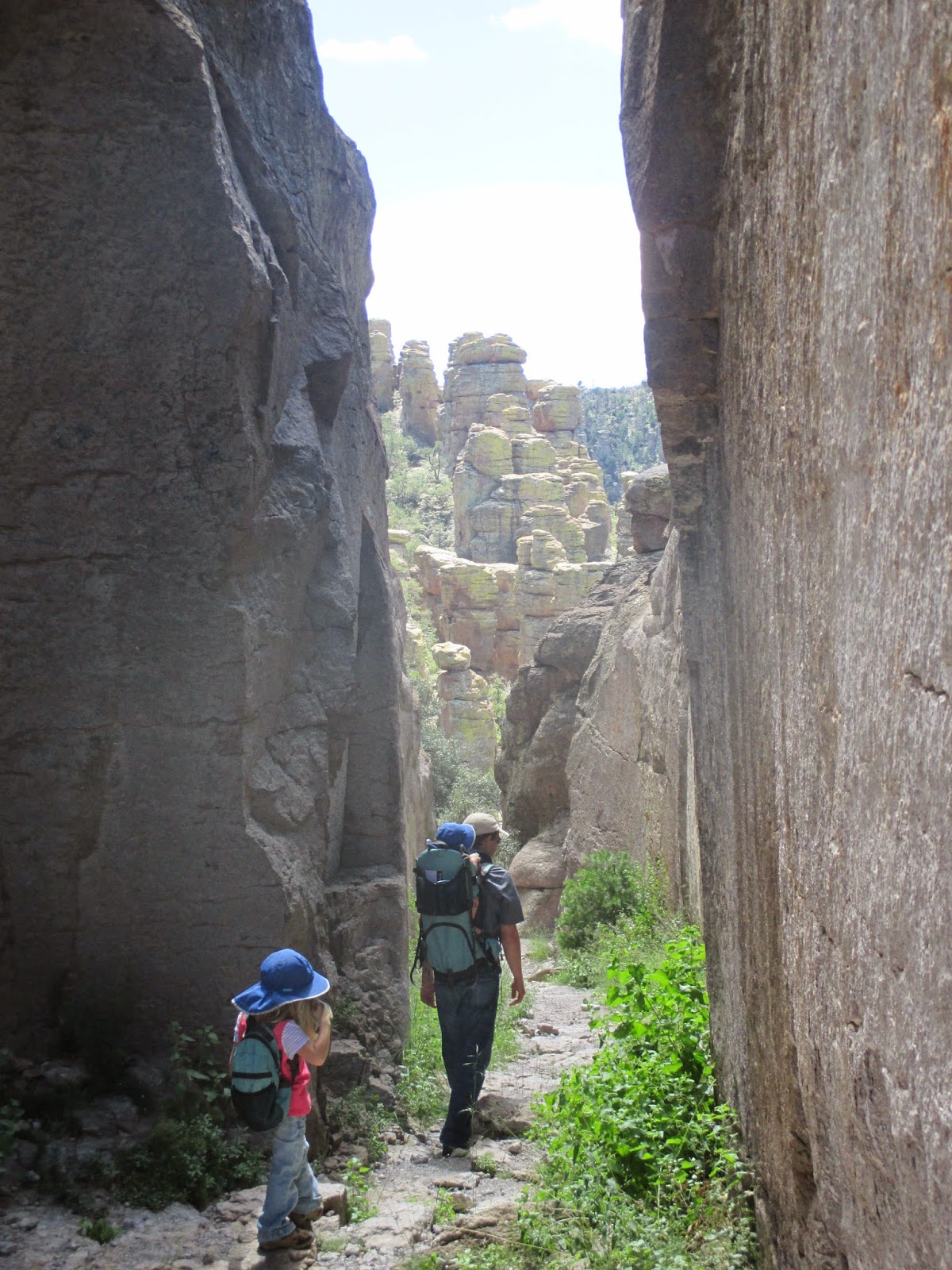
We hiked to the Echo Canyon Grotto, then played there in the shade for 10-15 minutes before hiking on. Another 1/4 to 1/2 mile down the trail was "Wall Street", a spot where the trail goes through several rocks that rise abruptly along each side of the trail. It got narrow enough that I was able to put myself in the gap and chimney up off of the trail. Almost slot canyon like!
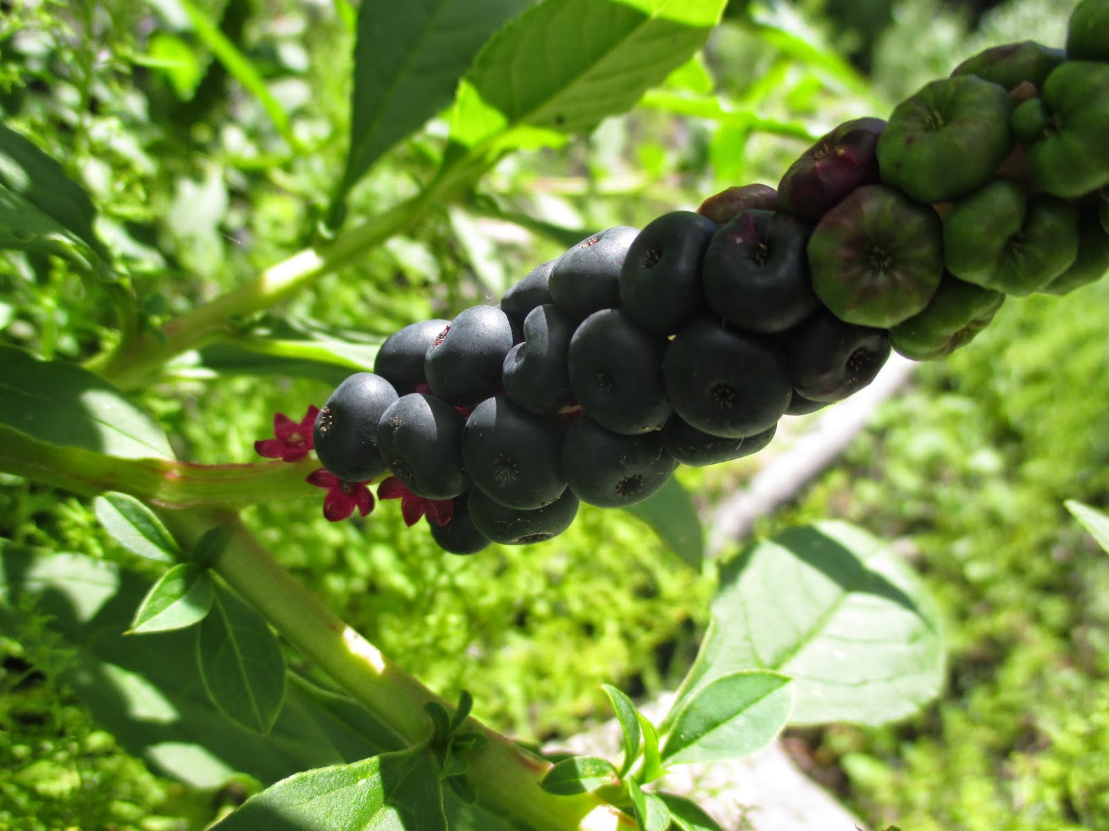
Our next fun discovery was some pokeberries growing alongside the trail. We didn't know what they were, but the spear covered in blue and green berries sure was pretty. We didn't eat them. Eating something you can't positively identify is never a good idea. When we showed the picture to a ranger at the visitor center to ask about them, they told us that they are pokeberries and are poisonous.

Before long we were in Echo Park, a small forested meadow down in the middle of the formations. There's a small stream that proved ideal spot to take off our shoes and wade. We took a snack break as well. I think the stream in Echo Park was the kids' favorite part of the hike!
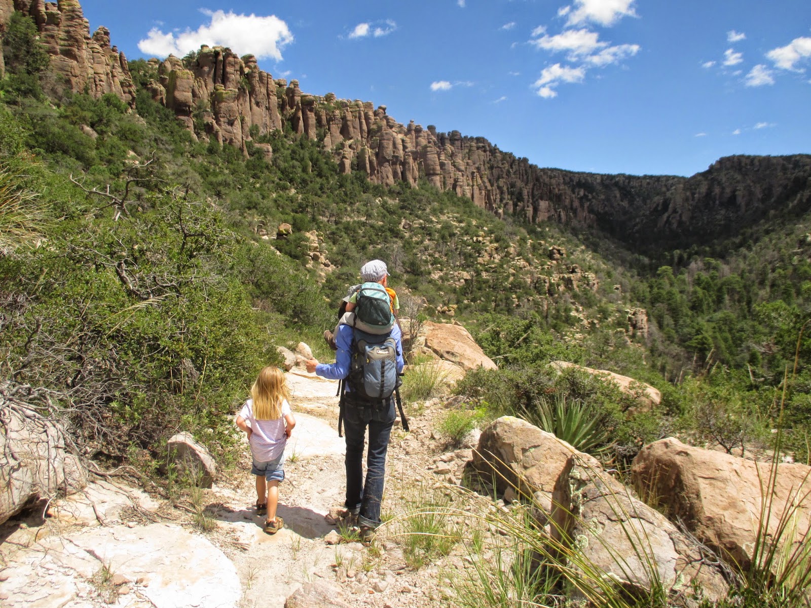
Shortly before the trail intersection with the Upper Rhyolite Canyon Trail, you have a beautiful view of the formations from below. Actually, the first 1/3 of the hike (the Echo Canyon Trail) was the best part of the hike. We then branched off onto the Upper Rhyolite Canyon Trail.

I was surprised how little use this part of the trail got. There were several spots that just didn't seem like they ever see much traffic. We got down to the streambed and had a few spots that had some pretty nifty stonework at the (mostly dry) creek crossing.

The rest of the hike was all a downhill descent through Rhyolite Canyon. It went pretty quickly- especially since we motivated the younger hikers with gummy bears, and counting the number of lizards along the way. We finally made it to the visitor center about 4 - 4 1/2 hours after we left. It was a great hike!
Featured image for home page:
