Aldaron
Member
- Joined
- Jun 16, 2012
- Messages
- 1,487
I used to hike along the Chattooga River when I went to grad school at Clemson. Recently I was hunched over maps trying to decide where to go backpacking when I realized that I didn't really explore very much of the Chattooga when I lived nearby. While I hiked a lot in college, I didn't really get serious about it until I moved out west. Now that I'm back in the east, I want to explore the nooks and crannies that I missed 15 years ago.
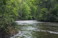
I know that most people on here live in the west, but I'm pretty sure that almost everyone here has seen the Chattooga River:
This river was certainly made infamous for its role in the movie Deliverance. And, to be honest with you, as you hike along the remote state lines of South Carolina, North Carolina, and Georgia, it's hard to get the images from the movie out of your head. Everywhere I went I kept thinking, "I wonder if that's where those scary people came from." In fact, after reading this story I wanted to swing by the Wal-mart in Clayton, GA, while we were stopping in town for lunch.
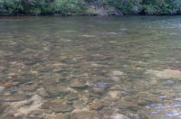
But we were here to backpack, and the trail didn't disappoint. We did an out-and-back from the trailhead at Russell Bridge on Highway 28. For me, the river itself is the highlight of this trail. The deep river canyon feels wonderfully remote and isolated.
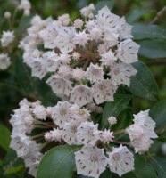
The trail didn't follow the river as much as I had expected, though, having been re-routed above the river to climb above some deep canyons. But there were some nice laurel blooming on the ridge tops.
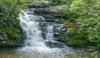
And there were some nice waterfalls.
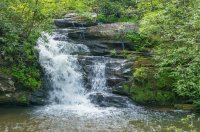
There was a nice fall at Lick Log Creek but I couldn't get a decent picture of it.
The hike was relatively flat with only a couple of notable ascents. We only saw people around Lick Log Creek because the long distance Foothills Trail has a trailhead less than a mile from the river at Lick Log. The humidity was nasty, but the bugs weren't bad. I did eat a LOT of spider webs, but that was good news: it meant no one had been hiking ahead of us. Due to the low elevation (~2000 feet), I do think this trail would be better in the late fall and winter to escape the heat and humidity.
The Chattooga River Trail is almost 40 miles long and we only did about 7 miles of it, so this is definitely a place I want to explore more. Even though our campsite was high above the river, the roar of the water through Rock Gorge was a wonderful way to fall asleep.
While it was a nice hike, I do have to offer a quote from my wife. I've been trying to get her excited about having moved back east, so when we got back to the trailhead after a night in the backcountry, I asked her what she thought about the trail. I realized my efforts to get her excited about the move were still a work in progress when she said, "I felt like mile seven looked just like mile one...so I was wondering why we went to the trouble to hike to mile seven."
Oh well. We'll be in the Winds in two months...I hope that doesn't make it worse.
Featured image for home page:
I know that most people on here live in the west, but I'm pretty sure that almost everyone here has seen the Chattooga River:
This river was certainly made infamous for its role in the movie Deliverance. And, to be honest with you, as you hike along the remote state lines of South Carolina, North Carolina, and Georgia, it's hard to get the images from the movie out of your head. Everywhere I went I kept thinking, "I wonder if that's where those scary people came from." In fact, after reading this story I wanted to swing by the Wal-mart in Clayton, GA, while we were stopping in town for lunch.
But we were here to backpack, and the trail didn't disappoint. We did an out-and-back from the trailhead at Russell Bridge on Highway 28. For me, the river itself is the highlight of this trail. The deep river canyon feels wonderfully remote and isolated.


The trail didn't follow the river as much as I had expected, though, having been re-routed above the river to climb above some deep canyons. But there were some nice laurel blooming on the ridge tops.

And there were some nice waterfalls.

There was a nice fall at Lick Log Creek but I couldn't get a decent picture of it.
The hike was relatively flat with only a couple of notable ascents. We only saw people around Lick Log Creek because the long distance Foothills Trail has a trailhead less than a mile from the river at Lick Log. The humidity was nasty, but the bugs weren't bad. I did eat a LOT of spider webs, but that was good news: it meant no one had been hiking ahead of us. Due to the low elevation (~2000 feet), I do think this trail would be better in the late fall and winter to escape the heat and humidity.
The Chattooga River Trail is almost 40 miles long and we only did about 7 miles of it, so this is definitely a place I want to explore more. Even though our campsite was high above the river, the roar of the water through Rock Gorge was a wonderful way to fall asleep.
While it was a nice hike, I do have to offer a quote from my wife. I've been trying to get her excited about having moved back east, so when we got back to the trailhead after a night in the backcountry, I asked her what she thought about the trail. I realized my efforts to get her excited about the move were still a work in progress when she said, "I felt like mile seven looked just like mile one...so I was wondering why we went to the trouble to hike to mile seven."
Oh well. We'll be in the Winds in two months...I hope that doesn't make it worse.
Featured image for home page:

