Parma
@parma26
- Joined
- Feb 12, 2014
- Messages
- 762
Big thanks to @steve and @Tess for inviting me on this trip, and @Backcountry Post for the forum to allow people like me to meet up with them, or else I never would have experienced this amazing trip. @Mike K and Lane missed out on a good one!
This was my first multi-day trip in Canyonlands, first time I've ever gone with people I didn't know (@steve and I did go to lunch the week before so we knew we were both weirdos willing to camp with strangers) and I've gone backpacking and rafting, but this was my first pack rafting trip. So it was an adventure in multiple ways...though my wife was convinced that this was just a ruse to lure me out to the desert so someone could harvest my organs or something...Ukrainians don't trust anyone though.
The permits were tricky/time consuming since we were going thru Needles, Maze, the Green River and the Colorado River, so there were plenty of rules and regulations we needed to follow. One was a life jacket, packing one in an already filled backpack is a chore.
@steve did take PLENTY of video and maybe by Christmas he'll have it edited and up on youtube. So look forward to that.
Here's a link to my Garmin tracks to see exactly where we went: http://adventures.garmin.com/en-US/by/parma26/canyonlands-packrafting-trip/#overview
It ended up being 49.5 miles total, 30 hiking and 19.5 floating over three full days.
Day one (Thursday) we started off by meeting at @steve's house and were on the road around 6:00 pm. We stopped at Grogg's in Price, and that burger was awesome HIGHLY recommended: http://www.groggspinnaclebrewing.com. This night we planned on camping near the trailhead outside of the Needles Visitors Center. But it was getting dark so we found the first available spot before entering Canyonlands.
Day two we got up and headed to Elephant Hill 4WD Road to leave my car, jumped in with @steve and @Tess in their Honda Fit and headed back up to the Needles Visitors Center. We got there minutes before they were open.
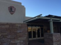
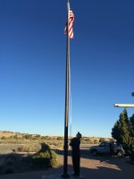
We did get to see them raise the flag in the morning though.
Went inside to finalize everything and check-in. And we found out that a Honda Fit isn't "fit" to drive down the road thru the parking lot toward our starting point. SO we just added about 5 miles to our day. And they were right...we wouldn't have made it very far!
We topped off our water containers and emptied every last bit of whatever we had inside us before leaving.
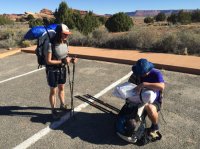
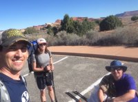
All packed and ready to go. Normally my backpack weighs 30 lbs for a trip, this one I added a Kokopelli Nirvana packraft: http://kokopelliraftco.com/collections/packrafts/products/nirvana a life jacket, and a paddle that breaks down into five parts (bar into 3 and the 2 blades). So I was at about 40 lbs! This is the heaviest pack I've had to haul...and yes I whined a lot!
We followed the 4WD road for five miles. Nothing too exciting, all the fun stuff was off in the distance.
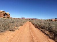
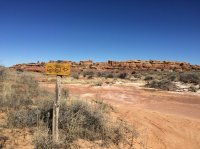
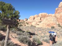
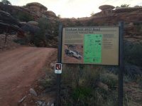
There was a sign pointing to what I thought was a pinewood derby track...nope.
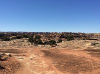
Off in the distance you could see the Needles district.
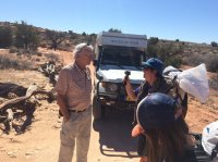
The people you meet in the backcountry seem to always be amazing and interesting to talk to. We had a couple drive up behind us and I'm pretty sure @steve is still drooling over their rig. Meet Henk and Marianne from the Netherlands.
Henk's rig is called the Blues Cruiser and he and his wife have driven it over some of the gnarliest roads and regions our planet has to offer. They have over 500,000 kilometers on it. Here's their website: http://www.henkmarianne.nl/ And their Blues Cruiser is a 1995 Toyota Land Cruiser 4.2 diesel pickup: http://www.henkmarianne.nl/index.php?option=com_content&view=article&id=15&Itemid=14
Their camper on the back expands and has solar panels on the roof.
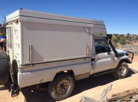
I think this will be @steve and @Tess in the not too distant future.
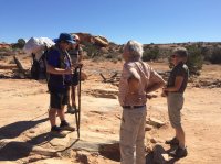
Amazing couple and they were great to chat with. We probably could have visited with them for hours, the places they have been were unreal!
We went our ways and headed to the Colorado River.
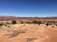
After a while we were finally closer to the water.
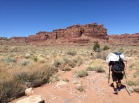
And finally we see it, the Colorado River, now we just need to find a way down to it.
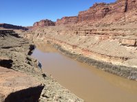
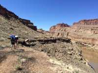
Thanks to @Kullaberg63 and his tracks from a previous trip, we were in good hands. After a mile or so we found the way down to a great looking beach to launch, a perfect spot for lunch, and a chance to refill our water.
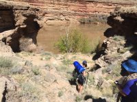
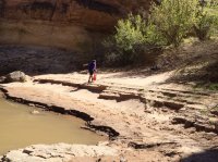
After eating and resting we unpacked the rafts, inflated them with our inflation bags, and we were off.
@steve is in the red one, @Tess is in the blue one, and mine was yellow. We were quite the picturesque group floating down the river.
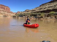
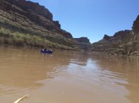
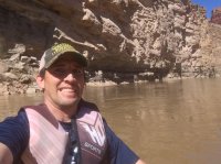
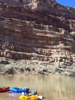
The water is pretty slow. The only quick moving water is at The Slide. A rock slide caused the river to narrow and makes for some faster water...maybe a class I rapid. With the steep walls on both sides of the river it sure did amplify the sounds and make it audible for a ways up river.
It's about seven miles from where we put in to the confluence with the Green River.
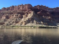
Coming down the Colorado River side of the Confluence we couldn't really see the color difference where the two rivers met. Later in the trip when we came down the Green River we could...maybe it was the lighting?
After a couple miles you see the warning sign for Cataract Canyon on the left. This sign also signifies that Spanish Bottom was coming up.
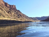
Most of the beaches had someone already there, mostly canoes. We continued on to the end to what I thought was rock steps leading up the bank from other photos I've seen. But to my dismay, it was dirt. And we got pretty muddy hauling out our wet rafts.
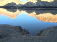
A couple ladies from Colorado were camped here, but were kind enough to share their camp with us as we packed up everything and prepared for the hike up to The Dollhouse.
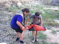
Spanish Bottom
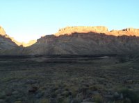
As you can see, the sun was going down, and the hike from Spanish Bottom to The Dollhouse is a steep one! It was a well marked trail, but it was A LOT of rock steps straight up the mountain side. Someone put in some work to make this trail.
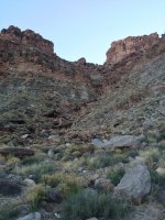
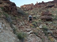
We made it up, slowly but surely, it was dark so we broke out the headlamps and found a place to camp for the night.
It was cold over the night. My watch thermometer said it got down to 36 degrees. Morning came and it was good to see the area in some daylight.
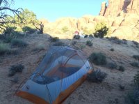
We ate breakfast, packed up, and ditched our packs and headed for The Granary. Here are some views headed that direction.
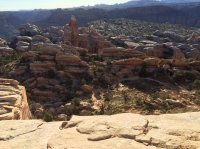
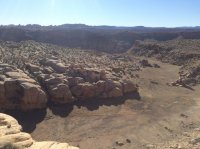
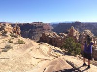
After a short walk, 1/4 mile or so, we found The Granary.
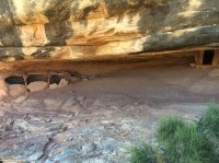
Back to the packs, and we were off to Chimney Rock thru The Dollhouse.
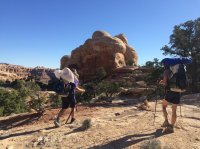
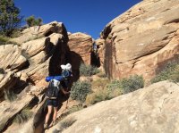
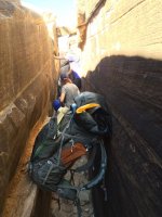
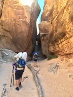
After a bit we approached a couple slots we needed to get thru. One was too narrow for our packs, so we slid thru with them in front of us and hoisted them up and out.
After The Dollhouse we had a couple miles of a sandy 4WD road to Chimney Rock. We were starting to get low on water and were really hoping some Jeeps or someone would come by. Lucky enough we found someone at Chimney Rock, a couple...one from Colorado and the other from Iraq. It seemed like everyone we met was either from another country or Colorado.
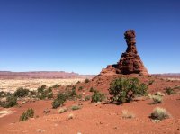
From Chimney Rock the views were great, all the way to the La Sal mountains.
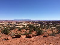
So we stopped for lunch in a nice shady spot below Chimney Rock.
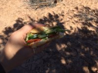
Obligatory flower photo
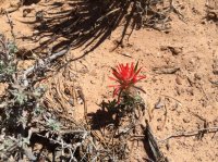
From here we needed to go thru Shot Canyon to Water Canyon and then to the Green River where we'd camp for the night.
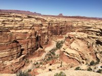
This rock looked cool. I think it looks like a big hammer just whacked it and left it crumbled.
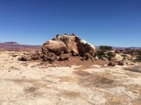
Making our way into Shot Canyon, notice the walking sticks with @steve. It's his paddle with little rubber caps on the ends. They worked OK, but the carbon fiber ridges weren't very comfy so he taped them up and made due. And later they would prove useful for a couple bees that decided to follow him for a couple miles.
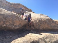
To get down into Shot Canyon there are some interesting stairs, they don't look very stable, but they surprisingly weren't too bad. @Tess still didn't trust them and took a different route.
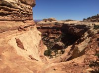
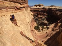
And the final decent into Shot Canyon
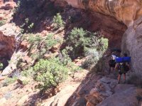
Temps were getting up there so keeping the ears and neck from the sun required a fashion statement
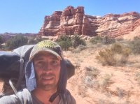
Here's a view of a couple Natural Arches as we cross from Shot to Water Canyon
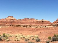
And the 360 degree view from the top of the pass was amazing.

This is looking down into Water Canyon
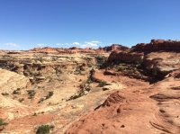
Another cool rock, and it's hard to see where these come from and the nice edges that are formed when they break lose too.
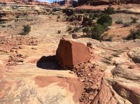
Meandering our way thru Water Canyon we found our friendly neighborhood snake for all you snake lovers
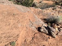
And here's the source of the water in Water Canyon. Spent some time here drinking and filling up for the day/night.
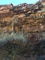
Now we needed to make our way from Water Canyon to the Green River. This is a trail not maintained by the park and was the sketchiest part of our whole trip.
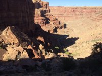
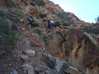
This is looking back up from where we came down.
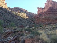
The whole time making our way down we needed to find a camping spot for the night. We heard that the portion of The Green River where we were headed was a very popular spot for floaters and would most likely be filled with people by the time we got there. Nothing was suitable for us so we hoped something would be open.
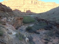
Once we reached the river, we found many nice spots...but no people! We had our pick of the litter of camp sites. So naturally we took up a couple and made ourselves at home.
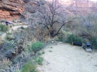
Here's my setup...In a van down by the river (in a Matt Foley voice)
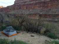
While eating that night we realized that some mice were in the area too. Steve will have to tell you all the exact smell proof bag he uses, but it worked! Morning came and our food was safe.
It was a very warm night, almost too warm. My watch showed it only got down to 49 degrees that night.
Ate, packed up, inflated our rafts and hit the silty water of the Green River.
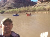
The Green River flowed noticeably faster than the Colorado. And floating the morning was the way to go. Very peaceful, great weather and very relaxing compared to lugging a 40lb pack up and down the trail.
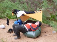
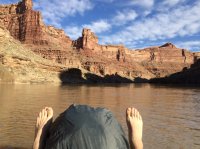
I just placed my pack in the front of my raft and put my rain cover over it because of the water that would splash it from paddling. I'd change from feet up and out like this photo, or tucked under on the sides of my pack. But tucked under was a little chilly against the cold water.
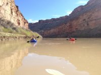
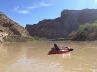
After a couple miles we came up on the Confluence again. Steve wanted a photo so the grassy area right at the point of the Confluence was perfect. Only trick was to get up on it. He made it and from there he said the color differences of the two rivers was visible.
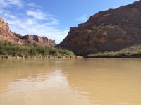
Back at Spanish Bottom looking up at The Dollhouse.
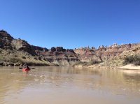
This is looking from opposite of Spanish Bottom where we took out a couple days prior at what the map refers to as Butler Wash.
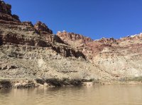
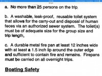
Where we took out there were some workers clearing some trees. And a Park Ranger talked to us and checked our permits. Most of everything was in order. Only thing lacking was an approved method of disposing human waste since we were on the river. Our reusable and sealable bags weren't sufficient. Luckily enough the Park Ranger gave us a warning instead of a $175 ticket (not sure if that was total or for each of us). We did promise to tell all yall that if you are required to have a disposal method that you need a Wag Bag and a dry bag to store it in. Even he wasn't sure if one for the group was enough or if we each needed one. I think they are still trying to figure out how to handle packrafters. Regardless, we were grateful for letting us off with a warning.
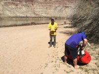
We packed up, ate, topped off our water and headed out.
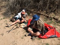
This stretch from the river to the 4WD road in Devils Lane was only five miles, but I swear that was the longest five miles in my life! It's a tough go. Between sand, rocks, tumble weeds, multiple passes over The Grabens, and the heat...it was rough!
For the first bit you follow the wash in thick sand.
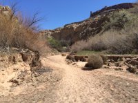
Then the hike up, but it did have a view of The Dollhouse.
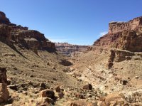
Then the tumble weeds/stickers.
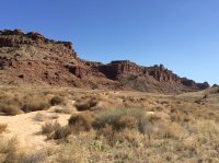
I found this rock formation that looks like The Sphinx (aliens probably made it)
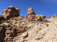
Then a much needed break, where we discovered Steve's jerky bag throwing abilities were lacking...maybe it was the heat that caused it to stick to his hand and fly on top of the rock behind him instead of to me right in front of him
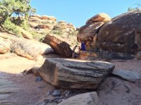
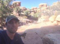
Now the Needles District is in sight.
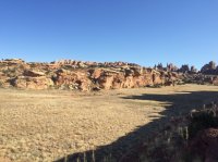
The last stretch is an easy hike on the Elephant Hill 4WD Road. These are also not Honda Fit accessible roads. There are some rough areas, and they look pretty fun too!
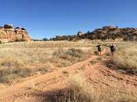
This narrow stretch had some scrapes and paint on the walls.
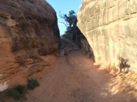
Some of the fun 4WD hills
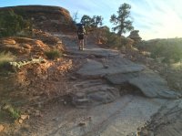
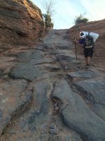
And even another pinewood derby car hill!
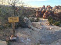
And the car is in sight, and still there in the parking lot.
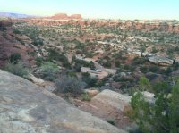
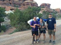
Here we are after three days, we planned on doing it in four days, but were covering more ground than we planned.
It was a great trip! Steve has some great video footage he'll post hopefully sooner than later. And it's always good to meet new friends.
Featured image for home page:
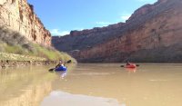
**Here's the video from this trip:
This was my first multi-day trip in Canyonlands, first time I've ever gone with people I didn't know (@steve and I did go to lunch the week before so we knew we were both weirdos willing to camp with strangers) and I've gone backpacking and rafting, but this was my first pack rafting trip. So it was an adventure in multiple ways...though my wife was convinced that this was just a ruse to lure me out to the desert so someone could harvest my organs or something...Ukrainians don't trust anyone though.
The permits were tricky/time consuming since we were going thru Needles, Maze, the Green River and the Colorado River, so there were plenty of rules and regulations we needed to follow. One was a life jacket, packing one in an already filled backpack is a chore.
@steve did take PLENTY of video and maybe by Christmas he'll have it edited and up on youtube. So look forward to that.
Here's a link to my Garmin tracks to see exactly where we went: http://adventures.garmin.com/en-US/by/parma26/canyonlands-packrafting-trip/#overview
It ended up being 49.5 miles total, 30 hiking and 19.5 floating over three full days.
Day one (Thursday) we started off by meeting at @steve's house and were on the road around 6:00 pm. We stopped at Grogg's in Price, and that burger was awesome HIGHLY recommended: http://www.groggspinnaclebrewing.com. This night we planned on camping near the trailhead outside of the Needles Visitors Center. But it was getting dark so we found the first available spot before entering Canyonlands.

Day two we got up and headed to Elephant Hill 4WD Road to leave my car, jumped in with @steve and @Tess in their Honda Fit and headed back up to the Needles Visitors Center. We got there minutes before they were open.

We did get to see them raise the flag in the morning though.

Went inside to finalize everything and check-in. And we found out that a Honda Fit isn't "fit" to drive down the road thru the parking lot toward our starting point. SO we just added about 5 miles to our day. And they were right...we wouldn't have made it very far!
We topped off our water containers and emptied every last bit of whatever we had inside us before leaving.


All packed and ready to go. Normally my backpack weighs 30 lbs for a trip, this one I added a Kokopelli Nirvana packraft: http://kokopelliraftco.com/collections/packrafts/products/nirvana a life jacket, and a paddle that breaks down into five parts (bar into 3 and the 2 blades). So I was at about 40 lbs! This is the heaviest pack I've had to haul...and yes I whined a lot!
We followed the 4WD road for five miles. Nothing too exciting, all the fun stuff was off in the distance.

There was a sign pointing to what I thought was a pinewood derby track...nope.

Off in the distance you could see the Needles district.

The people you meet in the backcountry seem to always be amazing and interesting to talk to. We had a couple drive up behind us and I'm pretty sure @steve is still drooling over their rig. Meet Henk and Marianne from the Netherlands.

Henk's rig is called the Blues Cruiser and he and his wife have driven it over some of the gnarliest roads and regions our planet has to offer. They have over 500,000 kilometers on it. Here's their website: http://www.henkmarianne.nl/ And their Blues Cruiser is a 1995 Toyota Land Cruiser 4.2 diesel pickup: http://www.henkmarianne.nl/index.php?option=com_content&view=article&id=15&Itemid=14
Their camper on the back expands and has solar panels on the roof.

I think this will be @steve and @Tess in the not too distant future.

Amazing couple and they were great to chat with. We probably could have visited with them for hours, the places they have been were unreal!
We went our ways and headed to the Colorado River.

After a while we were finally closer to the water.

And finally we see it, the Colorado River, now we just need to find a way down to it.


Thanks to @Kullaberg63 and his tracks from a previous trip, we were in good hands. After a mile or so we found the way down to a great looking beach to launch, a perfect spot for lunch, and a chance to refill our water.


After eating and resting we unpacked the rafts, inflated them with our inflation bags, and we were off.
@steve is in the red one, @Tess is in the blue one, and mine was yellow. We were quite the picturesque group floating down the river.


The water is pretty slow. The only quick moving water is at The Slide. A rock slide caused the river to narrow and makes for some faster water...maybe a class I rapid. With the steep walls on both sides of the river it sure did amplify the sounds and make it audible for a ways up river.
It's about seven miles from where we put in to the confluence with the Green River.

Coming down the Colorado River side of the Confluence we couldn't really see the color difference where the two rivers met. Later in the trip when we came down the Green River we could...maybe it was the lighting?
After a couple miles you see the warning sign for Cataract Canyon on the left. This sign also signifies that Spanish Bottom was coming up.

Most of the beaches had someone already there, mostly canoes. We continued on to the end to what I thought was rock steps leading up the bank from other photos I've seen. But to my dismay, it was dirt. And we got pretty muddy hauling out our wet rafts.

A couple ladies from Colorado were camped here, but were kind enough to share their camp with us as we packed up everything and prepared for the hike up to The Dollhouse.

Spanish Bottom

As you can see, the sun was going down, and the hike from Spanish Bottom to The Dollhouse is a steep one! It was a well marked trail, but it was A LOT of rock steps straight up the mountain side. Someone put in some work to make this trail.


We made it up, slowly but surely, it was dark so we broke out the headlamps and found a place to camp for the night.
It was cold over the night. My watch thermometer said it got down to 36 degrees. Morning came and it was good to see the area in some daylight.

We ate breakfast, packed up, and ditched our packs and headed for The Granary. Here are some views headed that direction.


After a short walk, 1/4 mile or so, we found The Granary.

Back to the packs, and we were off to Chimney Rock thru The Dollhouse.


After a bit we approached a couple slots we needed to get thru. One was too narrow for our packs, so we slid thru with them in front of us and hoisted them up and out.


After The Dollhouse we had a couple miles of a sandy 4WD road to Chimney Rock. We were starting to get low on water and were really hoping some Jeeps or someone would come by. Lucky enough we found someone at Chimney Rock, a couple...one from Colorado and the other from Iraq. It seemed like everyone we met was either from another country or Colorado.

From Chimney Rock the views were great, all the way to the La Sal mountains.

So we stopped for lunch in a nice shady spot below Chimney Rock.

Obligatory flower photo

From here we needed to go thru Shot Canyon to Water Canyon and then to the Green River where we'd camp for the night.

This rock looked cool. I think it looks like a big hammer just whacked it and left it crumbled.

Making our way into Shot Canyon, notice the walking sticks with @steve. It's his paddle with little rubber caps on the ends. They worked OK, but the carbon fiber ridges weren't very comfy so he taped them up and made due. And later they would prove useful for a couple bees that decided to follow him for a couple miles.

To get down into Shot Canyon there are some interesting stairs, they don't look very stable, but they surprisingly weren't too bad. @Tess still didn't trust them and took a different route.


And the final decent into Shot Canyon

Temps were getting up there so keeping the ears and neck from the sun required a fashion statement

Here's a view of a couple Natural Arches as we cross from Shot to Water Canyon

And the 360 degree view from the top of the pass was amazing.

This is looking down into Water Canyon

Another cool rock, and it's hard to see where these come from and the nice edges that are formed when they break lose too.

Meandering our way thru Water Canyon we found our friendly neighborhood snake for all you snake lovers

And here's the source of the water in Water Canyon. Spent some time here drinking and filling up for the day/night.

Now we needed to make our way from Water Canyon to the Green River. This is a trail not maintained by the park and was the sketchiest part of our whole trip.


This is looking back up from where we came down.

The whole time making our way down we needed to find a camping spot for the night. We heard that the portion of The Green River where we were headed was a very popular spot for floaters and would most likely be filled with people by the time we got there. Nothing was suitable for us so we hoped something would be open.

Once we reached the river, we found many nice spots...but no people! We had our pick of the litter of camp sites. So naturally we took up a couple and made ourselves at home.

Here's my setup...In a van down by the river (in a Matt Foley voice)

While eating that night we realized that some mice were in the area too. Steve will have to tell you all the exact smell proof bag he uses, but it worked! Morning came and our food was safe.
It was a very warm night, almost too warm. My watch showed it only got down to 49 degrees that night.
Ate, packed up, inflated our rafts and hit the silty water of the Green River.

The Green River flowed noticeably faster than the Colorado. And floating the morning was the way to go. Very peaceful, great weather and very relaxing compared to lugging a 40lb pack up and down the trail.
I just placed my pack in the front of my raft and put my rain cover over it because of the water that would splash it from paddling. I'd change from feet up and out like this photo, or tucked under on the sides of my pack. But tucked under was a little chilly against the cold water.


After a couple miles we came up on the Confluence again. Steve wanted a photo so the grassy area right at the point of the Confluence was perfect. Only trick was to get up on it. He made it and from there he said the color differences of the two rivers was visible.

Back at Spanish Bottom looking up at The Dollhouse.

This is looking from opposite of Spanish Bottom where we took out a couple days prior at what the map refers to as Butler Wash.

Where we took out there were some workers clearing some trees. And a Park Ranger talked to us and checked our permits. Most of everything was in order. Only thing lacking was an approved method of disposing human waste since we were on the river. Our reusable and sealable bags weren't sufficient. Luckily enough the Park Ranger gave us a warning instead of a $175 ticket (not sure if that was total or for each of us). We did promise to tell all yall that if you are required to have a disposal method that you need a Wag Bag and a dry bag to store it in. Even he wasn't sure if one for the group was enough or if we each needed one. I think they are still trying to figure out how to handle packrafters. Regardless, we were grateful for letting us off with a warning.

We packed up, ate, topped off our water and headed out.

This stretch from the river to the 4WD road in Devils Lane was only five miles, but I swear that was the longest five miles in my life! It's a tough go. Between sand, rocks, tumble weeds, multiple passes over The Grabens, and the heat...it was rough!
For the first bit you follow the wash in thick sand.

Then the hike up, but it did have a view of The Dollhouse.

Then the tumble weeds/stickers.

I found this rock formation that looks like The Sphinx (aliens probably made it)

Then a much needed break, where we discovered Steve's jerky bag throwing abilities were lacking...maybe it was the heat that caused it to stick to his hand and fly on top of the rock behind him instead of to me right in front of him


Now the Needles District is in sight.

The last stretch is an easy hike on the Elephant Hill 4WD Road. These are also not Honda Fit accessible roads. There are some rough areas, and they look pretty fun too!

This narrow stretch had some scrapes and paint on the walls.

Some of the fun 4WD hills


And even another pinewood derby car hill!

And the car is in sight, and still there in the parking lot.


Here we are after three days, we planned on doing it in four days, but were covering more ground than we planned.

It was a great trip! Steve has some great video footage he'll post hopefully sooner than later. And it's always good to meet new friends.
Featured image for home page:

**Here's the video from this trip:
Last edited:

