Canyonlands/Needles hiking along river

Mike Schasch

New Member
Joined
Feb 20, 2017
Messages
3
Hey there,

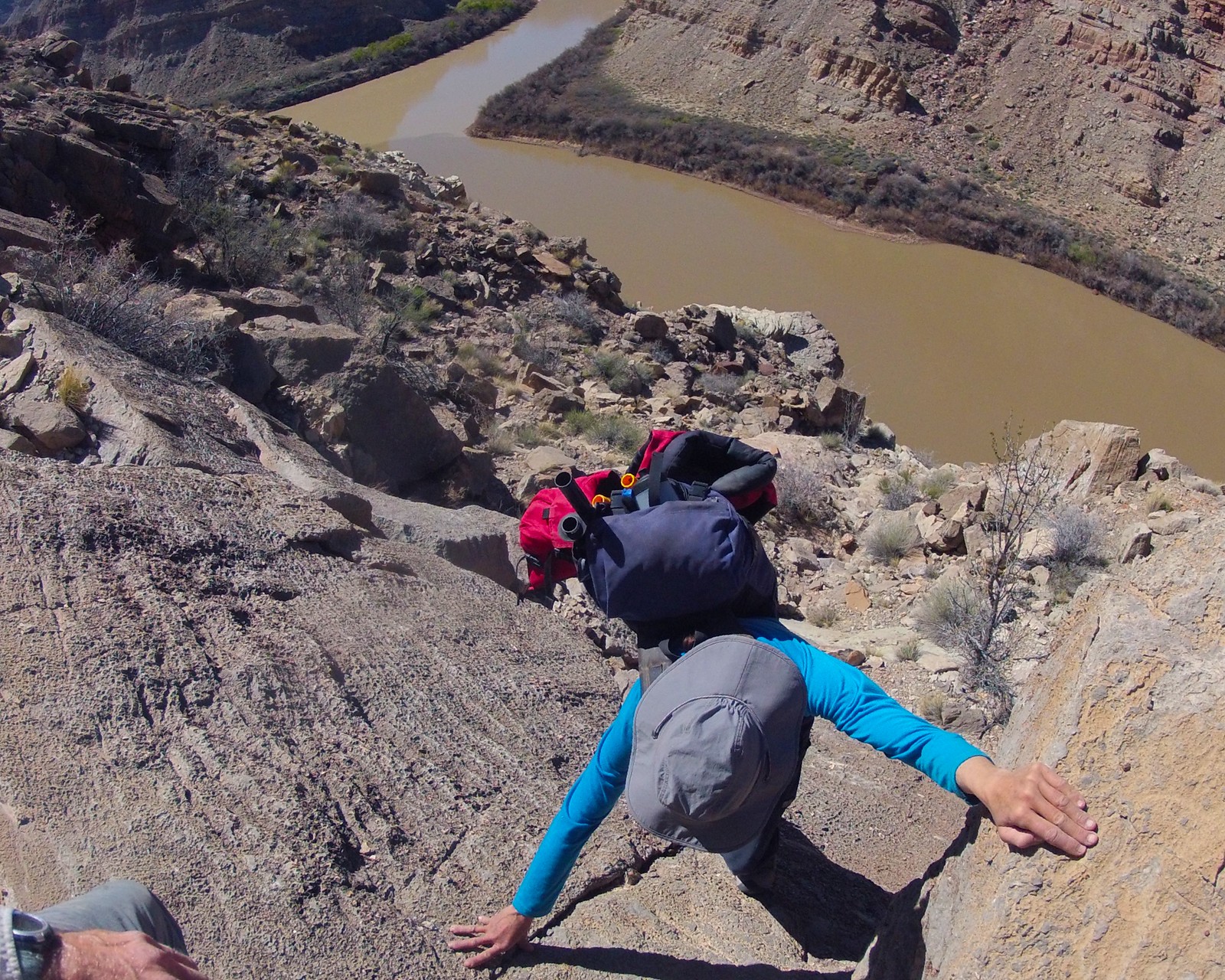
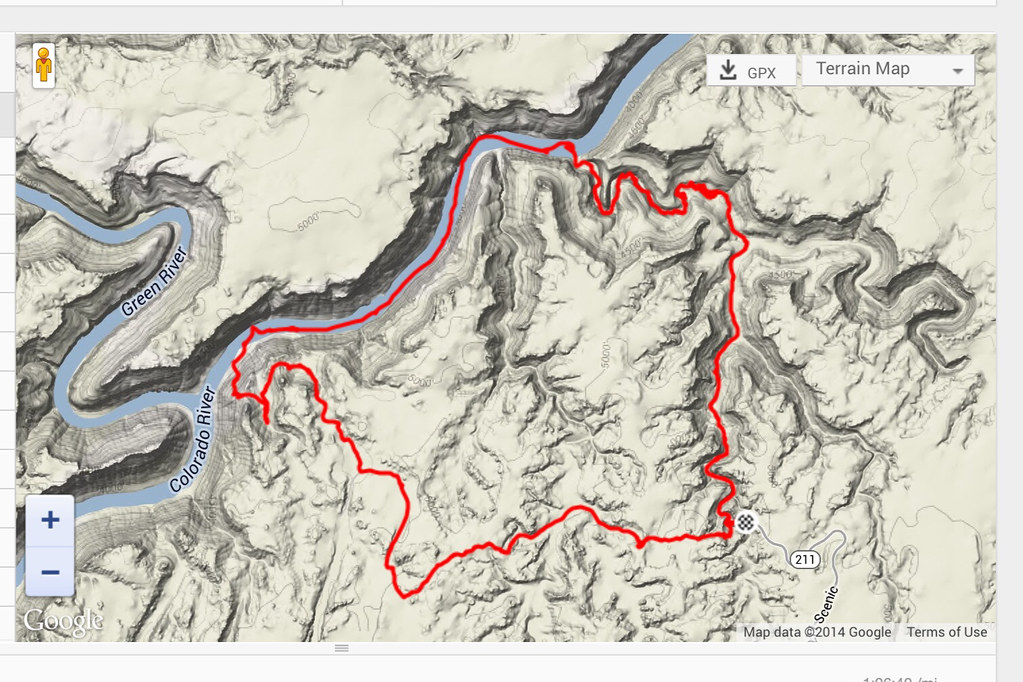
I'm wondering if anybody has any beta on hiking from Spanish bottom (Needles side) up past the confluence of the Green, and up and out the exit canyon roughly 1.3 miles upstream of the confluence. In particular I'm wondering about the zone right below the confluence overlook area. Doesn't look like there is a lot of room, but thats the best I can tell from space (google earth).

Thanks
 
Which exit canyon are you thinking about? Horse doesn't go and Salt must be difficult in upstream mode - at least 5.9 or aid. I would love to know of any other.

The two non technical ways I have done are the Box Elder camp to cat track up near the Loop, and the scramble almost directly above the confluence, pictured here:

image by jan nikolajsen, on Flickr
 
Thanks guys. We've got packrafts, but sometimes prefer the simplicity of traveling on foot.

Cool to know there is another scramble out. Where abouts is it?

The route I saw is circled in red:
2017-02-21 07_57_57-Canyonlands National Park - Google Maps.png
 
I've looked up the one you circle in red. Looks good. You've done it? There's a small lip at the top.

The confluence exit is on the pic below. This is a loop starting and ending at Big Spring. First down that canyon, then Salt to the river. Paddle down and up the scramble ending at Cyclone and following the Confluence Overlook trail back to the car. About 17 miles. Long day. Includes a 40' rappel in Salt.

image by jan nikolajsen, on Flickr
 
Very interesting, that break might work even better. Thanks!

I've not done my proposed route, or any route in the area for that matter. Trying to create an awesome loop for our first time to the Needles.
 
The route I saw is circled in red:
View attachment 52530

I've gone up that canyon. It's a scramble, but not that bad. One can't get out at the top though -- so you have to meander back to the west and then south to connect with the Confluence descent route to get all the way up. I did it back in 2009 when I couldn't spot the other route from the bottom.

Also... FYI, there is no more walking along the river north of that point as it gets walled out.

Looking up the canyon from the bottom:

92gAb_feb9R45wtpizqlMhiIbwdzNeqQo42-dltMwsjqZdQ35zOsVzGeMJGGqOiKWQ1LmO4rfvQIphge6CN5sM5UmrxXtw=s0-d
 
BTW -- if you wanna see a bit more of that canyon, check out my NV to CO video. The very end of part 3 has me trying to make my way up the canyon and finding it blocked. This link should jump to that section (if not, go to 11:45ish):


Back then I didn't have that much experience scrambling. I had only casually noted the location of the Confluence scramble route and thus was kinda making it up as I went -- so forgive the overly dramatic video. :)

Also -- once up on the higher ridges, there's another gully to the east which I didn't explore that might go out to the top. This area is within the Needles North zone btw -- which usually makes it easier to grab a permit if you want to camp.
 
Back
Top