Curt
Member
- Joined
- Feb 1, 2014
- Messages
- 426
I went backpacking in the Grand Canyon at the beginning of April with Brian, Scott, Jared, Andy, Thomas, and Steve. A trip on the Tonto platform was chosen for the great views that it affords. Most people doing this particular trip go west from the Grandview trailhead and come out on the South Kaibab Trail. We decided to go east and go a little farther by starting at the Bright Angel Trailhead. The reason for this is that we wouldn't have to carry a lot of water on the way down since we could fill up at Indian Garden and then top off at Pipe Creek Canyon or Burro Spring before reaching the South Kaibab Trail. From there we expected a dry camp and no water again till the middle of the next day at Lonetree Canyon. We planned our other over night stays to be at Grapevine Canyon and Cottonwood Canyon because we could expect to find water in those places.
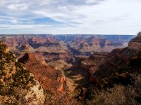
Starting out on Bright Angel Trail
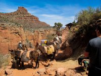 There was a crew doing trial repairs by the 3 mile Resthouse. We liked the caution sign just beyond the mules that said that going down is optional but coming out is mandatory.
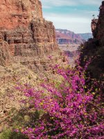
Spring has arrived in the Canyon. Red Bud Tree
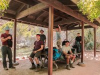 Lunch at Indian Garden. L-R Steve, Thomas, Brian, Jared, Andy, and Scott.
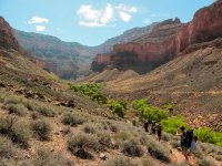 Leaving Indian Garden on the East Tonto trail. The West Tonto trial can be seen on the opposite side of the canyon.
 Panorama looking northeast between Indian Garden and Pipe Creek Canyon. Hikers in our group are visible on the trail on the right margin of the picture.
 Panorama looking southeast toward Pipe Creek Canyon. Its hard to capture the huge scale of everything in a picture. Hikers in our group are tiny dots on the trail on the lower right in the picture.
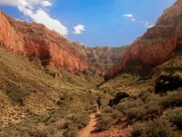
The green trees ahead are at the spring at the trail crossing. While there was plenty of water here we elected to top off at Burro Spring a short distance on the opposite side of the canyon. It was a mistake. Burro Spring was so full of riparian undergrowth that it was difficult to gain access to water. Access was easy at the trail crossing at Pipe Spring.
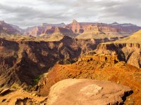
View from the Tipoff on the South Kaibab Trail. The trees at Phantom Ranch are visible on the lower right.
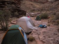
The Park Service had just moved the boundary for Corridor area to the west arm of Cremation Canyon. We had planned to camp here and were surprised to find about 20 other people already there when we arrived. We had to go down canyon a ways to find a suitable place large enough for our group.
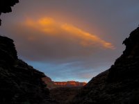
Sunset at Cremation Canyon looking north
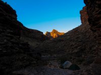
Morning at Cremation Canyon looking south.
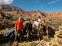
Between Lonetree and Cremation Canyons
Brian and Steve looking west. Zoroaster Temple is the point across the river on the right.
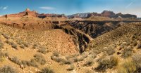
Looking north across the Gorge to where Clear Creek Canyon intersects the Colorado River Gorge.

View to the south at Boulder Canyon. The formations on the right are part of Newton Butte and the ones on the left are part of Lyell Butte. There are several large boulders near the trail that have rolled a long way from the Lyell Butte formation cliffs. One can be seen on the lower right edge of the picture. I assume that these boulders account for the name of the canyon.
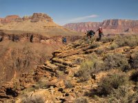
Admiring the view at the Gorge
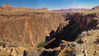
The view they were admiring. A hiker in our group can be seen as a tiny dot on the trail near the cliff edge on the upper right of the picture.
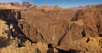
Scott at the intersection of Grapevine Canyon with the Colorado River Gorge. A sliver of the green river can seen just in front of Scott.
This is a 180 degree panorama of Grapevine Canyon. Scott is ahead on the right edge of the picture.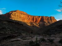
Sunset at Grapevine Canyon
Looking down canyon at the creek crossing. There was water in the creek at the crossing.
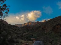
Sunset at Grapevine Canyon. Looking up canyon at the creek crossing. I think Grandview Point, where we would come out in a day and a half, is at the top of the farthest cliffs at the left.
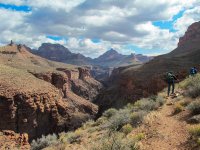
Looking north down Grapevine Canyon.
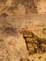
Getting a better view into Grapevine Canyon.
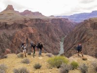
Jared, Scott, Andy, and Thomas.
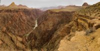
The view east along the trail near the intersection with Cottonwood Canyon. The trail contours along the cliff edge on the right.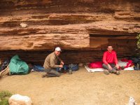
Steve and Brian at Cottonwood Creek. It rained for a couple hours after we pulled into camp. Then off and on into the night, but it was dry under the ledges.
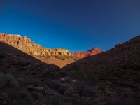
Morning at Cottonwood Canyon. Looking north.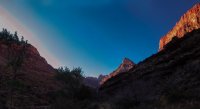 Morning at Cottonwood Canyon. Looking South.
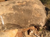 An old Inscription. Can't make out the first name. I think the date is 1895. Cottonwood Canyon.
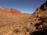 View down Cottonwood Canyon from the bottom of the Redwall break.
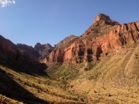
View up Cottonwood Canyon from the bottom of the Redwall break.
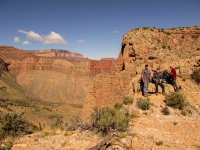
Andy, Thomas, and Steve resting at the top of the Redwall break. The remains of a barbwire fence are in the foreground. Presumably the fence was to keep the miner's livestock from escaping down into Cottonwood Canyon.
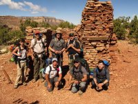 The obligatory group picture at the mining mess hall ruins. There is a large scattered pile of "historic" trash down the hillside beyond the ruins on the left.
Brian on the Grandview Trail. Horseshoe Mesa is in the valley on the left. Some snow is still visible from the storm of the previous night.
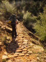
There are extensive sections of the upper part of the Grandview Trail that have cobble stone paving. I've read that the cobble stone paving was placed by the men working the mines on Horseshoe Mesa to assist the mule trains hauling ore to the South Rim. There are many scratches on the stones presumably from the shoes on the mules. The mines were active around the beginning of the 20th century so the paving has been in place a long time.
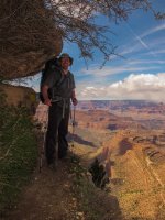
6" to Brian's left is a long way down. This was the most exposure we saw that wasn't intentional. Its actually pretty close to the top of the trail.
The view from Grandview Point at trail's end.
Featured image for home page:
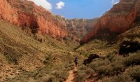

Starting out on Bright Angel Trail
 There was a crew doing trial repairs by the 3 mile Resthouse. We liked the caution sign just beyond the mules that said that going down is optional but coming out is mandatory.
Spring has arrived in the Canyon. Red Bud Tree
 Lunch at Indian Garden. L-R Steve, Thomas, Brian, Jared, Andy, and Scott.
 Leaving Indian Garden on the East Tonto trail. The West Tonto trial can be seen on the opposite side of the canyon.
 Panorama looking southeast toward Pipe Creek Canyon. Its hard to capture the huge scale of everything in a picture. Hikers in our group are tiny dots on the trail on the lower right in the picture.
The green trees ahead are at the spring at the trail crossing. While there was plenty of water here we elected to top off at Burro Spring a short distance on the opposite side of the canyon. It was a mistake. Burro Spring was so full of riparian undergrowth that it was difficult to gain access to water. Access was easy at the trail crossing at Pipe Spring.

View from the Tipoff on the South Kaibab Trail. The trees at Phantom Ranch are visible on the lower right.

The Park Service had just moved the boundary for Corridor area to the west arm of Cremation Canyon. We had planned to camp here and were surprised to find about 20 other people already there when we arrived. We had to go down canyon a ways to find a suitable place large enough for our group.

Sunset at Cremation Canyon looking north

Morning at Cremation Canyon looking south.

Between Lonetree and Cremation Canyons
Brian and Steve looking west. Zoroaster Temple is the point across the river on the right.

Looking north across the Gorge to where Clear Creek Canyon intersects the Colorado River Gorge.
View to the south at Boulder Canyon. The formations on the right are part of Newton Butte and the ones on the left are part of Lyell Butte. There are several large boulders near the trail that have rolled a long way from the Lyell Butte formation cliffs. One can be seen on the lower right edge of the picture. I assume that these boulders account for the name of the canyon.

Admiring the view at the Gorge

The view they were admiring. A hiker in our group can be seen as a tiny dot on the trail near the cliff edge on the upper right of the picture.

Scott at the intersection of Grapevine Canyon with the Colorado River Gorge. A sliver of the green river can seen just in front of Scott.

This is a 180 degree panorama of Grapevine Canyon. Scott is ahead on the right edge of the picture.

Sunset at Grapevine Canyon
Looking down canyon at the creek crossing. There was water in the creek at the crossing.

Sunset at Grapevine Canyon. Looking up canyon at the creek crossing. I think Grandview Point, where we would come out in a day and a half, is at the top of the farthest cliffs at the left.

Looking north down Grapevine Canyon.

Getting a better view into Grapevine Canyon.

Jared, Scott, Andy, and Thomas.

The view east along the trail near the intersection with Cottonwood Canyon. The trail contours along the cliff edge on the right.

Steve and Brian at Cottonwood Creek. It rained for a couple hours after we pulled into camp. Then off and on into the night, but it was dry under the ledges.

Morning at Cottonwood Canyon. Looking north.
 Morning at Cottonwood Canyon. Looking South.
 An old Inscription. Can't make out the first name. I think the date is 1895. Cottonwood Canyon.
 View down Cottonwood Canyon from the bottom of the Redwall break.
View up Cottonwood Canyon from the bottom of the Redwall break.

Andy, Thomas, and Steve resting at the top of the Redwall break. The remains of a barbwire fence are in the foreground. Presumably the fence was to keep the miner's livestock from escaping down into Cottonwood Canyon.
 The obligatory group picture at the mining mess hall ruins. There is a large scattered pile of "historic" trash down the hillside beyond the ruins on the left.
Brian on the Grandview Trail. Horseshoe Mesa is in the valley on the left. Some snow is still visible from the storm of the previous night.

There are extensive sections of the upper part of the Grandview Trail that have cobble stone paving. I've read that the cobble stone paving was placed by the men working the mines on Horseshoe Mesa to assist the mule trains hauling ore to the South Rim. There are many scratches on the stones presumably from the shoes on the mules. The mines were active around the beginning of the 20th century so the paving has been in place a long time.

6" to Brian's left is a long way down. This was the most exposure we saw that wasn't intentional. Its actually pretty close to the top of the trail.

The view from Grandview Point at trail's end.
Featured image for home page:

