Boulder Creek, Escalante

Thanks for sharing. That trip looked awesome. We've spent a little time down in escalante area and it is pretty much the greatest place ever, in the world, period! LOL. Seriously, it is very beautiful and full of adventure. Thanks again for sharing.
 
Great TR Nicholas! and most excellent photography, as usual. Did you carry your new dSLR down the creek? Was the sandy section harder than our exploration run after doing Larry's (the place with the hill "sandtrap")?

I did carry the new camera. Fortunately, I had just acquired a new, very robust insurance policy on it or I would have really been freaking out for much of the hike. There wasn't much of a sandy section other than crossing benches along the Escalante. The sand wasn't the problem there though, just the fact that the trails would disappear frequently and it would take some time bushwhacking and wading to get back on one. Nothing like the sandtrap after Larry. That incident is the biggest factor making me think I should keep my Taco!
 
Wow, Nick!
What a beautiful landscape.
Awesome TR and wonderful pictures. :)

This year I canceled my visit to Boulder Creek - 'cause the weather has bitten me.
Next year we plan to playing around Burr Trail - a couple of days.
These swimmers on your trail are not really suitable in the Spring - or?

Boulder Creek could be pretty dangerous in high water. So I guess whether it's okay in spring just depends on runoff. It was definitely low water for us. We could tell by the large amount of mossy boulders out of the water. But it was still a lot of water! If it were 6" deeper, it would have been significantly more challenging. 12" deeper and I'm not sure it would be prudent to attempt it. So no definitive answer, it just depends on the flow. There is a stream gauge down there that you can check the depth online and compare to this trip and others. That would probably help quite a bit.
 
Thank you for info, Nick. :)
That's helpful.
This trip will be a challenge for me.
I can't hike w/ lightweight pack and I'm only 5"/6.5'.
 
How many miles was it? I was guessing around 15 miles, but could not tell from you GPS track. What water gauge station did you look at to check the water flow. I have been looking but could not find one.
 
Boulder's been on my list but never have made it. Nice pics.... Good group hike especially with shuttle.
 
How many miles was it? I was guessing around 15 miles, but could not tell from you GPS track. What water gauge station did you look at to check the water flow. I have been looking but could not find one.

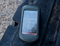
My GPS logged 17.31. It felt like more. Not fast moving through there.

upload_2014-6-3_15-55-54.png
 
My GPS logged 17.31. It felt like more. Not fast moving through there.

View attachment 17241
Thanks for the info. I did death hollow 2 years ago starting at the Boulder airport and ending at highway 12 bridge. Have you done Death Hollow, if so was it harder or easier the Boulder Creek.
 
I should elaborate on that. It's a different kind of hard. Death Hollow is more epic hard. Big landscapes, climbing over the benches to get in, etc. Boulder Creek is dancing on rocks for miles and miles and then getting out via the Escalante upstream is a bit of a bushwhack at times. Oh, and the quicksand... ugh. And if the Escalante isn't running clear, double ugh. The trail really doesn't get reliable until the last few miles, and by that point, you're walking past people's yards feeling miffed that you can't park closer. So I guess it's kind of hard to compare the two directly, but I'll say that Boulder Creek was more physically and mentally taxing on me than any Death Hollow route I've done.
 
I tried to come up Boulder/Deer creek from the Escalante about 2 weeks ago, after a week long trip, and spent 5 hours fighting water up to my belly button. I got tired of that, and just climbed up and crossed over to the Gulch. I just happened to catch it in high water, the previous 2 days all of the Escalante crossings were swift and above the waste. But what I did see of Boulder Creek was awesome. I haven't been up it before, going to try to come down it this fall. Really a beautiful area
 
it's definitely called Boulder Creek for a reason, and not because it is near Boulder town. you have to watch every single step while walking amongst slick as snot moss covered basalt boulders that were deposited from boulder mountain during the last ice age thaw and have been tumbled smooth over the centuries. the two upper branches of Boulder Creek are where two lobes of a glacier came off of the top of the mountain. there are some spots along the burr trail coming out of town heading south where you can see boulders piled along the north side of some of the hills as well - especially at the point right as the burr trail turns east to head towards deer creek. i personally believe that a large amount of canyon bottom scouring happened in the area during that period as well as the deposition of the large hills of silt deposit one sees in The Gulch which have been downcut since then which appears to have been level at one point in time across the entire canyon as 'refill' deposition after the canyon was originally eroded. the silt walls in that canyon are 15 to 20 feet high in some areas - easily seen just north of the burr trail as one enters the north part of the gulch.
 
Looking to do this backpack trip. Trying to get a better grasp of the drop in point of this. Any additional info would be helpful.
 
Excellent TR. Always wondered about that area. Now I know.
 
Back
Top