- Joined
- Feb 15, 2020
- Messages
- 580
I've been trying to get out to the Bob Marshall Wilderness for a number of years now - I'm happy to say I finally made it. For the third year in a row, I was able to join up with @travel2walk and we had a fantastic trip. I will say, despite my love for September/October backpacking, if I go back to do any high traverses in "the Bob" it will probably be earlier in the year - there's very little water above treeline by September. I suspected this and planned for it, but it definitely affected our route.
I'd told @travel2walk that I hoped for a bit of snow and shoulder season conditions and I wasn't disappointed on that count. The weather did convince us to make a few alterations to the route - including missing a traverse of the Chinese Wall itself - but I'll be back, so it's all good. And we did get to do the section I was most excited about - it didn't disappoint in the least.
While this would be my first trip to "the Bob", I knew it involved long approaches and most trips I've seen involve far too much on-trail, river bottom walking for my taste. With that in mind I started looking for higher options. Obviously the Chinese Wall jumped out, but I wanted to loop it w/ another long ridge. For the time I had available, there seemed to be one obvious choice. (Though I have since drawn up what will probably turn into my next trip and think I have another pretty fun option.)
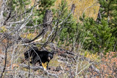
I had heard many stories about the bears in the Bob Marshall and I must say this is my only area of disappointment - we only saw one black bear and pretty much no sign of any bears the remainder of the trip. But we did see (at least) 8 wolves, so I certainly can't complain - it was pretty incredible.
Hopefully @travel2walk can chime in w/ a few of his pictures - he carries much nicer photography equipment than I do.
Day 1: Benchmark TH to West Fork South Fork Sun River (Yes, that's the official name.)
Today would be pretty easy - we'd driven up to Augusta, MT from Denver so that we could get an early start. Today was pretty much an "approach day" spent primarily on trail to setup for our first climb on Day 2. The weather was fantastic and leaves were mid-change throughout - we also saw a black bear a little over halfway in, so that was pretty great.
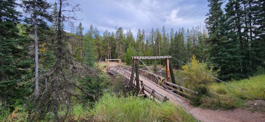
Pretty impressive bridges along the main trail. (This section is part of the CDT and a very common horse-packer route.)
A recovering burn scar encompassed much of the route until we crossed the Sun River again. Was interesting to see though, since many of the older trips reports I looked at were from a time when there wasn't nearly so much new growth.
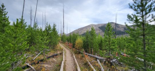
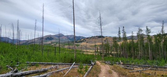
Views opened up a bit as we progressed.
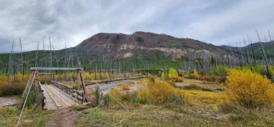
Another impressively engineered bridge.
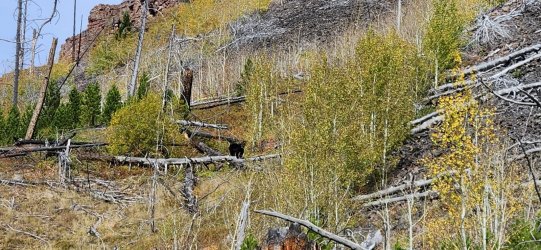
Our little black bear friend. He eyeballed me briefly and then sauntered up into the trees. (I know @travel2walk has a better picture.)
Beautiful horseshoe bend.
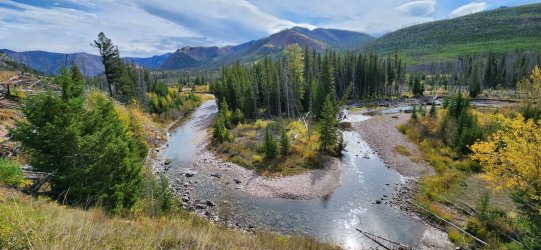
Camp for the evening was a beautiful, but high use spot along the river and near the junction to the Prairie Reef fire lookout.
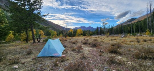
Day 2: West Fork South Fork Sun River to (almost) Moose Creek
No other way to say it - this day was phenomenal. Just fantastic from start to finish. So many highlights.
We started the day with a pretty quick 3k' up to the Prairie Reef fire lookout. Consistent uphill, but easy-going trail and very conservative switchbacks.
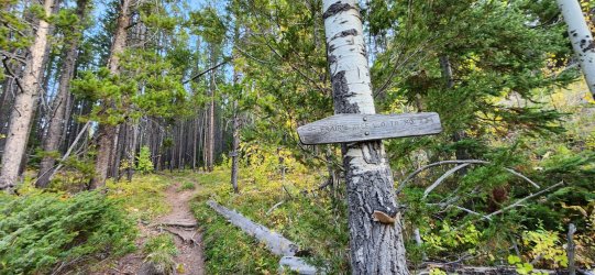
Yeah - no kidding. (We ended up hauling a few liters a piece for this day - turned out to be a good thing.)
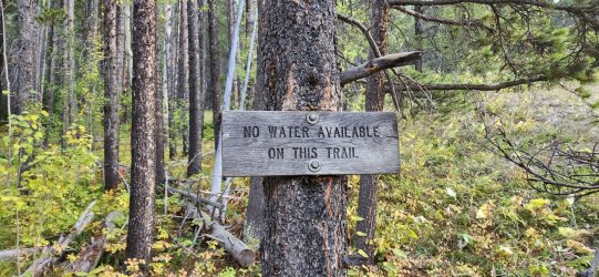
Views began opening up quickly near treeline. Our first definitive look at the Chinese Wall in the distance.
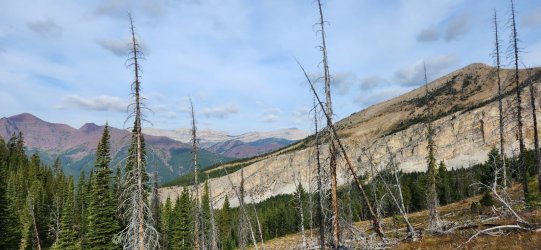
First look at the fire lookout.
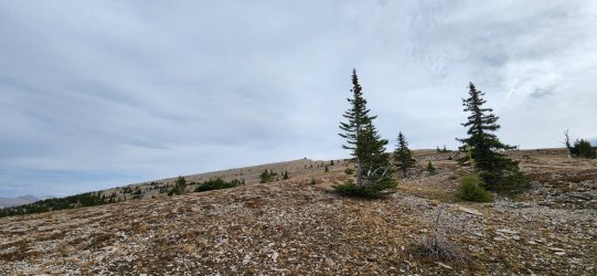
Almost there.
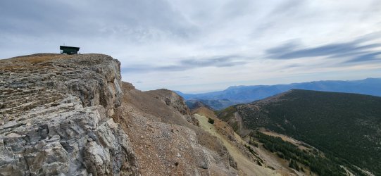
I'd initially assumed the lookout was shut down for the season, as all of the windows were fully boarded, but as I got closer an older gentleman (Bill) would step out to greet me. He invited me in for coffee, but warned it was pretty tight inside - he was packing up to head out for the season the next day. He had been at the lookout since mid-June. (Not a bad place to spend the summer...) As he was preparing to leave for the season, he had plenty of extra provisions and offered a warm meal as well - I'm pretty sure @travel2walk would give him a Michelin star if he could.
It turned out that Bill had previously manned the fire lookout in Yellowstone at Mount Sheridan for 13 years. So if you've been up there in the last couple decades, you've probably seen his handiwork. We chatted for a bit - greatly enjoying the warm food/drink - before continuing on our way. Towards the end of our conversation Bill mentioned a large elk herd that had been occupying a ridge nearby and that he'd seen a pack of ~10 wolves come by the lookout a few days previously. (He also said he hadn't seen any bears up there.)
View north from the fire lookout.
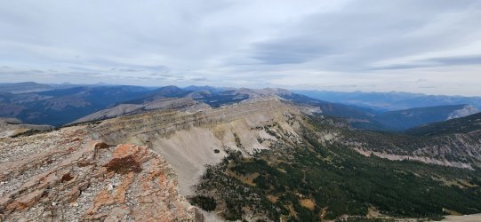
Looking back at the lookout as we continued our route. Really can't beat that location.
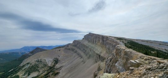
Mostly pretty good walking, but a few talus fields here and there. This is also where we started to hear howling...
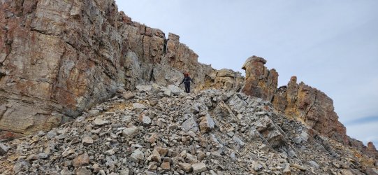
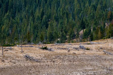
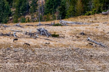
While climbing down one of the larger talus fields both @travel2walk and I started hearing what we thought was howling, but it was pretty indistinct. But once I had a chance to stop and listen it was pretty unmistakable, so I started scanning any open areas I could see. I saw a dark figure moving across a distant ridge - and then another - and then another - until I was able to count 8 of them. I turned back to @travel2walk and told him - he hurried the rest of the way to my viewpoint.
It was pretty far off, but we had a great look at the wolf pack running along the far ridge. At one point they grouped up and the howling became much louder. We stood there as long as they were in view and just enjoyed the moment. Magical experience.
I'll have to rely on @travel2walk chiming in with his pictures, because my phone was not up to the task.
This lake is apparently a pretty popular camp - this time of year and from a distance, even it was noticeably pretty low.
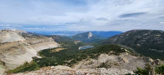
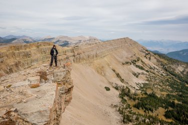
The Chinese Wall (and Sphinx Peak) in the distance. We would be there in a couple days... in the meantime, the views along our route were amazing and the terrain itself felt as wild as any other (while actually being pretty tame).
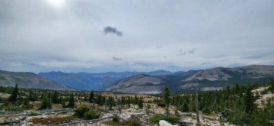
The ridge flattened a bit and we were able to spot a bull elk and his harem high up in a drainage - he let out a few bugles for us. Further along the ridge another bull elk would startle us with his very loud bugle - but we never actually saw him. Fun nonetheless.
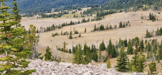
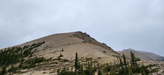
I had hoped to tag a high point near the end of the ridge (far right), but as it began to snow and having already climbed about 5k' on the day we decided to go ahead and begin our drop down to Moose Creek.
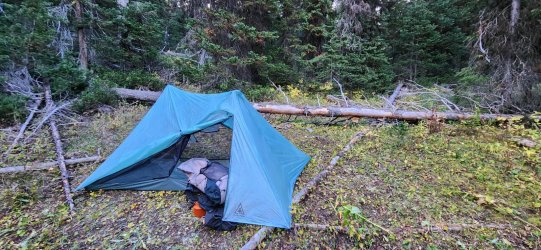
Once we found a reliable water source, we called it a night. Not the best campsite of the year... maybe even the worst, but I still slept like a baby. (There would've been a lot better options earlier in the year, but - without bushwhacking all the way down to Moose Creek - this was about our best option for the evening.)
Day 3: (almost) Moose Creek to the Chinese Wall
Day 3 would be pretty tame - once we finished bushwhacking 3 more miles down to Moose Creek. The morning was pretty slow and unscenic, but gave way to an afternoon that was easygoing and incredibly scenic. Today we arrived at the Chinese Wall.
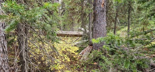
I think that's a game trail... there were a few good ones, but - once lost - they were tough to pick up again.
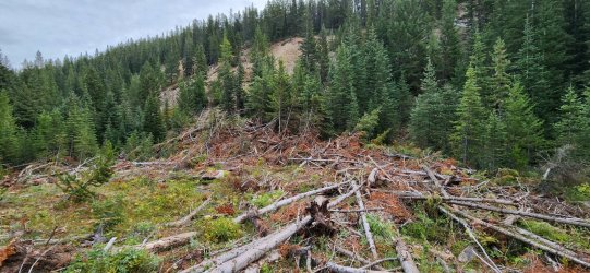
What a mess...
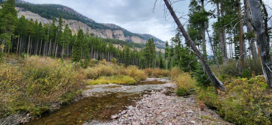
Moose Creek.
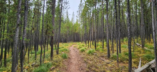
Back on the highway.
Approaching the Wall.
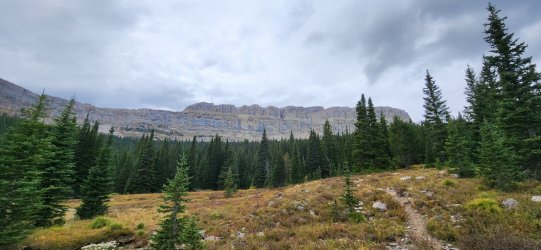
To the south.
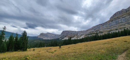
To the north.
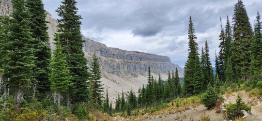
We found a nice spot that looked to be a regular camp for CDT hikers - we stopped a bit early, since there wouldn't be much water if we continued on. The plan was to fill up water and traverse the wall the next day.
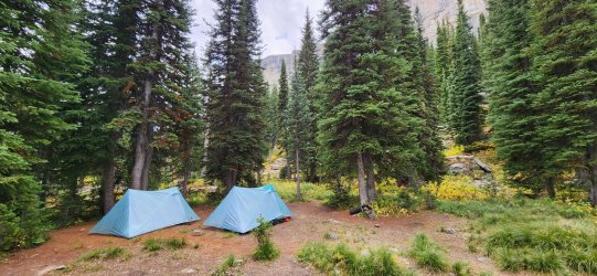
Day 4: Chinese Wall to Benchmark TH
Well, good morning. I got my snow. Only about 1.5", but beautiful!
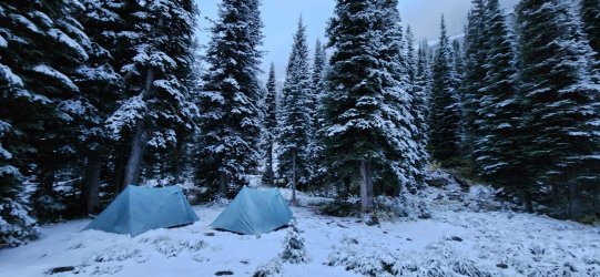
Unfortunately - despite looking beautiful - the weather forced a tough decision: the Chinese Wall traverse was a no go. Very low visibility and probable very high winds on the ridge made our prospects look pretty dim. We could do it - I was confident - but between the known quantities going against us and the unknown quantities awaiting us, I decided to make the conservative choice to take the low route. Knowing the next few days would only get worse, it seemed prudent to enjoy the AM walking the lower section of the Wall in the snow and head towards the trailhead. We considered stopping for another night, but ended up just hiking the remaining 22 miles to the trailhead.
I was disappointed, but by this time I already knew I'd be returning to the Bob Marshall so I'll get my chance - and hopefully have some visibility from up there.
My disappointment didn't last too long... our walk along the wall in the snow was pretty epic. Views came in and out, but the falling snow and ominous presence of the wall at our side was pretty awesome.
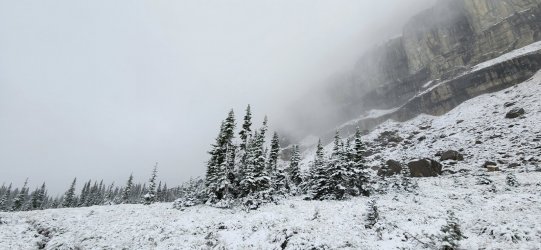
Hard to beat this.
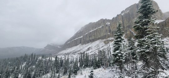
Eventually we descended below the snowline and the snow started to turn to rain - I'd say our pace picked up considerably at this point. I wasn't really ready to end the trip, but the incoming weather looked pretty miserable. Such is the nature of the outdoors - especially this time of year.
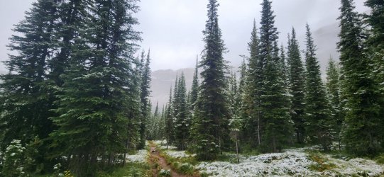
Interesting spot where the old trail was very apparent - the previous trail was essentially a straight line irrespective of incline. (Apologies to Robert Frost, but we stuck to the designated route here.)
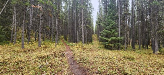
Almost back to our first night's camp.
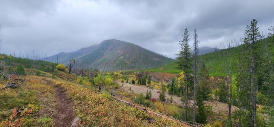
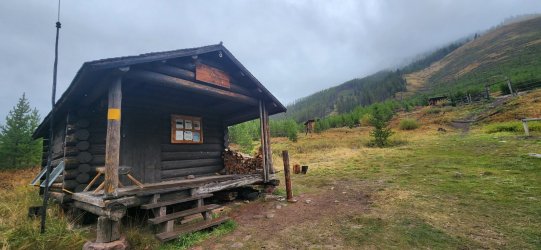
We made a quick stop at the Indian Point Station for lunch before continuing on.
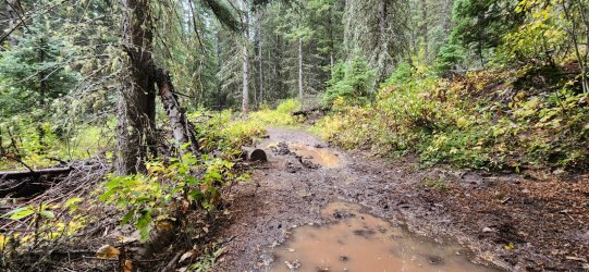
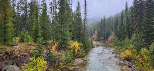
The precipitation and a few large mule trains had turned the trail into a bit of a slippery mess - but we were pretty much to the trailhead by the time it got really bad. (Thankfully.)
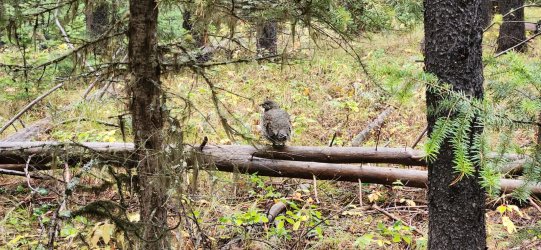
This little grouse gave me a bit of a scare, then hopped a few feet away and watched me plod along
Back to the trailhead.
Fantastic trip. I definitely tortured myself a bit about the decision to skip the Wall traverse, but it was the right call. I've already started planning my return... and maybe I'll have some grizzly luck next time, too.
Really happy to have shared another trip with @travel2walk - he's a great guy and a good sport about my sometimes odd route decisions. Definitely someone I'm happy to have met - and all thanks to Backcountry Post. Hopefully we'll be out together again next year... but where?
I'd told @travel2walk that I hoped for a bit of snow and shoulder season conditions and I wasn't disappointed on that count. The weather did convince us to make a few alterations to the route - including missing a traverse of the Chinese Wall itself - but I'll be back, so it's all good. And we did get to do the section I was most excited about - it didn't disappoint in the least.
While this would be my first trip to "the Bob", I knew it involved long approaches and most trips I've seen involve far too much on-trail, river bottom walking for my taste. With that in mind I started looking for higher options. Obviously the Chinese Wall jumped out, but I wanted to loop it w/ another long ridge. For the time I had available, there seemed to be one obvious choice. (Though I have since drawn up what will probably turn into my next trip and think I have another pretty fun option.)
I had heard many stories about the bears in the Bob Marshall and I must say this is my only area of disappointment - we only saw one black bear and pretty much no sign of any bears the remainder of the trip. But we did see (at least) 8 wolves, so I certainly can't complain - it was pretty incredible.
Hopefully @travel2walk can chime in w/ a few of his pictures - he carries much nicer photography equipment than I do.
Day 1: Benchmark TH to West Fork South Fork Sun River (Yes, that's the official name.)
Today would be pretty easy - we'd driven up to Augusta, MT from Denver so that we could get an early start. Today was pretty much an "approach day" spent primarily on trail to setup for our first climb on Day 2. The weather was fantastic and leaves were mid-change throughout - we also saw a black bear a little over halfway in, so that was pretty great.
Pretty impressive bridges along the main trail. (This section is part of the CDT and a very common horse-packer route.)

A recovering burn scar encompassed much of the route until we crossed the Sun River again. Was interesting to see though, since many of the older trips reports I looked at were from a time when there wasn't nearly so much new growth.

Views opened up a bit as we progressed.

Another impressively engineered bridge.

Our little black bear friend. He eyeballed me briefly and then sauntered up into the trees. (I know @travel2walk has a better picture.)

Beautiful horseshoe bend.

Camp for the evening was a beautiful, but high use spot along the river and near the junction to the Prairie Reef fire lookout.

Day 2: West Fork South Fork Sun River to (almost) Moose Creek
No other way to say it - this day was phenomenal. Just fantastic from start to finish. So many highlights.
We started the day with a pretty quick 3k' up to the Prairie Reef fire lookout. Consistent uphill, but easy-going trail and very conservative switchbacks.

Yeah - no kidding. (We ended up hauling a few liters a piece for this day - turned out to be a good thing.)

Views began opening up quickly near treeline. Our first definitive look at the Chinese Wall in the distance.

First look at the fire lookout.

Almost there.

I'd initially assumed the lookout was shut down for the season, as all of the windows were fully boarded, but as I got closer an older gentleman (Bill) would step out to greet me. He invited me in for coffee, but warned it was pretty tight inside - he was packing up to head out for the season the next day. He had been at the lookout since mid-June. (Not a bad place to spend the summer...) As he was preparing to leave for the season, he had plenty of extra provisions and offered a warm meal as well - I'm pretty sure @travel2walk would give him a Michelin star if he could.
It turned out that Bill had previously manned the fire lookout in Yellowstone at Mount Sheridan for 13 years. So if you've been up there in the last couple decades, you've probably seen his handiwork. We chatted for a bit - greatly enjoying the warm food/drink - before continuing on our way. Towards the end of our conversation Bill mentioned a large elk herd that had been occupying a ridge nearby and that he'd seen a pack of ~10 wolves come by the lookout a few days previously. (He also said he hadn't seen any bears up there.)
View north from the fire lookout.

Looking back at the lookout as we continued our route. Really can't beat that location.

Mostly pretty good walking, but a few talus fields here and there. This is also where we started to hear howling...

While climbing down one of the larger talus fields both @travel2walk and I started hearing what we thought was howling, but it was pretty indistinct. But once I had a chance to stop and listen it was pretty unmistakable, so I started scanning any open areas I could see. I saw a dark figure moving across a distant ridge - and then another - and then another - until I was able to count 8 of them. I turned back to @travel2walk and told him - he hurried the rest of the way to my viewpoint.
It was pretty far off, but we had a great look at the wolf pack running along the far ridge. At one point they grouped up and the howling became much louder. We stood there as long as they were in view and just enjoyed the moment. Magical experience.
I'll have to rely on @travel2walk chiming in with his pictures, because my phone was not up to the task.
This lake is apparently a pretty popular camp - this time of year and from a distance, even it was noticeably pretty low.

The Chinese Wall (and Sphinx Peak) in the distance. We would be there in a couple days... in the meantime, the views along our route were amazing and the terrain itself felt as wild as any other (while actually being pretty tame).

The ridge flattened a bit and we were able to spot a bull elk and his harem high up in a drainage - he let out a few bugles for us. Further along the ridge another bull elk would startle us with his very loud bugle - but we never actually saw him. Fun nonetheless.

I had hoped to tag a high point near the end of the ridge (far right), but as it began to snow and having already climbed about 5k' on the day we decided to go ahead and begin our drop down to Moose Creek.

Once we found a reliable water source, we called it a night. Not the best campsite of the year... maybe even the worst, but I still slept like a baby. (There would've been a lot better options earlier in the year, but - without bushwhacking all the way down to Moose Creek - this was about our best option for the evening.)

Day 3: (almost) Moose Creek to the Chinese Wall
Day 3 would be pretty tame - once we finished bushwhacking 3 more miles down to Moose Creek. The morning was pretty slow and unscenic, but gave way to an afternoon that was easygoing and incredibly scenic. Today we arrived at the Chinese Wall.
I think that's a game trail... there were a few good ones, but - once lost - they were tough to pick up again.

What a mess...

Moose Creek.

Back on the highway.

Approaching the Wall.

To the south.

To the north.

We found a nice spot that looked to be a regular camp for CDT hikers - we stopped a bit early, since there wouldn't be much water if we continued on. The plan was to fill up water and traverse the wall the next day.

Day 4: Chinese Wall to Benchmark TH
Well, good morning. I got my snow. Only about 1.5", but beautiful!

Unfortunately - despite looking beautiful - the weather forced a tough decision: the Chinese Wall traverse was a no go. Very low visibility and probable very high winds on the ridge made our prospects look pretty dim. We could do it - I was confident - but between the known quantities going against us and the unknown quantities awaiting us, I decided to make the conservative choice to take the low route. Knowing the next few days would only get worse, it seemed prudent to enjoy the AM walking the lower section of the Wall in the snow and head towards the trailhead. We considered stopping for another night, but ended up just hiking the remaining 22 miles to the trailhead.
I was disappointed, but by this time I already knew I'd be returning to the Bob Marshall so I'll get my chance - and hopefully have some visibility from up there.
My disappointment didn't last too long... our walk along the wall in the snow was pretty epic. Views came in and out, but the falling snow and ominous presence of the wall at our side was pretty awesome.

Hard to beat this.

Eventually we descended below the snowline and the snow started to turn to rain - I'd say our pace picked up considerably at this point. I wasn't really ready to end the trip, but the incoming weather looked pretty miserable. Such is the nature of the outdoors - especially this time of year.

Interesting spot where the old trail was very apparent - the previous trail was essentially a straight line irrespective of incline. (Apologies to Robert Frost, but we stuck to the designated route here.)

Almost back to our first night's camp.

We made a quick stop at the Indian Point Station for lunch before continuing on.

The precipitation and a few large mule trains had turned the trail into a bit of a slippery mess - but we were pretty much to the trailhead by the time it got really bad. (Thankfully.)

This little grouse gave me a bit of a scare, then hopped a few feet away and watched me plod along

Back to the trailhead.

Fantastic trip. I definitely tortured myself a bit about the decision to skip the Wall traverse, but it was the right call. I've already started planning my return... and maybe I'll have some grizzly luck next time, too.
Really happy to have shared another trip with @travel2walk - he's a great guy and a good sport about my sometimes odd route decisions. Definitely someone I'm happy to have met - and all thanks to Backcountry Post. Hopefully we'll be out together again next year... but where?
Last edited:

