John Morrow
Member
- Joined
- May 22, 2015
- Messages
- 1,102
Trip Report with more chronological pics here:
http://www.nwhikers.net/forums/viewtopic.php?t=8016013
It doesn't get better in the desert......
Glen Canyon National Recreation Area:
Crack in the Wall Route to Coyote Gulch/Escalante River.
Up Stevens Canyon complete ascent to Fold Pass.
Down Fold Canyon complete descent from Fold Pass.
Down Escalante River 7 mile wade and thrash.
Up Bobway Canyon to mesa.
Kings Mesa crossing.
Down Long Branch Sleepy Hollow Rim to Sleepy Hollow.
Down Coyote Gulch.
Crack in the Wall ascent to Trailhead.
53 mile loop.
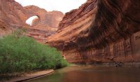
Pictures of an amazing 6 Day Backpack Loop through trailless canyons rising East and West off the Escalante River in Glen Canyon National Recreation Area.
I joined Kimberly S. (Rainie Too), Lori G., and Jerry S. for this spectacular adventure.
I can not come up with the words so here is the picture report. Could not have gone better and I can not thank my partners enough.....
Day 1: Crack in the wall to Escalante River to Stevens Canyon 5 miles.
![IMG_1240 [1024x768].JPG IMG_1240 [1024x768].JPG](https://backcountrypost.com/data/attachments/30/30502-6cc03e410968b751e6210dff68f416b7.jpg)
![IMG_1244 [1024x768].JPG IMG_1244 [1024x768].JPG](https://backcountrypost.com/data/attachments/30/30505-44eeb9dff968e5afdebbf203841b5770.jpg)
![IMG_1257 [1024x768].JPG IMG_1257 [1024x768].JPG](https://backcountrypost.com/data/attachments/30/30504-c4613da1c3f3cff335b5b70408238488.jpg)
Day 2: Up Stevens Canyon 9.5 miles.
![IMG_1309 [1024x768].JPG IMG_1309 [1024x768].JPG](https://backcountrypost.com/data/attachments/30/30506-541d850d2c20f83cfd2dfbc651e1d87e.jpg)
![IMG_1325 [1024x768].JPG IMG_1325 [1024x768].JPG](https://backcountrypost.com/data/attachments/30/30507-25312ff282babaa4bacff90e4858b166.jpg)
![IMG_1354 [1024x768].JPG IMG_1354 [1024x768].JPG](https://backcountrypost.com/data/attachments/30/30508-fa95e8e39d7655433e55bf9571bf37ff.jpg)
Day 3: Finish Stevens Canyon, climb to Fold pass, begin descent of Fold Canyon. 8 miles.
![IMG_1417 [1024x768].JPG IMG_1417 [1024x768].JPG](https://backcountrypost.com/data/attachments/30/30509-c6c53f97fd89da38942f19b54fdf7e91.jpg)
![IMG_1443 [1024x768].JPG IMG_1443 [1024x768].JPG](https://backcountrypost.com/data/attachments/30/30510-88b2d2615b8850230fbf1579aa4c2a01.jpg)
Day 4: Descend Fold Canyon, cross into spur canyon, downclimb to Escalante River, wade Escalante River downstream to Fools Canyon mouth. 9 miles.
![IMG_1468 [1024x768].JPG IMG_1468 [1024x768].JPG](https://backcountrypost.com/data/attachments/30/30511-dc66ee63c835900bb409e79cf32130fd.jpg)
![IMG_1472 [1024x768].JPG IMG_1472 [1024x768].JPG](https://backcountrypost.com/data/attachments/30/30512-c4a48871c5738eb4ac03fb1e374d4335.jpg)
![IMG_1478 [1024x768].JPG IMG_1478 [1024x768].JPG](https://backcountrypost.com/data/attachments/30/30513-366e523dc128f50eb3fe1c3fe6eb5a0d.jpg)
![IMG_1527 [1024x768].JPG IMG_1527 [1024x768].JPG](https://backcountrypost.com/data/attachments/30/30514-7fc330de33b233b564428213fbf31808.jpg)
![IMG_1552 [1024x768].JPG IMG_1552 [1024x768].JPG](https://backcountrypost.com/data/attachments/30/30515-7fcc569c419c80c90318110f47d47752.jpg)
![IMG_1599 [1024x768].JPG IMG_1599 [1024x768].JPG](https://backcountrypost.com/data/attachments/30/30516-ea31d6b9fa6015290be7b07d7e039b9f.jpg)
Day 5: Continue down Escalante River Canyon. Climb out the Bobway to King Mesa. Cross mesa. Descend south rim of Long Branch of Sleepy Hollow into Sleepy hollow. Camp at mouth on Coyote Gulch. 10 miles.
![IMG_1624 [1024x768].JPG IMG_1624 [1024x768].JPG](https://backcountrypost.com/data/attachments/30/30517-f69402cfc452f6c385eb8bb9d43eee1d.jpg)
![IMG_1638 [1024x768].JPG IMG_1638 [1024x768].JPG](https://backcountrypost.com/data/attachments/30/30518-1483ef887cdb1cf8861a1673eafdeff5.jpg)
![IMG_1656 [1024x768].JPG IMG_1656 [1024x768].JPG](https://backcountrypost.com/data/attachments/30/30519-8c441eed6c34b0762142566d7d1e43e6.jpg)
![IMG_1710 [1024x768].JPG IMG_1710 [1024x768].JPG](https://backcountrypost.com/data/attachments/30/30520-8c761b23b53b0e6756634c525271c2b6.jpg)
Day 6: descend Coyote Gulch to Crack in the Wall route back to Trailhead. 12 miles.
![IMG_1722 [1024x768].JPG IMG_1722 [1024x768].JPG](https://backcountrypost.com/data/attachments/30/30521-26eaec442bb313a55a1f3f299041e437.jpg)
![IMG_1729 [1024x768].JPG IMG_1729 [1024x768].JPG](https://backcountrypost.com/data/attachments/30/30522-204481829216736bf0cea45caeff3e45.jpg)
![IMG_1743 [1024x768].JPG IMG_1743 [1024x768].JPG](https://backcountrypost.com/data/attachments/30/30523-f9b4ef9d4cb4ede0bd096a9198232118.jpg)
![IMG_1753 [1024x768].JPG IMG_1753 [1024x768].JPG](https://backcountrypost.com/data/attachments/30/30524-b19b878e57959fa0d528c5e63216bba0.jpg)
![IMG_1761 [1024x768].JPG IMG_1761 [1024x768].JPG](https://backcountrypost.com/data/attachments/30/30525-c3545acb40ed037c2979b712e747d509.jpg)
![IMG_1765 [1024x768].JPG IMG_1765 [1024x768].JPG](https://backcountrypost.com/data/attachments/30/30526-30fefc9a41587eb000064eaee5a7c314.jpg)
Featured image for home page:

Last edited:
