- Joined
- Jul 23, 2013
- Messages
- 1,665
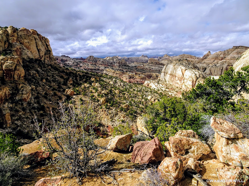
Sometimes things can come together so well it's as if catching lightning in a bottle. That happened this fall when such things played out into allowing me the opportunity to fulfill one of my top bucket list hikes since I found out about it. To do what's been called the Beehive Traverse, a route that takes one through the heart of the geological wonderland that is the Waterpocket Fold in Capitol Reef National Park. It is a 17 mile route for the main leg, plus an additional 8 to 9 for an optional extension.
It's course runs mostly off trail and is littered with all kinds of obstacles, as it follows sandstone spines, ridges, cliff sides, dry washes, slots, up and down, up and down some more, through canyon after canyon after canyon. It is so remote that the route passes by and through very few landmarks that even have an official name on maps. To top that all off, water sources can be very scarce along this route, due to long dry spells which are common throughout the year.
How did I come to find about about this lesser known and even lesser-hiked route? Well, the reader should understand that in falling in love with the woman who I'm now blessed to call my wife, I also came to fall in love with the landscape her great-great grandfather sought federal protection for in the early 1900's.
That man, Ephraim Pectol, who for some time owned and operated what is now the Chuckwagon Store in Torrey, Utah would ultimately go on to serve in the Utah state legislature and one of his very first acts there was to promote and campaign for a monument to be be created out of a stretch of land he had been calling Wayne Wonderland (in connection with Wayne County). He believed it would benefit the public to keep it a land where others could come and visit and be filled with wonder like himself. He was so passionate about getting it protected that he neglected his own business for years to lead and guide federal authorities around the landscape taking surveys for boundary markers. He was also aided in his efforts by much assistance from his brother-in-law, Joe Hickman. At last, their efforts were finally rewarded with the protection they sought in 1937 when Franklin D. Roosevelt signed off on an official proclamation creating Capitol Reef National Monument. Several years later, Congress extended some of the boundaries and upgraded it all to a National Park with the signature of President Nixon in 1971. Landmarks in the park, Pectol's Pyramid and Hickman Bridge, are named after them, respectively.
Given the marital connections I now have to the park and my love of the outdoors, it became a personal project of mine to hike and explore and become familiar with at least all the non-technical areas of Capitol Reef. So, a few years ago I had been studying topographic and satellite maps to see if there was any viable, non-technical way to connect Capitol Reef's Grand Wash with Capitol Gorge via through and over the Waterpocket Fold. And then Capitol Gorge with Pleasant Creek. Little did I know, all this had already been done. I had also been making a list of trails and places elsewhere in the park to visit that I had not yet been introduced to in earlier visits with my wife and her family. Having my in-laws retire and relocate to develop some long-owned property they've had in Torrey has only hastened the opportunities to return to Capitol Reef many more times with the regular visits we now make there.
At that same time, I had been searching out some more information on the Internet about some hikes in Capitol Reef when I stumbled into a write-up of the Beehive Traverse route by Michael Lanza on his blog, thebigoutside.com. At the time, access to most all content there was free, but there is now a paywall in which one must activate a paid subscription to access premium content, of which the Beehive Traverse write-up there is now a part of. At any rate, I was sold. There was no map, no gps coordinates or track shared, just lots of pictures accompanied by a great narration of his own journey along the route. He credited his friend and former colleague, Steve Howe - they had both once been regional editors for Backpacker Magazine - with providing the route with some helpful beta.
Of course, I turned to Google to see if I could find anything else about this route I'd never heard of as it seemed to follow just the kind of course in which I was thinking I would try to scout out myself. In that search I found Steve Howe's own adventureful write-up he had published for Backpacker years ago about how he came to pioneer this route, which is really quite a good little read! He is, after all, a resident of the small town of Torrey as well, runs his own guiding company there, and thus had plenty of time in his off days to pursue explorations into the more rugged and remote sections of neighboring Capitol Reef and beyond.
It just so happened that at the time I came across that article, there was also a footnote link to a mapping website Backpacker had an account with containing a GPS track that Steve apparently had released with the article for a time. The website was far from user-friendly and intuitive though. I couldn't figure out any way to download the track, so I painstakingly re-traced it onto a map of my own via my Caltopo account. I then added on a few potential alternate detours that I thought, based on landscape topography and geological features shown in satellite imagery, could possibly prove easier to navigate. I then copied over a few notes from some key waypoints listed.
I've since gone back to see if that track was still available on the site Backpacker made it available on and apparently it has been pulled offline, because I could not find it at all anymore. I'm not sure why it's no longer there, but I have my guesses.
In the mean time, this route, from the time I had discovered its existence, had loomed large on my bucket list over the last few years. I had strongly considered attempting it solo in April, but instead opted to go further south in the park to check off another Capitol Reef hike on my list, the Halls Creeks Narrows. It wasn't until later in the fall, when @Devin Ashby got in contact with me about wanting to go out on a desert trip in October, that another opportunity presented itself. He had a trip lined up with some other friends of his that fell through so I pitched him on the Beehive Traverse. After a bit of thought, he was sold. Plans were made and the stoke exploded.
And so, without further ado...here is my report of said trip!
Day 1
Thursday - October 18, 2018
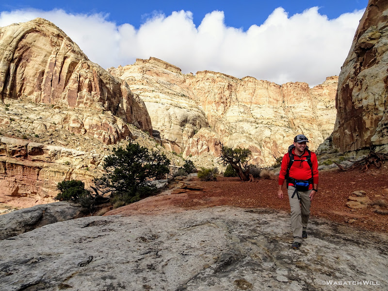
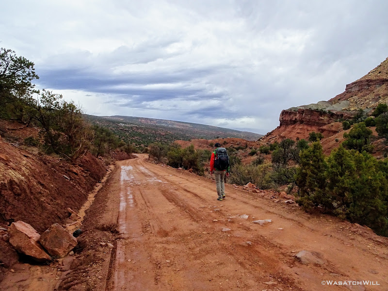
After picking up Devin early in the morning, I drove on down to Torrey where we made a brief layover at my in-laws. I introduced Devin, pleasantries were exchanged. To fuel up our bodies, we made a short walk up the road to the Capitol Reef Inn Cafe for some burgers. We then walked back to my in-laws where we had my father-in-law drive us down into the park, to the Visitor Center to pickup a necessary backcountry permit, and ultimately to our starting point for this trip, Grand Wash Trailhead.
We loaded up, said our farewell to my father-in-law and got underway. By now it was about mid-afternoon.

Devin heads down Grand Wash
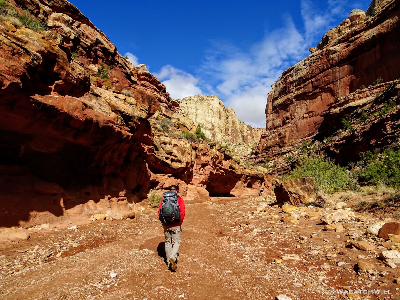
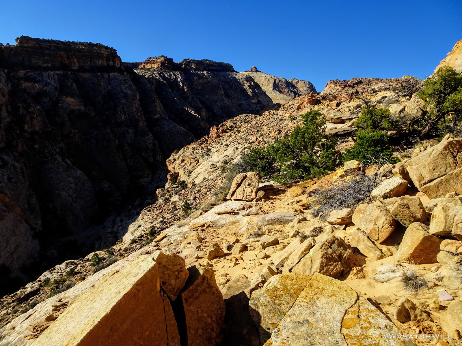
I had planned a 6 mile day for us to reach where I anticipated would make a good camp for our first night. Little did we know just how much more rugged and wild this route would prove to be for us, almost right out of the gate. Once we broke away from the crowds touring the mild and easy going Grand Wash, it was game on! To make our way up into a side canyon, we had to gain some elevation up a steep and rocky hill out onto a ledge.

Saying good bye to Grand Wash
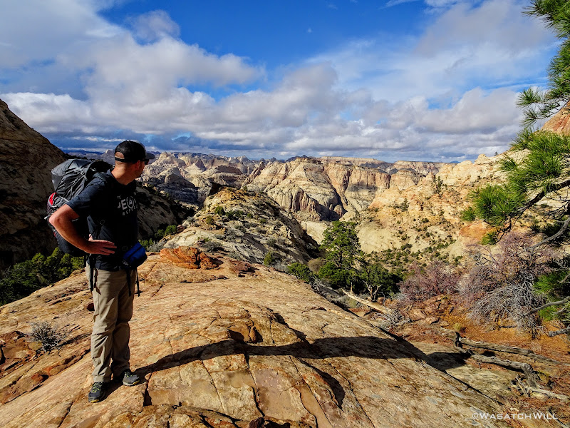
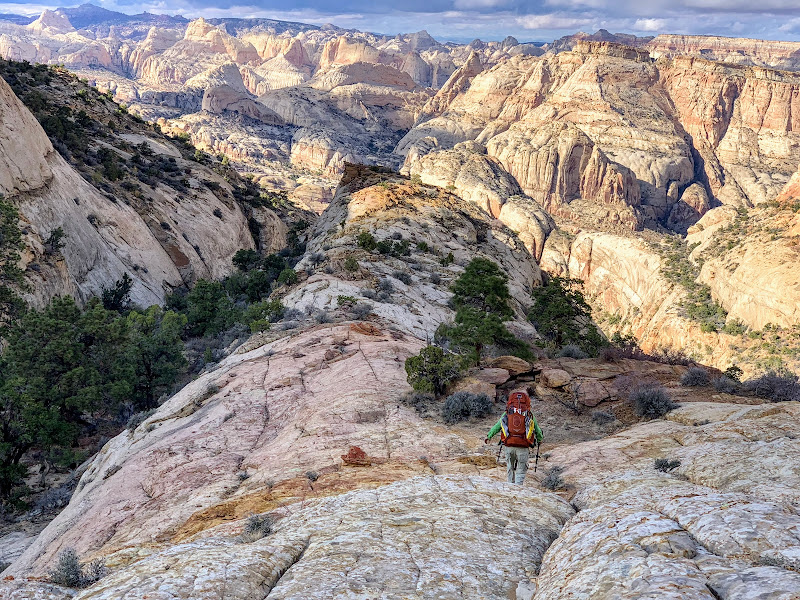
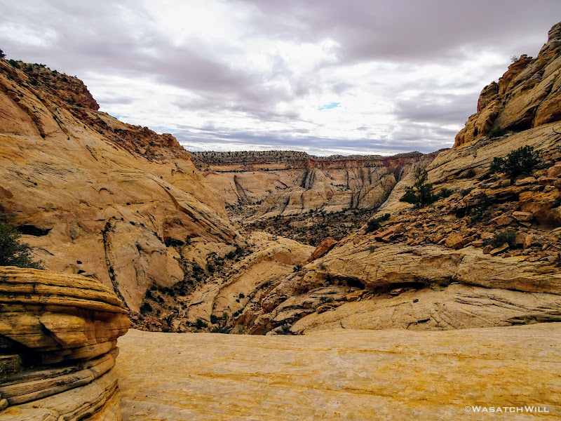
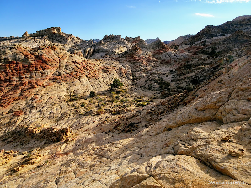
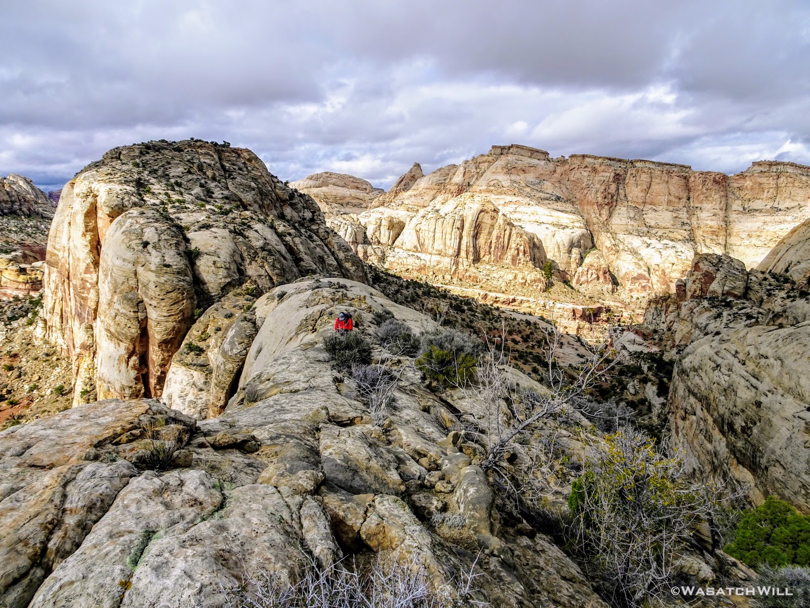
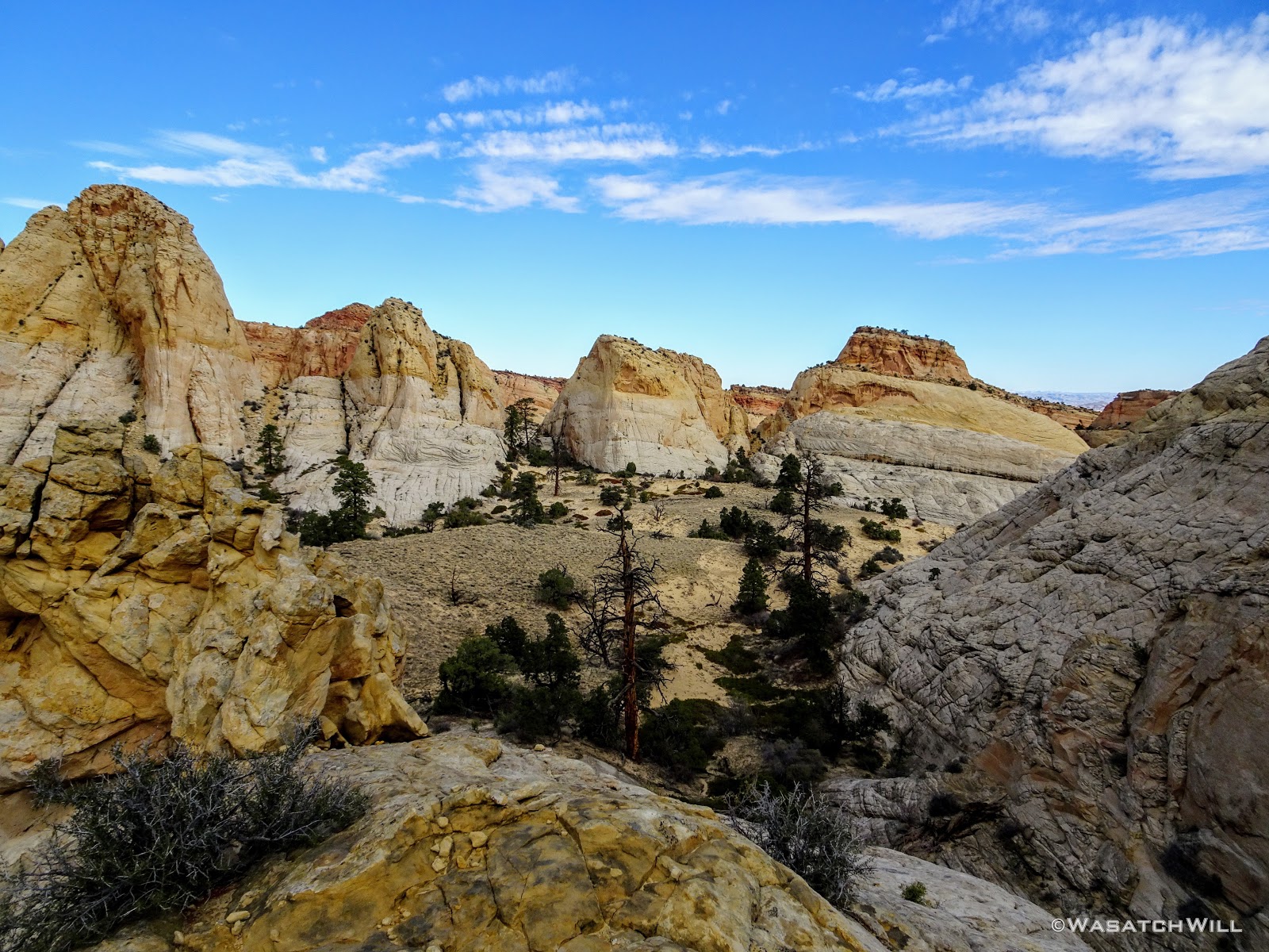
Once we arrived atop the ledge we were targeting and then turned the corner, we were instantly presented with our first of many breathtaking views to come. Now officially off-trail and with Grand Wash now behind us, it was highly unlikely we'd encounter another person for the next two days. On we went...
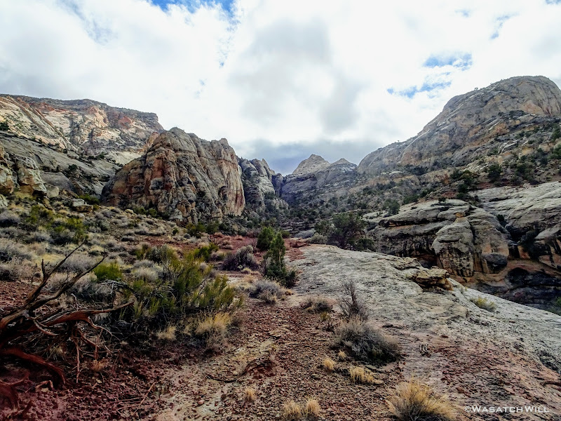
Looking ahead on the ledge
Looking back at Devin crossing over the ledge
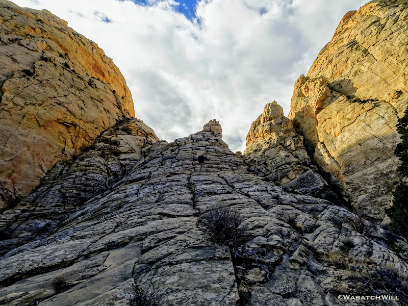
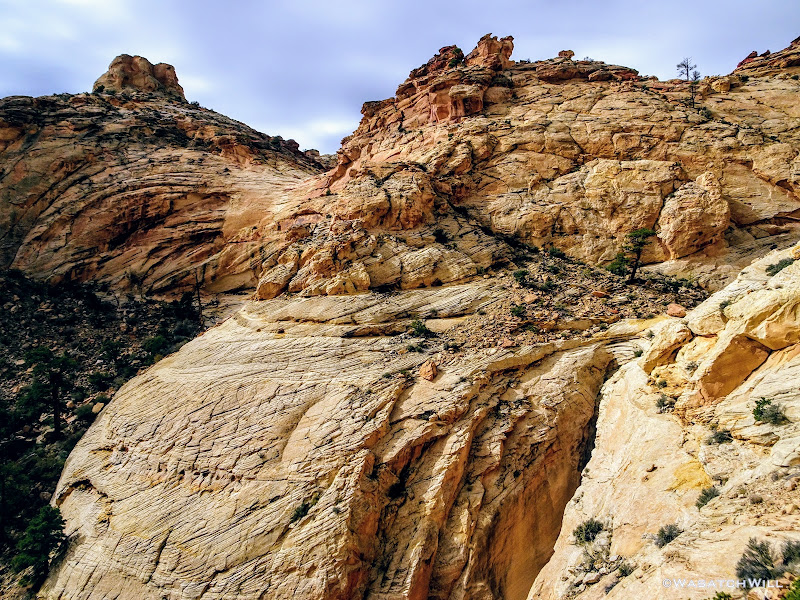
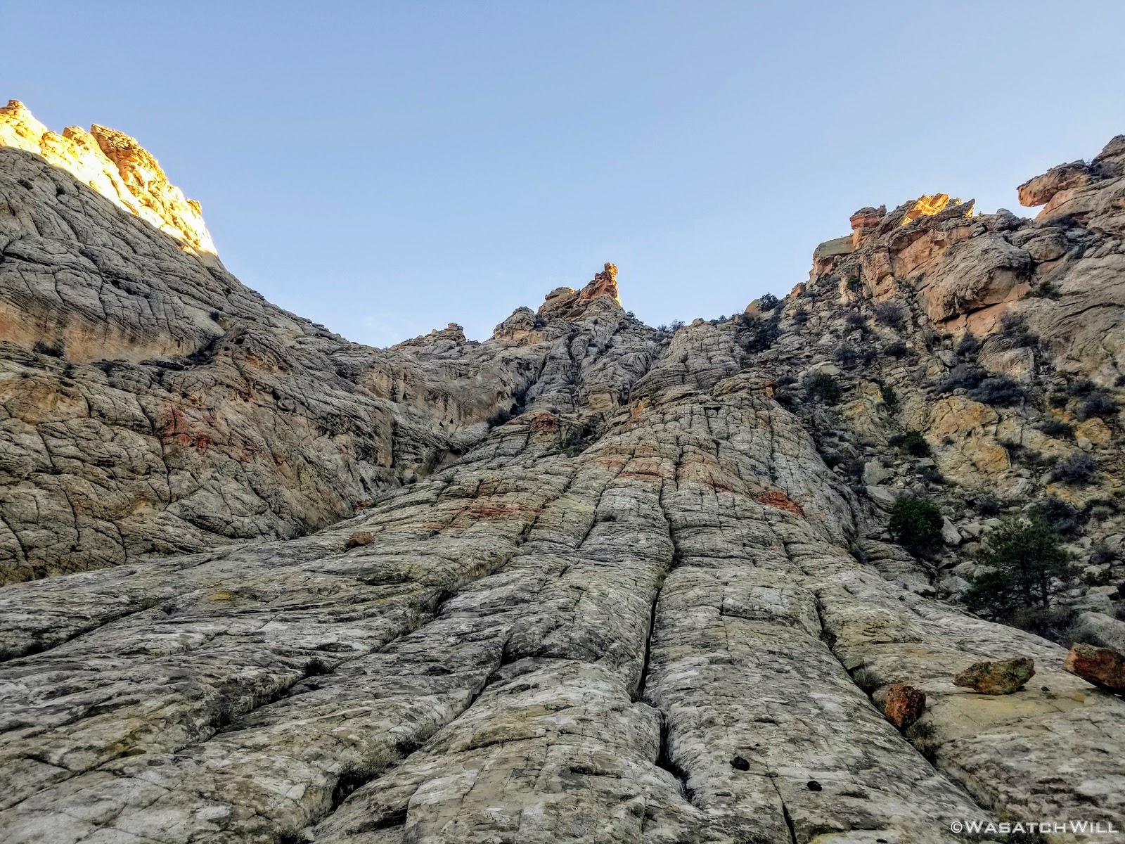
We followed the ledge until it brought us to another hill we had to gain to reach a saddle along a high sloped, domed ridge above. On the other side was sheer wall plunging deep into another canyon and its floor far below. Once up on the saddle, we had to sprawl our way up a steep slickrock ramp with plenty of exposure on either side until the ridge leveled out a bit for an easier traverse across it.

Devin traverses the top of the domed ridge
Once on the other end of the ridge, we could look back and see Cassidy Arch way out across the other side of Grand Wash.

Cassidy Arch off in the distance (center right)
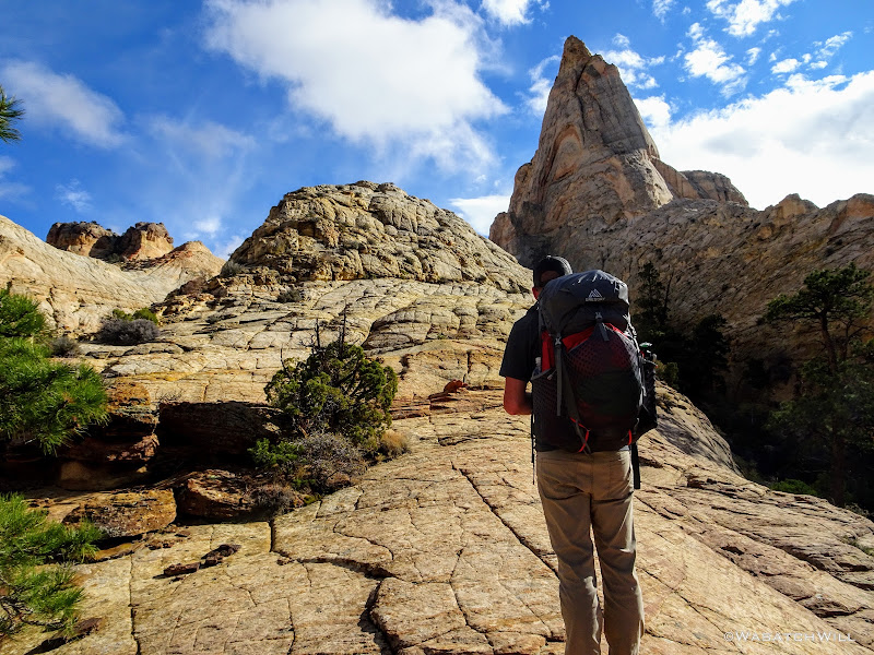
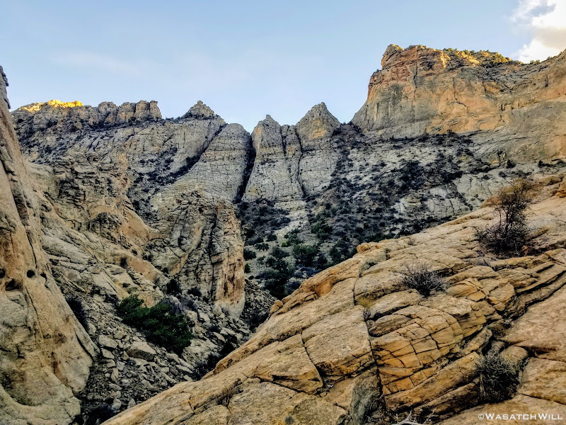
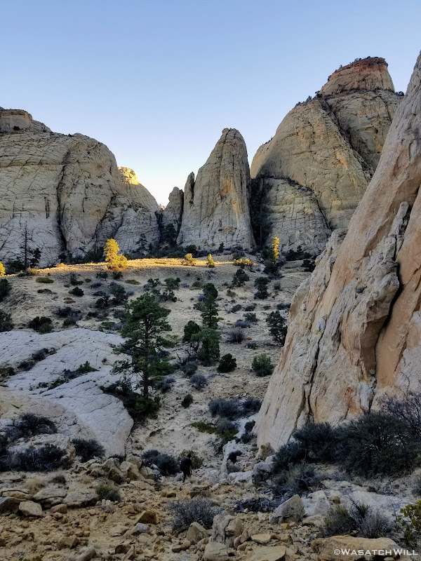
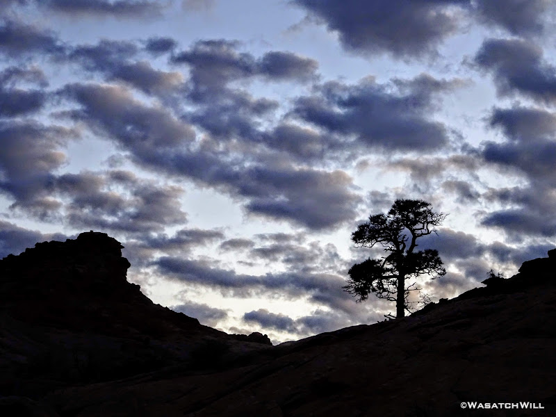
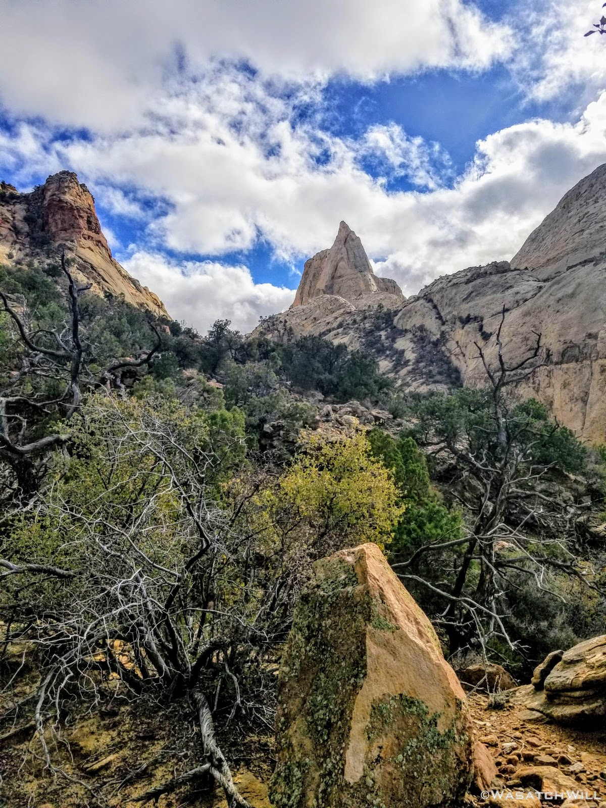
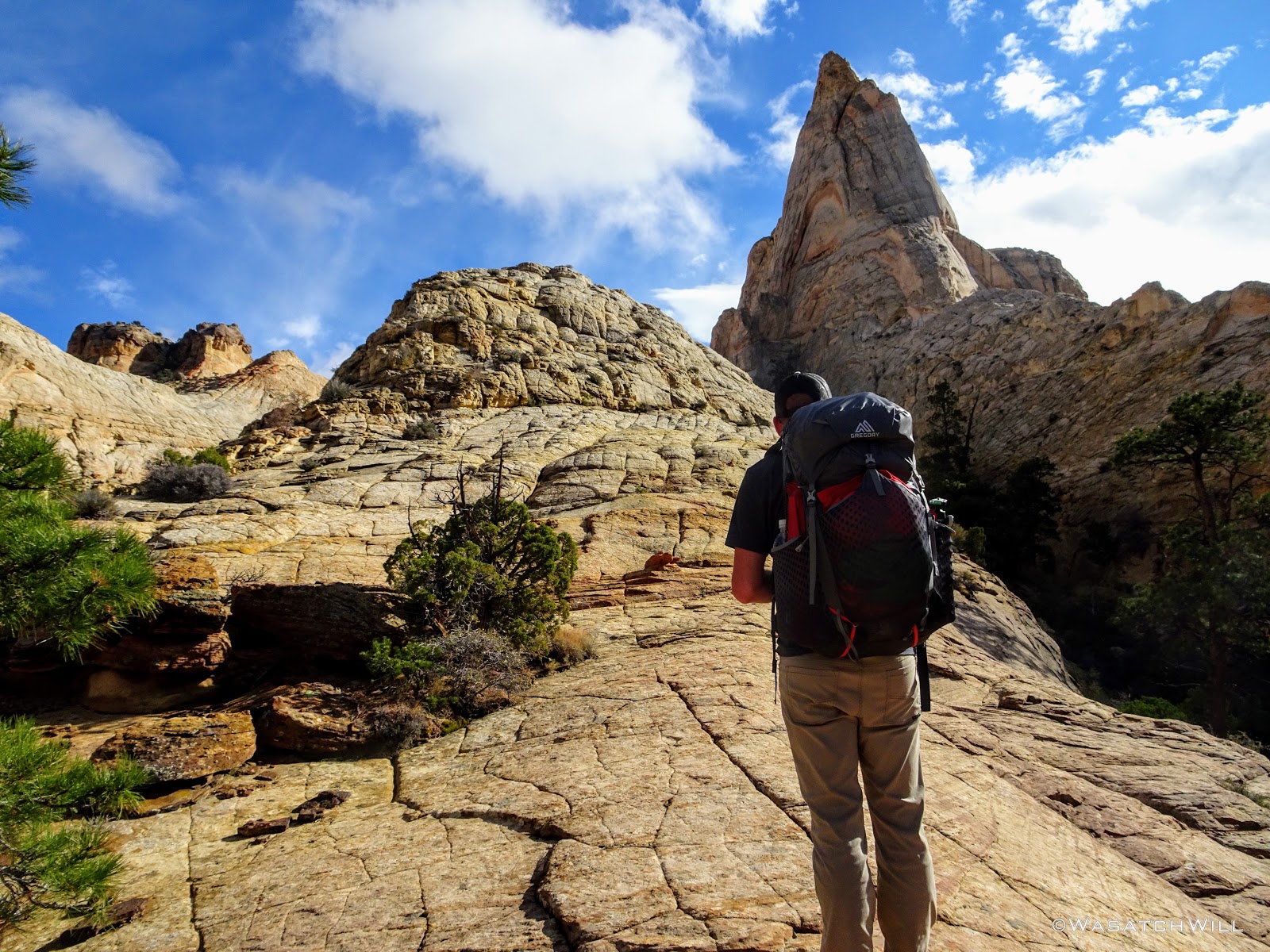
Up ahead of us loomed a majestic unnamed landmark. I simply called it, 'The Spire'.
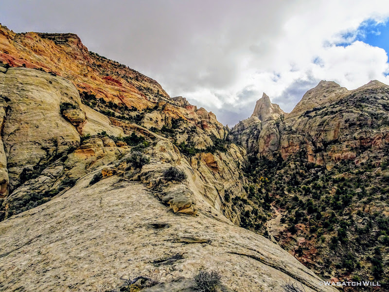
'The Spire' looms ahead
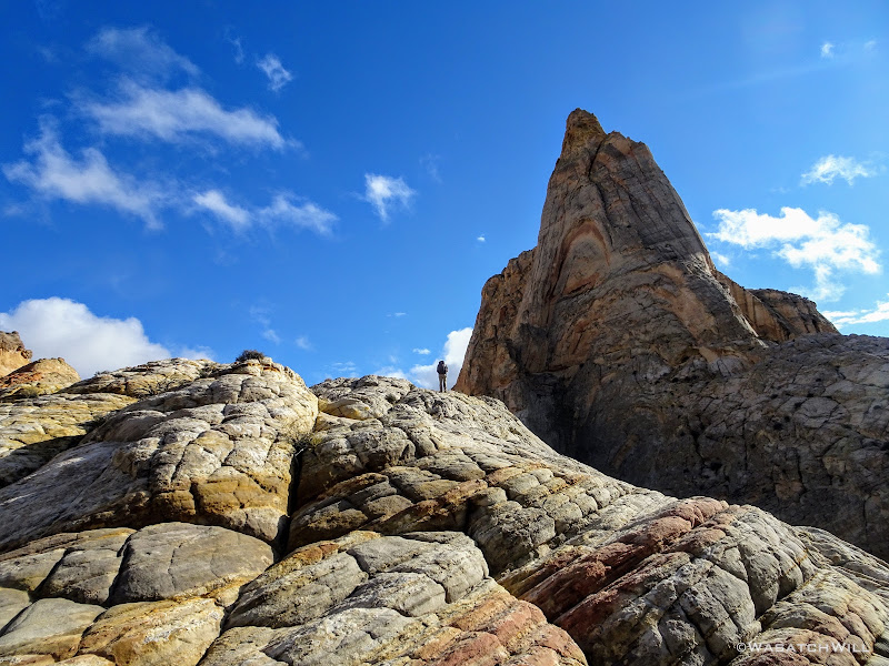
Myself, taking it in
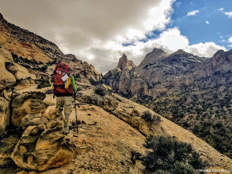
The ridge would go on to transition into another long ledge for us to follow along the canyon wall. After a nice stretch, we pulled over for a rest and to soak up more views both ahead of us and behind us.

'The Spire' as seen from where we rested
Looking back to the north
After snacking up, we continued on up to the head of the canyon where we were able to cross over to the other side and begin a series of steep switch backs and ramps to gain another ridge that would bring us to some views that would rival any others along the route. It was amazing!
Devin looks down from whence we came
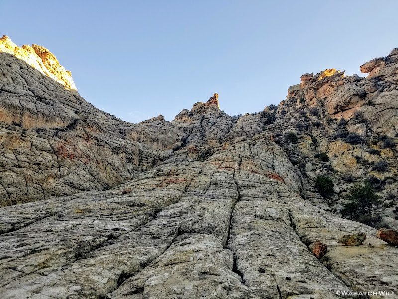
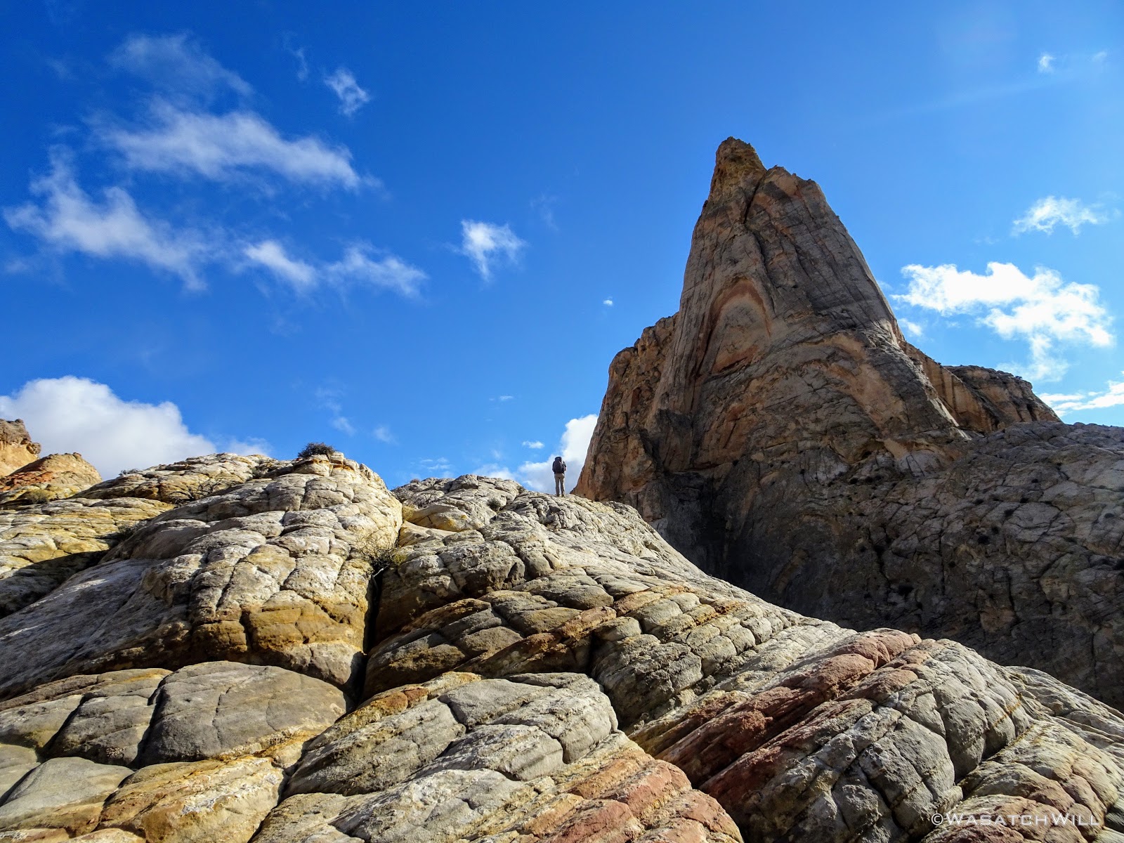
On the ridge, we had yet another steep ramp to step up to acquire yet another ledge, this one taking us right along side The Spire.
Devin sizes up 'The Spire'
Devin atop the ledge along 'The Spire'
Myself, going back down to retrieve some cameras (photo courtesy of Devin)

Rounding 'The Spire'
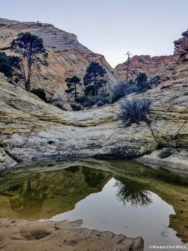
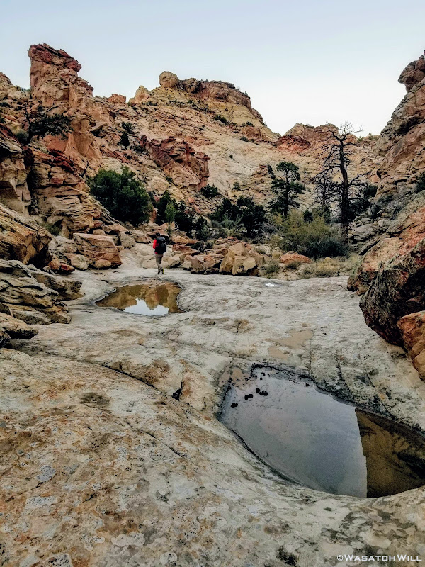
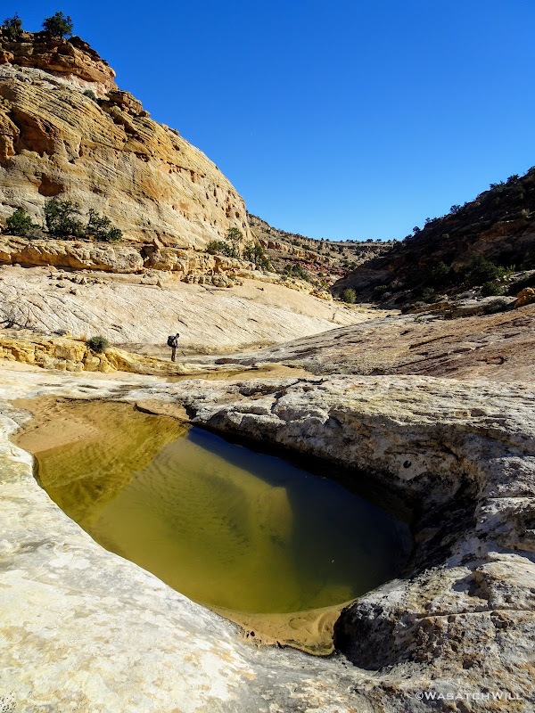
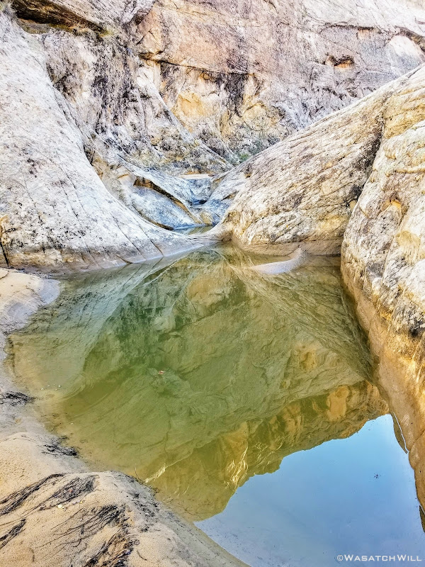
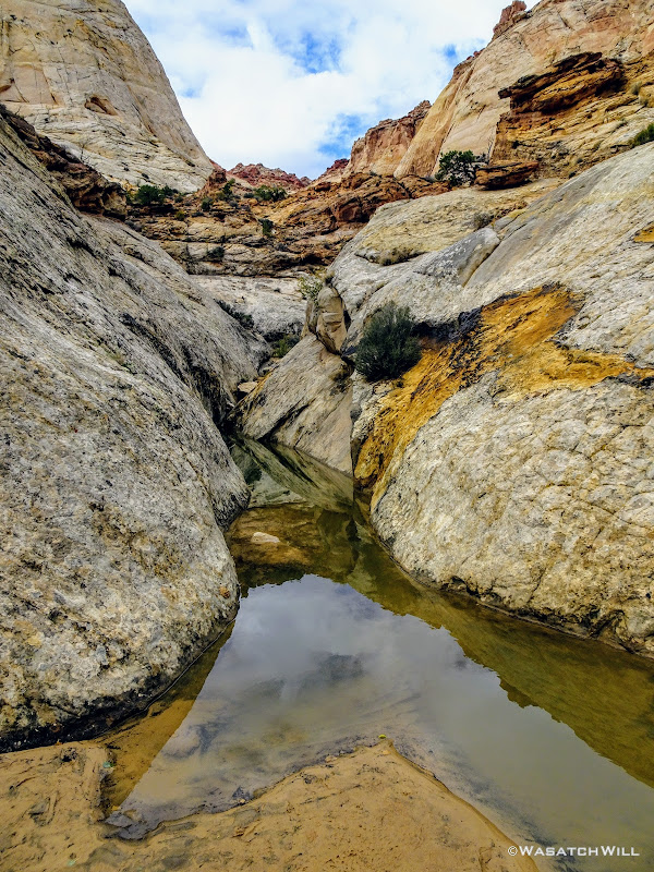
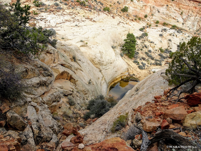
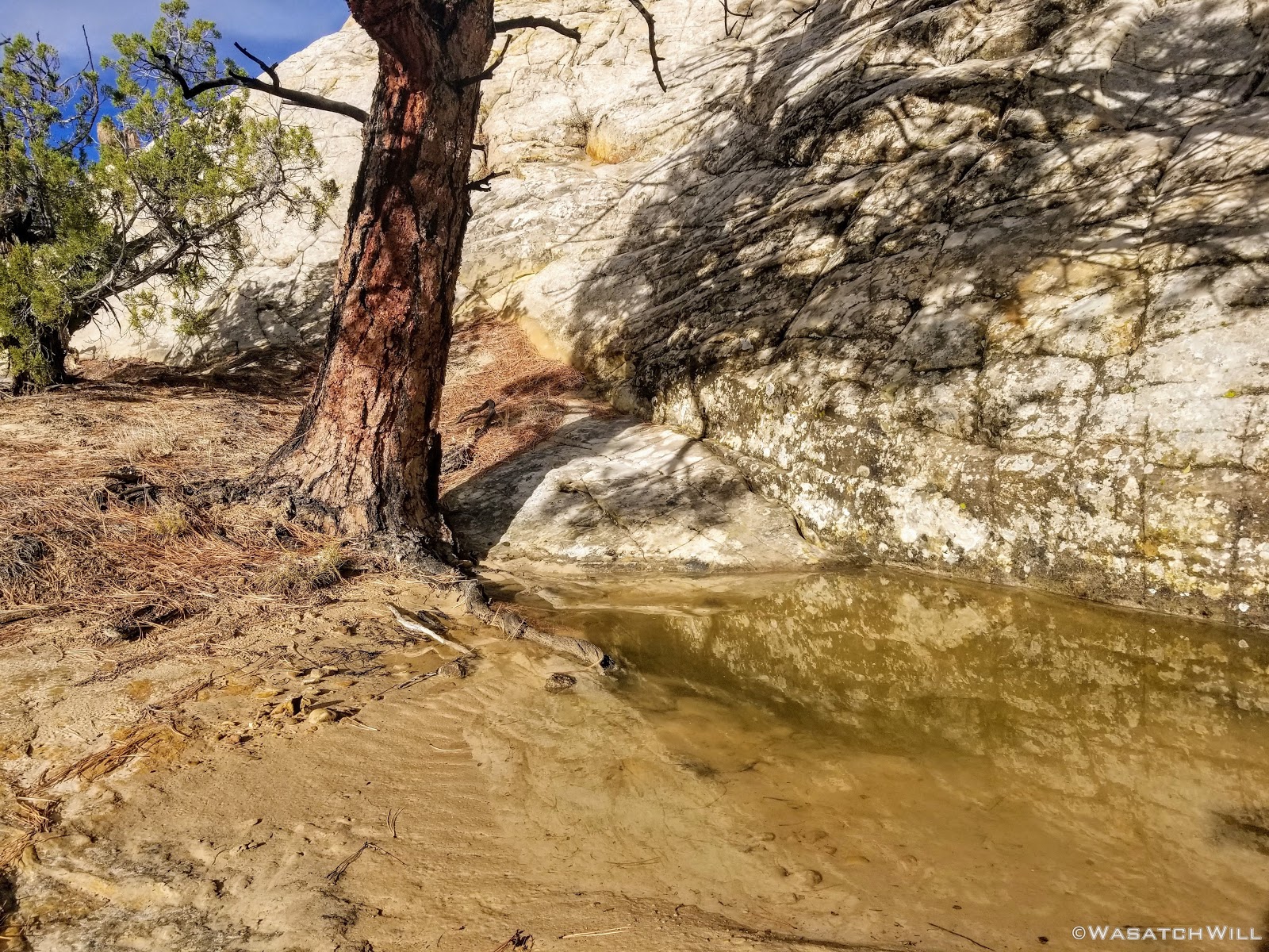
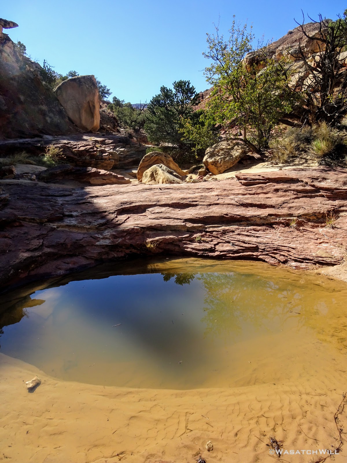
Once around the backside of The Spire, we had to find another ramp or gulley that could lead us off the ledge down into a wash. We ended up in a gulley with a lot of bushwhacking. Once in the wash and rounding a bend, we encountered something we fully expected to encounter many more of, a small pool of water. In recent weeks, the area had actually taken on an early snow storm along with some significant rains. Knowing this virtually assured us that water sources would be abundant all along our route. Did I mention this trip felt like catching lightning in a bottle?
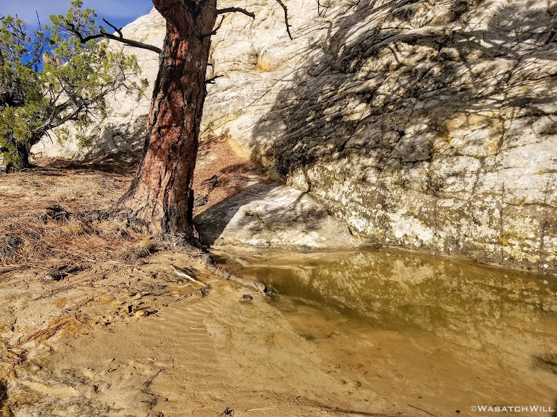
First of many water sources
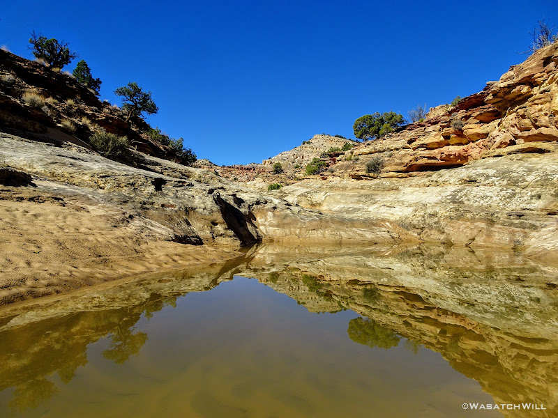
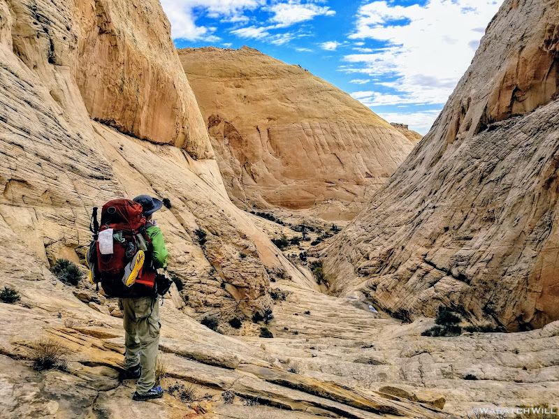
We followed the narrow wash the rest of its way out to a junction with a bigger wash that we then followed downstream for a bit.
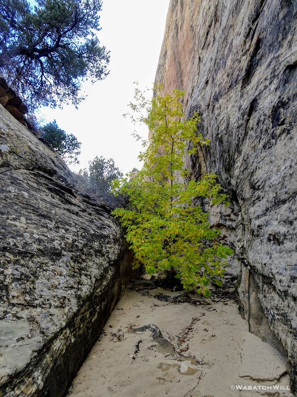
Little tree in the wash
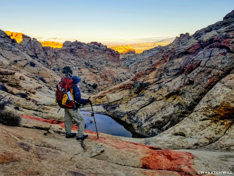
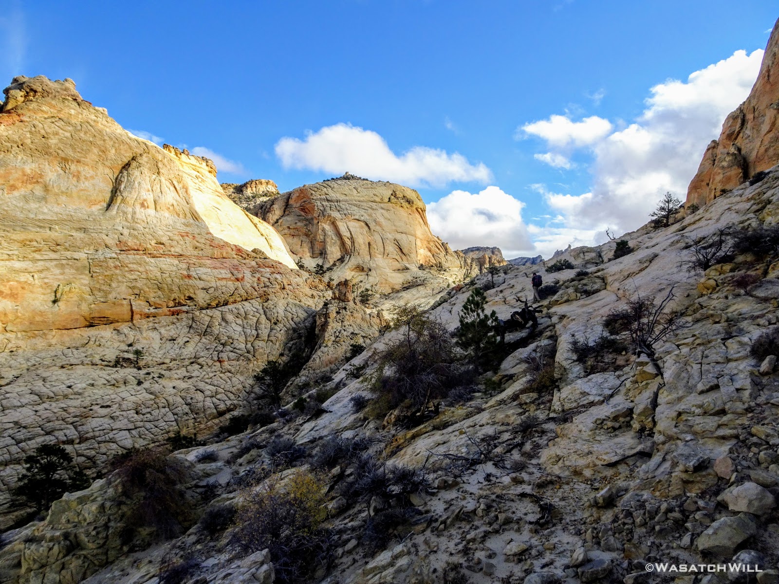
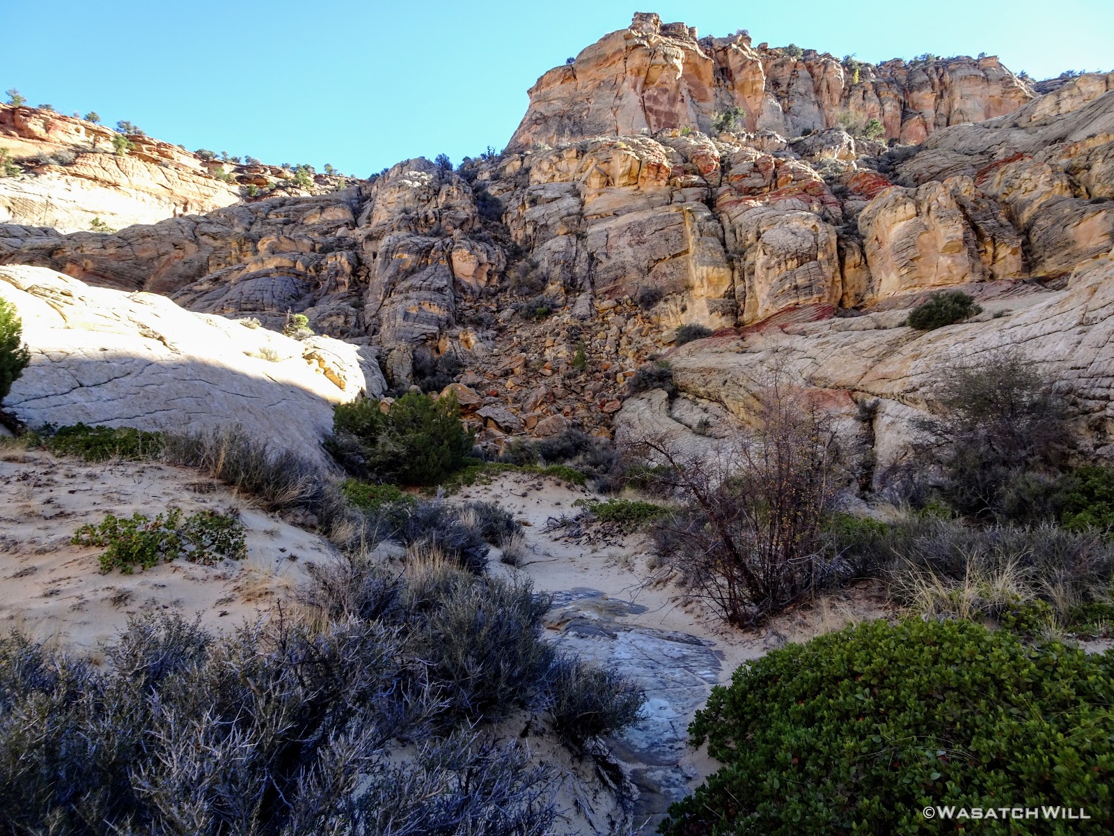
After a few bends along the larger wash, we made another exit, this time up into a sandstone amphitheater where we'd pause for another good rest and snack break as we braced for another good climb up to a saddle in the ridge overhead.
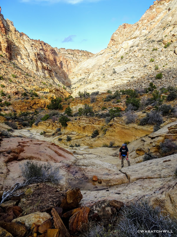
Devin pauses on the slickrock as we exit the wash behind
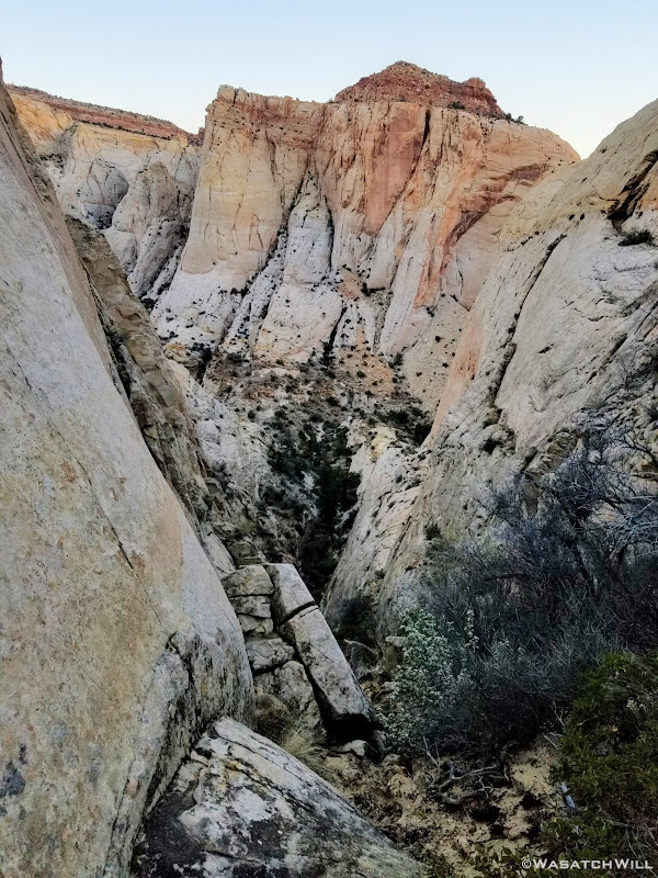
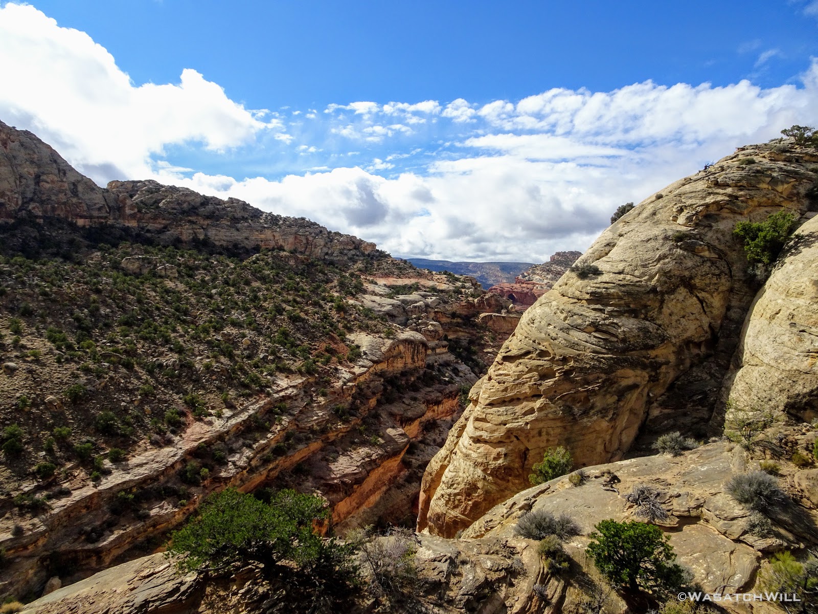
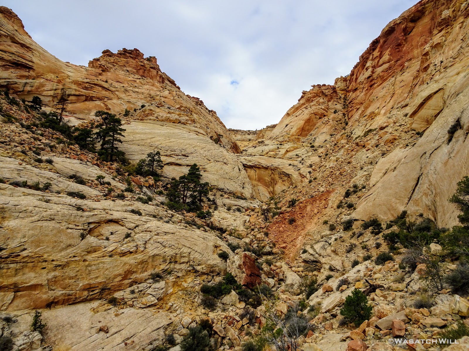
Getting up to the saddle we were after required a few class three moves and a moment later, we were were gazing down into what is unofficially named by Steve Howe as Redman Canyon. I believe Steve named it as such because somewhere from within the canyon one can look up and see a rock formation that looks like a red snowman. We never found it though.
Looking down into 'Redman Canyon'
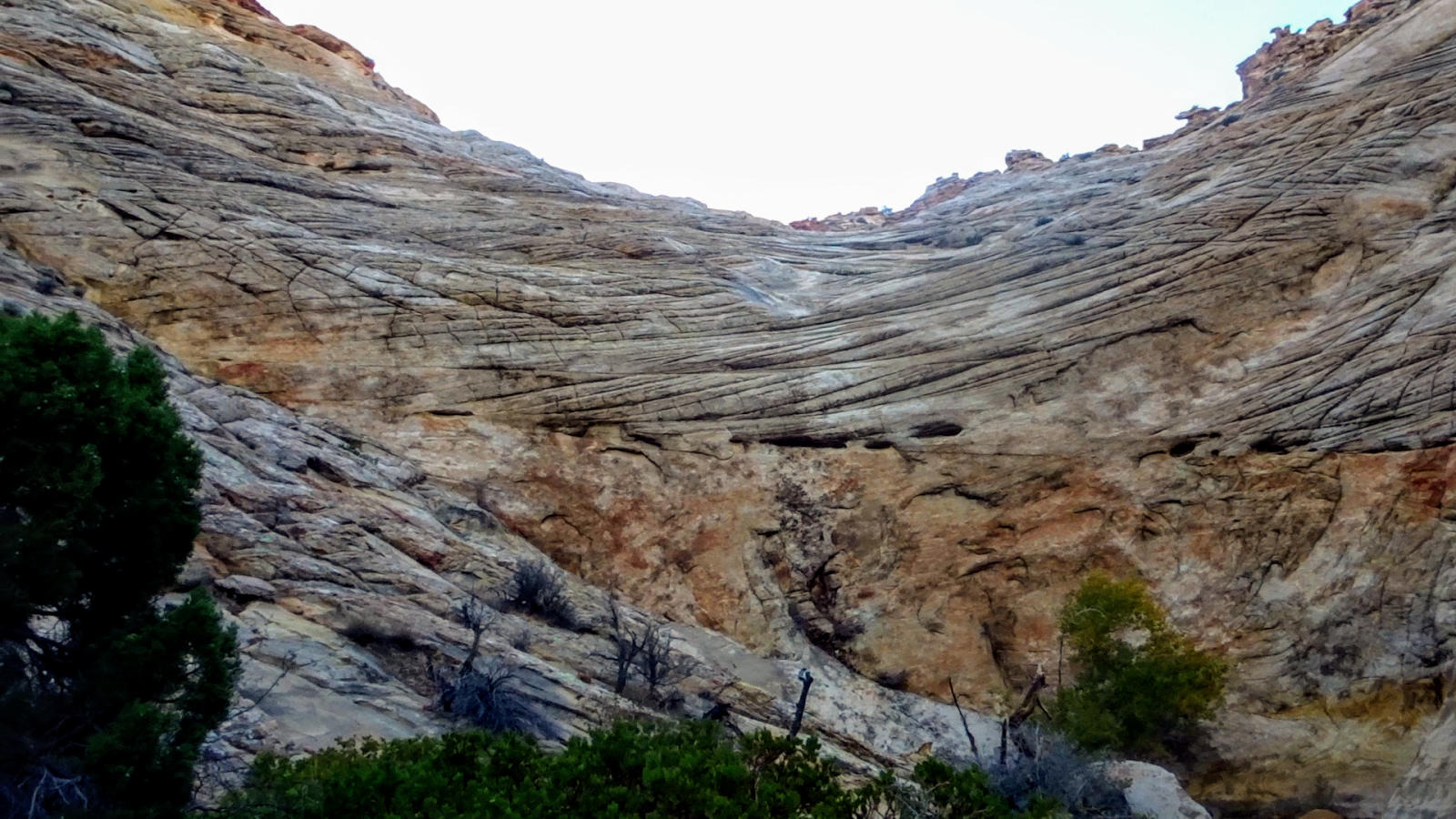
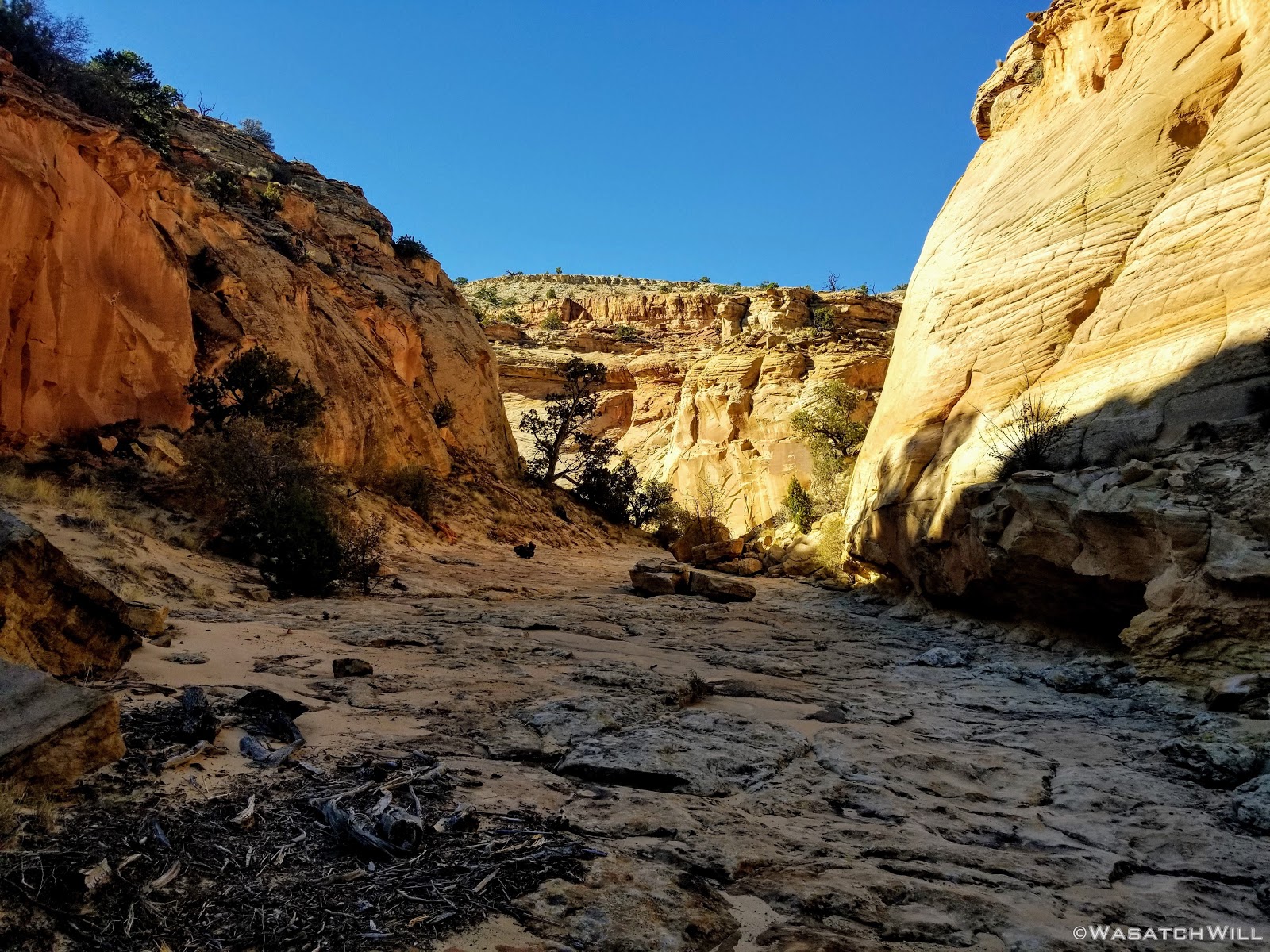
We descended down a chute to get to the wash in the canyon bottom where we followed it downstream, admiring the constantly changing textures and rock formations surrounding us.
Looking up to the ridge
Another pool
Myself, taking in the view out east (photo by Devin)
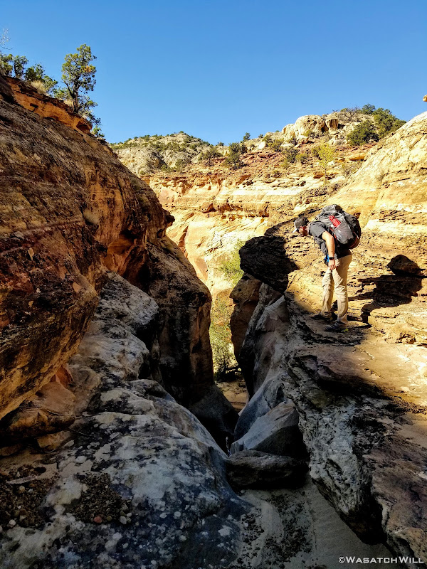
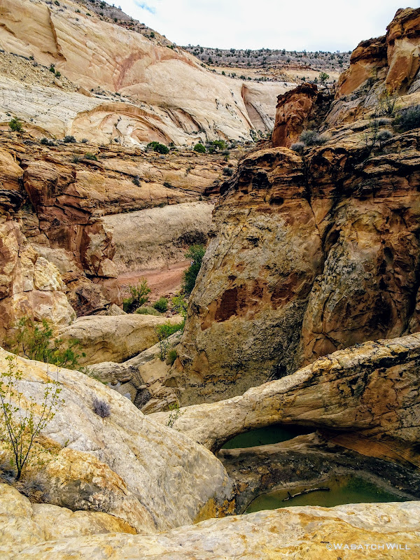
As we coursed our way down the wash, we ultimately hit what may well have been the most challenging obstacle for me of the entire trip. A pour-off that we anticipated having to bypass with some careful footing along the steep walls of the canyon.
Having only slept a couple hours the night before, my body was now feeling the fatigue of all the up and down we had done in the four to five miles we had come to reach this point. Halfway from the top of the dry-fall to the gulley that would lead us back down to the bottom, my legs started cramping up, both thighs and calves. I had to sit down in a little crevice and drop my pack to regain my composure. The exposure combined with the leg cramps really started to do a number on my mind.
Devin remained surprisingly nimble as he moved along the canyon wall toward the top of the gulley we were targeting. Seeing how shaken I was, he made himself a saint by completing the challenging traverse, dropping his pack, then coming back to take mine. After the brief rest and without the burden of my own pack, I was able to finish the traverse with my legs feeling much more stable again.
Having successfully made it across the daring traverse and then down the steep gully off to the side, we arrived at the bottom of the dry-fall that so wrangled my mind. Of course, it taunted me by looking a lot less intimidating from below than it did from above. I'm not sure why I didn't take a photo of it but I did get some video and settled on a still from that to show it off.

Video still of the dry-fall
Still a mile and a half away from where we desired to camp, we continued to push ahead. Unfortunately, the complications getting past the dry-fall set us behind our schedule considerably. Now the final hour of daylight was upon us.
Continuing on down canyon
About a half mile further down the wash, we had yet another ridge to crest over into the next canyon. Realizing that finishing out the final mile we had planned for, which included yet another bit of a climb to bypass a narrow slot section featuring another series of pour-offs, would probably result in some hiking in the dark and most certainly setting up camp in the dark, we opted to call it good right there at the top of the ridge we were on and make up the additional mile the next day. Thankfully, between the two of us, we had an adequate water supply to make a dry camp doable.
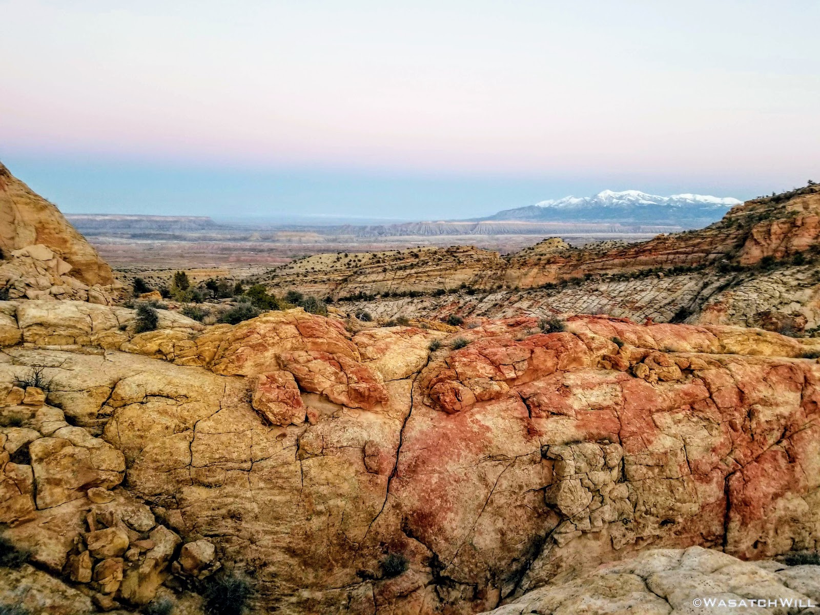
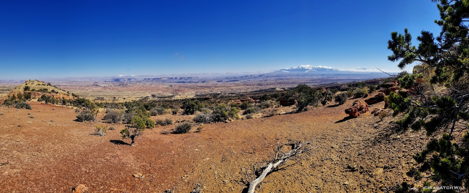
That and we simply couldn't pass up setting up camp with the views we now had, including that of the Henry Mountains out in the distance. From now until the final day of our trip, they'd be a common sight for us out to the east.
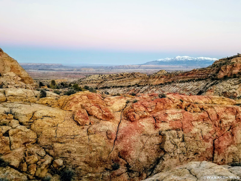
The Henry Mountains come into view
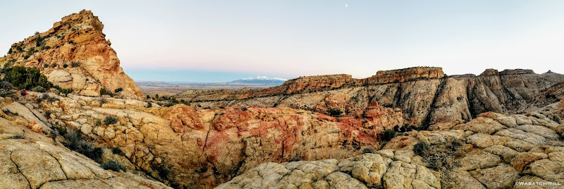
Panorama atop the ridge
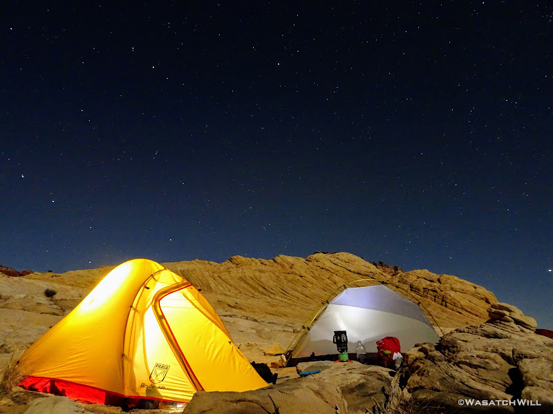
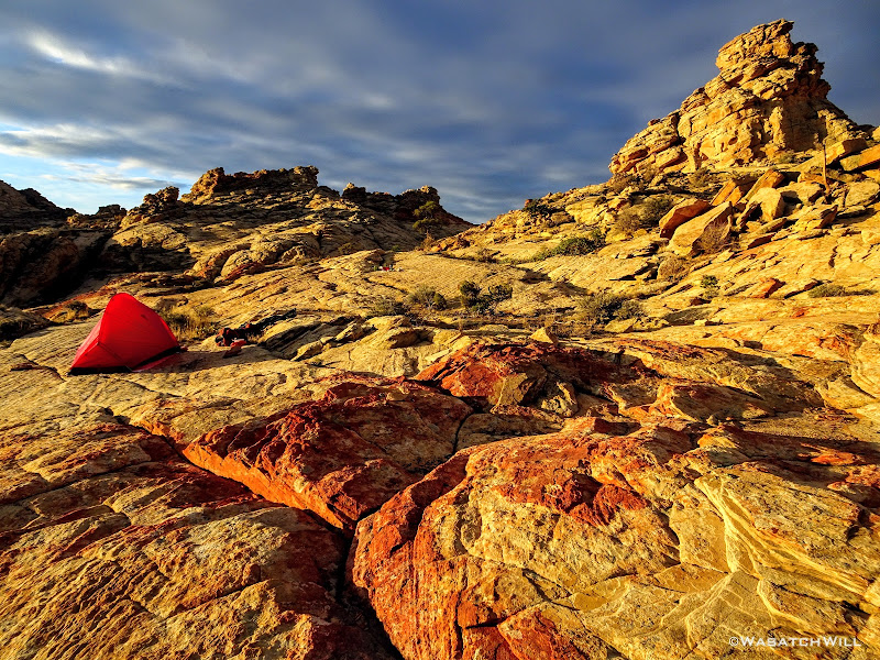
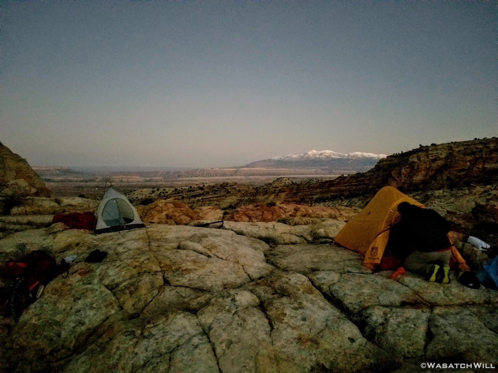
Down went our packs. Up went our tents.

Camp
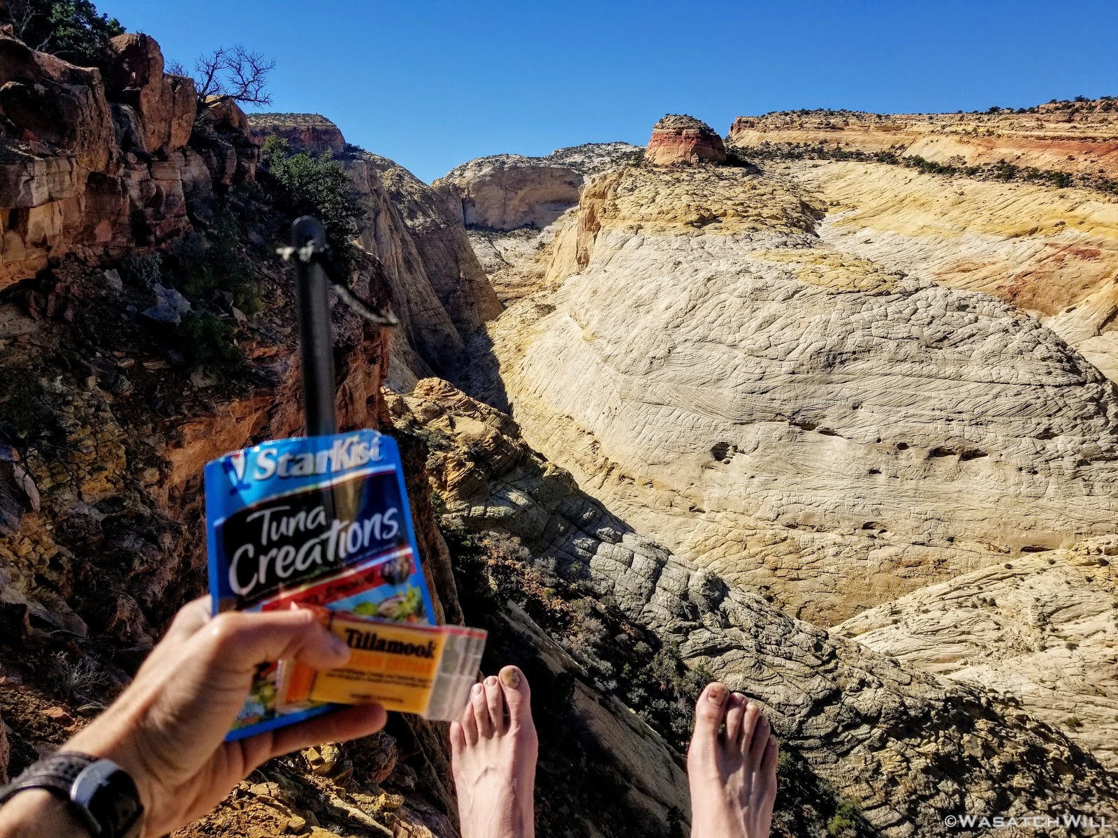
Moments later, we were enveloped by darkness. Dinner featured a new meal for me in the backcountry. Peak Refuel's Sweet Pork and Rice, along with some tortillas and some fresh spinach I had packed along all made for some fine wraps. This was my first time eating a meal by Peak Refuel, and it was quite good.
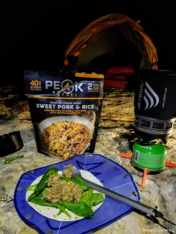
Dinner
Now completely exhausted, we spared no time cleaning up after dinner and getting into our respective tents and warm bags to close out day one.
Day 2
Friday - October 19, 2018
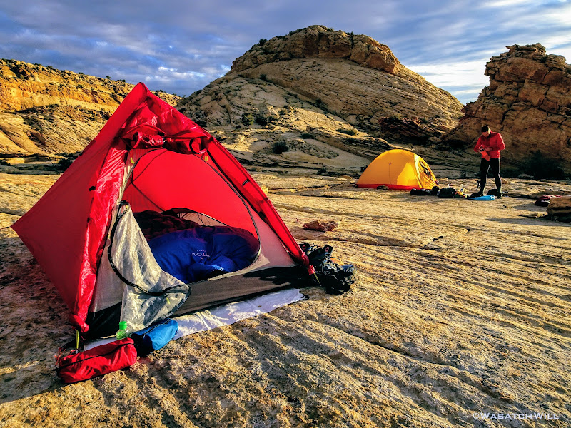
Day two greeted us with clear skies while some frost had graced some of our gear. Once the sun was out, we jumped out and cooked up a quick hot breakfast.
Morning at camp
View of the Sun over the Henry Mountains from camp

Another angle of camp
It didn't take long for the rising sun to dissipate the cold air away. With the extra mile to make up it was now set to be our longest milage day of the trip with the promise of another major obstacle, a wader through a short slot, that was on the agenda. The plan was to get through that then up to a camp where we could set out wet clothes to dry in the sun before it got too low in the sky.
Time to get moving.
Devin takes in the view of the Henrys as we leave camp
The canyon we must descend down into

Looking up canyon
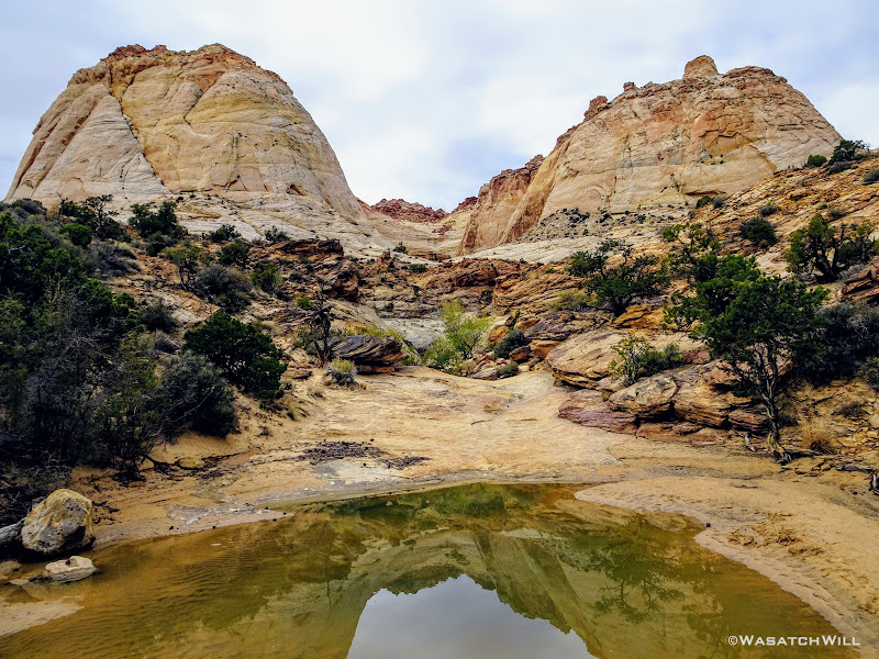
After making up the mile we missed out on the day before, we stopped to refill our now empty water bottles from one of the many water holes throughout the area we had originally planned to camp the night before. A fine camp it would have been too, sans the big views.
A pothole in the area we originally planned to camp, with Devin in the distance
Reflecting pool
From just below all the water holes we exited the canyon via another ridge line. This time we'd gain it right from its start at a big bend in the canyon we had just come down and at the edge of another massive series of pour-offs.
Devin scopes out another pour-off
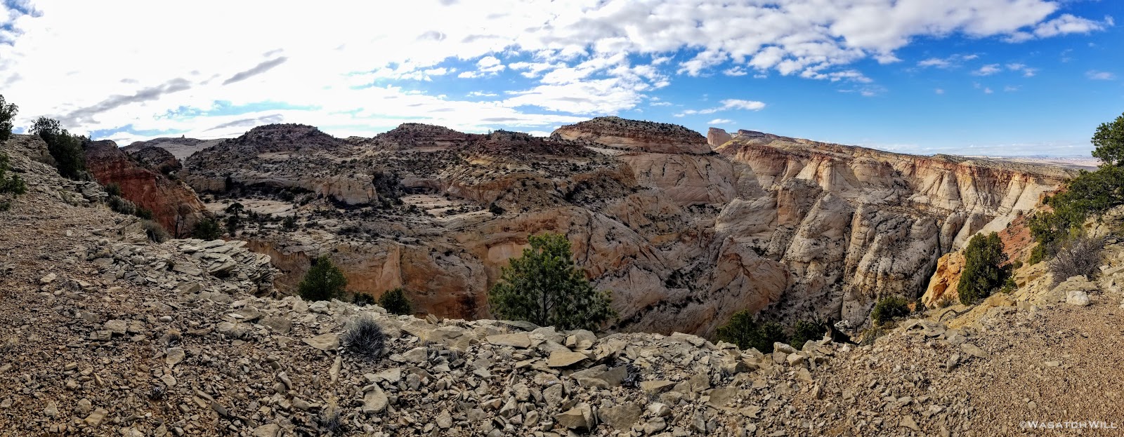
For the next mile and a half, we'd be riding high above the surrounding canyons, gaining a thousand feet of elevation in the process.
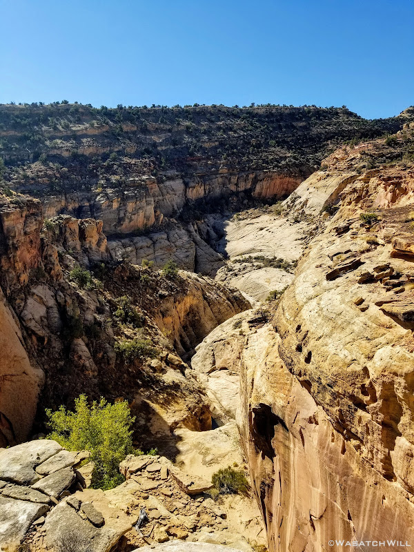
Looking down the drainage past the pour-off
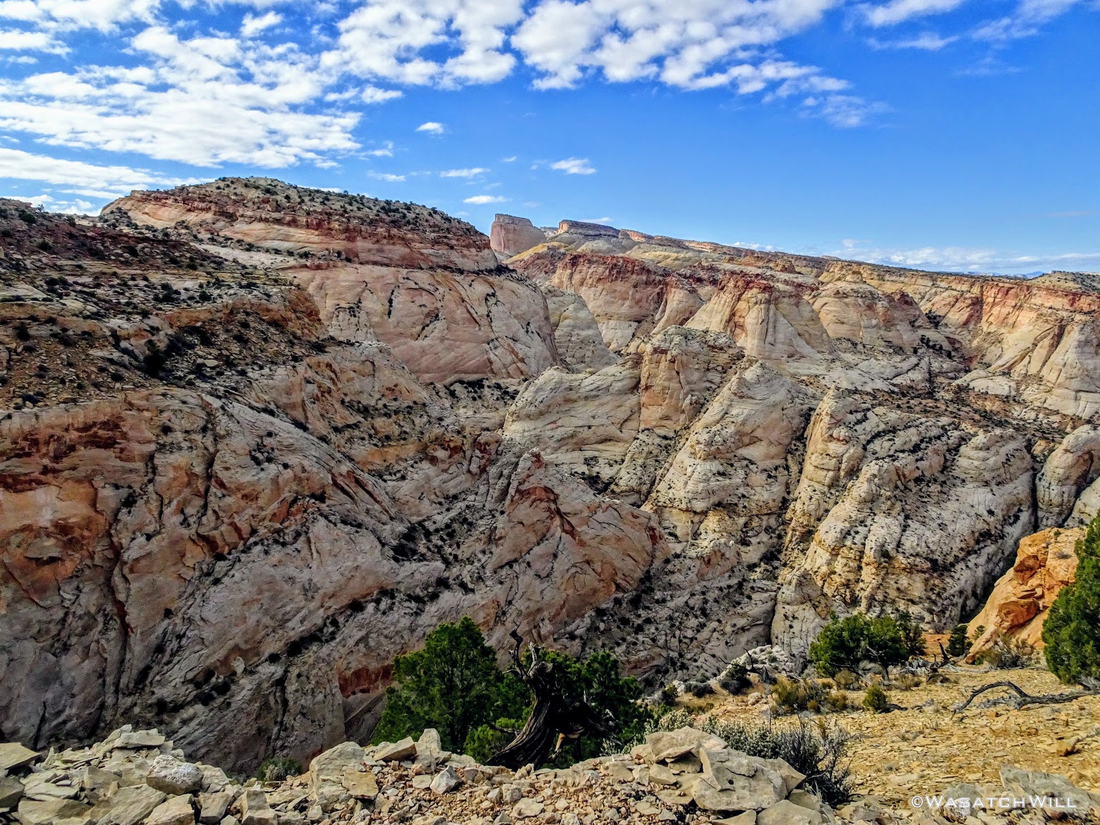
Waterpocket Fold

Zooming in on where we camped (center)
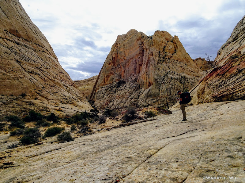
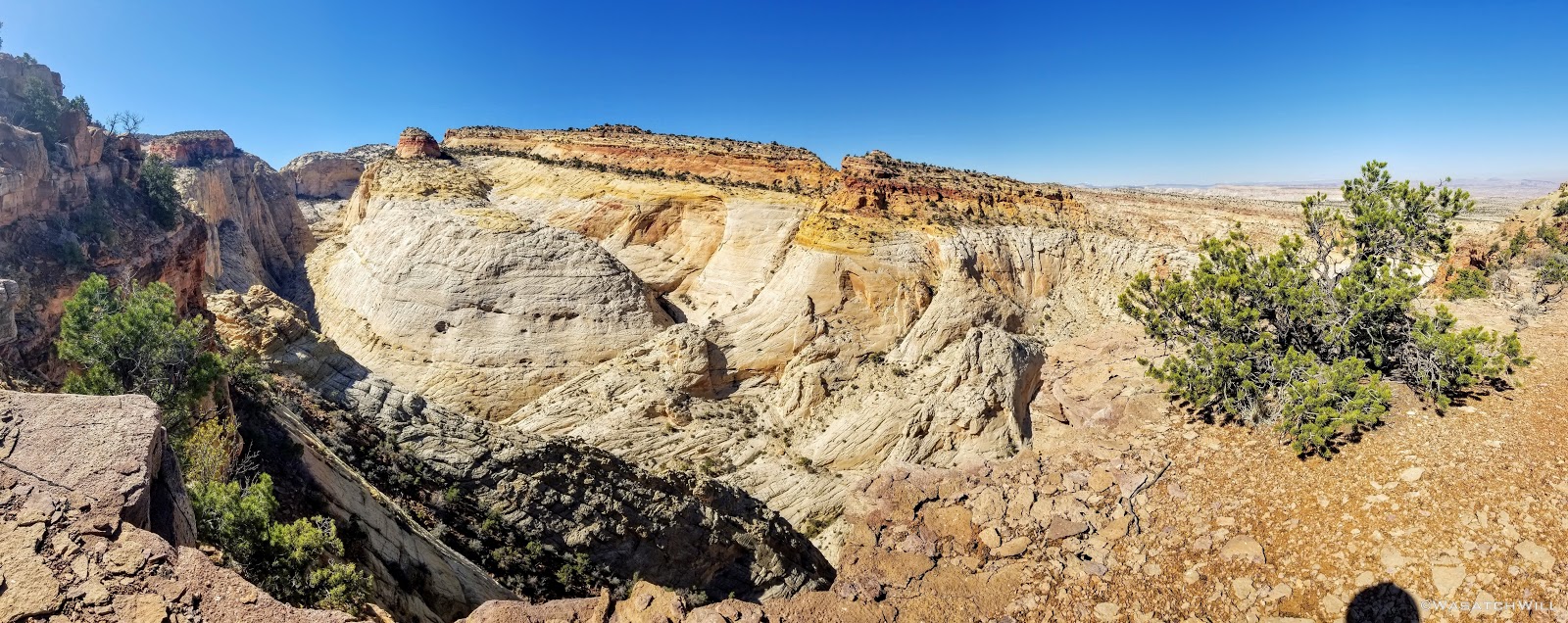
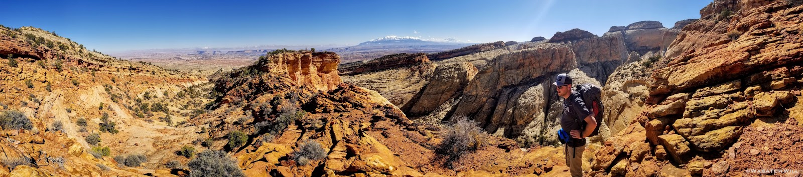
We eventually topped out where the rim we were on bends back like a horseshoe, revealing the head of the canyon we had exited further back. I have never been to Zion National Park, but I was told by Devin that the views along the rim we were now looking over rivaled those of Zion. One day I'll finally get down there so I can compare for myself. In the meantime, we'd now sit for lunch and enjoy our views of this desert heaven.

Rim Pano
Lunch and a view

Eastern Pano
Well rested and well fed, we saddled up again to begin our descent down the other side of the rim into yet the next canyon over. In a matter of a few minutes, we were once again peering down into that next canyon, and once again, we were made speechless with draw-dropping views.
Pano with Devin on rim descent
View down into into next canyon
Selfie Stop
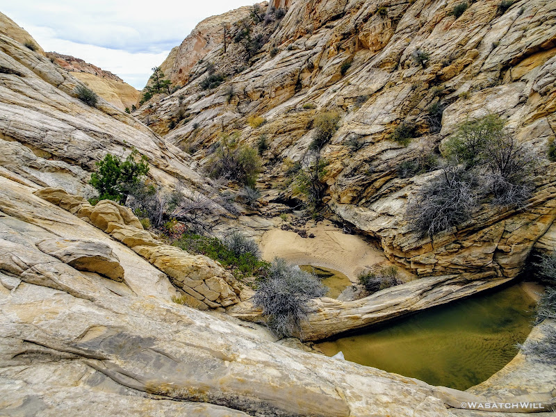
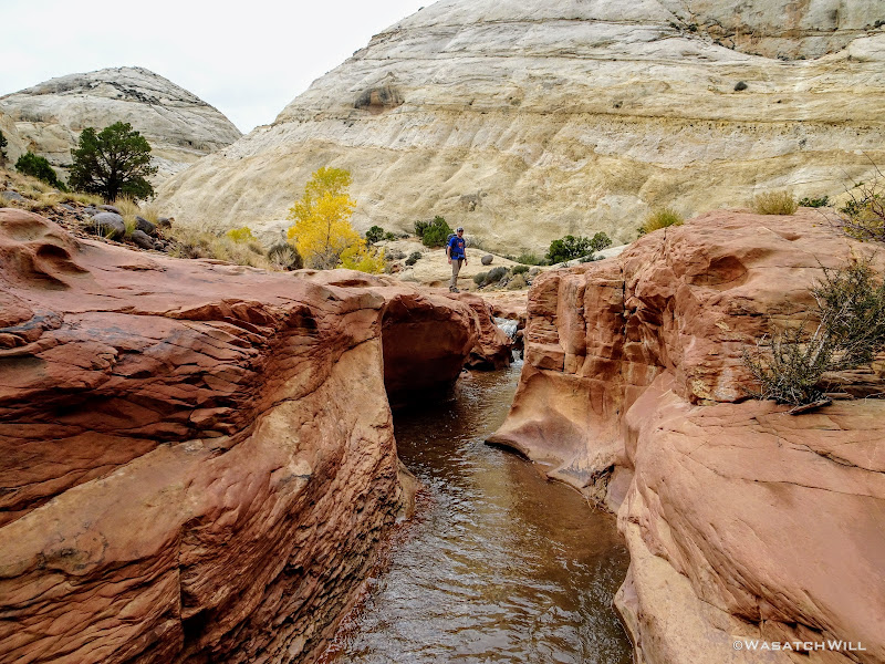
Once past those views, it was a relatively straight forward and uneventful 2 mile descent down 1400 feet of elevation to that next canyon bottom's wash via a small tributary drainage from the rim. Once in the wash, we continued to follow it eastward for a bit before exiting that one for a large tributary drainage across the other side of the main wash. Once again, water sources became plentiful.

Heading up another tributary drainage
Heading up the "wader" canyon
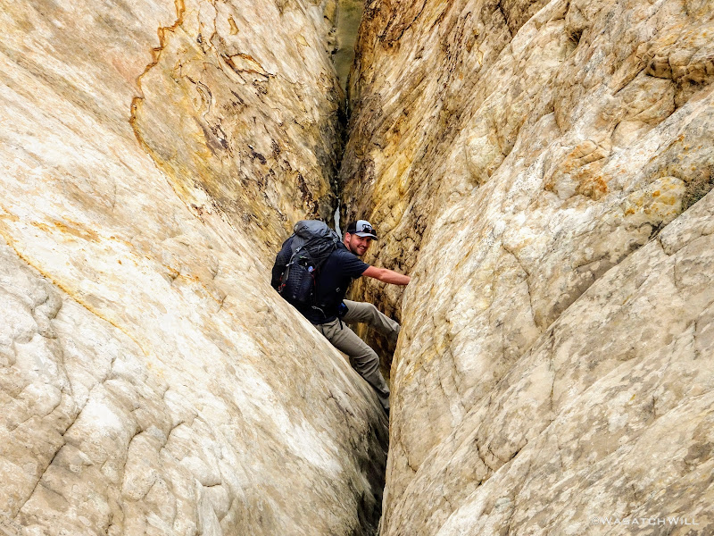
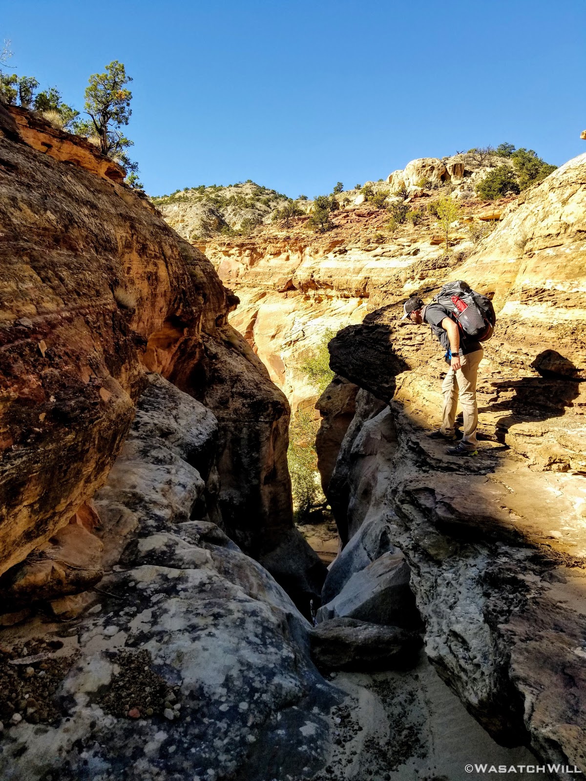
This particular drainage held the dreaded wader. We dreaded it because it can allegedly be a swimmer, or at least chest high, at times, depending on recent rains, floods, and the ever changing conditions some slot canyons can present from year to year. Thus, we did not know if we'd actually just be wading in waste high water, or if it'd be deeper given the recent storms that had passed through in recent weeks. In drier times, it's cold factor can be much less threatening becoming as shallow as only knee-depth.
But before we could find all that out, we'd be a faced with a few other obstacles that required us to navigate around, including another slot that had some chockstones and mud pots (potential quicksand traps) we didn't want to mess with. To bypass it, we found a ramp to take us up to a bench high up along the canyon wall.
Upper bench bypass
We followed that bench for a bit until we were able to find what seemed to be the only viable way back down, a steep chute with some patches of loose rock and a little bit of bushwhacking.
We made it back down to the canyon bottom without harm. It really did feel like an accomplishment to get back down.
The rocky chute (center) we descended from the upper bench
As luck would have it though, just minutes after reaching the canyon bottom again, we encountered an unexpected wader before the expected one. Being caught off guard, we plunged right through what became the "warm-up wader" (yes, that's an oxy-moron), not thinking to put on the actual water shoes I had brought for just the occasion. Oops! Fortunately, it was only knee-deep at various points.
"Warm-up" wader
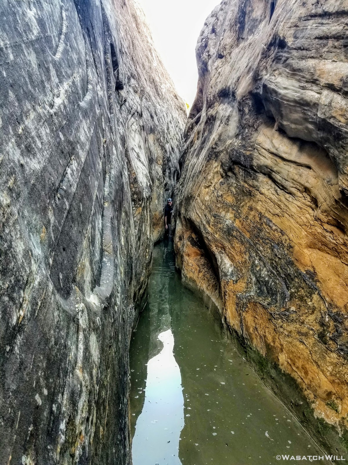
Now with cold soaken feet, we made the final approach to the big wader ahead. It looked ominous indeed. We knew it would be cold as was confirmed by shallow wader we just passed through, but how deep did this next one went was still big on our minds.
Devin and I stared each other down. Who would be the brave soul to go first and scout it out? I was about to suggest a duel of Rock, Paper, Scissors when Devin volunteered.
He dropped his pack and forged ahead. I offered over one of my trekking poles (he brought none) to help him gauge the depth ahead of each step. Fortunately, it got no worse than waist deep before reaching the end of it about 50 feet away where a couple of chockstones allowed a passage up between them.
"YEP, WE CAN DO IT!" Devin cried out.
"WOOO!" I responded.
Had it become too much, I had an alternate detour that would have routed us back down near the other end of the canyon and then cross country over less exciting terrain to get out to Capitol Wash for the next day. Thankfully, it did not come to that

The expected wader, with Devin at other end (center)
I proceeded to ferry our packs to the other end where we collaborated about another obstacle immediately after the chockstones.
What was not anticipated here was another pool of water sitting immediately on the other side of the chockstones, the surface of this one being a few feet higher than the one we just waded through. It was apparent that the lower chockstone and whatever sediment beneath it had teamed up to make quite a little dam. Devin was unable to make contact with the bottom of this pool with the pole. We wagered it was at least neck deep or more. Fortunately it wasn't nearly as long, maybe only 10 to 15 or so feet to the other end of it and the canyon walls were now close enough to allow us to simply employ some stem and chimney moves to get over it. Again packs were handed off to advance them forward.
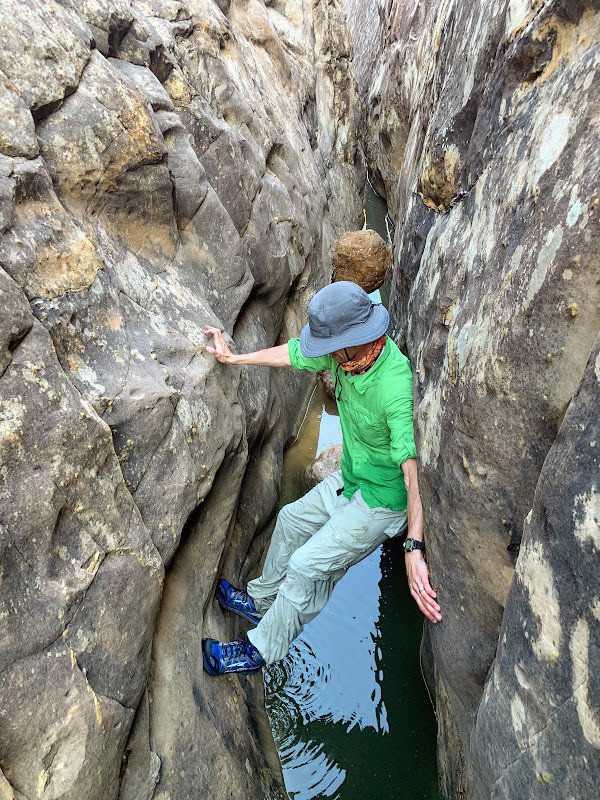
Myself, chimneying over the upper pool above the wader (photo courtesy of Devin)
Looking down canyon from the end of the upper pool
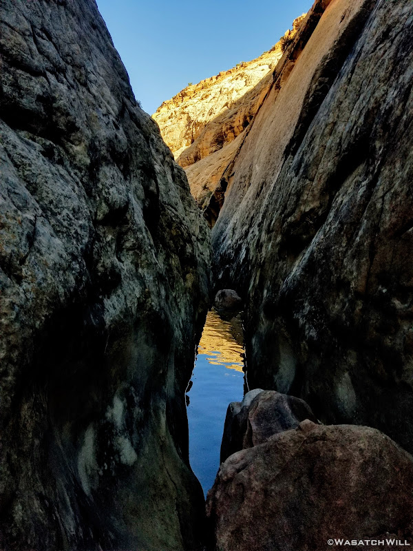
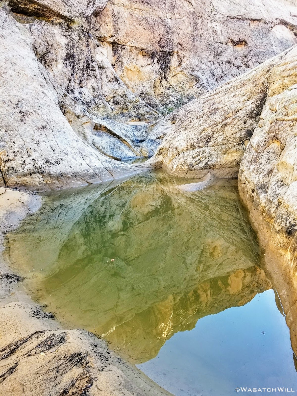
After reaching the barrier at the other end of the 2nd pool, we were greeted with a 3rd and final pool right after, the last being another shallow wader, thankfully just over knee high at its deepest, before we were done with the waders for good.
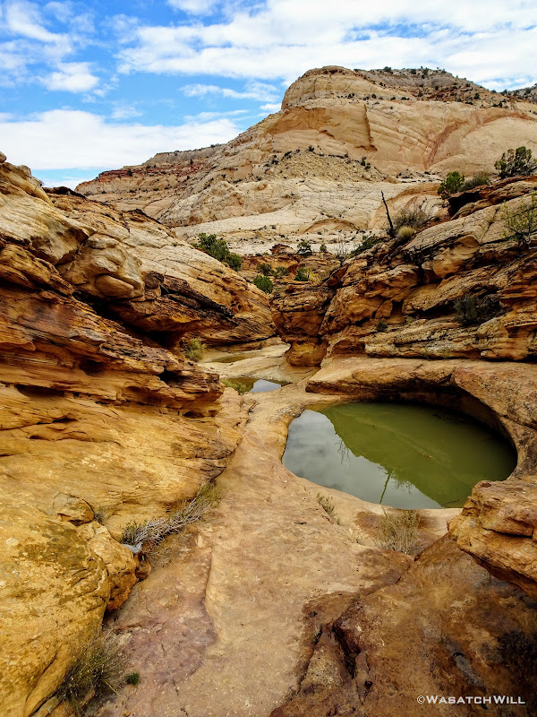
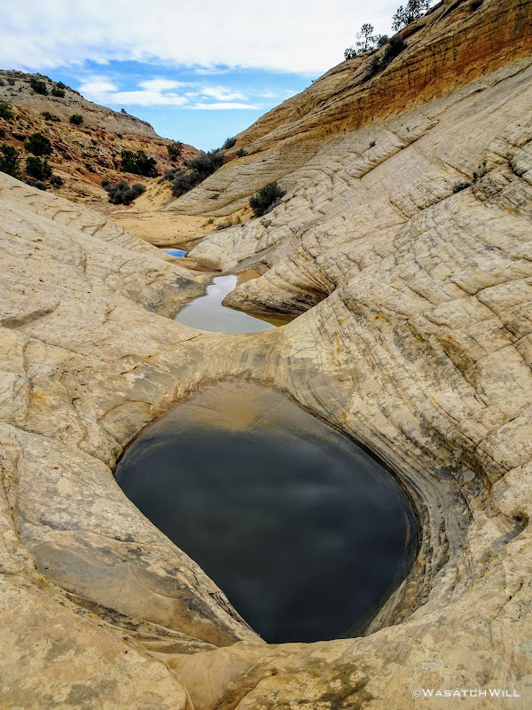
Unfortunately it was later in the day now that what we had wanted and the sun was starting to drop fast. We were now very close to where we wanted to camp for the night though, the only other obstacle standing in the way now being a steep scramble up a high gulley to what Steve Howe named Rabbit Ears Pass that would drop us into yet another canyon over. Before proceeding up to the pass though, we paused to top off our water reserves among another series of waterpockets within a bed of sandstone knowing that there was a good chance the area we wanted to camp at would be another dry camp.
A series of waterpockets
A few minutes up canyon from where we loaded up on water, we beheld the high pass. Earlier in the day, it wouldn't have looked so intimidating, but being near the end of the day, it now looked ominous. Still, we knew it'd be worth it to make camp on the other side though, so up we went, employing more teamwork at some various spots to get over some of the bigger boulders lying in the way.

Rabbit Ears Pass
After a good half hour or so of scrambling, we finally reached the top, where we could gaze down into Blow Sand Canyon, another informal name by Steve Howe. This had been billed in the write ups as another spot along the route surrounded by blissful scenery.
First look into Blow Sand Canyon
Looking back down what we had just climbed up confirmed it was no small feat.
Looking back down Rabbit Ears Pass and what we just climbed up
Fortunately, the descent down into Blow Sand Canyon was much less of a descent.

Looking up Blow Sand Canyon
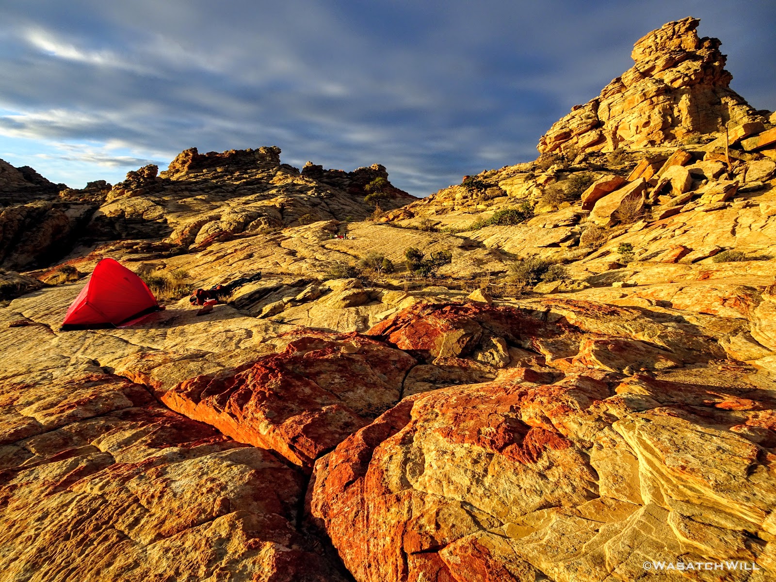
We proceeded to the lower edge of the flat and then wandered up some slickrock slopes where we found a space just level enough to comfortably accommodate our two tents. Yet again, we were rewarded with a jackpot of views.
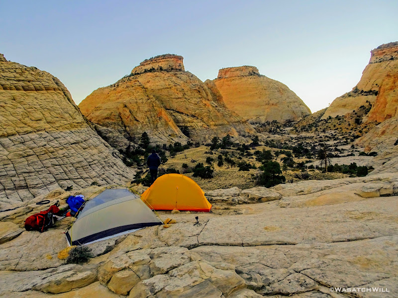
Our camp above Blow Sand Canyon
Looking east over our camp

Moon rise over camp
The next picture reveals a UFO that flew over head during dinner. (Ok, it was really a lens flare.)

Dinner and UFO
It was a nearly full moon, so we spent some time after dinner seeing what some long exposures could pick up with our cameras. After some play time with our cameras, we crawled into our tents for another night of well deserved rest.
Night glow
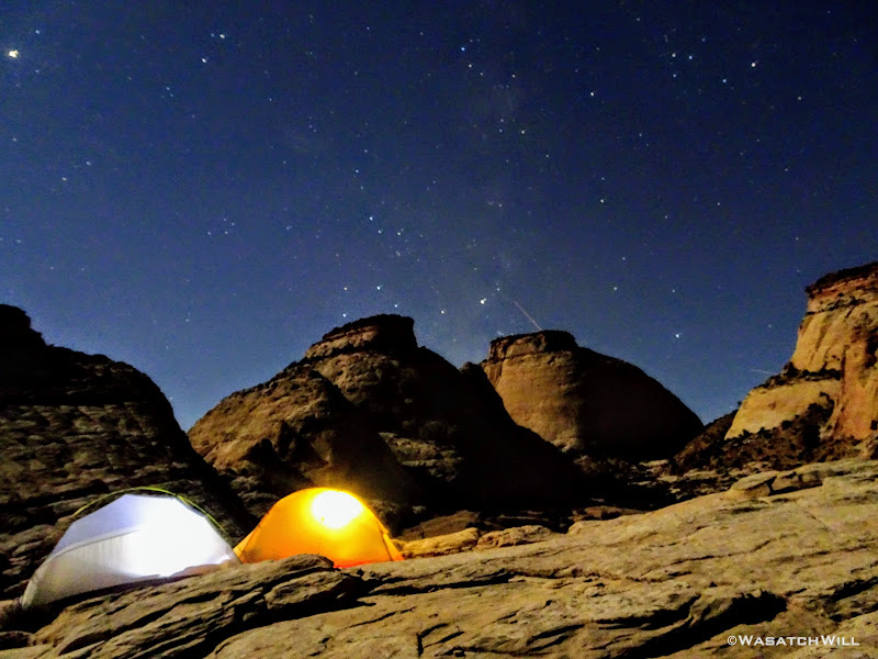
A bit of Milky Way made it into this shot
Day 3
Saturday - October 20, 2018
Day three opened with clear skies once again but unlike the previous day, they would not last for long.

Dawn at camp
Looking west over camp
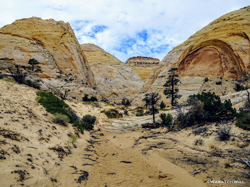
We broke camp and moved on back down into and through the flat.
Heading through the flat
Our route would take us over yet another pass into yet another canyon.
Up another pass
Clouds were gathering and darkening ahead of us to the south.

Looking south from the top of the pass
Bluebird skies persisted behind us.

Looking back down into Blow Sand Canyon from the pass
Down off the pass, we were spoiled with yet another spectacular sight before us.
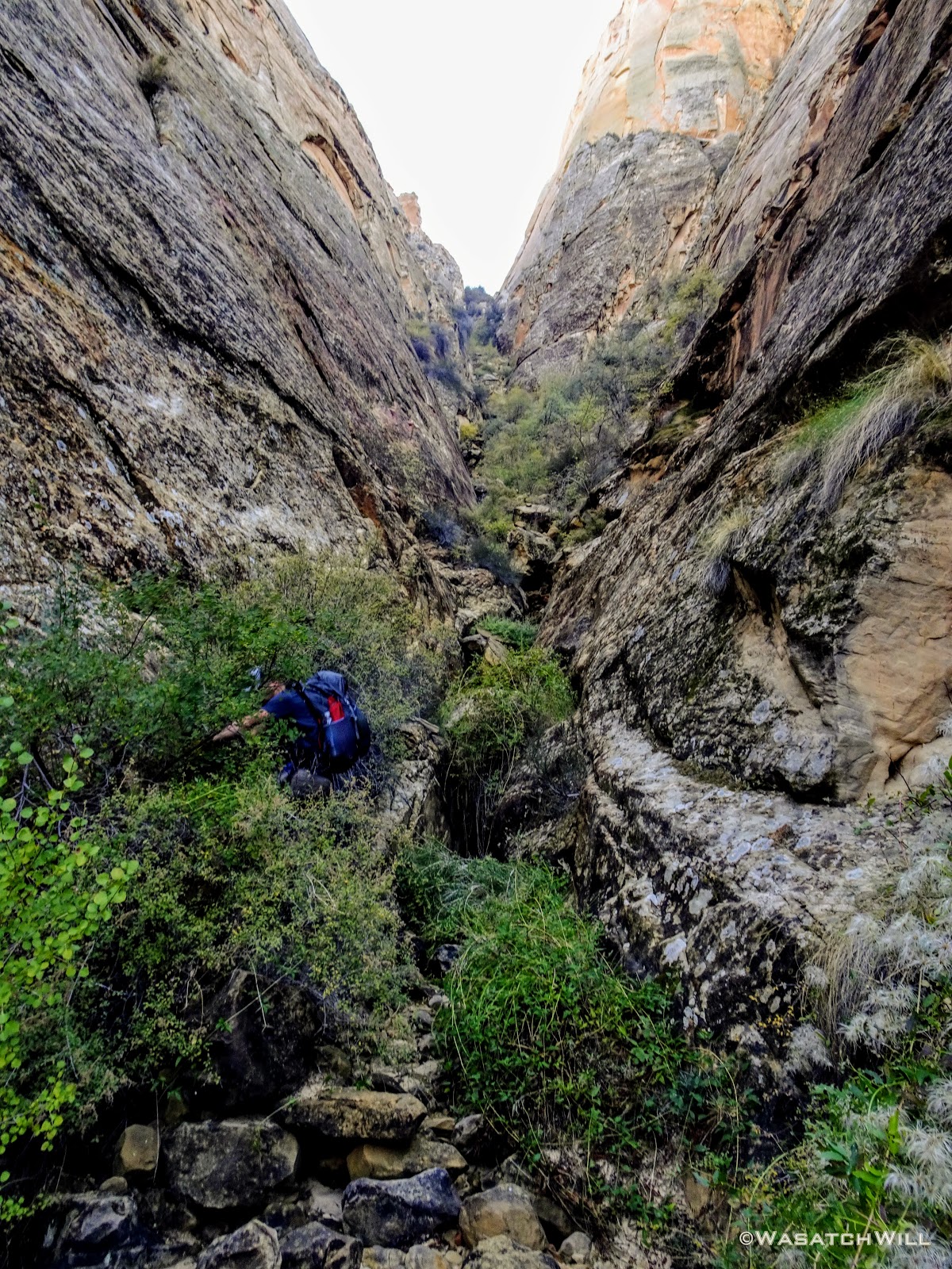
Myself, taking in the view down the canyon to descend
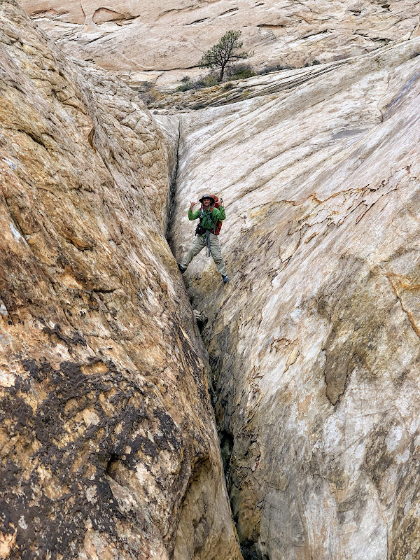
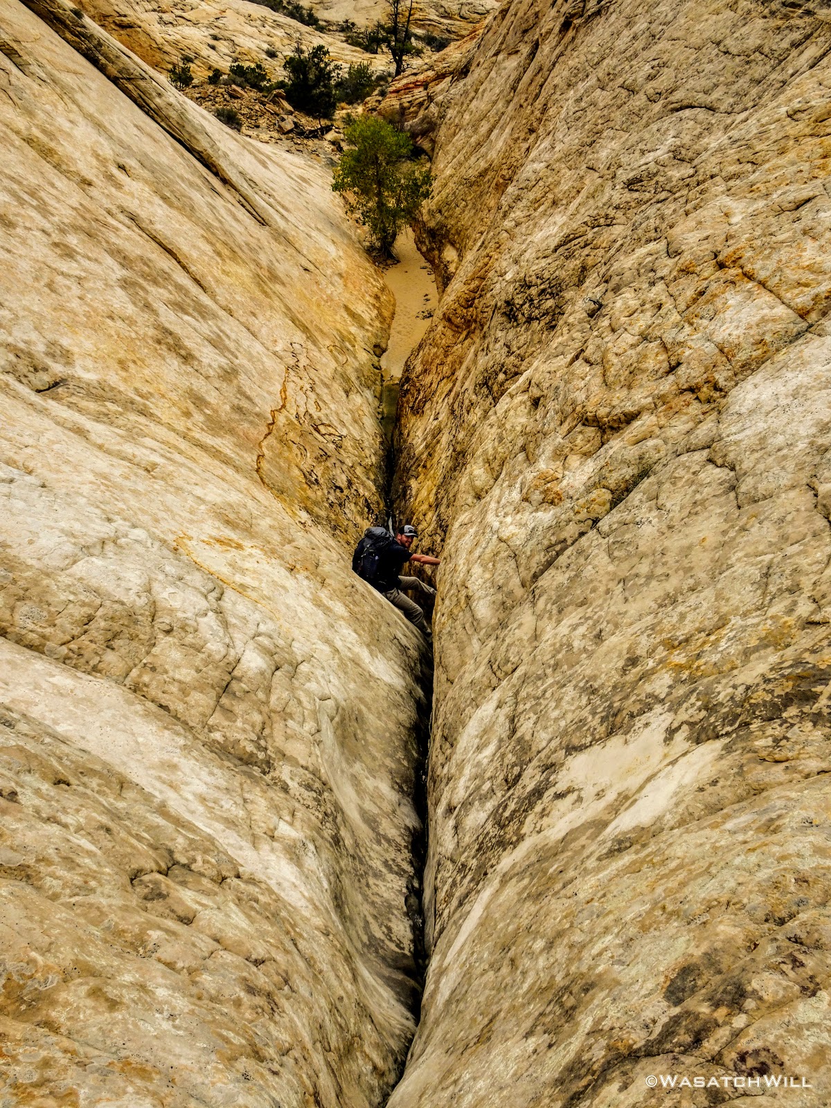
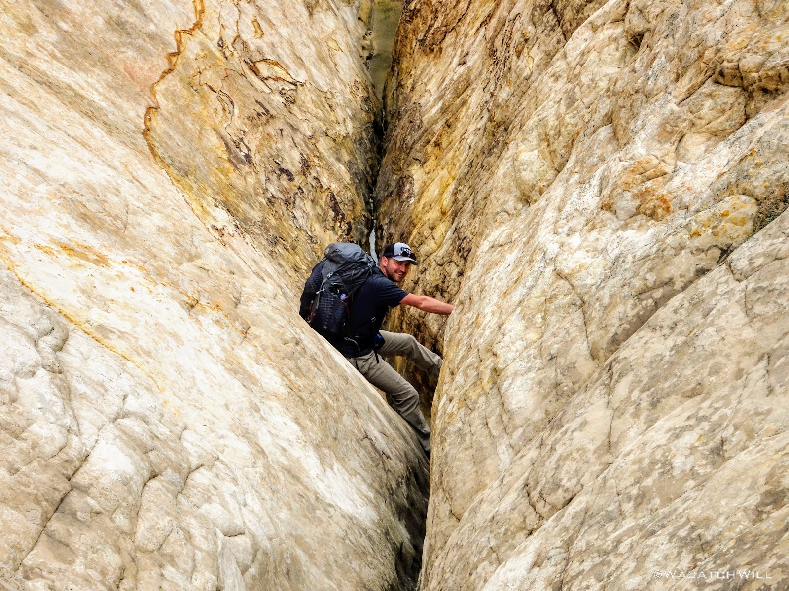
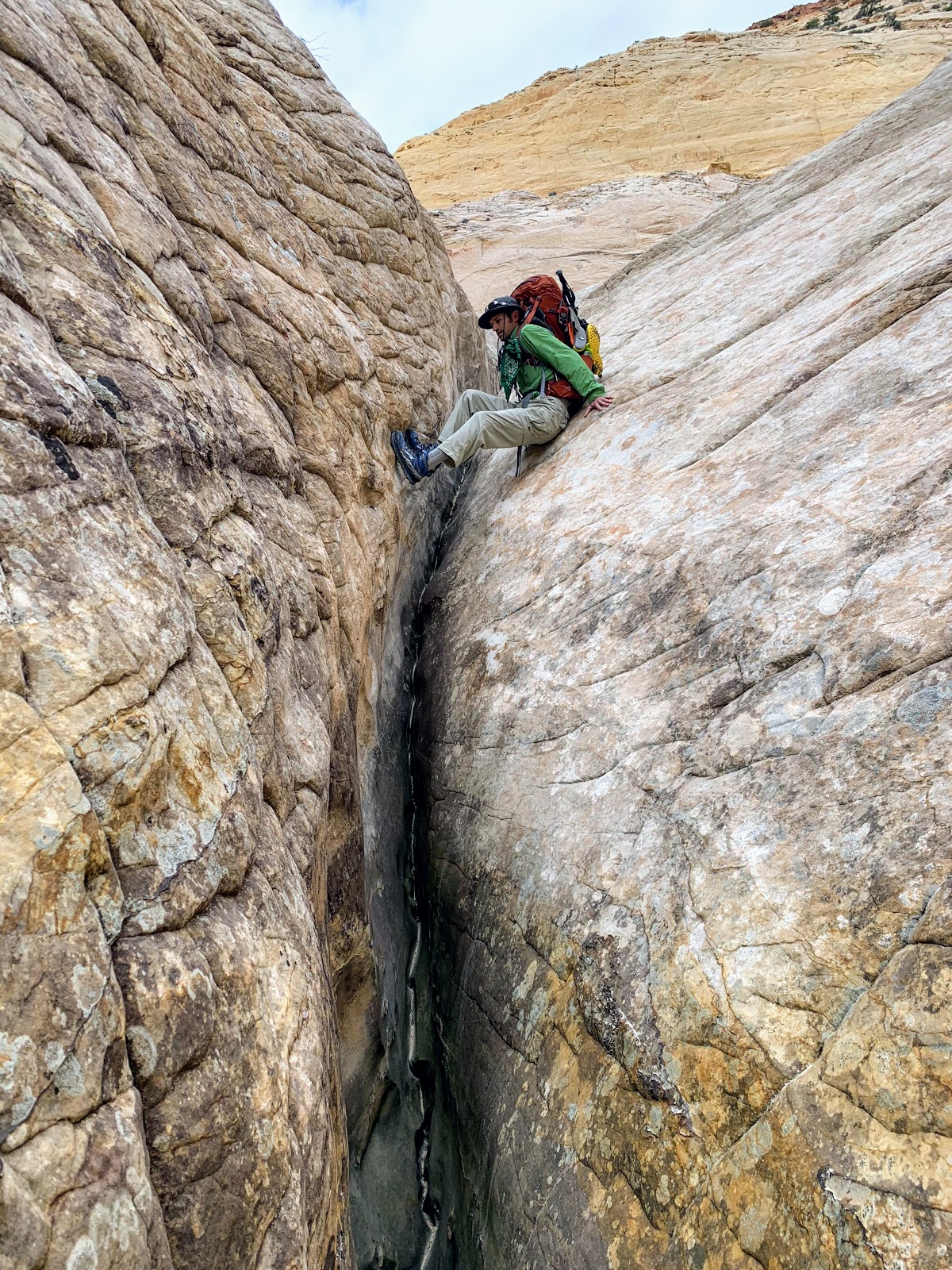
Just below us lied the last major obstacle of the route, a gathering of the canyon walls into a steep and narrow crevice, a feature that had also received an informal name from Steve Howe: The Butt Crack. With much less hesitation than shown at the big wader the day before, Devin once again volunteered to go down first. He's adventurous like that. Employing more stem and chimney moves enabled a safe descent down through the crack. We suppressed our middle-school minds to keep the jokes from becoming too obnoxious. Perhaps though, it would be fitting to name this whole canyon "Butt Crack Canyon".

Devin taking on the 'Butt Crack'
Devin, closer up

Myself, beginning the descent down the crack (photo courtesy of Devin)
Pausing for a stem shot (photo courtesy of Devin)
Once at the bottom of the crack, I was now on familiar ground. In preparation for the time I'd be able do this route, I had come up to to the bottom of this Butt Crack earlier in the spring to scout out the terrain up to that point, including a bypass over the biggest pour-off yet to come further down the canyon while out on a day hike in the area with my wife and youngest daughter. So, for the rest of the route onward, I'd now be retracing foot steps I had taken in the past. For Devin, the rest of the route ahead of us would largely continue to be his first time traveling it.
Butt Crack (May 2018)
Passing clouds continued to threaten us with some light showers but nothing ever came of it as we finished out our descent down through the canyon.
Devin standing further down canyon with clouds looming above
A pool to bypass along the canyon descent
Looking up canyon
The Henry Mountains come into view down canyon

The Henry Mountains closer up on the horizon
Devin continues the descent down the canyon
A little emerald pool

A little emerald pool, closer up
As we rounded a bend in the lower half of the canyon, Capitol Gorge came into view.
Capitol Gorge comes into view in the distance
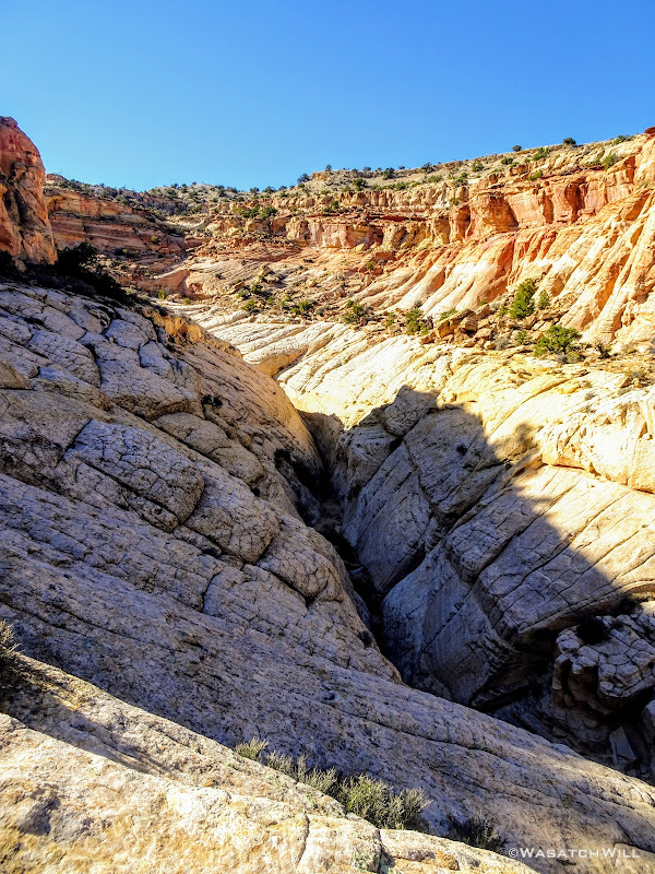
As mentioned just above, we had to bypass a great pour-off by scrambling a hill above the top of it to gain a small ledge that would swing us out to a large rock slide consisting of large boulders and lots of loose scree.
Standing above the big pour-off to be bypassed
The big pour-off (lower right) as seen along the bypass around it

Looking back up canyon at the pour-off and rock slide
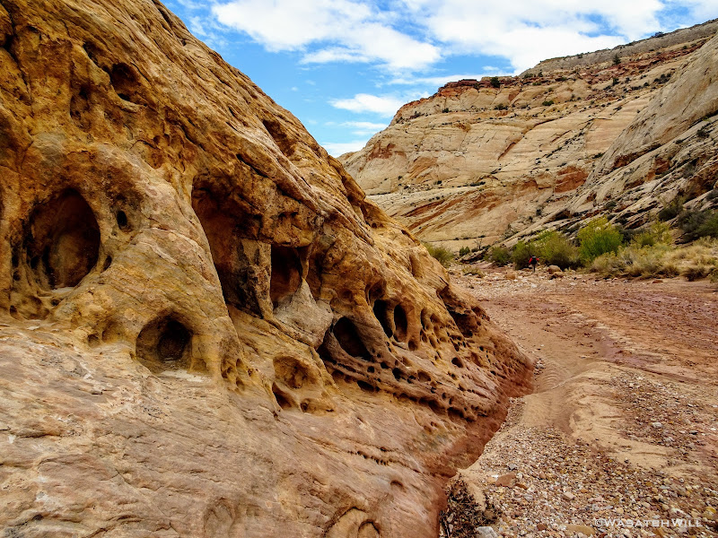
Having safely traversed the rock slide, we were back on solid ground as we followed a slick rock bench toward Capitol Gorge. We decided a stop at The Tanks was as good as any spot for lunch. Being Fall Break for all the state schools, we knew there'd be some crowds around, and sure enough, we greeted quite a few groups.
An upper pool at The Tanks
A pool at the Tanks
Full Tanks
Small bridge below The Tanks

Capitol Gorge Pano from The Tanks trail

Looking down Capitol Gorge from Tanks trail
Back down in Capitol Gorge we could have followed the parade of people up to the Capitol Gorge Trailhead and concluded our trip there. After all, this is where most of the few who've done the Beehive Traverse in the past concluded there respective trips. But with an extra night to spare, we planned another leg to our trip whereby we diverted away from the crowds once more and headed down canyon. Devin's mind was tripped up a bit by the sudden exposure to several dozen people around The Tanks over the course of the last hour, after having not seeing since we left the friendly confines of Grand Wash two days before. It really was quite an awakening. For me, it was my body that was tripped up by some slippery mud in the wash.
This extra leg of the trip would simply be a reverse of what I had done almost a year and a half prior. It was actually part of an extended version of the Beehive Traverse that Steve Howe had come up with as well. This leg would be a traverse up and across the rim of the Waterpocket Fold section lying between Capitol Gorge and Pleasant Creek.
Tafoni (Swiss Cheese Rock) in Capitol Gorge
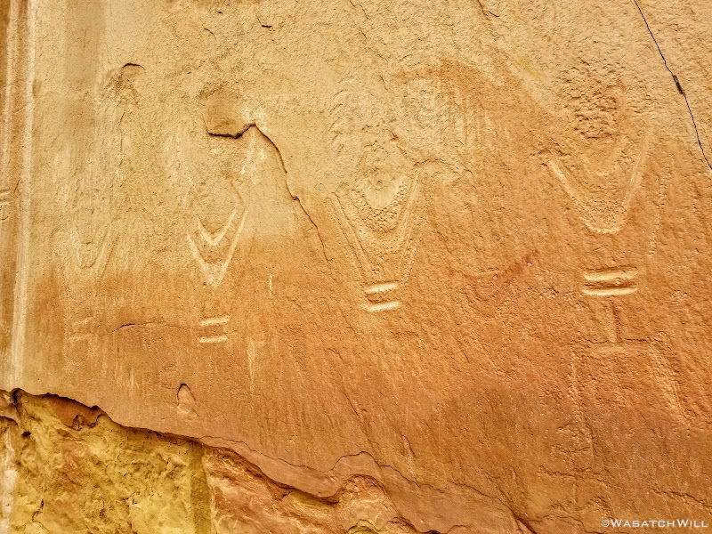
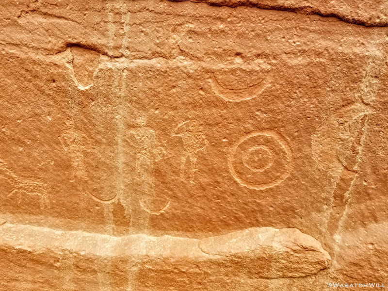
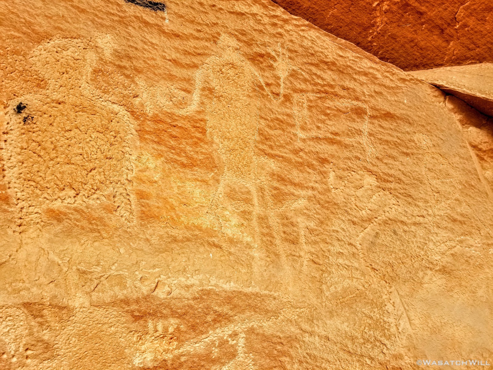
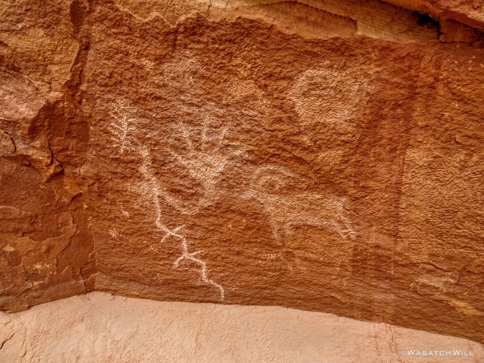
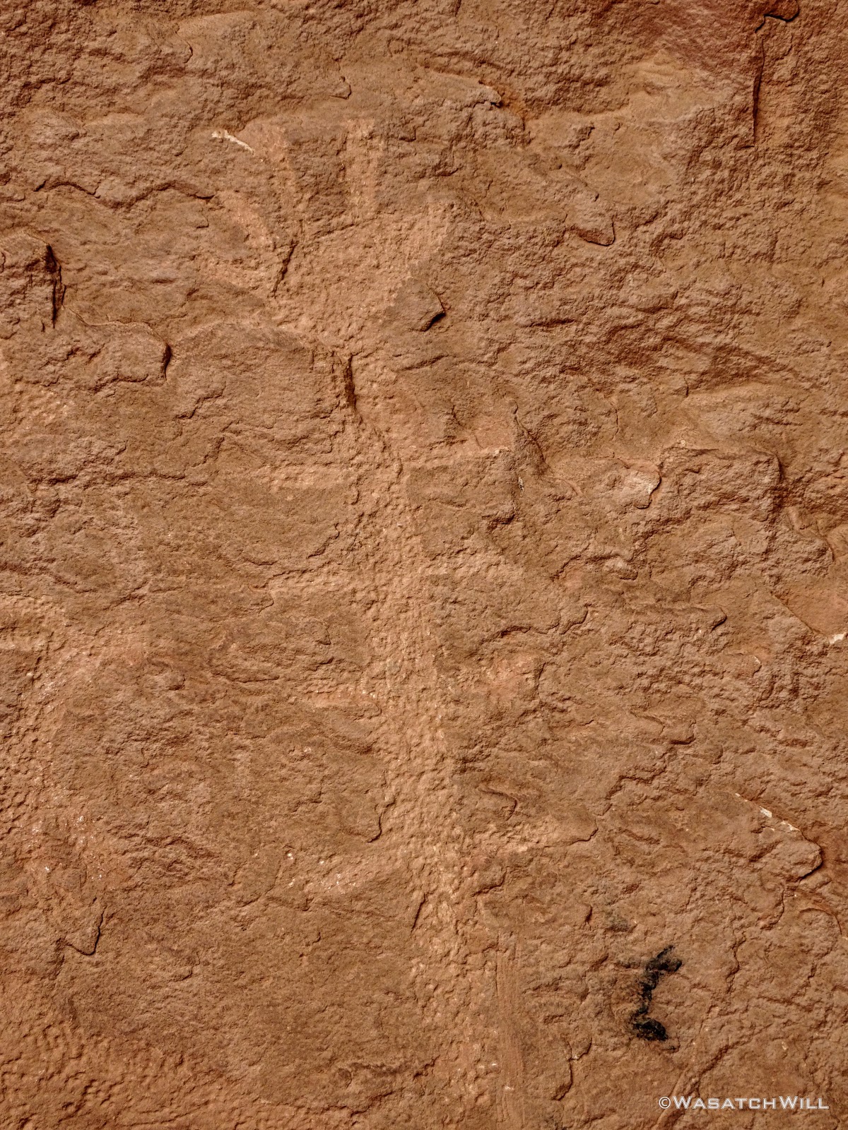
As we approached the tail end of the canyon, Devin noticed some graffiti up on a south-facing wall. We stopped for a moment to try and make it out better and immediately observed a petroglyph panel just to the side. Last time, I had come through the canyon, again, hiking in the opposite direction, I was in a bit of rush, and didn't think to look much for any rock art until arriving at the more well-known panels further up canyon. To get a closer look, we pulled ourselves up out of the wash and dropped our packs for another little break.
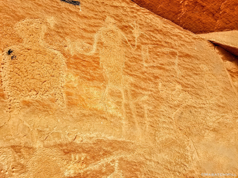
Petroglyphs (Barrier Canyon Style?)

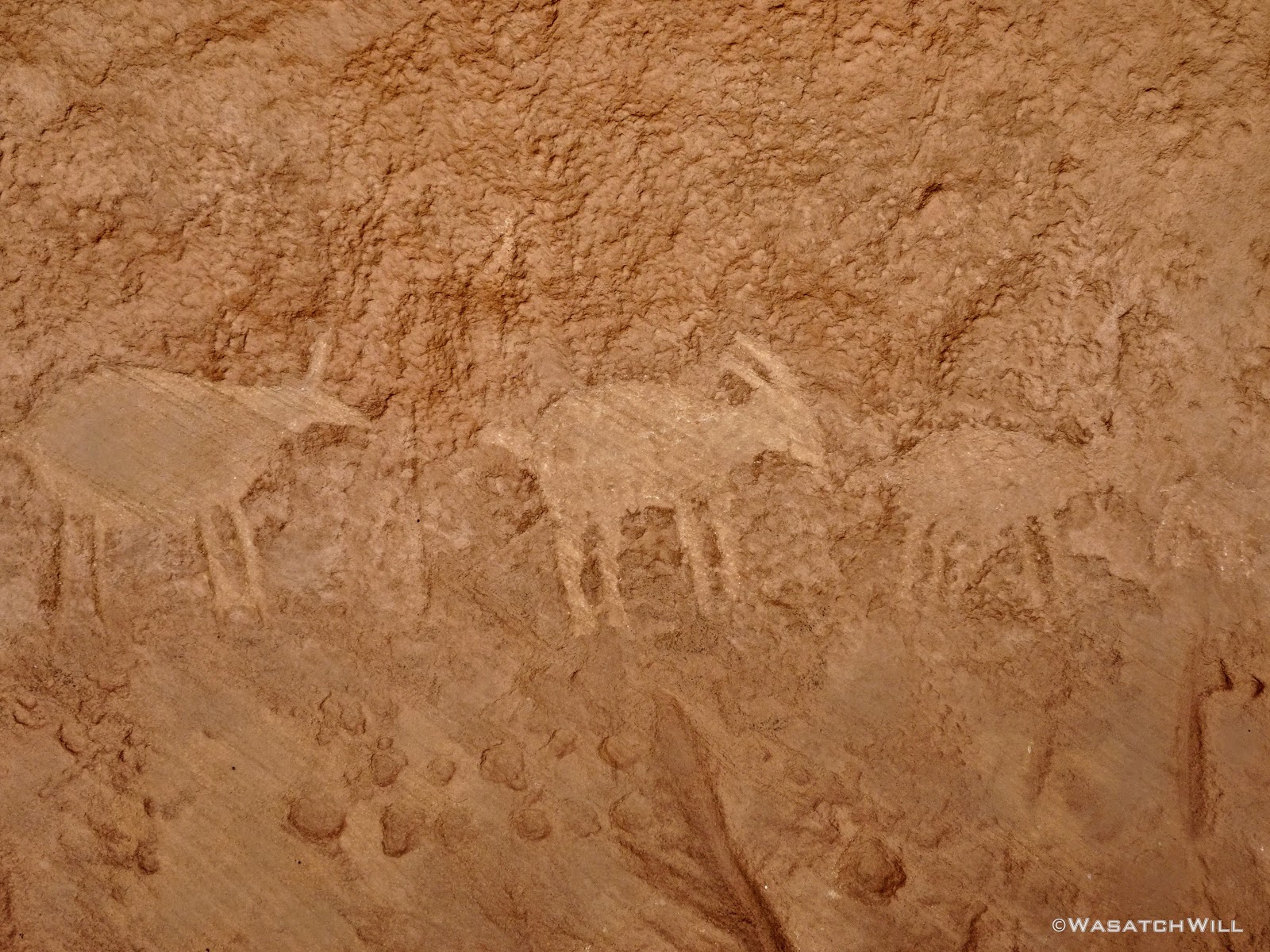
'Big Hand' and Sheep
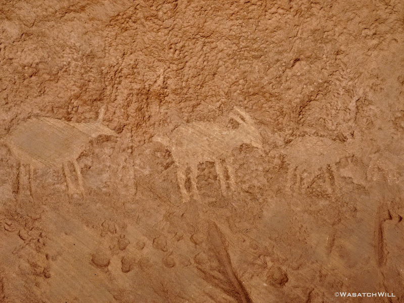
Deer?

Caterpillar?
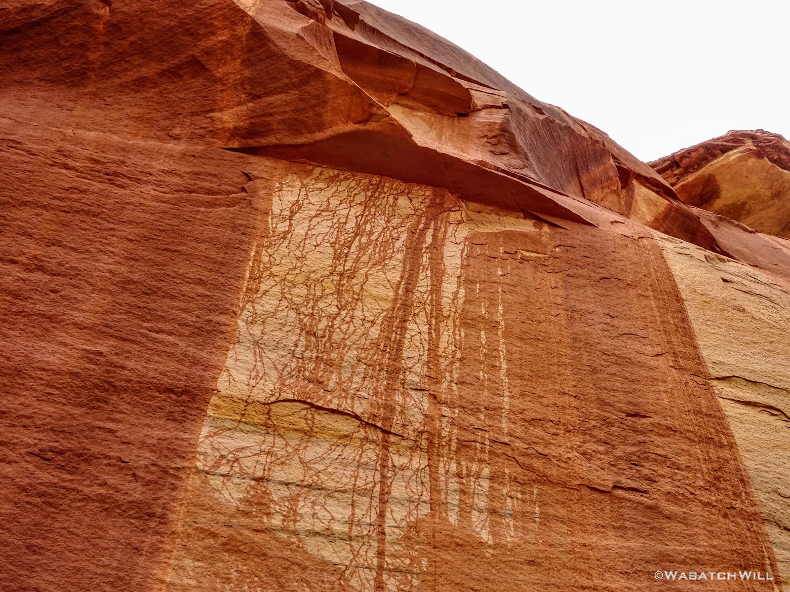
A bit further along the wall was some interesting streaks of desert varnish. It was as if the rock was alive with living veins or arteries of blood running through it.

Desert Varnish
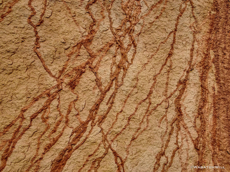
Organic veins
And on the other side of the streaky phenomenon, sat another panel of Fremont rock art.
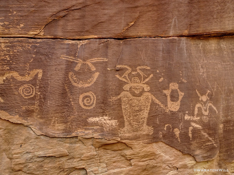
Fremont petroglyphs
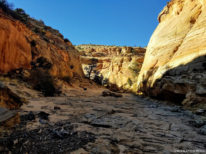
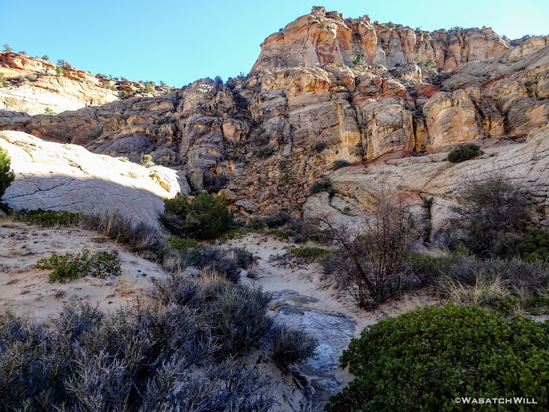
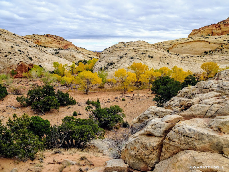
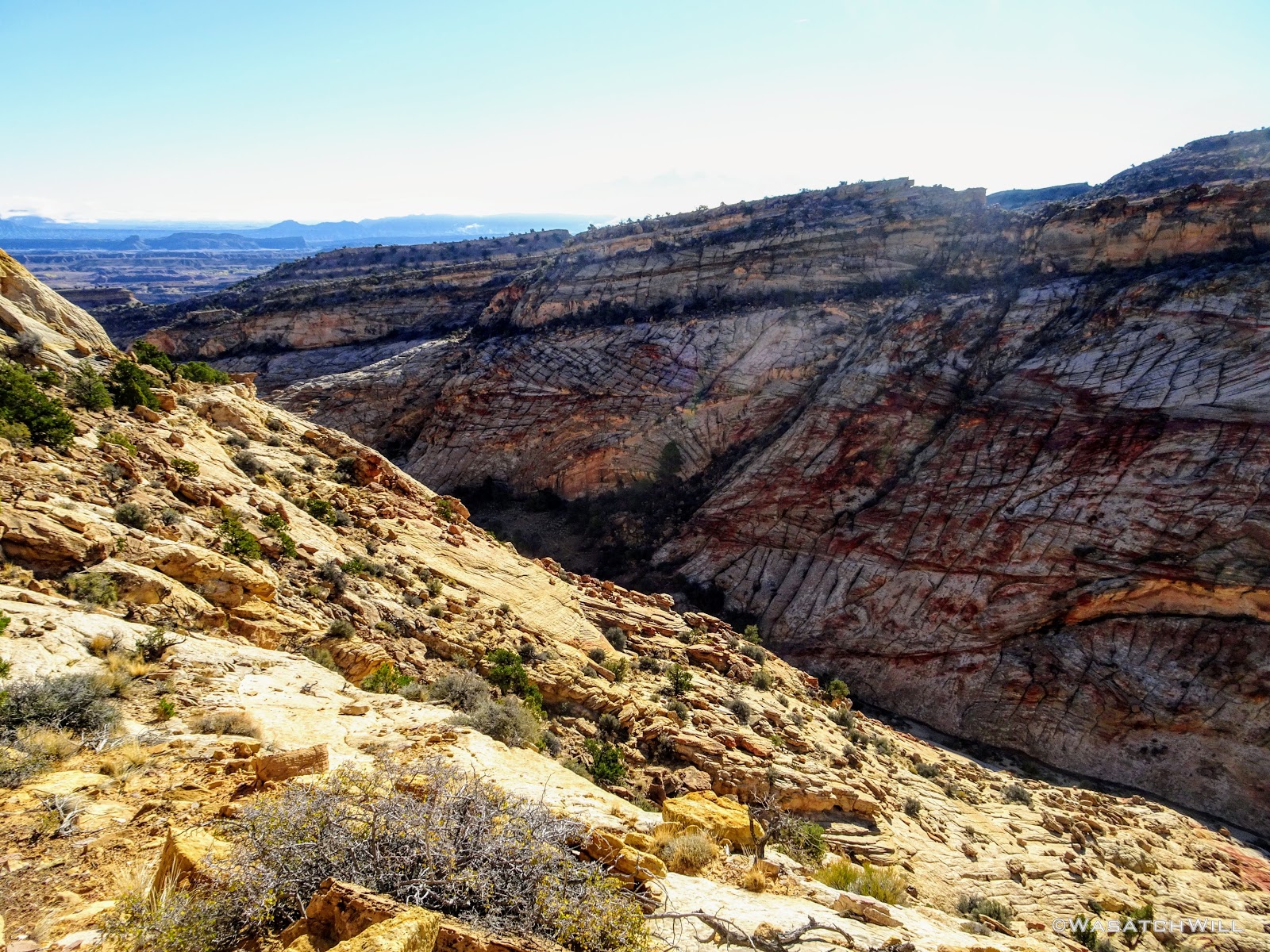
Back down in the wash, we continued down canyon until it opened up and the walls receded.
Under an overhang in lower Capitol Gorge
The old automobile shell that sits as a relic and border marker of what was previously Capitol Reef National Monument was there to greet us.
Capitol Reef National Monument "Scenic Attraction" border marker
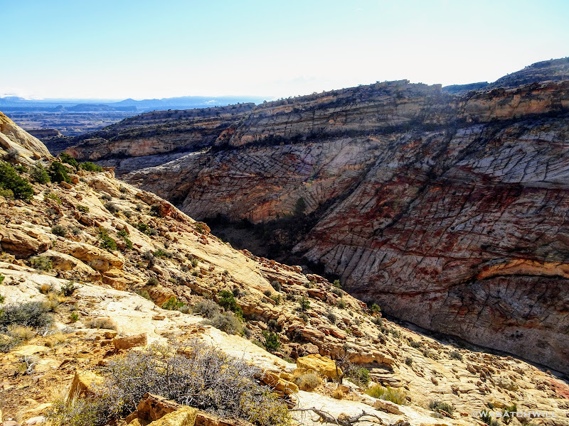
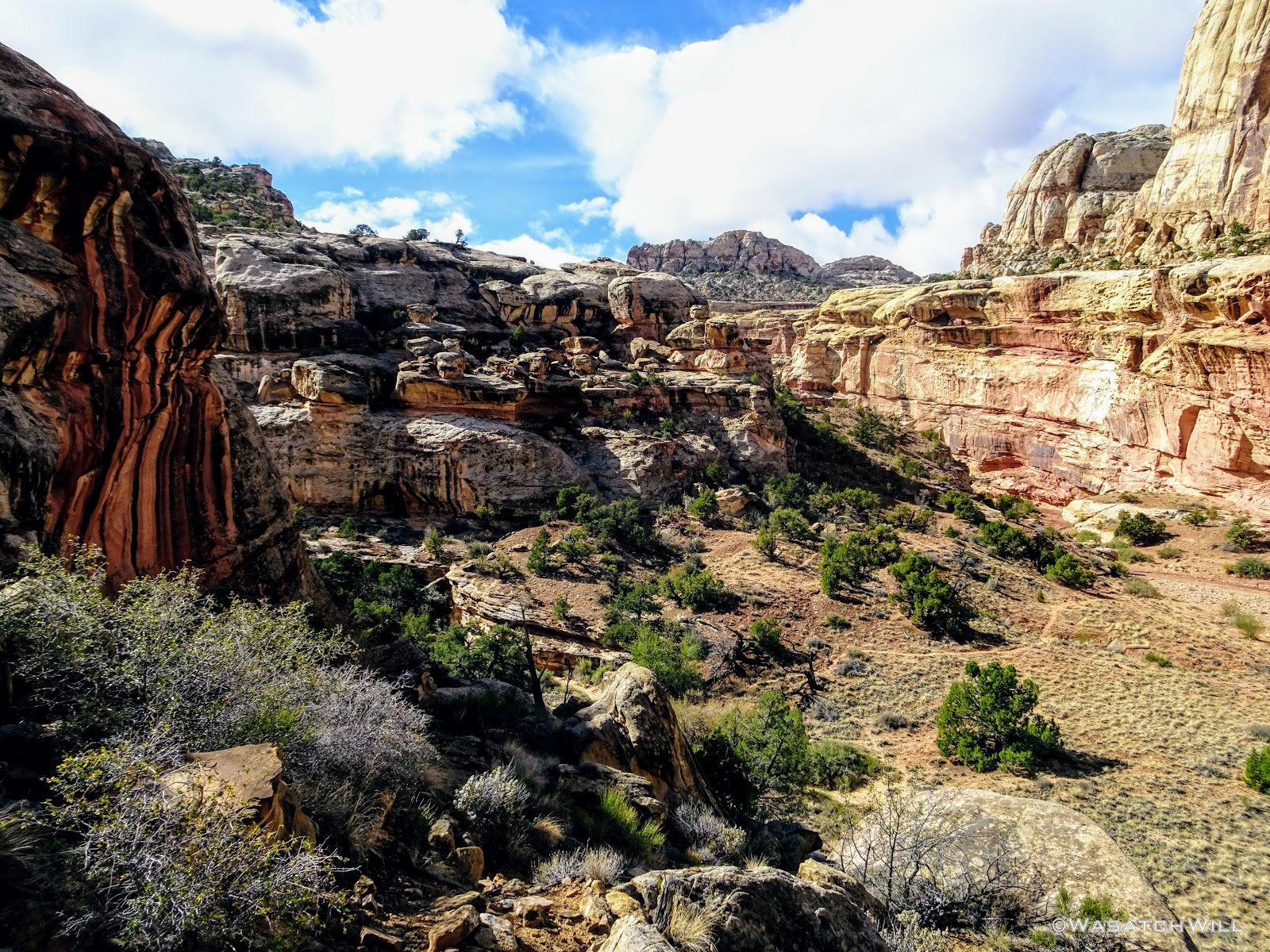
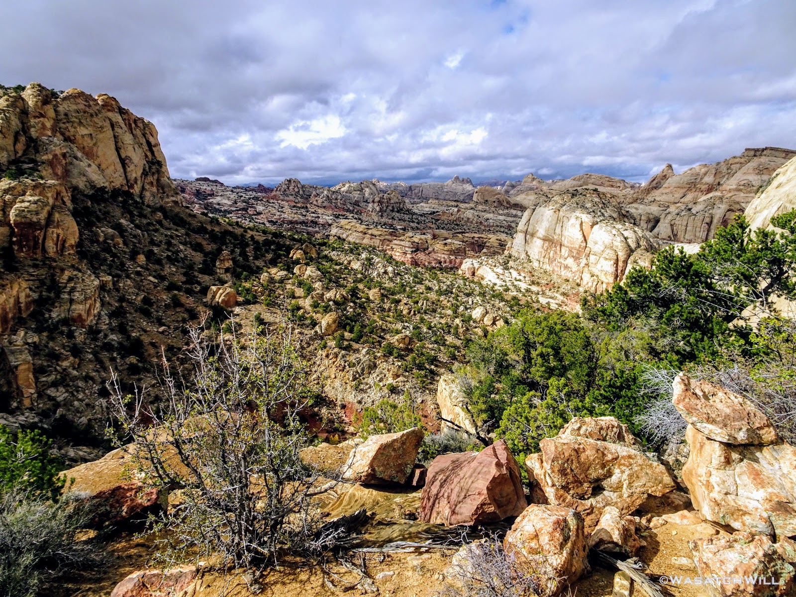
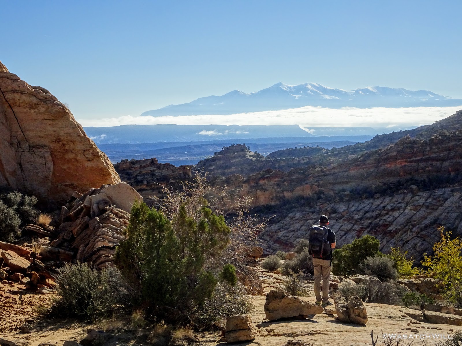
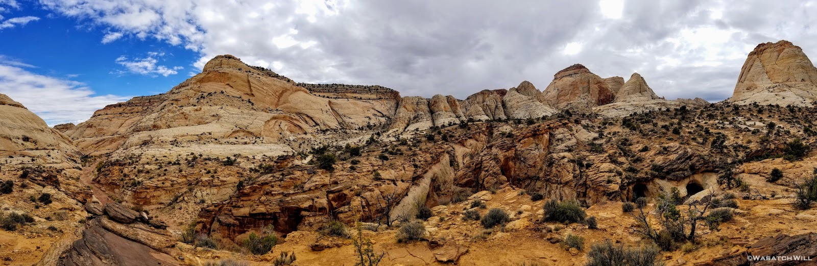
Soon after, we left the low lying Capitol Wash in pursuit of higher ground once again. This time being a 2.5 mile slog to gain 1100 feet. I knew what to brace myself for but this particular afternoon was more of a mental challenge on Devin than any other part of the trip. It wasn't very strenuous and certainly no major obstacles. It was just long and hot with little change in the terrain and scenery until the end. But...then, we finally hit a rim with yet another amazing overlook allowing us to see across the canyons we had just cut through that morning. It was another nice, hard-earned reward that served to recharge our spirits, every bit as breathtaking as I remembered it from the year before.
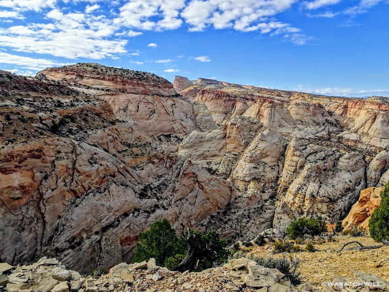
Looking north across Waterpocket Fold with Golden Throne in upper center

Pano or northern Waterpocket Fold
As nice as it could have been to linger a little longer, we were more eager to move along to the area where we'd seek out another worthy campsite. Along the way, I noticed a few small uprisings just off our route among the cryptobiotic soil we were passing by and around. I believe it was some Gypsum.

Gypsum crystal layers
We continued to edge our way along the rim until it brought us into what for me is a slickrock paradise.
The view northward from high atop the rim
Here, we could have made a great camp, but we opted to keep moving along through the upper end of another little canyon to the south. I'm keen to call it "Checkerboard Canyon" because of the far side that is textured like a grid. In the Capitol Reef episode of Rock the Park that airs on ABC each week, hosts Jack and Colton slept here on their night out in the Capitol Reef backcountry. It was obvious they had gotten their route from Steve as well.
View down "Checkerboard Canyon" with Henry Mountains on horizon
Looking down into upper "Checkerboard Canyon"
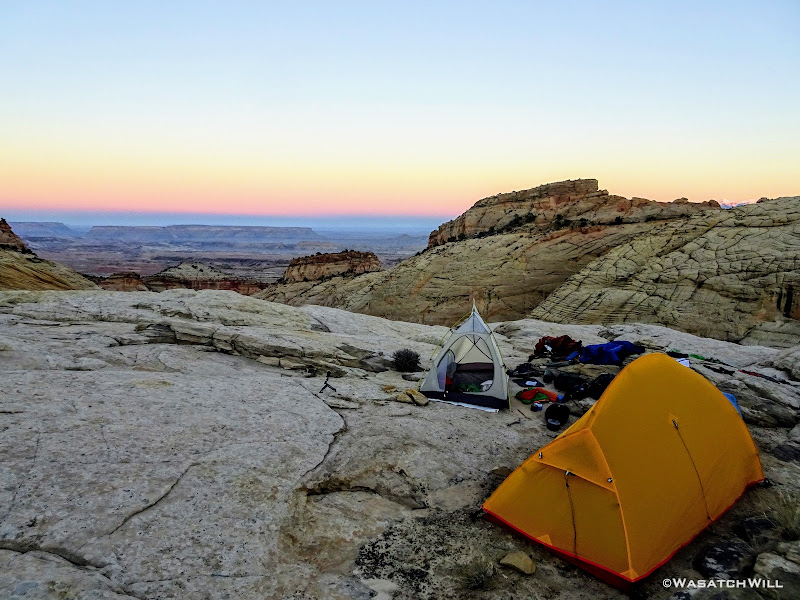
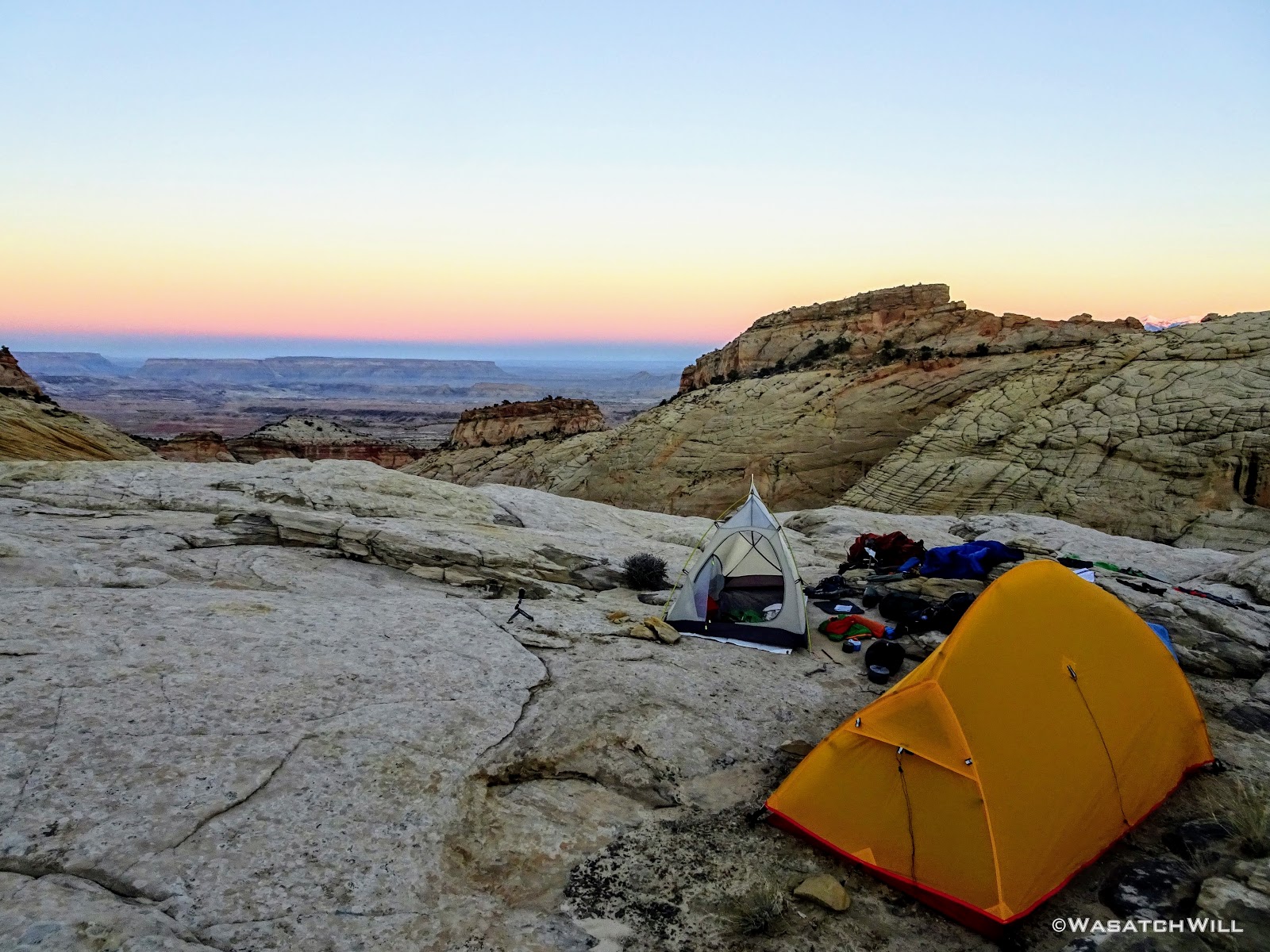
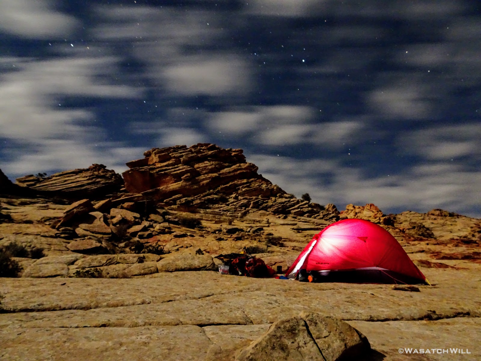
Once up the other side of the basin, we settled on a nice slickrock flat along a saddle between the basin we had just cut through and yet another basin lying to the south below us. There we made camp, and found a nearby shallow pool of water from which we filtered what we needed. And then, for the first and only time of the trip, we enjoyed our dinner before dark. And once again, we were spoiled with incredible views all around.

Mountain House Turkey Dinner
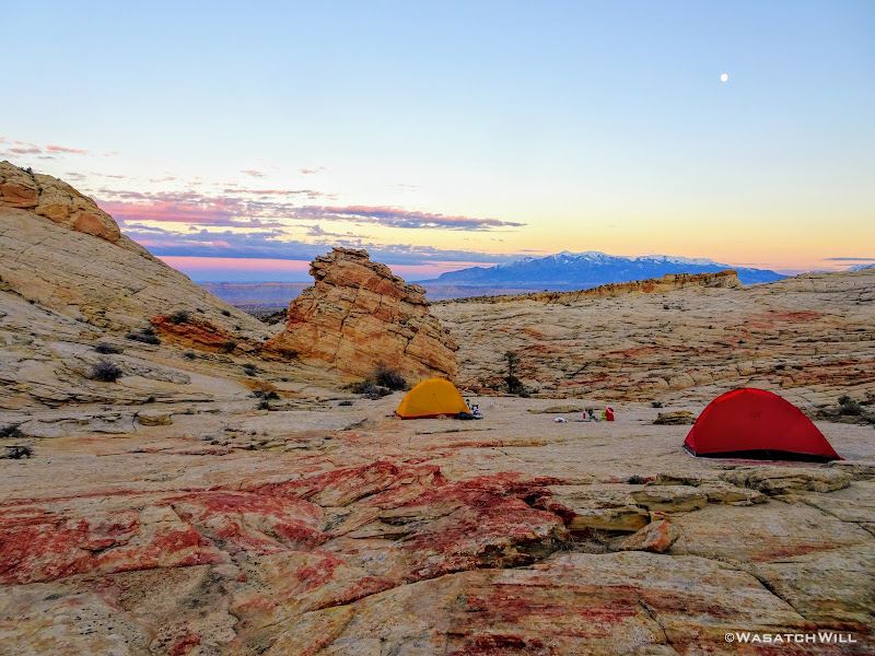
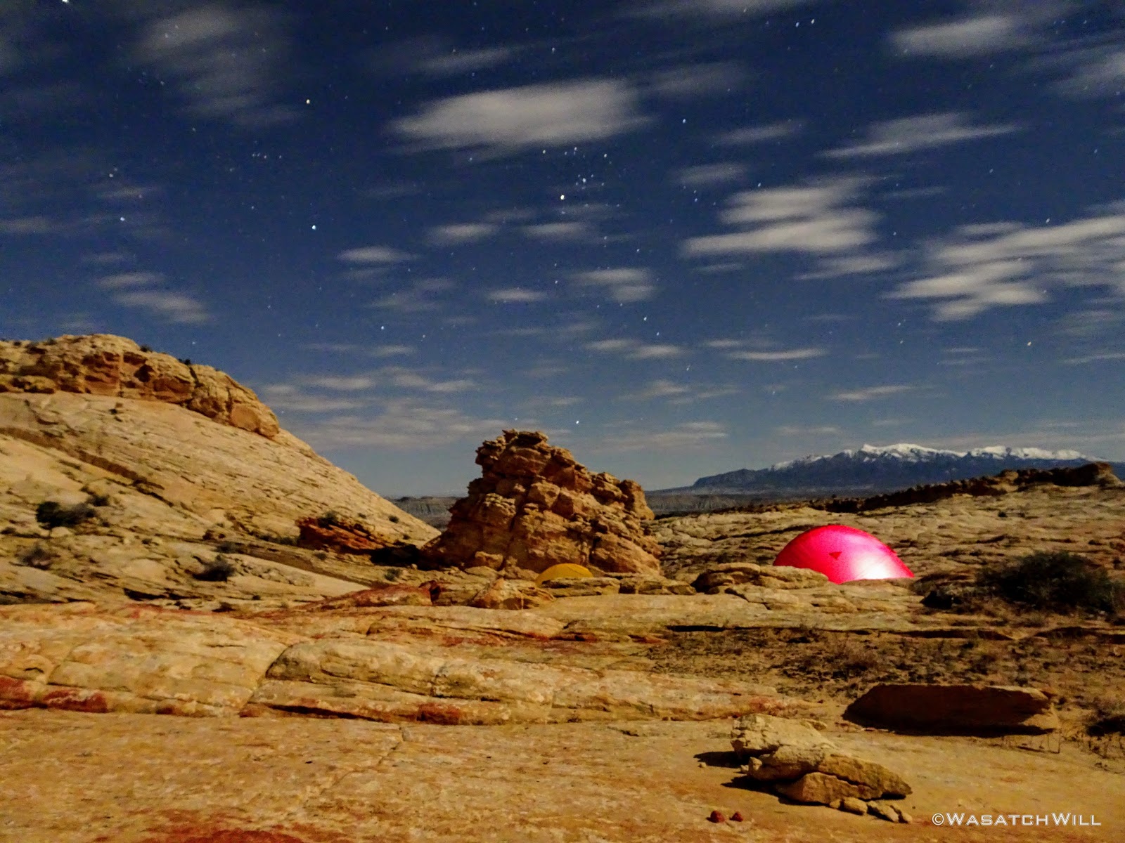
Moon over camp and Henry Mountains beyond
Northern backdrop from camp
High angle view of camp (tents are to the right)
After dinner and some wandering around checking out our camp's surroundings, we took advantage of some leisure time and got some R & R.

Tent door view
Lonesome tree above camp
I passed some time with a bit of reading followed by a helping of The Office and a few other Netflix downloads. By then, dusk had come and gone and the stars and moon were now fighting for visibility through some passing clouds. The next day's weather was due to be mostly cloudy with a good chance of some scattered showers by mid-day.
I got out of my tent to tend to a nature call, a late night dessert in the form of a snickers bar, and then just take in the ambient glow surrounding me courtesy of the moon as it illuminated the passing clouds and the surrounding landscape.

Passing clouds over camp
Eastern night view

Northern view
Satisfied, I retired back to my tent to sleep off the final night of the trip.
Day 4
Sunday - October 21, 2018
Unlike the previous two mornings, our last morning opened with some cloud cover just as expected. The sunrise wasn't as dramatic as I had hoped for, but we still got some shades or red out of it. Devin reported that there was a brief light shower earlier in the morning, but I must have been in a deep sleep at the time because I don't remember hearing anything on my tent.

Dawn, day four

Sun rays emerge from Henry Mountains
We had a good golden hour after dawn that produced some really interesting contrast of glowing sandstone against a dark and dreary sky.
Golden Hour
Cool contrast!
Golden glow
Breaking camp
We did our morning rituals, broke camp, and set off for Pleasant Creek. Along our way out, the clouds dispersed for a bit allowing us to enjoy a bit of bluebird sky once more. Moving along, we noticed what looked like a typical large ant hill in the desert. What made us scratch our heads was how a rock became perched upright within the crater.
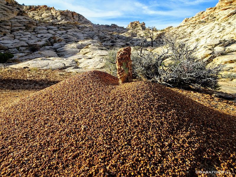
Rock on ant hill
Moving on....
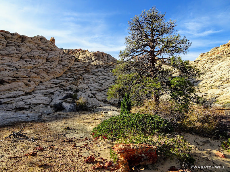
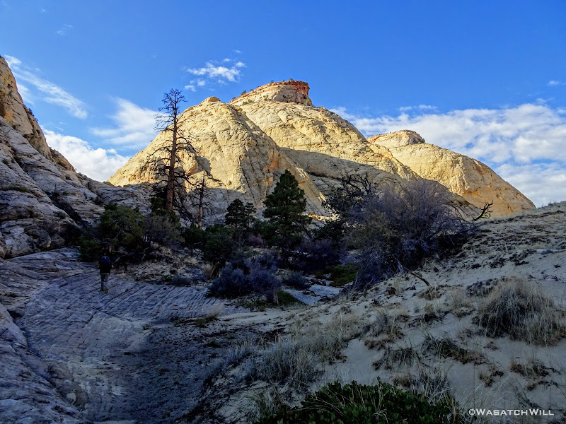
Lonesome Pine
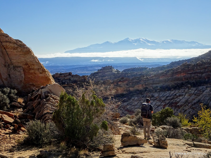
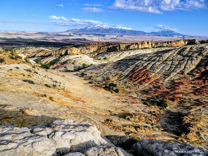
We gained the edge of another rim where we paused for another good break to enjoy some panoramic views all around. To the east, we could make out landmarks on the horizon like Factory Butte. Below us to the south ran Pleasant Creek. To the west, Boulder Mountain. And to the north, several miles of the maze that is Waterpocket Fold we had just traversed over and through the final days. We were at our high point for the day.
Factory Butte

View south across Pleasant Creek

Pano view west

Pano view east
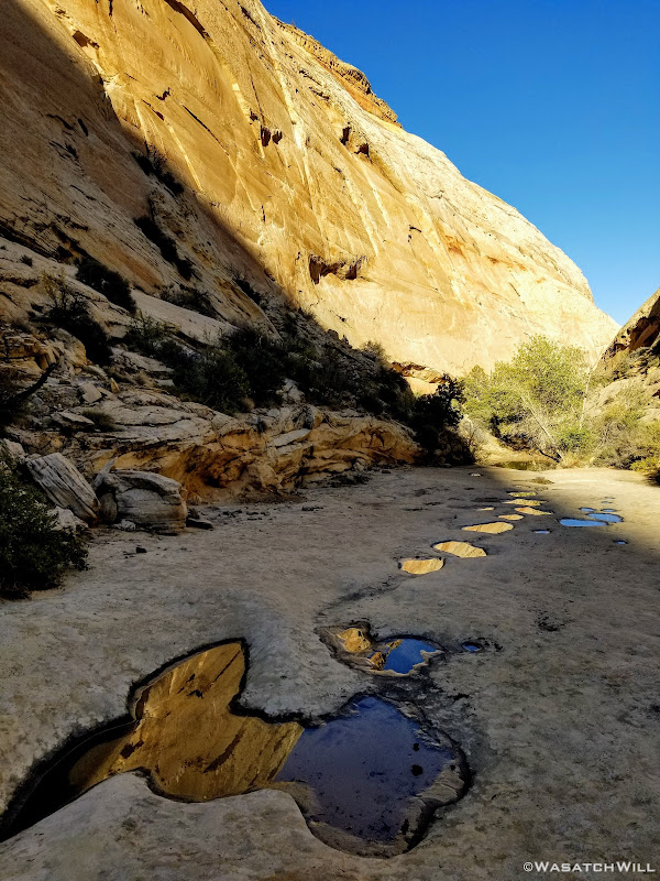
With packs back on, we now just had to descend the canyon I had camped in on my previous trip through these parts to reach the banks of Pleasant Creek. Pools and potholes full of water were ever plentiful down through this drainage.

Down the drainage we go

Another view of the Henry Mountains as we continue our descent

A shallow reflecting pool
Looking down canyon
Looking back up canyon
Devin stands beyond some interesting rock fins
A full pothole below a pour-off below

Siding around more pot holes

Another look back up canyon
More pot holes to move around down canyon
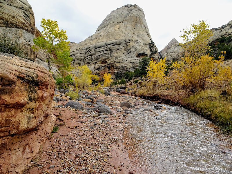
Snow-capped Henry Mountains appear above cottonwoods standing along Pleasant Creek
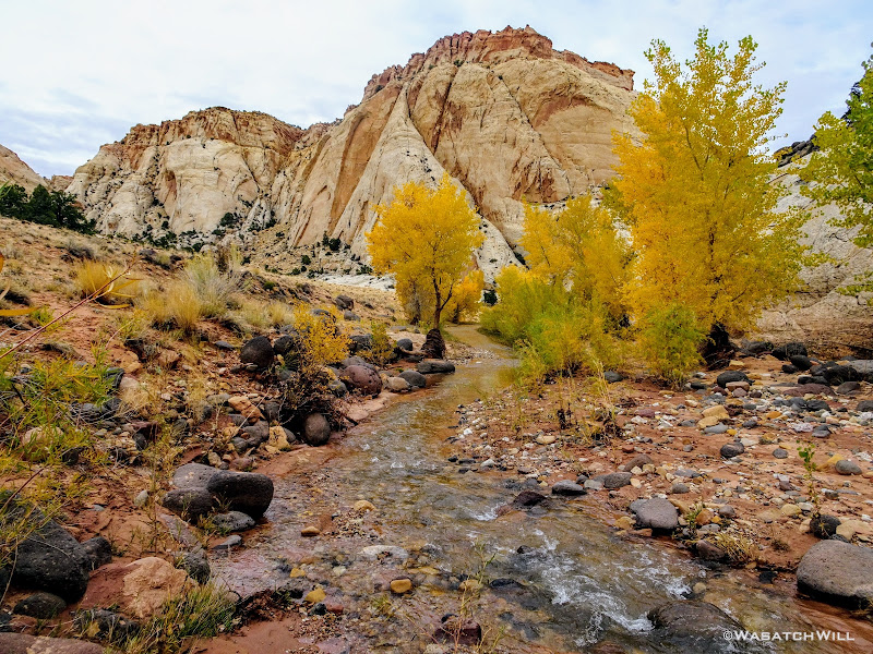
A couple miles later and 900 feet of elevation down, we found ourselves standing at Pleasant Creek. The end of our journey was now just a few miles upstream.
On the banks of Pleasant Creek
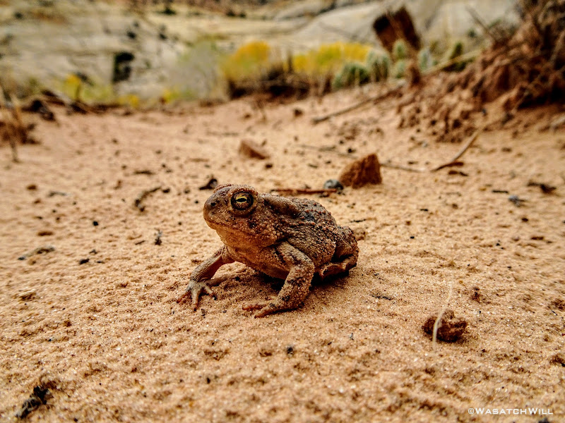
Woodhouse Toad
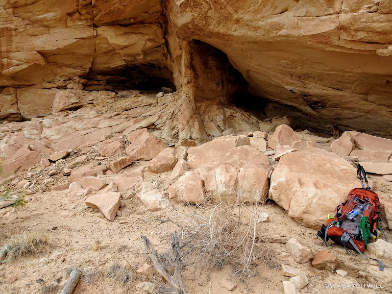
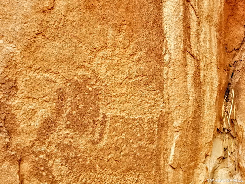
Up in the canyon, we pulled over for another break so I could show off a cozy little archeological spot with a nice view down onto the creek. Behind the rock we perched ourselves on for lunch were a couple of small cave-like cavities coated with soot in the cliff side, a mano and matate, a maize cob, and a couple petroglyphs. Having brought my daughter Ellory down to this point as part of our trip in June, it was my 2nd time here this year.
Fremont Caves
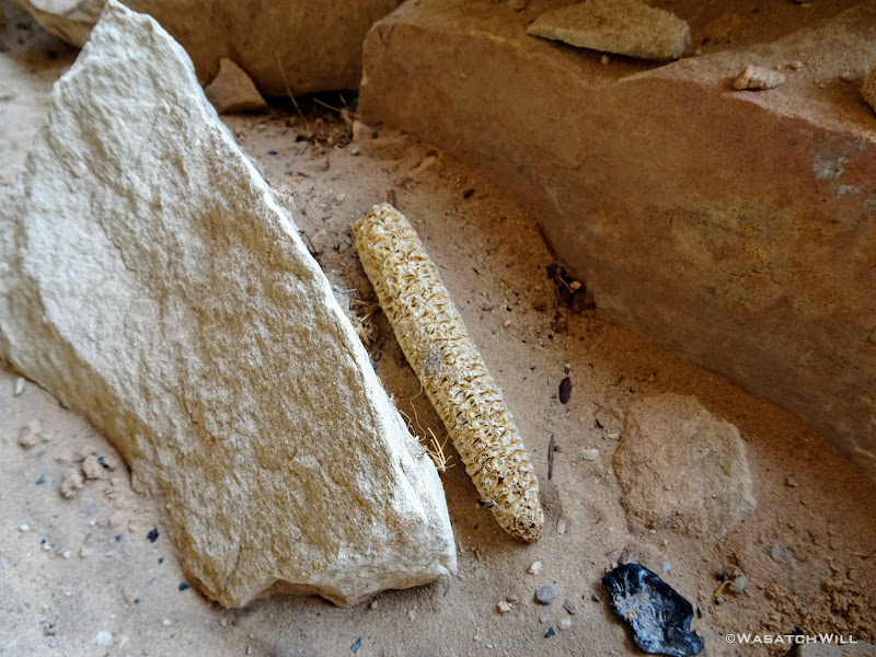
Ancient cob
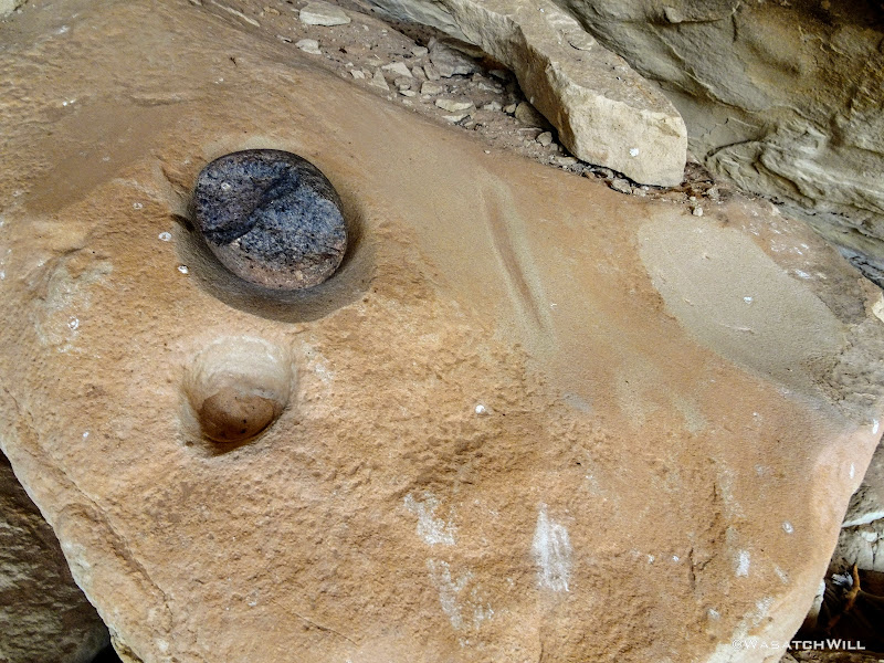
Mano y Matate
Petroglyphs
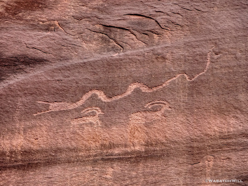
Further along the wall was another panel of petroglyphs I had found on the June visit. Mingling with the ancient Fremont art are some pioneer inscriptions of the late 1800's and early 1900's.
Bighorn sheep glyphs and pioneer inscriptions
Looking down at Pleasant Creek and cottonwoods
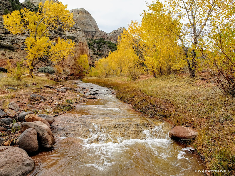
All along Pleasant Creek the cottonwood trees had donned their golden autumn coats.
Golden cottonwoods adorn Pleasant Creek
I had hoped to show-off a tributary slot canyon that feeds out into the creek to Devin, the same one I had led Ellory up earlier in June, but for the sake of getting back home to our families sooner, and because clouds were starting to gather again to produce what we expected to be some showers at some point, we mutually agreed to forego it.
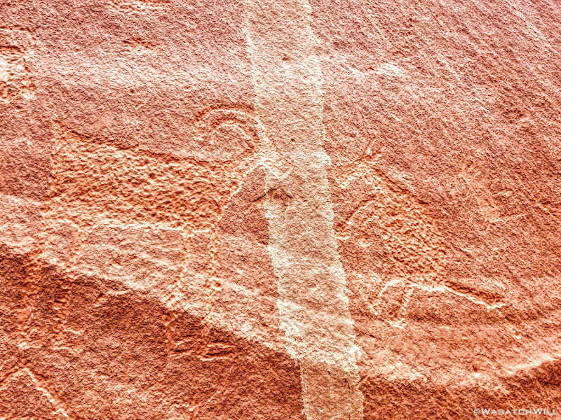
En route along the creek, Devin's keen eye spotted yet another panel of rock art. Of course, we jumped the creek and had ourselves a good up-close look. Having passed by this spot 3 different times before, I had not known of them. A set of four or five Fremont figures, almost uniform in size and appearance, were clearly the key subjects in whatever story or memorial was carved out and painted here, for the panel consisted of both petroglyphs and some pictographs.
Four big Fremont glyphs
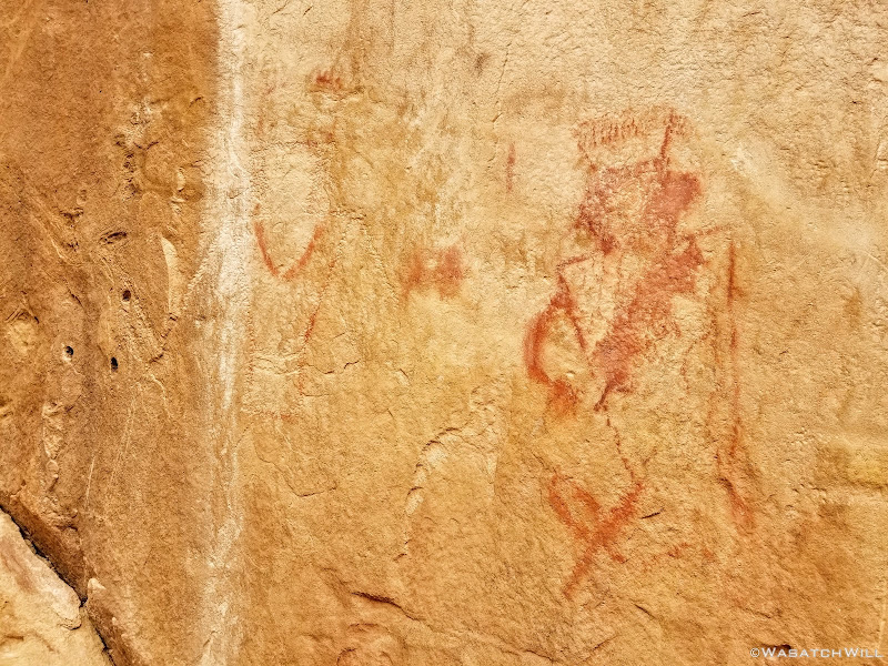
Fading pictographs
Back along the creek, we took a moment to enjoy the little cascades down in an infant slot canyon. Each time I've looked down into it, I've wondered how long it will take for the creek to carve fifty or even one hundred more feet down.
Devin at the edge of the young slot

Devin surveys the surrounding canyon walls

Continuing up the creek
We kept our course, jumping the creek a few more times, wondering when and if we'd ever encounter any rain while the cottonwoods continued to show off.
A Navajo dome rises above the creek
More fall featured cottonwoods

Autumn along the creek
After making our final creek crossing, I led Devin up to a wall near the mouth of the canyon where a quite a few more different rock art panels can be found.
Sun Head
Slug Snake over Bighorns
Bighorn vs donkey?
One spot has glyphs that puzzled me the first time I found them for they certainly weren't like all the other Fremont figures elsewhere along the wall. I now see them as more likely to be what I would call cowboy glyphs, probably carved by some rancher or pioneer of the more recent past.
Cowboy glyphs
Coming out of the mouth of the canyon, we made our way up to the UVU Field Station. Both being alumni of UVU, we both shared a bit of pride for the little establishment there. It's a completely self-sustaining facility reliant upon solar power, a well, and other sustainable and eco-friendly resources. It hosts a variety of programs and classes relevant to the surrounding environment not only for UVU and its community, but also occasionally welcomes classes from other colleges as well. On this week, Westminister College was making use of the facilities for a wilderness first responder course.

Field Station
While on our little layover at the Field Station, I was able to make contact with my father-in-law to let him know where we were at, and that we were ready for him to come down and pick us up. When we had picked up our backcountry permit from the Visitor Center on the first day of our trip, we had taken note that the dirt road out to Pleasant Creek had been closed due to a rain storm earlier in the week, so we weren't sure if it had been re-opened to vehicles or not. Even if we knew it had been, rather than waiting it out at the gate of the Field Station, we decided to walk the road as far as we could until we intercepted my father-in-law.
It wasn't until we started walking out that we got hit by a nice little passing shower but it dispersed after a few minutes.
Walking down the dirt road
After what was probably a couple of miles, my father-in-law arrived, officially putting a stop to our four day trip of epic proportions.
It was on that final mile that Devin and I almost had to collectively pinch ourselves to make sure we had really just hiked the route we did and were not just about to wake from a dream. For a moment, my eyes even watered up with the feeling that I had accomplished something big, a major backcountry test of sorts.
While it certainly wasn't the longest hike I'd been on, neither in distance, nor duration, it was however, by far, the most rugged and most strenuous hike I had ever done, with several of the biggest obstacles I had ever encountered on a backpacking trip or any kind of hike for that matter. Between the first day's ordeal bypassing the first big pour-off to the 2nd day's wader, and a handful of other more minor spots along the way, I was beyond grateful that Devin had accepted my invitation to join me for this trip. His assistance was invaluable and I was so glad I had not attempted to do that route on my own for I may well have gotten myself into some situations that could have been much more precarious without the teamwork he and I were able to provide for each other.
I am also very thankful for all the time and effort Steve Howe put into scouting out all those wild and unforgiving canyons we had just come across in assembling the route and for at one time, trusting the readership of Backpacker Magazine with a map of the route, a time right before social media and things like Instagram made other like locations go viral and explode in popularity, that have inevitably resulted in some negative impacts from less careful visitors who sought after those locations. Had Steve not made that route available when he did, had he not pioneered it at all, had I not been so fortuitous to stumble upon it when it was available online, I may well have tried to figure out such a route all on my own, likely spending years and years in the process, for I am certain, like Steve Howe experienced, I would have hit dead end after dead end before finding something that would work. For the many visits I've been fortunate to make to Torrey, Utah, I've yet to meet Steve Howe and his wife, Jen and hopefully that changes in the near future because I would enjoy the opportunity to thank him in person.
I would also like to thank renowned planetary scientist and geologist Jani Radebough, who happened to successfully complete the primary leg of the route with a couple of her friends a few months prior, whom also works at BYU like myself, and whom allowed me to contact her in preparation for this trip and come over to her office during a work break to meet her and discuss her experiences with the route, particularly the bigger obstacles.
Lastly, I would like to thank my wife for supporting these adventures of mine, even when she can't often be there herself, instead sacrificing her time to watch after our kids, and of course, her parents, particularly her father in this case, who ferried Devin and I to our starting point and from our ending point.
In the middle of this journey along the Beehive Traverse I began to ponder how many people in total had traveled the route before Devin and I had set foot on it. After all, it is one of Steve's offerings with his guiding company going by a description on his website. I reasoned that he might only guides a small group of clients once or twice a year at most on this particular route, and likely only for the last 10 to 15 years or so. I also reasoned that, given the remoteness and all the hazards and variable conditions of the route, few others have been bold enough to take on that inhospitable terrain on their own, even with a map of the route back when it had been made available online to a relatively large readership. Therefore, I feel confidant in estimating that less than 200 people, perhaps even less than 100 people, had traveled the route before Devin and I made our bold and successful attempt at it.
Video:
It's course runs mostly off trail and is littered with all kinds of obstacles, as it follows sandstone spines, ridges, cliff sides, dry washes, slots, up and down, up and down some more, through canyon after canyon after canyon. It is so remote that the route passes by and through very few landmarks that even have an official name on maps. To top that all off, water sources can be very scarce along this route, due to long dry spells which are common throughout the year.
How did I come to find about about this lesser known and even lesser-hiked route? Well, the reader should understand that in falling in love with the woman who I'm now blessed to call my wife, I also came to fall in love with the landscape her great-great grandfather sought federal protection for in the early 1900's.
That man, Ephraim Pectol, who for some time owned and operated what is now the Chuckwagon Store in Torrey, Utah would ultimately go on to serve in the Utah state legislature and one of his very first acts there was to promote and campaign for a monument to be be created out of a stretch of land he had been calling Wayne Wonderland (in connection with Wayne County). He believed it would benefit the public to keep it a land where others could come and visit and be filled with wonder like himself. He was so passionate about getting it protected that he neglected his own business for years to lead and guide federal authorities around the landscape taking surveys for boundary markers. He was also aided in his efforts by much assistance from his brother-in-law, Joe Hickman. At last, their efforts were finally rewarded with the protection they sought in 1937 when Franklin D. Roosevelt signed off on an official proclamation creating Capitol Reef National Monument. Several years later, Congress extended some of the boundaries and upgraded it all to a National Park with the signature of President Nixon in 1971. Landmarks in the park, Pectol's Pyramid and Hickman Bridge, are named after them, respectively.
Given the marital connections I now have to the park and my love of the outdoors, it became a personal project of mine to hike and explore and become familiar with at least all the non-technical areas of Capitol Reef. So, a few years ago I had been studying topographic and satellite maps to see if there was any viable, non-technical way to connect Capitol Reef's Grand Wash with Capitol Gorge via through and over the Waterpocket Fold. And then Capitol Gorge with Pleasant Creek. Little did I know, all this had already been done. I had also been making a list of trails and places elsewhere in the park to visit that I had not yet been introduced to in earlier visits with my wife and her family. Having my in-laws retire and relocate to develop some long-owned property they've had in Torrey has only hastened the opportunities to return to Capitol Reef many more times with the regular visits we now make there.
At that same time, I had been searching out some more information on the Internet about some hikes in Capitol Reef when I stumbled into a write-up of the Beehive Traverse route by Michael Lanza on his blog, thebigoutside.com. At the time, access to most all content there was free, but there is now a paywall in which one must activate a paid subscription to access premium content, of which the Beehive Traverse write-up there is now a part of. At any rate, I was sold. There was no map, no gps coordinates or track shared, just lots of pictures accompanied by a great narration of his own journey along the route. He credited his friend and former colleague, Steve Howe - they had both once been regional editors for Backpacker Magazine - with providing the route with some helpful beta.
Of course, I turned to Google to see if I could find anything else about this route I'd never heard of as it seemed to follow just the kind of course in which I was thinking I would try to scout out myself. In that search I found Steve Howe's own adventureful write-up he had published for Backpacker years ago about how he came to pioneer this route, which is really quite a good little read! He is, after all, a resident of the small town of Torrey as well, runs his own guiding company there, and thus had plenty of time in his off days to pursue explorations into the more rugged and remote sections of neighboring Capitol Reef and beyond.
It just so happened that at the time I came across that article, there was also a footnote link to a mapping website Backpacker had an account with containing a GPS track that Steve apparently had released with the article for a time. The website was far from user-friendly and intuitive though. I couldn't figure out any way to download the track, so I painstakingly re-traced it onto a map of my own via my Caltopo account. I then added on a few potential alternate detours that I thought, based on landscape topography and geological features shown in satellite imagery, could possibly prove easier to navigate. I then copied over a few notes from some key waypoints listed.
I've since gone back to see if that track was still available on the site Backpacker made it available on and apparently it has been pulled offline, because I could not find it at all anymore. I'm not sure why it's no longer there, but I have my guesses.
In the mean time, this route, from the time I had discovered its existence, had loomed large on my bucket list over the last few years. I had strongly considered attempting it solo in April, but instead opted to go further south in the park to check off another Capitol Reef hike on my list, the Halls Creeks Narrows. It wasn't until later in the fall, when @Devin Ashby got in contact with me about wanting to go out on a desert trip in October, that another opportunity presented itself. He had a trip lined up with some other friends of his that fell through so I pitched him on the Beehive Traverse. After a bit of thought, he was sold. Plans were made and the stoke exploded.
And so, without further ado...here is my report of said trip!
Day 1
Thursday - October 18, 2018
After picking up Devin early in the morning, I drove on down to Torrey where we made a brief layover at my in-laws. I introduced Devin, pleasantries were exchanged. To fuel up our bodies, we made a short walk up the road to the Capitol Reef Inn Cafe for some burgers. We then walked back to my in-laws where we had my father-in-law drive us down into the park, to the Visitor Center to pickup a necessary backcountry permit, and ultimately to our starting point for this trip, Grand Wash Trailhead.
We loaded up, said our farewell to my father-in-law and got underway. By now it was about mid-afternoon.
Devin heads down Grand Wash
I had planned a 6 mile day for us to reach where I anticipated would make a good camp for our first night. Little did we know just how much more rugged and wild this route would prove to be for us, almost right out of the gate. Once we broke away from the crowds touring the mild and easy going Grand Wash, it was game on! To make our way up into a side canyon, we had to gain some elevation up a steep and rocky hill out onto a ledge.
Saying good bye to Grand Wash
Once we arrived atop the ledge we were targeting and then turned the corner, we were instantly presented with our first of many breathtaking views to come. Now officially off-trail and with Grand Wash now behind us, it was highly unlikely we'd encounter another person for the next two days. On we went...

Looking ahead on the ledge

Looking back at Devin crossing over the ledge
We followed the ledge until it brought us to another hill we had to gain to reach a saddle along a high sloped, domed ridge above. On the other side was sheer wall plunging deep into another canyon and its floor far below. Once up on the saddle, we had to sprawl our way up a steep slickrock ramp with plenty of exposure on either side until the ridge leveled out a bit for an easier traverse across it.
Devin traverses the top of the domed ridge
Once on the other end of the ridge, we could look back and see Cassidy Arch way out across the other side of Grand Wash.
Cassidy Arch off in the distance (center right)
Up ahead of us loomed a majestic unnamed landmark. I simply called it, 'The Spire'.

'The Spire' looms ahead

Myself, taking it in
The ridge would go on to transition into another long ledge for us to follow along the canyon wall. After a nice stretch, we pulled over for a rest and to soak up more views both ahead of us and behind us.
'The Spire' as seen from where we rested
Looking back to the north
After snacking up, we continued on up to the head of the canyon where we were able to cross over to the other side and begin a series of steep switch backs and ramps to gain another ridge that would bring us to some views that would rival any others along the route. It was amazing!

Devin looks down from whence we came
On the ridge, we had yet another steep ramp to step up to acquire yet another ledge, this one taking us right along side The Spire.
Devin sizes up 'The Spire'
Devin atop the ledge along 'The Spire'

Myself, going back down to retrieve some cameras (photo courtesy of Devin)
Rounding 'The Spire'
Once around the backside of The Spire, we had to find another ramp or gulley that could lead us off the ledge down into a wash. We ended up in a gulley with a lot of bushwhacking. Once in the wash and rounding a bend, we encountered something we fully expected to encounter many more of, a small pool of water. In recent weeks, the area had actually taken on an early snow storm along with some significant rains. Knowing this virtually assured us that water sources would be abundant all along our route. Did I mention this trip felt like catching lightning in a bottle?
First of many water sources
We followed the narrow wash the rest of its way out to a junction with a bigger wash that we then followed downstream for a bit.

Little tree in the wash
After a few bends along the larger wash, we made another exit, this time up into a sandstone amphitheater where we'd pause for another good rest and snack break as we braced for another good climb up to a saddle in the ridge overhead.

Devin pauses on the slickrock as we exit the wash behind
Getting up to the saddle we were after required a few class three moves and a moment later, we were were gazing down into what is unofficially named by Steve Howe as Redman Canyon. I believe Steve named it as such because somewhere from within the canyon one can look up and see a rock formation that looks like a red snowman. We never found it though.

Looking down into 'Redman Canyon'
We descended down a chute to get to the wash in the canyon bottom where we followed it downstream, admiring the constantly changing textures and rock formations surrounding us.
Looking up to the ridge

Another pool

Myself, taking in the view out east (photo by Devin)
As we coursed our way down the wash, we ultimately hit what may well have been the most challenging obstacle for me of the entire trip. A pour-off that we anticipated having to bypass with some careful footing along the steep walls of the canyon.
Having only slept a couple hours the night before, my body was now feeling the fatigue of all the up and down we had done in the four to five miles we had come to reach this point. Halfway from the top of the dry-fall to the gulley that would lead us back down to the bottom, my legs started cramping up, both thighs and calves. I had to sit down in a little crevice and drop my pack to regain my composure. The exposure combined with the leg cramps really started to do a number on my mind.
Devin remained surprisingly nimble as he moved along the canyon wall toward the top of the gulley we were targeting. Seeing how shaken I was, he made himself a saint by completing the challenging traverse, dropping his pack, then coming back to take mine. After the brief rest and without the burden of my own pack, I was able to finish the traverse with my legs feeling much more stable again.
Having successfully made it across the daring traverse and then down the steep gully off to the side, we arrived at the bottom of the dry-fall that so wrangled my mind. Of course, it taunted me by looking a lot less intimidating from below than it did from above. I'm not sure why I didn't take a photo of it but I did get some video and settled on a still from that to show it off.
Video still of the dry-fall
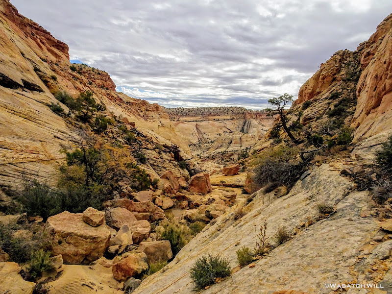
Still a mile and a half away from where we desired to camp, we continued to push ahead. Unfortunately, the complications getting past the dry-fall set us behind our schedule considerably. Now the final hour of daylight was upon us.

Continuing on down canyon
About a half mile further down the wash, we had yet another ridge to crest over into the next canyon. Realizing that finishing out the final mile we had planned for, which included yet another bit of a climb to bypass a narrow slot section featuring another series of pour-offs, would probably result in some hiking in the dark and most certainly setting up camp in the dark, we opted to call it good right there at the top of the ridge we were on and make up the additional mile the next day. Thankfully, between the two of us, we had an adequate water supply to make a dry camp doable.
That and we simply couldn't pass up setting up camp with the views we now had, including that of the Henry Mountains out in the distance. From now until the final day of our trip, they'd be a common sight for us out to the east.
The Henry Mountains come into view

Panorama atop the ridge
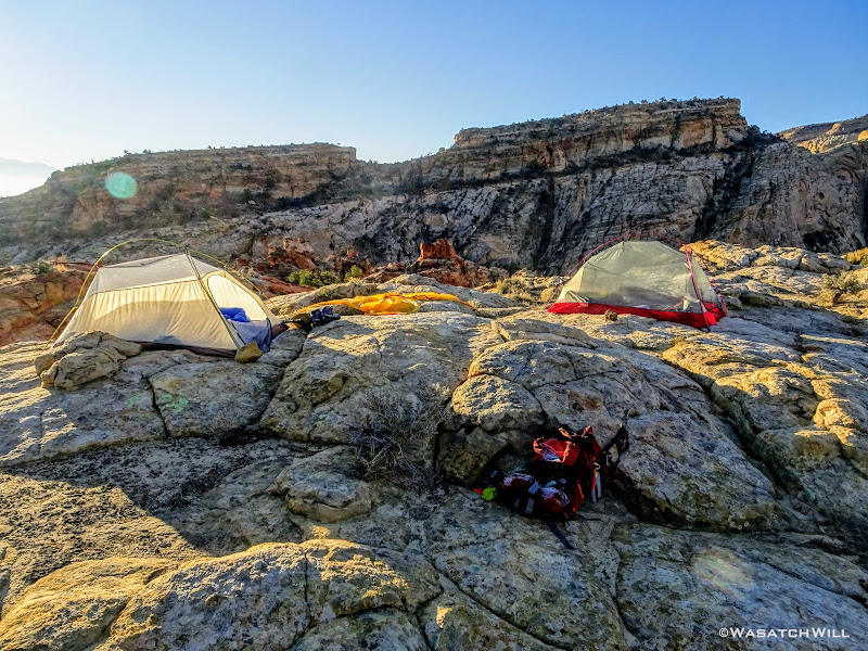
Down went our packs. Up went our tents.
Camp
Moments later, we were enveloped by darkness. Dinner featured a new meal for me in the backcountry. Peak Refuel's Sweet Pork and Rice, along with some tortillas and some fresh spinach I had packed along all made for some fine wraps. This was my first time eating a meal by Peak Refuel, and it was quite good.

Dinner
Now completely exhausted, we spared no time cleaning up after dinner and getting into our respective tents and warm bags to close out day one.
Day 2
Friday - October 19, 2018
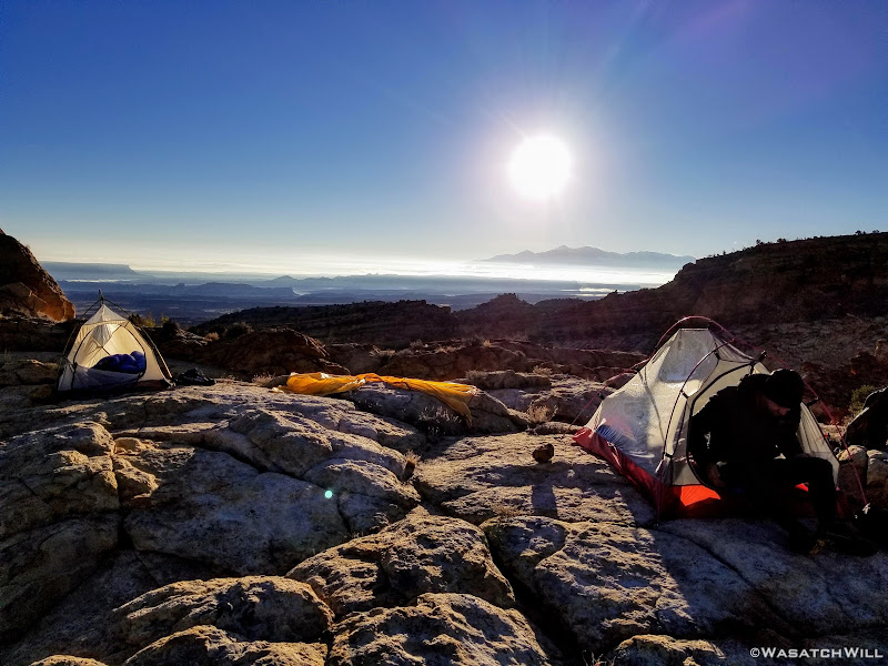
Day two greeted us with clear skies while some frost had graced some of our gear. Once the sun was out, we jumped out and cooked up a quick hot breakfast.

Morning at camp
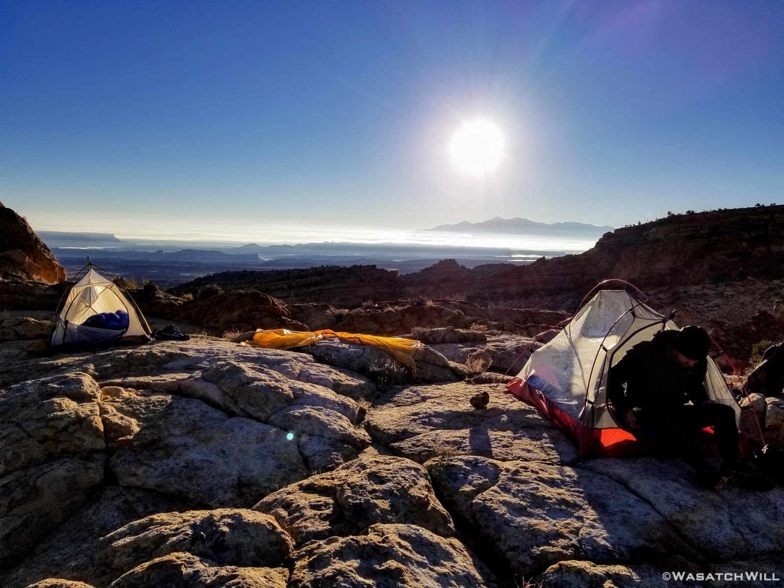
View of the Sun over the Henry Mountains from camp
Another angle of camp
It didn't take long for the rising sun to dissipate the cold air away. With the extra mile to make up it was now set to be our longest milage day of the trip with the promise of another major obstacle, a wader through a short slot, that was on the agenda. The plan was to get through that then up to a camp where we could set out wet clothes to dry in the sun before it got too low in the sky.
Time to get moving.
Devin takes in the view of the Henrys as we leave camp
The canyon we must descend down into
Looking up canyon
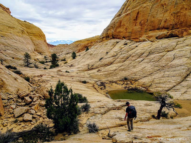
After making up the mile we missed out on the day before, we stopped to refill our now empty water bottles from one of the many water holes throughout the area we had originally planned to camp the night before. A fine camp it would have been too, sans the big views.

A pothole in the area we originally planned to camp, with Devin in the distance

Reflecting pool
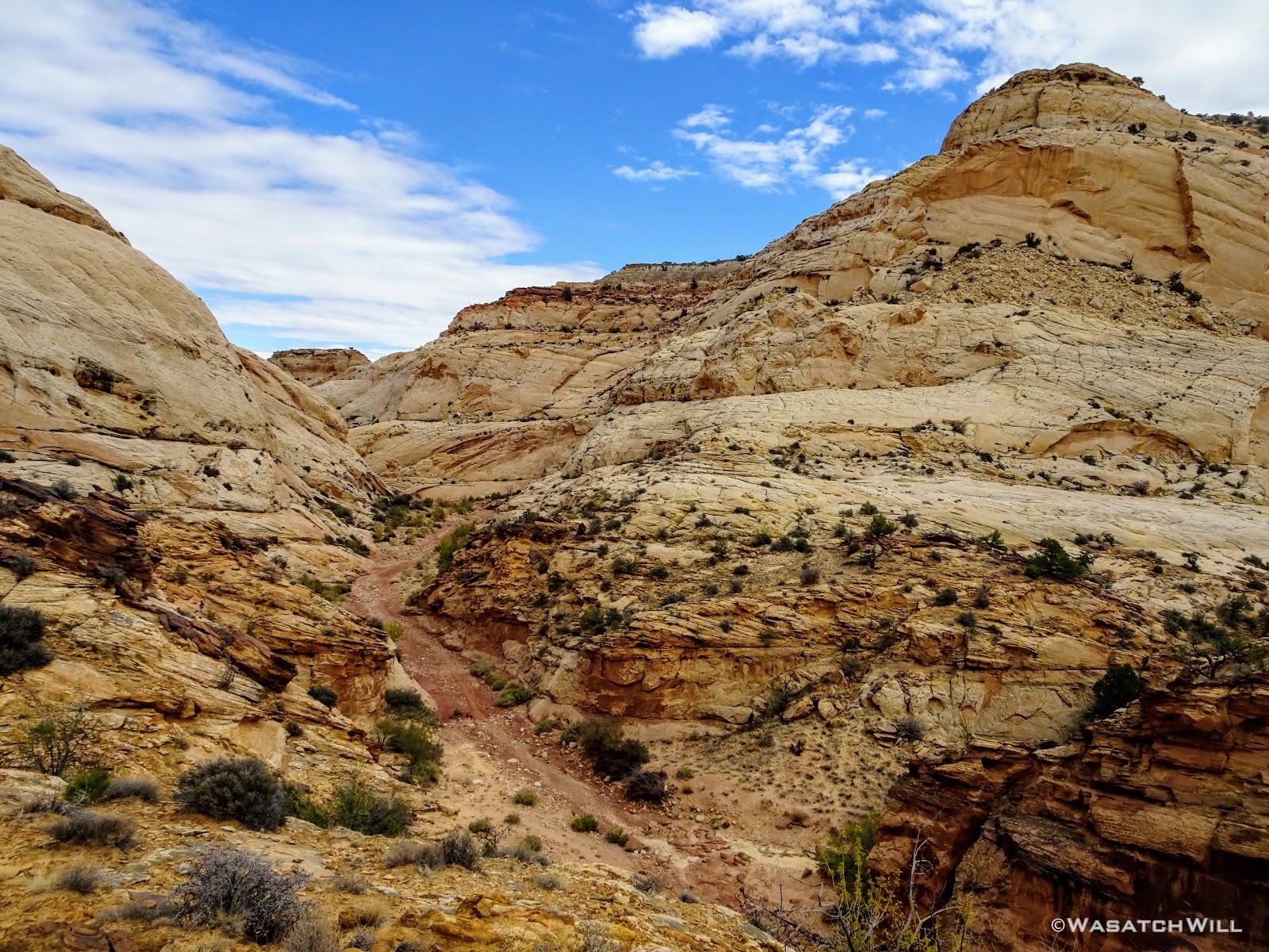
From just below all the water holes we exited the canyon via another ridge line. This time we'd gain it right from its start at a big bend in the canyon we had just come down and at the edge of another massive series of pour-offs.
Devin scopes out another pour-off
For the next mile and a half, we'd be riding high above the surrounding canyons, gaining a thousand feet of elevation in the process.

Looking down the drainage past the pour-off

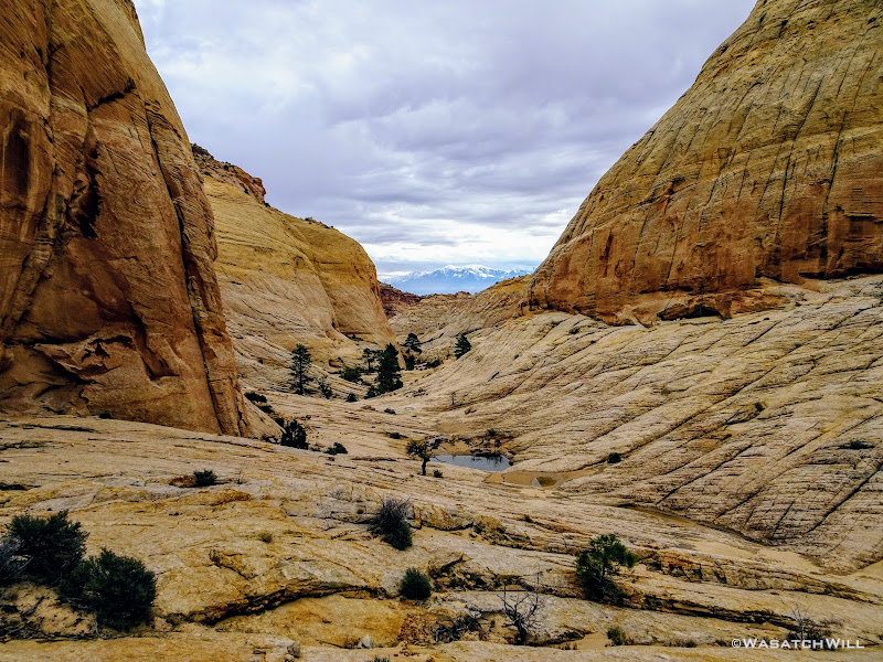
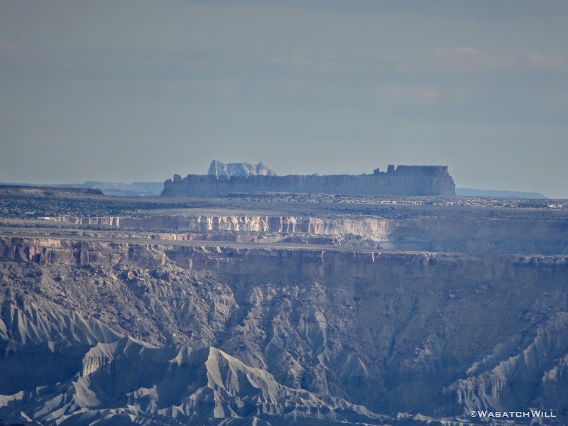
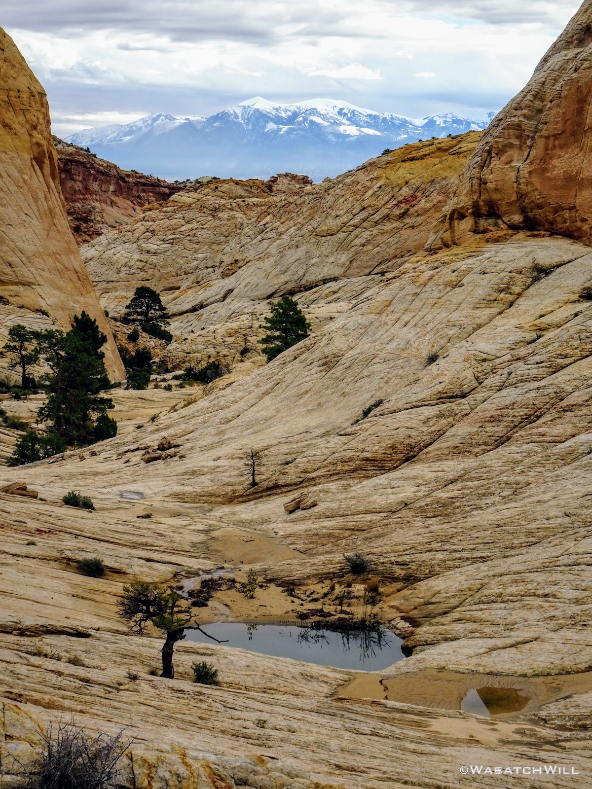
Waterpocket Fold
Zooming in on where we camped (center)
We eventually topped out where the rim we were on bends back like a horseshoe, revealing the head of the canyon we had exited further back. I have never been to Zion National Park, but I was told by Devin that the views along the rim we were now looking over rivaled those of Zion. One day I'll finally get down there so I can compare for myself. In the meantime, we'd now sit for lunch and enjoy our views of this desert heaven.
Rim Pano
Lunch and a view
Eastern Pano
Well rested and well fed, we saddled up again to begin our descent down the other side of the rim into yet the next canyon over. In a matter of a few minutes, we were once again peering down into that next canyon, and once again, we were made speechless with draw-dropping views.
Pano with Devin on rim descent
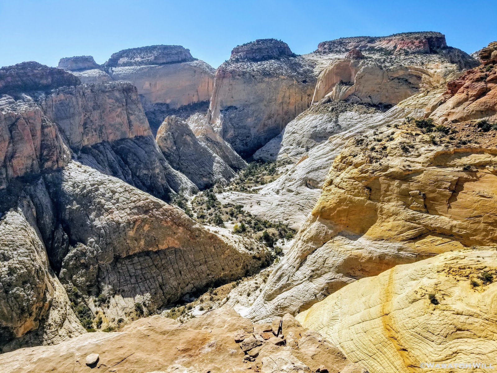
View down into into next canyon

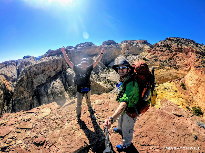
Selfie Stop
Once past those views, it was a relatively straight forward and uneventful 2 mile descent down 1400 feet of elevation to that next canyon bottom's wash via a small tributary drainage from the rim. Once in the wash, we continued to follow it eastward for a bit before exiting that one for a large tributary drainage across the other side of the main wash. Once again, water sources became plentiful.
Heading up another tributary drainage
Heading up the "wader" canyon
This particular drainage held the dreaded wader. We dreaded it because it can allegedly be a swimmer, or at least chest high, at times, depending on recent rains, floods, and the ever changing conditions some slot canyons can present from year to year. Thus, we did not know if we'd actually just be wading in waste high water, or if it'd be deeper given the recent storms that had passed through in recent weeks. In drier times, it's cold factor can be much less threatening becoming as shallow as only knee-depth.
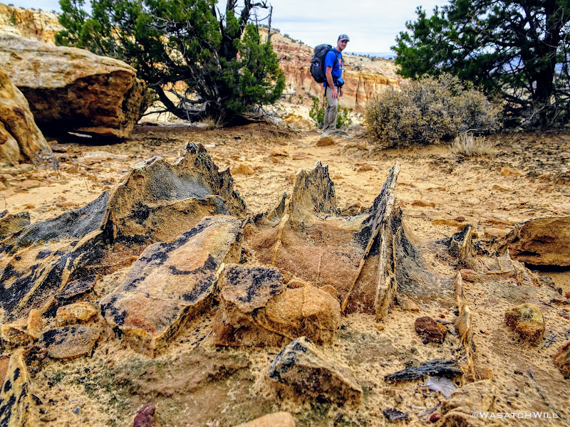
But before we could find all that out, we'd be a faced with a few other obstacles that required us to navigate around, including another slot that had some chockstones and mud pots (potential quicksand traps) we didn't want to mess with. To bypass it, we found a ramp to take us up to a bench high up along the canyon wall.

Upper bench bypass
We followed that bench for a bit until we were able to find what seemed to be the only viable way back down, a steep chute with some patches of loose rock and a little bit of bushwhacking.
We made it back down to the canyon bottom without harm. It really did feel like an accomplishment to get back down.
The rocky chute (center) we descended from the upper bench
As luck would have it though, just minutes after reaching the canyon bottom again, we encountered an unexpected wader before the expected one. Being caught off guard, we plunged right through what became the "warm-up wader" (yes, that's an oxy-moron), not thinking to put on the actual water shoes I had brought for just the occasion. Oops! Fortunately, it was only knee-deep at various points.
"Warm-up" wader
Now with cold soaken feet, we made the final approach to the big wader ahead. It looked ominous indeed. We knew it would be cold as was confirmed by shallow wader we just passed through, but how deep did this next one went was still big on our minds.
Devin and I stared each other down. Who would be the brave soul to go first and scout it out? I was about to suggest a duel of Rock, Paper, Scissors when Devin volunteered.
He dropped his pack and forged ahead. I offered over one of my trekking poles (he brought none) to help him gauge the depth ahead of each step. Fortunately, it got no worse than waist deep before reaching the end of it about 50 feet away where a couple of chockstones allowed a passage up between them.
"YEP, WE CAN DO IT!" Devin cried out.
"WOOO!" I responded.
Had it become too much, I had an alternate detour that would have routed us back down near the other end of the canyon and then cross country over less exciting terrain to get out to Capitol Wash for the next day. Thankfully, it did not come to that
The expected wader, with Devin at other end (center)
I proceeded to ferry our packs to the other end where we collaborated about another obstacle immediately after the chockstones.
What was not anticipated here was another pool of water sitting immediately on the other side of the chockstones, the surface of this one being a few feet higher than the one we just waded through. It was apparent that the lower chockstone and whatever sediment beneath it had teamed up to make quite a little dam. Devin was unable to make contact with the bottom of this pool with the pole. We wagered it was at least neck deep or more. Fortunately it wasn't nearly as long, maybe only 10 to 15 or so feet to the other end of it and the canyon walls were now close enough to allow us to simply employ some stem and chimney moves to get over it. Again packs were handed off to advance them forward.

Myself, chimneying over the upper pool above the wader (photo courtesy of Devin)

Looking down canyon from the end of the upper pool
After reaching the barrier at the other end of the 2nd pool, we were greeted with a 3rd and final pool right after, the last being another shallow wader, thankfully just over knee high at its deepest, before we were done with the waders for good.
Unfortunately it was later in the day now that what we had wanted and the sun was starting to drop fast. We were now very close to where we wanted to camp for the night though, the only other obstacle standing in the way now being a steep scramble up a high gulley to what Steve Howe named Rabbit Ears Pass that would drop us into yet another canyon over. Before proceeding up to the pass though, we paused to top off our water reserves among another series of waterpockets within a bed of sandstone knowing that there was a good chance the area we wanted to camp at would be another dry camp.

A series of waterpockets
A few minutes up canyon from where we loaded up on water, we beheld the high pass. Earlier in the day, it wouldn't have looked so intimidating, but being near the end of the day, it now looked ominous. Still, we knew it'd be worth it to make camp on the other side though, so up we went, employing more teamwork at some various spots to get over some of the bigger boulders lying in the way.
Rabbit Ears Pass
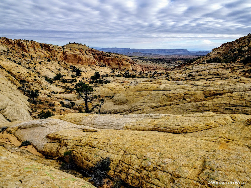
After a good half hour or so of scrambling, we finally reached the top, where we could gaze down into Blow Sand Canyon, another informal name by Steve Howe. This had been billed in the write ups as another spot along the route surrounded by blissful scenery.

First look into Blow Sand Canyon
Looking back down what we had just climbed up confirmed it was no small feat.

Looking back down Rabbit Ears Pass and what we just climbed up
Fortunately, the descent down into Blow Sand Canyon was much less of a descent.
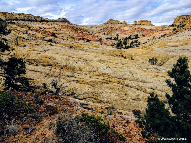
Looking up Blow Sand Canyon
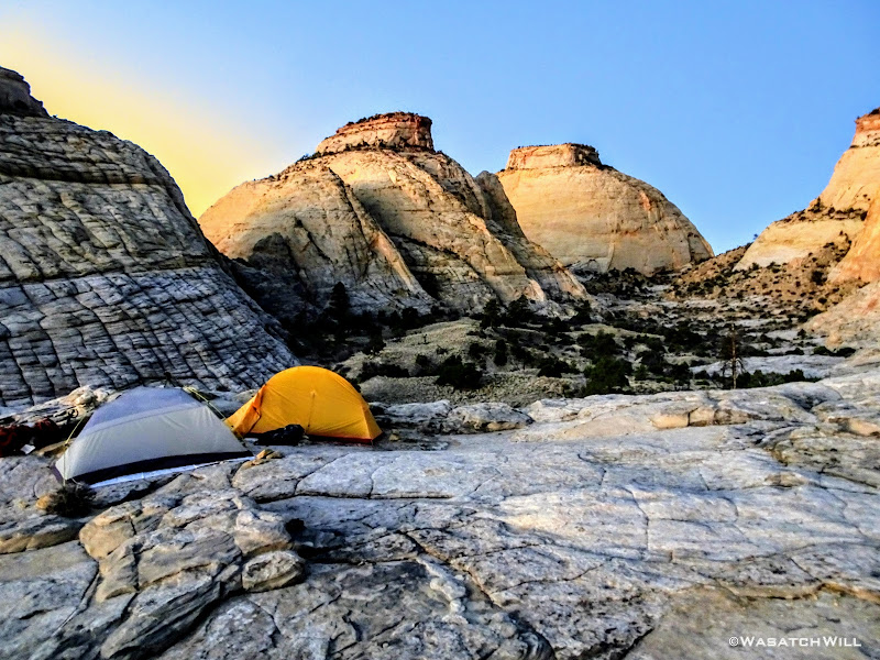
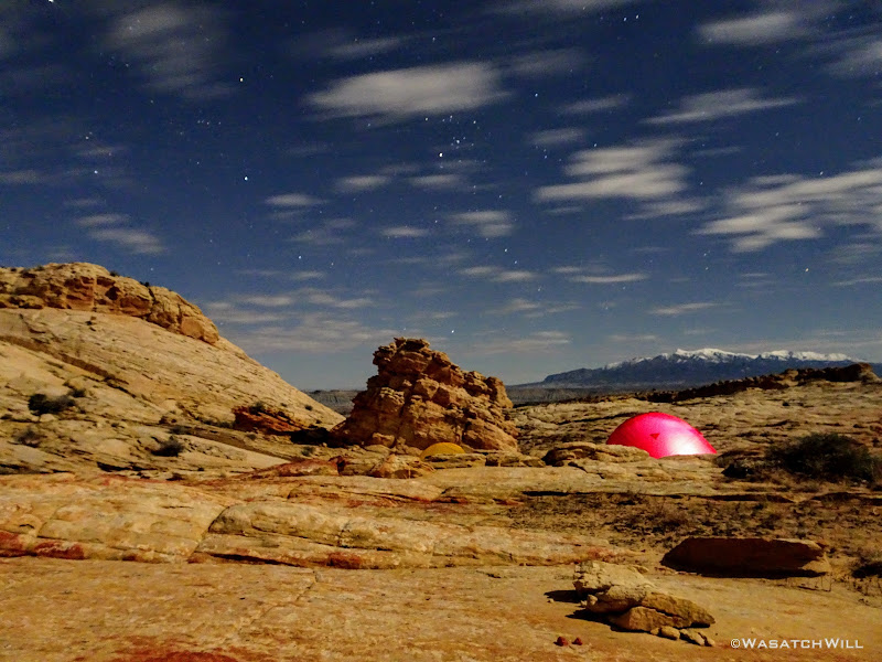
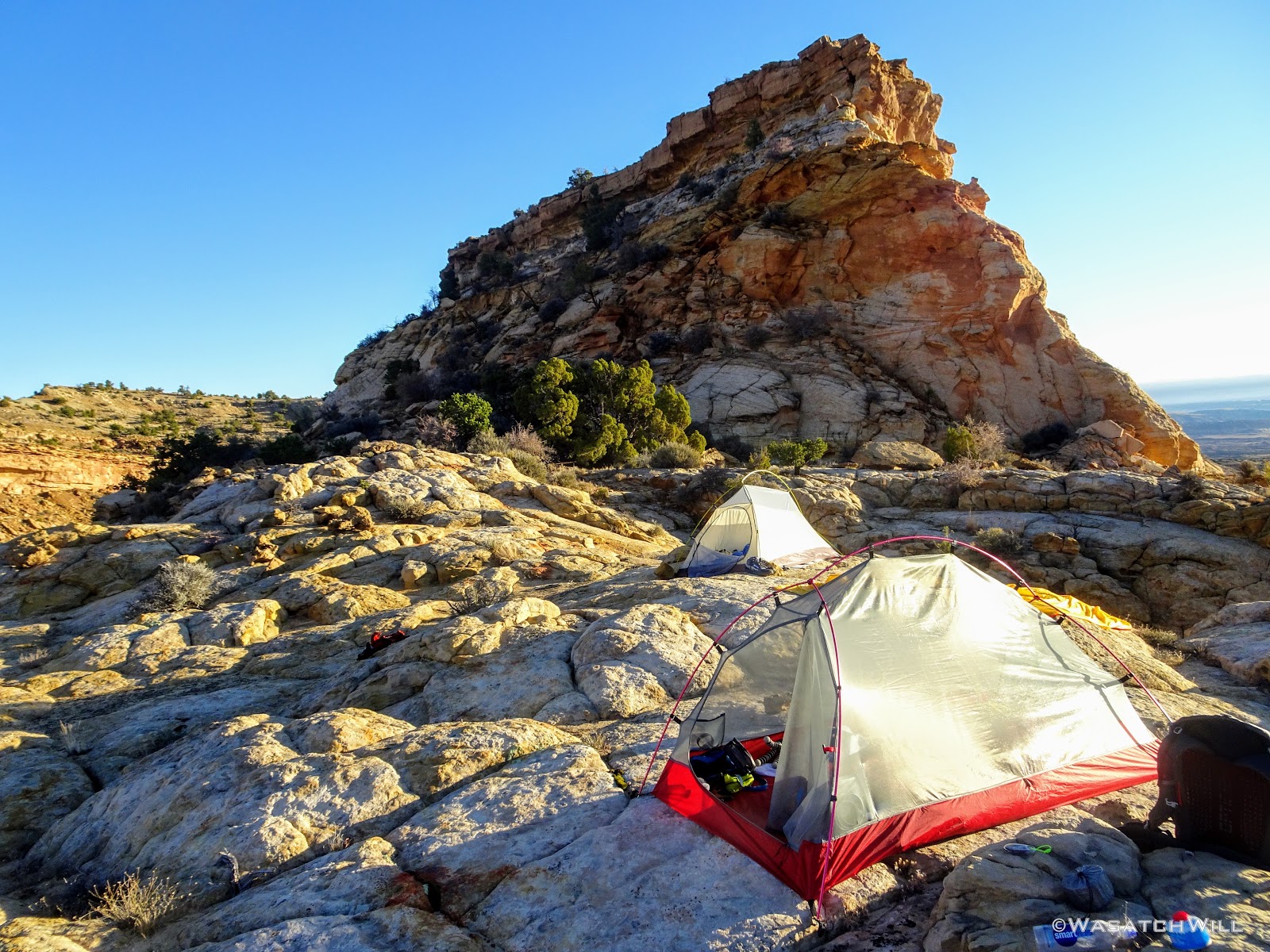
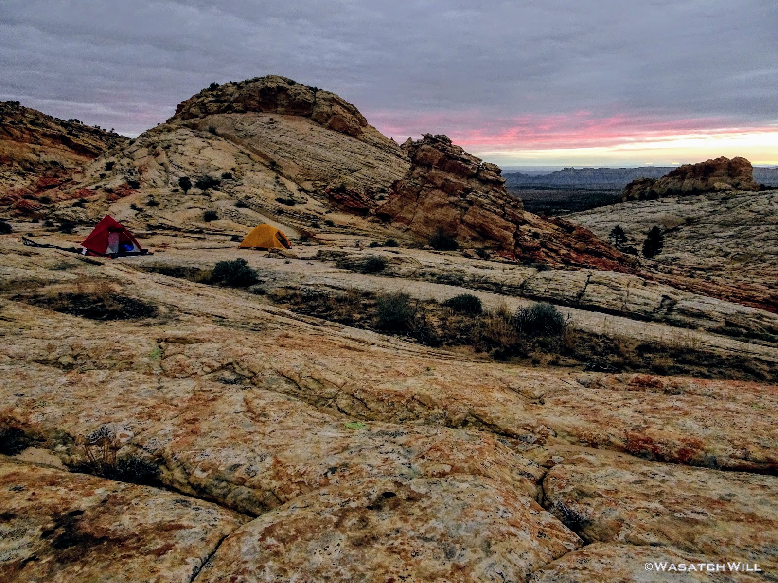
We proceeded to the lower edge of the flat and then wandered up some slickrock slopes where we found a space just level enough to comfortably accommodate our two tents. Yet again, we were rewarded with a jackpot of views.

Our camp above Blow Sand Canyon
Looking east over our camp
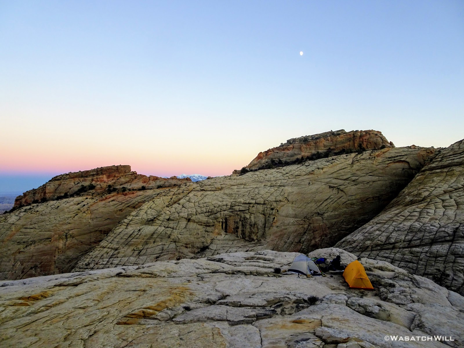
Moon rise over camp
The next picture reveals a UFO that flew over head during dinner. (Ok, it was really a lens flare.)
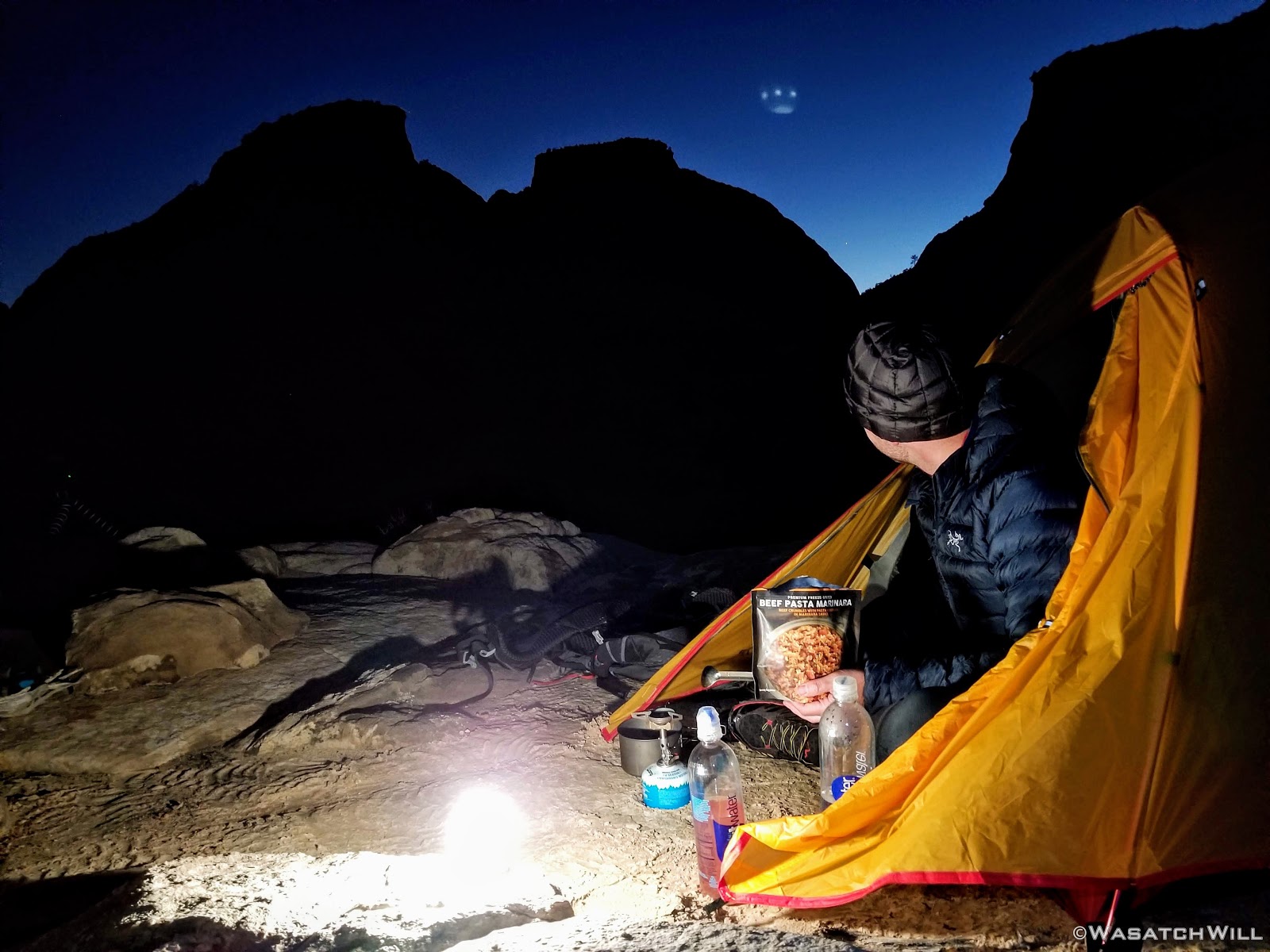
Dinner and UFO
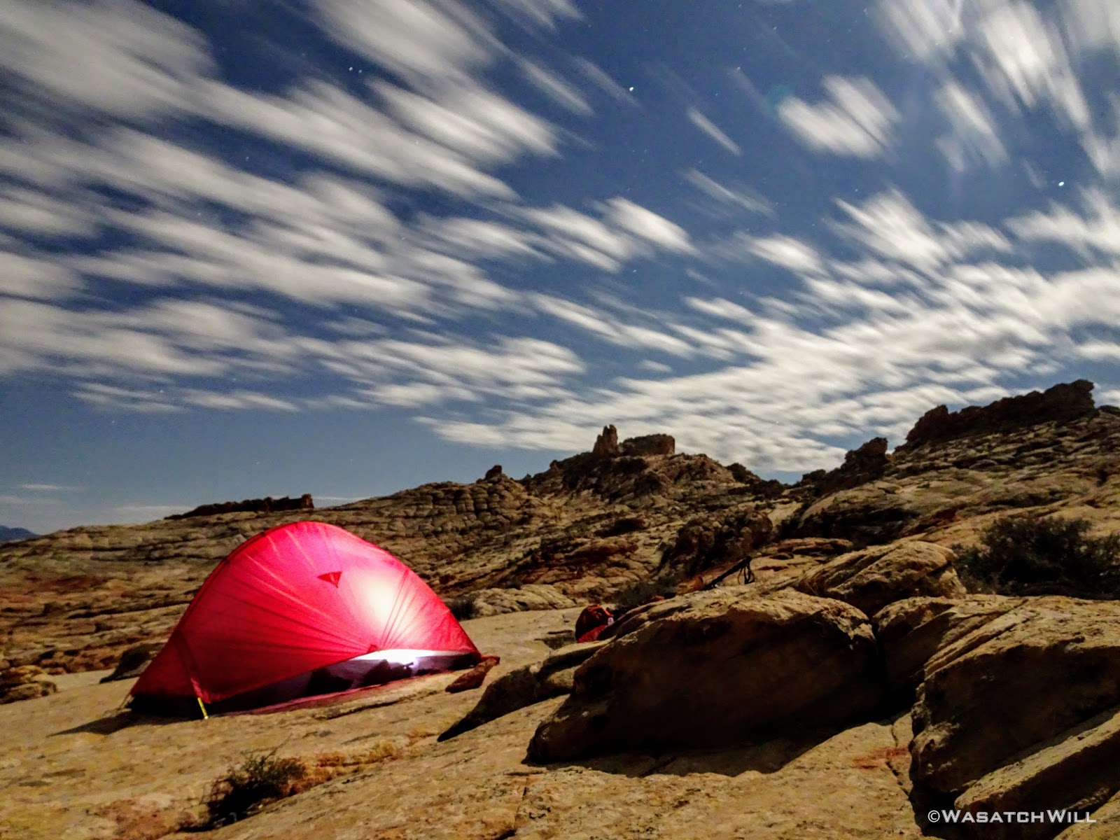
It was a nearly full moon, so we spent some time after dinner seeing what some long exposures could pick up with our cameras. After some play time with our cameras, we crawled into our tents for another night of well deserved rest.

Night glow

A bit of Milky Way made it into this shot
Day 3
Saturday - October 20, 2018
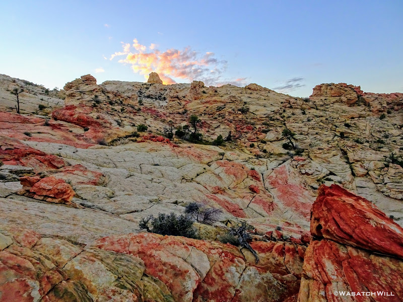
Day three opened with clear skies once again but unlike the previous day, they would not last for long.
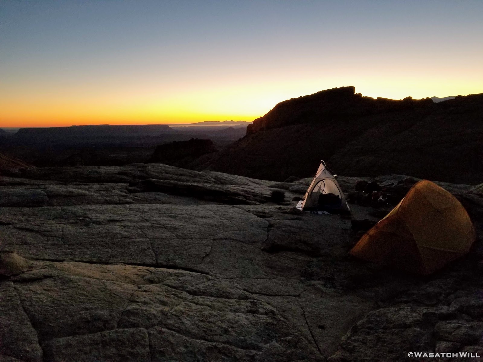
Dawn at camp

Looking west over camp
We broke camp and moved on back down into and through the flat.

Heading through the flat
Our route would take us over yet another pass into yet another canyon.

Up another pass
Clouds were gathering and darkening ahead of us to the south.
Looking south from the top of the pass
Bluebird skies persisted behind us.
Looking back down into Blow Sand Canyon from the pass
Down off the pass, we were spoiled with yet another spectacular sight before us.

Myself, taking in the view down the canyon to descend
Just below us lied the last major obstacle of the route, a gathering of the canyon walls into a steep and narrow crevice, a feature that had also received an informal name from Steve Howe: The Butt Crack. With much less hesitation than shown at the big wader the day before, Devin once again volunteered to go down first. He's adventurous like that. Employing more stem and chimney moves enabled a safe descent down through the crack. We suppressed our middle-school minds to keep the jokes from becoming too obnoxious. Perhaps though, it would be fitting to name this whole canyon "Butt Crack Canyon".
Devin taking on the 'Butt Crack'
Devin, closer up
Myself, beginning the descent down the crack (photo courtesy of Devin)

Pausing for a stem shot (photo courtesy of Devin)
Once at the bottom of the crack, I was now on familiar ground. In preparation for the time I'd be able do this route, I had come up to to the bottom of this Butt Crack earlier in the spring to scout out the terrain up to that point, including a bypass over the biggest pour-off yet to come further down the canyon while out on a day hike in the area with my wife and youngest daughter. So, for the rest of the route onward, I'd now be retracing foot steps I had taken in the past. For Devin, the rest of the route ahead of us would largely continue to be his first time traveling it.

Butt Crack (May 2018)
Passing clouds continued to threaten us with some light showers but nothing ever came of it as we finished out our descent down through the canyon.

Devin standing further down canyon with clouds looming above

A pool to bypass along the canyon descent

Looking up canyon

The Henry Mountains come into view down canyon
The Henry Mountains closer up on the horizon

Devin continues the descent down the canyon
A little emerald pool
A little emerald pool, closer up
As we rounded a bend in the lower half of the canyon, Capitol Gorge came into view.
Capitol Gorge comes into view in the distance
As mentioned just above, we had to bypass a great pour-off by scrambling a hill above the top of it to gain a small ledge that would swing us out to a large rock slide consisting of large boulders and lots of loose scree.

Standing above the big pour-off to be bypassed

The big pour-off (lower right) as seen along the bypass around it
Looking back up canyon at the pour-off and rock slide
Having safely traversed the rock slide, we were back on solid ground as we followed a slick rock bench toward Capitol Gorge. We decided a stop at The Tanks was as good as any spot for lunch. Being Fall Break for all the state schools, we knew there'd be some crowds around, and sure enough, we greeted quite a few groups.

An upper pool at The Tanks

A pool at the Tanks

Full Tanks

Small bridge below The Tanks
Capitol Gorge Pano from The Tanks trail
Looking down Capitol Gorge from Tanks trail
Back down in Capitol Gorge we could have followed the parade of people up to the Capitol Gorge Trailhead and concluded our trip there. After all, this is where most of the few who've done the Beehive Traverse in the past concluded there respective trips. But with an extra night to spare, we planned another leg to our trip whereby we diverted away from the crowds once more and headed down canyon. Devin's mind was tripped up a bit by the sudden exposure to several dozen people around The Tanks over the course of the last hour, after having not seeing since we left the friendly confines of Grand Wash two days before. It really was quite an awakening. For me, it was my body that was tripped up by some slippery mud in the wash.
This extra leg of the trip would simply be a reverse of what I had done almost a year and a half prior. It was actually part of an extended version of the Beehive Traverse that Steve Howe had come up with as well. This leg would be a traverse up and across the rim of the Waterpocket Fold section lying between Capitol Gorge and Pleasant Creek.

Tafoni (Swiss Cheese Rock) in Capitol Gorge
As we approached the tail end of the canyon, Devin noticed some graffiti up on a south-facing wall. We stopped for a moment to try and make it out better and immediately observed a petroglyph panel just to the side. Last time, I had come through the canyon, again, hiking in the opposite direction, I was in a bit of rush, and didn't think to look much for any rock art until arriving at the more well-known panels further up canyon. To get a closer look, we pulled ourselves up out of the wash and dropped our packs for another little break.
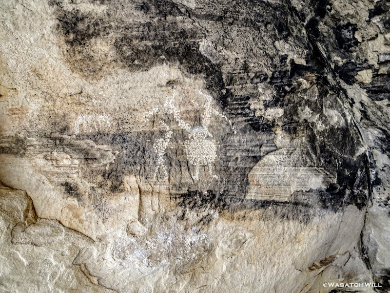
Petroglyphs (Barrier Canyon Style?)
'Big Hand' and Sheep
Deer?
Caterpillar?
A bit further along the wall was some interesting streaks of desert varnish. It was as if the rock was alive with living veins or arteries of blood running through it.
Desert Varnish
Organic veins
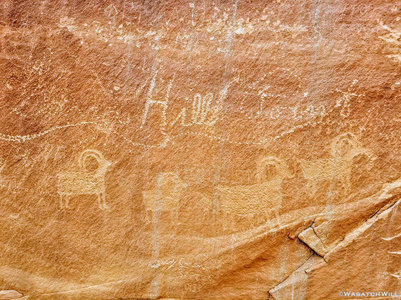
And on the other side of the streaky phenomenon, sat another panel of Fremont rock art.

Fremont petroglyphs
Back down in the wash, we continued down canyon until it opened up and the walls receded.

Under an overhang in lower Capitol Gorge
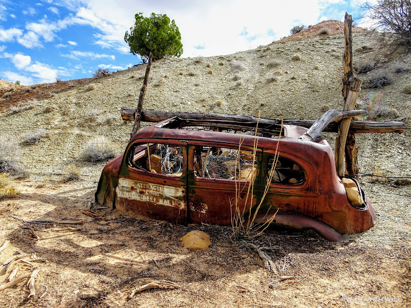
The old automobile shell that sits as a relic and border marker of what was previously Capitol Reef National Monument was there to greet us.

Capitol Reef National Monument "Scenic Attraction" border marker
Soon after, we left the low lying Capitol Wash in pursuit of higher ground once again. This time being a 2.5 mile slog to gain 1100 feet. I knew what to brace myself for but this particular afternoon was more of a mental challenge on Devin than any other part of the trip. It wasn't very strenuous and certainly no major obstacles. It was just long and hot with little change in the terrain and scenery until the end. But...then, we finally hit a rim with yet another amazing overlook allowing us to see across the canyons we had just cut through that morning. It was another nice, hard-earned reward that served to recharge our spirits, every bit as breathtaking as I remembered it from the year before.
Looking north across Waterpocket Fold with Golden Throne in upper center
Pano or northern Waterpocket Fold
As nice as it could have been to linger a little longer, we were more eager to move along to the area where we'd seek out another worthy campsite. Along the way, I noticed a few small uprisings just off our route among the cryptobiotic soil we were passing by and around. I believe it was some Gypsum.
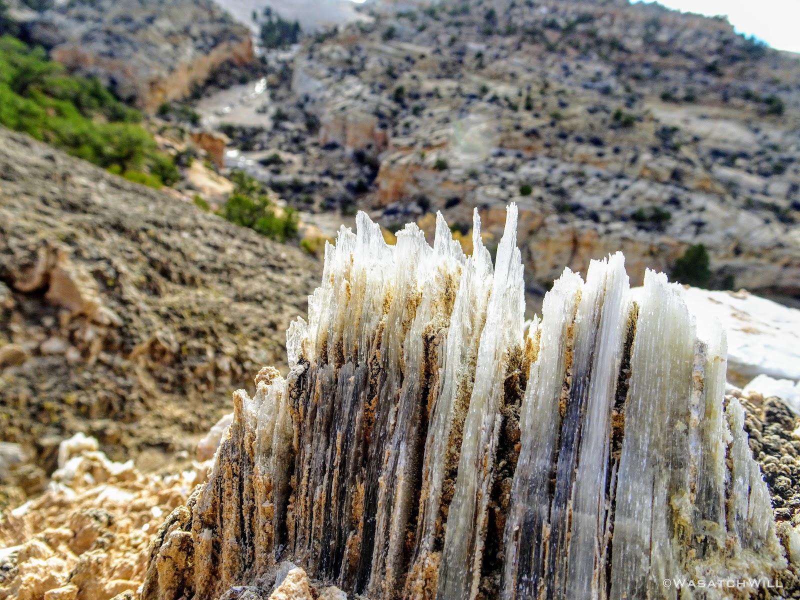
Gypsum crystal layers
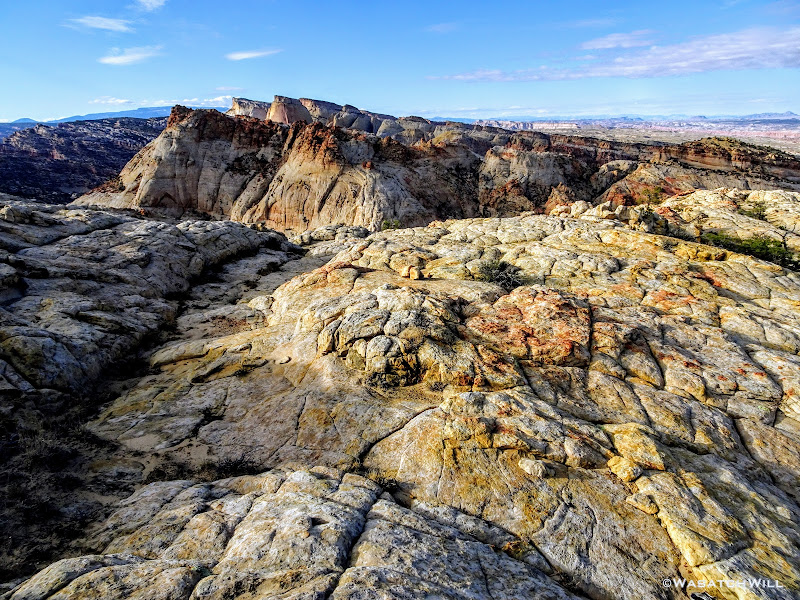
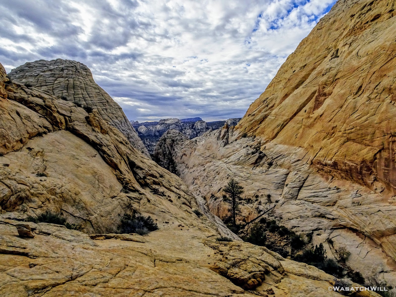
We continued to edge our way along the rim until it brought us into what for me is a slickrock paradise.

The view northward from high atop the rim
Here, we could have made a great camp, but we opted to keep moving along through the upper end of another little canyon to the south. I'm keen to call it "Checkerboard Canyon" because of the far side that is textured like a grid. In the Capitol Reef episode of Rock the Park that airs on ABC each week, hosts Jack and Colton slept here on their night out in the Capitol Reef backcountry. It was obvious they had gotten their route from Steve as well.

View down "Checkerboard Canyon" with Henry Mountains on horizon

Looking down into upper "Checkerboard Canyon"
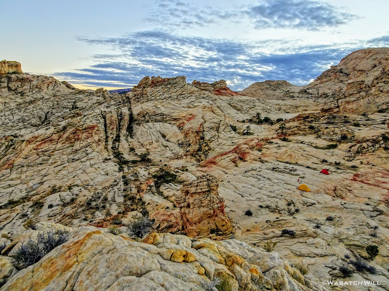
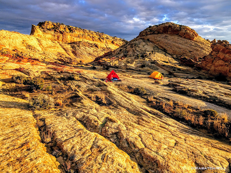
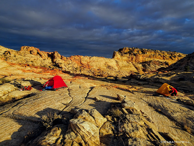
Once up the other side of the basin, we settled on a nice slickrock flat along a saddle between the basin we had just cut through and yet another basin lying to the south below us. There we made camp, and found a nearby shallow pool of water from which we filtered what we needed. And then, for the first and only time of the trip, we enjoyed our dinner before dark. And once again, we were spoiled with incredible views all around.
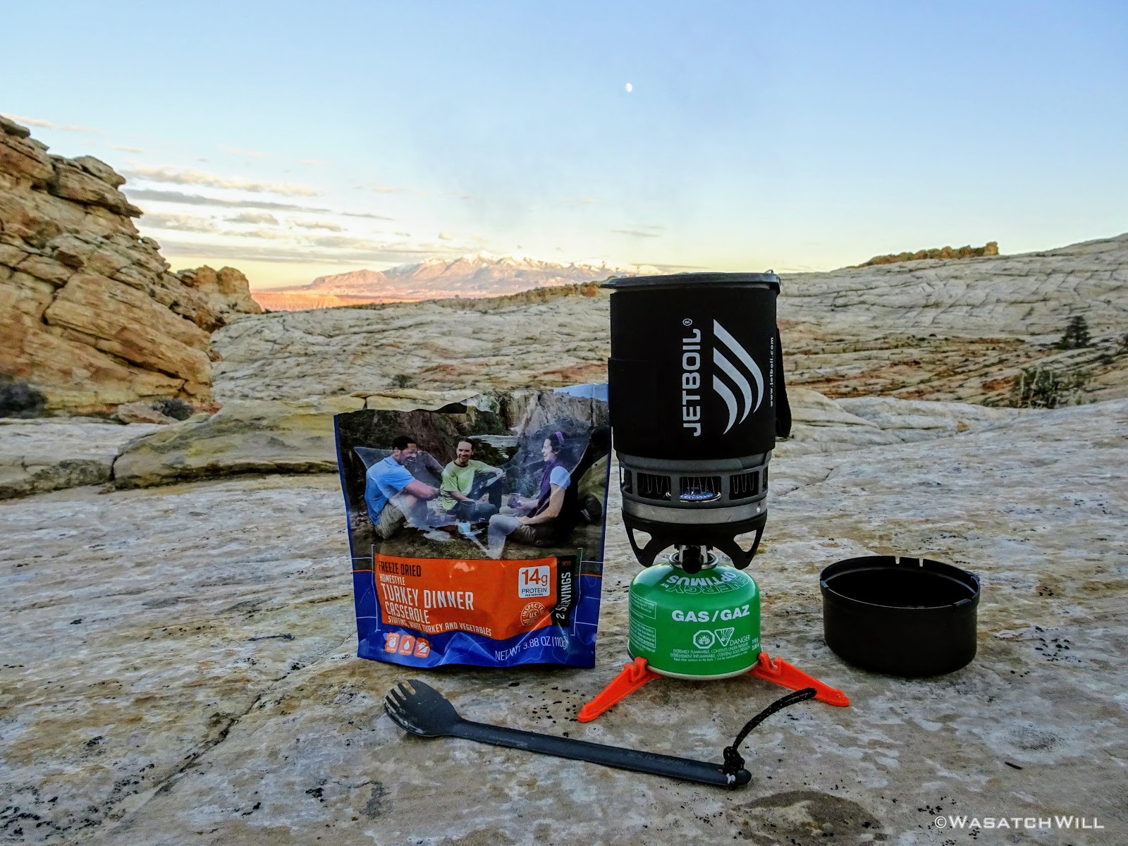
Mountain House Turkey Dinner

Moon over camp and Henry Mountains beyond

Northern backdrop from camp

High angle view of camp (tents are to the right)
After dinner and some wandering around checking out our camp's surroundings, we took advantage of some leisure time and got some R & R.
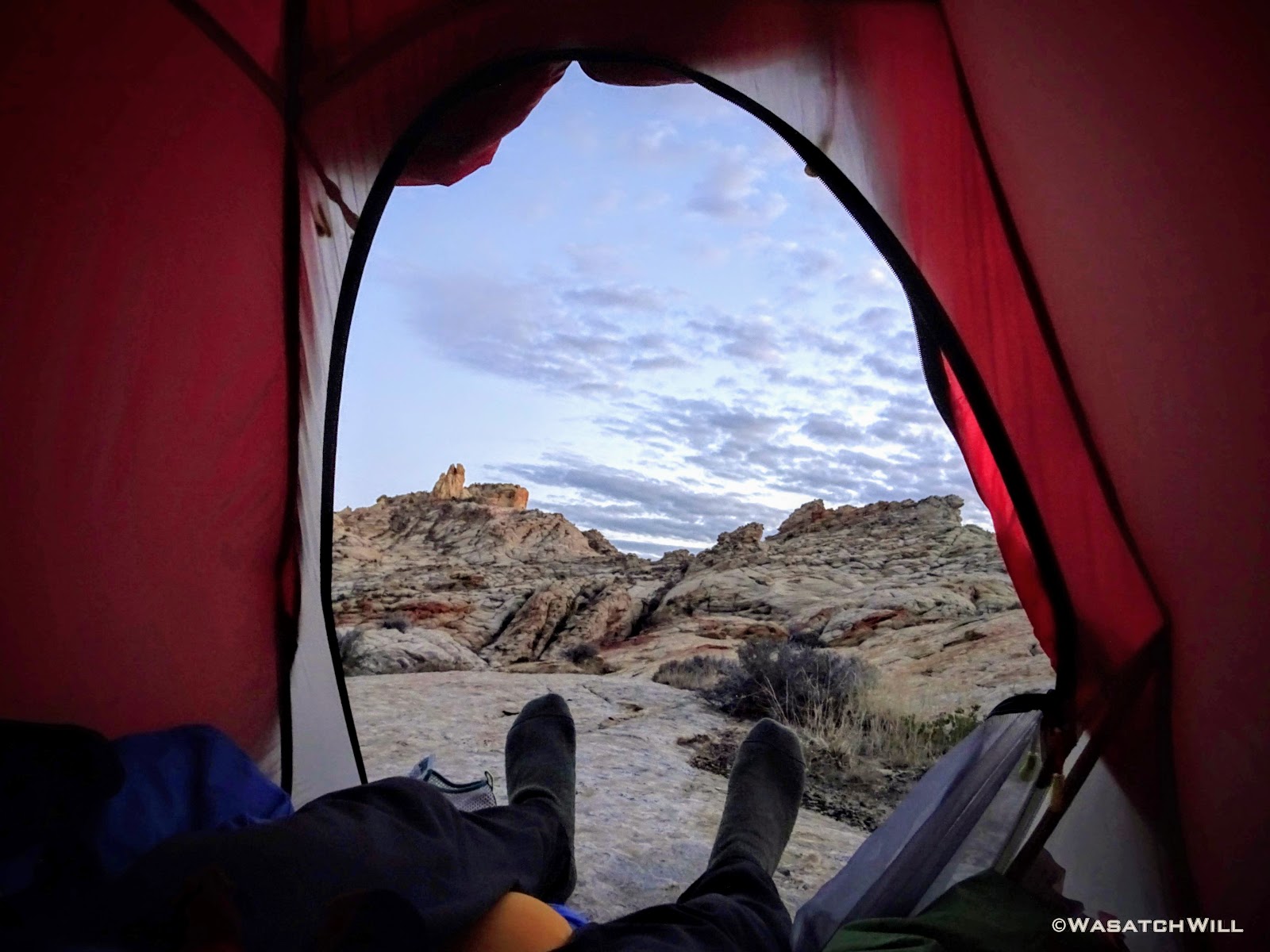
Tent door view

Lonesome tree above camp
I passed some time with a bit of reading followed by a helping of The Office and a few other Netflix downloads. By then, dusk had come and gone and the stars and moon were now fighting for visibility through some passing clouds. The next day's weather was due to be mostly cloudy with a good chance of some scattered showers by mid-day.
I got out of my tent to tend to a nature call, a late night dessert in the form of a snickers bar, and then just take in the ambient glow surrounding me courtesy of the moon as it illuminated the passing clouds and the surrounding landscape.
Passing clouds over camp
Eastern night view
Northern view
Satisfied, I retired back to my tent to sleep off the final night of the trip.
Day 4
Sunday - October 21, 2018
Unlike the previous two mornings, our last morning opened with some cloud cover just as expected. The sunrise wasn't as dramatic as I had hoped for, but we still got some shades or red out of it. Devin reported that there was a brief light shower earlier in the morning, but I must have been in a deep sleep at the time because I don't remember hearing anything on my tent.
Dawn, day four
Sun rays emerge from Henry Mountains
We had a good golden hour after dawn that produced some really interesting contrast of glowing sandstone against a dark and dreary sky.

Golden Hour

Cool contrast!
Golden glow

Breaking camp
We did our morning rituals, broke camp, and set off for Pleasant Creek. Along our way out, the clouds dispersed for a bit allowing us to enjoy a bit of bluebird sky once more. Moving along, we noticed what looked like a typical large ant hill in the desert. What made us scratch our heads was how a rock became perched upright within the crater.
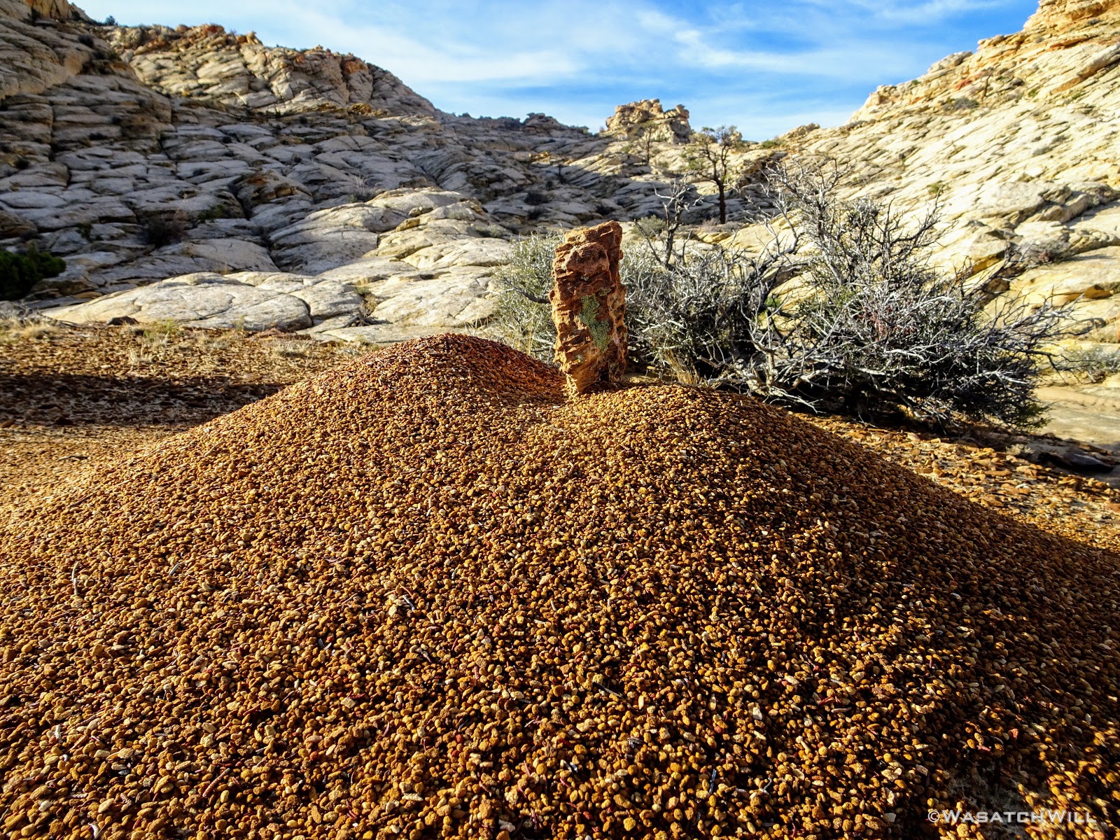
Rock on ant hill
Moving on....
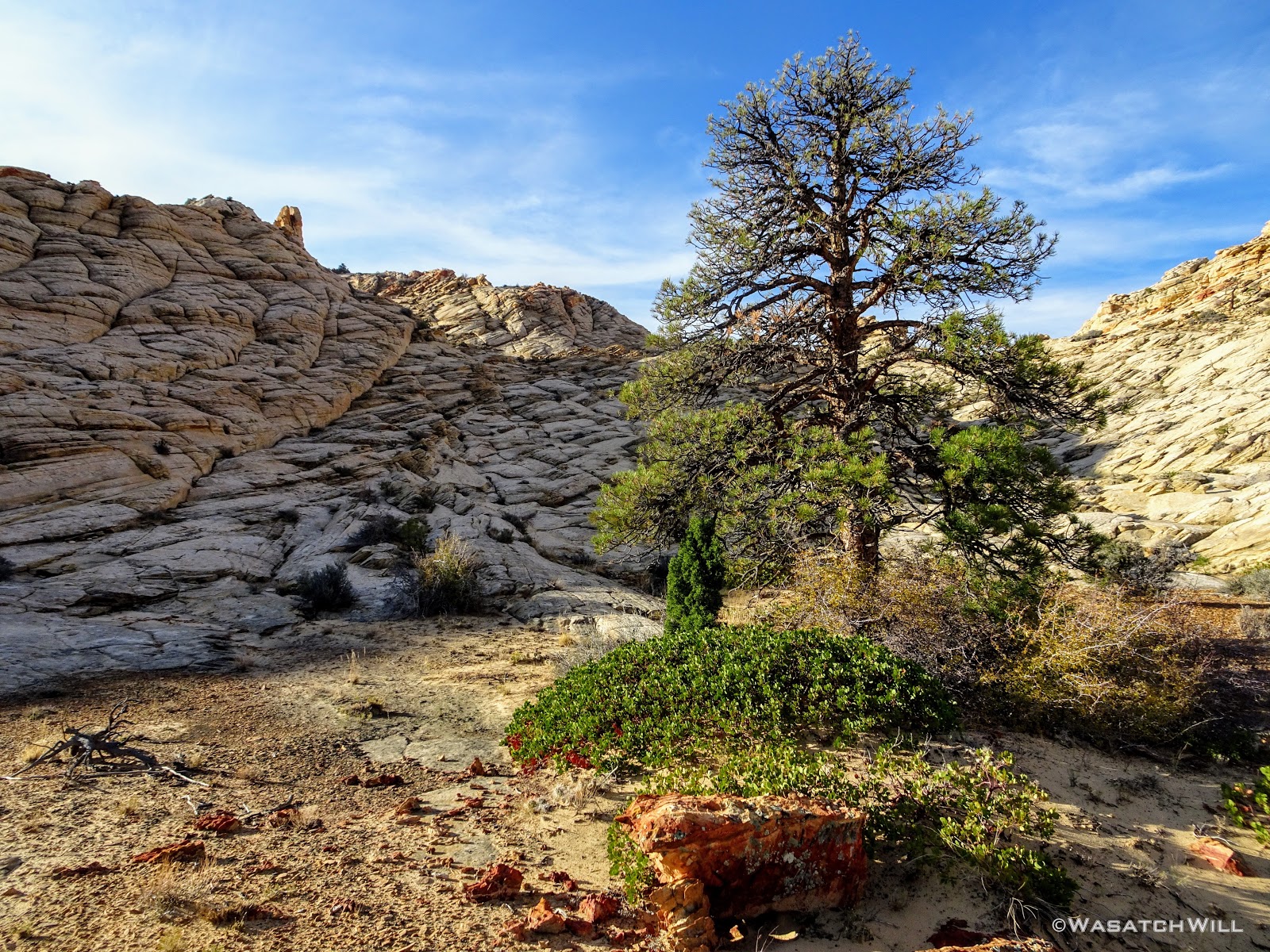
Lonesome Pine
We gained the edge of another rim where we paused for another good break to enjoy some panoramic views all around. To the east, we could make out landmarks on the horizon like Factory Butte. Below us to the south ran Pleasant Creek. To the west, Boulder Mountain. And to the north, several miles of the maze that is Waterpocket Fold we had just traversed over and through the final days. We were at our high point for the day.

Factory Butte
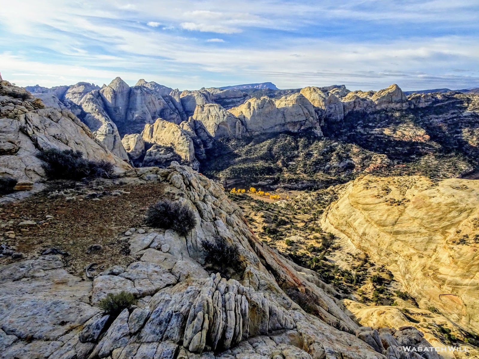
View south across Pleasant Creek
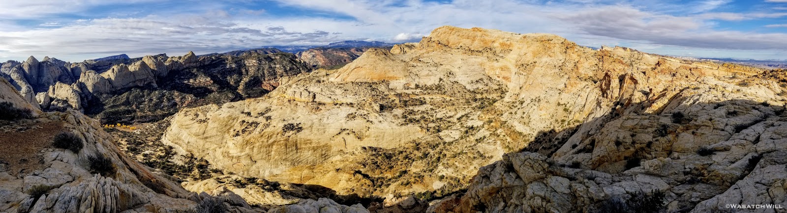
Pano view west
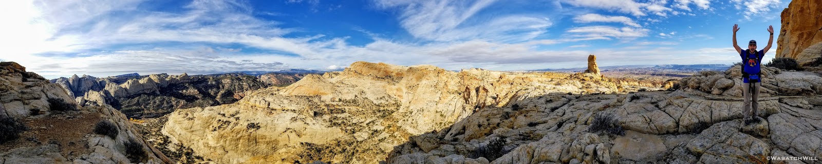
Pano view east
With packs back on, we now just had to descend the canyon I had camped in on my previous trip through these parts to reach the banks of Pleasant Creek. Pools and potholes full of water were ever plentiful down through this drainage.
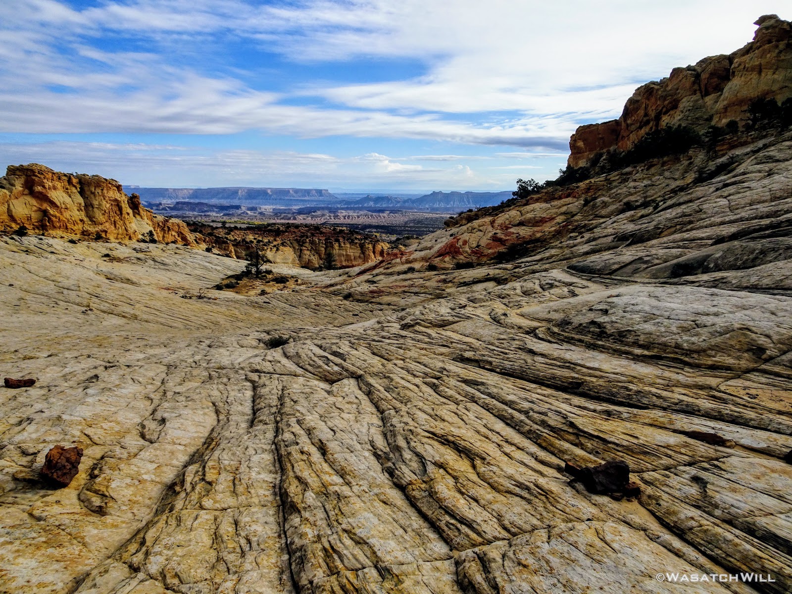
Down the drainage we go
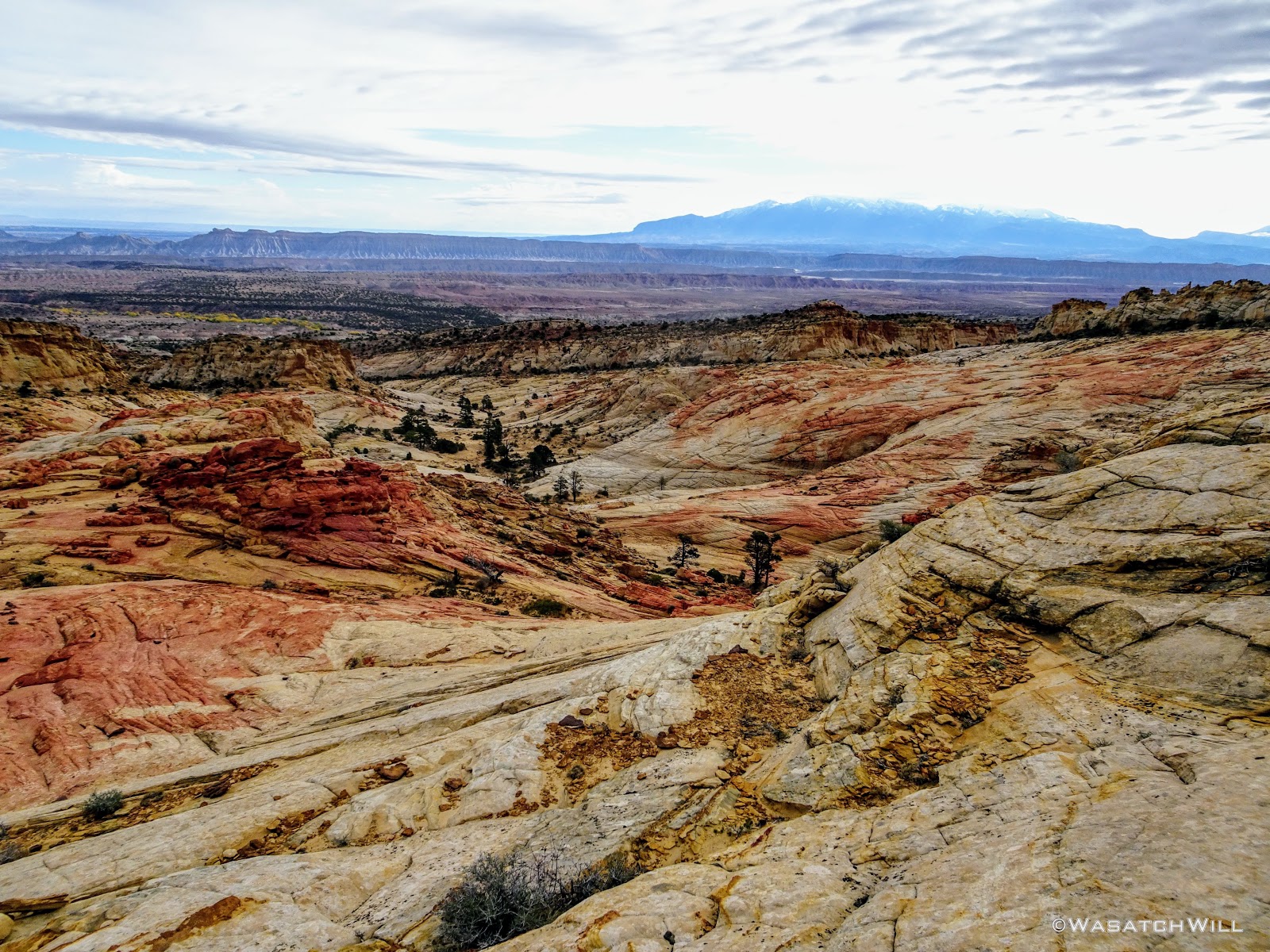
Another view of the Henry Mountains as we continue our descent
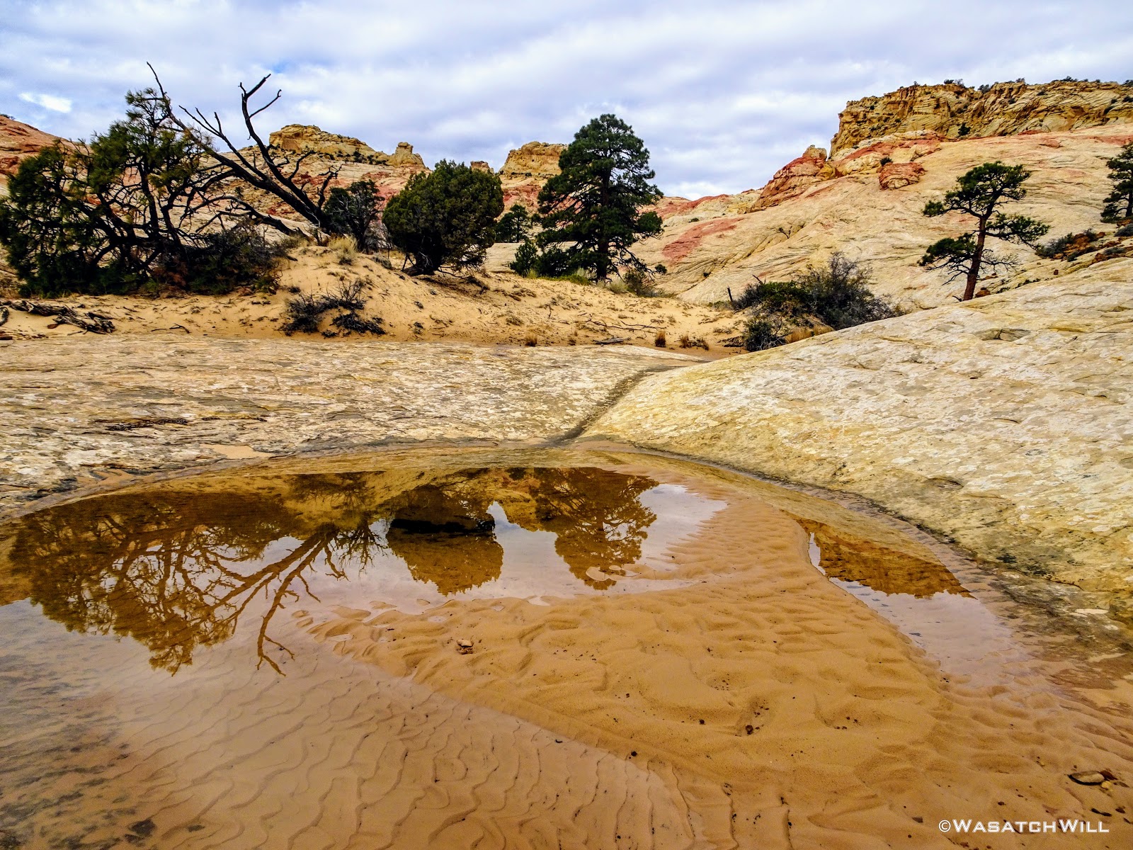
A shallow reflecting pool
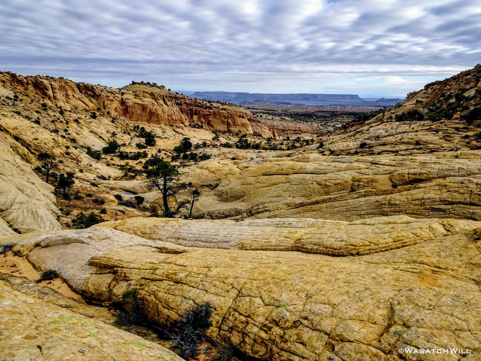
Looking down canyon

Looking back up canyon
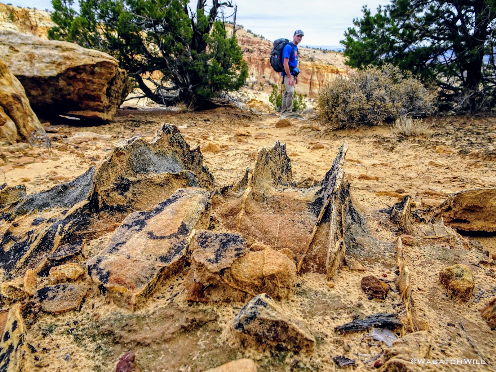
Devin stands beyond some interesting rock fins

A full pothole below a pour-off below
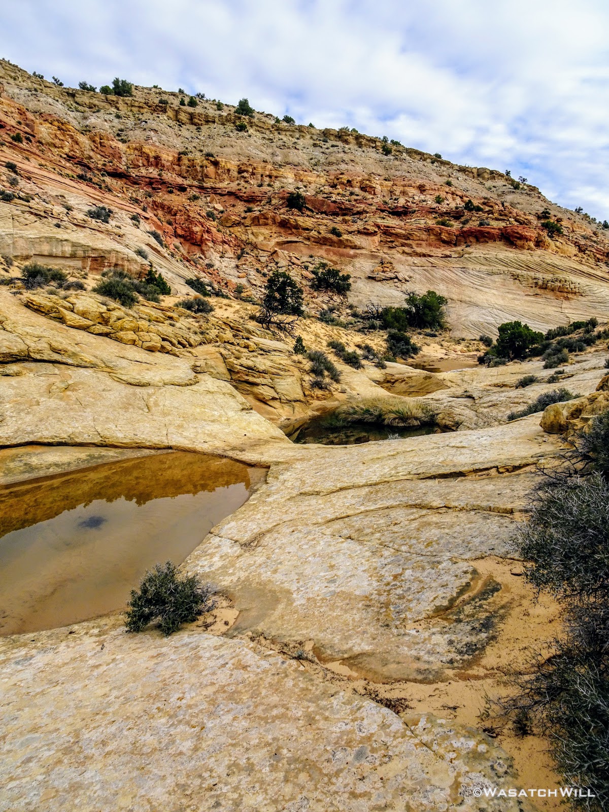
Siding around more pot holes
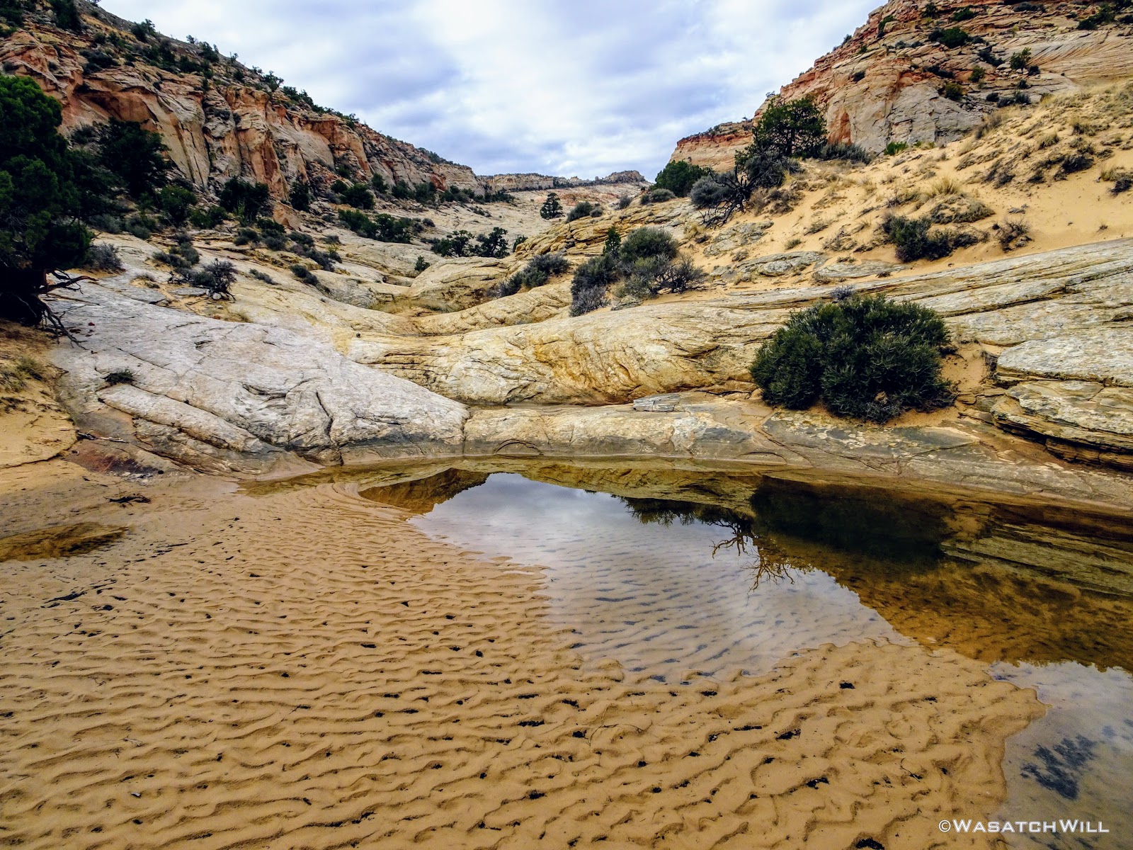
Another look back up canyon

More pot holes to move around down canyon

Snow-capped Henry Mountains appear above cottonwoods standing along Pleasant Creek
A couple miles later and 900 feet of elevation down, we found ourselves standing at Pleasant Creek. The end of our journey was now just a few miles upstream.

On the banks of Pleasant Creek
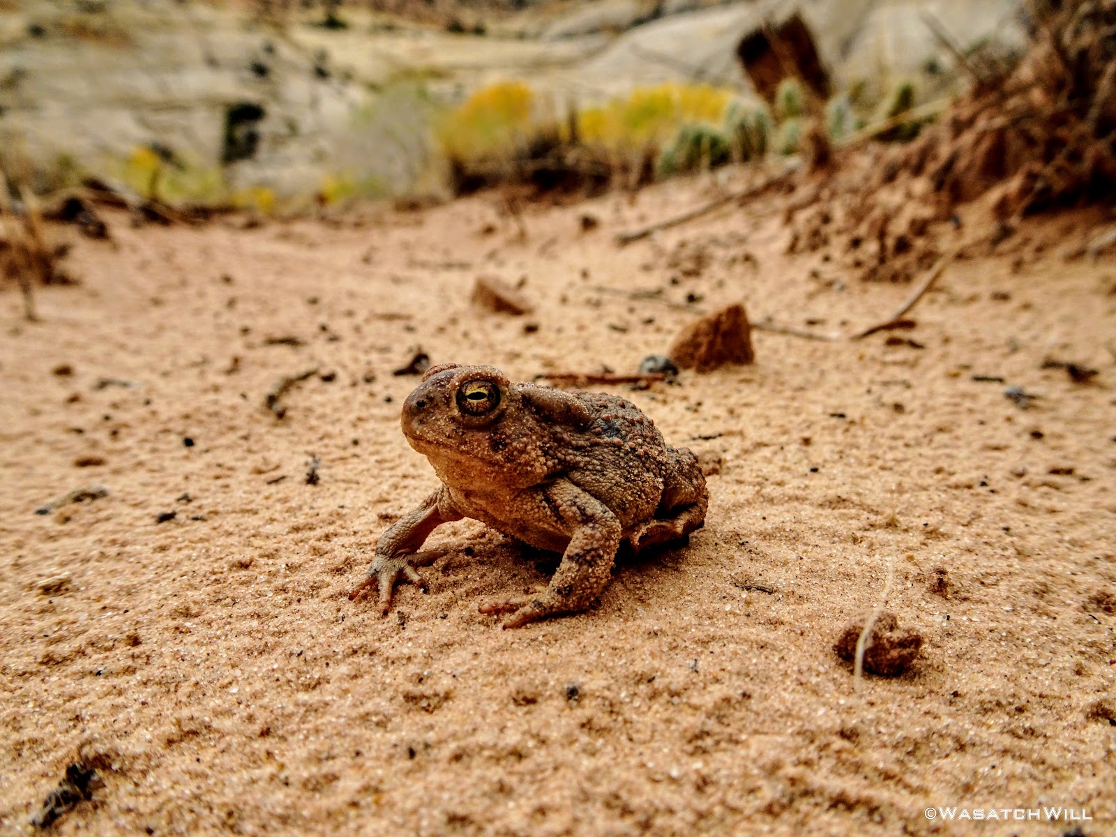
Woodhouse Toad
Up in the canyon, we pulled over for another break so I could show off a cozy little archeological spot with a nice view down onto the creek. Behind the rock we perched ourselves on for lunch were a couple of small cave-like cavities coated with soot in the cliff side, a mano and matate, a maize cob, and a couple petroglyphs. Having brought my daughter Ellory down to this point as part of our trip in June, it was my 2nd time here this year.

Fremont Caves

Ancient cob

Mano y Matate

Petroglyphs
Further along the wall was another panel of petroglyphs I had found on the June visit. Mingling with the ancient Fremont art are some pioneer inscriptions of the late 1800's and early 1900's.
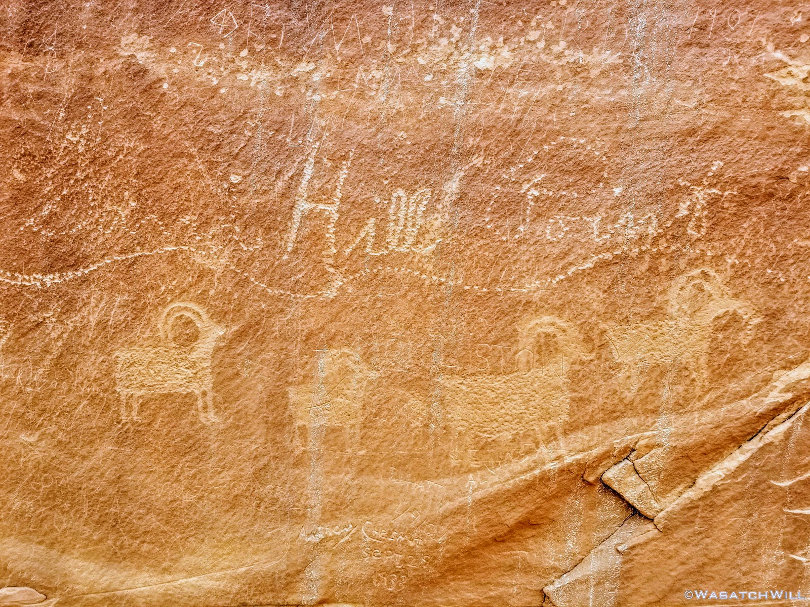
Bighorn sheep glyphs and pioneer inscriptions

Looking down at Pleasant Creek and cottonwoods
All along Pleasant Creek the cottonwood trees had donned their golden autumn coats.
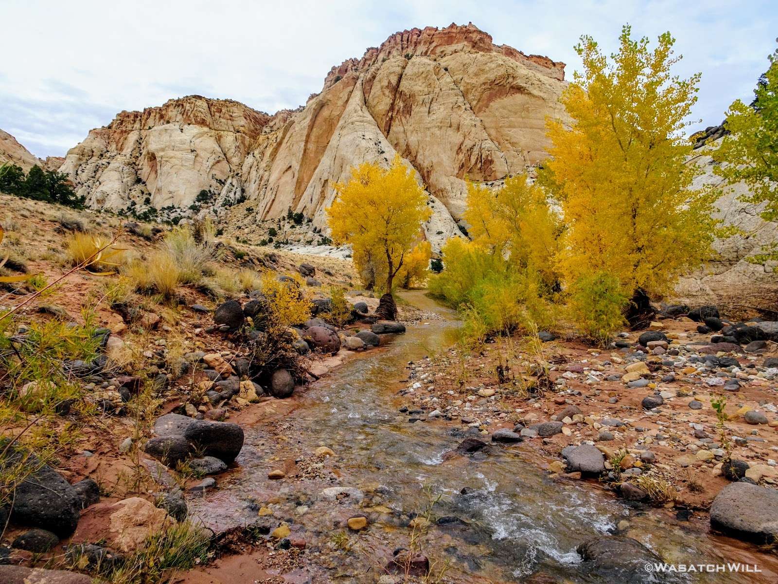
Golden cottonwoods adorn Pleasant Creek
I had hoped to show-off a tributary slot canyon that feeds out into the creek to Devin, the same one I had led Ellory up earlier in June, but for the sake of getting back home to our families sooner, and because clouds were starting to gather again to produce what we expected to be some showers at some point, we mutually agreed to forego it.
En route along the creek, Devin's keen eye spotted yet another panel of rock art. Of course, we jumped the creek and had ourselves a good up-close look. Having passed by this spot 3 different times before, I had not known of them. A set of four or five Fremont figures, almost uniform in size and appearance, were clearly the key subjects in whatever story or memorial was carved out and painted here, for the panel consisted of both petroglyphs and some pictographs.
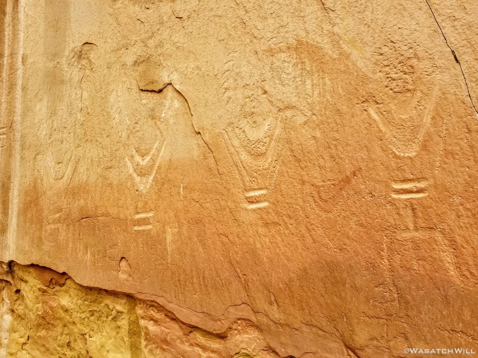
Four big Fremont glyphs
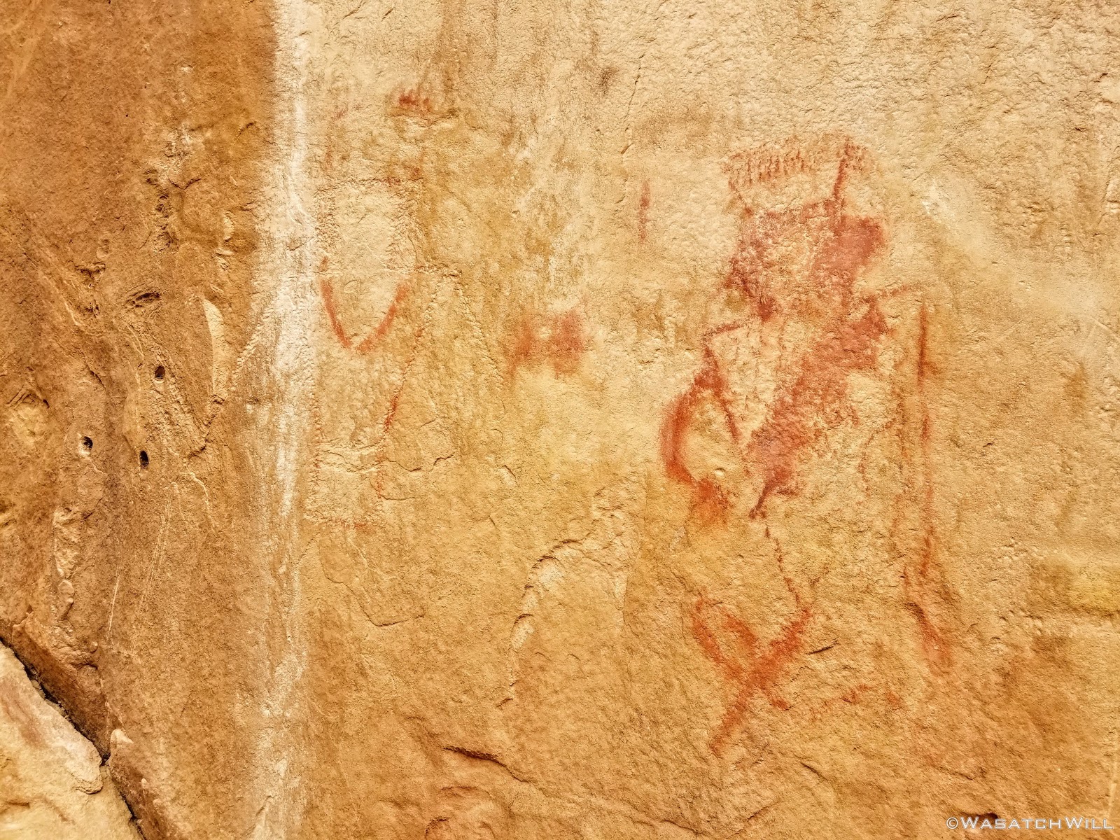
Fading pictographs
Back along the creek, we took a moment to enjoy the little cascades down in an infant slot canyon. Each time I've looked down into it, I've wondered how long it will take for the creek to carve fifty or even one hundred more feet down.

Devin at the edge of the young slot
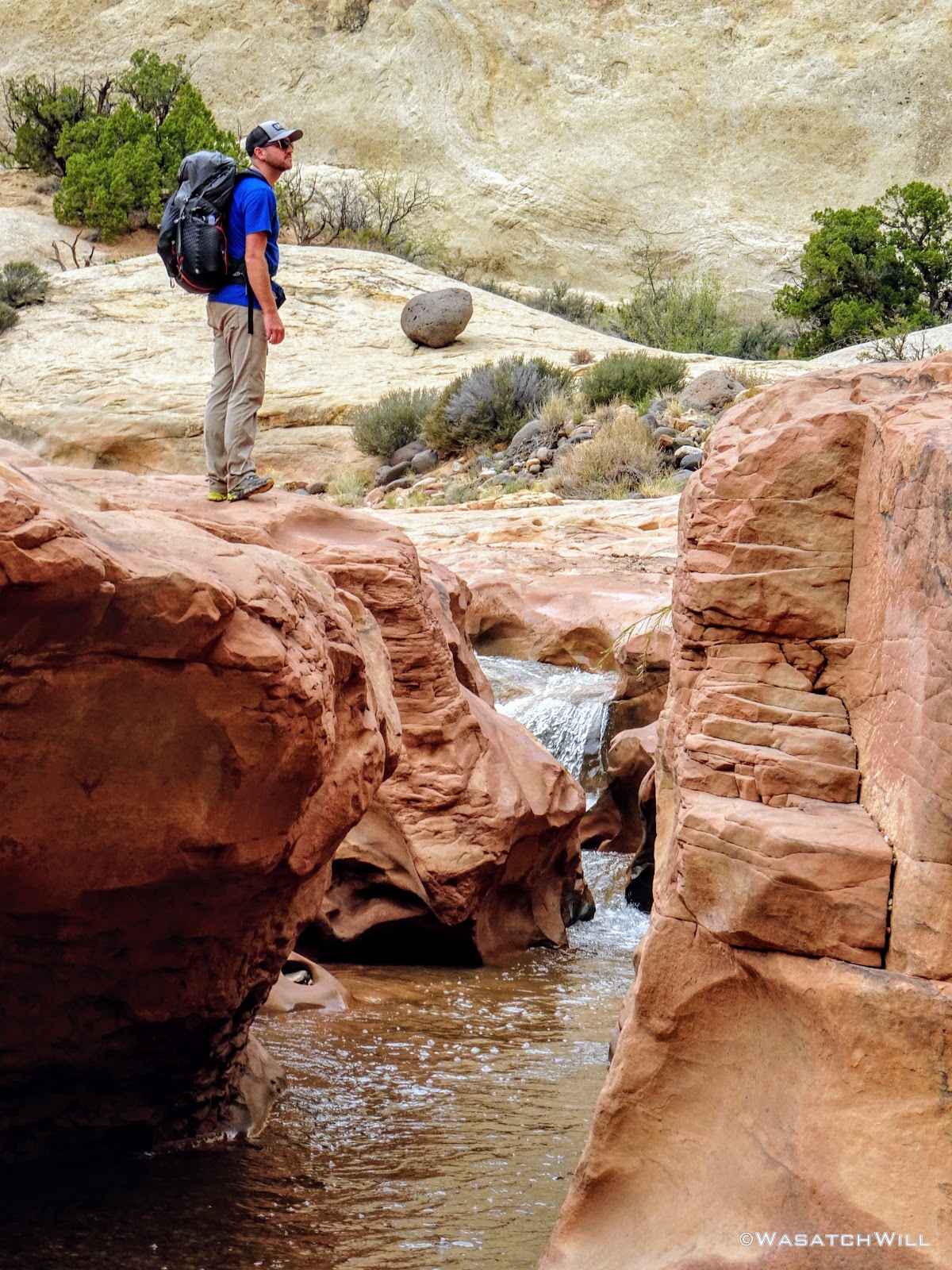
Devin surveys the surrounding canyon walls
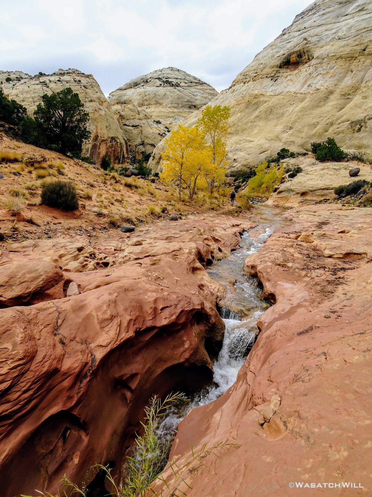
Continuing up the creek
We kept our course, jumping the creek a few more times, wondering when and if we'd ever encounter any rain while the cottonwoods continued to show off.
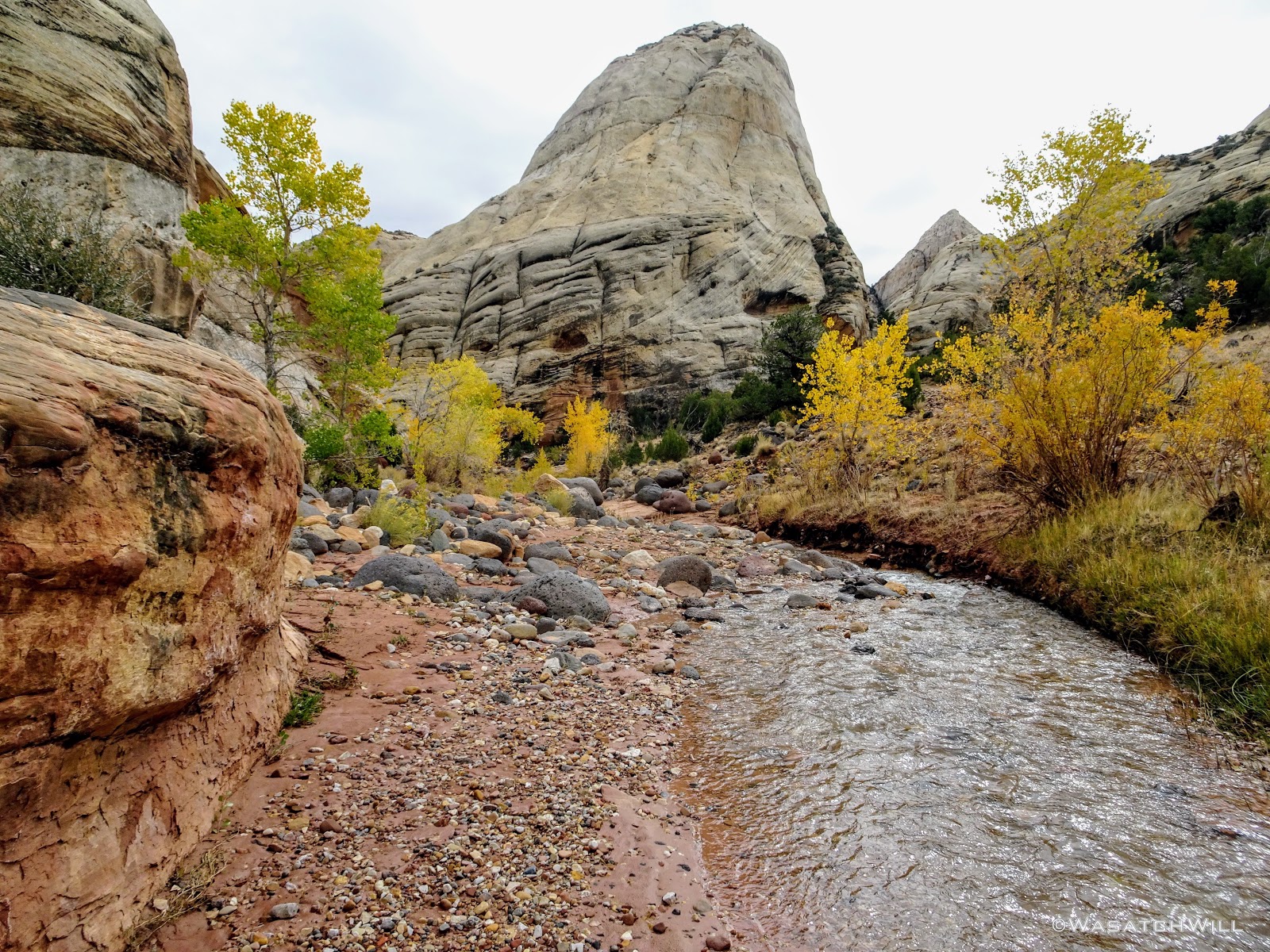
A Navajo dome rises above the creek
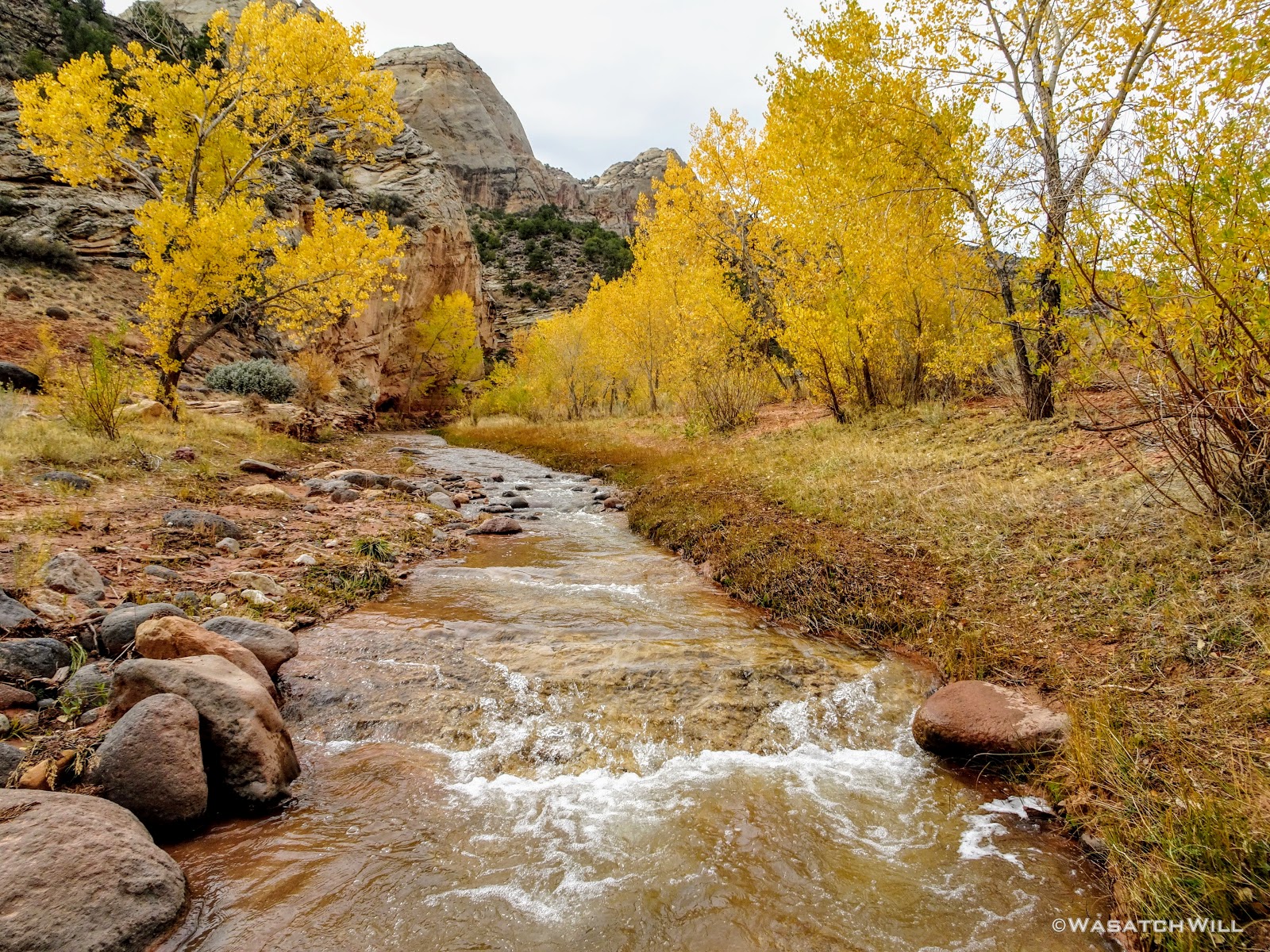
More fall featured cottonwoods
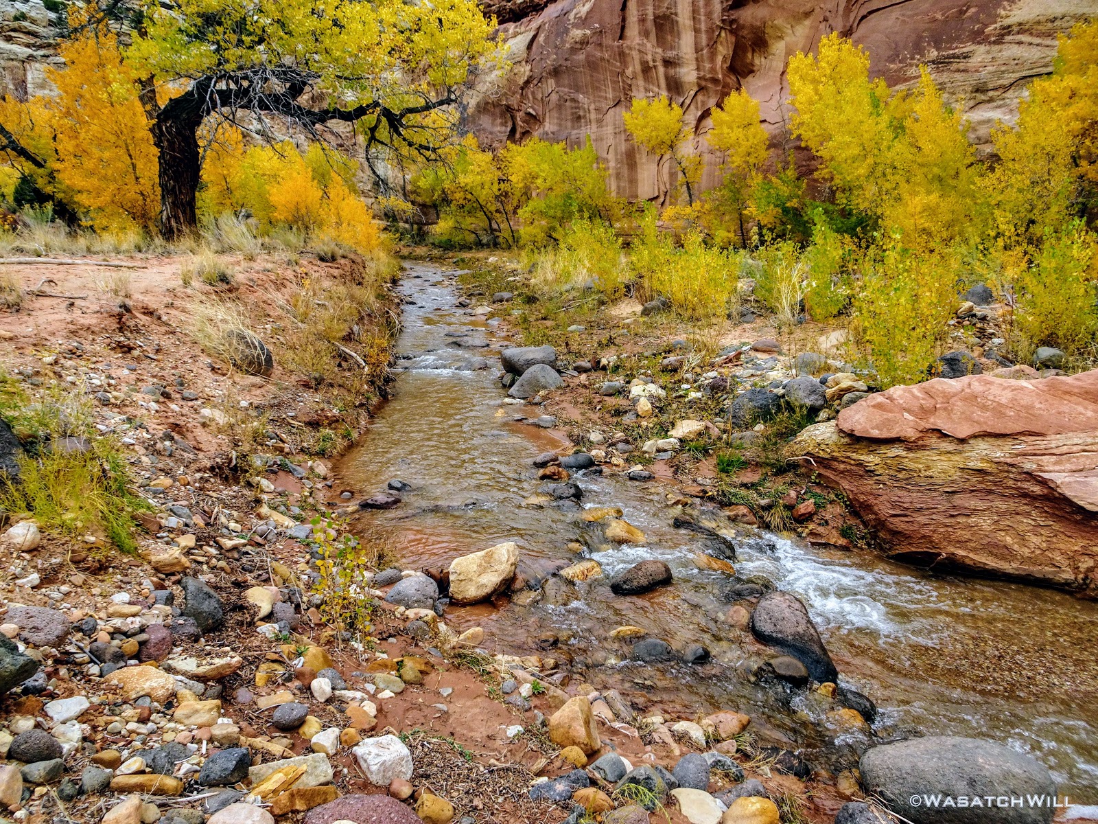
Autumn along the creek
After making our final creek crossing, I led Devin up to a wall near the mouth of the canyon where a quite a few more different rock art panels can be found.

Sun Head
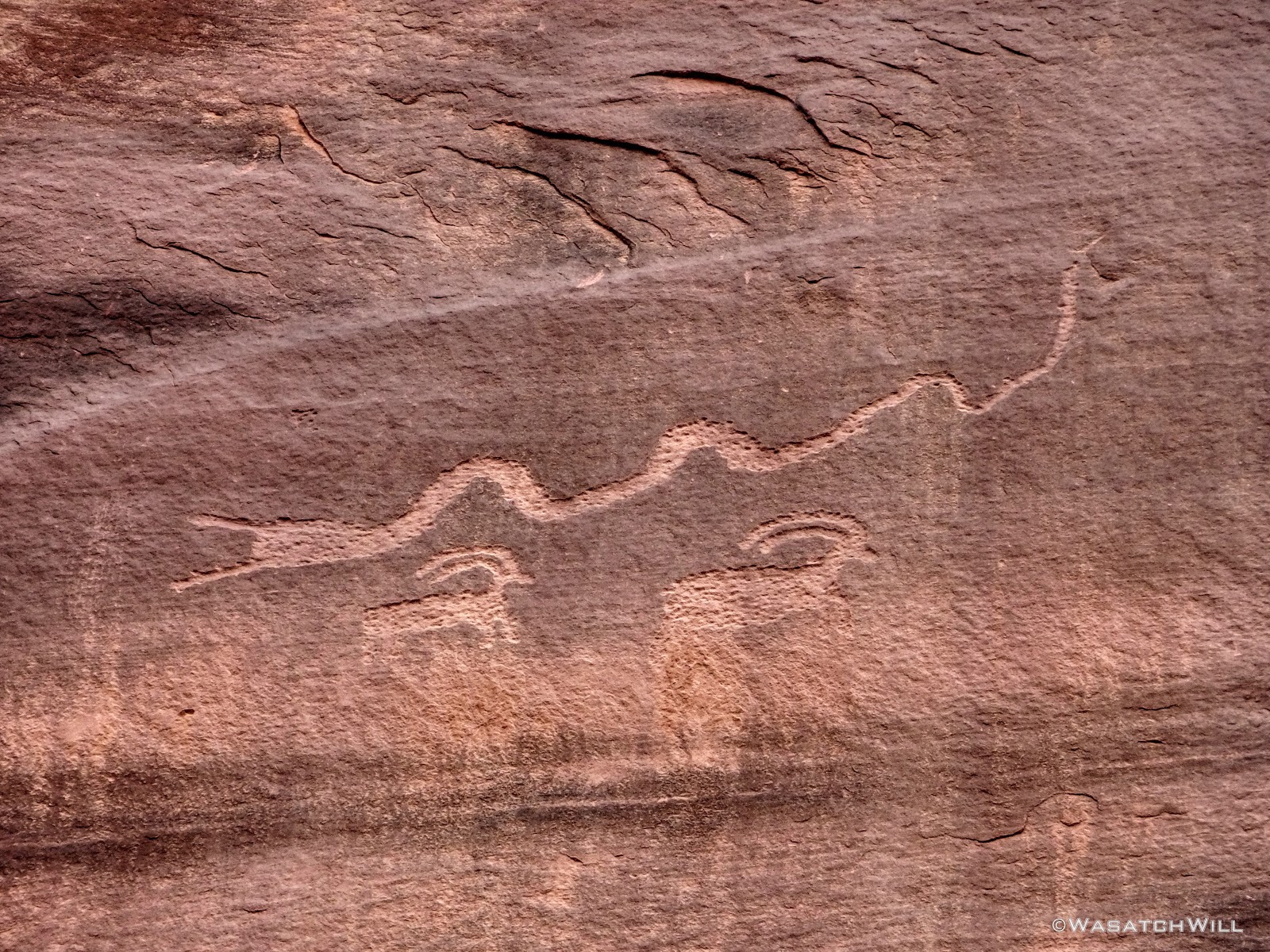
Slug Snake over Bighorns

Bighorn vs donkey?
One spot has glyphs that puzzled me the first time I found them for they certainly weren't like all the other Fremont figures elsewhere along the wall. I now see them as more likely to be what I would call cowboy glyphs, probably carved by some rancher or pioneer of the more recent past.
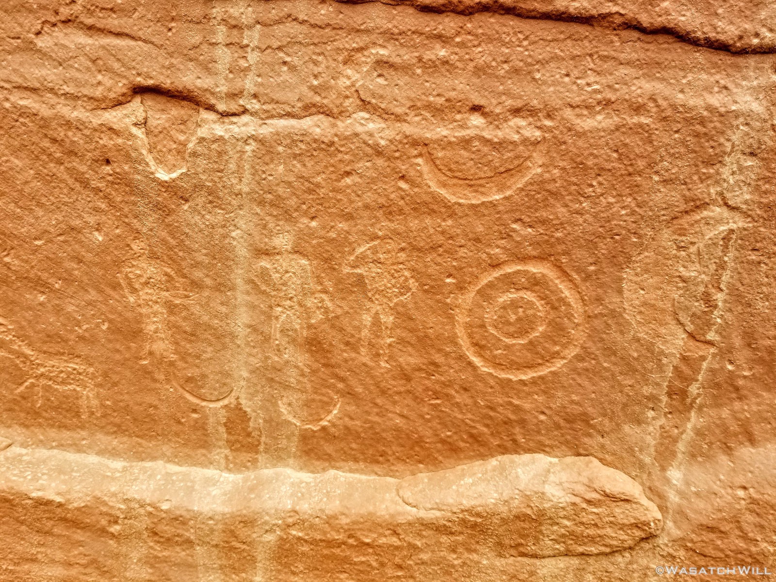
Cowboy glyphs
Coming out of the mouth of the canyon, we made our way up to the UVU Field Station. Both being alumni of UVU, we both shared a bit of pride for the little establishment there. It's a completely self-sustaining facility reliant upon solar power, a well, and other sustainable and eco-friendly resources. It hosts a variety of programs and classes relevant to the surrounding environment not only for UVU and its community, but also occasionally welcomes classes from other colleges as well. On this week, Westminister College was making use of the facilities for a wilderness first responder course.
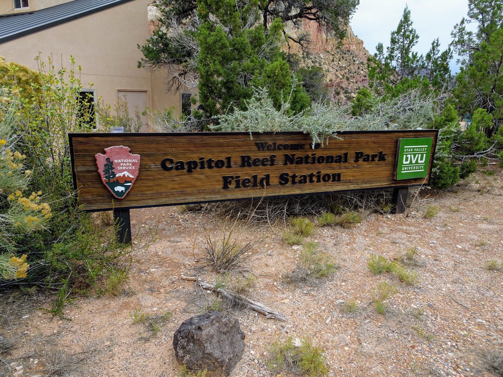
Field Station
While on our little layover at the Field Station, I was able to make contact with my father-in-law to let him know where we were at, and that we were ready for him to come down and pick us up. When we had picked up our backcountry permit from the Visitor Center on the first day of our trip, we had taken note that the dirt road out to Pleasant Creek had been closed due to a rain storm earlier in the week, so we weren't sure if it had been re-opened to vehicles or not. Even if we knew it had been, rather than waiting it out at the gate of the Field Station, we decided to walk the road as far as we could until we intercepted my father-in-law.
It wasn't until we started walking out that we got hit by a nice little passing shower but it dispersed after a few minutes.
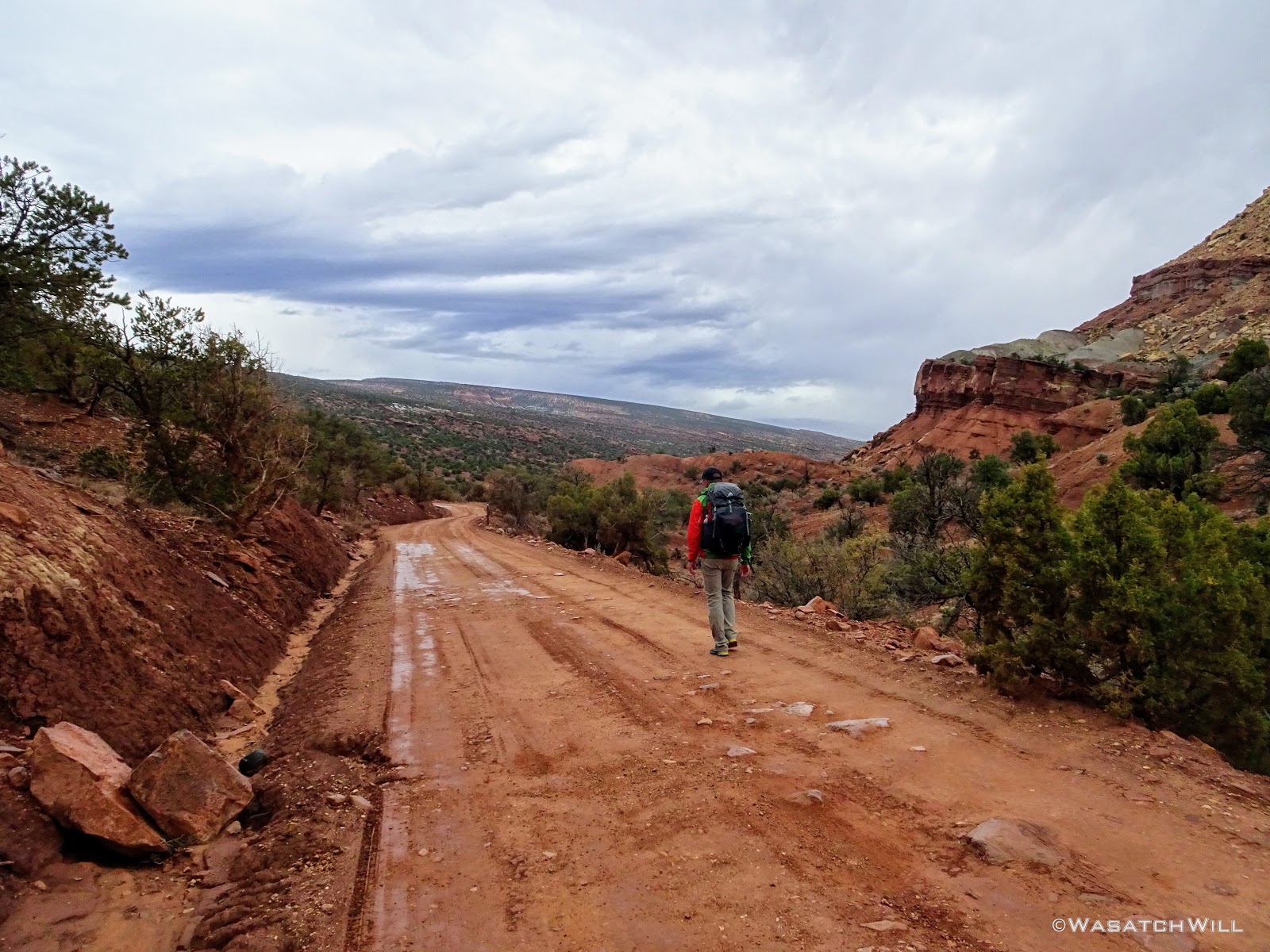
Walking down the dirt road
After what was probably a couple of miles, my father-in-law arrived, officially putting a stop to our four day trip of epic proportions.
It was on that final mile that Devin and I almost had to collectively pinch ourselves to make sure we had really just hiked the route we did and were not just about to wake from a dream. For a moment, my eyes even watered up with the feeling that I had accomplished something big, a major backcountry test of sorts.
While it certainly wasn't the longest hike I'd been on, neither in distance, nor duration, it was however, by far, the most rugged and most strenuous hike I had ever done, with several of the biggest obstacles I had ever encountered on a backpacking trip or any kind of hike for that matter. Between the first day's ordeal bypassing the first big pour-off to the 2nd day's wader, and a handful of other more minor spots along the way, I was beyond grateful that Devin had accepted my invitation to join me for this trip. His assistance was invaluable and I was so glad I had not attempted to do that route on my own for I may well have gotten myself into some situations that could have been much more precarious without the teamwork he and I were able to provide for each other.
I am also very thankful for all the time and effort Steve Howe put into scouting out all those wild and unforgiving canyons we had just come across in assembling the route and for at one time, trusting the readership of Backpacker Magazine with a map of the route, a time right before social media and things like Instagram made other like locations go viral and explode in popularity, that have inevitably resulted in some negative impacts from less careful visitors who sought after those locations. Had Steve not made that route available when he did, had he not pioneered it at all, had I not been so fortuitous to stumble upon it when it was available online, I may well have tried to figure out such a route all on my own, likely spending years and years in the process, for I am certain, like Steve Howe experienced, I would have hit dead end after dead end before finding something that would work. For the many visits I've been fortunate to make to Torrey, Utah, I've yet to meet Steve Howe and his wife, Jen and hopefully that changes in the near future because I would enjoy the opportunity to thank him in person.
I would also like to thank renowned planetary scientist and geologist Jani Radebough, who happened to successfully complete the primary leg of the route with a couple of her friends a few months prior, whom also works at BYU like myself, and whom allowed me to contact her in preparation for this trip and come over to her office during a work break to meet her and discuss her experiences with the route, particularly the bigger obstacles.
Lastly, I would like to thank my wife for supporting these adventures of mine, even when she can't often be there herself, instead sacrificing her time to watch after our kids, and of course, her parents, particularly her father in this case, who ferried Devin and I to our starting point and from our ending point.
In the middle of this journey along the Beehive Traverse I began to ponder how many people in total had traveled the route before Devin and I had set foot on it. After all, it is one of Steve's offerings with his guiding company going by a description on his website. I reasoned that he might only guides a small group of clients once or twice a year at most on this particular route, and likely only for the last 10 to 15 years or so. I also reasoned that, given the remoteness and all the hazards and variable conditions of the route, few others have been bold enough to take on that inhospitable terrain on their own, even with a map of the route back when it had been made available online to a relatively large readership. Therefore, I feel confidant in estimating that less than 200 people, perhaps even less than 100 people, had traveled the route before Devin and I made our bold and successful attempt at it.
Video:
Last edited:
")
") I did it in March 2017 with a friend. There wasn't much water in the slot, but enough in the potholes to resupply. We left ~7:30am and got back a few hrs before dark. We were surprised on how fast we finished given how it was described; we figured it was drawn out for guiding purposes.
I did it in March 2017 with a friend. There wasn't much water in the slot, but enough in the potholes to resupply. We left ~7:30am and got back a few hrs before dark. We were surprised on how fast we finished given how it was described; we figured it was drawn out for guiding purposes.