- Joined
- Jul 23, 2013
- Messages
- 1,665
Right on the heels of the recent trip and beautiful report by @Ugly, here's a report of a trip @WillisBodillus and I took up to Timp the very week after. While my pics aren't nearly as spectacular, I hope those of you viewing and reading still find them enjoyable...
Since we both go by Will, to distinguish ourselves, I've referred to he who joined along as "Big Will". While the trip would lead to a fourth time on the summit for me, it would be Big Will's first summit of "Timp".
Day 1
Friday - July 17, 2015
We started out by meeting at the mouth of Provo Canyon late Friday afternoon. We then took a car up to Aspen Grove Trailhead and begin the hike up Primrose Cirque. We were hoping some of the better sites for camping that are well out of sight from the main trail would still be available, despite it being later in the day, because from past experience, many of the crowds don't show up until later in the evening. I knew that while some scout troops will use the Aspen Grove trail and camp around Emerald Lake, most will typically use the more popular and slightly easier Timpooneke trail that comes up from the north and then camp all throughout the main basin. We had our fingers crossed, but it was a Friday after all.
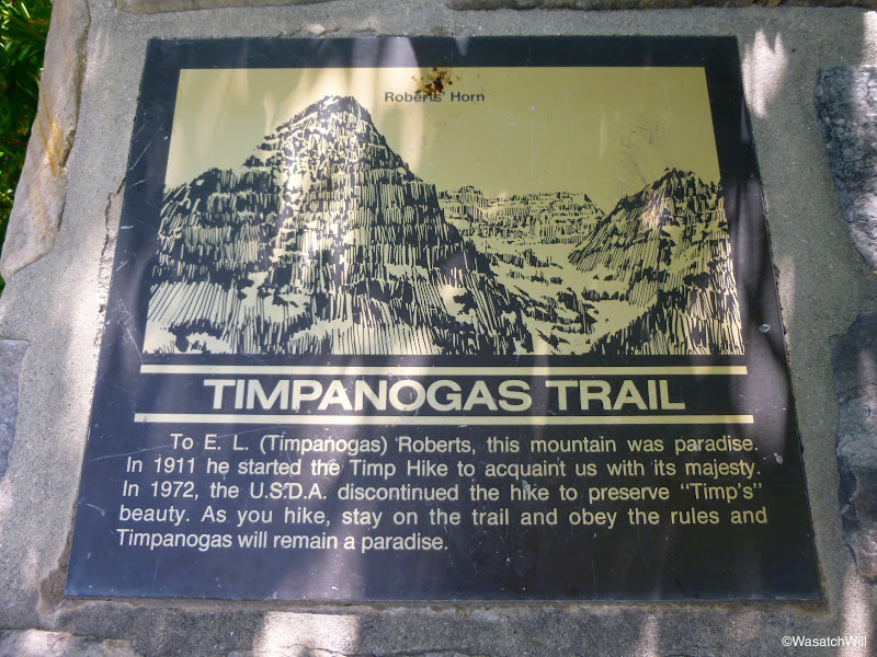
Shortly after the start, there is this sign with a tribute to Eugene L. Roberts. I found it odd that the sign has Timpanogos spelt with an 'a' before the concluding 's' rather than an 'o', which is the more common way of spelling the mountain's name. Early last century he started what would become a local community tradition known as the "Timp Hike". After starting out with groups of just BYU students and faculty, it quickly grew to attract University of Utah students as well as other members of the nearby communities. It became so popular, eventually drawing thousands to the annual event, that it even made news in a 1957 issue of Sports Illustrated. Ultimately, however, due to the risk of loving the mountain to death in the process after as many as 3,500 people made it to the summit in one gathering, organizers from the Forest Service, BYU, and other prominent community groups ended up voting to discontinue the annual event. That tradition still continues largely among smaller groups and families throughout mid to late summer, many, no doubt, whose grandparents and great grandparents used to participate in the annual gathering. Nevertheless, the sign here only scratches the surface of who Eugene Roberts was. (See the Noteworthy section at the end of the post.)
"Timpanogas Trail" sign
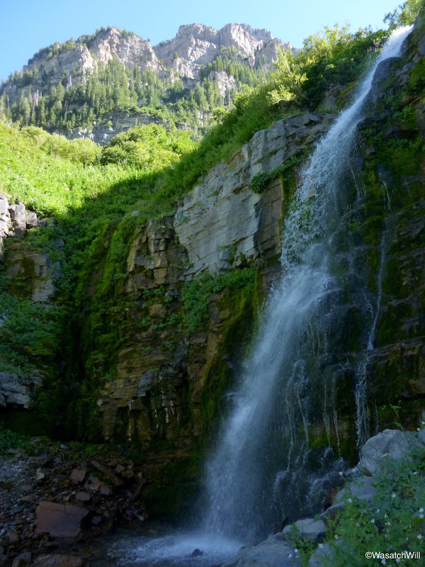
We pressed on and upward. Not long after, we passed the first and then the second of what would be many waterfalls along the way up.
Second waterfall
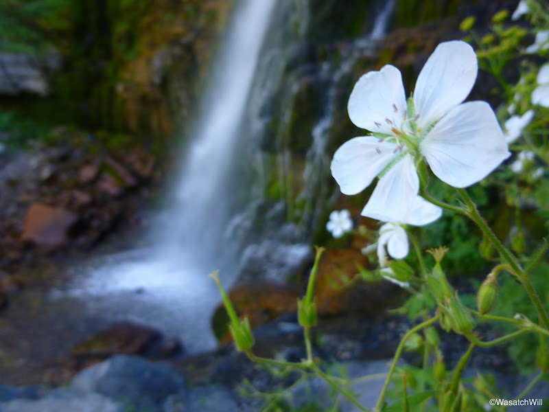
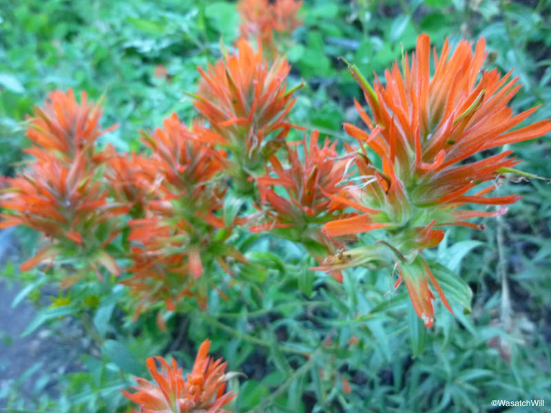
As typical, wildflowers were plentiful.
Indian Paintbrush
Big Will taking in the views from Primrose Cirque
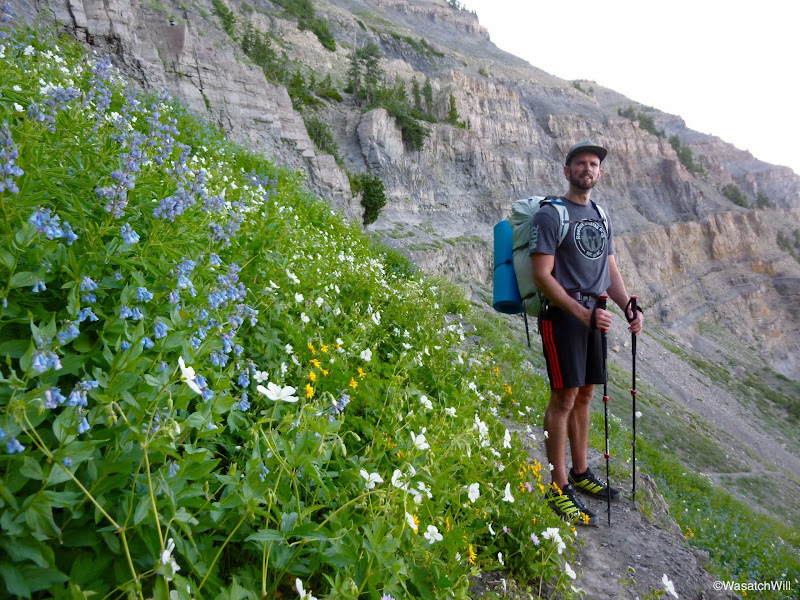
After a number of switchbacks, we reached the top of Primrose Cirque where Hidden Lakes basin lies. There are a couple of little lakes, more like shallow little ponds, that line the outer edges, but of course, they are pretty well "hidden" out of view from the main trail.
Hidden Lakes basin
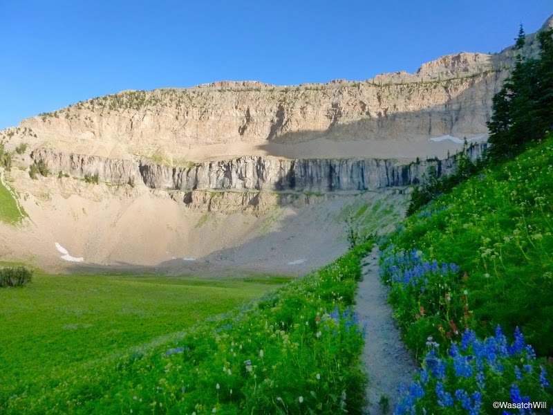
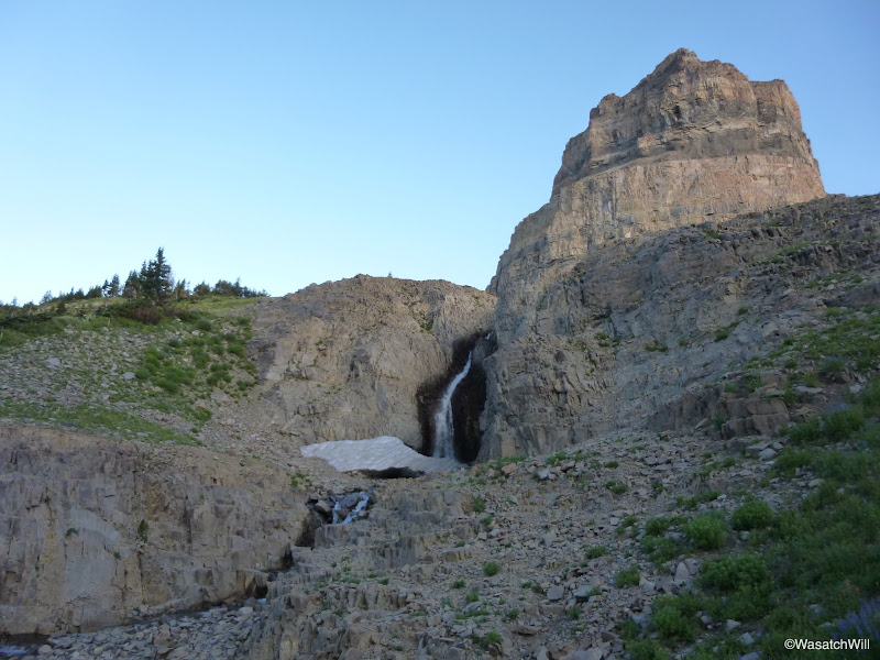
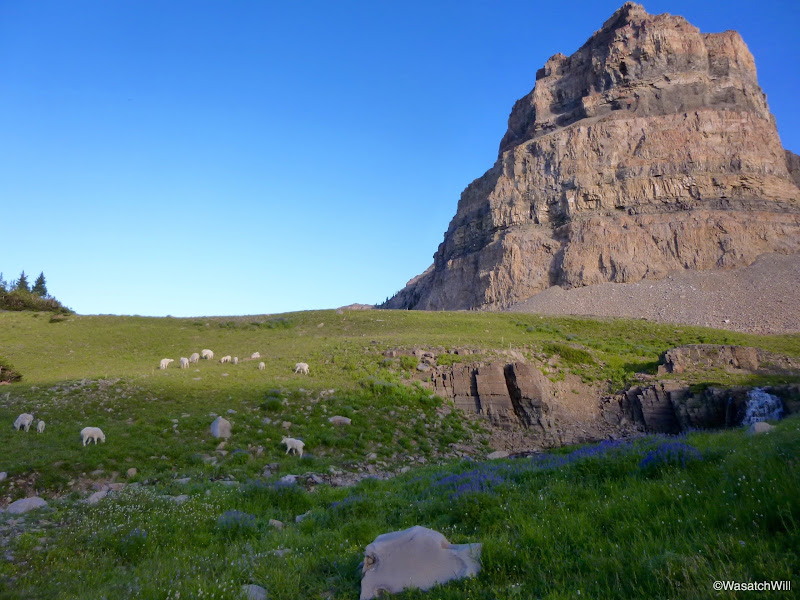
After Hidden Lakes Basin there is one final waterfall prior to arriving at Emerald Lake. We also had our first encounters with the resident mountain goat herd.
Waterfall below Emerald Lake
The resident goats
After almost 5 miles of hiking, we reached the shore of Emerald Lake.
Emerald Lake and Timp summit
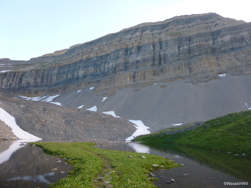
Looking toward Heber Valley across the outlet of Emerald Lake
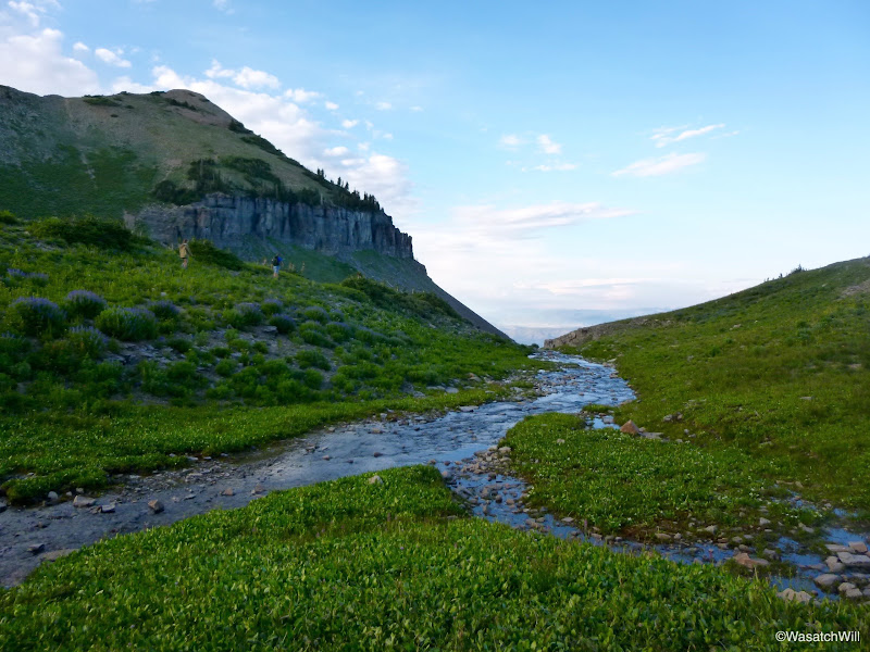
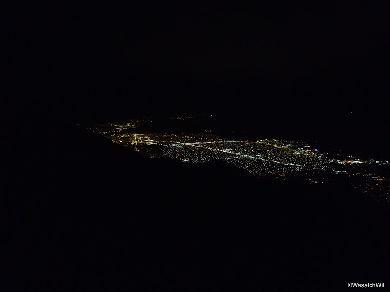
We set up camp nearby and gathered up what we needed for dinner and a little evening hike up to the Saddle where we'd try to catch the sunset and take in the views of the nighttime valley lights. We didn't quite make it up for the sunset though and it was pretty well overcast out west anyway, so there wouldn't have been much to see. Big Will's stomach was bothering him a bit on the way up which slowed us down a bit as well. He thought it may have been some jerky he had earlier in the hike so I let him have a few antacid tablets. Once we reached the saddle, we were able to gaze out across Utah Valley and the evening lights that filled up the landscape below. We had ourselves a late dinner and enjoyed a nice long rest before heading back down to camp for some much desired sleep. On the way up and down from the saddle, we encountered a couple small groups heading up to spend the rest of the evening on the actual summit.
Provo and Orem from the saddle
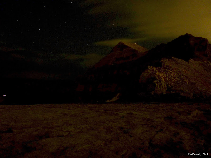
Timpanogos ridge and summit from the saddle, looking south
Day 2
Saturday - July 18, 2015
The following morning I arose well before sunrise to make an attempt at bagging Robert's Horn, a fairly prominent secondary peak rising just north from Emerald Lake and named after, yes, the aforementioned Eugene Roberts. Will stayed back to get a little extra rest. I was hoping to catch the sunrise from there and have a little personal ponder time, away from all the crowds higher up on the true summit of Timp. Unfortunately the slope got really spicy with an abundance of loose rocks and hand holds and it was slow going trying to ensure proper footing so as to avoid any slips and tumbles that could have sent me off some cliffs at the base of the slope. There were a number of shrubs densely patched over a stretch of the ridge leading up to it that I tried to avoid by staying under.
After getting around the shrubs, I topped out on a little bit of a knife-edge ridge. By now the sun was peeking up over the horizon and it was obvious I'd miss the sunrise. Because of how spicy the slope was on the side I was on with nothing but a vertical drop of several hundred feet on the other side, I opted to play it safe and stop there on the ridge. I probably had the worst of it all behind me at this point, but since the sunrise was a lost cause, and it would have taken more time to finish it out, I paused to enjoy what views I could.
Roberts Horn summit, lying a few hundred yards away
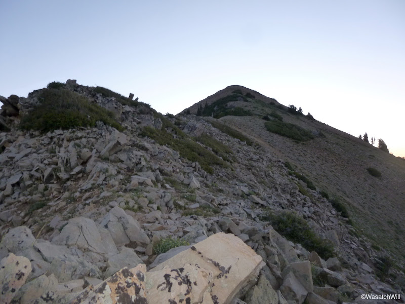
Emerald Lake and Timpanogos Summit from the ridge of Roberts Horn
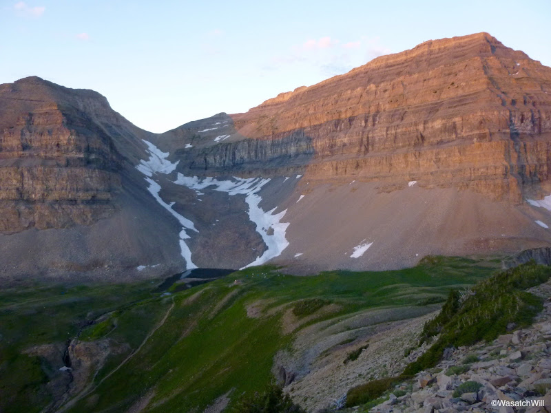
Timpanogos Basin from the ridge of Roberts Horn
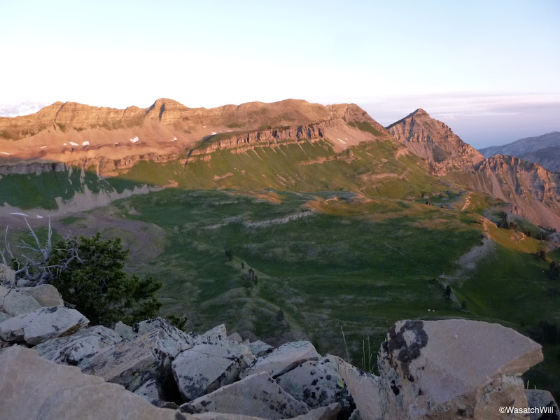
Looking across American Fork Canyon and Little Cottonwood ridge from Roberts Horn
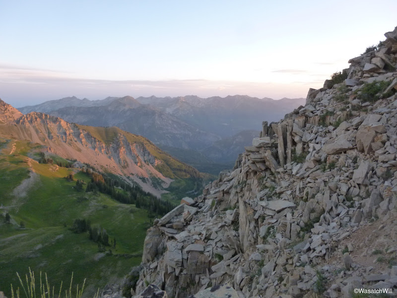
Upper Primrose Cirque and Hidden Lakes Basin from the ridge of Roberts Horn
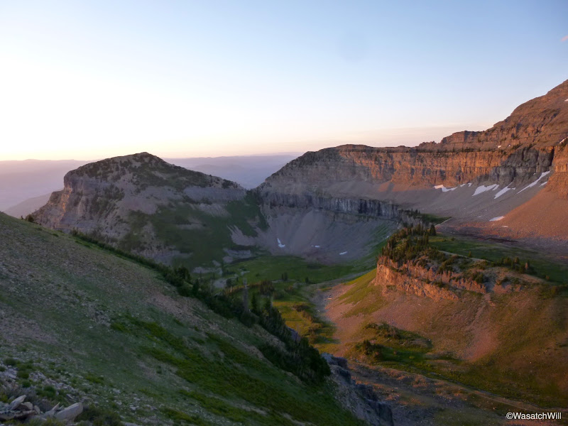
Timpanogos Pano from the ridge of Roberts Horn

After a few moments of picture taking and reflection, I dropped back down the slippery slope and captured a few reflections of Timp's summit on Emerald Lake and a nearby tarn prior to returning to camp.
Timp summit reflection on Emerald Lake
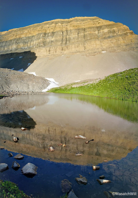
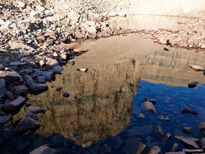
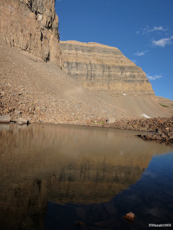
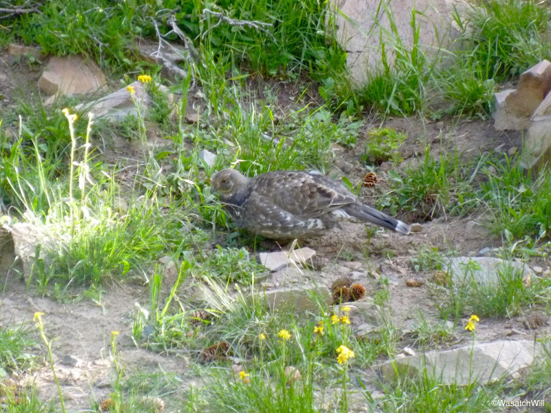
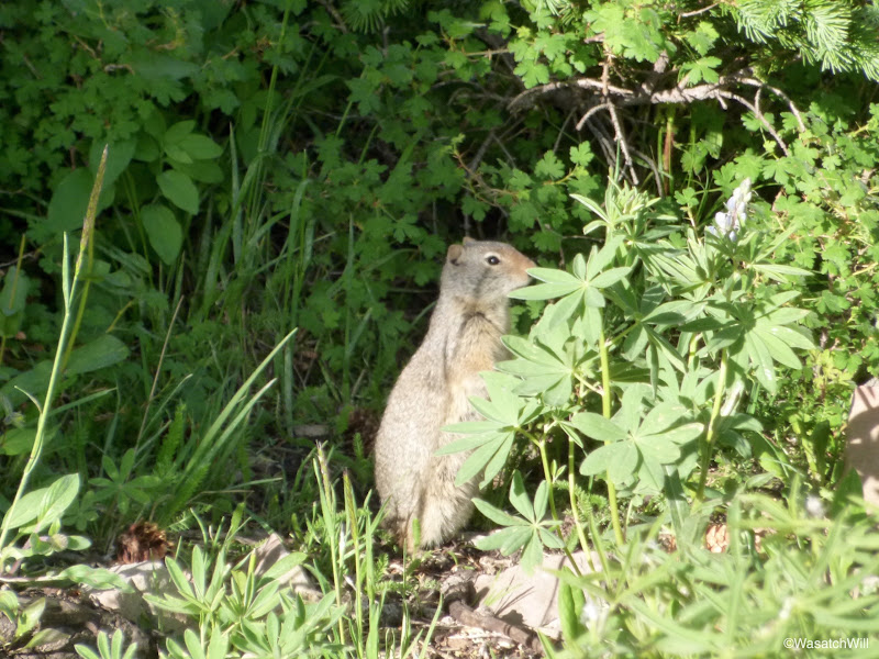
Back at camp, Big Will and I broke out some breakfast and made preparations for a tour through the main basin, a visit to the 1950's crash site of a World War II era B-25, and of course, the summit. While eating breakfast, our camp was visited by what I believe is a dusky grouse and a ground squirrel.
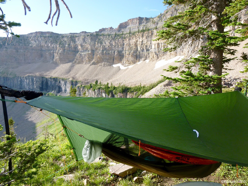
My hammock
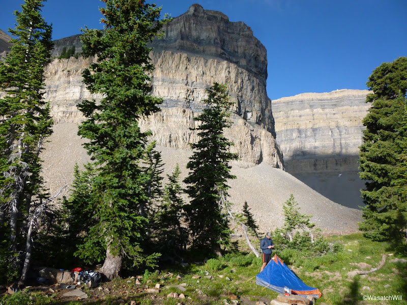
Big Will at his tent
Dusky grouse?
Ground squirrel
Big Will descending into Timpanogos Basin
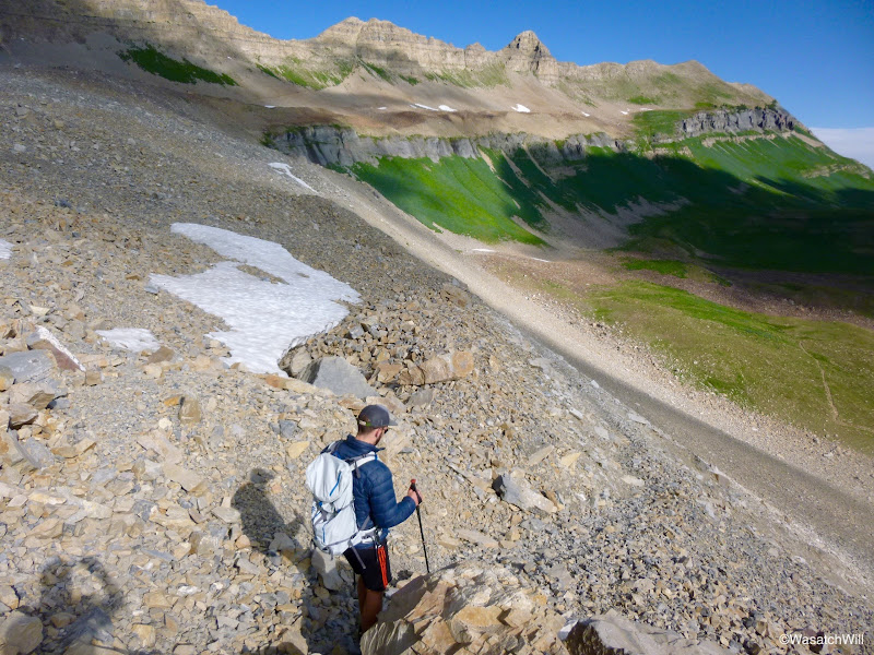
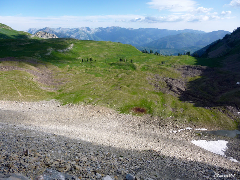
Timpanogos Basin
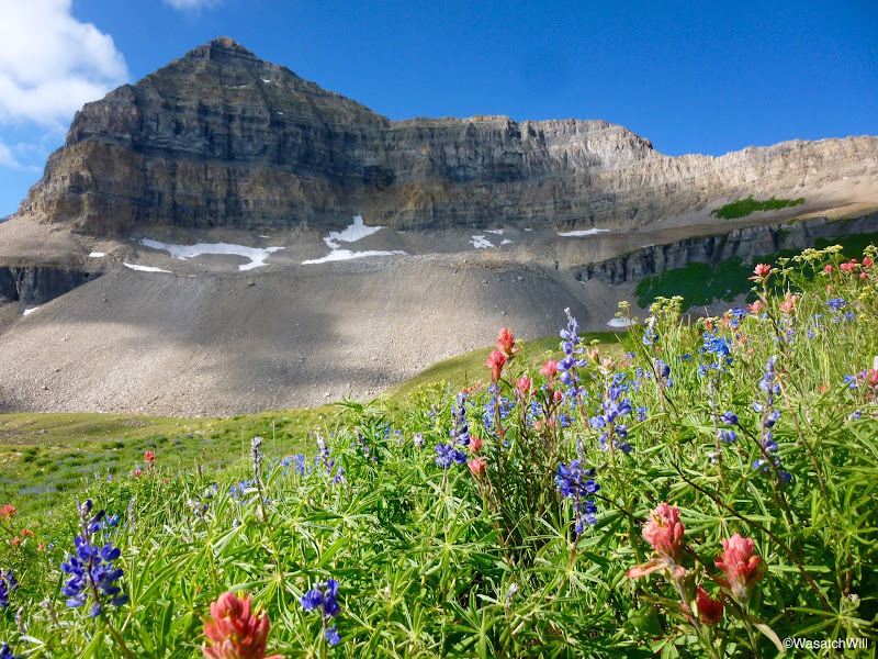
Mount Timpanogos summit from the flower filled basin
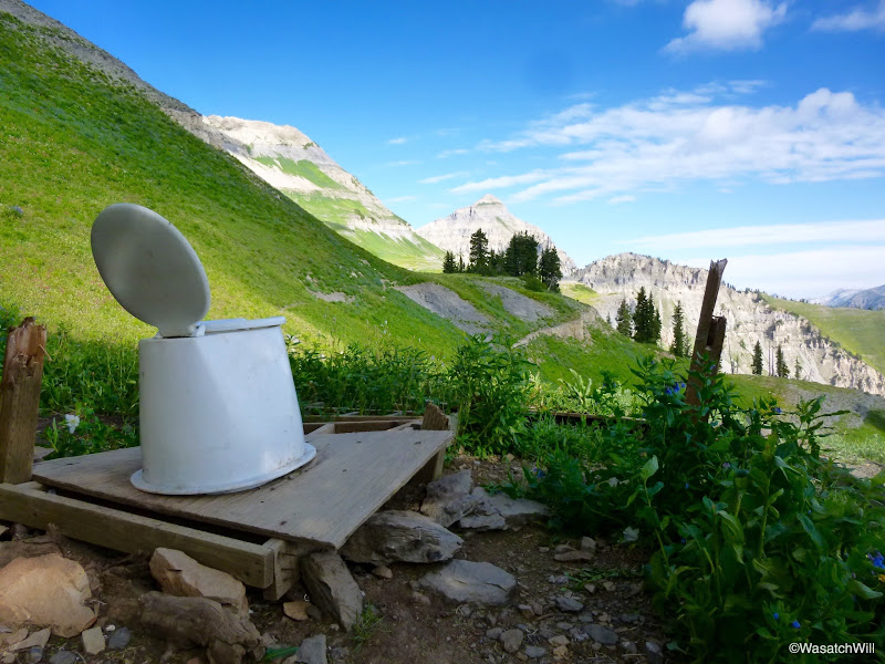
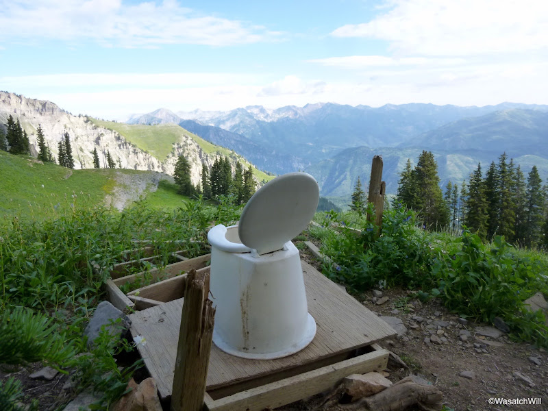
Along the way to the crash site, we investigated what might be the toilet with the world's best view! Of course it wasn't very hygienic though and neither Big Will or I would've considered ever using it, but it was obvious others recently had.
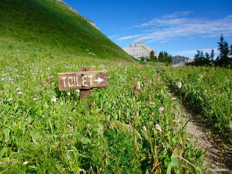
World's most scenic toilet?
The view makes a nice trade-off for the lack of privacy
Eventually we found our way up to the crash site of the B-25. While the wreckage and left-over debris make for a nice little side hike, making a long hike even longer, it's a tragic story how this debris got there. In the 1950's, a B-25 bomber fell victim to some winter weather when the pilot must have become a bit disoriented while in route from Montana to Southern California and wasn't able to clear the Timpanogos ridge. What resulted was a devastating crash that took the lives of all 5 servicemen aboard and a rather heroic effort from some local citizens who aided in the recovery of their bodies thereafter. Sadly, this crash was not the only plane that fell victim of the winter storm. Another crash occurred in the Uintas that same evening.
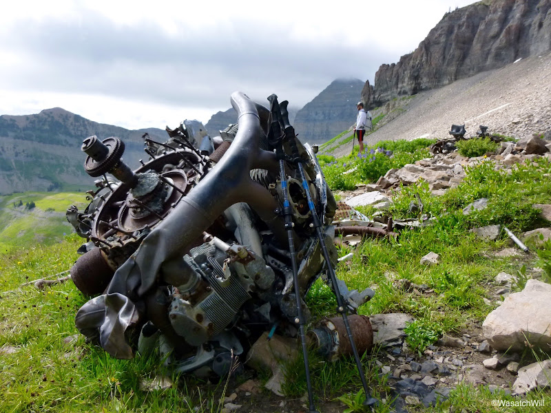
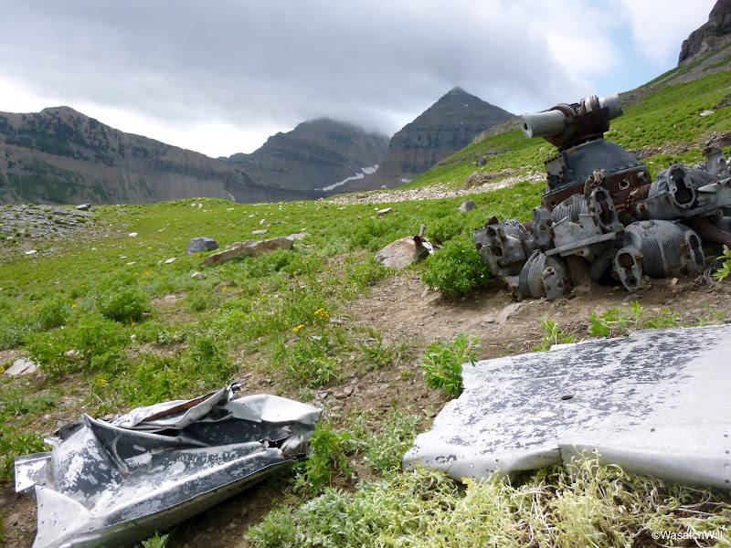
Much of the wreckage on Timp still sits there with pieces scattered out across at least an acre or so. Perhaps most interesting and photo-worthy are the two engines, one sitting on a little shelf significantly higher than the other. It would be fascinating to see one of those PBS programs like History Detectives try to investigate and reconstruct the events and physics of the crash, but it's just not on the same scale as other tragic events such as the sinking of the Titanic.
While at the site, we were also privileged to witness some amazing cloud formations ripping over the summit.
Upper engine with Big Will in the background
Lower engine with Timp's summit shrouded in clouds
After a good little tour of the crash site, we made our way for the saddle, again, and then on to the summit.
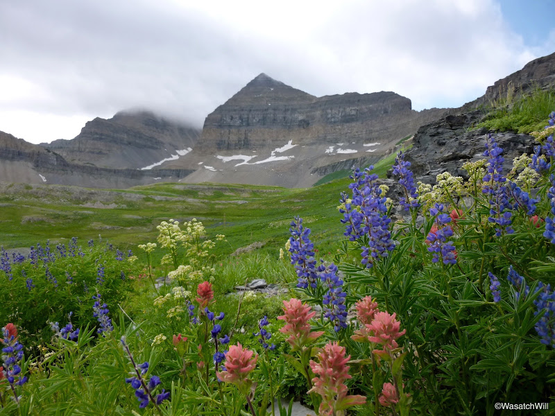
More flowers
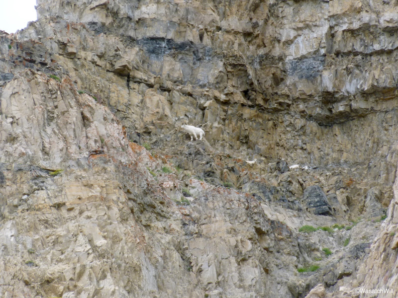
A wandering goat high up on a cliff
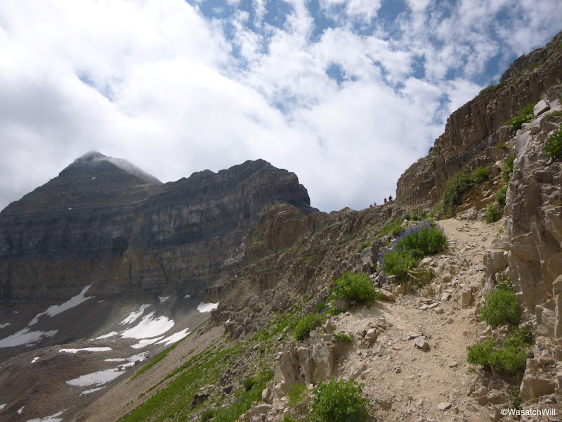
Approaching the saddle
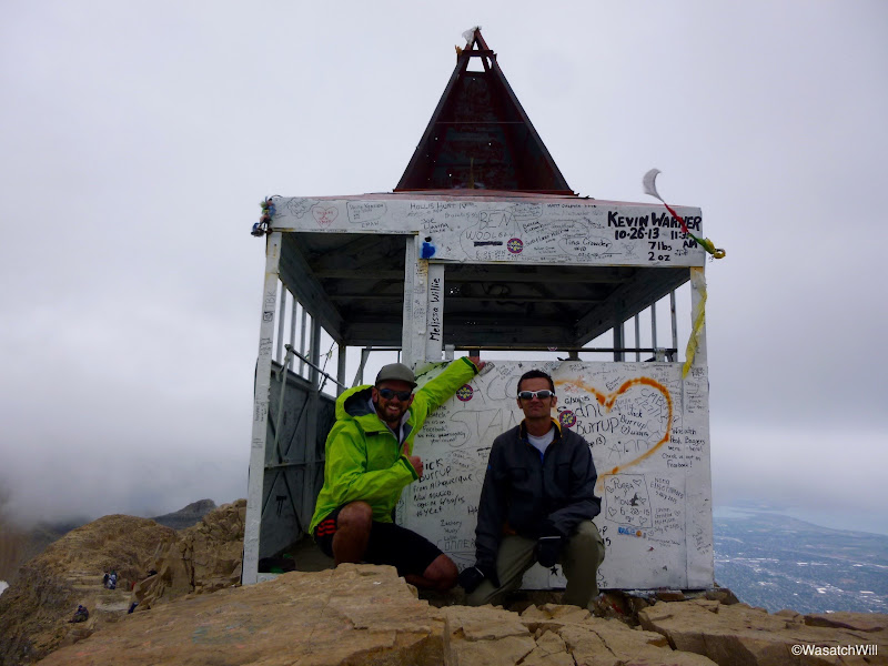
Once we hit the saddle, the wind started to take a beating on us. We knew what we were in for by how fast the clouds were ripping over the ridge. We donned our windbreakers while parades of others, many wearing just in tank tops and shorts, pushed on by. The stretch between the saddle and the summit quite possibly sees more hikers than any other trail in Utah outside of Utah's National Parks. It was Saturday and the crowds were out in full force as expected. In our own journey to the summit, we would pass hundreds of people, both going and coming with dozens more mingling at the summit itself. Not minding the crowds, it was neat to hike in the clouds again. I had been in the clouds last time I was on the summit a couple years ago, but this time we could still see out in the valleys or basins below. The summit proved to be cold, windy, and crowded. Even with our gear on, we were cold. I'm confident the wind-chill was well below freezing. It must have been miserable for those who were dressed with much less but still insisted on toughing it out. Oddly, the hut remained fairly free of people, except for a few who would come to sign the summit register and put their name on a wall, if they hadn't done it on the outside.
On the summit for my 4th time
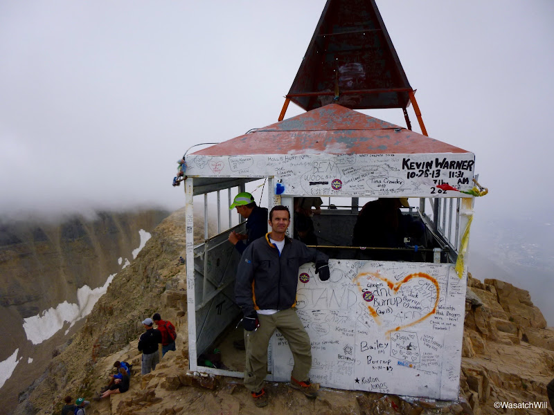
Big Will and I
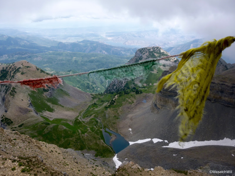
Emerald Lake and what's left of some prayer flags
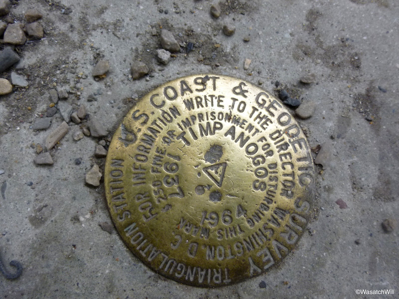
USGS marker
Looking out over Pleasant Grove, Lindon, and the edge of Utah Lake
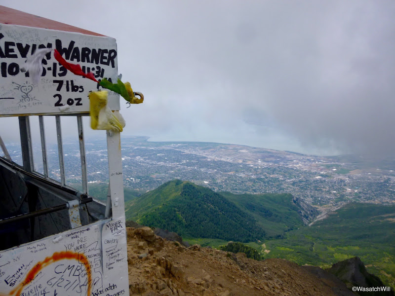
Panorama of Utah Valley from Timpanogos summit

We had originally wanted to descend down the "glacier" which is more technically just a perennial snowfield most years, but with the warmer than normal winter we had, the snowfield was already mostly melted out. We spoke with one group earlier in the morning who had descended down it and when asked if they'd do it again they responded without hesitation that they'd take the standard trail back down. Apparently they had bruised up their backsides pretty good with the steep and slipper rock slide at the top and all the many rocks scattered across the main body of snow. We took their advice and kept to the main trail coming back down.
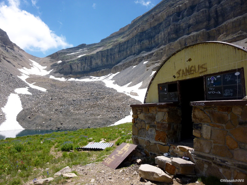
Back at Emerald Lake with the shelter and "glacier" snowfield
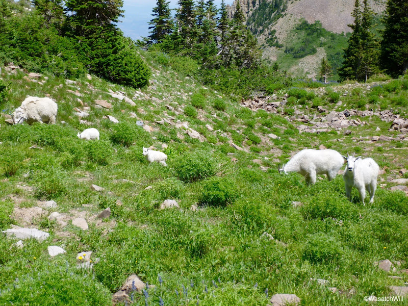
We returned to our camp where we found some of the local goats grazing about. We took a brief rest and gathered the rest of our gear together and descended back down to Aspen Grove trailhead and the car.
More goats
A snow-bridge, probably in its last week of life
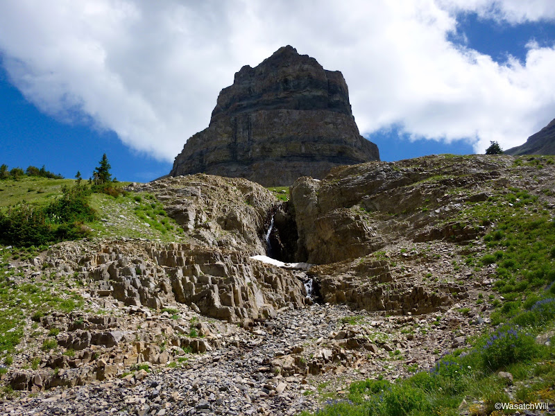
Leaving the Emerald Lake area
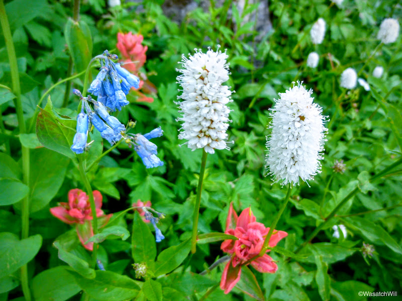
Red, White, and Blue
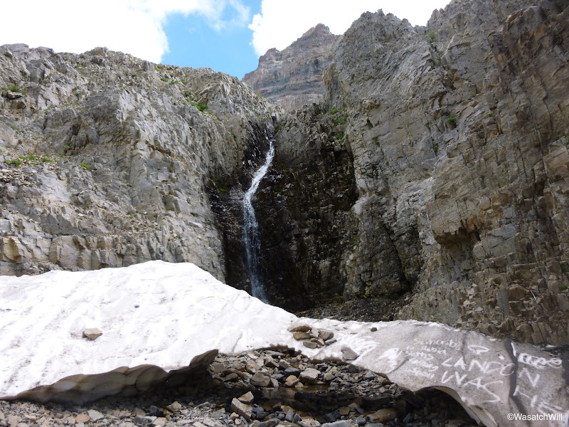
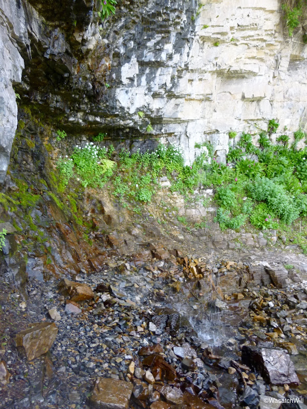
On our way down, we stopped at small waterfall for a refreshing cool-off. Given the picture of it below, I've named it "Invisible Falls". We also passed several more groups of backpackers heading up for the night. I was surprised to see so many going up for a Saturday night. Word must be getting out about it supposedly being better than a Friday night, because I'd venture to say there were just as many backpackers on their way up, if not more, than there were camped out the prior night. The only real difference between waking up Saturday and waking up Sunday up there would probably be that the number of day-hikers and runners passing through and hiking the summit would be significantly less on Sunday.
"Invisible Falls". Can you see it?
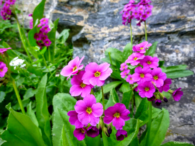
Parry's Primrose, the namesake for Primrose Cirque?
Primrose Cirque
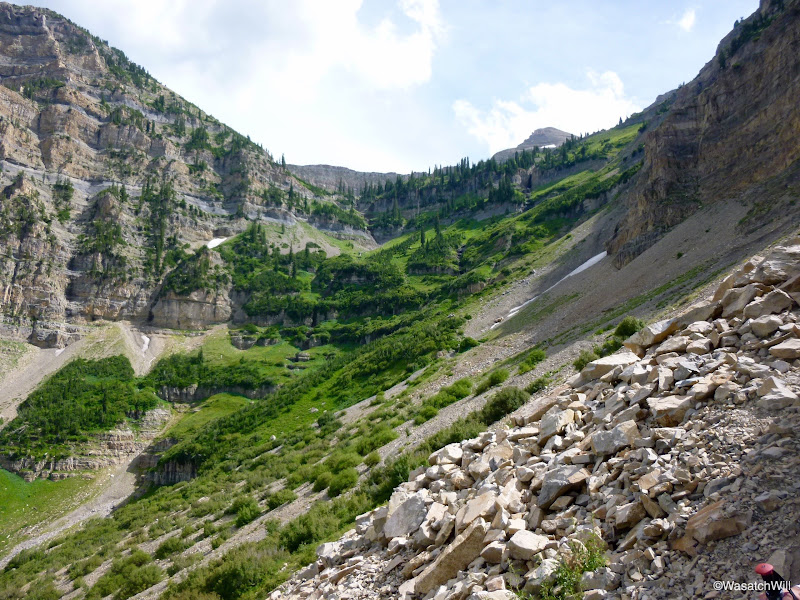
Closing in on Aspen Grove
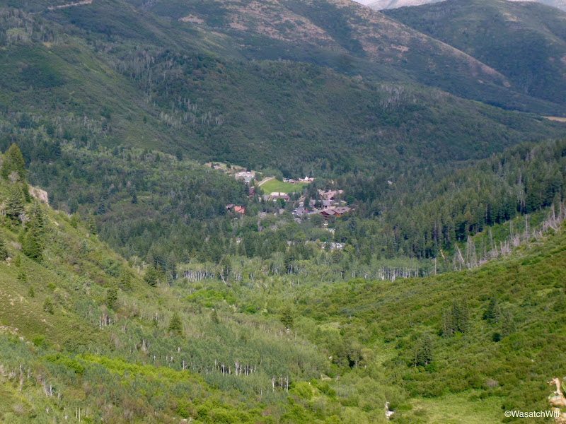
As tired as we were and happy to be heading back home and to a good meal, a big part of me longed to be back up there on that mystical mountain, crowds and all. It really is a special mountain, distinctly unique from anything else found in the Wasatch. Though it falls just short of being the highest of the Wasatch, giving up that honor to Mount Nebo to the south, it certainly has all the majesty to be deemed, "King of the Wasatch".

The Good
The mountain was as stunning and beautiful, if not more so, than any other time I've been on it. We were treated to several waterfalls, lots of diverse wildflowers, vast open vistas, and so much more. While I had descended down from Timp to Aspen Grove a couple times in the past, I had always ascended via the Timpooneke route. I'm glad we chose to ascend via the Aspen Grove route, despite it being just a bit more of a challenge on the legs and lungs. In my opinion, it is a bit more scenic and spectacular, though Timpooneke still provides gorgeous scenery and fun features as well.

The Bad
While our camp was secluded when we set up, upon our return from our night's visit to the saddle, we "came home" to a group that had set up their tents and a hammock no more than 30 yards and right in sight of us. I believe others, even on a mountain that gets as much use as Timpanogos does, should have the courtesy to camp at least 200 feet away from any others and out of site when possible.
A few groups down in the main basin clearly had some illegal fires. One was even still smoldering in the morning as we had passed by. Campfires are illegal up there and I believe in and the Forest Service's efforts to keep that wilderness area as pristine as possible. Unfortunately rangers can't be up there all the time to enforce the rules. Next time I'm up there, rather than do the summit, I'm considering on doing what I can to dismantle the dozens of fire-rings dotted all around the basin and lake. On the way down, one group was even packing up a bundle of scrap wood before an authority informed them of the fire restriction. At least they were willing to pack in their own rather than seeking out what few pieces of deadfall and wild wood exist up there.
There were also many shortcuts across the switchbacks that climb Primrose Cirque. Shortcutting can cause significant erosion which often leads to irreparable damage and hazards along trails and could threaten to someday ruin the trail from Aspen Grove permanently if people don't take better care to stay off the shortcuts.

The Ugly
There were a number of spots right off the trail, in the cirque, the basin, and even near the summit and saddle, where used toilet paper was just sitting out exposed for all to see. It disgusts me how lazy some people can be when a simple zip-loc bag or two is all that is needed to pack it out. And if one is too lazy to pack it out, they should at least have the decency to bury it. But on a mountain that see as many people as Timp does, used toilet paper and other like items really needs to be packed out.

Route
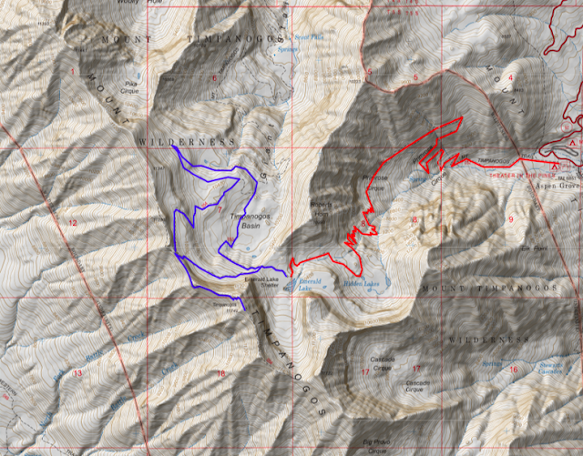
Trailhead: Aspen Grove
If You Go: Please, Please, Please be considerate and sensitive to this precious area (and all wilderness spaces) and the others who would like to visit it after you. Please pack out any and all manufactured material you pack in, including used toilet paper. Please stay on the main trails where possible and avoid shortcutting switchbacks, as tempting as it may be. Do not light fires where restrictions are in place and wood is scarce. Educate yourself on LNT (Leave No Trace) principles and ethics and then exercise them.

Trip Stats
Days: 2
Distance Hiked: ~18 miles
Elevation Low: 6,910 feet
Elevation High: 11,752 feet

Noteworthy
In doing a round of research, I learned that E.L. Roberts was a spiritual man of many interests, much like myself, who had a particular passion for nature, the wilderness, mountains, and sports. He was part of a "renegade" underground football team at BYU when the sport was banned on campus before it became an official school sponsored sport and later served as the first athletic director at BYU after receiving training at Yale and turning down other job offers. Over the course of his pioneering pursuit to establish the athletic program at BYU, he would coach a high jumper to Olympic gold among other achievements and wanted athletes to model specific traits of a cougar on the prowl: strength, agility, quickness, and grace. Because of his admiration of cougars (aka mountain lions, panthers, pumas, etc), BYU would later adopt the cougar as its official mascot.
Prior to his career endeavors, Roberts grew up in Provo and would go on to attend college at the local Brigham Young Academy (now BYU). While a student, he assisted with geologic research on expeditions in what is now Zion National Park, Grand Canyon National Park, and parts of Colorado and guided small groups on hikes upon Mount Timpanogos. He then served a mission for the LDS Church in Europe where he was able to ultimately spend time in Germany and Switzerland and got to experience the Swiss Alps first-hand. His experiences as a student and missionary only enriched and deepened his admiration and appreciation for the mountains and all that encompass them.
In 1912 (despite the sign further above stating 1911, a second error?), Roberts would gather together a group of about 20 people, mostly students, and some camping gear and travel up to what is now Sundance and from there, transport their gear by foot to the place he named Aspen Grove which sits at the foot of Primrose Cirque. There they would camp the night before making a bid for the summit without the aid of any established trail. This effort was motivated by Roberts experiences in Switzerland, his love for Timpanogos and desire to share it, and his responsibilities as BYU's director of physical education to provide programs for students to improve and maintain physical fitness. Guiding students up Timp was a way for him to satisfy many of these interests, passions, and goals. Hence, what became known as the annual "Timp Hike" was born and persisted for a few decades thereafter. Around 1921, he rounded up some 300 students to assist the Forest Service with carving an official trail to the summit. His love for Timpanogos was so great that he was given the nickname of "Timp" or "Timpanogos" Roberts. He even used some creative liberty to come up with an Indian legend to explain away its distinct horizontal profile.
Apparently, he was also instrumental in introducing the Scouting program to the LDS Church. I suppose he can be thanked for the scouting experiences many in our local communities, including myself, enjoyed while we were younger and the opportunities it gave us for exposure to the outdoors, and ultimately a reverent respect and appreciation for our wild places and the need to be good stewards with such precious wilderness areas.
Not only was Roberts the father of the BYU athletic program by many aspects, he can also be considered the father of Timpanogos in making it the popular mountain it is to hike and recreate on by so many people today, both near and far.
Unfortunately, due to the ever growing popularity of the mountain, there has been and continues to be great concern about the impact the volume of visitors has on the mountain.

Video
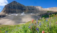
Featured image for home page:
Since we both go by Will, to distinguish ourselves, I've referred to he who joined along as "Big Will". While the trip would lead to a fourth time on the summit for me, it would be Big Will's first summit of "Timp".
Day 1
Friday - July 17, 2015
This mystical mountain does something to every pilgrim who treads its trails. If you yield to its spirit, it will elevate you.
-Eugene "Timpanogos" Roberts
We started out by meeting at the mouth of Provo Canyon late Friday afternoon. We then took a car up to Aspen Grove Trailhead and begin the hike up Primrose Cirque. We were hoping some of the better sites for camping that are well out of sight from the main trail would still be available, despite it being later in the day, because from past experience, many of the crowds don't show up until later in the evening. I knew that while some scout troops will use the Aspen Grove trail and camp around Emerald Lake, most will typically use the more popular and slightly easier Timpooneke trail that comes up from the north and then camp all throughout the main basin. We had our fingers crossed, but it was a Friday after all.
Shortly after the start, there is this sign with a tribute to Eugene L. Roberts. I found it odd that the sign has Timpanogos spelt with an 'a' before the concluding 's' rather than an 'o', which is the more common way of spelling the mountain's name. Early last century he started what would become a local community tradition known as the "Timp Hike". After starting out with groups of just BYU students and faculty, it quickly grew to attract University of Utah students as well as other members of the nearby communities. It became so popular, eventually drawing thousands to the annual event, that it even made news in a 1957 issue of Sports Illustrated. Ultimately, however, due to the risk of loving the mountain to death in the process after as many as 3,500 people made it to the summit in one gathering, organizers from the Forest Service, BYU, and other prominent community groups ended up voting to discontinue the annual event. That tradition still continues largely among smaller groups and families throughout mid to late summer, many, no doubt, whose grandparents and great grandparents used to participate in the annual gathering. Nevertheless, the sign here only scratches the surface of who Eugene Roberts was. (See the Noteworthy section at the end of the post.)
"Timpanogas Trail" sign

We pressed on and upward. Not long after, we passed the first and then the second of what would be many waterfalls along the way up.
Second waterfall


As typical, wildflowers were plentiful.
Indian Paintbrush

Big Will taking in the views from Primrose Cirque

After a number of switchbacks, we reached the top of Primrose Cirque where Hidden Lakes basin lies. There are a couple of little lakes, more like shallow little ponds, that line the outer edges, but of course, they are pretty well "hidden" out of view from the main trail.
Hidden Lakes basin

After Hidden Lakes Basin there is one final waterfall prior to arriving at Emerald Lake. We also had our first encounters with the resident mountain goat herd.
Waterfall below Emerald Lake

The resident goats

After almost 5 miles of hiking, we reached the shore of Emerald Lake.
Emerald Lake and Timp summit

Looking toward Heber Valley across the outlet of Emerald Lake

We set up camp nearby and gathered up what we needed for dinner and a little evening hike up to the Saddle where we'd try to catch the sunset and take in the views of the nighttime valley lights. We didn't quite make it up for the sunset though and it was pretty well overcast out west anyway, so there wouldn't have been much to see. Big Will's stomach was bothering him a bit on the way up which slowed us down a bit as well. He thought it may have been some jerky he had earlier in the hike so I let him have a few antacid tablets. Once we reached the saddle, we were able to gaze out across Utah Valley and the evening lights that filled up the landscape below. We had ourselves a late dinner and enjoyed a nice long rest before heading back down to camp for some much desired sleep. On the way up and down from the saddle, we encountered a couple small groups heading up to spend the rest of the evening on the actual summit.
Provo and Orem from the saddle

Timpanogos ridge and summit from the saddle, looking south

Day 2
Saturday - July 18, 2015
Child of the earthquake, featured by time, King of the Wasatch, majestic, sublime, Chieftain of Nature calling to Art, Boundless the raptures thy glories impart.
- George H. Brimhall, Former BYU President
The following morning I arose well before sunrise to make an attempt at bagging Robert's Horn, a fairly prominent secondary peak rising just north from Emerald Lake and named after, yes, the aforementioned Eugene Roberts. Will stayed back to get a little extra rest. I was hoping to catch the sunrise from there and have a little personal ponder time, away from all the crowds higher up on the true summit of Timp. Unfortunately the slope got really spicy with an abundance of loose rocks and hand holds and it was slow going trying to ensure proper footing so as to avoid any slips and tumbles that could have sent me off some cliffs at the base of the slope. There were a number of shrubs densely patched over a stretch of the ridge leading up to it that I tried to avoid by staying under.
After getting around the shrubs, I topped out on a little bit of a knife-edge ridge. By now the sun was peeking up over the horizon and it was obvious I'd miss the sunrise. Because of how spicy the slope was on the side I was on with nothing but a vertical drop of several hundred feet on the other side, I opted to play it safe and stop there on the ridge. I probably had the worst of it all behind me at this point, but since the sunrise was a lost cause, and it would have taken more time to finish it out, I paused to enjoy what views I could.
Roberts Horn summit, lying a few hundred yards away

Emerald Lake and Timpanogos Summit from the ridge of Roberts Horn

Timpanogos Basin from the ridge of Roberts Horn

Looking across American Fork Canyon and Little Cottonwood ridge from Roberts Horn

Upper Primrose Cirque and Hidden Lakes Basin from the ridge of Roberts Horn

Timpanogos Pano from the ridge of Roberts Horn

After a few moments of picture taking and reflection, I dropped back down the slippery slope and captured a few reflections of Timp's summit on Emerald Lake and a nearby tarn prior to returning to camp.
Timp summit reflection on Emerald Lake


Back at camp, Big Will and I broke out some breakfast and made preparations for a tour through the main basin, a visit to the 1950's crash site of a World War II era B-25, and of course, the summit. While eating breakfast, our camp was visited by what I believe is a dusky grouse and a ground squirrel.
My hammock

Big Will at his tent

Dusky grouse?

Ground squirrel

Big Will descending into Timpanogos Basin

Timpanogos Basin

Mount Timpanogos summit from the flower filled basin

Along the way to the crash site, we investigated what might be the toilet with the world's best view! Of course it wasn't very hygienic though and neither Big Will or I would've considered ever using it, but it was obvious others recently had.

World's most scenic toilet?

The view makes a nice trade-off for the lack of privacy

Eventually we found our way up to the crash site of the B-25. While the wreckage and left-over debris make for a nice little side hike, making a long hike even longer, it's a tragic story how this debris got there. In the 1950's, a B-25 bomber fell victim to some winter weather when the pilot must have become a bit disoriented while in route from Montana to Southern California and wasn't able to clear the Timpanogos ridge. What resulted was a devastating crash that took the lives of all 5 servicemen aboard and a rather heroic effort from some local citizens who aided in the recovery of their bodies thereafter. Sadly, this crash was not the only plane that fell victim of the winter storm. Another crash occurred in the Uintas that same evening.
Much of the wreckage on Timp still sits there with pieces scattered out across at least an acre or so. Perhaps most interesting and photo-worthy are the two engines, one sitting on a little shelf significantly higher than the other. It would be fascinating to see one of those PBS programs like History Detectives try to investigate and reconstruct the events and physics of the crash, but it's just not on the same scale as other tragic events such as the sinking of the Titanic.
While at the site, we were also privileged to witness some amazing cloud formations ripping over the summit.
Upper engine with Big Will in the background

Lower engine with Timp's summit shrouded in clouds

After a good little tour of the crash site, we made our way for the saddle, again, and then on to the summit.
More flowers

A wandering goat high up on a cliff

Approaching the saddle

Once we hit the saddle, the wind started to take a beating on us. We knew what we were in for by how fast the clouds were ripping over the ridge. We donned our windbreakers while parades of others, many wearing just in tank tops and shorts, pushed on by. The stretch between the saddle and the summit quite possibly sees more hikers than any other trail in Utah outside of Utah's National Parks. It was Saturday and the crowds were out in full force as expected. In our own journey to the summit, we would pass hundreds of people, both going and coming with dozens more mingling at the summit itself. Not minding the crowds, it was neat to hike in the clouds again. I had been in the clouds last time I was on the summit a couple years ago, but this time we could still see out in the valleys or basins below. The summit proved to be cold, windy, and crowded. Even with our gear on, we were cold. I'm confident the wind-chill was well below freezing. It must have been miserable for those who were dressed with much less but still insisted on toughing it out. Oddly, the hut remained fairly free of people, except for a few who would come to sign the summit register and put their name on a wall, if they hadn't done it on the outside.
On the summit for my 4th time

Big Will and I

Emerald Lake and what's left of some prayer flags

USGS marker

Looking out over Pleasant Grove, Lindon, and the edge of Utah Lake

Panorama of Utah Valley from Timpanogos summit

We had originally wanted to descend down the "glacier" which is more technically just a perennial snowfield most years, but with the warmer than normal winter we had, the snowfield was already mostly melted out. We spoke with one group earlier in the morning who had descended down it and when asked if they'd do it again they responded without hesitation that they'd take the standard trail back down. Apparently they had bruised up their backsides pretty good with the steep and slipper rock slide at the top and all the many rocks scattered across the main body of snow. We took their advice and kept to the main trail coming back down.
Back at Emerald Lake with the shelter and "glacier" snowfield

We returned to our camp where we found some of the local goats grazing about. We took a brief rest and gathered the rest of our gear together and descended back down to Aspen Grove trailhead and the car.
More goats

A snow-bridge, probably in its last week of life

Leaving the Emerald Lake area

Red, White, and Blue

On our way down, we stopped at small waterfall for a refreshing cool-off. Given the picture of it below, I've named it "Invisible Falls". We also passed several more groups of backpackers heading up for the night. I was surprised to see so many going up for a Saturday night. Word must be getting out about it supposedly being better than a Friday night, because I'd venture to say there were just as many backpackers on their way up, if not more, than there were camped out the prior night. The only real difference between waking up Saturday and waking up Sunday up there would probably be that the number of day-hikers and runners passing through and hiking the summit would be significantly less on Sunday.
"Invisible Falls". Can you see it?

Parry's Primrose, the namesake for Primrose Cirque?

Primrose Cirque

Closing in on Aspen Grove

As tired as we were and happy to be heading back home and to a good meal, a big part of me longed to be back up there on that mystical mountain, crowds and all. It really is a special mountain, distinctly unique from anything else found in the Wasatch. Though it falls just short of being the highest of the Wasatch, giving up that honor to Mount Nebo to the south, it certainly has all the majesty to be deemed, "King of the Wasatch".

The Good
The mountain was as stunning and beautiful, if not more so, than any other time I've been on it. We were treated to several waterfalls, lots of diverse wildflowers, vast open vistas, and so much more. While I had descended down from Timp to Aspen Grove a couple times in the past, I had always ascended via the Timpooneke route. I'm glad we chose to ascend via the Aspen Grove route, despite it being just a bit more of a challenge on the legs and lungs. In my opinion, it is a bit more scenic and spectacular, though Timpooneke still provides gorgeous scenery and fun features as well.

The Bad
While our camp was secluded when we set up, upon our return from our night's visit to the saddle, we "came home" to a group that had set up their tents and a hammock no more than 30 yards and right in sight of us. I believe others, even on a mountain that gets as much use as Timpanogos does, should have the courtesy to camp at least 200 feet away from any others and out of site when possible.
A few groups down in the main basin clearly had some illegal fires. One was even still smoldering in the morning as we had passed by. Campfires are illegal up there and I believe in and the Forest Service's efforts to keep that wilderness area as pristine as possible. Unfortunately rangers can't be up there all the time to enforce the rules. Next time I'm up there, rather than do the summit, I'm considering on doing what I can to dismantle the dozens of fire-rings dotted all around the basin and lake. On the way down, one group was even packing up a bundle of scrap wood before an authority informed them of the fire restriction. At least they were willing to pack in their own rather than seeking out what few pieces of deadfall and wild wood exist up there.
There were also many shortcuts across the switchbacks that climb Primrose Cirque. Shortcutting can cause significant erosion which often leads to irreparable damage and hazards along trails and could threaten to someday ruin the trail from Aspen Grove permanently if people don't take better care to stay off the shortcuts.

The Ugly
There were a number of spots right off the trail, in the cirque, the basin, and even near the summit and saddle, where used toilet paper was just sitting out exposed for all to see. It disgusts me how lazy some people can be when a simple zip-loc bag or two is all that is needed to pack it out. And if one is too lazy to pack it out, they should at least have the decency to bury it. But on a mountain that see as many people as Timp does, used toilet paper and other like items really needs to be packed out.

Route

Trailhead: Aspen Grove
If You Go: Please, Please, Please be considerate and sensitive to this precious area (and all wilderness spaces) and the others who would like to visit it after you. Please pack out any and all manufactured material you pack in, including used toilet paper. Please stay on the main trails where possible and avoid shortcutting switchbacks, as tempting as it may be. Do not light fires where restrictions are in place and wood is scarce. Educate yourself on LNT (Leave No Trace) principles and ethics and then exercise them.

Trip Stats
Days: 2
Distance Hiked: ~18 miles
Elevation Low: 6,910 feet
Elevation High: 11,752 feet

Noteworthy
In doing a round of research, I learned that E.L. Roberts was a spiritual man of many interests, much like myself, who had a particular passion for nature, the wilderness, mountains, and sports. He was part of a "renegade" underground football team at BYU when the sport was banned on campus before it became an official school sponsored sport and later served as the first athletic director at BYU after receiving training at Yale and turning down other job offers. Over the course of his pioneering pursuit to establish the athletic program at BYU, he would coach a high jumper to Olympic gold among other achievements and wanted athletes to model specific traits of a cougar on the prowl: strength, agility, quickness, and grace. Because of his admiration of cougars (aka mountain lions, panthers, pumas, etc), BYU would later adopt the cougar as its official mascot.
Prior to his career endeavors, Roberts grew up in Provo and would go on to attend college at the local Brigham Young Academy (now BYU). While a student, he assisted with geologic research on expeditions in what is now Zion National Park, Grand Canyon National Park, and parts of Colorado and guided small groups on hikes upon Mount Timpanogos. He then served a mission for the LDS Church in Europe where he was able to ultimately spend time in Germany and Switzerland and got to experience the Swiss Alps first-hand. His experiences as a student and missionary only enriched and deepened his admiration and appreciation for the mountains and all that encompass them.
In 1912 (despite the sign further above stating 1911, a second error?), Roberts would gather together a group of about 20 people, mostly students, and some camping gear and travel up to what is now Sundance and from there, transport their gear by foot to the place he named Aspen Grove which sits at the foot of Primrose Cirque. There they would camp the night before making a bid for the summit without the aid of any established trail. This effort was motivated by Roberts experiences in Switzerland, his love for Timpanogos and desire to share it, and his responsibilities as BYU's director of physical education to provide programs for students to improve and maintain physical fitness. Guiding students up Timp was a way for him to satisfy many of these interests, passions, and goals. Hence, what became known as the annual "Timp Hike" was born and persisted for a few decades thereafter. Around 1921, he rounded up some 300 students to assist the Forest Service with carving an official trail to the summit. His love for Timpanogos was so great that he was given the nickname of "Timp" or "Timpanogos" Roberts. He even used some creative liberty to come up with an Indian legend to explain away its distinct horizontal profile.
Apparently, he was also instrumental in introducing the Scouting program to the LDS Church. I suppose he can be thanked for the scouting experiences many in our local communities, including myself, enjoyed while we were younger and the opportunities it gave us for exposure to the outdoors, and ultimately a reverent respect and appreciation for our wild places and the need to be good stewards with such precious wilderness areas.
Not only was Roberts the father of the BYU athletic program by many aspects, he can also be considered the father of Timpanogos in making it the popular mountain it is to hike and recreate on by so many people today, both near and far.
Unfortunately, due to the ever growing popularity of the mountain, there has been and continues to be great concern about the impact the volume of visitors has on the mountain.

Video
Featured image for home page:

Last edited:
