- Joined
- Jun 25, 2012
- Messages
- 4,430
By popular request by several friends here at BackCountryPost.com I am posting a TR of traversing Amethyst Pass from a few years ago. This pass is a way to get over the Uintas Divide from south to north in the west end of our precious mountain range. This route’s crux is the crossing from the Upper Rock Creek drainage past Lightning Lake, up and over what I call (informally) Amethyst Pass and down to Amethyst Lake. I know it goes because I go’ed it. I had no idea that it was passable but was encouraged once I climbed up to the pass and saw fellow travelers of the ungulate kind (mountain goats and deer) had made it and then watched my own two and four legged companions readily descend down the other side. I jumped in to descend and whooped and hollered on down as well.
I am posting this TR with some trepidation because it is not a report of an established or published or mainstream route. I am not nervous solely because this is not documented (although I am a little not wanting to advertise) but rather because it is not a path much traveled. The path described below is not a trail for the beginner or the inexperienced soloist. Not that it is especially difficult or dangerous but it is untrammeled and loose and a long way from anywhere if you have a problem. The travelers in the TR are experienced mountaineers and off-piste travelers. That said the path is very rewarding and enjoyable. So… caveat emptor. For some it would be a relatively easy passage and for some maybe not so easy.
The majority of the route is well-traveled and well documented. That is, starting on the Mirror Lake Highway at the Highline trailhead, walk the Highline Trail east to Pigeon Milk Springs. Ascend up and over Rocky Sea Pass to the Upper Rock Creek drainage and make your way to Lightning Lake. Trail the whole way. I didn’t publish pictures of much of this part of the route. All the pictures I did post are compromised by heavy smoke from summer wildfires.
The route then goes over Amethyst Pass and down to Amethyst Lake where we found a very pleasant camp at the top (inlet) side of the lake on rock ledges with a few krummholz trees (the low, ground-hugging trees you see at treeline). The route then goes out the standard way from the lake to Christmas Meadows where we set up a car shuttle. It is an easy car shuttle to setup with a relatively short drive between. (actually we talked my wife into day hiking up to Amethyst Lake with the doggies as we left effectively and kindly eliminating the car shuttle). The whole trip is an easy three day, two night affair of maybe 20 miles car to car.
So here are a few pictures of the highlights.
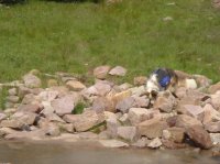
Merlin, the aforementioned four legged companion at Pigeon Milk Springs looking for the pigeons… or the source of the milk. Note the border collie doesn’t shirk his load.
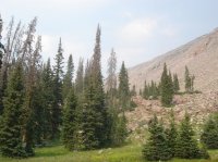
The view up to Rocky Sea Pass from the springs with evidence of the fire in the air.
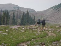
The two legged companions, Don and Mike and four legged Merlin ascending to Rocky Sea pass.
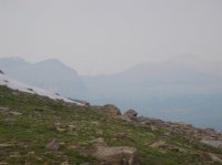
The view into upper Rock Creek from the pass.
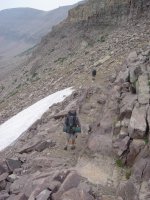
Descending Rocky Sea Pass into Rock Creek. This trip occurred on July 28th-30th. Thus the small volume of snow in all the pics.
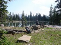
Small lake for first nights camp in Upper Rock Creek near the base of Rocky Sea Pass.
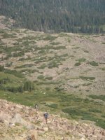
The south side of the pass was surprisingly pleasant and user friendly. Pretty steep uphill but with grass and flowers between the boulders and talus. Quite nice actually.
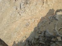
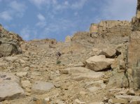
Now we are at the meat of the matter. First view down the north side of the pass. There is one obvious low point you are shooting for as you ascend the south side of the pass. Once I got to this point I started seeing goat prints and fur. I also found some mule deer prints – all heading down. So I was very pleased to find out that it “goes” or went. Anywhere a deer can go I can go. Mountain goats not so much…. ☺ I scouted around on the ridge for 10 minutes and found no other easier ways handy. Nor could I see other descent routes possible without using a rappel rope. Note that it looks steep and loose. This route would be a big problem with snow on the north side which I am sure exists 10 months of the year. It could be done, in snow, with crampons and an ice axe and experience. It could be done if it was ice, with crampons, ice axe, experience and huevos.
Since it still looked sketchy so I did what every smart traveler does - I dillydallied until my gung-ho two legged friends jumped in. Don started descending while I removed Merlin’s (the four legged friend) pack to free him up and attached it to the top of my pack. I was worried about Merlin making it down without having to drag him. By the time I shouted to Don “can Merlin do it” Merlin had scampered right down to him, 100’ below thus proving for the millionth time that my dog’s four wheel drive is far superior to our two wheel drive in anything short of 4th class terrain. Merlin is brave! plus he hates to be left behind….
A view from the pass at the flanks of Lamotte Peak and Amethyst Lake below.
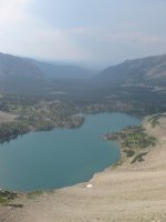
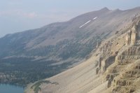
Amethyst Lake from the pass. This view is to the north down the Amethyst and Stillwater drainages.
OK, Merlin and Don were safe behind a solid rock outcropping so I descended and took this pic of Mike coming down to us to give an impression of the crux. The top of the descent is loose, thin dirt and scree on rock. The footing is poor but is OK if you work at making it good on the exposed, solid rock sticking out in places and use your hands on the rock on the sides of the gully. Once you descend past the low point in this shot you hit loose scree at the angle of repose. This is the steepness or angle of the slope at which anything that is loose is at “repose” or rest. Once you add another rock to a slope at the angle of repose the whole slope shifts until the slope attains equilibrium again, again at the angle of the repose. It sounds like a scree avalanche and that is exactly what could happen. But rarely. To a climber that can be ideal conditions because you can then plunge step or even scree glissade the hundreds of feet to the lake which we promptly did. It was great fun, spread out laterally so we wouldn’t take each other out. Merlin even liked it a lot although maybe it was painful to his feetsies. For the reason of the steep loose scree I, personally, would rather not ascend this pass from the north. It would be a painful experience of one step up and two steps sliding back down.
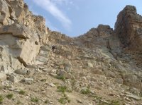
A better view of the scree glissade down to the and the slabs in the krummholz trees on the lake where we drank our scotch toasting our good fortune on camp night 2.
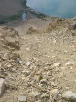
Another view of the steep scree portion with two legged travelers above.
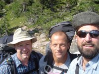
Requisite hero shot of the two legged travelers after having escaped with our lives. I am the bloke on the right.
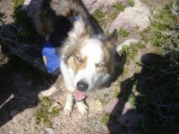
Requisite hero shot of the four legged traveler. He, Merlin, is the bloke in the center.
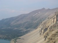
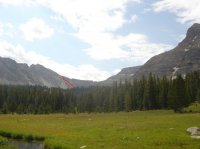
Poor views of the pass from the north due to the smoke. I tried to mark the route in red.
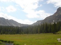
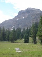
The meadow just below Amethyst Lake and Ostler Peak.
If this Uintahs divide crossing looks evil and nasty it probably is so please pick a more traveled path. If it looks fun then hitch it up and get out there. Please be safe! If you try the pass please post your effort so I can know whether it was as downright fun as I remember.
If you treasure the High Uintas and want to learn more about the range and how to preserve it look for our new site uintas.org coming in the near future. Hike ON !
Featured image for home page:
I am posting this TR with some trepidation because it is not a report of an established or published or mainstream route. I am not nervous solely because this is not documented (although I am a little not wanting to advertise) but rather because it is not a path much traveled. The path described below is not a trail for the beginner or the inexperienced soloist. Not that it is especially difficult or dangerous but it is untrammeled and loose and a long way from anywhere if you have a problem. The travelers in the TR are experienced mountaineers and off-piste travelers. That said the path is very rewarding and enjoyable. So… caveat emptor. For some it would be a relatively easy passage and for some maybe not so easy.
The majority of the route is well-traveled and well documented. That is, starting on the Mirror Lake Highway at the Highline trailhead, walk the Highline Trail east to Pigeon Milk Springs. Ascend up and over Rocky Sea Pass to the Upper Rock Creek drainage and make your way to Lightning Lake. Trail the whole way. I didn’t publish pictures of much of this part of the route. All the pictures I did post are compromised by heavy smoke from summer wildfires.
The route then goes over Amethyst Pass and down to Amethyst Lake where we found a very pleasant camp at the top (inlet) side of the lake on rock ledges with a few krummholz trees (the low, ground-hugging trees you see at treeline). The route then goes out the standard way from the lake to Christmas Meadows where we set up a car shuttle. It is an easy car shuttle to setup with a relatively short drive between. (actually we talked my wife into day hiking up to Amethyst Lake with the doggies as we left effectively and kindly eliminating the car shuttle). The whole trip is an easy three day, two night affair of maybe 20 miles car to car.
So here are a few pictures of the highlights.
Merlin, the aforementioned four legged companion at Pigeon Milk Springs looking for the pigeons… or the source of the milk. Note the border collie doesn’t shirk his load.

The view up to Rocky Sea Pass from the springs with evidence of the fire in the air.

The two legged companions, Don and Mike and four legged Merlin ascending to Rocky Sea pass.

The view into upper Rock Creek from the pass.

Descending Rocky Sea Pass into Rock Creek. This trip occurred on July 28th-30th. Thus the small volume of snow in all the pics.

Small lake for first nights camp in Upper Rock Creek near the base of Rocky Sea Pass.

The south side of the pass was surprisingly pleasant and user friendly. Pretty steep uphill but with grass and flowers between the boulders and talus. Quite nice actually.

Now we are at the meat of the matter. First view down the north side of the pass. There is one obvious low point you are shooting for as you ascend the south side of the pass. Once I got to this point I started seeing goat prints and fur. I also found some mule deer prints – all heading down. So I was very pleased to find out that it “goes” or went. Anywhere a deer can go I can go. Mountain goats not so much…. ☺ I scouted around on the ridge for 10 minutes and found no other easier ways handy. Nor could I see other descent routes possible without using a rappel rope. Note that it looks steep and loose. This route would be a big problem with snow on the north side which I am sure exists 10 months of the year. It could be done, in snow, with crampons and an ice axe and experience. It could be done if it was ice, with crampons, ice axe, experience and huevos.

Since it still looked sketchy so I did what every smart traveler does - I dillydallied until my gung-ho two legged friends jumped in. Don started descending while I removed Merlin’s (the four legged friend) pack to free him up and attached it to the top of my pack. I was worried about Merlin making it down without having to drag him. By the time I shouted to Don “can Merlin do it” Merlin had scampered right down to him, 100’ below thus proving for the millionth time that my dog’s four wheel drive is far superior to our two wheel drive in anything short of 4th class terrain. Merlin is brave! plus he hates to be left behind….
A view from the pass at the flanks of Lamotte Peak and Amethyst Lake below.

Amethyst Lake from the pass. This view is to the north down the Amethyst and Stillwater drainages.

OK, Merlin and Don were safe behind a solid rock outcropping so I descended and took this pic of Mike coming down to us to give an impression of the crux. The top of the descent is loose, thin dirt and scree on rock. The footing is poor but is OK if you work at making it good on the exposed, solid rock sticking out in places and use your hands on the rock on the sides of the gully. Once you descend past the low point in this shot you hit loose scree at the angle of repose. This is the steepness or angle of the slope at which anything that is loose is at “repose” or rest. Once you add another rock to a slope at the angle of repose the whole slope shifts until the slope attains equilibrium again, again at the angle of the repose. It sounds like a scree avalanche and that is exactly what could happen. But rarely. To a climber that can be ideal conditions because you can then plunge step or even scree glissade the hundreds of feet to the lake which we promptly did. It was great fun, spread out laterally so we wouldn’t take each other out. Merlin even liked it a lot although maybe it was painful to his feetsies. For the reason of the steep loose scree I, personally, would rather not ascend this pass from the north. It would be a painful experience of one step up and two steps sliding back down.

A better view of the scree glissade down to the and the slabs in the krummholz trees on the lake where we drank our scotch toasting our good fortune on camp night 2.

Another view of the steep scree portion with two legged travelers above.

Requisite hero shot of the two legged travelers after having escaped with our lives. I am the bloke on the right.

Requisite hero shot of the four legged traveler. He, Merlin, is the bloke in the center.

Poor views of the pass from the north due to the smoke. I tried to mark the route in red.


The meadow just below Amethyst Lake and Ostler Peak.

If this Uintahs divide crossing looks evil and nasty it probably is so please pick a more traveled path. If it looks fun then hitch it up and get out there. Please be safe! If you try the pass please post your effort so I can know whether it was as downright fun as I remember.
If you treasure the High Uintas and want to learn more about the range and how to preserve it look for our new site uintas.org coming in the near future. Hike ON !
Featured image for home page:

