Absorokas Fun Route

LarryBoy

Hiker Trash
.
Joined
Jan 4, 2015
Messages
2,818
Looking forward to my annual "big trip" this August. I'm hoping to do a route through the Absarokas. I've done some off-trail stuff in the Winds and in the Beartooths, but never been to the Absarokas. I'm hoping those of you more familiar with the GYE can provide some helpful feedback about the route I'm trying to do.

This route intentionally eschews trails and forested valleys, and stays as high as possible without involving (I hope) technical travel. I will be doing the route solo so nothing above Class III. Is this route doable in, say, a week or so? Is this too ambitious of a project? Any trouble spots? Any re-routes, or must-see places to hit? Everyone's comments are welcome!

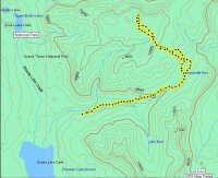
Note the blue line (between US 20 and the Beartooth Highway) is a lot more speculative and can probably be ignored. Looking for feedback primarily on the red section (between US 26 and US 20). Thanks!

Click here to view on CalTopo
 
I'd recommend PMing or otherwise contacting @Kmatjhwy or @Joey or @scatman. Or all three. I've recently talked with all three in planning for a somewhat similar route to the Younts Peak area. There's a whole lot of knowledge between them. Probably can't find better beta anywhere else.
 
Larry Boy, now will be more then happy to help you out on this. I am at the local library which is about to close. Next week will be here like on Tuesday and will give you in depth pointers on these routes for have hiked about most of it. But parts would be not doable with regards to the cliffs and such, and one would need wings. Doing this in August after such a heavy snow winter looks doable also. But only near a week or so and all of this country. I think one would need near 3 weeks plus or so if hiking straight. It would take a half of a week or so just going from Togwotee Pass to Younts Peak and area and for this area, have done it at various times in my life. Also have hiked that North Absaroka Area also and can give you pointers there also. Plus I plan to be back in this area myself this next summer. Later. Wishing You the Best!
 
Having horse and back packed much of the Teton Wilderness and some of the Washakie I am REALLY jealous.

I would not end at Togwotee. If you are going to come down the Divide/Buffalo Plateau around Wall Mountain from Marston Pass towards Crescent Mountain it is genrally broad, open, and spectacular. I've always been amazed the CDT skips this relatively benign but spectacular section of the Divide and drops down from Rainbow and Upper Brooks Lake into the TW. If you do this late in the season remember the grizzlies come up to talus and Boulder Fields to find Army Cutworm Moths, traditionally their greatest sources of protein.

I spend a lot of time car camping and dayhiking the Brooks Lake area. Depending on your schedule I might help you get to Jackson or Dubois if you end your hike on the CDT there.

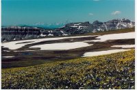
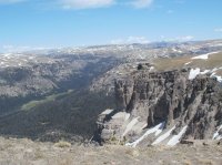
Looking at the Tetons over the Brooks Lake Cliffs and Breccia Peak from Divide Crest near Austin Peak.

Austin Peak, Tetons July 02.jpg

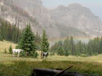
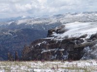
Just east of the Divide near Crescent Mountain.

Absaroka Pack Camp.jpg

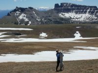
Across Austin Peaks Plateau to the Wind Rivers beyond the Pinnacle Buttes.

Absaroka Ausrin Samah and Smokey 2013.jpg

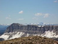
The Gros Ventre Range beyond Mount Sublette/Brooks Lake Cliffs.

Absaroka Austin over Sublette to Gros Ventre.jpg

Looking into Cub Creek and much of the Teton Wilderness from Austin Peak.

Absaroka Cub Creek June 2103.jpg

Absaroka Austin Peak And Elephant Heads in SnowTo Cub Creek And Beyond.jpg Absaroka Austin Topo Summit Post.JPG

Grizzly sow and cubs turning over rocks toward the end of Septemer on Austin Peak.

Absaroka Austin Grizzlies Sep 2008.jpg

Summer over at Younts and Thorofare.

Absaroka Austin Younts and Thorofare 2013.jpg

Younts & Thorofare 2008.jpg

Cub Creek and the TW.

Absaroka Austin Smokey 2013.jpg

The TW from the road to Lilly Lake and Mt. Leidy.

Absaroka Teteon Wilderness Sunrise.jpg
Middle of August.
Absaroka Pinnacles From Austin After August Snow.jpg

I've got some digital pics from up on Crescent Mt. I'll have to locate. Like I said, I'm jealous.
 
Larry Boy, now will be more then happy to help you out on this. I am at the local library which is about to close. Next week will be here like on Tuesday and will give you in depth pointers on these routes for have hiked about most of it. But parts would be not doable with regards to the cliffs and such, and one would need wings. Doing this in August after such a heavy snow winter looks doable also. But only near a week or so and all of this country. I think one would need near 3 weeks plus or so if hiking straight. It would take a half of a week or so just going from Togwotee Pass to Younts Peak and area and for this area, have done it at various times in my life. Also have hiked that North Absaroka Area also and can give you pointers there also. Plus I plan to be back in this area myself this next summer. Later. Wishing You the Best!
Awesome thank you Kmat!! I feel pretty confident that the southern half of the Red section will be doable, but there's a few spots in the northern area where I wasn't sure if they'd be doable (unfortunately I do not in fact have a pair of wings :) ). Would love to hear which sections you suggest I re-route. Also I'm still trying to find a good line through the northern section so your input would be awesome there too :) I'm planning two weeks for the entire Hwy 26 - Cooke City or Hwy 26- Red Lodge section... we'll see how the project shapes up!
 
Having horse and back packed much of the Teton Wilderness and some of the Washakie I am REALLY jealous.

I would not end at Togwotee. If you are going to come down the Divide/Buffalo Plateau around Wall Mountain from Marston Pass towards Crescent Mountain it is genrally broad, open, and spectacular. I've always been amazed the CDT skips this relatively benign but spectacular section of the Divide and drops down from Rainbow and Upper Brooks Lake into the TW. If you do this late in the season remember the grizzlies come up to talus and Boulder Fields to find Army Cutworm Moths, traditionally their greatest sources of protein.

I spend a lot of time car camping and dayhiking the Brooks Lake area. Depending on your schedule I might help you get to Jackson or Dubois if you end your hike on the CDT there.

Looking at the Tetons over the Brooks Lake Cliffs and Breccia Peak from Divide Crest near Austin Peak.

View attachment 52413

Just east of the Divide near Crescent Mountain.

View attachment 52414

Across Austin Peaks Plateau to the Wind Rivers beyond the Pinnacle Buttes.

View attachment 52415

The Gros Ventre Range beyond Mount Sublette/Brooks Lake Cliffs.

View attachment 52416

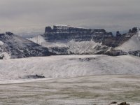
Looking into Cub Creek and much of the Teton Wilderness from Austin Peak.

View attachment 52417

View attachment 52418 View attachment 52419

Grizzly sow and cubs turning over rocks toward the end of Septemer on Austin Peak.

View attachment 52420

Summer over at Younts and Thorofare.

View attachment 52421

View attachment 52422

Cub Creek and the TW.

View attachment 52423

The TW from the road to Lilly Lake and Mt. Leidy.

View attachment 52424
Middle of August.
View attachment 52425

I've got some digital pics from up on Crescent Mt. I'll have to locate. Like I said, I'm jealous.
This is amazing Absarokanaut! Some really cool photos that have got me awfully stoked for this trip. When you say that you would not end at Togwotee, can you clarify what you mean? Would you follow the CDT route straight south from Brooks Lake instead?

I agree that the CDT seems to sell short the potential of the Absarokas. Hopefully I'll be thru-hiking the CDT in 2018, and from what I've read, nobody talks about the Absarokas (it also doesn't help that it's sandwiched between Yellowstone and the Winds haha). That's why I'm hiking the Absarokas this year, Lord willing. Want to experience somethign beautiful, alpine, and remote. And yes, I'd love a shuttle or somethign depending on both of our schedules. I'll message you once I have my dates nailed down, closer to the start of the trip :)
 
Y'all are killing me.
I'm sitting in Texas. No winter to be found. Swatting mosquitos. Did I mention no winter?
Making me look at photos of alpine tundra and snow. Not fair at all.
Have fun!
Wayne


Sent from my iPhone using Tapatalk
 
As for the CDT,
Hike your own hike. Go where you want to go. See what you want to see.
It's not your fault that the Gummermint didn't pick the best route. Cheers!
Wayne


Sent from my iPhone using Tapatalk
 
As for the CDT,
Hike your own hike. Go where you want to go. See what you want to see.
It's not your fault that the Gummermint didn't pick the best route. Cheers!
Wayne


Sent from my iPhone using Tapatalk
Well that's the nice part about the CDT - unlike other long trails (particularly the AT), the CDT doesn't really have a "purist" culture where there is only one true, correct, and absolute route that you must walk - the CDT goes where you want your CDT to go. :)
 
Larry Boy, Hi There! Hope that you are doing well. Am back here on the computer after several days because of work and the Presidents day Holiday. Now have hiked about all of this and will give you in details what I think of these routes. Good for you for thinking of this. How much of this country is about at wild as it gets here in the lower 48. great Great Country. I have been personally hiking in here since 1982. Now I have a photosite if you desire to take a look of this country at www.reflectionsofthewild.zenfolio.com - and do enjoy

First now with your trip being in August, you will encounter snow but I do not think you will have the problems as one would encounter early in the summer on account of this winter's big snowpack. The first time in 1982 when i visited this country, I crossed over the Buffalo Plateau going south to north in early August. The summer of 1982 was also a year after a winter with a big snowpack with on top over 500 inches. Then there was still quite abit of snow on top in early August but had no problems. I will give notations from south to north.

Togwotee Pass to Marston Pass

Now you should encounter no problems along this entire route. This will probably take 3 to 4 days. I do not know how much of a hiker you are but this is in general realizations of which most people hike in my opinion. If you do not want to hike along the Continental Divide, going up Cub Creek is a nice alternative also with all of it's nice meadows in it's upper stretches. Going up to near Crescent Mountain will not be a problem but just a walk up. In going along the rolling Buffalo Plateau, nearby Wall Mountain makes a very nice walkup. Tremendous views up on top with espicielly down to nearby South Fork of the Shoshone below. Nice views in all directions from the Buffalo Plateau of mountains near and far with espicielly the Tetons to the west. No problem if you have a good sense of direction when up on top of the Buffalo Plateau.

The Younts Peak Area

Now you also should have no problem in here also. Now be on the lookout for Grizzlies in here bigtime for Younts Peak is a well known Cutworm Moth Site. I have seen as near a dozen Grizzlies feeding at one time on the upper slopes of Younts Peak among the boulders. Some of my closest grizzly encounters have happened in this area. So be on the lookout. Also if you have the time, I recommend you climbing Younts Peak for it is well well worth the effort. You can see for miles and miles and miles in all directions. This whole Younts Peak Area is a good place for wildlife including maybe even a Fisher or a Wolverine. Now going on from Marston Pass to the South Fork of the Yellowstone headwaters will be no problems. Good camping down a ways, down the South Fork at the first big meadow and near the trees. At the pass (11,000 feet) between Younts Peak and Thorofare, you will encounter a trail - route down into the head basin of the North Fork of the Yellowstone. This is a very very awesome place. There is a good places to camp in here. Lots of Waterfalls in here. Again Yes Fishers have been seen in this area and a few Wolverines are around also besides the abundant Grizzlies and other wildlife. Now to the NE off of the North Fork of the Yellowstone is a nice drainage - this drainage has a route up it made by outfitters many years ago. Then off of this unnamed drainage, on the upper east side is a pass heading over to the Upper Thorofare Creek and River - there is this same route thru this pass and have hiked it with no problems. One can from this pass area also get easier up on the mountains above and go cross country to near Thorofare Peak. Also a trail in the Upper Thorofare Creek / River drainage continues up the drainage to its upper basin also for have been on this trail - route also. One could spend days and days in here with never once having a bad day.

Thorofare River - Woody Creek To Deer Creek

The Upper Thorofare Creek Area is Awesome with it's nice meadows and the mountains all around. Paradise! Also nearby is Hidden Creek down and off of the Thorofare Creek, a separate drainage. There are some nice meadows in Upper Hidden Creek which is one of the most beautiful places all in this whole Absaroka Wilderness environs - Really Nice! Could spend days and days all in this area. I LOVE Upper Mountain Meadows with the peaks all around bigtime personally! The Woody Creek Trail is not exactly where it is on the maps. In upper Thorofare Creek, there is a site of an outfitter camp. here is where the Woody Creek Trail goes off - a good good trail. But the last time I was here, there was no sigh of where it heads off. At that place where on the map, it goes over the mountain ridge, the trail is actually more north and goes around the mountain and ridge. But a great trail with no problems all the way to Deer Creek Pass and Area. Also places along the Absaroka Crest from Thorofare Mountain to Deer Creek Pass is hikeable in many places but some cliffed peaks to go around in places.

Deer Creek Pass, Saddle 10,438, Pass Creek, and Ishawooa Pass Area

Now you might have problems from Deer Creek Pass itself going up and over this 10,438 foot saddle. Some cliffs around but in the general area, there should be a route somewhere. I personally Have never gone over this one saddle. But when I was nearby in upper North Fork of Butte Creek - seriously scanned the saddle area and saw a line of cliffs on the north side of this saddle. These cliffs might present a problem but have actually not been up to this cliffs itself. Just mentioning from my scanning the last time I was here. Now there is a good trail in North Fork of Butte Creek. If you want another route if need be, then one can go down Butte Creek to the North Fork of Butte Creek and up the North Fork of Butte Creek which is all serviced by good trails. There is a good trail over what you can Twelfth Parallel Pass for have been on it, which goes over this pass, down to beautiful upper Pass Creek, and all the way up to Ishawooa Pass. Have been here many a time. Also the Absaroka Crest here which extends from near Twelfth Parallel Pass to Ishawooa Pass is all hikeable for have done it. Beautiful country. But be on the lookout again for grizzlies, for was bluff charged by a sow Grizzly when on top of this ridge back in the summer of 2006 (July 19th of that year by the way. It was a Sow with one newborn cub which bluff charged me down to about 6 or 8 feet three separate times. But also Upper Pass Creek is gorgeous with it's huge grassy meadows and the mountains all around.

Now to be continued in a next segment .... stay tuned.
 
Last edited:
Now LarryBoy to contnue on ....

Petrified Ridge and Ishawooa Cone Peak

Personally now have Been up here on Petrified Ridge and Pass many many a time - Gorgeous Country! Now everytime I have been on top have seen signs of Grizzlies. Now the route you have of going up to South Ishawooa Saddle - Ishawooa Cone Peak and down to Upper Open Creek - have never done this route. I personally do not know if this is doable. You might want to check out the book by Tom Turiano called 'Select Peaks' for he talks of climbing Ishawooa Cone Peak by this very ridge. I am not a climber and do think with a big pack, it might not be doable. Check this book. And nice side route though is here also which have hiked various times in my life which I offer here. There is a trail which goes from Upper Pass Creek, up and over Petrified Pass Ridge (dayhike around on top), and down to Upper Silvertip Creek on the other side. Here in Upper Silvertip Creek are some nice beautiful spacious meadows which have camped in. There there is a good trail down to nearby Upper Open Creek and up to the headwaters of Open Creek. Good trail in here and not that long to make the go around to Upper Open Creek.

Upper Open Creek, Overlook Mountain, Upper Mountain Creek, Fishhawk Glacier, and Glacier Pass and Area

Now Upper Open Creek is Gorgeous! It is like being in a Box Canyon but this time in the High Country with a high wall of mountains all around. there are some nice meadows in here in very Upper Open Creek and Nice! Now do think you might not be able to get across like you put on the map in here. If you are going up the trail and over Rampart Mountain - this is a steep but doable trail, which goes over Rampart Mountain itself and down to Rampart Creek on the other side. Not for horses but doable for hikers. And Upper Rampart Creek is Nice. But nearby Overlook Mountain is one high cliffed peak! There is a route in here over to the head of Mountain Creek if interested. On a side drainage south of here in Upper Open Creek, one can go up a side drainage to the top - the Upper Trident Ridge, hike along the top to near Overlook Mountain and climb Overlook, then down the slope to Upper Mountain Creek. Once in Upper Mountain Creek, over Glacier Pass to Upper Fishhawk Creek. Have been in here and it is nice. But the ridge from Overlook Mountain to Battlement Mountain is one long line of pinnacles for the most part as seen from Glacier Pass ( the pass at the head of Mountain Creek with Fishhawk Creek. Then a nice pass north of Battlement Mountain, then another line of cliffed peaks to Fortress Mountain / Sheep Mesa. Have some photos of this not posted, of this whole ridge. There is a trail - route over this Glacier Pass also which is not on the maps. Great little basin right below the west sides cliffs of Overlook Mtn., at the very very head of Mountain Creek near this Glacier Pass. Have been here and want to get back here again. I love Glacier Pass and do always see Bighorn Sheep in here.

Battlement Mountain, Saddle 10,705, Fortress Mountain / Sheep Mesa

Now if in Upper Fishhawk Creek, there is a way up offtrail, up to the nice saddle near 10,705 feet which would present no problems. There is a little mesa and area here. Then some offtrail travel on the east side, not the west side, from mountain basin to mountain basin to a wild offtrail basin right below fortress Mountain. Do think Fortress Mountain could be climbed from the SE side but have not been right there. Most of the south sides of Fortress are cliffs. this little mesa - plateau area near saddle 10,705 could be climbed up from upper Rampart Creek if on the other side coming over the trail over rampart Mountain and Pass. Then if here in either in Fishhawk Creek, Upper Rampart Creek - Elk Fork, or On Sheep Mesa - down and out to Highway 26. But personally, this is one place that have never been in as of yet, Fortress Mtn. - Sheep Mesa, and the Elk Fork.

Do think to do all of this, one way maybe two weeks - three weeks, or gonna just take your time and enjoy .... mmaybe a month. There is a lot of country in here to see, to enjoy, and to explore. This is it for here and now a net segment on from Highway 26 to the Cook City Road thru the North Absarokas. Hope this helps.
 
Last edited:
Now as for the North Absaroka Segment on your map. This is hikeable in many of the places that you showed on your map. I did this many years ago and soooo need to get back in here again. Yes to fully enjoy and see this area, one to two weeks would be a good trip.

First you show your route in going up Grinnell Creek. It has been many a year, but this should be no problem. There is a good trail here up to the Upper Grinnell Creek Meadows. I camped in here years ago - beautiful. I love upper mountain meadows personally. The basin at the upper end of Grinnell Creek looks great. But never thought of going over to the Upper North Fork of the Shoshone Waters Basin. I went back down and then went up the North Fork all the way to its head basins. In the head basins there, there is a good route over to Sunlight Creek also which would provide no problems. In here if wanting to, Stinkingwater Peak makes a excellent and easy dayhike and climb which have done. In again Tom Turiano's book, 'Select Peaks', he talks of routes to climb Sunlight Peak itself if interested. Now in Upper Sunlight Creek, there is a good route and trail up to the Hoodoo Basin Area in extreme eastern Yellowstone NP. No problems. Here on top I found little places where I could camp outside the park but up on the plateau top itself. Completely legal - lots of little nooks along the Absaroka Crest in here where one could camp legal with outside the park but up on top. If in here, an excellent dayhike would be going down the ridge to overlook the Little Lamar Valley Creek Drainage with it's peaks and the drainage, and in the drainage, some upper meadows nice and wild up in the Upper Little Lamar. Lots of other side trips available in here. Near Parker Peak in the old days but now vanished, up on top, was an Indian Encampment found rotting away in 1880 when Superintendent Norris came upon it in 1880. Just for the Info. Hoodoo peak also makes a good and easy climb for have done it. Years ago I hiked all over in here and climbed other peaks. One other favorite area was climbing Noche Peak and camping in the basin on it's east side. Then from Bootjack Gap to the pass near Canoe Lake right near YNP's east boundary, it is a nice, wild, and offtrail ridge. I personally have hiked this entire ridge and soooo doable and wild. Then going on down either Timber Creek, Papoose Creek, or what is an easy hike down. But one could spend days up all along the Absaroka Crest in here and Hoodoo Basin camping, hiking, exploring and never have a bad day.

Now hope this all helps, If you have any further questions then feel free to contact me and will be happy to help you out.

Wishing You the Best and Good Hiking!
 
This is all amazing, amazing stuff Kmat. Dinner on me next time I'm in Jackson. I've been plotting and updating my route (the recommended alternates are in green) with feedback that you've provided - the map in the original post should reflect these changes.

I've got a bunch of other questions for you that I'll send via private message. Again this is outstanding advice and thank you a million times over!!
 
Similar threads
Thread starter Title Forum Replies Date
regehr (Uintas) Lake Fork Fun Backpacking 8
norwegianxplorer Ski Dogs, Norway, fun days off piste ski touring amazing conditions Winter Sports 0
balzaccom Fun in Mokelumne Canyon Backpacking 1
Ugly Front Range Friday Fun Winter Sports 5
J Lake Mead Natl Recreation Area North Shore scramble fun. Nov. 28-30, 2019 Hiking & Camping 5
Titans Fun shaped Rocks Photography 26
pstm13 Snowshoeing With Kids: So Much Fun it “Yurts.” Winter Sports 11
gnwatts Family Meander Canyon float trip, slow, fun and hot On The Water 4
Titans Surprising winter fun in Fiery Furnace Hiking & Camping 8
TractorDoc Album Fun with Fungus -- aka Mushroom Pictures Photography 34
LarryBoy Absarokas Fun Route - 12 Days of High Adventure Backpacking 21
dug Type 1 Fun. Bikerafting Labyrinth Cyn. On The Water 0
westy Roost and Swell fun Canyoneering 3
toejam This looks like fun Noobs: Introduce yourself! 6
Dave Winter Fun on the North Slope Winter Sports 2
Michael Wire Pass to Lee's Ferry - 4 days adventure and fun (May 2012) Backpacking 25
J Fun remote trails, northern utah? Trip Planning 1
powderglut Kids having fun!! General Discussion 2
Jen Emergency fun planning! General Discussion 6
Ranger Joe The Great Western Expedition of 2011, Pt.1...Fun with Fins Off Road 1
Kullaberg63 Dirty Devil home brewed 'overland route' March 2024 Trip Reports 18
Kullaberg63 15 day canyon route Backpacking 13
fossana A challenging week on the Escalante Overland Route Backpacking 21
TheMountainRabbit Dana Meadows to Twin Lakes via the High Route (Yosemite/Hoover Wilderness) - August 2023 Backpacking 8
meowtaingal Wind river high route mid september Trip Planning 7
D Wind River offtrail route questions Trip Planning 28
scatman Grandeur Peak - Dragon Tail Route - June 10, 2023 Hiking & Camping 13
B Sawtooths - Off Trail Route Plan Trip Planning 9
TheMountainRabbit Red's Meadow to Tuolumne Meadows via the High Route (Ansel Adams/Yosemite Wilderness) - August 2022 Backpacking 5
climbhigh1119 How doable is the sneak route out of Death Hollow with kids and a dog? Trip Planning 6
PaulMags Grand - Moab Route Backpacking 1
seekinglost Introducing the Mojave-Sonoran Trail: A NEW 625-mile Winter Thru-Hiking Route Backpacking 4
RyanP Young's/Lean-To Route in DC Trip Planning 7
M Grand Canyon NP, Royal Arch Route Backpacking 0
Yvonne Climbing Mount Saint Helens via Monitor Ridge Route, July 2021 Hiking & Camping 16
scatman Grandeur Peak - Dagon's Tail Route - November 21, 2021 Hiking & Camping 9
RyanP Coyote Gulch to Halls Creek via Steven's Canyon and the Baker Route (car/key swap) Meet Up (Members Only) 8
stretch Most Scenic Route to Traverse the Gros Ventre? Trip Planning 17
W 9 Days Solo Escalante Loop in October (water advice) - Stevens Canyon, Baker Route over Waterpocket fold, Halls Narrows to Moody Canyons Trip Planning 11
M 5 days Green > Elk Wind River route advice August 17th Trip Planning 9
Mikjik86 FULL Video Part 2 Backpacking Glacier National Park "North Circle Route" Backpacking 0
Mikjik86 Backpacking Glacier National Park (Part 2 Preview) "North Circle Route" Montana, August 2019 Backpacking 2
Nick Dirty Devil Miner's Route Trip Planning 0
K Cycling The Divide Mountain Route Trip Planning 16
Mikjik86 Backpacking Glacier National Park - North Circle Route Part 1 Preview Video. Backpacking 1
b.stark Wrangell-St Elias "Seven Pass Route" Backpacking 29
Devin Ashby The Lower Gulch - Escalante (Seeking info on the route) Trip Planning 14
LarryBoy A Route In Between: Mexico to Canada Through the Heart of the West Backpacking 50
Perry Any Beta in this Proposed Route Near Coffin Benchmark? Trip Planning 5
NorthwestWanderer Route Finding adventure, Copper Pass to Blue Lake - Goats, Bears, Lions, Oh my! Backpacking 3

Similar threads

Back
Top