b.stark
Forever Wandering
- Joined
- Apr 8, 2015
- Messages
- 1,302
Finally posting a very long overdue trip report from a 6-day hike in the Beartooths in August. I've put off making any sort of trip report for this one because it just wasn't a very enjoyable trip for me overall. The route itself was OK, save for one part which about did me in, and that part of the route and the discussion just before taking it were really where the trip went badly wrong for me. The trip was originally supposed to be 7 days, but I made the call to cut a day off at the end of it. That being said, the Beartooths are a fantastic mountain range with some amazingly beautiful places, and I will surely be back someday in the future.
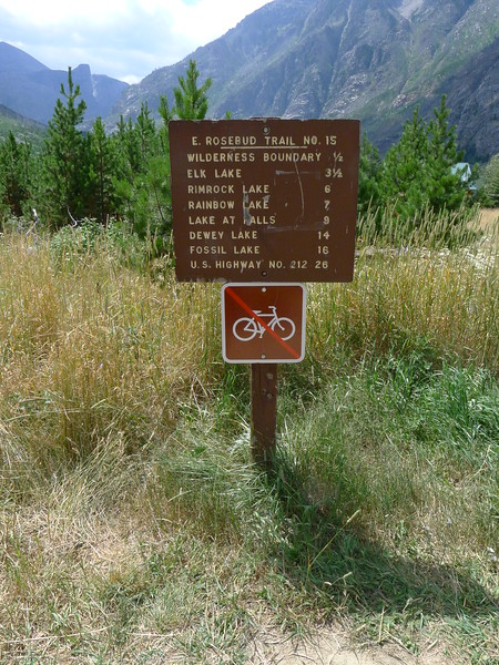
Day 1: 14 hour drive to East Rosebud Trailhead, then hike to Elk Lake
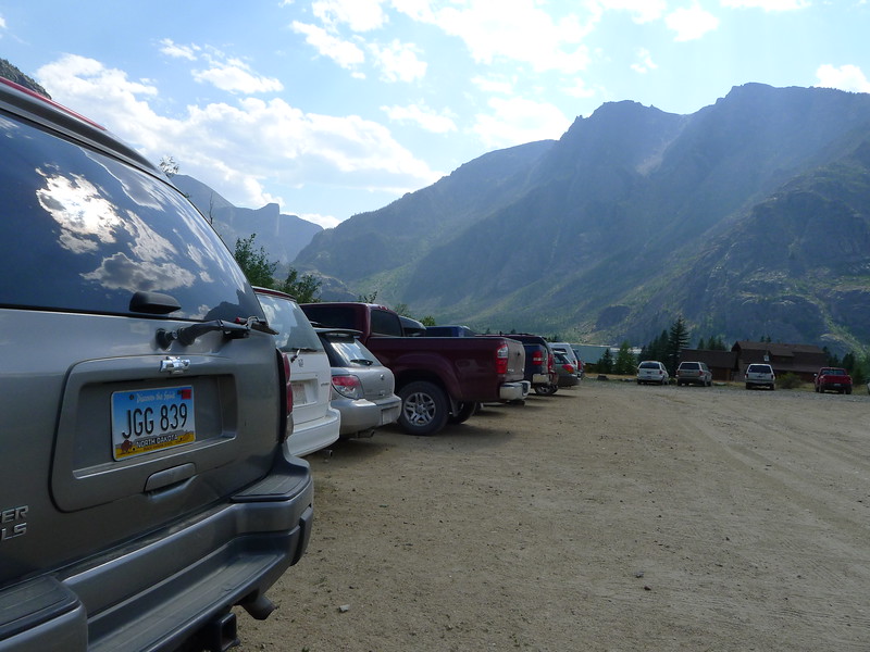
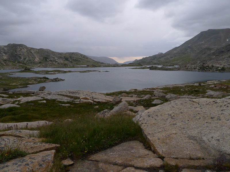
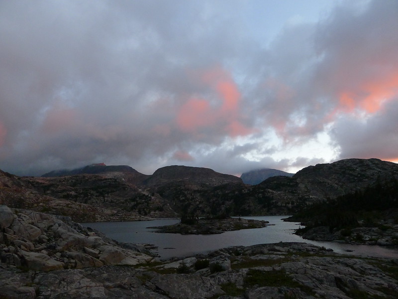
We left at a crazy early time in the morning and drove from my home in eastern Nebraska to the East Rosebud trailhead straight through, which isn't really a terrible drive except that we did it during the Sturgis rally which meant that as we drove through South Dakota, the traffic was SOLID the whole way across on a road that usually has pretty sparse traffic. We arrived at the trailhead and did our final packing. On the trail by 4:30PM to find a campsite at Elk Lake. It was much warmer than we had expected, but then again the trailhead here is a lot lower than where we usually hike.
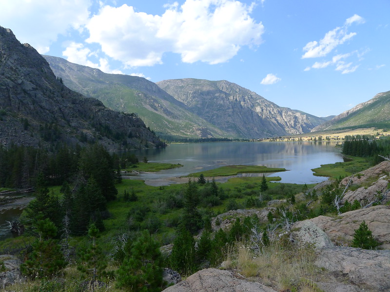
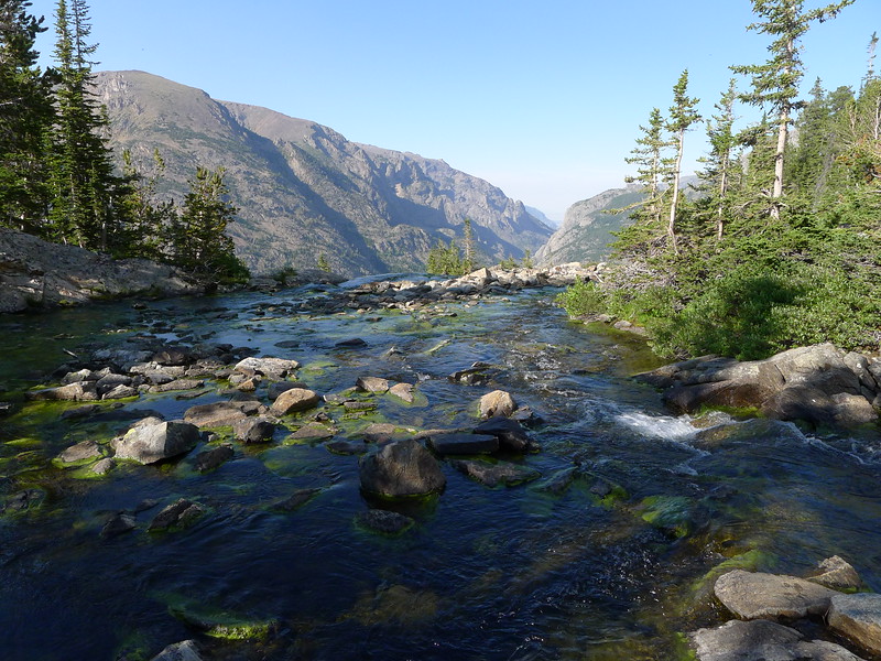
I had hiked to the upper end of East Rosebud lake last year, so the view wasn't new to me but it is still a spectacular place. The drive in the the trailhead is awesome, even though the road is a bit rough.
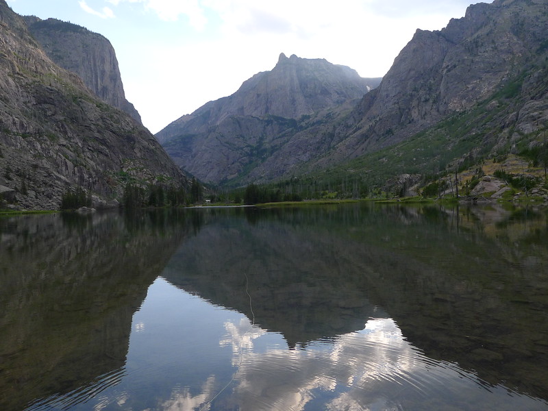
The evening at Elk Lake was beautiful, though a touch crowded. I think there were two other groups at the lake that night, but they were not bothersome. Talked to a backcountry ranger here, who thought part of our route was a bit on the crazy side. I fished for a while with no luck, though there were plenty of fish there.
Day 2: Elk Lake to Martin Lake
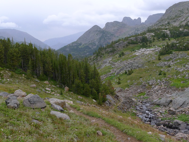
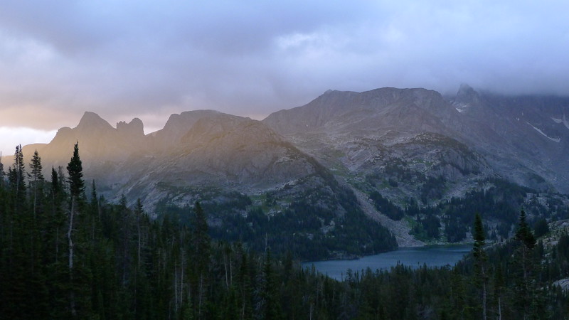
After a beautiful night, we got up early to head to Martin Lake, which we knew would really be the roughest day of the trip. We would take the trail to Lake at the Falls then head up a very steep, wooded, ugly climb that by all reports was wretched.
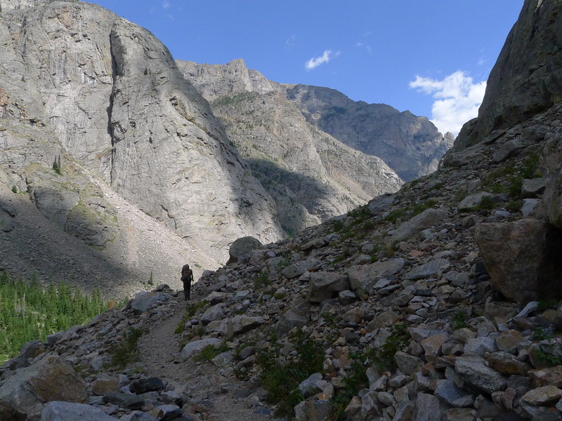
The day started out good, though the trail gains a lot of elevation it is a very well made trail and the scenery is beautiful. There's good reason this is the "beaten path."
At Rimrock Lake
At Rainbow Lake we got our first clear look at the climb to Martin. It lived up to its ugly reputation just from looking at it, but I've hiked some pretty ugly stuff before.
The switchbacks and elevation gain above Rainbow killed me. I hadn't gotten in shape well enough for the trip and was carrying a pack a bit heavier than I prefer. By the time we got to Lake at the Falls I was of serious mind to bypass the whole Martin Lake canyon and just continue on up to the plateau. This idea did not go over well at all with my hiking partner, and I begrudgingly agreed to at least give a try to getting to Martin Lake. After crossing the stream at the top of Lake at the Falls, we began the climb. I believe it was around 11AM when we began climbing to Martin, but I don't recall for sure.
Being pretty tired and not having much drive to do the climb, I followed. The climb up kind of went as follows: Blair (the other guy on the hike) struck out first to routefind and I followed, sometimes getting quite a ways behind and having to "track" him.
The hike just kept getting steeper and more difficult the farther we went up. I was exhausted and out of water, and counting on finding some water soon because I was sweating buckets. At a particularly difficult point, we agreed for Blair to just continue up, and if he hadn't come back in 10-15 minutes I would follow and meet him at the outlet of Martin Lake. It doesn't take much to see that this is where it went wrong. Blair hiked up, was gone for maybe 10 minutes, then came back down and yelled something to me. I figured he had found a way up and climbed. In reality he had said that there was no way up, and he hiked back down. Unfortunately, he took a different route down and evidently didn't think it was important to find where I had been left, as he continued on down below where I had been waiting and continued up a different way which got him to the lake. I hiked up to where I had last seen him and got walled out. Exhausted, dehydrated, and very angry, I sat down and waited. My initial plan was to wait an hour then hike back down to Lake at the Falls and set up camp and wait. Though we were sharing a tent I had plenty of stuff to make shelter and keep myself perfectly comfortable, fed, and hydrated on my own. I ended up deciding to wait about 1.5 hours and about an hour and 20 minutes in, I heard Blair yelling. After quite a while of yelling back and forth we located each other (much harder to do than you'd think) and there was much rejoicing. He had brought water, which I badly needed. I was really hoping he had gotten walled out and we could quit this whole ugly ordeal and just have a nice hike in the mountains, but he had found a way up and it was much closer than going down, so up we went. Both of us were so exhausted that we traded my pack back and forth for a fair bit of the way up to Martin Lake.
The last bit of the climb is up this waterfall. Not a bad climb overall, but in my condition I was extremely careful getting up it.
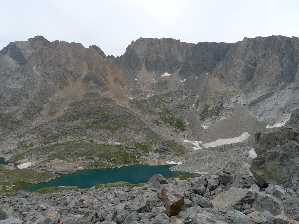
The reward at the top was a stunningly beautiful infinity pool effect where the creek plunges over the edge, a campsite that was almost perfect, and a beautiful valley and lake.
Martin Lake
I spent a lot of time recovering. I wasn't in pain, so much as dehydrated and just overall exhausted physically and mentally. It was a relief to have made it to the lake, but at the same time the only two ways out and neither one was easy. One way was back down, and the other was up over the pass between Glissade and Elpestrine lakes. Before the trip, I had looked this over and researched it plenty, and though it looked difficult I thought it didn't look terrible. After the day's events, though, I wasn't so sure, and that weighed heavy on my mind.
Day 3: Martin Lake to Desolation Lake
Another beautiful night. Our site at Martin was excellent, and of course I slept like a rock. Blair kicked me out of bed "late" at something like 6:00-6:30AM, already having made breakfast. We began hiking toward the pass at about 7:30AM, I think. Immediately I knew today would be rough--the hike up above Martin to begin the day took far more out of me than a little climb like that should. One step at a time, frequent rests. That would become the story of the morning.
At the Scat lakes we found the worst mosquitoes of the trip, and I had to put on a little mosquito spray. Much worse than the mosquitoes was my condition. On anything that looked like a climb I had to rest about every 10 steps or so. We had to deviate from our planned route due to some ugly looking snow, but the alternative was not that bad and in the end probably the better choice anyway. Instead of following Falls Creek straight up we had to go up another valley to the right, ending up at the lower end of Falls Creek Lake.
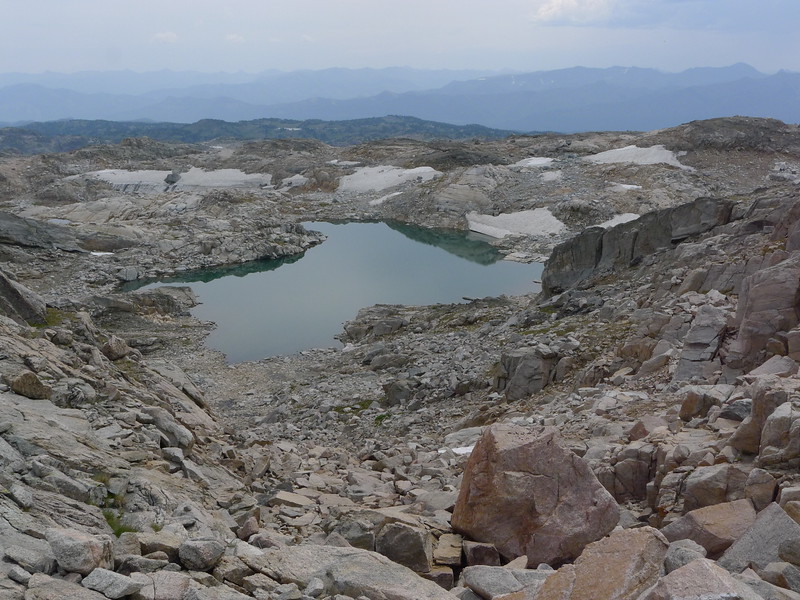
The cirque here is incredible. Sheer cliffs, isolation, teal blue lakes, and that thin, cool high mountain air. We made our way to Glissade Lake and stopped for lunch. It had taken us (held back by me) until almost noon to get this far, which is way too much time for such a short hike. I was really worried about getting over the pass and down to Desolation Lake (our goal for the day) but it was kind of the only option at this point. The easy mac and instant potatoes did something magical though.
In the above image you can see the lower part of the route up the pass. Up the talus and scree just to the left of the snowfield. Then contour left just above the rock face on more talus and boulders until you find the pass going back to the right. Then up boulder fields (they were basically moraines) through the pass, across a couple snow fields, and you top out on a nice, clear spot above Elpestrine.
This is the crux of the route, for sure. To the left is a significant drop pretty much straight down. This chute itself is very gravelly and you really have to hug those rocks on the right to guard yourself against falling. The gravel is very loose and it's 2 steps forward 1 step back for most of it.
That chute really scared the heck out of me, though I made it through just fine. Usually heights and steep terrain don't bother me much but this one got to me a bit, not sure if it was my frayed nerves from the past day or what. The views up here were pretty amazing.
Looking back down to Glissade Lake
Plenty of boulders, but this is nothing I'm not familiar with. My optimism is growing now, as we've made it quite a way up, and that magical mac and cheese changed my day and though I wasn't exactly burning up the miles, I was able to climb at a steady and satisfactory pace, and even enjoy the amazing scenery and the challenge of boulder hopping through a high pass. The adrenaline rush of coming success must have been carrying me quite a bit, as the closer we got to the top the better I felt.
We were both carrying ice axes and crampons specifically for this pass, and we did get to use them for maybe 100 yards. I will admit to being a bit bitter about carrying them as extra weight when they really weren't even all that necessary, but I'm not going to linger on that too much. In 2013 in the Winds an ice axe and crampons would have made part of our route much less stressful, and that made it clear to me that they're not totally worthless weight.
Elpestrine Lake! Success! The rest of the hike to Desolation surely would have nothing we couldn't handle, and we had done the hard part of the whole trip already. I was incredibly happy to be out of that beautiful canyon that I never wanted to go back to ever again. To be honest, at this point, in my mind the rest of the trip was a hike back to the trailhead. I was so happy to be in terrain comfortable to me and was completely over having to physically and mentally push myself to the limit. As much as the rest of the trip was really just an enjoyable stroll through the mountains, I did not enjoy it as much as I should have because of all the nonsense I went through getting up through the Martin Lake canyon.
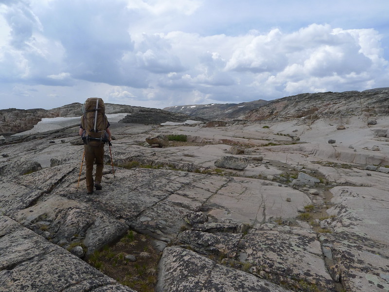
The hike from here to Desolation Lake is pretty classic high Beartooth Plateau hiking. Lots of micro route finding, boulders, and rolling terrain. About the time we got to the other end of this unnamed high tarn, some storms started brewing so we had to rush instead of really enjoy the hike.
A bit further on we found ourselves hiking and down climbing on some really neat slabs.
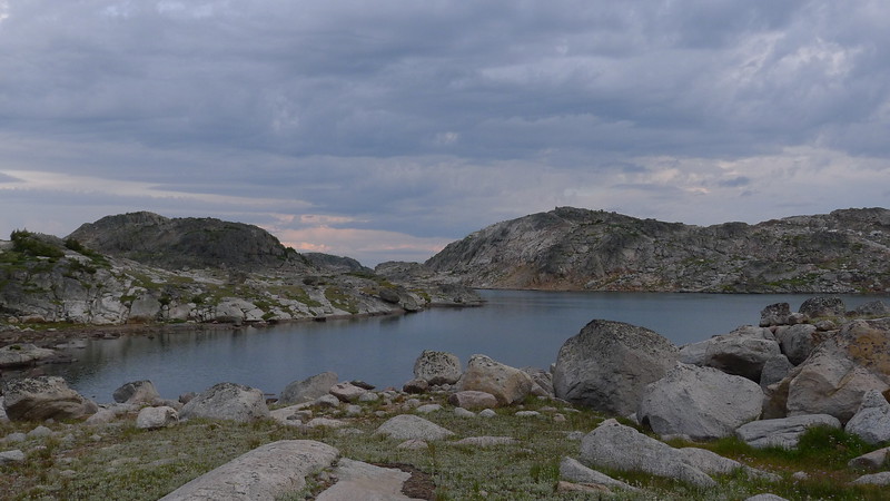
At last we made it to Desolation (photo from the next day, but this is pretty much how it looked in the evening)
We shared Desolation with a pretty large group, but again they were not at all bothersome. I spent most of the evening sitting around at camp resting, eating, and enjoying the fact we were out of that canyon.
Day 4: Desolation Lake to Fossil Lake
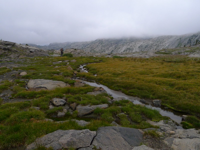
This may have been the most enjoyable day of the trip, despite frequent rain and clouds. We started at a decent time in the morning and headed off toward Z Lake. This was the single most enjoyable hike of the trip, being pretty much an easy off trail stroll in a wonderfully remote and scenic area.
Z Lake is a spot I would like to revisit someday.
By the time we got to Lake of the Winds the clouds were closing in fast. By the time we got around to the other end of the lake it was raining right along and we pretty well got fogged in. We stopped to fish a while and get lunch. Blair caught a couple fish to eat, our first meal of fish for the trip. I tried my luck with his pole for a while (I didn't feel like getting my fly rod out) and only had a bite or two, no fish on.
The clouds finally parted and we wasted no time heading on toward Lake of the Clouds. This part of the hike was a bit more difficult with ups and downs but still wasn't too bad. The worst part of it was getting down to then around Lake of the Clouds. It turned out to not be too challenging, though bouldery. On our way out, we went up the low spot in this picture toward the left.
We took another break at the upper end of the lake before continuing on to Fossil Lake. The climb up and out looked a lot worse than it was.
The hike toward Fossil follows a valley with a chain of tarns and a lot of small ups and downs.
Upon coming over a ridge and seeing Fossil, we instantly picked out our campsite. Yeah, right in the middle of that pinensula. Yeah, maybe not the most sheltered spot, blah blah blah whatever I don't care it's a beautiful place to camp.
We had plenty of time to set up camp, do photography, and fish for the eager but smallish cutthroats in Fossil Lake.
The rest of the day consisted of running out to fish, do laundry, cook food, or do whatever else we pleased between rainstorms. The evening gave us the best sunset of the trip.
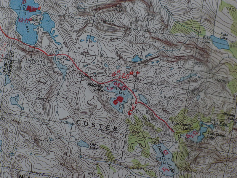
Before turning in for the night, I pretty much demanded my way on a route change, and instead of doing our original route which would swing over to the Aero Lakes, Cairn Lake, then Medicine Lake over the next two days, we would go straight to Medicine Lake the next day, then out to the trailhead the day after that. As enjoyable as the day's hike had been, I was still pretty much over this hike. I also knew there was rain forecast for pretty much the rest of the trip, and I'll admit I just didn't feel like being wet for the next three days. To be honest I would have hiked out the next day, but spending a day at Medicine Lake was perfectly acceptable.
Day 5: Fossil Lake to Medicine Lake
A dreary morning. The rain threatened right away, and we got cold drizzle shortly after starting the hike. The walk around Fossil is easy and at the other end we found ourselves on trail again. Fossil Lake is big and has some very wide open views.
The hike to Martin was essentially a cake walk for us. Short and the only hard part was the climb up to Martin (which was not that bad). For the most part I really prefer being off trail, but this time I was very happy to see the trail, which would take me to the trailhead tomorrow.
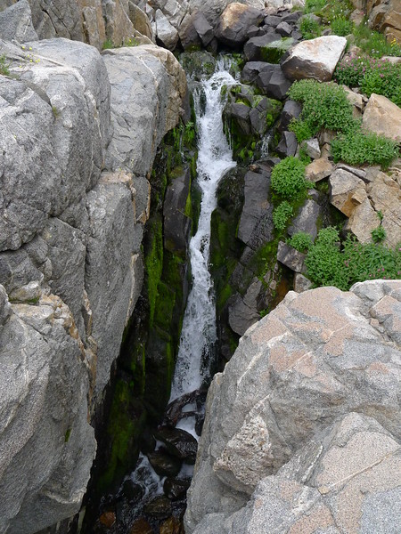
There are a lot of very nice waterfalls on the way up to Martin, as good a string of them as you could ever wish for, and at the top the outlet of the lake is a small waterfall that drops into a tiny but deep slot.
Medicine Lake is a great spot, but we didn't find ideal camping. Given the questionable weather we didn't really want to try finding a camp at the other end of the lake, and eventually I found a spot that ended up working very well and keeping us somewhat protected from the crazy wind that blew all day long.
Since it was such a short hike, we had tons of time left in the day. I considered fishing but didn't feel like fighting the wind that must have been 30-40mph+ at times with a fly rod, so I was content lazing around camp, eating, watching the clouds scream past the peaks, and reading. It was probably good we didn't get too ambitious while at Medicine Lake, as the elevation is a staggering 99067ft above sea level.
In the evening the rainstorms moved back in and we dodged them to make supper, then turned in for the night.
Day 6: Medicine Lake to East Rosebud Trailhead
The day dawned threatening us with weather again, and it was pretty chilly. It seemed each night had been steadily cooler, and this was fittingly the coldest. When I got out of the tent there was a goat in camp, and he scared the living daylights out of me. A bit of yelling got him out of camp and he never did return. Since it was a day to hike out and pretty chilly, we packed quickly and hit the trail early. The sun did peek through the clouds a bit, painting some color on the scenery.
We descended toward the trail and Dewey Lake.
The rest of the hike out was pretty uneventful, and while we did see quite a few people on the trail, it wasn't by any means crowded, at least until we got to Elk Lake. After hiking it, this is probably one of my favorite trails. Great scenery and excellent trail construction/maintenance.
Obligatory Impasse Falls pic

Back below Rimrock Lake. The wind decided to blow like crazy while we were in this section of canyon.
Starting at Elk Lake, there were simply a lot of people. Given how I felt about this trip, I was actually pretty happy to start seeing people and talk to some of them. We made very few stops on the hike out and just kept pounding out the miles. I want to say we left Medicine Lake around 7AM, and we made it back to the trailhead at 1:45PM. Not a bad pace for me at all.
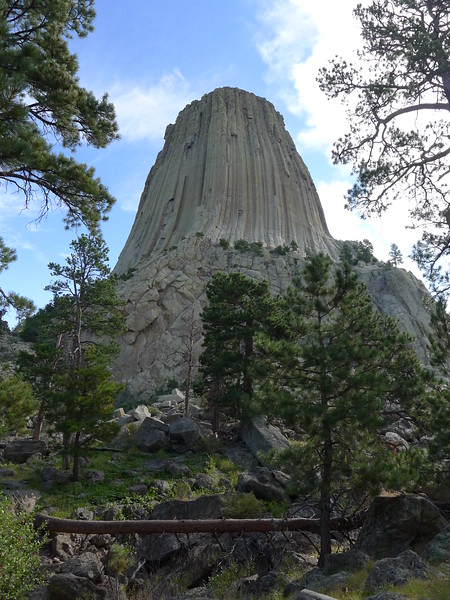
We drove to Sheridan WY that night, then the rest of the way home the next day, as neither of us was interested in doing a 14 hour drive that day. More fighting Sturgis Rally traffic, and a quick stop at Devil's Tower as Blair had never seen it.
With it all said and done, I'm glad I got to spend some time in the mountains this year. A large takeaway from the trip was learning much more about myself and my limits. Every trip does that, but this one much more so than most. I don't have anything against challenging trips per se, but that was really not what I was looking for this year. Next year, if I do get to take a backpacking trip to the mountains, I really have my mind set on a nice, simple southern Winds trip.
That got a bit long, hope it's an enjoyable read for folks!
Day 1: 14 hour drive to East Rosebud Trailhead, then hike to Elk Lake
We left at a crazy early time in the morning and drove from my home in eastern Nebraska to the East Rosebud trailhead straight through, which isn't really a terrible drive except that we did it during the Sturgis rally which meant that as we drove through South Dakota, the traffic was SOLID the whole way across on a road that usually has pretty sparse traffic. We arrived at the trailhead and did our final packing. On the trail by 4:30PM to find a campsite at Elk Lake. It was much warmer than we had expected, but then again the trailhead here is a lot lower than where we usually hike.
I had hiked to the upper end of East Rosebud lake last year, so the view wasn't new to me but it is still a spectacular place. The drive in the the trailhead is awesome, even though the road is a bit rough.
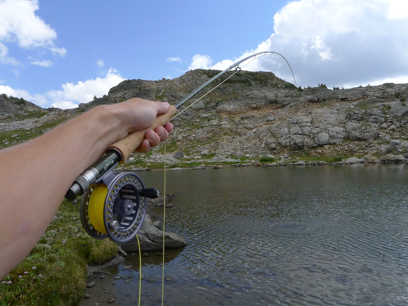
The evening at Elk Lake was beautiful, though a touch crowded. I think there were two other groups at the lake that night, but they were not bothersome. Talked to a backcountry ranger here, who thought part of our route was a bit on the crazy side. I fished for a while with no luck, though there were plenty of fish there.
Day 2: Elk Lake to Martin Lake
After a beautiful night, we got up early to head to Martin Lake, which we knew would really be the roughest day of the trip. We would take the trail to Lake at the Falls then head up a very steep, wooded, ugly climb that by all reports was wretched.
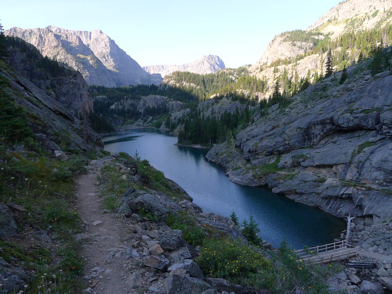
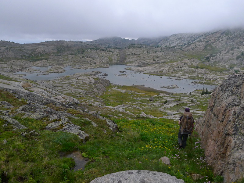
The day started out good, though the trail gains a lot of elevation it is a very well made trail and the scenery is beautiful. There's good reason this is the "beaten path."
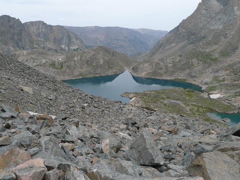
At Rimrock Lake
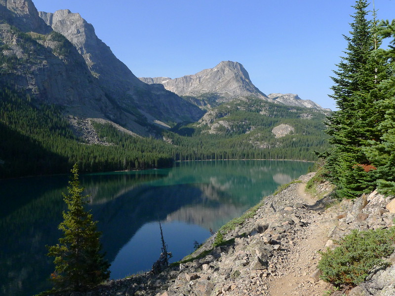
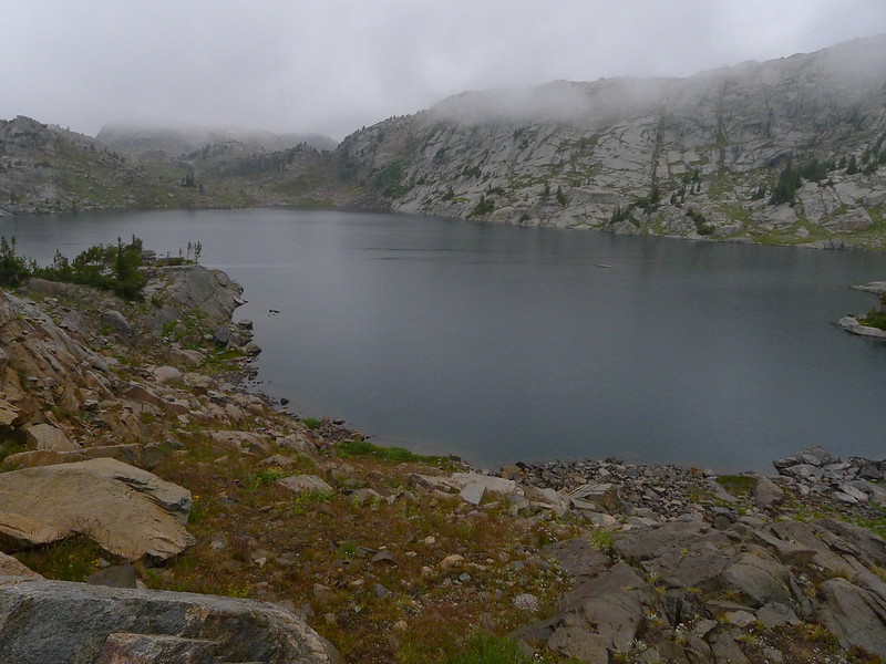
At Rainbow Lake we got our first clear look at the climb to Martin. It lived up to its ugly reputation just from looking at it, but I've hiked some pretty ugly stuff before.
The switchbacks and elevation gain above Rainbow killed me. I hadn't gotten in shape well enough for the trip and was carrying a pack a bit heavier than I prefer. By the time we got to Lake at the Falls I was of serious mind to bypass the whole Martin Lake canyon and just continue on up to the plateau. This idea did not go over well at all with my hiking partner, and I begrudgingly agreed to at least give a try to getting to Martin Lake. After crossing the stream at the top of Lake at the Falls, we began the climb. I believe it was around 11AM when we began climbing to Martin, but I don't recall for sure.
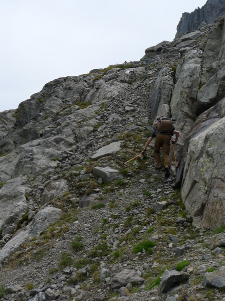
Being pretty tired and not having much drive to do the climb, I followed. The climb up kind of went as follows: Blair (the other guy on the hike) struck out first to routefind and I followed, sometimes getting quite a ways behind and having to "track" him.
The hike just kept getting steeper and more difficult the farther we went up. I was exhausted and out of water, and counting on finding some water soon because I was sweating buckets. At a particularly difficult point, we agreed for Blair to just continue up, and if he hadn't come back in 10-15 minutes I would follow and meet him at the outlet of Martin Lake. It doesn't take much to see that this is where it went wrong. Blair hiked up, was gone for maybe 10 minutes, then came back down and yelled something to me. I figured he had found a way up and climbed. In reality he had said that there was no way up, and he hiked back down. Unfortunately, he took a different route down and evidently didn't think it was important to find where I had been left, as he continued on down below where I had been waiting and continued up a different way which got him to the lake. I hiked up to where I had last seen him and got walled out. Exhausted, dehydrated, and very angry, I sat down and waited. My initial plan was to wait an hour then hike back down to Lake at the Falls and set up camp and wait. Though we were sharing a tent I had plenty of stuff to make shelter and keep myself perfectly comfortable, fed, and hydrated on my own. I ended up deciding to wait about 1.5 hours and about an hour and 20 minutes in, I heard Blair yelling. After quite a while of yelling back and forth we located each other (much harder to do than you'd think) and there was much rejoicing. He had brought water, which I badly needed. I was really hoping he had gotten walled out and we could quit this whole ugly ordeal and just have a nice hike in the mountains, but he had found a way up and it was much closer than going down, so up we went. Both of us were so exhausted that we traded my pack back and forth for a fair bit of the way up to Martin Lake.
The last bit of the climb is up this waterfall. Not a bad climb overall, but in my condition I was extremely careful getting up it.
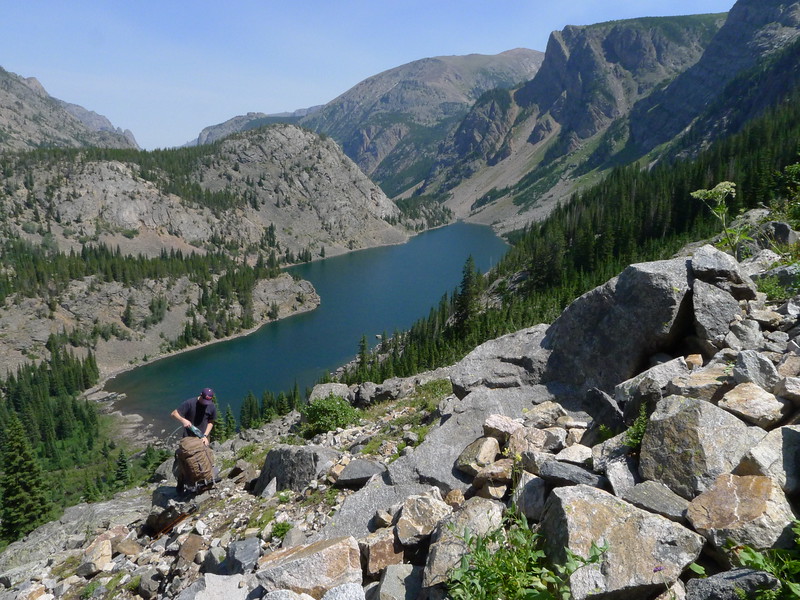
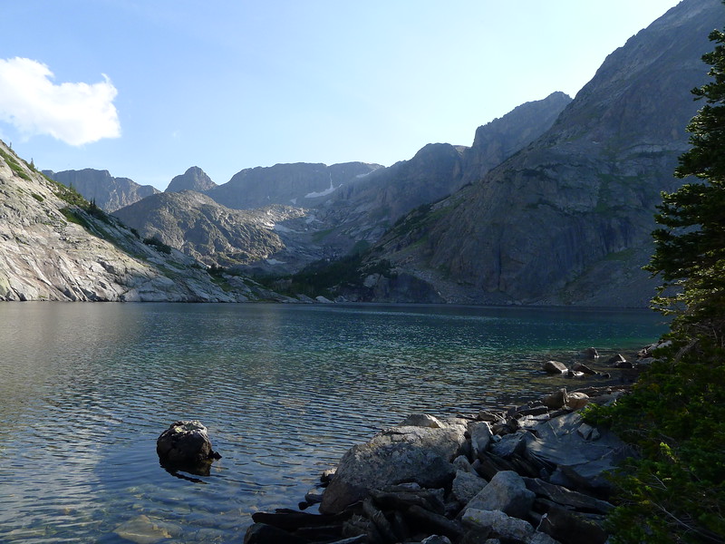
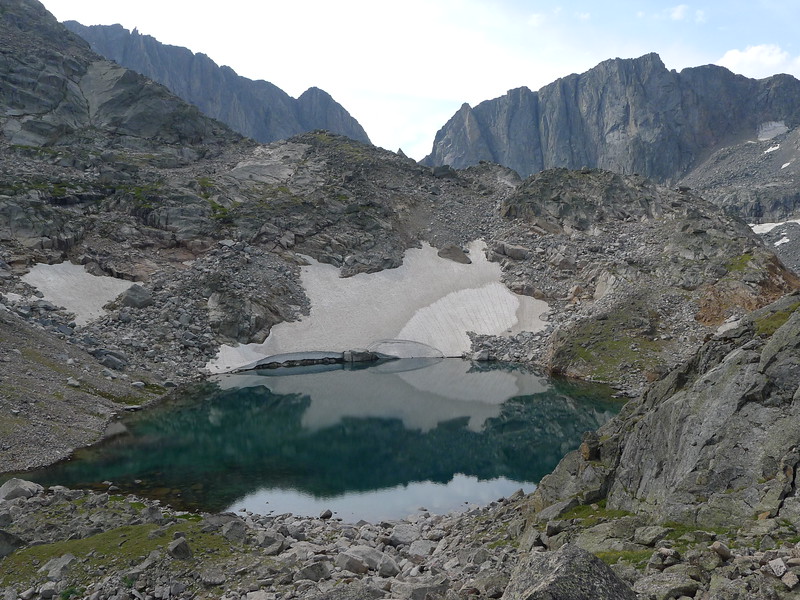
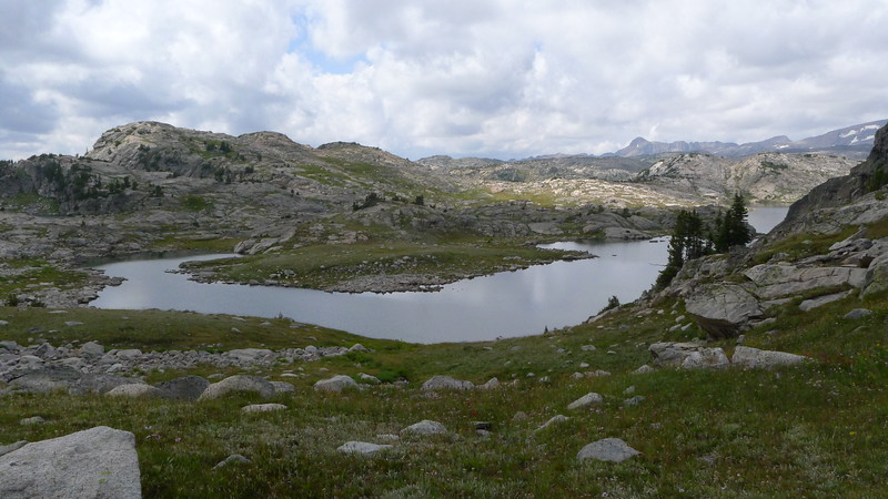
The reward at the top was a stunningly beautiful infinity pool effect where the creek plunges over the edge, a campsite that was almost perfect, and a beautiful valley and lake.
Martin Lake
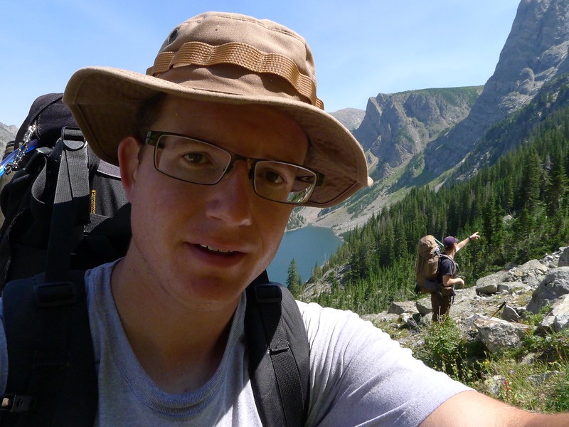
I spent a lot of time recovering. I wasn't in pain, so much as dehydrated and just overall exhausted physically and mentally. It was a relief to have made it to the lake, but at the same time the only two ways out and neither one was easy. One way was back down, and the other was up over the pass between Glissade and Elpestrine lakes. Before the trip, I had looked this over and researched it plenty, and though it looked difficult I thought it didn't look terrible. After the day's events, though, I wasn't so sure, and that weighed heavy on my mind.
Day 3: Martin Lake to Desolation Lake
Another beautiful night. Our site at Martin was excellent, and of course I slept like a rock. Blair kicked me out of bed "late" at something like 6:00-6:30AM, already having made breakfast. We began hiking toward the pass at about 7:30AM, I think. Immediately I knew today would be rough--the hike up above Martin to begin the day took far more out of me than a little climb like that should. One step at a time, frequent rests. That would become the story of the morning.
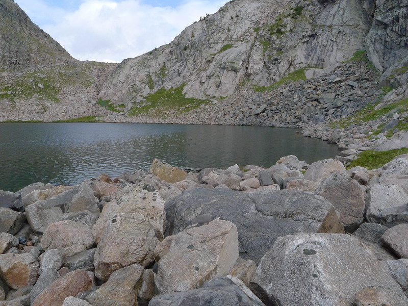
At the Scat lakes we found the worst mosquitoes of the trip, and I had to put on a little mosquito spray. Much worse than the mosquitoes was my condition. On anything that looked like a climb I had to rest about every 10 steps or so. We had to deviate from our planned route due to some ugly looking snow, but the alternative was not that bad and in the end probably the better choice anyway. Instead of following Falls Creek straight up we had to go up another valley to the right, ending up at the lower end of Falls Creek Lake.
The cirque here is incredible. Sheer cliffs, isolation, teal blue lakes, and that thin, cool high mountain air. We made our way to Glissade Lake and stopped for lunch. It had taken us (held back by me) until almost noon to get this far, which is way too much time for such a short hike. I was really worried about getting over the pass and down to Desolation Lake (our goal for the day) but it was kind of the only option at this point. The easy mac and instant potatoes did something magical though.
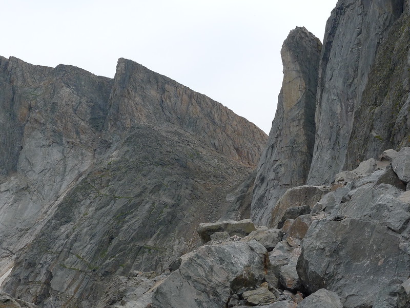
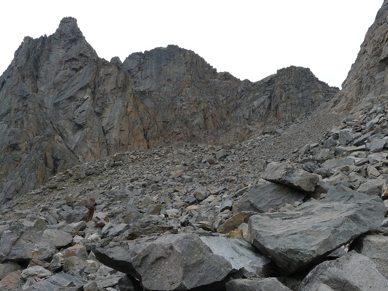
In the above image you can see the lower part of the route up the pass. Up the talus and scree just to the left of the snowfield. Then contour left just above the rock face on more talus and boulders until you find the pass going back to the right. Then up boulder fields (they were basically moraines) through the pass, across a couple snow fields, and you top out on a nice, clear spot above Elpestrine.
This is the crux of the route, for sure. To the left is a significant drop pretty much straight down. This chute itself is very gravelly and you really have to hug those rocks on the right to guard yourself against falling. The gravel is very loose and it's 2 steps forward 1 step back for most of it.
That chute really scared the heck out of me, though I made it through just fine. Usually heights and steep terrain don't bother me much but this one got to me a bit, not sure if it was my frayed nerves from the past day or what. The views up here were pretty amazing.
Looking back down to Glissade Lake
Plenty of boulders, but this is nothing I'm not familiar with. My optimism is growing now, as we've made it quite a way up, and that magical mac and cheese changed my day and though I wasn't exactly burning up the miles, I was able to climb at a steady and satisfactory pace, and even enjoy the amazing scenery and the challenge of boulder hopping through a high pass. The adrenaline rush of coming success must have been carrying me quite a bit, as the closer we got to the top the better I felt.
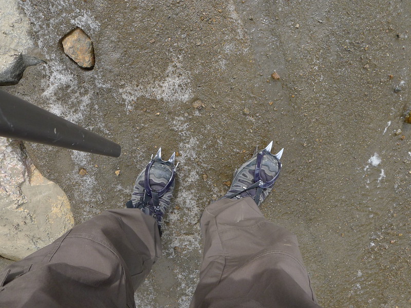
We were both carrying ice axes and crampons specifically for this pass, and we did get to use them for maybe 100 yards. I will admit to being a bit bitter about carrying them as extra weight when they really weren't even all that necessary, but I'm not going to linger on that too much. In 2013 in the Winds an ice axe and crampons would have made part of our route much less stressful, and that made it clear to me that they're not totally worthless weight.
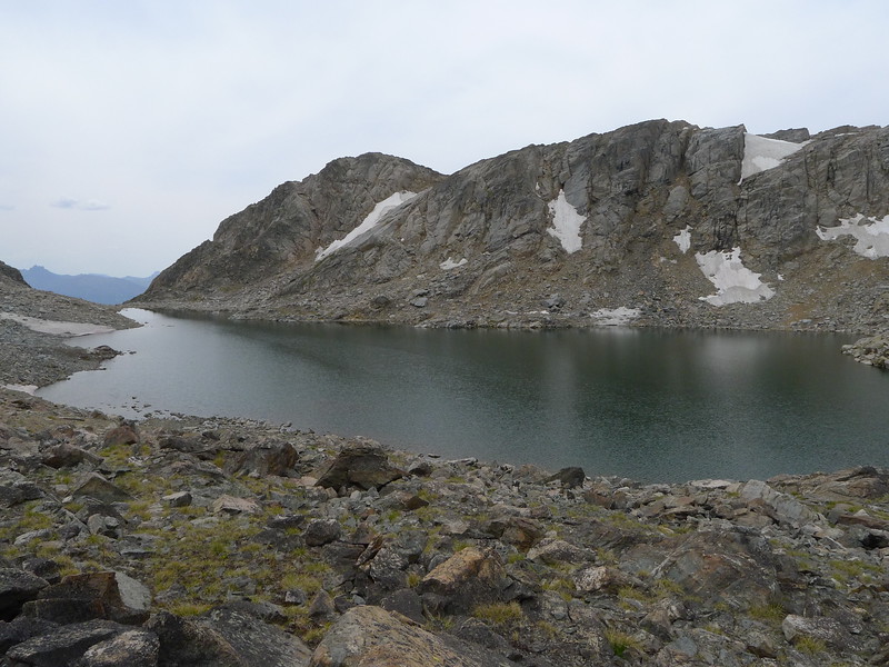
Elpestrine Lake! Success! The rest of the hike to Desolation surely would have nothing we couldn't handle, and we had done the hard part of the whole trip already. I was incredibly happy to be out of that beautiful canyon that I never wanted to go back to ever again. To be honest, at this point, in my mind the rest of the trip was a hike back to the trailhead. I was so happy to be in terrain comfortable to me and was completely over having to physically and mentally push myself to the limit. As much as the rest of the trip was really just an enjoyable stroll through the mountains, I did not enjoy it as much as I should have because of all the nonsense I went through getting up through the Martin Lake canyon.
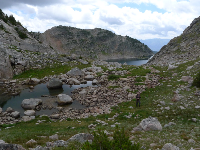
The hike from here to Desolation Lake is pretty classic high Beartooth Plateau hiking. Lots of micro route finding, boulders, and rolling terrain. About the time we got to the other end of this unnamed high tarn, some storms started brewing so we had to rush instead of really enjoy the hike.
A bit further on we found ourselves hiking and down climbing on some really neat slabs.
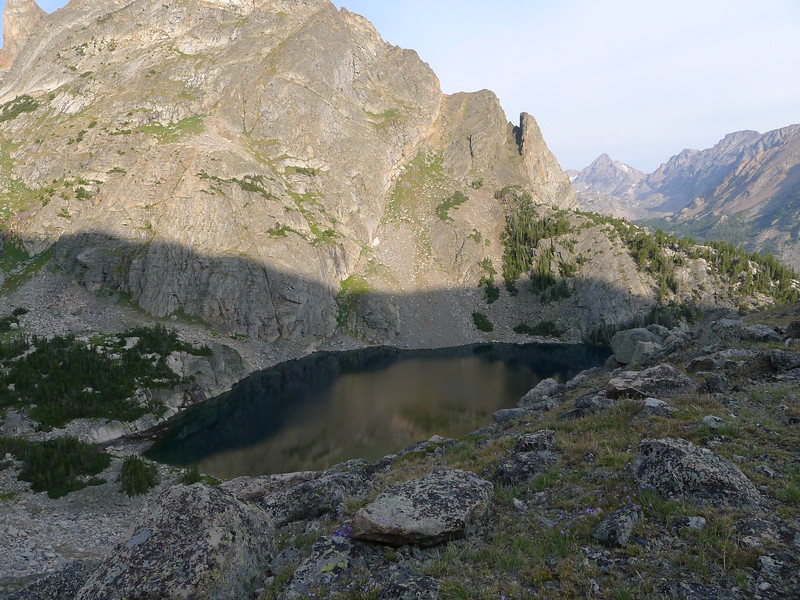
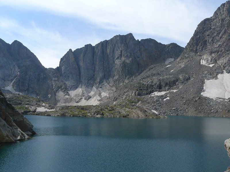
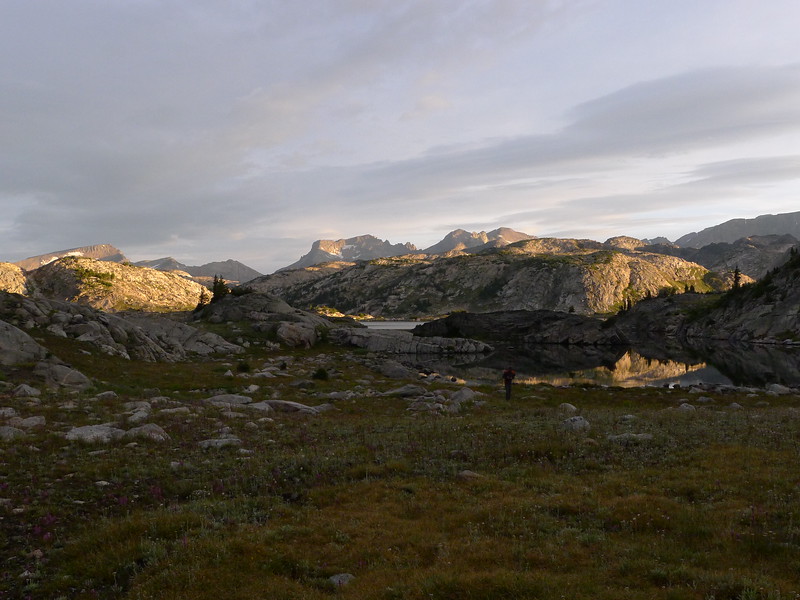
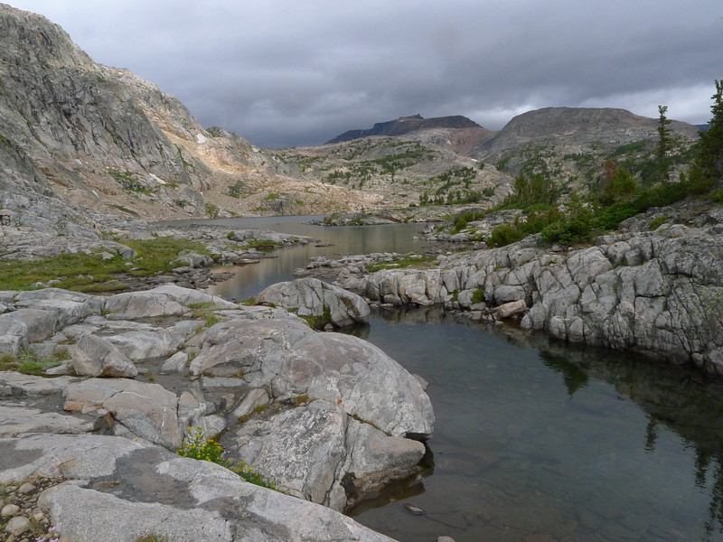
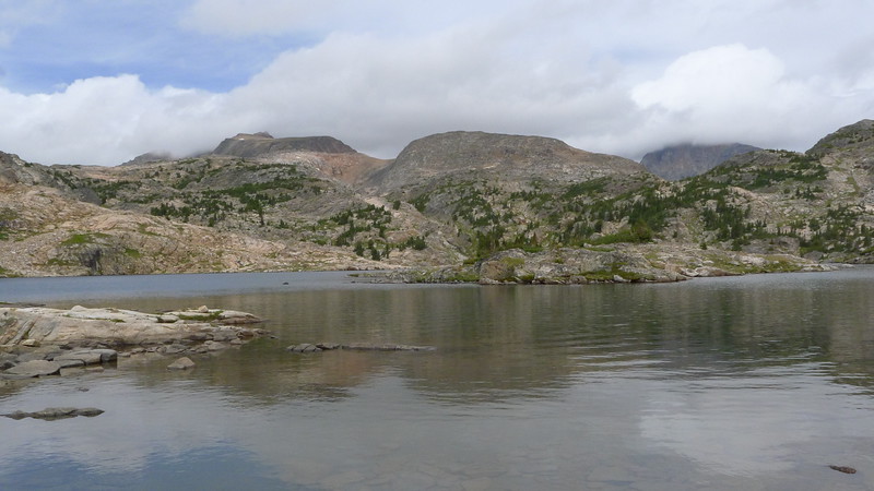
At last we made it to Desolation (photo from the next day, but this is pretty much how it looked in the evening)
We shared Desolation with a pretty large group, but again they were not at all bothersome. I spent most of the evening sitting around at camp resting, eating, and enjoying the fact we were out of that canyon.
Day 4: Desolation Lake to Fossil Lake
This may have been the most enjoyable day of the trip, despite frequent rain and clouds. We started at a decent time in the morning and headed off toward Z Lake. This was the single most enjoyable hike of the trip, being pretty much an easy off trail stroll in a wonderfully remote and scenic area.
Z Lake is a spot I would like to revisit someday.
By the time we got to Lake of the Winds the clouds were closing in fast. By the time we got around to the other end of the lake it was raining right along and we pretty well got fogged in. We stopped to fish a while and get lunch. Blair caught a couple fish to eat, our first meal of fish for the trip. I tried my luck with his pole for a while (I didn't feel like getting my fly rod out) and only had a bite or two, no fish on.
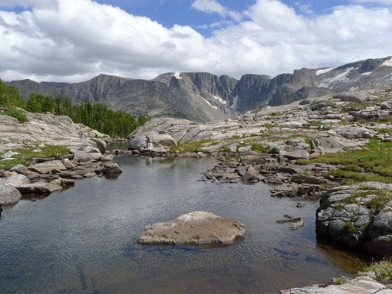
The clouds finally parted and we wasted no time heading on toward Lake of the Clouds. This part of the hike was a bit more difficult with ups and downs but still wasn't too bad. The worst part of it was getting down to then around Lake of the Clouds. It turned out to not be too challenging, though bouldery. On our way out, we went up the low spot in this picture toward the left.
We took another break at the upper end of the lake before continuing on to Fossil Lake. The climb up and out looked a lot worse than it was.
The hike toward Fossil follows a valley with a chain of tarns and a lot of small ups and downs.
Upon coming over a ridge and seeing Fossil, we instantly picked out our campsite. Yeah, right in the middle of that pinensula. Yeah, maybe not the most sheltered spot, blah blah blah whatever I don't care it's a beautiful place to camp.
We had plenty of time to set up camp, do photography, and fish for the eager but smallish cutthroats in Fossil Lake.
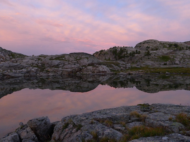
The rest of the day consisted of running out to fish, do laundry, cook food, or do whatever else we pleased between rainstorms. The evening gave us the best sunset of the trip.
Before turning in for the night, I pretty much demanded my way on a route change, and instead of doing our original route which would swing over to the Aero Lakes, Cairn Lake, then Medicine Lake over the next two days, we would go straight to Medicine Lake the next day, then out to the trailhead the day after that. As enjoyable as the day's hike had been, I was still pretty much over this hike. I also knew there was rain forecast for pretty much the rest of the trip, and I'll admit I just didn't feel like being wet for the next three days. To be honest I would have hiked out the next day, but spending a day at Medicine Lake was perfectly acceptable.
Day 5: Fossil Lake to Medicine Lake
A dreary morning. The rain threatened right away, and we got cold drizzle shortly after starting the hike. The walk around Fossil is easy and at the other end we found ourselves on trail again. Fossil Lake is big and has some very wide open views.
The hike to Martin was essentially a cake walk for us. Short and the only hard part was the climb up to Martin (which was not that bad). For the most part I really prefer being off trail, but this time I was very happy to see the trail, which would take me to the trailhead tomorrow.
There are a lot of very nice waterfalls on the way up to Martin, as good a string of them as you could ever wish for, and at the top the outlet of the lake is a small waterfall that drops into a tiny but deep slot.
Medicine Lake is a great spot, but we didn't find ideal camping. Given the questionable weather we didn't really want to try finding a camp at the other end of the lake, and eventually I found a spot that ended up working very well and keeping us somewhat protected from the crazy wind that blew all day long.
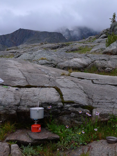
Since it was such a short hike, we had tons of time left in the day. I considered fishing but didn't feel like fighting the wind that must have been 30-40mph+ at times with a fly rod, so I was content lazing around camp, eating, watching the clouds scream past the peaks, and reading. It was probably good we didn't get too ambitious while at Medicine Lake, as the elevation is a staggering 99067ft above sea level.
In the evening the rainstorms moved back in and we dodged them to make supper, then turned in for the night.
Day 6: Medicine Lake to East Rosebud Trailhead
The day dawned threatening us with weather again, and it was pretty chilly. It seemed each night had been steadily cooler, and this was fittingly the coldest. When I got out of the tent there was a goat in camp, and he scared the living daylights out of me. A bit of yelling got him out of camp and he never did return. Since it was a day to hike out and pretty chilly, we packed quickly and hit the trail early. The sun did peek through the clouds a bit, painting some color on the scenery.
We descended toward the trail and Dewey Lake.
The rest of the hike out was pretty uneventful, and while we did see quite a few people on the trail, it wasn't by any means crowded, at least until we got to Elk Lake. After hiking it, this is probably one of my favorite trails. Great scenery and excellent trail construction/maintenance.
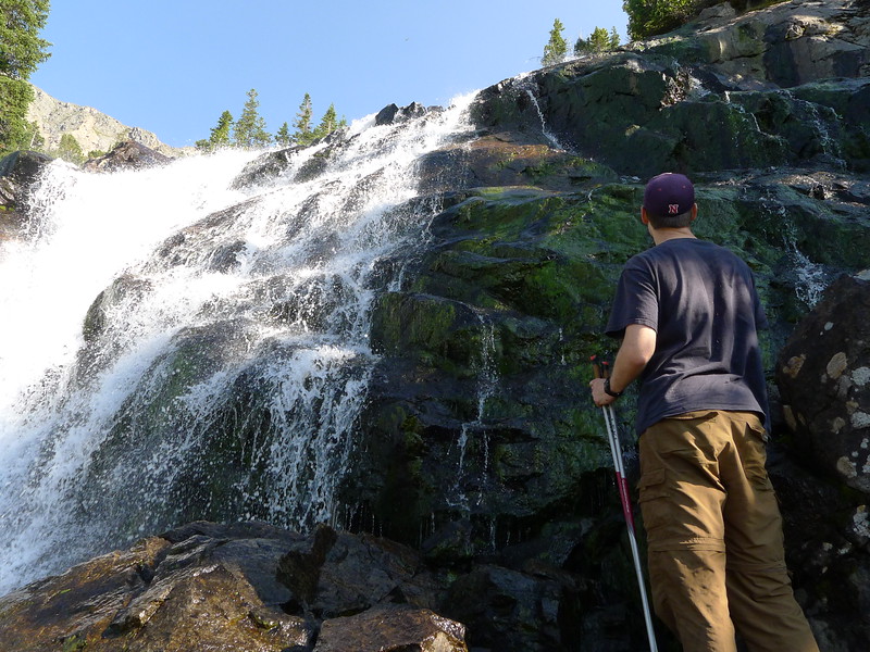
Obligatory Impasse Falls pic
Back below Rimrock Lake. The wind decided to blow like crazy while we were in this section of canyon.
Starting at Elk Lake, there were simply a lot of people. Given how I felt about this trip, I was actually pretty happy to start seeing people and talk to some of them. We made very few stops on the hike out and just kept pounding out the miles. I want to say we left Medicine Lake around 7AM, and we made it back to the trailhead at 1:45PM. Not a bad pace for me at all.
We drove to Sheridan WY that night, then the rest of the way home the next day, as neither of us was interested in doing a 14 hour drive that day. More fighting Sturgis Rally traffic, and a quick stop at Devil's Tower as Blair had never seen it.
With it all said and done, I'm glad I got to spend some time in the mountains this year. A large takeaway from the trip was learning much more about myself and my limits. Every trip does that, but this one much more so than most. I don't have anything against challenging trips per se, but that was really not what I was looking for this year. Next year, if I do get to take a backpacking trip to the mountains, I really have my mind set on a nice, simple southern Winds trip.
That got a bit long, hope it's an enjoyable read for folks!
Last edited:
")